 Block
From the record
20 National Register listings published here.
Sources: the National Register database, National Park Service
88 topographic sheets cover 53 settlements here, and 20 properties are on the National Register of Historic Places.
20 National Register listings published here.
Sources: the National Register database, National Park Service
Every property in this county listed on the National Register of Historic Places, with the year it was listed and the federal nomination document.
| Photograph | Property | Type | Listed | Reference |
|---|---|---|---|---|
| Berkshire Block | building | 1985 | 85001466 | |
| Brule-St. Croix Portage | site | 1970 | 70000033 | |
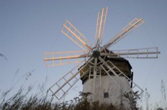 | Davidson Windmill | structure | 1979 | 79000075 |
| Douglas County Courthouse | building | 1982 | 82000664 | |
| Empire Block | building | 1985 | 85001467 | |
| Antoine and Sarah Gordon House | building | 2022 | 100007769 | |
| Lake Nebagamon Auditorium | building | 1981 | 81000041 | |
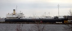 | METEOR (Whaleback carrier) | structure | 1974 | 74000081 |
| Maryland Block | building | 1985 | 85001468 | |
| Minnesota Block-Board of Trade Bldg. | building | 1985 | 85001470 | |
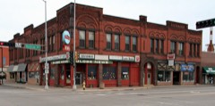 | New Jersey Building | building | 1983 | 83003373 |
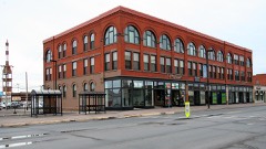 | New York Block | building | 1985 | 85001472 |
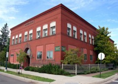 | Northern Block | building | 1985 | 85001471 |
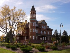 | Martin Pattison House | building | 1981 | 81000042 |
| Roosevelt Terrace | building | 2005 | 04001483 | |
 | Superior Entry South Breakwater Light | structure | 2007 | 07000102 |
| A.D. Thompson Cabin | building | 2022 | 100007979 | |
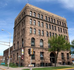 | Trade and Commerce Building | building | 1979 | 79000076 |
| Washington Block | building | 1985 | 85001473 | |
| Wemyss Building | building | 1985 | 85001474 |
Every wildfire the federal occurrence database records inside this county: 992 of them, burning about 10,126 acres. 22 started naturally and 54 were recorded as arson. Each settlement page carries the fires within five miles of it.
| Reported cause | Fires |
|---|---|
| Equipment and vehicle use | 233 |
| Debris and open burning | 223 |
| Missing data/not specified/undetermined | 151 |
| Railroad operations and maintenance | 146 |
| Arson/incendiarism | 54 |
| Recreation and ceremony | 51 |
| Power generation/transmission/distribution | 40 |
| Smoking | 24 |
| Natural | 22 |
| Other causes | 18 |
| Misuse of fire by a minor | 16 |
| Fireworks | 14 |
The five largest, by the area the report gives. None of them was recorded as arson.
| Date | Cause | Size | Reported by | Name on the report |
|---|---|---|---|---|
| 14 May 2013 | Equipment and vehicle use | 7,499 acres | Wisconsin Department of Natural Resources | GERMANN ROAD FIRE |
| 29 April 2007 | Equipment and vehicle use | 487 acres | Wisconsin Department of Natural Resources | BN COMPLEX #2 |
| 12 April 1998 | Power generation/transmission/distribution | 240 acres | Wisconsin Department of Natural Resources | not named |
| 29 April 2007 | Equipment and vehicle use | 171 acres | Wisconsin Department of Natural Resources | FOXBORO FIRE |
| 23 May 2000 | Debris and open burning | 170 acres | Wisconsin Department of Natural Resources | not named |
| 14 May 1993 | Equipment and vehicle use | 88 acres | Wisconsin Department of Natural Resources | not named |
| 12 April 1998 | Debris and open burning | 70 acres | Wisconsin Department of Natural Resources | not named |
| 24 October 1998 | Equipment and vehicle use | 56 acres | Wisconsin Department of Natural Resources | not named |
Every settlement page carries the fires within five miles of it - see the settlement index below.
The NOAA Storm Events Database holds 307 reports for this county, causing no deaths, no injuries and about $24,326,000 in recorded property damage. Each settlement page carries the reports that name it.
| Kind of event | Reports |
|---|---|
| Thunderstorm Wind | 159 |
| Hail | 106 |
| Flash Flood | 16 |
| Tornado | 12 |
| Lightning | 7 |
| Flood | 6 |
| Heavy Rain | 1 |
The most serious of them, by death, then injury, then recorded damage. The accounts are quoted exactly as the forecast office filed them.
| When | Event | Place named | Harm | What the report says |
|---|---|---|---|---|
| June 2012 | Flood | Itasca | $21,000,000 | The Nemadji River gage, at Superior, normally between 4 and 5 feet, rose to 20 feet early in the morning of June 20th. The river reached a record stage of 27.91 feet at 100 AM on June 21st, then fell back below 20 feet about midnight the night of June 22nd. Most of the runoff, resulting in the high stages, came from excessively heavy rain on Carlton County MN flowing downstream. Many roads were flooded in Superior and surrounding areas from the flood of the river and the excessive rainfall. Many buildings at he University of Wisconsin in Superior (UWS) was flooded. Uninsured damage at UWS was $8-10 million. Damage to homes was estimated at $6.3 million. Damage to businesses was estimated at $4 million. |
| July 1999 | Flash Flood | Countywide | $2,000,000 | no account filed |
| June 1994 | Tornado (F1) | Wascott | $500,000 | no account filed |
| June 1968 | Tornado (F2) | not stated | $250,000 | no account filed |
| April 2023 | Flood | Oliver | $150,000 | Warm temperatures early in April led to rapid snowmelt of a well above normal snowpack across the region. Additionally, heavy rainfall on top of the snowpack led to additional high runoff across the county as well. Roads began to be impacted on the 11th with water overtopping low spots leading to washouts and failed culverts. Temperatures cooled during the middle of the month along with a heavy snow event the 16th into the 17th. This allowed the runoff to slow and water levels to drop. All major roads were reported back open by the 18th. Multiple communities in addition to the county issued disaster declarations due to the extent of washed out roads. The Town of Superior estimated $100,000 in damages from the flooding, which was the highest report from an entity in the county. |
| September 2017 | Lightning | Saunders | $100,000 | An assisted living residence was struck by lightning damaging the roof and ignited an electric fire in the attic. |
| July 2011 | Lightning | Solon Springs | $100,000 | Lightning hit a boat lift canopy, which burned the boat, shortly after a nearby house was hit by lightning. The house burned. |
| August 2005 | Lightning | Superior | $60,000 | Lightning struck a wood pile at Johnson Timber Corporation woodyard, causing the wood to catch fire. Four hundred cords of wood were destroyed. |
| June 1994 | Tornado (F1) | Dairyland | $50,000 | no account filed |
| August 1998 | Tornado (F0) | Maple | $28,500 | no account filed |
| September 1980 | Tornado (F2) | not stated | $25,000 | no account filed |
| March 2000 | Lightning | Superior | $15,000 | Lightning struck a home and started a fire on the second floor. No one was injured. |
| May 2022 | Thunderstorm Wind | Lake Nebagamon | $10,000 | Large pine trees were snapped and fell onto a garage and outbuilding causing damage. |
| July 1995 | Hail | Lake Nebagamon | $10,000 | A severe thunderstorm produced 1.75 inch diameter hail and winds that toppled trees and blew down power lines. |
| August 2023 | Thunderstorm Wind | Waino | $5,000 | Photos were received showing three large and healthy trees that were uprooted and possibly snapped. A trailer was also blown over onto its side. |
| July 1995 | Thunderstorm Wind | Superior | $5,000 | Trees 50-60 feet high were blown down on a house. |
| June 2010 | Thunderstorm Wind | Superior | $3,000 | A half dozen 6-inch diameter trees were blown down on County Road A near the Nemadji Golf Course. |
| September 1979 | Tornado (F1) | not stated | $2,500 | no account filed |
| August 2023 | Thunderstorm Wind | South Superior | $2,000 | Trees and fence panels were blown down. |
| August 2023 | Thunderstorm Wind | Cloverland | $2,000 | Multiple pine trees were uprooted with a 12 to 18 inch diameter pine tree broken about 25 feet off the ground. An empty hay wagon was overturned and some structural damage was reported as well at the location. |
| June 2010 | Thunderstorm Wind | Lake Nebagamon | $2,000 | Trees were blown down along a quarter mile stretch of Highway B in and south of Lake Nebagamon. A few trees over 1 foot in diameter were snapped. |
| July 2010 | Thunderstorm Wind | Blueberry | $1,500 | Three large trees were blown down. |
| July 2010 | Thunderstorm Wind | Maple | $1,500 | Several power lines were blown down. |
| August 2023 | Thunderstorm Wind | South Superior | $1,000 | Fence panels were broken by winds and then blown into a window during the storm. |
| June 2010 | Thunderstorm Wind | Lake Nebagamon | $500 | A 6-inch diameter tree was reported blown down, along with a few smaller trees. |
| June 2010 | Thunderstorm Wind | Brule | $500 | A 6 to 7-inch diameter tree was snapped along Highway 27. |
| September 1999 | Lightning | Superior | $500 | no account filed |
| July 1994 | Thunderstorm Wind | not stated | $500 | no account filed |
| March 2025 | Hail | South Range | - | Most were penny to nickel size and accumulated deep enough to shovel. The largest stones were quarter to half dollar sized. |
| June 2025 | Thunderstorm Wind | Cloverland | - | A couple of trees were downed in the storm. |
| June 2025 | Thunderstorm Wind | Patzau | - | Several branches were broken off due to high winds. |
| June 2025 | Thunderstorm Wind | Bennett | - | Multiple trees were down in Bennett. |
| June 2025 | Thunderstorm Wind | Gordon | - | A couple of powerlines were down from the storm. |
| May 2024 | Thunderstorm Wind | East End | - | Thunderstorm winds blew over a 40 pound deck chair with a steel base and downed branches around 1.5 inches in diameter. |
| July 2024 | Thunderstorm Wind | Superior | - | An 18 to 24 inch diameter silver maple tree was snapped about 8 feet up in front of the old library. |
| June 2024 | Thunderstorm Wind | South Superior | - | A photo was received showing an uprooted tree about 2 feet in diameter on the ground in the Village of Superior near highways 105 and 35. |
| July 2023 | Thunderstorm Wind | Gordon | - | Numerous white spruce and red pine branches were reported down that were around 2 inches in diameter. |
| August 2023 | Thunderstorm Wind | Sunnyside | - | A 12 to 13 inch tree was snapped at the base by the storm. |
| August 2023 | Thunderstorm Wind | Sunnyside | - | A report was received of a tree that had been uprooted or snapped. |
| August 2023 | Thunderstorm Wind | Cloverland | - | A photo was received showing multiple mature poplar trees that had been snapped 10 to 20 feet off the ground during the storm. |
| August 2023 | Thunderstorm Wind | Cutter | - | A tree was downed onto a power line. |
| May 2022 | Thunderstorm Wind | Bennett | - | Lawn furniture and a 50 pound grill were blown across a yard. |
| August 2022 | Thunderstorm Wind | Solon Springs | - | A sign was blown over near mile marker 202 along US Highway 53 near Solon Springs. |
| August 2022 | Thunderstorm Wind | Wascott | - | A photo was received of a 30 foot tall health oak tree that had been broken near the trunk. |
| July 2021 | Thunderstorm Wind | Cozy Corners | - | A secondhand report was received of trees down along with a power outage near Cozy Corner. |
| July 2021 | Thunderstorm Wind | Superior | - | A gust of 62 mph was recorded by the MnDOT RWIS station MN081 just south of the main span of the Blatnik Bridge over the St. Louis River. |
| July 2021 | Thunderstorm Wind | Superior | - | Multiple reports of trees down were received from around Superior. |
| July 2021 | Thunderstorm Wind | Gordon | - | A photo was received of a downed tree in Gordon. |
| September 2021 | Flash Flood | Blueberry | - | A culvert was damaged by a flash flood along Highway FF in Maple. |
| September 2021 | Thunderstorm Wind | Bennett | - | Sporadic tree and power line damage at this location and near Lake Nabagamon. |
| July 2020 | Thunderstorm Wind | Solon Springs | - | Two trees 4 to 6 inches in diameter were blown down by the storm. |
| July 2020 | Thunderstorm Wind | Dedham | - | Trees were downed by the storm at the Pattison Park Golf Course. |
| July 2020 | Thunderstorm Wind | Blueberry | - | Numerous branches were broken and a measured wind gust of 53 mph was recorded as well. |
| July 2020 | Tornado (EF1) | Blueberry | - | A weak, brief tornado formed along a line of thunderstorms that moved across Douglas County between 1:00 AM and 2:00 AM CDT. Meteorologists were tracking a number of weak areas of rotation on radar as these storms moved through, and a Tornado Warning was issued for one such area of rotation at 1:10 AM CDT including Maple and Blueberry. At 1:43 AM CDT, meteorologists saw a dramatic increase in radar-detected rotation from this storm just south of Maple, WI, and based on this information issued an additional Tornado Warning using radar-confirmed tornado language to indicate the|confidence in a tornado occurring or imminent. Minutes later, a tornado developed north of Maple and Blueberry knocking down dozens of trees, including snapping some trees off near the base. Just as soon as it developed, the area of rotation weakened|considerably. Radar indicates this tornado may have begun a few minutes earlier but at this time there is not enough conclusive damage evidence that the tornado formed earlier than documented. |
| August 2020 | Flash Flood | Lake Nebagamon Arpt | - | Water was reported over County Road A two miles west of Highway 27. |
| August 2020 | Thunderstorm Wind | Boylston | - | A patio table was flipped over and 3 to 4 gallon potted plants were knocked over by the winds as well. |
| August 2020 | Thunderstorm Wind | Superior | - | A large tree was downed by the storm in Superior. |
| August 2020 | Thunderstorm Wind | Sauntry | - | Several trees were down with some as large as 10 inches in diameter. |
| August 2020 | Thunderstorm Wind | Solon Springs | - | A tree was down onto a road in Solon Springs. |
| August 2020 | Thunderstorm Wind | Lake Nebagamon | - | Multiple pine trees approximately 10 to 12 inches in diameter were snapped and uprooted near the Lake Nebagamon Cemetery. |
The Survey's mineral resources record lists 161 workings inside this county. 22 still produce and 139 are closed or unrecorded. Each settlement page carries the workings within five miles of it.
| Commodity | Workings |
|---|---|
| Sand and Gravel, Construction | 108 |
| Copper | 26 |
| Stone, Crushed/Broken | 15 |
| Copper, Lead | 3 |
| Copper, Zinc | 2 |
| Lead, Copper | 1 |
| Zinc, Copper | 1 |
| Stone | 1 |
| Nickel, Silver, Gold, Copper | 1 |
| Sulfur | 1 |
| Clay, Sand and Gravel, Construction | 1 |
| Silver, Copper | 1 |
The least common of them first, because a county's hundredth gravel pit says nothing its first ten did not.
| Where | Site | Commodity | Status | Recorded |
|---|---|---|---|---|
| (Facility) Superior Refinery--Murphy Oil Co | Sulfur | Plant | ||
| Chippewa Copper-Nickel Mine | Nickel, Silver, Gold, Copper | Prospect | ||
| Martinson Clay & Gravel Pit | Clay, Sand and Gravel, Construction | Past Producer | ||
| Stupac Pit | Stone | Producer | ||
| Unnamed Prospect Along Anderson C | Lead, Copper | Occurrence | ||
| Unnamed Prospect Near Rock Creek | Zinc, Copper | Occurrence | ||
| Weyerhaeuser Explorations | Silver, Copper | Prospect | 1890 | |
| Chippewa Copper-Nickel Mine | Copper, Zinc | Occurrence | ||
| Unnamed Prospect Near Lakeside Cemetary | Copper, Zinc | Occurrence | ||
| Unnamed Prospect Near Flannagan F | Copper, Lead | Occurrence | ||
| Unnamed Prospect Near Waino | Copper, Lead | Occurrence | ||
| Weyerhauser | Copper, Lead | Prospect | 1890 | |
| Amnicon Falls Station Quarry | Stone, Crushed/Broken | Occurrence | ||
| Big Manitou Falls Quarry | Stone, Crushed/Broken | Occurrence | ||
| Buckley Mill | Stone, Crushed/Broken | Plant | ||
| Buckley Pit | Stone, Crushed/Broken | Past Producer | ||
| Copper Creek Quarry #1 | Stone, Crushed/Broken | Occurrence | ||
| Copper Creek Quarry #2 | Stone, Crushed/Broken | Occurrence | ||
| Flannagan Fire Tower Quarry | Stone, Crushed/Broken | Occurrence | ||
| George Larson Quarry | Stone, Crushed/Broken | Prospect | ||
| Granum Quarry | Stone, Crushed/Broken | Past Producer | ||
| Robert Missine Quarry | Stone, Crushed/Broken | Occurrence | ||
| Sam Anderson Quarry | Stone, Crushed/Broken | Past Producer | ||
| Smith Quarry | Stone, Crushed/Broken | Producer | ||
| Stupak Quarry | Stone, Crushed/Broken | Producer | ||
| Superior Grinding Plant | Stone, Crushed/Broken | Plant | ||
| Superior Lime Plant | Stone, Crushed/Broken | Plant | ||
| Aminicon | Copper | Unknown | Chalcocite, Chalcopyrite, Malachite | |
| Astor | Copper | Unknown | Chalcopyrite | |
| Catlin | Copper | Unknown | Copper | |
| Copper Creek | Copper | Unknown | Copper | |
| Culligan | Copper | Unknown | Copper | |
| Emetery | Copper | Occurrence | ||
| Fon Du Lac | Copper | Unknown | Copper, Malachite | |
| Nd Unnamed Prospect Near Moose R | Copper | Occurrence | ||
| North Wisconsin | Copper | Unknown | Copper | |
| Percival | Copper | Unknown | Copper | |
| Rd Unnamed Prospect Along Moose | Copper | Occurrence | ||
| Starkweather | Copper | Unknown | Copper | |
| Unnamed Prospect Along Anderson C | Copper | Occurrence | ||
| Unnamed Prospect Along Moose | Copper | Occurrence | ||
| Unnamed Prospect Along Moose Rive | Copper | Occurrence | ||
| Unnamed Prospect Along Moose Rive | Copper | Occurrence | ||
| Unnamed Prospect Near Dairyland C | Copper | Occurrence | ||
| Unnamed Prospect Near Flannagan F | Copper | Occurrence | ||
| Unnamed Prospect Near Lakeside Ce | Copper | Occurrence | ||
| Unnamed Prospect Near Moose R | Copper | Occurrence | ||
| Unnamed Prospect Near Rock Creek | Copper | Occurrence | ||
| Unnamed Prospect Near Rockmont | Copper | Occurrence | ||
| Unnamed Prospect Near Rockmont | Copper | Occurrence | ||
| Unnamed Prospect Near Sunnyside | Copper | Occurrence | ||
| Unnamed Prospect Near Sunnyside | Copper | Occurrence | ||
| Unnamed Prospect Near Waino | Copper | Occurrence | ||
| Albany Crushing Plant | Sand and Gravel, Construction | Producer | ||
| Albany Crushing Plant Plant | Sand and Gravel, Construction | Plant | ||
| Amnicon River Gravel Pit | Sand and Gravel, Construction | Occurrence | ||
| Anderson & McKay Pits | Sand and Gravel, Construction | Past Producer | ||
| Anthony Jacksino Pit | Sand and Gravel, Construction | Prospect | ||
| Bear Creek Pit | Sand and Gravel, Construction | Occurrence | ||
| Bear Lake Pit | Sand and Gravel, Construction | Producer | ||
| Beaver Creek Pit | Sand and Gravel, Construction | Past Producer | ||
| Bellwood Pit | Sand and Gravel, Construction | Occurrence | ||
| Bennett Rd Sand Pit | Sand and Gravel, Construction | Occurrence | ||
| Berg Park Pit | Sand and Gravel, Construction | Past Producer | ||
| Berry Rd Sand Pit | Sand and Gravel, Construction | Occurrence | ||
| Black River Pit | Sand and Gravel, Construction | Occurrence | ||
| Blueberry Creek Pit #1 | Sand and Gravel, Construction | Past Producer | ||
| Blueberry Creek Pit #2 | Sand and Gravel, Construction | Past Producer | ||
| Blueberry Creek Pit #3 | Sand and Gravel, Construction | Past Producer | ||
| Blueberry Creek Pit #4 | Sand and Gravel, Construction | Occurrence | ||
| Blueberry Gravel Pit | Sand and Gravel, Construction | Occurrence | ||
| Bois Brule River Pit #1 | Sand and Gravel, Construction | Past Producer | ||
| Bois Brule River Pit #2 | Sand and Gravel, Construction | Occurrence | ||
| Bois Brule River Pit #3 | Sand and Gravel, Construction | Past Producer | ||
| Bois Brule River Pit #4 | Sand and Gravel, Construction | Occurrence | ||
| Bois Brule River Pit #5 | Sand and Gravel, Construction | Occurrence | ||
| Bois Brule River Sand Pit | Sand and Gravel, Construction | Past Producer | ||
| Cecil Williams Sand Pit | Sand and Gravel, Construction | Occurrence | ||
| Chase Creek Pit #1 | Sand and Gravel, Construction | Occurrence | ||
| Chase Creek Pit #2 | Sand and Gravel, Construction | Occurrence | ||
| Church Pit | Sand and Gravel, Construction | Past Producer | ||
| Cleveland Rd Pit | Sand and Gravel, Construction | Occurrence | ||
| Copper Creek Pit #1 | Sand and Gravel, Construction | Occurrence | ||
| Copper Creek Pit #2 | Sand and Gravel, Construction | Occurrence | ||
| Copper Creek Pit #3 | Sand and Gravel, Construction | Past Producer | ||
| Crotte Creek Pit | Sand and Gravel, Construction | Occurrence | ||
| Douglas County Farmers' Union Pits | Sand and Gravel, Construction | Past Producer | ||
| Erickson-Harstad Pit | Sand and Gravel, Construction | Past Producer | ||
| Fire Tower Pit | Sand and Gravel, Construction | Producer | ||
| Fire Tower Rd Pit | Sand and Gravel, Construction | Past Producer | ||
| Fish Hatchery Rd Pit #1 | Sand and Gravel, Construction | Past Producer | ||
| Fish Hatchery Rd Pit #2 | Sand and Gravel, Construction | Past Producer | ||
| Fish Hatchery Rd Pit #3 | Sand and Gravel, Construction | Past Producer | ||
| Fish Hatchery Rd Pit #4 | Sand and Gravel, Construction | Past Producer | ||
| Hagman Rd Sand Pit | Sand and Gravel, Construction | Occurrence | ||
| Hemmerling Pit | Sand and Gravel, Construction | Occurrence | ||
| Hendrickson Rd Sand Pit | Sand and Gravel, Construction | Occurrence | ||
| Highland Fire Tower Pit | Sand and Gravel, Construction | Occurrence | ||
| Hokkinen Rd Pit | Sand and Gravel, Construction | Occurrence | ||
| Hoodoo Lake Pit | Sand and Gravel, Construction | Prospect | ||
| Jacksino Rd Sand Pit | Sand and Gravel, Construction | Past Producer | ||
| Johnson Pit | Sand and Gravel, Construction | Occurrence | ||
| Johnstad Pit | Sand and Gravel, Construction | Producer | ||
| Kingsdale Rd Pit | Sand and Gravel, Construction | Past Producer | ||
| La Gro Pit | Sand and Gravel, Construction | Producer | ||
| Lakeside Rd & Amnicon River Pits | Sand and Gravel, Construction | Occurrence | ||
| Largo Pit | Sand and Gravel, Construction | Unknown | ||
| Largro Pit | Sand and Gravel, Construction | Unknown | ||
| Larson Sand Pit | Sand and Gravel, Construction | Occurrence | ||
| Leo Creek Pits | Sand and Gravel, Construction | Past Producer | ||
| Lindquist Pit | Sand and Gravel, Construction | Past Producer | ||
| Lyman Lake Pit | Sand and Gravel, Construction | Producer | ||
| Manitou Falls Pit | Sand and Gravel, Construction | Occurrence | ||
| Many Lakes Pit | Sand and Gravel, Construction | Past Producer | ||
| Maple & E Lakeview Rd Pit | Sand and Gravel, Construction | Past Producer | ||
| Mclean Dredge | Sand and Gravel, Construction | Unknown | ||
| Middle River Gravel Pits | Sand and Gravel, Construction | Occurrence | ||
| Middle River Sand Pit | Sand and Gravel, Construction | Past Producer | ||
| Mike Mix Pit | Sand and Gravel, Construction | Producer | ||
| Milchesky Pit | Sand and Gravel, Construction | Producer | ||
| Miller Pit | Sand and Gravel, Construction | Occurrence | ||
| N Flowage Dr Pit #1 | Sand and Gravel, Construction | Past Producer | ||
| N Flowage Dr Pit #2 | Sand and Gravel, Construction | Occurrence | ||
| N Flowage Dr Pit #3 | Sand and Gravel, Construction | Past Producer | ||
| Nemadji River Pit | Sand and Gravel, Construction | Occurrence | ||
| New Pit | Sand and Gravel, Construction | Producer | ||
| Old Logging Rd Pit | Sand and Gravel, Construction | Past Producer | ||
| Oliver Pit | Sand and Gravel, Construction | Past Producer | ||
| Pattison Park Pit | Sand and Gravel, Construction | Producer | ||
| Pine Dr Pit | Sand and Gravel, Construction | Past Producer | ||
| Poplar Pit | Sand and Gravel, Construction | Producer | ||
| Ranger Sta. Rd Pit | Sand and Gravel, Construction | Past Producer | ||
| Repke Pit | Sand and Gravel, Construction | Producer | ||
| Richard Flamang Sand Pit | Sand and Gravel, Construction | Past Producer | ||
| Roadside Pit | Sand and Gravel, Construction | Occurrence | ||
| Robert Nelson Sand Pit | Sand and Gravel, Construction | Occurrence | ||
| Rock Creek Pit #1 | Sand and Gravel, Construction | Occurrence | ||
| Rock Creek Pit #2 | Sand and Gravel, Construction | Occurrence | ||
| Rothenbeuler Pit | Sand and Gravel, Construction | Past Producer | ||
| Sauntry Pit | Sand and Gravel, Construction | Past Producer | ||
| Sclavi Pit | Sand and Gravel, Construction | Past Producer | ||
| Silver Creek Sand Pit | Sand and Gravel, Construction | Past Producer | ||
| South Slope Pit | Sand and Gravel, Construction | Past Producer | ||
| Spruce River Pit | Sand and Gravel, Construction | Occurrence | ||
| St Croix River Pit | Sand and Gravel, Construction | Occurrence | ||
| Swamp Pit | Sand and Gravel, Construction | Occurrence | ||
| Swedish Hwy Pit | Sand and Gravel, Construction | Occurrence | ||
| Tavern Pit | Sand and Gravel, Construction | Producer | ||
| Toad Creek Pit #1 | Sand and Gravel, Construction | Occurrence | ||
| Toad Creek Pit #2 | Sand and Gravel, Construction | Occurrence | ||
| Toad Creek Pit #3 | Sand and Gravel, Construction | Occurrence | ||
| Troy Pit | Sand and Gravel, Construction | Producer | ||
| Troy Rd Pit | Sand and Gravel, Construction | Occurrence | ||
| Udeen Pit | Sand and Gravel, Construction | Past Producer | ||
| Upper St Croix Lake Pit | Sand and Gravel, Construction | Occurrence | ||
| Upper Tamarack River Pit | Sand and Gravel, Construction | Occurrence | ||
| Vokovich Pit | Sand and Gravel, Construction | Occurrence | ||
| Wasko Rd Sand Pit | Sand and Gravel, Construction | Occurrence | ||
| William Culligan Pit | Sand and Gravel, Construction | Occurrence | ||
| Willox Rd Gravel Pit | Sand and Gravel, Construction | Past Producer | ||
| Winneboujou Pit | Sand and Gravel, Construction | Occurrence |
Named settlements recorded in the Geographic Names Information System, each with the topographic sheets covering it. Villages, hamlets and abandoned places alike. Each is shown with the nearest named watercourse or landform and the survey quadrangle it falls on.
Superior town · 54880 · On Copper Creek · Sunnyside quadrangle
12 sheets, 1915 to 1980
Superior city · 54880 · Near Barkers Island · Superior quadrangle
16 sheets, 1915 to 1980
Oliver village · 54880 · On Little Pokegama River · West Duluth quadrangle
20 sheets, 1915 to 1997
Superior town · 54880 · On Little Pokegama River · West Duluth quadrangle
20 sheets, 1915 to 1997
Solon Springs town · 54873 · On Beebe Creek · Solon Springs quadrangle
10 sheets, 1945 to 1982
Solon Springs town · 54873 · On Park Creek · Solon Springs quadrangle
10 sheets, 1945 to 1982
Superior city · 54880 · On Crawford Creek · Superior quadrangle
16 sheets, 1915 to 1980
Superior village · 54880 · On Crawford Creek · Superior quadrangle
16 sheets, 1915 to 1980