 Block
From the record
7 National Register listings published here.
Sources: the National Register database, National Park Service
63 topographic sheets cover 35 settlements here, and 7 properties are on the National Register of Historic Places.
7 National Register listings published here.
Sources: the National Register database, National Park Service
Every property in this county listed on the National Register of Historic Places, with the year it was listed and the federal nomination document.
| Photograph | Property | Type | Listed | Reference |
|---|---|---|---|---|
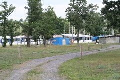 | Black Hawk Powwow Grounds | site | 2007 | 07000244 |
| Black River Falls Commercial Historic District | district | 2021 | 100006789 | |
 | Black River Falls Public Library | building | 2007 | 07001330 |
| Franklin E. and Eva E. Keefe House | building | 2023 | 100008607 | |
| Millston Union Church | building | 2022 | 100008109 | |
| Spring Creek School | building | 2024 | 100010817 | |
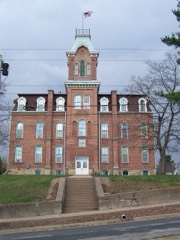 | Union High School | building | 1978 | 78000103 |
Every wildfire the federal occurrence database records inside this county: 840 of them, burning about 1,576 acres. 19 started naturally and 71 were recorded as arson. Each settlement page carries the fires within five miles of it.
| Reported cause | Fires |
|---|---|
| Debris and open burning | 201 |
| Missing data/not specified/undetermined | 182 |
| Equipment and vehicle use | 177 |
| Arson/incendiarism | 71 |
| Recreation and ceremony | 49 |
| Railroad operations and maintenance | 43 |
| Other causes | 24 |
| Smoking | 22 |
| Misuse of fire by a minor | 22 |
| Natural | 19 |
| Power generation/transmission/distribution | 19 |
| Fireworks | 11 |
The five largest, by the area the report gives. None of them was recorded as arson.
| Date | Cause | Size | Reported by | Name on the report |
|---|---|---|---|---|
| 21 April 2007 | Recreation and ceremony | 159 acres | Wisconsin Department of Natural Resources | JEAN FIRE |
| 1 April 1994 | Equipment and vehicle use | 74 acres | Wisconsin Department of Natural Resources | not named |
| 23 April 1993 | Equipment and vehicle use | 65 acres | Wisconsin Department of Natural Resources | not named |
| 5 April 2000 | Railroad operations and maintenance | 62 acres | Wisconsin Department of Natural Resources | not named |
| 24 May 2000 | Equipment and vehicle use | 60 acres | Wisconsin Department of Natural Resources | not named |
| 20 May 2009 | Missing data/not specified/undetermined | 48 acres | Necedah National Wildlife Refuge | BELL MOUND |
| 19 April 2001 | Debris and open burning | 39 acres | Wisconsin Department of Natural Resources | not named |
| 24 April 2003 | Debris and open burning | 38 acres | Wisconsin Department of Natural Resources | not named |
Every settlement page carries the fires within five miles of it - see the settlement index below.
The NOAA Storm Events Database holds 415 reports for this county, causing 1 death, 13 injuries and about $12,263,050 in recorded property damage. Each settlement page carries the reports that name it.
| Kind of event | Reports |
|---|---|
| Thunderstorm Wind | 173 |
| Hail | 122 |
| Flood | 63 |
| Tornado | 19 |
| Heavy Rain | 16 |
| Flash Flood | 13 |
| Lightning | 6 |
| Funnel Cloud | 3 |
The most serious of them, by death, then injury, then recorded damage. The accounts are quoted exactly as the forecast office filed them.
| When | Event | Place named | Harm | What the report says |
|---|---|---|---|---|
| August 1996 | Thunderstorm Wind | Taylor | 1 killed, 4 hurt, $80,000 | no account filed |
| September 2015 | Flash Flood | Requa | 4 hurt, $400,000 | Flood waters from Schoolhouse Creek caused U.S. Highways 10 and 12 to be closed in the extreme northern part of Jackson County east of Price. Numerous other roads were washed out with general flooding across the northern sections of the county covering much of the Townships of Cleveland and Garfield. Two accidents occurred when the drivers attempted to drive their vehicles over water covered roads that had been washed out. Three residents were stranded when flood waters overtook a dead end road in the Town of Cleveland. There were no reports of damage to private property with the damage limited to roads. |
| July 1966 | Tornado (F2) | not stated | 3 hurt, $25,000 | no account filed |
| May 1964 | Tornado (F2) | not stated | 2 hurt, $250,000 | no account filed |
| September 2010 | Flood | North Bend | $2,600,000 | Numerous roads were closed throughout the county due to heavy rains and flooding along rivers, streams, and creeks. Most bridges on township roads were over-topped with water. At one time, 56 roads were closed throughout the county. State Highway 95 was closed in several locations. Other specific road closures included Old Highway 95 and County Roads S, X, and VV. Lowland flooding occurred across much of the county, while many roads, trails, and campgrounds in the Black River State Forest were closed. Pigeon Creek was flooded and the Pigeon Falls Dam incurred some damage. Parks around Merrillan were all flooded, and the baseball field in Hixton was completely underwater. A person was rescued from a stranded vehicle on County Road VV, while assistance was given to a family evacuating in Irving Township. In Melrose, 8 structures and 4 homes were damaged due to flooding from the Black River. Throughout the county, 13 homes incurred major damage and 29 homes had minor damage. Although rain fell from the evening of the 22nd through much of the day on the 23rd, the majority of the rain had fallen as of 10 a.m. CST on the 23rd. At that point 5.30 inches had been measured in Merrillan. |
| June 1969 | Tornado (F2) | not stated | $2,500,000 | no account filed |
| September 2016 | Flood | Vaudreuil | $825,000 | Runoff from heavy rain pushed the Black River out of its banks in Black River Falls. The river crested over thirteen feet above the flood stage at 60.3 feet, which was the 3rd highest crest on record at the time. The hydroelectric dam lost a gate when a large tree traveled through it. Several boats and docks that broke away on Lake Arbutus also traveled through the dam. |
| April 1994 | Thunderstorm Wind | Melrose | $500,000 | no account filed |
| September 2010 | Flood | Vaudreuil | $350,000 | Locally heavy rains pushed the Black River at Black River Falls out of its banks from September 23rd to the 27th. The river exceeded the flood stage by over fourteen feet, cresting at 61.46 feet. This crest established a new flood of record. Ironically the dam at Black River Falls was being reconstructed during this event and was not in place during the peak. An early damage estimate of $600,000 was lowered to $110,000 at the dam by the utility and local contractor. From the evening of the 23rd to the afternoon of the 24th, 80 homes in the city of Black River Falls were evacuated. |
| April 2026 | Hail | Millston | $325,000 | The public reported tennis ball sized hail in Millston. The report was relayed via social media. |
| July 2017 | Flash Flood | Taylor | $303,000 | After heavy rains of 4 to 6 inches, flash flooding occurred across the southwest sections of Jackson County. French Creek went out of its banks sending water over County Road X southeast of Taylor. The townships of Springfield, Franklin and North Bend were hit the hardest with several roads either washed out or damaged from the flooding. Two homes sustained minor damage during the flooding. |
| August 2010 | Flood | Requa | $297,300 | Various roads were closed across parts of Jackson county and sustained damage from flooding. The flooding also caused damage to some parks and utility systems. |
| September 1994 | Tornado (F1) | Melrose | $250,000 | no account filed |
| July 1982 | Tornado (F1) | not stated | $250,000 | no account filed |
| May 1959 | Tornado (F3) | not stated | $250,000 | no account filed |
| June 1954 | Tornado (F2) | not stated | $250,000 | no account filed |
| August 2012 | Lightning | Winnebago Mission | $210,000 | A log home was completely destroyed by a fire that was started by a lightning strike. Fire crews were first called to the area around 330 a.m. but found no evidence of a fire and left. They returned to the scene around 5 a.m. to find the home completely engulfed in flames. Three fire departments battled the fire for over 4 hours. Local officials estimated the value of the home and contents at just over $200,000. |
| June 2000 | Flash Flood | Southwest Portion | $116,000 | no account filed |
| May 2017 | Flood | Requa | $110,000 | At least 18 roads were closed across the northwest part of Jackson County as the result of flooding from heavy rains. Hixton Levis Road east of Northfield and Moore Road northwest of Alma Center were completely washed out. |
| June 2020 | Hail | Pray | $105,000 | Up to golf ball sized hail fell near Pray. |
| May 1996 | Thunderstorm Wind | Taylor | $100,000 | no account filed |
| June 1998 | Thunderstorm Wind | North Bend | $85,000 | no account filed |
| June 2014 | Lightning | Vaudreuil | $82,000 | An elderly lady died from smoke inhalation after a lightning strike started her house on fire in Black River Falls. At least three other nearby homes also suffered some electrical damage. |
| July 2024 | Thunderstorm Wind | Hixton | $75,000 | Law enforcement reported trees and power lines down in the Hixton area. |
| December 2021 | Thunderstorm Wind | Schlerville | $75,000 | A semi loaded with 30,000 pounds of perishable goods was blown over on Interstate 94. The driver sustained minor injuries. |
| August 2006 | Hail | Millston | $75,000 | no account filed |
| June 2004 | Tornado (F1) | Taylor | $75,000 | no account filed |
| June 1998 | Flash Flood | Hatfield | $70,000 | no account filed |
| May 2012 | Lightning | Buckholz Corners | $60,000 | Lightning struck and caught a house on fire northwest of Melrose. The house was totally destroyed by the fire. |
| September 2016 | Flood | North Bend | $58,000 | Runoff from heavy rains caused several streams to go out of their banks across Jackson County. County Highway VV in North Bend, County Highway Z in City Point and several other township roads were closed because of the flooding. |
| August 2009 | Flash Flood | Sheppard | $50,000 | Law Enforcement officials reported several washed out county roads in the northern half of Jackson County and vehicles submerged in the city of Black River Falls. Several cooperative observers reported over six inches of rain in the northern portions of Jackson County. |
| April 2008 | Flood | Pray | $50,000 | no account filed |
| August 2006 | Hail | Merrillan | $50,000 | no account filed |
| August 2006 | Hail | Black River Falls | $50,000 | no account filed |
| August 2006 | Hail | Millston | $50,000 | no account filed |
| October 2006 | Hail | Northfield | $50,000 | no account filed |
| July 2023 | Thunderstorm Wind | Millston | $45,000 | Public reported multiple fallen and uprooted trees near Millston. |
| December 2021 | Tornado (EF1) | Levis | $45,000 | This EF1 tornado developed in northeast Trempealeau County before moving into Jackson County near County Highway G southwest of Levis. The tornado continued to move northeast and dissipated along County Highway FF before reaching Interstate 94. Damage was primarily to trees with a couple of farm outbuildings also damaged. |
| June 1998 | Thunderstorm Wind | Melrose | $40,000 | no account filed |
| April 2026 | Tornado (EF1) | Requa | $37,000 | This tornado continued from northeast Trempealeau County where it crossed Interstate 94, moving northeast into far northwest Jackson County where it caused roof damage to two residences and damaged a significant number of trees. |
| May 2008 | Thunderstorm Wind | Pray | $36,000 | A few pine trees were blown down in a campground near Highway 54, but more extensive damage was reported at a cranberry farm where one building was blown down and many nearby trees were broken or sheared off. There may have been a brief gustnado. Cranberry vines were extensively damaged as well. |
| December 2021 | Thunderstorm Wind | Melrose | $35,000 | The attached garage was blown off a house northwest of Melrose and several trees were blown down. |
| July 2017 | Flash Flood | Franklin | $35,000 | Runoff from locally heavy rains washed out a culvert on Franklin Road south of Taylor. Beaver Creek went out of its banks and covered Beck Road. |
| June 1998 | Thunderstorm Wind | Melrose | $32,000 | no account filed |
| August 2018 | Thunderstorm Wind | Price | $30,000 | Trees were blown down in the Town of Cleveland. Some of the downed trees landed on vehicles. |
| May 2016 | Lightning | Vaudreuil | $30,000 | A house was damaged by a fire started from a lightning strike. Lightning hit propane tanks outside of the house, which started the gas on fire. The house fire started where the gas lines entered the home. |
| July 1997 | Thunderstorm Wind | Hixton | $30,000 | no account filed |
| June 2007 | Thunderstorm Wind | Shamrock | $25,000 | Trees were blown along Thunder Cloud Road. |
| August 2006 | Hail | Black River Falls | $25,000 | no account filed |
| June 2000 | Thunderstorm Wind | Hatfield | $25,000 | no account filed |
| September 1997 | Hail | Millston | $25,000 | no account filed |
| October 1962 | Tornado (F1) | not stated | $25,000 | no account filed |
| May 1959 | Tornado (F2) | not stated | $25,000 | no account filed |
| September 2015 | Lightning | Vaudreuil | $20,000 | Lightning hit a rural Black River Falls home striking the house's TV antenna and then traveling into the house. A hole was blown into an interior wall of a second floor bedroom where a mattress and box springs caught on fire. A wall stud was blown apart causing a hole in an exterior wall and numerous outlets and light switches throughout the house had their covers blown off or charred. |
| August 2006 | Hail | Millston | $20,000 | no account filed |
| October 2006 | Hail | Alma Center | $20,000 | no account filed |
| April 2026 | Hail | Price | $17,000 | The public reported golf ball sized hail 2 miles east of Price. |
| April 2026 | Hail | Price | $15,000 | A trained spotter reported golf ball sized hail roughly 2 miles south-southeast of Price. |
| May 2024 | Thunderstorm Wind | North Branch | $15,000 | The public reported a barn destroyed 2 miles west of Alma Center. |
| August 2019 | Hail | Price | $15,000 | Golf ball sized hail fell across the far northern sections of Jackson County east of Price. |
The Survey's mineral resources record lists 13 workings inside this county. 7 still produce and 6 are closed or unrecorded. Each settlement page carries the workings within five miles of it.
| Commodity | Workings |
|---|---|
| Sand and Gravel, Construction | 7 |
| Iron | 5 |
| Silica | 1 |
| Water, Free | 1 |
The least common of them first, because a county's hundredth gravel pit says nothing its first ten did not.
| Where | Site | Commodity | Status | Recorded |
|---|---|---|---|---|
| Black River Falls | Iron, Water, Free | Past Producer | 1839, 1969 | |
| Taylor Pit | Silica | Producer | ||
| Black River Falls | Iron | Past Producer | 1969, 1982 | |
| Black River Falls Pellet Plant | Iron | Plant | ||
| Tilden Mound Deposit | Iron | Past Producer | 1839, 1856, 1892 | |
| Tilden Mound Deposit | Iron | Past Producer | 1839, 1856 | |
| Airport Pit | Sand and Gravel, Construction | Past Producer | ||
| Arnt Pit and Mill | Sand and Gravel, Construction | Producer | ||
| Harris Pit | Sand and Gravel, Construction | Past Producer | ||
| Jackson County Operations | Sand and Gravel, Construction | Producer | ||
| Pierce Pit | Sand and Gravel, Construction | Producer | ||
| Potter Pit | Sand and Gravel, Construction | Producer | ||
| Smith Gravel Pit | Sand and Gravel, Construction | Producer |
Named settlements recorded in the Geographic Names Information System, each with the topographic sheets covering it. Villages, hamlets and abandoned places alike. Each is shown with the nearest named watercourse or landform and the survey quadrangle it falls on.
Alma Center village · 54611 · On Hayden Creek · Alma Center quadrangle
13 sheets, 1924 to 1985
Black River Falls city · 54615 · On Town Creek · Black River Falls quadrangle
13 sheets, 1924 to 1985
Brockway town · 54615 · On Coffee Creek · Black River Falls quadrangle
13 sheets, 1924 to 1985
Albion town · 54615 · On Hawk Creek · Black River Falls quadrangle
13 sheets, 1924 to 1985
No longer a settlement
City Point town · 54466 · On Indian Creek · City Point quadrangle
13 sheets, 1953 to 1985
Komensky town · 54754 · On Pollies Creek · Hatfield quadrangle
11 sheets, 1953 to 1985
No longer a settlement
Manchester town · 54615 · On Stony Creek · Shamrock quadrangle
11 sheets, 1928 to 1985
Knapp town · 54666 · Spaulding quadrangle
12 sheets, 1953 to 1985
No longer a settlement
Merrillan village · 54754 · On South Fork Halls Creek · Merrillan quadrangle
13 sheets, 1924 to 1985
North Bend town · 54642 · Near Sandberg Valley · North Bend quadrangle
13 sheets, 1926 to 1985
Garden Valley town · 54611 · On Judkins Creek · Alma Center quadrangle
13 sheets, 1924 to 1985
Franklin town · 54642 · Near Cuffy Knob · North Bend NE quadrangle
12 sheets, 1926 to 1985
No longer a settlement
Millston town · 54615 · On Town Line Creek · Hatfield SE quadrangle
11 sheets, 1953 to 1985
No longer a settlement
Brockway town · 54615 · On Levis Creek · Black River Falls quadrangle
13 sheets, 1924 to 1985
Komensky town · 54615 · On Dickey Creek · Black River Falls quadrangle
13 sheets, 1924 to 1985
Alma town · 54754 · On Wrightsville Creek · Merrillan quadrangle
13 sheets, 1924 to 1985
No longer a settlement
The vanished settlements of Jackson County: the places named above that are no longer on the map.