 Block
Vaudreuil, Wisconsin
13 topographic sheets cover this place, the earliest surveyed in 1924 and the latest in 1985. It stands in Brockway town. It lies in ZIP code area 54615. It stands on Levis Creek. The Survey maps it on the Black River Falls quadrangle. It stands 853 feet above sea level.
Research this city
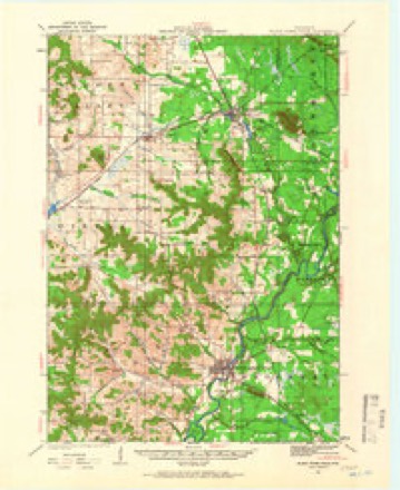
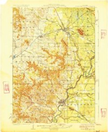
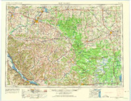
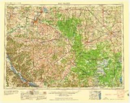
Topographic sheets covering this place
8 surveys from 13 printed sheetsMatched by testing this settlement's coordinate against the published boundary of every sheet in the United States Geological Survey's historical collection. Each opens the scanned sheet at the Survey.
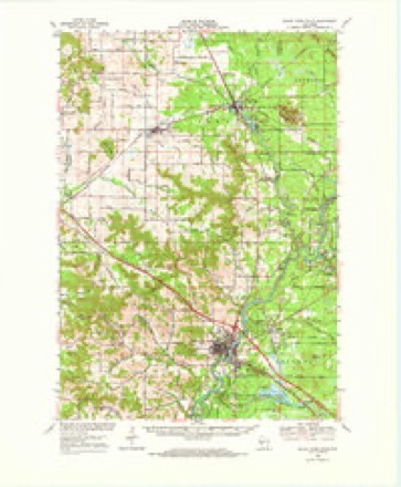
- 1924 USGS Black River Falls quadrangle1:62500, 2 printings
- 1926 USGS Black River Falls quadrangle1:62500
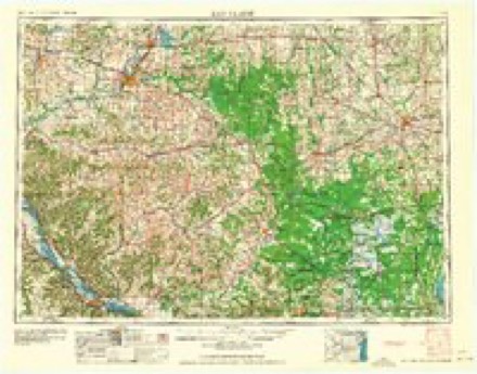
- 1953 USGS Eau Claire quadrangle1:250000, 4 printings
- 1958 USGS Eau Claire quadrangle1:250000
- 1964 USGS Eau Claire quadrangle1:250000
- 1968 USGS Black River Falls quadrangle1:62500
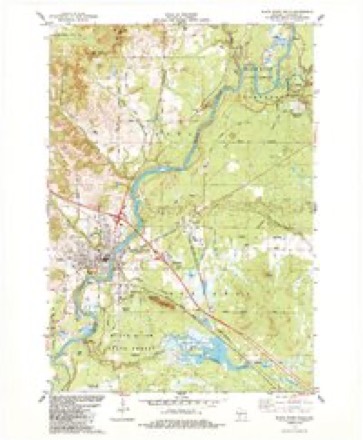
- 1984 USGS Black River Falls quadrangle1:24000
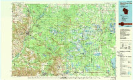
- 1985 USGS Black River Falls quadrangle1:100000, 2 printings
Fires near this place
236 since 1992Regional context, not property-specific evidence. The federal wildfire occurrence database lists 236 fires within 5 miles of Vaudreuil between 1992 and 2020, burning about 168 acres in total. 3 started naturally. 29 were recorded as arson. Distance is straight-line from the map coordinates, so a fire counted here may appear on a neighbouring settlement's page as well.
| Reported cause | Fires |
|---|---|
| Missing data/not specified/undetermined | 57 |
| Debris and open burning | 48 |
| Equipment and vehicle use | 48 |
| Arson/incendiarism | 29 |
| Misuse of fire by a minor | 13 |
| Recreation and ceremony | 11 |
| Fireworks | 8 |
| Smoking | 6 |
| Railroad operations and maintenance | 5 |
| Power generation/transmission/distribution | 4 |
| Other causes | 4 |
| Natural | 3 |
The most recent of them, most recent first, with the day each was reported and the service that recorded it.
| Date | Cause | Size | Reported by | Name on the report |
|---|---|---|---|---|
| 7 September 2002 | Equipment and vehicle use | under an acre | Wisconsin Department of Natural Resources | not named |
| 7 September 2002 | Equipment and vehicle use | under an acre | Wisconsin Department of Natural Resources | not named |
| 6 September 2013 | Debris and open burning | under an acre | Wisconsin Department of Natural Resources | ALLEN CREEK |
| 6 September 2007 | Equipment and vehicle use | under an acre | Wisconsin Department of Natural Resources | not named |
| 6 September 2007 | Equipment and vehicle use | under an acre | Wisconsin Department of Natural Resources | not named |
| 6 September 2005 | Arson/incendiarism | 4.7 acres | Wisconsin Department of Natural Resources | not named |
| 5 September 2004 | Recreation and ceremony | 6.0 acres | Wisconsin Department of Natural Resources | not named |
| 28 September 2012 | Equipment and vehicle use | 3.9 acres | Wisconsin Department of Natural Resources | KROME RD. II FIRE |
Settlements close enough to share some of these fires:
Mines and quarries near this place
9 within 5 milesRegional context, not property-specific evidence. The federal mineral resources record lists 9 workings within 5 miles of Vaudreuil: 5 past producers, 3 producers, 1 plant. 4 still produce. What was taken out: Iron, Sand and Gravel, Construction, Water, Free. Distance is straight-line from the map coordinates, so a quarry counted here may appear on a neighbouring settlement's page as well.
| Where | Site | Commodity | Status | Recorded |
|---|---|---|---|---|
| Black River Falls | Iron, Water, Free | Past Producer | 1839, 1969 | |
| Airport Pit | Sand and Gravel, Construction | Past Producer | ||
| Jackson County Operations | Sand and Gravel, Construction | Producer | ||
| Potter Pit | Sand and Gravel, Construction | Producer | ||
| Smith Gravel Pit | Sand and Gravel, Construction | Producer | ||
| Black River Falls | Iron | Past Producer | 1969, 1982 | |
| Black River Falls Pellet Plant | Iron | Plant | ||
| Tilden Mound Deposit | Iron | Past Producer | 1839, 1856, 1892 | |
| Tilden Mound Deposit | Iron | Past Producer | 1839, 1856 |
Storms near this place
58 since 2009Regional context, not property-specific evidence. The National Weather Service names Vaudreuil in 58 storm reports between 2009 and 2026: 32 flood, 11 hail, 7 thunderstorm wind, 5 heavy rain. No death or injury is recorded in these reports. Each account below is quoted exactly as the forecast office filed it, from the NOAA Storm Events Database, and each date opens the federal record of that event.
| When | Event | Place named | Harm | What the report says |
|---|---|---|---|---|
| September 2016 | Flood | Vaudreuil | $825,000 | Runoff from heavy rain pushed the Black River out of its banks in Black River Falls. The river crested over thirteen feet above the flood stage at 60.3 feet, which was the 3rd highest crest on record at the time. The hydroelectric dam lost a gate when a large tree traveled through it. Several boats and docks that broke away on Lake Arbutus also traveled through the dam. |
| September 2010 | Flood | Vaudreuil | $350,000 | Locally heavy rains pushed the Black River at Black River Falls out of its banks from September 23rd to the 27th. The river exceeded the flood stage by over fourteen feet, cresting at 61.46 feet. This crest established a new flood of record. Ironically the dam at Black River Falls was being reconstructed during this event and was not in place during the peak. An early damage estimate of $600,000 was lowered to $110,000 at the dam by the utility and local contractor. From the evening of the 23rd to the afternoon of the 24th, 80 homes in the city of Black River Falls were evacuated. |
| June 2014 | Lightning | Vaudreuil | $82,000 | An elderly lady died from smoke inhalation after a lightning strike started her house on fire in Black River Falls. At least three other nearby homes also suffered some electrical damage. |
| May 2016 | Lightning | Vaudreuil | $30,000 | A house was damaged by a fire started from a lightning strike. Lightning hit propane tanks outside of the house, which started the gas on fire. The house fire started where the gas lines entered the home. |
| September 2015 | Lightning | Vaudreuil | $20,000 | Lightning hit a rural Black River Falls home striking the house's TV antenna and then traveling into the house. A hole was blown into an interior wall of a second floor bedroom where a mattress and box springs caught on fire. A wall stud was blown apart causing a hole in an exterior wall and numerous outlets and light switches throughout the house had their covers blown off or charred. |
| July 2023 | Thunderstorm Wind | Vaudreuil | $10,000 | Public reported several fallen trees near Vaudreuil. |
| August 2014 | Hail | Vaudreuil | $10,000 | Quarter sized hail fell northwest of Black River Falls. The hail dented cars and damaged roof shingles. |
| May 2016 | Thunderstorm Wind | Vaudreuil | $5,000 | Trees were blown down on the west side of Black River Falls. One of these trees landed on a car. |
| June 2014 | Flood | Vaudreuil | $5,000 | Runoff from heavy rain caused street flooding to occur in Black River Falls. One vehicle had to be pulled from a water filled ditch after swerving to miss debris in the roadway and entered the ditch. |
| August 2014 | Hail | Vaudreuil | $5,000 | Quarter to ping pong ball sized hail fell in Black River Falls. Some RV's parked at the Jackson County Fairgrounds had skylights and awnings damaged by the hail. |
| May 2017 | Thunderstorm Wind | Vaudreuil | $3,000 | Numerous trees were blown down just north of Black River Falls. |
| August 2013 | Thunderstorm Wind | Vaudreuil | $3,000 | Numerous trees were blown down in and around Black River Falls. |
| July 2016 | Thunderstorm Wind | Vaudreuil | $2,000 | Several trees were blown down northwest of Black River Falls. |
| September 2016 | Thunderstorm Wind | Vaudreuil | $1,000 | Trees were blown down in Black River Falls. The locally heavy rain also caused some street flooding to occur. |
| April 2026 | Hail | Vaudreuil | - | The public reported nickel sized hail near Black River Falls. |
| March 2025 | Flood | Vaudreuil | - | The combination of recent rainfall and some snowmelt allowed the Black River to reach into minor flood stage just after midnight on March 31st. The river then crested by early morning at a stage of 47.94 ft in minor flood stage before falling below flood stage during the afternoon on March 31st. |
| April 2025 | Flood | Vaudreuil | - | The Black River at Black River Falls went into minor flood stage on April 21st during the afternoon before cresting at a height of 49.15 feet. The river stage eventually fell below flood stage during the morning hours on April 22nd. |
| July 2024 | Thunderstorm Wind | Vaudreuil | - | The public reported several trees snapped and uprooted. |
| May 2024 | Hail | Vaudreuil | - | The public reported nickel sized hail on the northeast side of Black River Falls. |
| June 2024 | Flood | Vaudreuil | - | Significant rainfall later into June pushed the Black River at Black River Falls into flood stage on June 22nd. The river stage crested during the early on June 23rd in minor flood stage at 50.43 ft. |
| April 2023 | Flood | Vaudreuil | - | A strong spring storm in the middle of April provided over 20 of snow on a deeper than average snowpack in north-central Wisconsin, quickly followed by anomalously warm temperatures and rapid melting. The Black River at Black River Falls rapidly rose above flood stage and crested at 53.42 ft on April 21st, 6.42 ft above flood stage. |
| April 2023 | Flood | Vaudreuil | - | A strong spring storm at the end of March resulted in over an inch of rain falling on a deeper than average snowpack in north-central Wisconsin. The Black River at Black River Falls quickly rose above flood stage and crested at 51.17 ft on April 1st, 4.17 ft above flood stage. |
| October 2023 | Flood | Vaudreuil | - | The Black River at Black River Falls reached minor flood stage on October 25th, cresting 9.73 feet above flood stage, in major flood stage later that day. |
| October 2023 | Heavy Rain | Vaudreuil | - | A volunteer observer reported 6.23 inches of rainfall near Black River Falls. |
| March 2022 | Flood | Vaudreuil | - | Runoff after a rainfall event pushed the Black River out of its banks in Black River Falls. The river crested over a foot above the flood stage at 48.36 feet on the 24th. |
| August 2021 | Flood | Vaudreuil | - | Runoff from heavy rains pushed the Black River out of its banks in Black River Falls. The river crested over a foot above the flood stage at 48.2 feet. |
| August 2021 | Flood | Vaudreuil | - | Runoff from heavy rains pushed the Black River out of its banks in Black River Falls. The river crested almost nine feet above the flood stage at 55.93 feet on the 28th. This was the fifth highest crest ever recorded. |
| March 2019 | Flood | Vaudreuil | - | Runoff from melting snow pushed the Black River out of its banks in Black River Falls. The river crested over a foot above the flood stage at 48.54 feet on March 14th. |
| April 2019 | Flood | Vaudreuil | - | Runoff from rain and snowmelt pushed the Black River out of its banks in Black River Falls. The river crested just over eleven feet above the flood stage at 58.04 feet on April 18th. |
| July 2019 | Flood | Vaudreuil | - | Runoff from heavy rain pushed the Black River out of its banks in Black River Falls. The river crested over three feet above the flood stage 50.3 feet. |
| September 2019 | Flood | Vaudreuil | - | Runoff from heavy rain pushed the Black River out of its banks in Black River Falls. The river crested a foot above the flood stage at 48 feet. |
| September 2018 | Flood | Vaudreuil | - | Runoff from heavy rains pushed the Black River out of its banks in Black River Falls. The river crested just over two feet above the flood stage at 49.03 feet on September 5th. |
| October 2018 | Flood | Vaudreuil | - | Runoff from heavy rains pushed the Black River out of its banks in Black River Falls. The river crested almost three feet above the flood stage at 49.88 feet on October 10th. |
| May 2017 | Flood | Vaudreuil | - | Runoff from heavy rains pushed the Black River out of its banks in Black River Falls. The river crested almost three feet above the flood stage at 49.73 feet. |
| February 2017 | Flood | Vaudreuil | - | Rainfall of a half to one inch, combined with runoff from snowmelt, pushed the Black River out of its banks in Black River Falls. The river crested just over five feet above the flood stage at 52.14 feet. |
| April 2017 | Flood | Vaudreuil | - | Runoff from heavy rains pushed the Black River out of its banks in Black River Falls. The river crested almost 3 feet above the flood stage at 49.73 feet. |
| June 2017 | Hail | Vaudreuil | - | Quarter sized hail was reported just northwest of Black River Falls. |
| June 2017 | Hail | Vaudreuil | - | Quarter to half dollar sized hail was reported in Black River Falls. |
| March 2016 | Flood | Vaudreuil | - | Runoff from heavy rain pushed the Black River out of its banks in Black River Falls. The river crested at 52.92 feet, almost six feet above the flood stage. |
| September 2016 | Hail | Vaudreuil | - | Quarter sized hail fell at the Black River Falls wastewater treatment facility. |
| September 2016 | Hail | Vaudreuil | - | Quarter sized hail fell in Black River Falls. |
| December 2015 | Flood | Vaudreuil | - | Runoff from heavy rain pushed the Black River out of its banks in Black River Falls. The river crested at 51.27 feet, which was over four feet above the flood stage. |
| September 2015 | Flood | Vaudreuil | - | Runoff from heavy rains pushed the Black River out of its banks in Black River Falls. The river crested at 50.01 feet which was three feet over the flood stage. |
| April 2014 | Flood | Vaudreuil | - | Run off from heavy rains pushed the Black River out of its banks in Black River Falls. The river crested around a quarter of a foot above the flood stage at 47.22 feet. |
| June 2014 | Heavy Rain | Vaudreuil | - | In Black River Falls, 3.05 inches of rain fell. |
| May 2014 | Flood | Vaudreuil | - | Runoff from locally heavy rain pushed the Black River out of its banks in Black River Falls. The river crested almost 3 feet over the flood stage at 49.86 feet. |
| August 2014 | Hail | Vaudreuil | - | Up to half dollar sized hail fell west of Black River Falls. |
| May 2013 | Flood | Vaudreuil | - | Runoff from heavy rains pushed the Black River out of its banks in Black River Falls. The river crested over two feet above the flood stage at 49.31 feet. |
| April 2013 | Flood | Vaudreuil | - | The combination of several rounds of rain and melting snow caused the Black River in Black River Falls to go above flood stage three times between April 9th and April 20th. The first round of flooding occurred between the 9th and 12th with a crest of 51.02 feet on the 10th. The second round of flooding occurred on the 15th and 16th with a crest of 49.25 feet on the 16th. The final round of flooding occurred on the 19th and 20th with a crest of 49.15 feet on the 19th. Flood stage at Black River Falls is 47 feet. |
| May 2012 | Flood | Vaudreuil | - | Heavy rains pushed the Black River out of its banks in Black River Falls. The river crested about a half foot above the flood stage during the early morning of May 7th. |
| April 2011 | Flood | Vaudreuil | - | Two day rainfall amounts of 1 to 2 inches across central Wisconsin produced a period of flooding along the Black River in Black River Falls. The river exceeded the flood stage from the 10th into the 12th. The river crested over four feet above the flood stage at 51.6 feet. |
| March 2011 | Flood | Vaudreuil | - | The combination of rainfall and melting snow pushed the Black River at Black River Falls out of its banks. The river exceeded the flood stage from the 20th into the 23rd. The river crested about a foot and a half over the flood stage at 48.35 feet. |
| July 2011 | Flood | Vaudreuil | - | Heavy rains produced some standing water over U.S. Highway 12 and State Highway 27 northeast of Black River Falls. |
| September 2010 | Heavy Rain | Vaudreuil | - | The storm total rainfall amounted to 7.01 inches. |
| August 2009 | Heavy Rain | Vaudreuil | - | An observer measured 6.55 inches of rain during the preceding 24-hours. |
| August 2009 | Heavy Rain | Vaudreuil | - | An observer measured 6.34 inches of rain during the preceding 24-hours. |
| April 2017 | Hail | Vaudreuil | - | no account filed |
| June 2017 | Hail | Vaudreuil | - | no account filed |
Nearest settlements
The eight closest, with where each one stands in the county. Distances are straight-line, computed from the Geographic Names Information System coordinates.
| Map | Place | Distance | Sheets |
|---|---|---|---|
| Brockway | 2.2 miles | 13 | |
| Black River Falls | 2.4 miles | 13 | |
| Sheppard | 3.5 miles | 13 | |
| Winnebago Mission | 4.0 miles | 13 | |
| Charter Oak Mills (historical) | 4.3 miles | 13 | |
| Wrightsville (historical) | 7.5 miles | 13 | |
| Fall Hall Glen | 7.8 miles | 11 | |
| Hatfield | 8.6 miles | 11 |
Elsewhere
Matched on this settlement's Geographic Names Information System number rather than its name, so it cannot be a different place of the same name in another state.
| Wikipedia article on Vaudreuil | An encyclopaedic summary. Its text is share-alike, so it is linked here rather than copied. |
| Wikidata item Q7917266 | The structured record the population and elevation above come from. Public domain (CC0). |
Provenance
This settlement is recorded in the Geographic Names Information System as feature 1576050. The sheet list is computed by point-in-boundary test against the United States Geological Survey's historical topographic inventory. Both are works of the United States government and carry no copyright under 17 U.S.C. 105.
Wildfire. Short, Karen C. 2022. Spatial wildfire occurrence data for the United States, 1992-2020 [FPA_FOD_20221014]. 6th Edition. Fort Collins, CO: Forest Service Research Data Archive. https://doi.org/10.2737/RDS-2013-0009.6 Collected with United States Government funding and usable without additional permissions or fees.
Mines and quarries. USGS Mineral Resources Data System (MRDS) https://mrdata.usgs.gov/mrds/ A work of the United States government, no copyright under 17 U.S.C. 105.
Storms. NOAA National Centers for Environmental Information, Storm Events Database https://www.ncei.noaa.gov/stormevents/ A work of the United States government, no copyright under 17 U.S.C. 105. Narratives are quoted verbatim from the National Weather Service report and are not edited or summarised.