 Block
From the record
6 National Register listings published here.
Sources: the county history on the Internet Archive · the National Register database, National Park Service
48 topographic sheets cover 28 settlements here, and 6 properties are on the National Register of Historic Places.
6 National Register listings published here.
Sources: the county history on the Internet Archive · the National Register database, National Park Service
Every property in this county listed on the National Register of Historic Places, with the year it was listed and the federal nomination document.
| Photograph | Property | Type | Listed | Reference |
|---|---|---|---|---|
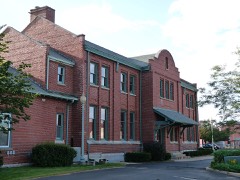 | Antigo Depot | building | 1992 | 92000029 |
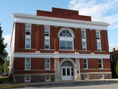 | Antigo Opera House | building | 1984 | 84003699 |
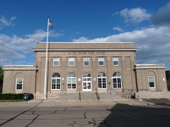 | Antigo Post Office | building | 2000 | 00001255 |
 | Antigo Public Library and Deleglise Cabin | building | 1978 | 78000115 |
 | Langlade County Courthouse | building | 1977 | 77000034 |
| Modern Woodmen of America Lodge | building | 2024 | 100010443 |
Every wildfire the federal occurrence database records inside this county: 664 of them, burning about 688 acres. 7 started naturally and 75 were recorded as arson. Each settlement page carries the fires within five miles of it.
| Reported cause | Fires |
|---|---|
| Debris and open burning | 165 |
| Equipment and vehicle use | 147 |
| Missing data/not specified/undetermined | 113 |
| Arson/incendiarism | 75 |
| Recreation and ceremony | 63 |
| Power generation/transmission/distribution | 34 |
| Smoking | 25 |
| Other causes | 21 |
| Natural | 7 |
| Fireworks | 7 |
| Misuse of fire by a minor | 5 |
| Railroad operations and maintenance | 2 |
The five largest, by the area the report gives. One of them was set deliberately.
| Date | Cause | Size | Reported by | Name on the report |
|---|---|---|---|---|
| 6 April 2007 | Arson/incendiarism | 95 acres | Wisconsin Department of Natural Resources | not named |
| 28 April 1992 | Missing data/not specified/undetermined | 68 acres | Wisconsin Department of Natural Resources | not named |
| 20 August 2008 | Equipment and vehicle use | 54 acres | Menominee Tribe | COUNTY S |
| 5 May 2018 | Recreation and ceremony | 27 acres | Wisconsin Department of Natural Resources | LAWRENCE LAKE |
| 12 August 2018 | Equipment and vehicle use | 22 acres | Wisconsin Department of Natural Resources | BRING THE HEAVY |
| 7 April 2005 | Debris and open burning | 18 acres | Wisconsin Department of Natural Resources | not named |
| 27 April 2013 | Debris and open burning | 15 acres | Wisconsin Department of Natural Resources | OLD HIPPIE |
| 15 August 2019 | Equipment and vehicle use | 14 acres | Wisconsin Department of Natural Resources | TRACTOR FIRE |
Every settlement page carries the fires within five miles of it - see the settlement index below.
The NOAA Storm Events Database holds 208 reports for this county, causing 1 death, 5 injuries and about $6,882,530 in recorded property damage. Each settlement page carries the reports that name it.
| Kind of event | Reports |
|---|---|
| Thunderstorm Wind | 130 |
| Hail | 58 |
| Tornado | 8 |
| Lightning | 4 |
| Flood | 4 |
| Flash Flood | 2 |
| Heavy Rain | 1 |
| Funnel Cloud | 1 |
The most serious of them, by death, then injury, then recorded damage. The accounts are quoted exactly as the forecast office filed them.
| When | Event | Place named | Harm | What the report says |
|---|---|---|---|---|
| July 2006 | Lightning | Antigo | 1 killed | no account filed |
| April 1984 | Tornado (F2) | not stated | 1 hurt, $2,500,000 | no account filed |
| June 2007 | Tornado (EF3) | White Lake | 1 hurt, $2,200,000 | The long-track tornado moved from Menominee Co. into Langlade Co. about three miles south of White Lake at 4:48 PM CDT. Significant damage occurred as the tornado grew to just over one-half mile. The Bear Paw Outdoor Adventure Resort sustained severe damage with nearly every building (ten) damaged or destroyed, including a three-story inn that was pushed over by the high winds. Only nine people were on site at the time of the tornado; hundreds were expected the next day for the upcoming weekend. One employee at the resort was injured, suffering minor cuts to the head. Hundreds of acres of trees were flattened, and nine homes sustained damage. The average width of the tornado was 700 yards as it moved across the county. The tornado was rated EF3 (DI 6, DOD 9; poorly anchored buildings) with winds estimated of 150 to 160 mph. The tornado exited Langlade Co., around 6 miles east-northeast of White Lake, and moved into Oconto Co. at 4:58 PM CDT. |
| September 1971 | Tornado (F3) | not stated | 1 hurt, $250,000 | no account filed |
| April 2011 | Thunderstorm Wind | Deerbrook | 1 hurt, $5,000 | Two houses sustained minor damage from straight line winds associated with a thunderstorm that, about 10 minutes later, produced a tornado near Parrish. An occupant of one of the houses sustained minor injuries from flying glass. |
| July 2016 | Thunderstorm Wind | Markton | 1 hurt | Thunderstorm winds snapped approximately 40 trees at Gardner Dam Boy Scouts Camp. One of the campers suffered a minor injury, a bump on the head, when a tree fell on a tent. The storms also downed numerous trees near the intersection of Highway 55 and County Road WW. The time of this event was estimated based on radar data. |
| April 2011 | Tornado (EF1) | Parrish | $1,000,000 | A tornado formed about five miles south of Parrish at 6:50 pm CDT (1750 CST) and moved just east of north for a little over five miles. The tornado affected about 1600 acres of hardwood and softwood trees. It was estimated that over one million trees were snapped, uprooted, or suffered serious damage (DI 27, DOD 3-4). The loss to timber alone is estimated at over one million dollars. One cabin was destroyed by fallen trees. The tornado was seen by a storm chaser at 6:55 pm CDT. The average width of the tornado was 250 yards. |
| July 2019 | Thunderstorm Wind | Lily | $350,000 | Thunderstorm winds snapped and uprooted tens of thousands of trees across northern Langlade County. One hundred thirty-five structures in the county sustained damage. The hardest hit area was near Lily. |
| July 2020 | Flash Flood | Parrish | $318,500 | Thunderstorms dumped 4 to 8 inches of rain over Langlade County during the morning hours. This caused several roads to be closed due to flash flooding as well as culverts becoming full or washed out across much of Langlade County. Several roads and culverts were damaged as a result of the flooding with several towns declaring disasters. |
| July 2019 | Thunderstorm Wind | Antigo | $50,000 | Thunderstorm winds downed trees and power lines in Antigo and across Langlade County. |
| July 2019 | Thunderstorm Wind | Elcho | $50,000 | Thunderstorm winds snapped and uprooted thousands of trees around Elcho. |
| July 2019 | Thunderstorm Wind | Pickerel | $50,000 | Thunderstorm winds uprooted and snapped thousands of trees, mainly pines, around Pickerel. |
| June 2008 | Thunderstorm Wind | Langlade Co Arpt | $25,000 | Downburst thunderstorm winds produced an area of damage over several blocks on the south side of Antigo. Hundreds of trees were uprooted or damaged and two flag poles were bent over. Two houses sustained roof damage from felled trees. |
| September 1997 | Lightning | Antigo | $25,000 | no account filed |
| May 1996 | Thunderstorm Wind | Antigo | $10,000 | no account filed |
| August 2013 | Thunderstorm Wind | Antigo | $5,000 | The public reported a couple trees and three to four-inch diameter tree limbs down on the south side of Antigo. One tree damaged a truck. |
| July 1994 | Thunderstorm Wind | Antigo | $5,000 | Widely scattered severe thunderstorms produced a funnel cloud and damaging winds over central Wisconsin. A small tornado moved a garage off its foundation and wrecked a house roof and shed three miles northwest of Elderon (Marathon County). A second small tornado destroyed a garage and toppled trees three miles southeast of Aniwa (Shawano County). Thunderstorm wind damage was confined to trees and power lines. |
| August 1996 | Thunderstorm Wind | Antigo | $5,000 | no account filed |
| April 1996 | Thunderstorm Wind | Antigo | $5,000 | no account filed |
| October 2018 | Thunderstorm Wind | Phlox | $3,000 | Thunderstorm winds uprooted approximately 40 trees and caused a barn to collapse. |
| June 2012 | Thunderstorm Wind | Kempster | $3,000 | Numerous trees were knocked down by strong thunderstorm winds. Four structures sustained minor damage by the fallen trees. |
| June 1998 | Thunderstorm Wind | Antigo | $3,000 | no account filed |
| June 1996 | Thunderstorm Wind | Antigo | $3,000 | no account filed |
| June 1976 | Tornado (F1) | not stated | $2,500 | no account filed |
| June 1976 | Tornado (F1) | not stated | $2,500 | no account filed |
| June 2017 | Flood | Pulaski | $2,000 | Heavy rainfall from thunderstorms caused street flooding in Antigo. |
| June 1998 | Thunderstorm Wind | Pickerel | $2,000 | no account filed |
| July 1997 | Thunderstorm Wind | Pearson | $2,000 | no account filed |
| May 2013 | Thunderstorm Wind | Deerbrook | $1,000 | Thunderstorm winds downed a tree and tore the steel roof from an out building. |
| July 1997 | Thunderstorm Wind | Elton | $1,000 | no account filed |
| July 1997 | Thunderstorm Wind | Pickerel | $1,000 | no account filed |
| June 1997 | Thunderstorm Wind | Langlade | $1,000 | no account filed |
| June 1997 | Thunderstorm Wind | Antigo | $1,000 | no account filed |
| July 1996 | Hail | Kempster | $1,000 | no account filed |
| May 1959 | Tornado | not stated | $30 | no account filed |
| April 2025 | Hail | Antigo | - | Penny size hail fell in Antigo. |
| July 2025 | Thunderstorm Wind | Elmhurst | - | Thunderstorm winds downed trees near Aniwa. The time of this report is an estimate based on radar data. |
| July 2024 | Hail | Parrish | - | Quarter size hail fell near Parrish. The time of this report is an estimate based on radar data. |
| May 2024 | Thunderstorm Wind | Deerbrook | - | Thunderstorm winds downed trees in the township of Vilas. The time of this report is an estimate based on radar data. |
| June 2023 | Hail | Antigo | - | Nickel size hail fell in Antigo. |
| June 2023 | Hail | Pearson | - | Quarter size hail fell near Pearson. |
| July 2023 | Hail | Polar | - | Penny size hail fell in Polar. |
| July 2023 | Hail | Polar | - | Penny size hail fell in Polar. |
| July 2023 | Thunderstorm Wind | Langlade Co Arpt | - | Thunderstorm winds downed several trees in the Norwood area. The time of this event is an estimate based on radar data. |
| July 2023 | Thunderstorm Wind | Antigo | - | Thunderstorm winds downed several trees in Rolling township. The time of this event is an estimate based on radar data. |
| May 2022 | Hail | White Lake | - | Nickel size hail fell in White Lake. |
| June 2022 | Thunderstorm Wind | Kempster | - | Thunderstorm winds downed trees near Summit Lake. The time of this event is an estimate based on radar data. |
| June 2021 | Thunderstorm Wind | Post Lake | - | Thunderstorm winds downed trees and a power line near Post Lake. The time of this report is an estimate based on radar data. |
| August 2021 | Thunderstorm Wind | Antigo | - | Thunderstorm winds downed trees in Antigo. The time of this event is an estimate based on radar data. |
| July 2021 | Thunderstorm Wind | Antigo | - | A thunderstorm wind gust of 70 mph was measured west of Antigo by a trained spotter. |
| July 2021 | Thunderstorm Wind | Antigo | - | Thunderstorm winds downed numerous trees and power lines in Antigo. The time of this event is an estimate based on radar data. |
| May 2020 | Hail | Summit Lake | - | Quarter size hail fell in Summit Lake. |
| September 2019 | Hail | White Lake | - | Quarter size hail fell in White Lake. The time of this event is an estimate based on radar data. |
| September 2018 | Thunderstorm Wind | Antigo | - | Thunderstorm winds downed trees and power lines in Antigo. The time of this report is an estimate base on radar data. |
| August 2018 | Thunderstorm Wind | Antigo | - | Thunderstorm winds downed trees in Antigo. The time of this report was estimated based on radar data. |
| June 2018 | Thunderstorm Wind | White Lake | - | Thunderstorm winds downed several trees as they passed through White Lake. The time of this report is an estimate based on radar data. |
| May 2017 | Thunderstorm Wind | Antigo | - | Thunderstorm winds downed trees in Antigo. |
| May 2017 | Thunderstorm Wind | Elcho | - | Thunderstorm winds downed trees in Elcho. |
| May 2017 | Thunderstorm Wind | Parrish | - | Thunderstorm winds downed at least a dozen trees east of Parrish. |
| June 2017 | Thunderstorm Wind | Antigo | - | Thunderstorm winds downed trees and power lines in Antigo. |
The Survey's mineral resources record lists 86 workings inside this county. 10 still produce and 76 are closed or unrecorded. Each settlement page carries the workings within five miles of it.
| Commodity | Workings |
|---|---|
| Sand and Gravel, Construction | 84 |
| Stone, Crushed/Broken | 2 |
The least common of them first, because a county's hundredth gravel pit says nothing its first ten did not.
| Where | Site | Commodity | Status | Recorded |
|---|---|---|---|---|
| Black Brook Diorite Quarry | Stone, Crushed/Broken | Past Producer | ||
| Martin Bretl Diorite Deposit | Stone, Crushed/Broken | Occurrence | ||
| Angle Road Gravel Pit | Sand and Gravel, Construction | Past Producer | ||
| Antigo Gravel Pit | Sand and Gravel, Construction | Past Producer | ||
| Bear Lake Road Gravel Deposit | Sand and Gravel, Construction | Occurrence | ||
| Bishop Road Gravel Deposit | Sand and Gravel, Construction | Occurrence | ||
| Black Oak Lake Gravel Pit | Sand and Gravel, Construction | Past Producer | ||
| Bluebell Road Gravel Pit | Sand and Gravel, Construction | Past Producer | ||
| Callsen Road Gravel Pit | Sand and Gravel, Construction | Past Producer | ||
| Chillie Road Gravel Pit | Sand and Gravel, Construction | Past Producer | ||
| Clear Lake Road Gravel Pit | Sand and Gravel, Construction | Past Producer | ||
| Clover Road Gravel Pit | Sand and Gravel, Construction | Past Producer | ||
| Deer Creek Gravel Deposit | Sand and Gravel, Construction | Occurrence | ||
| Deer Creek Gravel Pit | Sand and Gravel, Construction | Past Producer | ||
| Deerbrook Gravel Pit | Sand and Gravel, Construction | Past Producer | ||
| Duffek Sand and Gravel Pit | Sand and Gravel, Construction | Producer | ||
| Eau Claire River Gravel Pit #1 | Sand and Gravel, Construction | Past Producer | ||
| Elbow Road Sand Deposit | Sand and Gravel, Construction | Occurrence | ||
| Elmhurst Gravel Pit | Sand and Gravel, Construction | Past Producer | ||
| Elton Gravel Pit | Sand and Gravel, Construction | Past Producer | ||
| Enterprise Lake Gravel Pit | Sand and Gravel, Construction | Past Producer | ||
| Enterprise Lake Road Gravel Pit | Sand and Gravel, Construction | Past Producer | ||
| Fisher Pit Benes Pit | Sand and Gravel, Construction | Unknown | ||
| Fosterling Gravel Pit | Sand and Gravel, Construction | Past Producer | ||
| Freiburger Pit | Sand and Gravel, Construction | Producer | ||
| Hess Pit | Sand and Gravel, Construction | Producer | ||
| Highland Road Gravel Deposit | Sand and Gravel, Construction | Occurrence | ||
| Highland Road Gravel Pit | Sand and Gravel, Construction | Past Producer | ||
| Huggins Road Gravel Pit | Sand and Gravel, Construction | Past Producer | ||
| Huggins Road Sand Deposit | Sand and Gravel, Construction | Occurrence | ||
| Hunting River Road Gravel Pit | Sand and Gravel, Construction | Past Producer | ||
| Keppel Pit | Sand and Gravel, Construction | Producer | ||
| Koepenick Road Gravel Deposit | Sand and Gravel, Construction | Occurrence | ||
| Koepenick Road Gravel Pit | Sand and Gravel, Construction | Past Producer | ||
| Langlade County Highway Dept. | Sand and Gravel, Construction | Producer | ||
| Langlade County Hwy. Dept. | Sand and Gravel, Construction | Unknown | ||
| Langlade County Pits | Sand and Gravel, Construction | Producer | ||
| Langlade County Pits | Sand and Gravel, Construction | Producer | ||
| Lower First Lake Gravel Deposit | Sand and Gravel, Construction | Occurrence | ||
| Lower Post Lake Gravel Pit | Sand and Gravel, Construction | Past Producer | ||
| Maurer Gravel Deposit | Sand and Gravel, Construction | Occurrence | ||
| Moccasin Lake Gravel Pit #1 | Sand and Gravel, Construction | Past Producer | ||
| Moccasin Lake Gravel Pit #2 | Sand and Gravel, Construction | Past Producer | ||
| Mueller Lake Gravel Deposit | Sand and Gravel, Construction | Occurrence | ||
| Neva Gravel Pit | Sand and Gravel, Construction | Past Producer | ||
| Noskowiak Pit | Sand and Gravel, Construction | Producer | ||
| Ormsby Road Gravel Pit | Sand and Gravel, Construction | Past Producer | ||
| Otter Lake Gravel Pit | Sand and Gravel, Construction | Past Producer | ||
| Parrish Gravel Pit | Sand and Gravel, Construction | Past Producer | ||
| Parrish Sand Deposit #1 | Sand and Gravel, Construction | Occurrence | ||
| Parrish Sand Deposit #2 | Sand and Gravel, Construction | Occurrence | ||
| Payne Spring Gravel Deposit | Sand and Gravel, Construction | Occurrence | ||
| Pit Road Gravel Pit | Sand and Gravel, Construction | Past Producer | ||
| Polar Road Gravel Pit | Sand and Gravel, Construction | Past Producer | ||
| Pollock Creek Gravel Pit | Sand and Gravel, Construction | Past Producer | ||
| Rabe Creek Gravel Pit | Sand and Gravel, Construction | Past Producer | ||
| Rangeline Road Gravel Pit | Sand and Gravel, Construction | Past Producer | ||
| Reeves Gravel Pit | Sand and Gravel, Construction | Past Producer | ||
| Reimer Road Gravel Deposit | Sand and Gravel, Construction | Occurrence | ||
| River Grove School Gravel Pit | Sand and Gravel, Construction | Past Producer | ||
| Riverview Road Gravel Deposit | Sand and Gravel, Construction | Occurrence | ||
| Rocky Road Gravel Deposit | Sand and Gravel, Construction | Occurrence | ||
| Rolling Township Gravel Pit | Sand and Gravel, Construction | Past Producer | ||
| Shadick Gravel Deposit | Sand and Gravel, Construction | Occurrence | ||
| Shady Road Gravel Pit | Sand and Gravel, Construction | Past Producer | ||
| Singer Road Gravel Pit | Sand and Gravel, Construction | Past Producer | ||
| Spring Brook Gravel Deposit #1 | Sand and Gravel, Construction | Occurrence | ||
| Spring Brook Gravel Pit #1 | Sand and Gravel, Construction | Past Producer | ||
| Spring Brook Gravel Pit #2 | Sand and Gravel, Construction | Past Producer | ||
| Spring Road Gravel Deposit #1 | Sand and Gravel, Construction | Occurrence | ||
| Spring Road Gravel Deposit #2 | Sand and Gravel, Construction | Occurrence | ||
| Spring Road Gravel Pit | Sand and Gravel, Construction | Past Producer | ||
| Springbrook Road Gravel Deposit #1 | Sand and Gravel, Construction | Occurrence | ||
| Springbrook Road Gravel Deposit #2 | Sand and Gravel, Construction | Occurrence | ||
| Star-Neva Road Gravel Pit | Sand and Gravel, Construction | Past Producer | ||
| Stevens Pond Creek Sand Deposit | Sand and Gravel, Construction | Occurrence | ||
| Stevens Pond Sand Deposit | Sand and Gravel, Construction | Prospect | ||
| Sugar Bush Road Gravel Pit | Sand and Gravel, Construction | Past Producer | ||
| Sunset Road Gravel Pit | Sand and Gravel, Construction | Past Producer | ||
| Trout Road Gravel Pit | Sand and Gravel, Construction | Past Producer | ||
| Ventor Lake Gravel Pit | Sand and Gravel, Construction | Past Producer | ||
| Vilas Dump Pit | Sand and Gravel, Construction | Producer | ||
| W. Bear Lake Road Sand Deposit | Sand and Gravel, Construction | Occurrence | ||
| West Elcho Road Gravel Pit | Sand and Gravel, Construction | Past Producer | ||
| White Lake Pit | Sand and Gravel, Construction | Producer | ||
| Wooduck Springs Gravel Pit | Sand and Gravel, Construction | Past Producer |
History of Langlade County, Wisconsin, from U. S. Government Survey to Present Time, with Biographical Sketches devotes a chapter to each township: its boundaries and streams, who settled it and when, the mills, the schools and the churches. All 7 are reproduced here in full. Each row shows the township's own shape and where it lies in the county, drawn from the Census Bureau's boundary. Which settlements belong to which township is computed from that same boundary, not taken from the book.
| Shape and position in the county | Township | Settlements in it | Length | Sections |
|---|---|---|---|---|
| Ainsworth Town | Pearson | 2,417 words | 11 | |
| Antigo City | Antigo | 1,381 words | 6 | |
| Elcho Town | Elcho, Post Lake | 2,730 words | 10 | |
| Langlade Town | Choate, Freeman, Lily, Pickerel | 3,588 words | 11 | |
| Rolling Town | Elmhurst | 1,794 words | 1 | |
| White Lake Village | White Lake | 993 words | 2 | |
| Wolf River Town | Hollister, Langlade, Markton | 1,407 words | 6 |
One book written about this county, cut here where the book itself is cut, at its printed chapters: 50 chapters in all. Every chapter is public domain, machine-read from the scan and reproduced complete. A chapter already given under one of the county's towns is not repeated in this list.
Named settlements recorded in the Geographic Names Information System, each with the topographic sheets covering it. Villages, hamlets and abandoned places alike. Each is shown with the nearest named watercourse or landform and the survey quadrangle it falls on.
Wolf River town · 54491 · On Ninemile Creek · White Lake quadrangle
8 sheets, 1952 to 1990