Block
From the record
38 National Register listings published here.
Sources: the National Register database, National Park Service
70 topographic sheets cover 22 settlements here, and 38 properties are on the National Register of Historic Places.
38 National Register listings published here.
Sources: the National Register database, National Park Service
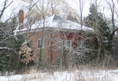
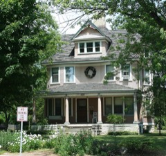
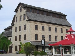
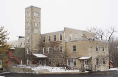
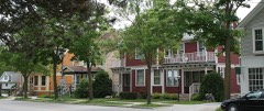
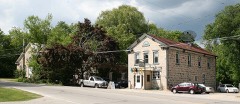
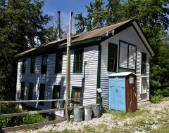
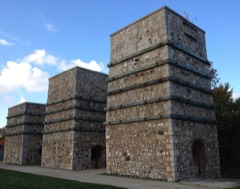
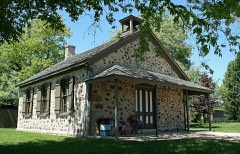
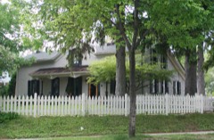
Every property in this county listed on the National Register of Historic Places, with the year it was listed and the federal nomination document.
Ozaukee County has 1 covered bridge on the National Register. Each is a listed structure with a federal nomination on file.
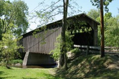 | Covered Bridge | Listed 1973 |
Every wildfire the federal occurrence database records inside this county: 37 of them, burning about 30 acres. 1 started naturally and 2 were recorded as arson. Each settlement page carries the fires within five miles of it.
| Reported cause | Fires |
|---|---|
| Debris and open burning | 15 |
| Missing data/not specified/undetermined | 12 |
| Recreation and ceremony | 4 |
| Arson/incendiarism | 2 |
| Natural | 1 |
| Equipment and vehicle use | 1 |
| Smoking | 1 |
| Power generation/transmission/distribution | 1 |
The five largest, by the area the report gives. One of them was set deliberately.
| Date | Cause | Size | Reported by | Name on the report |
|---|---|---|---|---|
| 28 April 2018 | Debris and open burning | 6.0 acres | Wisconsin Department of Natural Resources | 18486 |
| 1 May 2018 | Debris and open burning | 5.0 acres | Wisconsin Department of Natural Resources | 110 |
| 17 October 2010 | Missing data/not specified/undetermined | 2.7 acres | Wisconsin Department of Natural Resources | not named |
| 20 April 2020 | Recreation and ceremony | 2.0 acres | Wisconsin Department of Natural Resources | 20027 |
| 26 May 2018 | Arson/incendiarism | 1.4 acres | Wisconsin Department of Natural Resources | MUD LAKE BOARDWALK FIRE |
| 4 August 2018 | Debris and open burning | 1.0 acres | Wisconsin Department of Natural Resources | 180850 |
| 3 April 2020 | Recreation and ceremony | 1.0 acres | Wisconsin Department of Natural Resources | 200365 |
| 27 March 2020 | Recreation and ceremony | 1.0 acres | Wisconsin Department of Natural Resources | 20446 |
Every settlement page carries the fires within five miles of it - see the settlement index below.
The NOAA Storm Events Database holds 225 reports for this county, causing no deaths, 40 injuries and about $27,546,360 in recorded property damage. Each settlement page carries the reports that name it.
| Kind of event | Reports |
|---|---|
| Thunderstorm Wind | 85 |
| Hail | 71 |
| Flood | 21 |
| Lightning | 19 |
| Flash Flood | 16 |
| Heavy Rain | 5 |
| Tornado | 4 |
| Waterspout | 2 |
| Funnel Cloud | 2 |
The most serious of them, by death, then injury, then recorded damage. The accounts are quoted exactly as the forecast office filed them.
| When | Event | Place named | Harm | What the report says |
|---|---|---|---|---|
| August 1964 | Tornado (F4) | not stated | 30 hurt, $2,500,000 | no account filed |
| May 1998 | Thunderstorm Wind | Countywide | 4 hurt, $3,460,000 | no account filed |
| April 2001 | Lightning | Mequon | 3 hurt, $20,000 | no account filed |
| June 2008 | Thunderstorm Wind | Cedarburg | 2 hurt, $500 | Powerful thunderstorms winds knocked down a few large trees, andn blew down some tents at the annual Strawberry Festival. Two people at the festival were injured by broken tree branches and received medical treatment for minor injuries. |
| August 2002 | Flood | Port Washington | 1 hurt | no account filed |
| April 2006 | Hail | Saukville | $6,340,000 | no account filed |
| June 1996 | Flash Flood | Port Washington | $5,300,000 | no account filed |
| June 1997 | Flash Flood | Mequon | $3,600,000 | no account filed |
| June 2010 | Lightning | Mequon | $1,000,000 | A lightning strike in the city of Mequon resulted in a fire at a strip mall in the 1100 block of North Port Washington Road that destroyed 9 businesses. Time is estimated. Other severe weather was reported in southern Wisconsin during the pre-dawn hours of June 23, 2010. |
| June 1996 | Flash Flood | Belgium | $1,000,000 | no account filed |
| August 2018 | Flood | Bayside | $854,000 | Overall, many flooded roads and lowlands due to 4 to 8 inches of rain. Some road washouts and homes flooded. I-43 was closed through late morning due to flooding between mile marker 101 and 107. Many of the cities in the county experienced severe street flooding and closures. The Milwaukee River reached minor flood stage throughout the county with many roads and intersections flooded and closed near the river, especially near Saukville and Cedarburg. Some piers washed away on the Milwaukee River. Dozens of vehicles across the county were stranded in flood waters. Overall, 76 homes sustained affected flood damage, 52 homes with minor flood damage, and 11 homes with major damage. 25 businesses sustained minor flood damage and 5 businesses sustained major flood damage. |
| July 2005 | Lightning | Mequon | $500,000 | no account filed |
| June 2008 | Flash Flood | Mequon | $462,160 | Heavy rains resulted in flash flooding from the Mequon area northeast to the Belgium to Port Washington area. Water depths on road surfaces reached 3 feet or more and there were gravel washouts. One hundred twenty-seven homes had minor damage, and 191 homes had major damage (total of $3.765 million for all home property losses). Business losses were about $810 thousand. Crops losses were estimated at $500 thousand. Public sector damage was about $1.1 million. There were several roads and bridges that sustained damage. |
| August 2025 | Flash Flood | Bayside | $450,000 | The flash flooding of streets, creeks, rivers, and low lying neighborhoods in Mequon, Thiensville, Cedarburg and southern Grafton. More specifically, the flash flooding of Pigeon Creek washed out a portion of Highland Rd. The flash flooding of Olau Creek flooded Pioneer Rd. just west of Port Washington Rd., and also flooded Port Washington Rd. just north of Pioneer Rd. The same creek flooded a portion of Bonniwell Rd. The flash flooding of the Little Menomonee River flooded a portion of County Line Rd. between Tamerland Dr. and Granville Rd. The Mequon Nature Preserve experienced flooding including its Education Center. Other roads were closed near the flooded Milwaukee River. At least 400 basements experienced flooding due to excessive runoff or sewer backups. Several vehicles stranded in floodwaters with some floating in relatively deep water. |
| July 1996 | Tornado (F1) | Fredonia | $300,000 | no account filed |
| June 1996 | Flash Flood | Port Washington | $200,000 | no account filed |
| June 1996 | Flash Flood | Port Washington | $200,000 | no account filed |
| May 2004 | Thunderstorm Wind | Port Washington | $150,000 | no account filed |
| July 2007 | Flash Flood | Fredonia | $100,000 | Heavy rains, measured at 4.5 to 5.0 inches within a couple hours, resulted in a flash flood in and near the village of Fredonia. Water depths on roads reached 1 to 3 feet. Some residents mentioned that some roads had never flooded until this event. Several gravel driveways were washed out as well as culverts. |
| May 2004 | Lightning | Port Washington | $100,000 | no account filed |
| May 2007 | Lightning | Saukville | $75,000 | Lightning struck a barn that was subsequently destroyed by a fire. All of the animals escaped, and stored tools were saved. Only a minor amount of hay was lost. |
| August 2006 | Lightning | Cedarburg | $75,000 | Lightning struck a downtown Cedarburg building's chimney. The collapsed chimney then tore a hole in the roof, allowing rain water to run into the building and damage some contents. |
| June 2001 | Thunderstorm Wind | Countywide | $75,000 | no account filed |
| May 2000 | Flash Flood | Mequon | $75,000 | no account filed |
| August 2025 | Flash Flood | Five Corners | $50,000 | The flash flooding of some streets, creeks, rivers, and low lying neighborhoods in northern Cedarburg, Grafton, Saukville and Port Washington. Some basement flooding due to excessive runoff or sewer backups. |
| May 2004 | Thunderstorm Wind | Cedarburg | $50,000 | no account filed |
| June 2004 | Hail | Thiensville | $50,000 | no account filed |
| April 2015 | Heavy Rain | Knellsville | $35,000 | A 100 yard stretch of southbound I-43 became flooded resulting in two vehicles mostly submerged in standing water. The flooding was under the overpass and a clogged drain significantly contributed to the flooding. Approximately 2-3 inches of rain had fallen during the overnight period. |
| May 2020 | Flood | Lake Church | $30,000 | Numerous flooding reports all over the county with some road closures. Numerous basements flooded in Port Washington. A retaining wall collapsed onto an elderly woman in Port Washington, killing her. Two drivers rescued driving into deep water underneath a railroad bridge on Spring St. and Sunset Rd. in Port Washington. |
| August 2007 | Thunderstorm Wind | Grafton | $30,000 | Powerful thunderstorm wind gusts up to 52 knots (60 mph) toppled several large trees and damaged some power-lines. |
| July 2001 | Thunderstorm Wind | Cedarburg | $30,000 | no account filed |
| November 2022 | Thunderstorm Wind | Five Corners | $25,000 | Several power poles snapped near Cedarburg. |
| May 2004 | Lightning | Port Washington | $25,000 | no account filed |
| May 2016 | Thunderstorm Wind | Freistadt | $20,000 | Straight line winds causing the collapse of one wall of an old barn. Another old barn and a couple sheds sustaining some wall, door, or roof damage. Trees and branches snapped and uprooted trees. |
| May 2012 | Lightning | Cedarburg | $20,000 | The Ozaukee County Sheriff Department reported a fire ignited by a lightning strike in the 3200 block of Twin Creeks Road in the town of Cedarburg. |
| July 2010 | Flash Flood | Five Corners | $20,000 | Police reported runoff from heavy rains caused a few sewer backups in homes causing damage to contents in Mequon. Police also reported water over roads in Cedarburg, draining with enough force to pop off a manhole cover near the high school. Law enforcement also closed I-43 at both Mequon Road and County Line Road, mainly due to impassable conditions due to flooding just over the county line in Milwaukee. Thiensville officials reported 2.85 inches of rain in less than 2 hours, while Mequon received 2.84 inches. |
| July 2005 | Lightning | Grafton | $20,000 | Lightning struck a house, setting it on fire. |
| July 1996 | Thunderstorm Wind | Waubeka | $20,000 | no account filed |
| August 2006 | Thunderstorm Wind | Saukville | $15,000 | Trees and power-poles down. |
| August 2002 | Lightning | Grafton | $15,000 | no account filed |
| August 2001 | Lightning | Port Washington | $15,000 | no account filed |
| May 1998 | Lightning | Port Washington | $15,000 | no account filed |
| June 2022 | Thunderstorm Wind | Port Washington | $10,000 | Numerous trees and power lines down. |
| October 2019 | Flash Flood | Lake Church | $10,000 | Southbound lanes of I-43 flooded and closed from highway D at Belgium to highway H near Port Washington. Several roads flooded and impassable in the northern portion of Ozaukee County. |
| March 2019 | Flood | Waubeka | $10,000 | A significant ice jam at the Milwaukee River at Waubeka closed the Cigrant Rd. bridge. Just upstream from the bridge, 20 homes were impacted by flooding and 50 people were evacuated. The American Red Cross gave aid to the evacuees. Much farther upstream, a lift station in the Village of Newburg was damaged. An Emergency Declaration was issued due to excessive flooding, although the flooding primarily was lowland. |
| August 2018 | Thunderstorm Wind | Grafton | $10,000 | A swath of tree damage over several blocks including a large tree branch down on a home and a large tree uprooted. |
| June 2014 | Thunderstorm Wind | Thiensville | $10,000 | Numerous trees and power lines down. |
| June 2006 | Thunderstorm Wind | Mequon | $10,000 | Trees and power lines down. |
| May 2000 | Hail | Cedarburg | $10,000 | no account filed |
| August 1999 | Lightning | Port Washington | $10,000 | no account filed |
| July 1998 | Lightning | Grafton | $10,000 | no account filed |
| November 2022 | Thunderstorm Wind | Freistadt | $8,000 | Scattered trees and branches down, including power lines, throughout the county. |
| August 2021 | Thunderstorm Wind | Thiensville | $8,000 | Sporadic downed power lines and old/dead trees downed across southern and eastern portions of Ozaukee County. |
| July 1998 | Lightning | Port Washington | $8,000 | no account filed |
| June 2014 | Thunderstorm Wind | Grafton | $7,000 | Many trees knocked down and laying in roads. Shopko garden center damaged. |
| July 2023 | Thunderstorm Wind | Fredonia | $6,000 | Damage to small sheds, a porch which was under construction, and trees all near Willow Valley Road. |
| April 2026 | Flash Flood | Bayside | $5,000 | Flash flooding of streets in southern Ozaukee County. More specifically, flooded roads and intersections on Mequon Rd. from Wauwatosa Rd. to just east of I-43. Other intersections across the area with 3-6 inches of standing water. |
| August 2024 | Thunderstorm Wind | Five Corners | $5,000 | Scattered trees and power lines down through central and southern portions of the county. |
| October 2019 | Flood | Saukville | $5,000 | The Milwaukee River at Saukville reached moderate flood stage, cresting at 15.22 feet during the morning on October 2nd. Floodwaters affect parts of Green Bay Ave., Park St., Mill St., S. Riverside Drive and N. Riverside Drive in and near Saukville. Parks that are flooded are Peninsula Park, Grady Park and Schowalter Park. |
| April 2013 | Flood | Bartel | $5,000 | The Milwaukee River near Cedarburg experienced minor flooding, cresting at 12.44 feet, or 1.44 feet over the flood stage of 11 feet, at 419 AM CDT on April 14th. |
The Survey's mineral resources record lists 13 workings inside this county. 8 still produce and 5 are closed or unrecorded. Each settlement page carries the workings within five miles of it.
| Commodity | Workings |
|---|---|
| Sand and Gravel, Construction | 12 |
| Stone, Crushed/Broken | 1 |
The least common of them first, because a county's hundredth gravel pit says nothing its first ten did not.
| Where | Site | Commodity | Status | Recorded |
|---|---|---|---|---|
| Cedarburg Stone | Stone, Crushed/Broken | Producer | ||
| Ciriak Pit | Sand and Gravel, Construction | Past Producer | ||
| Clump Pit | Sand and Gravel, Construction | Past Producer | ||
| County Pit | Sand and Gravel, Construction | Unknown | ||
| H.F. Prahl Corp. Pit | Sand and Gravel, Construction | Past Producer | ||
| Hamm Pit | Sand and Gravel, Construction | Producer | ||
| Hartman Pit | Sand and Gravel, Construction | Producer | ||
| Hartmann Pit | Sand and Gravel, Construction | Producer | ||
| Lakeland Site | Sand and Gravel, Construction | Producer | ||
| Lane Pit | Sand and Gravel, Construction | Producer | ||
| Maple Road Pit | Sand and Gravel, Construction | Past Producer | ||
| Rau Pit Number 2 | Sand and Gravel, Construction | Producer | ||
| Rowe Sand and Gravel, Inc. | Sand and Gravel, Construction | Producer |
Named settlements recorded in the Geographic Names Information System, each with the topographic sheets covering it. Villages, hamlets and abandoned places alike. Each is shown with the nearest named watercourse or landform and the survey quadrangle it falls on.
Thiensville village · 53092 · On Pigeon Creek · Thiensville quadrangle
19 sheets, 1892 to 1980
Port Washington city · 53074 · On Sauk Creek · Port Washington West quadrangle
12 sheets, 1892 to 1980
Thiensville village · 53092 · On Pigeon Creek · Thiensville quadrangle
19 sheets, 1892 to 1980