 Block
From the record
10 National Register listings published here.
Sources: the National Register database, National Park Service
50 topographic sheets cover 37 settlements here, and 10 properties are on the National Register of Historic Places.
10 National Register listings published here.
Sources: the National Register database, National Park Service
Every property in this county listed on the National Register of Historic Places, with the year it was listed and the federal nomination document.
| Photograph | Property | Type | Listed | Reference |
|---|---|---|---|---|
 | Roscius S. and Lydia R. Freeman House | building | 2007 | 07000501 |
| Roscius and Ingebor Freeman House | building | 2025 | 100011509 | |
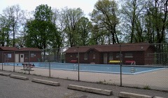 | Glen Park Municipal Swimming Pool | structure | 2007 | 07000542 |
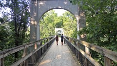 | Glen Park Suspension Footbridge | structure | 2018 | 100002671 |
| Jay and Bernice Grimm House | building | 2025 | 100011401 | |
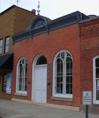 | H. S. Miller Bank | building | 1994 | 94000998 |
 | North Hall-River Falls State Normal School | building | 1986 | 86000627 |
| Pierce County Courthouse | building | 1982 | 82000696 | |
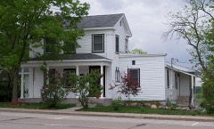 | Daniel Smith House | building | 1984 | 84003775 |
 | South Hall, River Falls State Normal School | building | 1976 | 76000073 |
Every wildfire the federal occurrence database records inside this county: 17 of them, burning about 79 acres. None started naturally and 1 was recorded as arson. Each settlement page carries the fires within five miles of it.
| Reported cause | Fires |
|---|---|
| Missing data/not specified/undetermined | 9 |
| Debris and open burning | 6 |
| Equipment and vehicle use | 1 |
| Arson/incendiarism | 1 |
The five largest, by the area the report gives. None of them was recorded as arson.
| Date | Cause | Size | Reported by | Name on the report |
|---|---|---|---|---|
| 28 April 2018 | Debris and open burning | 60 acres | Wisconsin Department of Natural Resources | 91 |
| 30 April 2018 | Debris and open burning | 13 acres | Wisconsin Department of Natural Resources | 0LF1811 |
| 4 May 2019 | Debris and open burning | 2.0 acres | Wisconsin Department of Natural Resources | 190032 |
| 25 April 2018 | Debris and open burning | 2.0 acres | Wisconsin Department of Natural Resources | 90 |
| 7 May 2019 | Debris and open burning | 1.0 acres | Wisconsin Department of Natural Resources | 47 |
| 18 April 2004 | Debris and open burning | under an acre | Wisconsin Department of Natural Resources | not named |
| 31 July 2018 | Equipment and vehicle use | under an acre | Wisconsin Department of Natural Resources | 0LF1811 |
| 21 October 2018 | Missing data/not specified/undetermined | under an acre | Wisconsin Department of Natural Resources | 201831 |
Every settlement page carries the fires within five miles of it - see the settlement index below.
The NOAA Storm Events Database holds 335 reports for this county, causing no deaths, 6 injuries and about $31,789,000 in recorded property damage. Each settlement page carries the reports that name it.
| Kind of event | Reports |
|---|---|
| Thunderstorm Wind | 153 |
| Hail | 129 |
| Tornado | 27 |
| Flash Flood | 11 |
| Heavy Rain | 9 |
| Funnel Cloud | 3 |
| Lightning | 2 |
| Flood | 1 |
The most serious of them, by death, then injury, then recorded damage. The accounts are quoted exactly as the forecast office filed them.
| When | Event | Place named | Harm | What the report says |
|---|---|---|---|---|
| July 1967 | Tornado (F2) | not stated | 3 hurt, $250,000 | no account filed |
| July 1966 | Tornado (F1) | not stated | 2 hurt, $250,000 | no account filed |
| June 1990 | Tornado (F1) | not stated | 1 hurt, $250,000 | no account filed |
| May 2001 | Hail | River Falls | $20,000,000 | Wind driven baseball size hail damaged houses and vehicles, and knocked out hundreds of windows on the south side of town. The local University was particularly hard hit, including a greenhouse that was destroyed. |
| June 1996 | Thunderstorm Wind | Hager City | $3,500,000 | no account filed |
| May 1953 | Tornado (F2) | not stated | $2,500,000 | no account filed |
| June 2001 | Thunderstorm Wind | Ellsworth | $1,000,000 | Six barns leveled, numerous sheds and outbuildings down. Trees and power lines felled, some on houses. Damage figures are totals from all storms in Pierce County between 1558 and 1800. |
| May 1996 | Thunderstorm Wind | River Falls | $1,000,000 | no account filed |
| July 2010 | Tornado (EF2) | El Paso | $800,000 | Several sheds and outbuildings were destroyed, as were a couple of barns. Hundreds of trees were snapped. The tornado was accompanied by strong rear flank downdraft winds that also knocked down numerous trees. |
| July 2010 | Tornado (EF2) | Beldenville | $500,000 | Several barns and sheds were destroyed, and structural damage was noted at some homes. Many trees were broken or snapped. This tornado was accompanied by strong rear flank downdraft winds, which also knocked down trees and damaged some sheds. |
| May 1998 | Thunderstorm Wind | Ellsworth | $300,000 | Trees blown down. Boat flipped over. |
| July 2021 | Thunderstorm Wind | Spring Valley | $250,000 | A storm survey determined a downburst hit the west side of Spring Valley. Numerous trees, sheds and power lines were blown down. A school gymnasium roof was damaged and a lot of the debris landed on houses and vehicles. A local resident stated that the severe winds persisted for several minutes. |
| June 1981 | Tornado (F2) | not stated | $250,000 | no account filed |
| May 1958 | Tornado (F3) | not stated | $250,000 | no account filed |
| July 2016 | Thunderstorm Wind | Plum City | $200,000 | A mesocyclone originated in Pierce County and caused widespread downburst damage across a 1.5 mile wide area. It knocked down many hundreds of trees, and partially removed the roof off of one house. The mesocyclone continued into Pepin County, where it continued to produce wind damage and then a tornado (see separate entries for Pepin County). |
| August 2009 | Flash Flood | Maiden Rock | $100,000 | The local law enforcement officials received reports of a few roads closed by high water across the southern part of Pierce county, north of Maiden Rock. Also, a mud slide was reported along Highway A, between State Road 35 and U.S. Highway 10. |
| June 1998 | Thunderstorm Wind | Diamond Bluff | $75,000 | Damage estimate for entire county. |
| June 2021 | Thunderstorm Wind | Elmwood | $50,000 | A 14 inch diameter tree blew down and landed on a house in Elmwood. |
| July 2016 | Thunderstorm Wind | Ellsworth | $50,000 | Scattered trees and power lines were blown down, mainly just east and southeast of Ellsworth. |
| July 2010 | Thunderstorm Wind | Olivet | $50,000 | Numerous trees were broken or felled, and a couple of sheds were destroyed by rear flank downdraft winds associated with the tornado that formed just south of El Paso. |
| July 2011 | Thunderstorm Wind | Trimbelle | $25,000 | Numerous trees and power lines were blown down from near Ellsworth, west to the intersection of Highway 10 and County Road O. |
| June 2010 | Thunderstorm Wind | Prescott Jacques Arp | $25,000 | Several trees and power lines were blown down east of Prescott, Wisconsin. |
| October 1979 | Tornado (F2) | not stated | $25,000 | no account filed |
| July 1970 | Tornado (F0) | not stated | $25,000 | no account filed |
| May 2022 | Thunderstorm Wind | Elmwood | $20,000 | There was damage to a shed, barn and farm equipment near Elmwood. |
| July 2010 | Thunderstorm Wind | El Paso | $20,000 | A shed was damaged and several dozen trees broken due to rear flank downdraft winds from the tornado that developed west of Beldenville. |
| December 2021 | Thunderstorm Wind | Diamond Bluff | $15,000 | A outdoor weather siren on the east side of County Road 00 was damaged. Several trees were blown down and blocking roads from near Diamond Bluff to Ellsworth. |
| July 1969 | Tornado (F0) | not stated | $2,500 | no account filed |
| July 1955 | Tornado | not stated | $2,500 | no account filed |
| June 1954 | Tornado | not stated | $2,500 | no account filed |
| August 2020 | Thunderstorm Wind | Bay City | $1,000 | A few trees and power lines were blown down in Bay City. |
| May 1994 | Thunderstorm Wind | River Falls | $500 | no account filed |
| April 2026 | Hail | Esdaile | - | Emailed photos of large hail in backyard. |
| July 2025 | Thunderstorm Wind | Prescott | - | Trees and power lines reported down in Prescott. |
| July 2025 | Thunderstorm Wind | Ellsworth | - | Trees and power lines reported down in Ellsworth. |
| July 2025 | Thunderstorm Wind | Spring Valley | - | Downed large tree blocking the road near Van Buren and Silver Fox in Spring Valley. |
| July 2025 | Thunderstorm Wind | (Rgk)Red Wing Regional Airport | - | The AWOS station at Red Wing Airport measured a 58-mph thunderstorm wind gust. |
| August 2025 | Thunderstorm Wind | Prescott | - | Trees and power lines downed just east of Prescott. |
| August 2025 | Heavy Rain | Plum City | - | Cocorahs station WI-PC-31 Plum City 2.1 NNW 72 hour total of 5.36 inches. |
| August 2024 | Thunderstorm Wind | River Falls | - | Report on social media of a large tree snapped at the trunk. |
| August 2024 | Tornado (EF0) | Beldenville | - | The tornado damaged a couple hundred trees along a sporadic path. It also hit a house, removing part of its roof with pole barn type construction, and one wall collapsed. |
| August 2024 | Tornado (EF0) | Prescott | - | A tornado developed at the southern edge of Bellwood Oaks Golf Course, in Dakota County. It moved northeast and tracked across a sliver of northern Goodhue County before crossing the Mississippi River into Wisconsin, about 5 miles southeast of Prescott. Several dozen trees were broken or uprooted and a trailer was flipped. |
| August 2024 | Thunderstorm Wind | Beldenville | - | Photos provided via social media of several trees down in the village of Beldenville. |
| May 2023 | Hail | El Paso | - | Two local storm reports from trained spotters reported quarter to an inch and a quarter sized hail between the towns of El Paso, WI and Maiden Rock, WI. Or, approximately 5 miles ESE of Ellsworth, WI. |
| May 2023 | Hail | El Paso | - | Social media showed a photo of hail stone compared to a quarter, and the size was estimated to be golfball size. |
| May 2023 | Hail | El Paso | - | One inch hail was reported near El Paso WI. |
| August 2023 | Hail | Plum City | - | The broadcast media relayed a report through NWS chat of estimated hail size up to 2 inches. |
| July 2023 | Hail | Ellsworth | - | Hail coated the ground after just 2 minutes, and ended at 347 PM CDT. Largest hail was golf ball size. |
| July 2023 | Hail | Ellsworth | - | End of hail after falling for ten minutes. Largest stone was 1.75 inches. |
| July 2023 | Funnel Cloud | Esdaile | - | The storm was rotating with a funnel cloud that dissipated before reaching the ground. |
| May 2022 | Hail | Prescott | - | There was a social media picture of quarter size hail. |
| May 2022 | Thunderstorm Wind | Martell | - | A ten mile long and three mile wide swath of damaging wind hit far northeast Pierce County. Several hundred trees were knocked down, with many across roads and power lines, and a few on houses and cars. A roof was partially blown off a house two miles southwest of Spring Valley. A barn was blown down four miles west-northwest of Spring Valley. |
| September 2022 | Hail | River Falls | - | Social media had several pictures of large hail that fell around River Falls, Wisconsin. One of the pictures measured 3 inches in diameter. Based on pictures and social media posts, there was a swath of this large hail that occurred on the northwest side of River Falls, and moved over the town, and exited on the southeast side. |
| June 2020 | Flash Flood | Prescott | - | There were numerous road closures, and culverts overwhelmed by flood waters across portions of Pierce County. Some specific closures included Highway 10 west of Ellsworth, County Road O along the Trimbelle River, and the towns of Martell and El Paso were severely flooded from the Rush River. In addition, some crops were washed out around Spring Valley. |
| July 2020 | Tornado (EF0) | Prescott | - | This is the continuation of the tornado that moved across southern Washington County, and into Wisconsin. The path of the tornado continued to move east-northeast before dissipating 1.7 miles southwest of River Falls, Wisconsin. Trees were uprooted along the continuous path which was 6.2 miles long. |
| September 2018 | Tornado (EF0) | Diamond Bluff | - | This is a continuation of a tornado that tracked from Goodhue County in Minnesota, then across the Mississippi River near Diamond Bluff. This tornado tracked for 0.6 miles in Pierce County before dissipating. EF0 damage was observed from trees and power lines based on a storm survey. |
| September 2018 | Thunderstorm Wind | Spring Valley | - | A NWS storm survey concluded that sporadic downburst winds caused damage to several dozen large trees, from southwest of Spring Valley, then northeast through the southern part of the city, south of Highway 29. Damage also occurred to the Spring Valley Middle/High School on the south side of town. |
| September 2018 | Tornado (EF0) | Ellsworth | - | A NWS storm survey concluded that an EF0 tornado tracked from the Village of Ellsworth, northeast for 1.67 miles before dissipating. Damage was confined to large trees blown down or uprooted. |
| August 2018 | Thunderstorm Wind | Hager City | - | Several large trees were snapped off in Hager City. |
| August 2018 | Thunderstorm Wind | (Rgk)Red Wing Regional Airport | - | Significant building damage occurred at the Red Wing Airport, including the destruction of a hangar that was under construction. |
The Survey's mineral resources record lists 173 workings inside this county. 12 still produce and 161 are closed or unrecorded. Each settlement page carries the workings within five miles of it.
| Commodity | Workings |
|---|---|
| Sand and Gravel, Construction | 91 |
| Stone, Crushed/Broken | 69 |
| Clay | 5 |
| Stone | 3 |
| Slate, Dimension | 1 |
| Limestone, General | 1 |
| Silica | 1 |
| Sand and Gravel, Industrial/Frac Sand | 1 |
| Clay, Stone, Crushed/Broken | 1 |
The least common of them first, because a county's hundredth gravel pit says nothing its first ten did not.
| Where | Site | Commodity | Status | Recorded |
|---|---|---|---|---|
| Bay City Sand Co Bay City Mine | Silica | Producer | ||
| Grant Avenue Quarry | Clay, Stone, Crushed/Broken | Past Producer | ||
| Maiden Rock Mine | Sand and Gravel, Industrial/Frac Sand | Producer | 1920 | |
| Pierce County Operations | Slate, Dimension | Producer | ||
| River Falls Agricultural Lime Site | Limestone, General | Past Producer | ||
| Christenson Quarry | Stone | Unknown | ||
| Lindgren Quarry | Stone | Unknown | ||
| Morrow Quarry | Stone | Unknown | ||
| Goose Creek Clay Deposit | Clay | Occurrence | ||
| Lincoln Drive Shale Quarry #1 | Clay | Past Producer | ||
| Lincoln Drive Shale Quarry #2 | Clay | Past Producer | ||
| Trimbelle River Clay Deposit | Clay | Occurrence | ||
| Truman Drive Shale Quarry | Clay | Past Producer | ||
| Bay City Limestone Deposit | Stone, Crushed/Broken | Occurrence | ||
| Beldenville Pass Limestone Quarry | Stone, Crushed/Broken | Past Producer | ||
| Bredahl Limestone Deposit | Stone, Crushed/Broken | Occurrence | ||
| Bridge Road Limestone Deposit | Stone, Crushed/Broken | Occurrence | ||
| Cave Creek Limestone Deposit | Stone, Crushed/Broken | Occurrence | ||
| Creek Road Limestone Deposit | Stone, Crushed/Broken | Occurrence | ||
| Devils Gate Limestone Deposit | Stone, Crushed/Broken | Occurrence | ||
| Don Borst Quarry | Stone, Crushed/Broken | Producer | ||
| Donald Sears Quarry | Stone, Crushed/Broken | Past Producer | ||
| Eisenhower Drive Dolomite Quarry | Stone, Crushed/Broken | Past Producer | ||
| Ellsworth Limestone Quarry #1 | Stone, Crushed/Broken | Past Producer | ||
| Ellsworth Limestone Quarry #2 | Stone, Crushed/Broken | Past Producer | ||
| Ellsworth Limestone Quarry #3 | Stone, Crushed/Broken | Past Producer | ||
| Elmwood Dolomite Quarry | Stone, Crushed/Broken | Past Producer | ||
| Elmwood Quarry | Stone, Crushed/Broken | Producer | ||
| Elmwood Sandstone Deposit #1 | Stone, Crushed/Broken | Occurrence | ||
| Elmwood Sandstone Deposit #2 | Stone, Crushed/Broken | Occurrence | ||
| Elmwood Sandstone Deposit #3 | Stone, Crushed/Broken | Occurrence | ||
| Esdaile Limestone Deposit | Stone, Crushed/Broken | Occurrence | ||
| Gilbertson Dolomite Deposit | Stone, Crushed/Broken | Occurrence | ||
| Hager City Dolomite Deposit #1 | Stone, Crushed/Broken | Occurrence | ||
| Hager City Dolomite Deposit #2 | Stone, Crushed/Broken | Occurrence | ||
| Halverson Quarry | Stone, Crushed/Broken | Past Producer | ||
| Hammond Hill Dolomite Deposit | Stone, Crushed/Broken | Occurrence | ||
| Hilbert Stark Limestone Deposit | Stone, Crushed/Broken | Occurrence | ||
| J. Dettling Limestone Quarry | Stone, Crushed/Broken | Past Producer | ||
| Johnson Quarry | Stone, Crushed/Broken | Past Producer | ||
| Kassac Quarry | Stone, Crushed/Broken | Past Producer | ||
| Knollwood Road Limestone Quarry #1 | Stone, Crushed/Broken | Past Producer | ||
| Knollwood Road Limestone Quarry #2 | Stone, Crushed/Broken | Past Producer | ||
| Maiden Rock Limestone Deposit | Stone, Crushed/Broken | Occurrence | ||
| Maiden Rock Limestone Quarry #1 | Stone, Crushed/Broken | Past Producer | ||
| Maiden Rock Limestone Quarry #2 | Stone, Crushed/Broken | Past Producer | ||
| Marrow Quarry | Stone, Crushed/Broken | Producer | ||
| Peach Road Limestone Deposit | Stone, Crushed/Broken | Occurrence | ||
| Pechacek Quarry | Stone, Crushed/Broken | Past Producer | ||
| Pine Coulee Road Limestone Deposit | Stone, Crushed/Broken | Occurrence | ||
| Plum City Limestone Deposit #1 | Stone, Crushed/Broken | Occurrence | ||
| Plum City Limestone Deposit #2 | Stone, Crushed/Broken | Occurrence | ||
| Plum City Limestone Quarry | Stone, Crushed/Broken | Past Producer | ||
| Porcupine Creek Dolomite Deposit | Stone, Crushed/Broken | Occurrence | ||
| Richardson Quarry | Stone, Crushed/Broken | Past Producer | ||
| River Falls Dolomite Deposit #1 | Stone, Crushed/Broken | Occurrence | ||
| River Falls Dolomite Deposit #2 | Stone, Crushed/Broken | Occurrence | ||
| River Falls Dolomite Quarry #6 | Stone, Crushed/Broken | Past Producer | ||
| Rock Elm Sandstone Quarry | Stone, Crushed/Broken | Past Producer | ||
| Rocky Branch Creek Dolomite Deposit | Stone, Crushed/Broken | Occurrence | ||
| Rocky Branch Creek Dolomite Quarry | Stone, Crushed/Broken | Past Producer | ||
| Rush Coulee Limestone Deposit #1 | Stone, Crushed/Broken | Occurrence | ||
| Rush Coulee Limestone Deposit #2 | Stone, Crushed/Broken | Occurrence | ||
| Rush River Dolomite Deposit #1 | Stone, Crushed/Broken | Occurrence | ||
| Rush River Dolomite Deposit #2 | Stone, Crushed/Broken | Occurrence | ||
| Rush River Limestone Deposit | Stone, Crushed/Broken | Occurrence | ||
| Scenic View Road Limestone Deposit | Stone, Crushed/Broken | Occurrence | ||
| Schoeder Quarry | Stone, Crushed/Broken | Past Producer | ||
| Spring Creek Dolomite Quarry | Stone, Crushed/Broken | Past Producer | ||
| Spring Valley Dolomite Deposit | Stone, Crushed/Broken | Occurrence | ||
| Spring Valley Dolomite Quarry | Stone, Crushed/Broken | Past Producer | ||
| Stirratt Ave Limestone Deposit | Stone, Crushed/Broken | Occurrence | ||
| Sukawaty Quarry | Stone, Crushed/Broken | Past Producer | ||
| Svec Quarry | Stone, Crushed/Broken | Past Producer | ||
| Trimbelle River Dolomite Deposit | Stone, Crushed/Broken | Occurrence | ||
| Trimbelle River Dolomite Quarry | Stone, Crushed/Broken | Past Producer | ||
| Trimbelle River Limestone Quarry #1 | Stone, Crushed/Broken | Past Producer | ||
| Trimbelle River Limestone Quarry #2 | Stone, Crushed/Broken | Past Producer | ||
| Trimbelle River Limestone Quarry #3 | Stone, Crushed/Broken | Past Producer | ||
| W. & K. Svoboda Limestone Deposit | Stone, Crushed/Broken | Occurrence | ||
| Washington Drive Dolomite Deposit | Stone, Crushed/Broken | Occurrence | ||
| Willow Drive Dolomite Deposit | Stone, Crushed/Broken | Occurrence | ||
| Adams Road Gravel Pit | Sand and Gravel, Construction | Past Producer | ||
| Ahlgren Gravel Deposit | Sand and Gravel, Construction | Occurrence | ||
| Anderson Pit | Sand and Gravel, Construction | Unknown | ||
| Angel Hill Drive Gravel Deposit | Sand and Gravel, Construction | Occurrence | ||
| Angel Hill Drive Gravel Pit | Sand and Gravel, Construction | Past Producer | ||
| Barkley Coulee Gravel Pit | Sand and Gravel, Construction | Past Producer | ||
| Big River Gravel Pit #1 | Sand and Gravel, Construction | Past Producer | ||
| Big River Gravel Pit #2 | Sand and Gravel, Construction | Past Producer | ||
| Big River Gravel Pit #3 | Sand and Gravel, Construction | Past Producer | ||
| Birch Road Gravel Pit | Sand and Gravel, Construction | Past Producer | ||
| Bridge Road Gravel Pit | Sand and Gravel, Construction | Past Producer | ||
| Brush Creek Drive Gravel Deposit | Sand and Gravel, Construction | Occurrence | ||
| C. & L. Deiss Gravel Deposit | Sand and Gravel, Construction | Occurrence | ||
| Cady Lane Gravel Pit | Sand and Gravel, Construction | Past Producer | ||
| Cave Creek Gravel Deposit #1 | Sand and Gravel, Construction | Occurrence | ||
| Cave Creek Gravel Deposit #2 | Sand and Gravel, Construction | Occurrence | ||
| Cave Creek Gravel Pit | Sand and Gravel, Construction | Past Producer | ||
| Chimney Rock Drive Gravel Deposit | Sand and Gravel, Construction | Occurrence | ||
| Clay Corner Road Gravel Deposit | Sand and Gravel, Construction | Occurrence | ||
| Clay Corner Road Sand Deposit | Sand and Gravel, Construction | Occurrence | ||
| Coulee Road Gravel Deposit | Sand and Gravel, Construction | Occurrence | ||
| E. & D. Meier Gravel Deposit | Sand and Gravel, Construction | Occurrence | ||
| Eau Galle River Sand Pit #3 | Sand and Gravel, Construction | Past Producer | ||
| Eau Galle River Sand Pit #4 | Sand and Gravel, Construction | Past Producer | ||
| El Paso Township Pit | Sand and Gravel, Construction | Producer | ||
| Ellsworth Sand Pit | Sand and Gravel, Construction | Past Producer | ||
| Elm Road Gravel Pit | Sand and Gravel, Construction | Past Producer | ||
| Frank Hauth Gravel Pit | Sand and Gravel, Construction | Past Producer | ||
| Funk Sand and Gravel Pit | Sand and Gravel, Construction | Past Producer | ||
| Gravel Pit Drive Gravel Pit | Sand and Gravel, Construction | Past Producer | ||
| Hager City Gravel Deposit | Sand and Gravel, Construction | Occurrence | ||
| Hager City Gravel Pit #1 | Sand and Gravel, Construction | Past Producer | ||
| Hager City Gravel Pit #2 | Sand and Gravel, Construction | Past Producer | ||
| Hager City Pit | Sand and Gravel, Construction | Producer | ||
| Hillcrest Road Gravel Deposit | Sand and Gravel, Construction | Occurrence | ||
| Hillcrest Road Gravel Pit | Sand and Gravel, Construction | Past Producer | ||
| Johnson & Rohl Gravel Deposit | Sand and Gravel, Construction | Occurrence | ||
| Lawton Sand Pit | Sand and Gravel, Construction | Past Producer | ||
| Lost Creek Gravel Deposit | Sand and Gravel, Construction | Occurrence | ||
| Lost Creek Gravel Pit | Sand and Gravel, Construction | Past Producer | ||
| Lost Creek Road Gravel Deposit | Sand and Gravel, Construction | Occurrence | ||
| Lost Creek Sand Deposit | Sand and Gravel, Construction | Occurrence | ||
| Maple Road Gravel Pit | Sand and Gravel, Construction | Past Producer | ||
| Maple Road Sand Pit | Sand and Gravel, Construction | Past Producer | ||
| Martell Sand Deposit | Sand and Gravel, Construction | Occurrence | ||
| Marvin Loida Gravel Pit | Sand and Gravel, Construction | Past Producer | ||
| Mill Road Gravel Deposit | Sand and Gravel, Construction | Occurrence | ||
| Myers Pit | Sand and Gravel, Construction | Producer | ||
| North Branch Pine Creek Gravel Pit | Sand and Gravel, Construction | Past Producer | ||
| Pine Creek Gravel Deposit | Sand and Gravel, Construction | Occurrence | ||
| Porter Spring Sand Deposit | Sand and Gravel, Construction | Occurrence | ||
| Prescott Gravel Pit | Sand and Gravel, Construction | Past Producer | ||
| Railroad Pit | Sand and Gravel, Construction | Producer | ||
| Randall Road Gravel Pit #1 | Sand and Gravel, Construction | Past Producer | ||
| Randall Road Gravel Pit #2 | Sand and Gravel, Construction | Past Producer | ||
| River Falls Gravel Deposit | Sand and Gravel, Construction | Occurrence | ||
| River Falls Gravel Pit #1 | Sand and Gravel, Construction | Past Producer | ||
| River Falls Gravel Pit #2 | Sand and Gravel, Construction | Past Producer | ||
| Rohl & Most Gravel Deposit | Sand and Gravel, Construction | Occurrence | ||
| Rush River Gravel Deposit #3 | Sand and Gravel, Construction | Occurrence | ||
| Rush River Gravel Deposit #4 | Sand and Gravel, Construction | Occurrence | ||
| Rush River Gravel Deposit #5 | Sand and Gravel, Construction | Occurrence | ||
| Rush River Gravel Deposit #6 | Sand and Gravel, Construction | Occurrence | ||
| Rush River Gravel Deposit #7 | Sand and Gravel, Construction | Occurrence | ||
| Rush River Gravel Deposit #8 | Sand and Gravel, Construction | Occurrence | ||
| Rush River Gravel Deposit #9 | Sand and Gravel, Construction | Occurrence | ||
| Salem Township Pit | Sand and Gravel, Construction | Producer | ||
| Sand Hill Road Sand Deposit | Sand and Gravel, Construction | Occurrence | ||
| Sand Hill Road Sand Pit #1 | Sand and Gravel, Construction | Past Producer | ||
| Sand Hill Road Sand Pit #2 | Sand and Gravel, Construction | Past Producer | ||
| Selmer Swenson Gravel Pit | Sand and Gravel, Construction | Past Producer | ||
| Spring Creek Gravel Pit | Sand and Gravel, Construction | Past Producer | ||
| Spring Lake Sand Deposit | Sand and Gravel, Construction | Occurrence | ||
| Spruce Drive Gravel Pit | Sand and Gravel, Construction | Past Producer | ||
| State Hill Road Gravel Pit | Sand and Gravel, Construction | Past Producer | ||
| Stirratt Ave Gravel Pit | Sand and Gravel, Construction | Past Producer | ||
| Stogdil Pit | Sand and Gravel, Construction | Unknown | ||
| Trenton Gravel Deposit | Sand and Gravel, Construction | Occurrence | ||
| Trimbelle River Gravel Pit | Sand and Gravel, Construction | Past Producer | ||
| Valley Road Sand Deposit | Sand and Gravel, Construction | Occurrence | ||
| Warrentown Coulee Gravel Deposit | Sand and Gravel, Construction | Occurrence | ||
| Warrentown Gravel Deposit | Sand and Gravel, Construction | Occurrence | ||
| Watschke & Dvorak Gravel Pit | Sand and Gravel, Construction | Past Producer | ||
| Weiser Pit | Sand and Gravel, Construction | Producer | ||
| West Martell Road Gravel Pit | Sand and Gravel, Construction | Past Producer | ||
| Wildwood Road Gravel Pit #1 | Sand and Gravel, Construction | Past Producer | ||
| Wildwood Road Gravel Pit #2 | Sand and Gravel, Construction | Past Producer | ||
| Wildwood Road Gravel Pit #3 | Sand and Gravel, Construction | Past Producer | ||
| Willow Drive Gravel Deposit | Sand and Gravel, Construction | Occurrence | ||
| Willow Drive Sand Pit | Sand and Gravel, Construction | Past Producer | ||
| Winkler Pit | Sand and Gravel, Construction | Unknown |
Named settlements recorded in the Geographic Names Information System, each with the topographic sheets covering it. Villages, hamlets and abandoned places alike. Each is shown with the nearest named watercourse or landform and the survey quadrangle it falls on.
Trimbelle town · 54003 · On Goose Creek · River Falls East quadrangle
12 sheets, 1946 to 1990
Diamond Bluff town · 54014 · On Wind River · Diamond Bluff West quadrangle
15 sheets, 1944 to 1992
Maiden Rock town · 54750 · On Rush River · Maiden Rock quadrangle
15 sheets, 1940 to 1990
Isabelle town · 54723 · Near Warrentown Ridge · Bay City quadrangle
16 sheets, 1940 to 1990
River Falls city · 54022 · On South Fork Kinnickinnic River · River Falls East quadrangle
12 sheets, 1946 to 1990
Salem town · 54750 · Near Bremenington Coulee · Maiden Rock quadrangle
15 sheets, 1940 to 1990
Oak Grove town · 54021 · On Big River · Diamond Bluff West quadrangle
15 sheets, 1944 to 1992
Spring Valley village · 54767 · On Burkhart Creek · Spring Valley quadrangle
11 sheets, 1946 to 1990
Trimbelle town · 54011 · Near Negro Hill · Diamond Bluff East quadrangle
14 sheets, 1944 to 1990
Maiden Rock town · 54750 · In Warrentown Coulee · Maiden Rock quadrangle
15 sheets, 1940 to 1990