Block
From the record
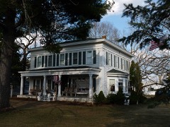
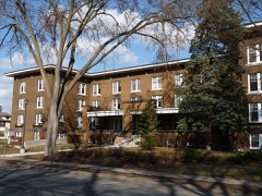
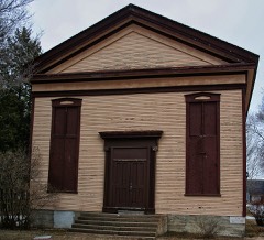
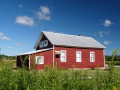
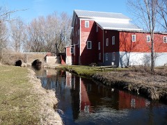
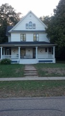
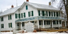
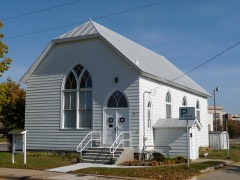
22 National Register listings published here.
Sources: the county history on the Internet Archive · the National Register database, National Park Service
40 topographic sheets cover 36 settlements here, and 22 properties are on the National Register of Historic Places.
22 National Register listings published here.
Sources: the county history on the Internet Archive · the National Register database, National Park Service
Every property in this county listed on the National Register of Historic Places, with the year it was listed and the federal nomination document.
Every wildfire the federal occurrence database records inside this county: 1,268 of them, burning about 2,318 acres. 14 started naturally and 67 were recorded as arson. Each settlement page carries the fires within five miles of it.
| Reported cause | Fires |
|---|---|
| Equipment and vehicle use | 344 |
| Debris and open burning | 317 |
| Missing data/not specified/undetermined | 182 |
| Railroad operations and maintenance | 153 |
| Arson/incendiarism | 67 |
| Recreation and ceremony | 55 |
| Power generation/transmission/distribution | 53 |
| Smoking | 24 |
| Fireworks | 22 |
| Other causes | 19 |
| Misuse of fire by a minor | 18 |
| Natural | 14 |
The five largest, by the area the report gives. Two of them were set deliberately.
| Date | Cause | Size | Reported by | Name on the report |
|---|---|---|---|---|
| 27 April 1997 | Debris and open burning | 300 acres | Wisconsin Department of Natural Resources | not named |
| 6 April 2004 | Railroad operations and maintenance | 109 acres | Wisconsin Department of Natural Resources | not named |
| 7 March 2000 | Railroad operations and maintenance | 82 acres | Wisconsin Department of Natural Resources | not named |
| 9 May 1992 | Equipment and vehicle use | 82 acres | Wisconsin Department of Natural Resources | not named |
| 13 April 2005 | Arson/incendiarism | 72 acres | Wisconsin Department of Natural Resources | EMMONS COMPLEX |
| 13 April 2005 | Arson/incendiarism | 70 acres | Wisconsin Department of Natural Resources | EMMONS COMPLEX |
| 3 May 2000 | Equipment and vehicle use | 58 acres | Wisconsin Department of Natural Resources | not named |
| 17 April 2009 | Equipment and vehicle use | 53 acres | Wisconsin Department of Natural Resources | MEMORY LANE FIRE |
Every settlement page carries the fires within five miles of it - see the settlement index below.
The NOAA Storm Events Database holds 331 reports for this county, causing 2 deaths, 5 injuries and about $10,984,700 in recorded property damage. Each settlement page carries the reports that name it.
| Kind of event | Reports |
|---|---|
| Thunderstorm Wind | 153 |
| Hail | 108 |
| Tornado | 25 |
| Lightning | 12 |
| Heavy Rain | 12 |
| Flash Flood | 9 |
| Funnel Cloud | 6 |
| Flood | 6 |
The most serious of them, by death, then injury, then recorded damage. The accounts are quoted exactly as the forecast office filed them.
| When | Event | Place named | Harm | What the report says |
|---|---|---|---|---|
| April 1956 | Tornado (F2) | not stated | 2 killed, 2 hurt, $250,000 | no account filed |
| June 1976 | Tornado (F1) | not stated | 2 hurt, $25,000 | no account filed |
| June 2007 | Hail | Stevens Pt | 1 hurt | Hail broke the windshield of a FedEx delivery truck. The driver of the truck was injured by flying glass. |
| June 2001 | Thunderstorm Wind | Whiting | $4,060,000 | no account filed |
| May 2011 | Tornado (EF1) | Kellner | $1,800,000 | The tornado entered Portage County from Wood County at 6:20 pm CDT (1720 CST) mainly over farmland. The twister continued to snap trees (DI 28, DOD 4) and overturn agricultural irrigation systems. About six miles south of Plover, a nearly half-mile long row of power poles were bent over (DI 24, DOD 3). The tornado crossed Interstate 39 at Coddington Road two miles west of Keene. The tornado grew to nearly 700 yards wide as it passed just north of Keene and heavily damaged a farmstead. A silo was damaged and barn flattened (DI 1, DOD 6). Several outbuildings were also damaged or destroyed. Along the path, at least two dozen irrigation systems were overturned and damaged (resulting in over $1 million in losses) and many hundreds of trees snapped or uprooted. This area also experienced high-end EF1 damage with winds of 100 to 110 mph. The tornado dissipated about nine miles southeast of Plover at about 6:46 pm (1746 CST). The average path width was 300 yards. |
| September 2010 | Flash Flood | Junction City | $700,000 | Heavy rain fell across Portage County, causing rivers and streams to overflow their banks, washing out roads and damaging homes and businesses. Much of the county had in excess of 4 inches of rain. The highest recorded total was 5.65 inches at Stevens Point. County crews sandbagged several roads in the northwest part of the county. The flooding caused minor damage to 36 homes and 2 businesses and major damage to 1 home. |
| June 2002 | Flash Flood | Countywide | $700,000 | no account filed |
| July 2011 | Thunderstorm Wind | Park Ridge | $530,000 | Widespread thunderstorms wind damage occurred in the Stevens Point and Whiting areas. There were pockets of more significant damage from downtown Stevens Point south to Whiting. Hundreds of trees were blown down or had broken branches and limbs. Stevens Point lost $108,000 worth of city-owned trees in the storm. One home was destroyed, 8 were heavily damaged and 72 sustained minor damage from the storm. The storm left 17,000 customers without electrical power. |
| June 2017 | Flash Flood | Park Ridge | $500,000 | Heavy rainfall caused significant urban flooding near downtown Stevens Point. Several underpasses were impassable. At least two roads were damaged when rain washed out culverts. There were at least 15 homes impacted by the heavy rain. |
| July 2011 | Flash Flood | Park Ridge | $300,000 | Heavy rain in Stevens Point caused flash flooding on the UW-Stevens Point campus, at St. Michaels Hospital and at the County Courthouse and submerged cars on some streets. A low crossing under a railroad bridge in Stevens Point remained closed for much of the next day while the water slowly drained. |
| May 1992 | Tornado (F1) | not stated | $250,000 | no account filed |
| May 1992 | Tornado (F2) | not stated | $250,000 | no account filed |
| October 1992 | Tornado (F1) | not stated | $250,000 | no account filed |
| April 1984 | Tornado (F2) | not stated | $250,000 | no account filed |
| March 1982 | Tornado (F1) | not stated | $250,000 | no account filed |
| September 1951 | Tornado (F4) | not stated | $250,000 | no account filed |
| June 2004 | Tornado (F1) | Blaine | $200,000 | no account filed |
| March 2019 | Flood | Bancroft | $105,000 | Runoff from rainfall and snow melt combined to flood roads and low-lying areas, mainly in and around Park Ridge, Plover, Bancroft and Almond. The runoff also caused flooding of other low-lying and poor drainage areas. The Village of Plover's wastewater system was inundated with water and there was also considerable road and yard flooding in the village. Four homes sustained minor flood damage, and some roads were also damage by the flooding and required repairs after the water receded. A county-wide state of emergency was declared on March 14th and the City of Park Ridge also declared a state of emergency that same day. |
| July 2005 | Thunderstorm Wind | Stevens Pt | $75,000 | no account filed |
| June 1976 | Tornado (F2) | not stated | $25,000 | no account filed |
| July 1970 | Tornado (F2) | not stated | $25,000 | no account filed |
| August 1964 | Tornado (F2) | not stated | $25,000 | no account filed |
| April 1957 | Tornado (F1) | not stated | $25,000 | no account filed |
| June 1998 | Thunderstorm Wind | Rosholt | $20,000 | no account filed |
| May 1996 | Thunderstorm Wind | Stevens Point | $20,000 | no account filed |
| July 2011 | Thunderstorm Wind | Park Ridge | $15,000 | Thunderstorm winds knocked a two foot diameter tree down onto a house, damaging a part of the roof and gutters. |
| August 1996 | Thunderstorm Wind | Rosholt | $15,000 | no account filed |
| June 2017 | Thunderstorm Wind | Plover | $10,000 | A thunderstorm, with wind gusts to 61 mph, downed trees onto homes and knocked out power to several neighborhoods. The storm also dropped 1.92 inches of rain in less than 45 minutes. |
| September 2016 | Lightning | Plover | $10,000 | Lightning stuck a communications tower used by Portage County law enforcement. The time of this event is estimated. |
| August 2009 | Thunderstorm Wind | Almond | $10,000 | A thunderstorm produced wind gusts estimated to near 70 mph near Almond. The storm downed several trees, including a large section of a willow. The tree fell onto a 28' diameter swimming pool, severely damaging the pool. A flag pole was also damaged. |
| July 2017 | Tornado (EF0) | Custer | $5,000 | A weak tornado produced minor crop damage and damaged the roof of an outbuilding (DI 1, DOD 2) which resulted in the building losing a wall. |
| June 1996 | Thunderstorm Wind | Stevens Point | $5,000 | no account filed |
| May 1988 | Tornado (F0) | not stated | $2,500 | no account filed |
| June 1976 | Tornado (F1) | not stated | $2,500 | no account filed |
| June 1976 | Tornado (F2) | not stated | $2,500 | no account filed |
| June 1974 | Tornado (F1) | not stated | $2,500 | no account filed |
| December 1970 | Tornado (F1) | not stated | $2,500 | no account filed |
| July 1997 | Thunderstorm Wind | Stevens Pt | $2,000 | no account filed |
| July 1997 | Thunderstorm Wind | Amherst Jct | $2,000 | no account filed |
| April 1997 | Thunderstorm Wind | Stevens Pt | $2,000 | no account filed |
| June 1996 | Thunderstorm Wind | Bancroft | $2,000 | no account filed |
| June 1996 | Thunderstorm Wind | Plover | $2,000 | no account filed |
| August 1996 | Thunderstorm Wind | Stevens Pt | $2,000 | no account filed |
| June 2017 | Flood | Bancroft | $1,000 | Heavy rainfall caused street flooding in Bancroft. |
| May 1998 | Thunderstorm Wind | Stevens Pt | $1,000 | no account filed |
| June 1997 | Thunderstorm Wind | Amherst | $1,000 | no account filed |
| June 1997 | Thunderstorm Wind | Stevens Pt | $1,000 | no account filed |
| April 1997 | Thunderstorm Wind | Bancroft | $1,000 | no account filed |
| May 1995 | Hail | not stated | $200 | no account filed |
| April 2026 | Hail | Ellis | - | Quarter size hail fell in Ellis. |
| April 2026 | Hail | Plover | - | Quarter size hail fell in Plover. |
| March 2025 | Hail | Whiting | - | Quarter size hail fell near Plover. |
| March 2025 | Hail | Plover | - | Penny size hail fell in Plover. |
| March 2025 | Hail | Plover | - | Half dollar size hail fell in Plover. |
| March 2025 | Hail | Blaine | - | Nickel size hail fell near Blaine. |
| May 2025 | Hail | Kellner | - | Quarter size hail fell in Wisconsin Rapids. The time of this report is an estimate based on radar data. |
| May 2025 | Hail | Coddington | - | Ping pong size hail fell near Bancroft. |
| May 2025 | Hail | Lake Emily | - | Ping pong size hail fell near Amherst Junction. |
| May 2025 | Tornado (EF0) | Bancroft | - | A tornado developed near Bancroft at 5:52 pm CDT, then tracked north before lifting at 6:03 pm CDT. The start of the tornado was noted by trees across a road near the start of the path, with the rest of the tornado occurring over open area that was void of clear damage indicators. Total path length is estimated to be 5.21 miles long, with a width of 45 yards. Peak wind estimated to be around 65 mph. |
| June 2025 | Thunderstorm Wind | Amherst | - | Thunderstorm winds downed multiple trees, power poles, and power lines in Amherst. The time of this report is an estimate based on radar data. |
The Survey's mineral resources record lists 6 workings inside this county. 5 still produce and 1 is closed or unrecorded. Each settlement page carries the workings within five miles of it.
| Commodity | Workings |
|---|---|
| Sand and Gravel, Construction | 6 |
The least common of them first, because a county's hundredth gravel pit says nothing its first ten did not.
| Where | Site | Commodity | Status | Recorded |
|---|---|---|---|---|
| Arnot Pit | Sand and Gravel, Construction | Producer | ||
| Charneski Pit | Sand and Gravel, Construction | Past Producer | ||
| Gosh Pit | Sand and Gravel, Construction | Producer | ||
| Mengel Sand and Gravel Pit | Sand and Gravel, Construction | Producer | ||
| Portage Pits | Sand and Gravel, Construction | Producer | ||
| Somers Gravel Pit | Sand and Gravel, Construction | Producer |
One book written about this county, cut here where the book itself is cut, at its printed chapters: 1 chapter in all. Every chapter is public domain, machine-read from the scan and reproduced complete. A chapter already given under one of the county's towns is not repeated in this list.
| Chapter | Length |
|---|---|
| The whole text | 232,881 words in 15 parts |
Named settlements recorded in the Geographic Names Information System, each with the topographic sheets covering it. Villages, hamlets and abandoned places alike. Each is shown with the nearest named watercourse or landform and the survey quadrangle it falls on.
The vanished settlements of Portage County: the places named above that are no longer on the map.