 Block
Browntown, Wisconsin
14 topographic sheets cover this place, the earliest surveyed in 1923 and the latest in 1981. It stands in Cadiz town. It lies in ZIP code area 53522. It stands on Zander Creek. The Survey maps it on the Browntown quadrangle. 245 people lived here at the 2020 count. It stands 837 feet above sea level.
On record in Browntown
Buildings and businesses the archive holds for this place. Each opens its own page, with the source record it came from.
On the National Register 1 record
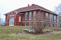 Cadiz Township Joint District No. 2 Schoollisted 1996
Population over time
2 figuresBrowntown fell from 280 to 245 between 2010 and 2020. These are the recorded population figures Wikidata holds for this place, reached through the Geographic Names Information System number this page is keyed on rather than by name, so they belong to this place and not to another of the same name. Most are census counts, but not all are: an early figure may be a founding or settlement estimate, and an estimate published within five years of a census is left out. The change column is computed, and is left blank where more than 20 years separate a figure from the one before it, because a gap that long is not a change between two counts.
| Year | People | Change |
|---|---|---|
| 2010 | 280 | |
| 2020 | 245 | -35 (-12%) |
Topographic sheets covering this place
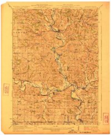
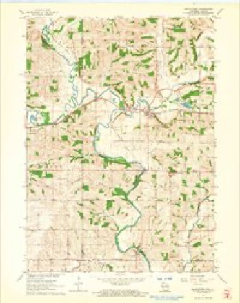
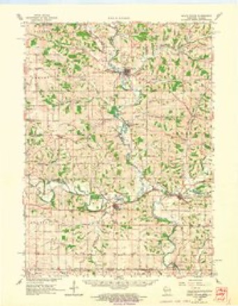
8 surveys from 14 printed sheetsMatched by testing this settlement's coordinate against the published boundary of every sheet in the United States Geological Survey's historical collection. Each opens the scanned sheet at the Survey.
- 1923 USGS South Wayne quadrangle1:62500, 3 printings
- 1954 USGS Rockford quadrangle1:250000
- 1955 USGS Rockford quadrangle1:250000
- 1958 USGS Rockford quadrangle1:250000, 4 printings
- 1962 USGS Browntown quadrangle1:24000, 2 printings
- 1962 USGS South Wayne quadrangle1:62500
- 1963 USGS Rockford quadrangle1:250000
- 1981 USGS Monroe quadrangle1:100000





In the county-history sources
13,507 words on this townshipHistory of Green County, Wisconsin, published 1877; History of Green County, Wisconsin, published 1884 names this settlement in its chapter on Cadiz Town. These are the passages that mention it, exactly as the scans read.
Browntown and Franklin are unrecorded villages. Browntown, on the left bank of the Skinner, dates its beginning from a mill built in iS^6-'qj by Wm. Brown, Henson Irion, and John Wood, and consists of Emanuel Divan's flour-mill, the usual store and blacksmith-shop of country villages, and dwellings enough to make a total of ten buildings. The store and dwellings of Franklin find the reason of their being in the saw-mill of J. E. and Geo. L. Shattuck, which is also a factory of wagon feloes and broom handles. At a very early day speculators bought a large tract of land in Clarno and Cadiz, and borrowed money of the Franklin Bank in Illinois to pay for it. They were never able to pay the bank, and so gave up the land, which was thenceforth called the Franklin land. Before the organization of the towns, the Methodists divided the county into circuits, and the name of the circuit in which this land lay was Franklin. The usual place of holding meetings in the circuit was a school-house on what is now section one of the town of Cadiz, and gradually the name was restricted to this particular place. A steam saw-mill, built there in 1854 by Benjamin Chenoweth and Henry Barber, was called the Franklin mill, and when a post-office was established there, the people wanted to call it Franklin. The postoffice department objecting, it was called Lamar ; but the place is Franklin still.
Passage source: History of Green County, Wisconsin, published 1877.
The earliest settlers of this town were from the mining regions of this State, farther west. The flrst settler of Cadiz was George Lot, who settled on the southeast quarter of section 36, in 1834. Lot came directly from the mines, where he had gone previous to the Black Hawk War. He was originally from the State of Pennsylvania. He remained here but a short time then moved to near Winslow, 111 , where he built a saw mill. Later ho became crazy and hung himself.
Passage source: History of Green County, Wisconsin, published 1884.
Soon afterward came Andrew Rabb and son, Samuel, who located on section 19, and Reuben Tuttle on section 20. The former removed to Dakota, in the spring of 1883, and the latter remained but three years, when he removed to Sheboygan.
Passage source: History of Green County, Wisconsin, published 1884.
Machine-read from a century-old scan, so expect the errors a machine makes: misspelled names, dropped words, stray characters.
Read the whole chapter on Cadiz Town - it names this place 10 more 10 times.
Fires near this place
10 since 2018Regional context, not property-specific evidence. The federal wildfire occurrence database lists 10 fires within 5 miles of Browntown between 2018 and 2020, burning about 18 acres in total. None started naturally. None was recorded as arson. Distance is straight-line from the map coordinates, so a fire counted here may appear on a neighbouring settlement's page as well.
| Reported cause | Fires |
|---|---|
| Debris and open burning | 7 |
| Missing data/not specified/undetermined | 3 |
The most recent of them, most recent first, with the day each was reported and the service that recorded it.
| Date | Cause | Size | Reported by | Name on the report |
|---|---|---|---|---|
| 5 April 2020 | Debris and open burning | under an acre | Wisconsin Department of Natural Resources | 322020 |
| 27 April 2018 | Debris and open burning | under an acre | Wisconsin Department of Natural Resources | 442018 |
| 20 April 2018 | Debris and open burning | 3.0 acres | Wisconsin Department of Natural Resources | 372018 |
| 16 April 2019 | Missing data/not specified/undetermined | under an acre | Wisconsin Department of Natural Resources | 432019 |
| 15 April 2019 | Debris and open burning | 1.0 acres | Wisconsin Department of Natural Resources | 2019004 |
| 11 April 2018 | Debris and open burning | 1.0 acres | Wisconsin Department of Natural Resources | 352018 |
| 23 March 2019 | Debris and open burning | under an acre | Wisconsin Department of Natural Resources | 302109 |
| 22 March 2018 | Debris and open burning | 5.0 acres | Wisconsin Department of Natural Resources | 302108 |
Settlements close enough to share some of these fires:
Mines and quarries near this place
5 within 5 milesRegional context, not property-specific evidence. The federal mineral resources record lists 5 workings within 5 miles of Browntown: 4 past producers, 1 producer. 1 still produces. What was taken out: Stone, Crushed/Broken. Distance is straight-line from the map coordinates, so a quarry counted here may appear on a neighbouring settlement's page as well.
| Where | Site | Commodity | Status | Recorded |
|---|---|---|---|---|
| Devoe Quarry | Stone, Crushed/Broken | Producer | ||
| Emil Maurer Quarry | Stone, Crushed/Broken | Past Producer | ||
| Juenemann Quarry | Stone, Crushed/Broken | Past Producer | ||
| Rees Construction Company | Stone, Crushed/Broken | Past Producer | ||
| Stites Quarry | Stone, Crushed/Broken | Past Producer |
Storms near this place
27 since 1994Regional context, not property-specific evidence. The National Weather Service names Browntown in 27 storm reports between 1994 and 2026: 15 thunderstorm wind, 6 hail, 3 flash flood, 3 flood. The reports record 1 injury. Each account below is quoted exactly as the forecast office filed it, from the NOAA Storm Events Database, and each date opens the federal record of that event.
| When | Event | Place named | Harm | What the report says |
|---|---|---|---|---|
| July 1996 | Flash Flood | Browntown | 1 hurt, $6,000,000 | no account filed |
| June 2008 | Flash Flood | Browntown | $1,320,000 | Heavy rains resulted in flash flooding across much of Green County. Water depths on road surfaces reached 3 feet or more and there were gravel washouts. Some farm fields remained flooded into early July. The breakdown for residential home losses were: 109 with minor damage, 12 with major damage, and 1 destroyed (total of $750 thousand for home losses). There were no business losses. Farm buiding losses were: 1 with minor damage, 2 with major damage, and 4 destroyed (for a total of $195 thousand in farm building losses). Crop losses were estimated at $20 million. Public sector damage was about $373.3 thousand. There were several roads and bridges that sustained damage. |
| August 2007 | Flash Flood | Browntown | $400,000 | Several rounds of thunderstorms with heavy rains on top of a saturated ground resulted in another round of scattered flash flooding across Green County. At least another 150 residents sustained water damage to basement contents and/or basement walls. Two homes in Browntown had basements on the verge of collapsing. One farm home near Brooklyn had 5 feet of water in the basement and the basement walls cracked. Two silos on the same property had cracking due to water accumulation. In the city of Brodhead, a sink hole developed which resulted in the sewer system collapsing at that location. Road damages (gravel washouts or culverts) were scattered around the county, and totaled 91,000. Several roads were closed over the eastern third of the county due to either fast-flowing water or high water levels. Many other roads across the county had at least 6 inches to 1 foot of fast flowing water covering them. About 20 homes in Albany had basement flooding and sewage backups and needed to be pumped out. In some cases water depths were almost to the basement ceiling! Several homes and businesses in New Glarus had sewage backups. A home on CTH Y near Monroe had a partial collapse of two basement walls. A mudslide occurred on CTH M just south of Jordon Center. Soil erosion and crop damage was also noted. Refer to the August 18-19, 2007, Flash Flood event for Green County for related information.||August, 2007, rainfall totals include: 15.57 at Brodhead, 15.43 in Monroe, and 20.20 in New Glarus. |
| April 2002 | Thunderstorm Wind | Browntown | $200,000 | no account filed |
| July 2017 | Flood | Browntown | $172,000 | The Pecatonica River in Martintown crested at 18.45 ft. which is moderate flood stage. Some homes in the Martintown area have floodwaters in their basements and first floors. In total, 8 homes had either very minor or minor flood damage, with 3 homes having major flood damage. One business in Browntown suffered major flood damage. Portions of Martintown Road, West River Road, and Babler Road are flooded. A portion of Zimmerman Lane was washed out. Upstream in Browntown, Highway MM and West Indies Road are flooded. |
| February 2018 | Flood | Browntown | $120,000 | The Pecatonica River in Martintown crested at 20.07 ft., which is moderate flood stage.|Some homes in the Martintown area have floodwaters in their basements and first floors; Martintown Road and West River Road in Martintown are flooded as is Highway 73 about 1 mile downstream in Winslow, Illinois. Highways MM and West Indies Road upstream in the Browntown area are flooded. Road damage did occur to some of the flooded roads and will require repair. |
| April 1997 | Thunderstorm Wind | Browntown | $35,000 | no account filed |
| May 2013 | Thunderstorm Wind | Browntown | $30,000 | Law enforcement officials reported trees and power lines blown down by thunderstorm wind gusts estimated at 65 mph (56 knots) along a 15 mile-wide path from 5 miles south-southeast of Browntown to Dayton. |
| October 2019 | Flood | Browntown | $20,000 | The Pecatonica River at Martintown reached moderate flood stage, cresting at 18.83 feet the early morning of October 7th. This is a continuation of flooding that began on September 15th. Some homes in the Martintown area have floodwaters in their basements and first floors. Martintown Road and West River Road are flooded. Upstream in Browntown, Highway MM and West Indies Road are flooded. |
| August 2005 | Thunderstorm Wind | Browntown | $20,000 | Numerous trees and some power lines down. |
| August 2004 | Thunderstorm Wind | Browntown | $20,000 | no account filed |
| July 2006 | Thunderstorm Wind | Browntown | $15,000 | Trees and some power-lines down in the area southwest through southeast of Browntown, including Browntown. |
| July 2018 | Thunderstorm Wind | Browntown | $8,000 | Scattered reports of trees and power lines down across the county. |
| July 2018 | Thunderstorm Wind | Browntown | $5,000 | Several trees and large branches down in the Browntown area. |
| June 2005 | Thunderstorm Wind | Browntown | $5,000 | Trees and powerlines down. |
| June 1998 | Thunderstorm Wind | Browntown | $5,000 | no account filed |
| September 2000 | Thunderstorm Wind | Browntown | $2,000 | no account filed |
| September 1997 | Thunderstorm Wind | Browntown | $200 | no account filed |
| June 2009 | Thunderstorm Wind | Browntown | - | Seveal large trees blown down by thunderstorm winds. |
| June 2008 | Thunderstorm Wind | Browntown | - | Powerful thunderstorms winds knocked down a few large trees. |
| June 2006 | Thunderstorm Wind | Browntown | - | Tree down. |
| July 1994 | Hail | Browntown | - | Isolated severe thunderstorms dropped hail up to two inches in diameter and generated winds to 58 mph over extreme southern Wisconsin. |
| March 2026 | Hail | Browntown | - | no account filed |
| April 2020 | Hail | Browntown | - | no account filed |
| April 2020 | Hail | Browntown | - | no account filed |
| June 2008 | Hail | Browntown | - | no account filed |
| October 2001 | Hail | Browntown | - | no account filed |
Nearest settlements
The eight closest, with where each one stands in the county. Distances are straight-line, computed from the Geographic Names Information System coordinates.
| Map | Place | Distance | Sheets |
|---|---|---|---|
| Martintown | 4.8 miles | 14 | |
| Monroe Estates | 7.0 miles | 14 | |
| Monroe | 8.4 miles | 14 | |
| Clarno | 8.8 miles | 14 | |
| Schneyville | 9.2 miles | 14 | |
| Willet (historical) | 10.0 miles | 13 | |
| Stearns | 11.3 miles | 15 | |
| Schultz | 12.8 miles | 15 |
Elsewhere
Matched on this settlement's Geographic Names Information System number rather than its name, so it cannot be a different place of the same name in another state.
| Wikipedia article on Browntown | An encyclopaedic summary. Its text is share-alike, so it is linked here rather than copied. |
| Wikidata item Q2444335 | The structured record the population and elevation above come from. Public domain (CC0). |
Provenance
This settlement is recorded in the Geographic Names Information System as feature 1562278. The sheet list is computed by point-in-boundary test against the United States Geological Survey's historical topographic inventory. Both are works of the United States government and carry no copyright under 17 U.S.C. 105.
Wildfire. Short, Karen C. 2022. Spatial wildfire occurrence data for the United States, 1992-2020 [FPA_FOD_20221014]. 6th Edition. Fort Collins, CO: Forest Service Research Data Archive. https://doi.org/10.2737/RDS-2013-0009.6 Collected with United States Government funding and usable without additional permissions or fees.
Mines and quarries. USGS Mineral Resources Data System (MRDS) https://mrdata.usgs.gov/mrds/ A work of the United States government, no copyright under 17 U.S.C. 105.
Storms. NOAA National Centers for Environmental Information, Storm Events Database https://www.ncei.noaa.gov/stormevents/ A work of the United States government, no copyright under 17 U.S.C. 105. Narratives are quoted verbatim from the National Weather Service report and are not edited or summarised.