 Block
Clarno, Wisconsin
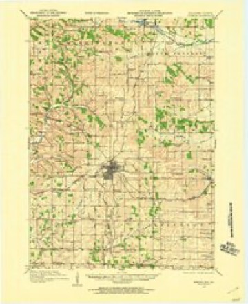
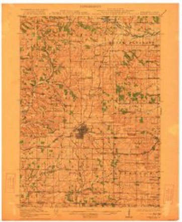
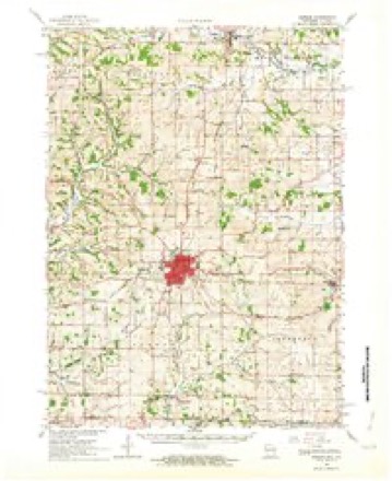
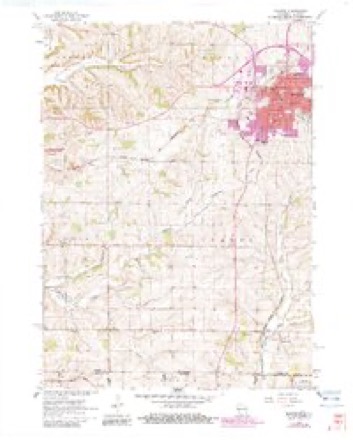
14 topographic sheets cover this place, the earliest surveyed in 1920 and the latest in 1981. It stands in Clarno town. It lies in ZIP code area 53566. It stands on Little Richard Creek. The Survey maps it on the Monroe quadrangle. It stands 843 feet above sea level.
Topographic sheets covering this place
9 surveys from 14 printed sheetsMatched by testing this settlement's coordinate against the published boundary of every sheet in the United States Geological Survey's historical collection. Each opens the scanned sheet at the Survey.
- 1920 USGS Monroe quadrangle1:62500
- 1922 USGS Monroe quadrangle1:62500
- 1954 USGS Rockford quadrangle1:250000
- 1955 USGS Rockford quadrangle1:250000
- 1958 USGS Rockford quadrangle1:250000, 4 printings
- 1962 USGS Monroe quadrangle1:62500, 2 printings
- 1962 USGS Monroe quadrangle1:24000, 2 printings
- 1963 USGS Rockford quadrangle1:250000
- 1981 USGS Monroe quadrangle1:100000





In the county-history sources
31,846 words on this townshipHistory of Green County, Wisconsin, published 1877 names this settlement in its chapter on Clarno Town. These are the passages that mention it, exactly as the scans read.
The first man who came to Green County to farm was Andrew Clarno. He visited the county as early as 1827. In 1829 he selected a part of section 30 of the township which bears his name, for a farm, and, after spending the winter of i829-'3o at Skinner diggings, he began work on his claim. In 1831 he persuaded Wm. Wallace and Joseph Paine, Mr. Wallace's son-in-law, to settle near him with their families. He had been acquainted with his new neighbors in Illinois, whence they all came to Green County. The next year the Black Hawk war broke out, and the Wallaces and Paines went to Willow Springs, where, to use the phrase of the time, they "forted" during the war. On the day selected for going to the fort, Mr. Paine, fearing no immediate danger, walked leisurely to the Pecatonica, three or four miles south-west of his house, to bail out the ferry boat. The two families were nearly ready to start and expected to overtake Mr. Paine by the time the boat was ready for use. At the river, Mr. Paine was surprised and startled to find that the Indians had been there before him. They had stolen his ferry boat and gone he knew not whither. Their camp fires were still smoking, and lie thought he could discern one dusky warrior lurking in the grass and watching him. No long time elapsed before Mr. Paine was again at his cabin. Almost in despair, he saw that Air. Wallace still sat smoking his pipe, and that the preparations for the journey had made no progress whatever since he went away. Very soon, however, the wagon was made ready and the flight began. It was not much like the removal of patriarchs. They took no large flocks and herds, no rich treasure with them. As Mr. Paine expressed it, they threw in the women and children, and started. In a short time darkness overtook them. There were no roads except Indian trails. With a wagon, it was difficult to follow the trails in the day time ; after dark it was impossible. They stopped for the night in a little grove on the Capt. Foster place in the village of Monroe. Here, without daring to strike a light, they sat in silence and waited for morning. Sometimes the long silence of the night was broken by a wild whoop in the distance. Once they saw Indians passing by, and great was their fear lest some movement of the horses or the children should betray them. But a strong wind carried all sounds of the little camp in an opposite direction. Morning came at last, and the travelers went on in safety to the fort, crossing the Pecatonica nearly as far north as Argyle. The day after their flight the deserted home was visited by soldiers sent out from the fort to warn and assist the settlers ; but they found the cabin burned and its contents destroyed. At this time, Mr. Clarno was in Illinois, where he had gone after his two sons. Hostilities having begun, he stopped on his return at Fort Hamilton, so-called in honor of a son of Alexander Hamilton, Col. W. S. Hamilton, who, as early as 1823 had distinguished himself by his bold enterprises in Illinois and Wisconsin, and who used to say, half in earnest, half in jest, that he might have been quite a man but for his distinguished father, with whom people always compared him. Mr. Clarno was made captain of a company of soldiers, and his son O. H. i*. Clarno, then a little boy, had charge of a gun inside the fort.
Passage source: History of Green County, Wisconsin, published 1877.
After the war, the settlers returned to their homes, or rather to their land, for this was all they had. Mr. Clarno, who had neither oxen nor horses, helped his boys across the streams, and father and sons walked from the fort. In 1S33 ^r- P^me induced James Hawthorne to come to Clarno. Mr. Hawthorne had come to the mines in the western part of Iowa County in 1827, had afterwards returned to New York state, and had again come west on hearing that Uncle Sam had given miners permission to work on the Dubuque side of the river; but he was soon driven from Dubuque by the cholera, and during the war he was at White Oak Springs. When a boy of seventeen, Mr. Hawthorne served in the war of 181 2 as a substitute for a drafted man, though, as substitutes were not accepted by the government, he was known through his soldier life by the name of the drafted man. In 1832, wishing to try again the life of a soldier, he offered $125 for a horse, but he could not get one for that amount, and, as a horse was an indispensable part
Passage source: History of Green County, Wisconsin, published 1877.
During the winter of iS33-,34, O. H. P. Clarno was left alone on his father's claim. To while away the long evenings, the Indians undertook to teach him their language. After a time, he observed that the woods around his cabin were full of little piles of corn cobs, and now was explained the hitherto mysterious diminution of his corn. While some of his instructors were giving him a lesson, the habit had been for others to shell a few ears of corn, putting the corn into the bags or pockets always carried on their persons. This exercise being over, they went into the house, to relieve the teachers who had preceded them. In 1834 Abner Van Sant and his son-inlaw, John W. Deniston, moved to Clarno from Missouri, and in iS^^-^6 they were joined by Matthew. William, and Peter Wells, Jonathan Snyder, A. De Haven, Calvin Hale, Adam and Levi Starr, and Joseph Kelly of Ohio, John Patterson of Indiana, T. S. and Wm. Bowen, natives of New York but directly from Illinois. O.J. White, Wm. Chilton, and Wm. Draper of Illinois. Jacob Starr of Virginia, Joseph Smith of Pennsylvania, P. C. Grupe of Missouri, Wm. and John Blunt, Wm. Brown, Henry Ater, and -, - *-*-*- McDonald. Mr. De Haven returned to Ohio in 1836, and remained several years, during which time his brother-in-law, John Cameron, worked his Clarno farm. Besides these men who made homes, there were probably many single men, Certainly there were Cutler Wilkins of Missouri, Wm. Baird of Ohio, now, as for many years a prominent citizen of Sylvester, and James Campbell of New York, the first settler in the town of Albany. Whenever a new settler came, those here before him helped him raise his house. One of the best attended of the Clarno raisings was that at Mr. Starr's, where both house and barn were built the same, day the logs were cut.
Passage source: History of Green County, Wisconsin, published 1877.
Machine-read from a century-old scan, so expect the errors a machine makes: misspelled names, dropped words, stray characters.
Read the whole chapter on Clarno Town - it names this place 8 more 8 times.
Fires near this place
4 since 2018Regional context, not property-specific evidence. The federal wildfire occurrence database lists 4 fires within 5 miles of Clarno between 2018 and 2020, burning about 8 acres in total. None started naturally. None was recorded as arson. Distance is straight-line from the map coordinates, so a fire counted here may appear on a neighbouring settlement's page as well.
| Reported cause | Fires |
|---|---|
| Debris and open burning | 3 |
| Equipment and vehicle use | 1 |
The most recent of them, most recent first, with the day each was reported and the service that recorded it.
| Date | Cause | Size | Reported by | Name on the report |
|---|---|---|---|---|
| 5 April 2020 | Equipment and vehicle use | 2.0 acres | Wisconsin Department of Natural Resources | 68 |
| 3 April 2019 | Debris and open burning | 3.0 acres | Wisconsin Department of Natural Resources | 64 |
| 11 April 2018 | Debris and open burning | 3.0 acres | Wisconsin Department of Natural Resources | 61 |
| 14 December 2019 | Debris and open burning | under an acre | Wisconsin Department of Natural Resources | 19101 |
Settlements close enough to share some of these fires:
Mines and quarries near this place
4 within 5 milesRegional context, not property-specific evidence. The federal mineral resources record lists 4 workings within 5 miles of Clarno: 2 past producers, 2 producers. 2 still produce. What was taken out: Stone, Crushed/Broken. Distance is straight-line from the map coordinates, so a quarry counted here may appear on a neighbouring settlement's page as well.
| Where | Site | Commodity | Status | Recorded |
|---|---|---|---|---|
| Clark Quarry | Stone, Crushed/Broken | Producer | ||
| Monte Quarry | Stone, Crushed/Broken | Producer | ||
| Unnamed Limestone Quarry | Stone, Crushed/Broken | Past Producer | ||
| Unnamed Limestone Quarry | Stone, Crushed/Broken | Past Producer |
Storms near this place
7 since 1996Regional context, not property-specific evidence. The National Weather Service names Clarno in 7 storm reports between 1996 and 2023: 4 hail, 2 thunderstorm wind, 1 tornado. No death or injury is recorded in these reports. Each account below is quoted exactly as the forecast office filed it, from the NOAA Storm Events Database, and each date opens the federal record of that event.
| When | Event | Place named | Harm | What the report says |
|---|---|---|---|---|
| June 2014 | Tornado (EF1) | Clarno | $300,000 | Numerous large trees uprooted and snapped. Severe damage to several barns, and sheds of various sizes destroyed. Straight line wind damage likely occurred to the right of the tornado path with tree and shed damage in various locations. |
| August 1996 | Thunderstorm Wind | Clarno | $20,000 | no account filed |
| May 2020 | Thunderstorm Wind | Clarno | $10,000 | A swath of tree and power line damage, some falling in roads. A couple sheds blown off foundations. |
| April 2023 | Hail | Clarno | - | no account filed |
| April 2020 | Hail | Clarno | - | no account filed |
| April 2020 | Hail | Clarno | - | no account filed |
| June 1997 | Hail | Clarno | - | no account filed |
Nearest settlements
The eight closest, with where each one stands in the county. Distances are straight-line, computed from the Geographic Names Information System coordinates.
| Map | Place | Distance | Sheets |
|---|---|---|---|
| Schneyville | 0.5 miles | 14 | |
| Monroe Estates | 5.0 miles | 14 | |
| Twin Grove | 5.6 miles | 15 | |
| Monroe | 5.7 miles | 14 | |
| Martintown | 8.1 miles | 14 | |
| Browntown | 8.8 miles | 14 | |
| Juda | 9.0 miles | 15 | |
| Oakley | 9.6 miles | 18 |
Elsewhere
Matched on this settlement's Geographic Names Information System number rather than its name, so it cannot be a different place of the same name in another state.
| Wikipedia article on Clarno | An encyclopaedic summary. Its text is share-alike, so it is linked here rather than copied. |
| Wikidata item Q5127714 | The structured record the population and elevation above come from. Public domain (CC0). |
Provenance
This settlement is recorded in the Geographic Names Information System as feature 1563126. The sheet list is computed by point-in-boundary test against the United States Geological Survey's historical topographic inventory. Both are works of the United States government and carry no copyright under 17 U.S.C. 105.
Wildfire. Short, Karen C. 2022. Spatial wildfire occurrence data for the United States, 1992-2020 [FPA_FOD_20221014]. 6th Edition. Fort Collins, CO: Forest Service Research Data Archive. https://doi.org/10.2737/RDS-2013-0009.6 Collected with United States Government funding and usable without additional permissions or fees.
Mines and quarries. USGS Mineral Resources Data System (MRDS) https://mrdata.usgs.gov/mrds/ A work of the United States government, no copyright under 17 U.S.C. 105.
Storms. NOAA National Centers for Environmental Information, Storm Events Database https://www.ncei.noaa.gov/stormevents/ A work of the United States government, no copyright under 17 U.S.C. 105. Narratives are quoted verbatim from the National Weather Service report and are not edited or summarised.