 Block
Butman Corners, Wisconsin
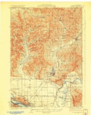
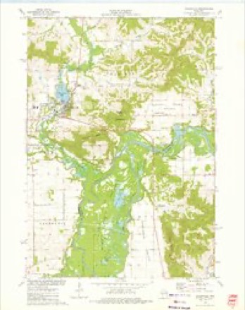
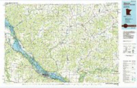
11 topographic sheets cover this place, the earliest surveyed in 1929 and the latest in 1985. It stands in Gale town. It lies in ZIP code area 54630. It lies near Decorah Prairie. The Survey maps it on the Galesville quadrangle.
Topographic sheets covering this place
6 surveys from 11 printed sheetsMatched by testing this settlement's coordinate against the published boundary of every sheet in the United States Geological Survey's historical collection. Each opens the scanned sheet at the Survey.
- 1929 USGS Galesville quadrangle1:62500, 2 printings
- 1953 USGS Eau Claire quadrangle1:250000, 4 printings
- 1958 USGS Eau Claire quadrangle1:250000
- 1964 USGS Eau Claire quadrangle1:250000
- 1973 USGS Galesville quadrangle1:24000
- 1985 USGS Winona quadrangle1:100000, 2 printings
Fires near this place
10 since 2018Regional context, not property-specific evidence. The federal wildfire occurrence database lists 10 fires within 5 miles of Butman Corners between 2018 and 2020, burning about 22 acres in total. None started naturally. 2 were recorded as arson. Distance is straight-line from the map coordinates, so a fire counted here may appear on a neighbouring settlement's page as well.
| Reported cause | Fires |
|---|---|
| Debris and open burning | 3 |
| Missing data/not specified/undetermined | 3 |
| Arson/incendiarism | 2 |
| Smoking | 1 |
| Equipment and vehicle use | 1 |
The most recent of them, most recent first, with the day each was reported and the service that recorded it.
| Date | Cause | Size | Reported by | Name on the report |
|---|---|---|---|---|
| 2 June 2019 | Debris and open burning | under an acre | Wisconsin Department of Natural Resources | 19-0471 |
| 13 May 2019 | Debris and open burning | under an acre | Wisconsin Department of Natural Resources | 513192 |
| 28 April 2018 | Missing data/not specified/undetermined | 1.0 acres | Wisconsin Department of Natural Resources | 428181 |
| 26 April 2018 | Equipment and vehicle use | 14 acres | Wisconsin Department of Natural Resources | 426181 |
| 24 April 2019 | Arson/incendiarism | 1.0 acres | Wisconsin Department of Natural Resources | 19-0363 |
| 21 April 2020 | Debris and open burning | under an acre | Wisconsin Department of Natural Resources | 200285 |
| 22 March 2018 | Smoking | 5.0 acres | Wisconsin Department of Natural Resources | 18-0190 |
| 20 March 2018 | Missing data/not specified/undetermined | under an acre | Wisconsin Department of Natural Resources | 320181 |
Settlements close enough to share some of these fires:
Mines and quarries near this place
10 of 22 shownRegional context, not property-specific evidence. The federal mineral resources record lists 22 workings within 5 miles of Butman Corners: 18 past producers, 4 occurrences. None of them still produces. What was taken out: Stone, Crushed/Broken, Sand and Gravel, Construction. Distance is straight-line from the map coordinates, so a quarry counted here may appear on a neighbouring settlement's page as well.
| Where | Site | Commodity | Status | Recorded |
|---|---|---|---|---|
| Archie Britt Gravel Deposit | Sand and Gravel, Construction | Occurrence | ||
| Archie Britt Gravel Pit | Sand and Gravel, Construction | Past Producer | ||
| Black River Gravel Deposit | Sand and Gravel, Construction | Occurrence | ||
| A Irvine Stone Quarry | Stone, Crushed/Broken | Past Producer | ||
| A Rosenvold Limestone Quarry | Stone, Crushed/Broken | Past Producer | ||
| Becker Stone Quarry | Stone, Crushed/Broken | Past Producer | ||
| Blankenhorn Sandstone Quarry | Stone, Crushed/Broken | Past Producer | ||
| C Sahlstrom Dolomite Quarry | Stone, Crushed/Broken | Past Producer | ||
| Dereen Farms Sandstone Quarry | Stone, Crushed/Broken | Past Producer | ||
| Leo Lemieux Stone Quarry | Stone, Crushed/Broken | Past Producer |
Storms near this place
37 since 2010Regional context, not property-specific evidence. The National Weather Service names Butman Corners in 37 storm reports between 2010 and 2026: 25 flood, 6 thunderstorm wind, 4 hail, 2 tornado. No death or injury is recorded in these reports. Each account below is quoted exactly as the forecast office filed it, from the NOAA Storm Events Database, and each date opens the federal record of that event.
| When | Event | Place named | Harm | What the report says |
|---|---|---|---|---|
| July 2021 | Hail | Butman Corners | $105,000 | Tennis ball sized hail was reported east of Galesville. |
| May 2017 | Tornado (EF1) | Butman Corners | $60,000 | An EF-1 tornado moved across far southeast Trempealeau County and damaged trees and farm buildings. One barn was destroyed, part of a metal roof was taken off an outbuilding and a tree was knocked over onto the roof of a mobile home. |
| May 2017 | Thunderstorm Wind | Butman Corners | $50,000 | East of Galesville, a large metal grain bin was flattened and moved several hundred yards. |
| July 2023 | Hail | Butman Corners | $15,000 | Trained spotter reported hen egg sized hail near Butman Corners. |
| May 2017 | Thunderstorm Wind | Butman Corners | $15,000 | A farm outbuilding was destroyed west of Galesville. |
| May 2017 | Thunderstorm Wind | Butman Corners | $15,000 | A section of a large barn was destroyed east of Galesville. Part of the destroyed roof was blown about a quarter mile away. |
| July 2019 | Thunderstorm Wind | Butman Corners | $10,000 | Multiple trees were blown down at a campground along the Black River southeast of Galesville. Almost all 200 campsites were evacuated as the storms rolled through. |
| May 2017 | Thunderstorm Wind | Butman Corners | $10,000 | East of Galesville, a portion of a large tree was blown down. As the tree came down, it damaged the roof of a house. |
| July 2019 | Thunderstorm Wind | Butman Corners | $2,000 | Numerous trees were blown down southeast of Galesville. |
| April 2026 | Flood | Butman Corners | - | Heavy rain from multiple rounds of thunderstorms during the middle of April contributed to the Black River at Galesville rising into flood stage during the afternoon hours on April 15th. The river crested in moderate flood stage during the morning hours on April 16th before falling below flood stage during the morning hours on April 18th. |
| September 2024 | Hail | Butman Corners | - | The public reported half dollar sized hail 5 miles east of Butman Corners. |
| April 2023 | Flood | Butman Corners | - | A strong spring storm at the end of March resulted in over an inch of rain falling on a deeper than average snowpack in north-central Wisconsin. The Black River at Galesville quickly rose above flood stage and crested at 13.45 ft on April 3rd, 1.45 ft above flood stage. |
| April 2023 | Flood | Butman Corners | - | A strong spring storm in the middle of April provided over 20 of snow on a deeper than average snowpack in north-central Wisconsin, quickly followed by anomalously warm temperatures and rapid melting. The Black River at Galesville rapidly rose above flood stage and crested at 14.48 ft on April 22nd, 2.48 ft above flood stage. |
| October 2023 | Flood | Butman Corners | - | The Black River at Galesville reached minor flood stage on October 26th, cresting 2.98 feet above flood stage, in moderate flood stage on October 27th. |
| March 2022 | Flood | Butman Corners | - | Runoff after a rainfall event pushed the Black River out of its banks near Galesville. The river crested almost a half foot above the flood stage at 12.44 feet on the 26th. |
| August 2021 | Flood | Butman Corners | - | Runoff from heavy rains pushed the Black River out of its banks near Galesville. The river crested less than a foot above the flood stage at 12.29 feet. |
| August 2021 | Flood | Butman Corners | - | Runoff from heavy rains pushed the Black River out of its banks near Galesville. The river crested over three feet above the flood stage at 15.03 feet on the 30th. This was the fifth highest crest ever recorded. The flooding continued into September 2021. |
| September 2021 | Flood | Butman Corners | - | Flooding that began in late August on the Black River near Galesville ended very early in September. |
| March 2019 | Flood | Butman Corners | - | Runoff from rain earlier in March along with melting snow and ice jams, pushed the Black River out of its banks near Galesville. The river crested over a foot above the flood stage at 13.42 feet on March 18th. |
| March 2019 | Flood | Butman Corners | - | Runoff from melting snow pushed the Black River out of its banks near Galesville. The river crested around a half foot above the flood stage at 12.4 feet on March 26th. |
| April 2019 | Flood | Butman Corners | - | Runoff from rain and snowmelt pushed the Black River out of its banks near Galesville. The river crested almost three feet above the flood stage at 14.95 feet on April 19th. |
| July 2019 | Tornado (EF0) | Butman Corners | - | A brief tornado occurred in the far southeast corner of Trempealeau County southeast of Ettrick. The tornado touched down in a corn field, crossed State Highway 54 and dissipated in a wooden area. Damage was limited to the corn and trees. |
| July 2019 | Flood | Butman Corners | - | Runoff from heavy rain pushed the Black River out of its banks near Galesville. The river crested around a half foot above the flood stage at 12.42 feet. |
| October 2018 | Flood | Butman Corners | - | Runoff from heavy rains pushed the Black River out of its banks near Galesville. The river crested a foot above the flood stage at 13.02 feet on October 13th. |
| May 2017 | Flood | Butman Corners | - | Runoff from heavy rains pushed the Black River out of its banks near Galesville. The river crested almost a foot and a half above the flood stage at 13.39 feet. |
| February 2017 | Flood | Butman Corners | - | Rainfall of a half to one inch, combined with runoff from snowmelt, pushed the Black River out of its banks near Galesville. The river crested almost two feet above the flood stage at 13.92 feet. |
| April 2017 | Flood | Butman Corners | - | Runoff from heavy rains pushed the Black River out of its banks near Galesville. The river crested less than 2 feet above the flood stage at 16.64 feet. |
| March 2016 | Flood | Butman Corners | - | Runoff from heavy rains pushed the Black River out of its banks near Galesville. The river crested at 14.2 feet, around two feet above the flood stage. |
| September 2016 | Flood | Butman Corners | - | Runoff from heavy rain pushed the Black River out of its banks near Galesville. The river crested almost three feet above the flood stage at 14.76 feet. |
| December 2015 | Flood | Butman Corners | - | Runoff from heavy rain pushed the Black River out of its banks near Galesville. The river crested at 13.38 feet, which was a little over a foot above the flood stage. |
| May 2014 | Flood | Butman Corners | - | Runoff from heavy rain in late April and early May pushed the Black River out of its banks near Galesville. The river crested around a quarter of a foot over the flood stage at 12.27 feet. |
| June 2013 | Flood | Butman Corners | - | Runoff from heavy rain pushed the Black River out of its banks near Galesville. The river crested around a half foot over flood stage at 12.59 feet. |
| April 2013 | Flood | Butman Corners | - | The combination of several rounds of rain and melting snow caused the Black River near Galesville to go above flood stage three times between April 11th and April 21st. The first round of flooding occurred between the 11th and 14th with a crest of 13.35 feet on the 12th. The second round of flooding occurred between the 17th and 19th with a crest of 12.49 feet on the 18th. The final round of flooding occurred on the 20th and 21st with a crest of 12.58 feet on the 21st. Flood stage at Galesville is 12 feet. |
| April 2011 | Flood | Butman Corners | - | Two day rainfall amounts of 1 to 2 inches across western and central Wisconsin produced a period of flooding along the Black River near Galesville. The river exceeded the flood stage from the 11th into the 14th. The river crested over a foot and a half above the flood stage at 13.6 feet on the 12th. |
| March 2011 | Flood | Butman Corners | - | The combination of rainfall and melting snow pushed the Black River near Galesville out of its banks. The river exceeded the flood stage from the 23rd into the 25th. The river crested less than a foot over the flood stage at 12.88 feet. |
| September 2010 | Flood | Butman Corners | - | Locally heavy rains pushed the Black River near Galesville out of its banks from September 24th through the 29th. The river exceeded the flood stage by almost five feet, cresting at 16.77 feet. This crest established a new flood of record. |
| June 2010 | Hail | Butman Corners | - | no account filed |
Nearest settlements
The eight closest, with where each one stands in the county. Distances are straight-line, computed from the Geographic Names Information System coordinates.
| Map | Place | Distance | Sheets |
|---|---|---|---|
| Galesville | 3.0 miles | 11 | |
| Frenchville | 5.2 miles | 11 | |
| Ettrick | 6.3 miles | 11 | |
| Iduna | 8.4 miles | 11 | |
| Centerville | 8.5 miles | 11 | |
| Beachs Corners | 9.0 miles | 13 | |
| Wrights Corners | 9.0 miles | 11 | |
| Trempealeau | 9.4 miles | 11 |
Provenance
This settlement is recorded in the Geographic Names Information System as feature 1562471. The sheet list is computed by point-in-boundary test against the United States Geological Survey's historical topographic inventory. Both are works of the United States government and carry no copyright under 17 U.S.C. 105.
Wildfire. Short, Karen C. 2022. Spatial wildfire occurrence data for the United States, 1992-2020 [FPA_FOD_20221014]. 6th Edition. Fort Collins, CO: Forest Service Research Data Archive. https://doi.org/10.2737/RDS-2013-0009.6 Collected with United States Government funding and usable without additional permissions or fees.
Mines and quarries. USGS Mineral Resources Data System (MRDS) https://mrdata.usgs.gov/mrds/ A work of the United States government, no copyright under 17 U.S.C. 105.
Storms. NOAA National Centers for Environmental Information, Storm Events Database https://www.ncei.noaa.gov/stormevents/ A work of the United States government, no copyright under 17 U.S.C. 105. Narratives are quoted verbatim from the National Weather Service report and are not edited or summarised.