 Block
Chetek, Wisconsin
7 topographic sheets cover this place, the earliest surveyed in 1951 and the latest in 1980. It stands in Chetek City. It lies in ZIP code area 54728. It stands on Tenmile Creek. The Survey maps it on the Chetek quadrangle. 2,172 people lived here at the 2020 count. It stands 1,050 feet above sea level.
Population over time
2 figuresChetek fell from 2,221 to 2,172 between 2010 and 2020. These are the recorded population figures Wikidata holds for this place, reached through the Geographic Names Information System number this page is keyed on rather than by name, so they belong to this place and not to another of the same name. Most are census counts, but not all are: an early figure may be a founding or settlement estimate, and an estimate published within five years of a census is left out. The change column is computed, and is left blank where more than 20 years separate a figure from the one before it, because a gap that long is not a change between two counts.
| Year | People | Change |
|---|---|---|
| 2010 | 2,221 | |
| 2020 | 2,172 | -49 (-2%) |
Topographic sheets covering this place
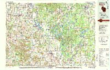
5 surveys from 7 printed sheetsMatched by testing this settlement's coordinate against the published boundary of every sheet in the United States Geological Survey's historical collection. Each opens the scanned sheet at the Survey.
- 1951 USGS Chetek quadrangle1:62500, 2 printings
- 1953 USGS Rice Lake quadrangle1:250000, 2 printings
- 1959 USGS Rice Lake quadrangle1:250000
- 1978 USGS Chetek quadrangle1:24000
- 1980 USGS Bloomer quadrangle1:100000
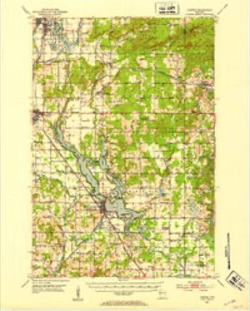
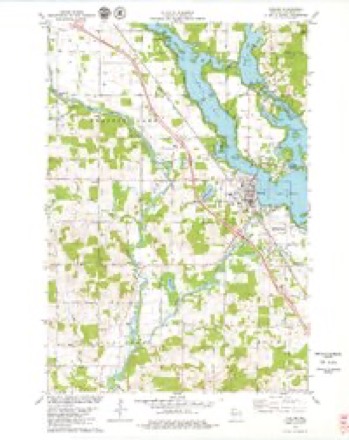
In the county-history sources
8,609 words on this townshipHistory of Barron County Wisconsin, published 1922 names this settlement in its chapter on Chetek City. These are the passages that mention it, exactly as the scans read.
It is situated on the northwest shore of Chetek Lake, a beautiful body of water of Irregular outline, well stocked with bass, pickerel and other choice fish, and largely frequented in the summer time by tourists and rest seekers from various and some far-distant parts of the country. This lake is one of a chain extending seven or eight miles from northwest to southeast, the north end of Chetek city touching the south end of Prairie Lake. The country surrounding the city, and especially that near the shores of the lake, presents many picturesque fea¬ tures. It is well adapted to stock raising, dairying and general farming, all of which are extensively carried on.
Passage source: History of Barron County Wisconsin, published 1922.
Previous to white settlement the country in this vicinity was well wooded, the timber consisting mostly of White and jack pine, with some varieties of hardwood. Knapp, Stout & Co., who began logging operations here in the middle of the sixties, cut only the white pine, as there was no profit to be made at that Ume from the hardwood. Wil¬ liam W. Carey, now living in Chetek city, arrived in this vicinity about 1866, as a boy of fifteen, and remembers that lumber¬ ing operations were then being actively car¬ ried on by the above mentioned company.
Passage source: History of Barron County Wisconsin, published 1922.
Chetek was platted Oct. 16, 1875, on land owned by Knapp, Stout & Co. and E. M. Sexton. It embraced a large tract including much of the present platted portion of the city and other territory besides. Dec. 4, 1877, all except blocks 29 and 30 were vacated. The present business section is located largely on the Second Addition, replatted on a part of the vacated land formerly occu¬ pied by the original plat. This Second Addition was platted June 12, 1682, by Knapp. Stout ft Co., the surveyor being Thomas Parker. It occupies six blocks and is bounded by Main and Fourth, Douglass and Moore streets. The two blocks left of the original plat lie between Main and Sec¬ ond, Mill and Douglass streets.
Passage source: History of Barron County Wisconsin, published 1922.
Machine-read from a century-old scan, so expect the errors a machine makes: misspelled names, dropped words, stray characters.
Read the whole chapter on Chetek City - it names this place 36 more 36 times.
Fires near this place
130 since 1992Regional context, not property-specific evidence. The federal wildfire occurrence database lists 130 fires within 5 miles of Chetek between 1992 and 2020, burning about 130 acres in total. 1 started naturally. 3 were recorded as arson. Distance is straight-line from the map coordinates, so a fire counted here may appear on a neighbouring settlement's page as well.
| Reported cause | Fires |
|---|---|
| Debris and open burning | 46 |
| Missing data/not specified/undetermined | 22 |
| Railroad operations and maintenance | 22 |
| Equipment and vehicle use | 13 |
| Recreation and ceremony | 7 |
| Smoking | 5 |
| Misuse of fire by a minor | 4 |
| Other causes | 4 |
| Power generation/transmission/distribution | 3 |
| Arson/incendiarism | 3 |
| Natural | 1 |
The most recent of them, most recent first, with the day each was reported and the service that recorded it.
| Date | Cause | Size | Reported by | Name on the report |
|---|---|---|---|---|
| 6 September 2013 | Debris and open burning | under an acre | Wisconsin Department of Natural Resources | 329 SS |
| 19 September 2020 | Missing data/not specified/undetermined | 1.0 acres | Wisconsin Department of Natural Resources | 2009589 |
| 19 September 2008 | Recreation and ceremony | under an acre | Wisconsin Department of Natural Resources | not named |
| 3 August 2006 | Debris and open burning | under an acre | Wisconsin Department of Natural Resources | not named |
| 13 August 2007 | Natural | under an acre | Wisconsin Department of Natural Resources | not named |
| 12 August 2003 | Equipment and vehicle use | under an acre | Wisconsin Department of Natural Resources | not named |
| 1 August 1998 | Debris and open burning | under an acre | Wisconsin Department of Natural Resources | not named |
| 6 July 2013 | Railroad operations and maintenance | under an acre | Wisconsin Department of Natural Resources | AA-SS RAIL FIRE |
Settlements close enough to share some of these fires:
Mines and quarries near this place
10 of 19 shownRegional context, not property-specific evidence. The federal mineral resources record lists 19 workings within 5 miles of Chetek: 7 producers, 7 occurrences, 5 past producers. 7 still produce. What was taken out: Sand and Gravel, Construction, Stone, Crushed/Broken. Distance is straight-line from the map coordinates, so a quarry counted here may appear on a neighbouring settlement's page as well.
| Where | Site | Commodity | Status | Recorded |
|---|---|---|---|---|
| Chetek Quartzite Deposit | Stone, Crushed/Broken | Occurrence | ||
| American Materials Corp. Pit | Sand and Gravel, Construction | Producer | ||
| Anna Haseman Gravel Pit | Sand and Gravel, Construction | Past Producer | ||
| Barron County Pits | Sand and Gravel, Construction | Producer | ||
| Chetek River Gravel Pit | Sand and Gravel, Construction | Past Producer | ||
| Curtis Havgestuen Gravel Deposit | Sand and Gravel, Construction | Occurrence | ||
| Edward Kraemer & Sons Pit | Sand and Gravel, Construction | Producer | ||
| Hazel B. Francois Gravel Deposit | Sand and Gravel, Construction | Occurrence | ||
| Lloyd & Ruth Otten Gravel Deposit 1 | Sand and Gravel, Construction | Occurrence | ||
| Marg. Ruppell Gravel Pit | Sand and Gravel, Construction | Past Producer |
Storms near this place
30 since 1996Regional context, not property-specific evidence. The National Weather Service names Chetek in 30 storm reports between 1996 and 2024: 15 thunderstorm wind, 12 hail, 1 funnel cloud, 1 tornado. No death or injury is recorded in these reports. Each account below is quoted exactly as the forecast office filed it, from the NOAA Storm Events Database, and each date opens the federal record of that event.
| When | Event | Place named | Harm | What the report says |
|---|---|---|---|---|
| May 1996 | Thunderstorm Wind | Chetek | $250,000 | no account filed |
| July 2016 | Tornado (EF0) | Chetek | $50,000 | A storm chaser and local residents recorded a tornado just south of Chetek. A large metal shed was destroyed and a number of trees were downed. |
| August 2024 | Thunderstorm Wind | Chetek | - | Time estimated from radar. Delayed report of multiple large trees down blocking roads. |
| August 2024 | Thunderstorm Wind | Chetek | - | Time estimated from radar. Delayed report of multiple large trees down blocking roads. |
| August 2024 | Thunderstorm Wind | Chetek | - | Time estimated from radar. Delayed report of multiple large trees down blocking roads. |
| August 2024 | Thunderstorm Wind | Chetek | - | Time estimated from radar. Delayed report of multiple trees and powerlines down in Chetek. |
| August 2024 | Thunderstorm Wind | Chetek | - | County Dispatch reported trees down along 25 3/4 St. |
| July 2022 | Heavy Rain | Chetek | - | A 6 hour rainfall report of 3.12 inches. |
| May 2021 | Thunderstorm Wind | Chetek | - | Several trees were blown down with one blocking Highway 53 south of Chetek. |
| June 2018 | Thunderstorm Wind | Chetek | - | A few trees and power lines were blown down near Chetek. |
| August 2018 | Thunderstorm Wind | Chetek | - | Several trees were blown down in Chetek. |
| June 2017 | Thunderstorm Wind | Chetek | - | The Chetek Police Department confirmed a storm-related fatality, as a 46-year-old was killed while cutting down storm damage and the debris rolled over the individual. This was an indirect fatality. |
| July 2011 | Thunderstorm Wind | Chetek | - | A large tree was blown down. |
| July 2007 | Thunderstorm Wind | Chetek | - | Over 100 trees toppled, some onto power lines. Much of Chetek was without power for several hours. |
| June 2005 | Hail | Chetek | - | Hail up to the size of golf balls fell in Prairie Lake Estates off County Road SS. |
| April 2004 | Thunderstorm Wind | Chetek | - | A tree was downed onto Stout Street. |
| July 2000 | Thunderstorm Wind | Chetek | - | Power lines down. |
| June 1998 | Thunderstorm Wind | Chetek | - | Large trees blown down. Shed destroyed. Boats flipped onto docks. |
| September 2024 | Hail | Chetek | - | no account filed |
| September 2012 | Hail | Chetek | - | no account filed |
| September 2012 | Hail | Chetek | - | no account filed |
| September 2012 | Hail | Chetek | - | no account filed |
| September 2012 | Hail | Chetek | - | no account filed |
| September 2012 | Hail | Chetek | - | no account filed |
| May 2008 | Hail | Chetek | - | no account filed |
| May 2008 | Hail | Chetek | - | no account filed |
| June 2005 | Hail | Chetek | - | no account filed |
| May 2001 | Hail | Chetek | - | no account filed |
| August 2000 | Hail | Chetek | - | no account filed |
| July 1999 | Funnel Cloud | Chetek | - | no account filed |
Nearest settlements
The eight closest, with where each one stands in the county. Distances are straight-line, computed from the Geographic Names Information System coordinates.
Elsewhere
Matched on this settlement's Geographic Names Information System number rather than its name, so it cannot be a different place of the same name in another state.
| Wikipedia article on Chetek | An encyclopaedic summary. Its text is share-alike, so it is linked here rather than copied. |
| Wikidata item Q1570219 | The structured record the population and elevation above come from. Public domain (CC0). |
Provenance
This settlement is recorded in the Geographic Names Information System as feature 1562995. The sheet list is computed by point-in-boundary test against the United States Geological Survey's historical topographic inventory. Both are works of the United States government and carry no copyright under 17 U.S.C. 105.
Wildfire. Short, Karen C. 2022. Spatial wildfire occurrence data for the United States, 1992-2020 [FPA_FOD_20221014]. 6th Edition. Fort Collins, CO: Forest Service Research Data Archive. https://doi.org/10.2737/RDS-2013-0009.6 Collected with United States Government funding and usable without additional permissions or fees.
Mines and quarries. USGS Mineral Resources Data System (MRDS) https://mrdata.usgs.gov/mrds/ A work of the United States government, no copyright under 17 U.S.C. 105.
Storms. NOAA National Centers for Environmental Information, Storm Events Database https://www.ncei.noaa.gov/stormevents/ A work of the United States government, no copyright under 17 U.S.C. 105. Narratives are quoted verbatim from the National Weather Service report and are not edited or summarised.