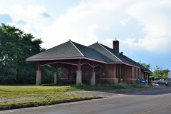
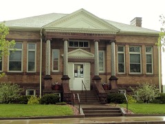
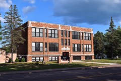
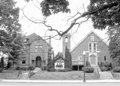
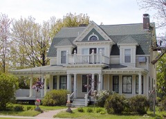
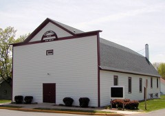
7 National Register listings published here · the county-history sources name 1 person · people the book names include Rev. E. E. Savageau (Almena Village, 1922) (machine-read).
Every wildfire the federal occurrence
database records inside this county: 487 of them, burning
about 665 acres. 5 started naturally and 25 were recorded as arson. Each settlement page carries the fires within
five miles of it.
Reported cause
Fires
Debris and open burning
180
Missing data/not specified/undetermined
95
Equipment and vehicle use
68
Railroad operations and maintenance
50
Recreation and ceremony
25
Arson/incendiarism
25
Smoking
11
Power generation/transmission/distribution
10
Misuse of fire by a minor
8
Other causes
8
Natural
5
Fireworks
2
The five largest, by the area the report
gives. Two of them were set deliberately.
Date
Cause
Size
Reported by
Name on the report
17 March 1998
Arson/incendiarism
140 acres
Wisconsin Department of Natural Resources
not named
22 October 2011
Debris and open burning
34 acres
Wisconsin Department of Natural Resources
CHETEK TOWER FIRE
17 April 1997
Equipment and vehicle use
28 acres
Wisconsin Department of Natural Resources
not named
13 April 2005
Debris and open burning
27 acres
Wisconsin Department of Natural Resources
not named
5 May 2019
Debris and open burning
20 acres
Wisconsin Department of Natural Resources
552019
3 April 1994
Debris and open burning
15 acres
Wisconsin Department of Natural Resources
not named
15 May 2008
Arson/incendiarism
13 acres
Wisconsin Department of Natural Resources
not named
21 April 1993
Smoking
13 acres
Wisconsin Department of Natural Resources
not named
Every settlement page carries the fires within five
miles of it - see the settlement index below.
Storms,
1957 to 2025
60 of 421 shown
The
NOAA Storm Events Database holds
421 reports for this county, causing 1 death, 50 injuries and about $54,787,500 in recorded property damage.
Each settlement page carries the reports that name it.
Kind of event
Reports
Thunderstorm Wind
178
Hail
172
Tornado
41
Funnel Cloud
11
Flash Flood
9
Heavy Rain
7
Lightning
3
The most serious of them, by death, then
injury, then recorded damage. The accounts are quoted exactly as the
forecast office filed them.
The tornado first developed over southeastern Polk County, then tracked mostly east-northeast across southern Barron before moving into Rusk County and eventually Price County. In Barron County, the tornado hit numerous farmsteads, devastating barns and other outbuildings. The hardest hit area in Barron County was just north of Chetek, WI, where high-end EF2 damage was found. A number of mobile homes were completely demolished, and this is where the one fatality occurred. After that, several turkey barns were leveled, and then multiple homes were hit hard near Prairie Lake, especially those on the eastern shore.
A National Weather Service Storm Damage Survey determined that downburst winds caused substantial tree damage north of Cumberland, Wisconsin. In addition, a local business roof was blown off just north of Cumberland, and several trailers in Eagle Point Campground were damaged.
Scattered trees fell around the Haugen area, and the town of Cedar Lake. Also, a tree landed on a camper in the Bear Lake area, and a women was injured and taken to a local hospital.
Hundreds of houses damaged from wind driven large hail. Numerous car windows shattered. The local newspaper reported that one auto glass replacement company estimated about 200 different jobs were required.
A storm survey was conducted and estimated the winds of 80 to 90 mph. Numerous large trees, up to 4 feet in diameter, were uprooted, snapped, or blown down on the west side of Prairie Lake. ||The damage was concentrated in a one mile swath from near 10th 1/2 Ave and 23rd street, north-northwest to 22nd 1/2 Street and 23rd near Lakewood Park. Almost all of the trees were blown to the north-northwest with some indication of a divergence signature on the west side of the storm damage. One of worst area of damage was at the Sandy Grove Resort where significant structural damage occurred to residences and cabins. ||There were also several lake homes that were severely damage from the fallen trees. No injuries were reported during this event that only lasted 30 seconds to a minute based on eyewitness accounts.
5 mile wide swath of damaging wind extended across much of Barron County. Numerous trees down, roof blown off house, trailers tipped over at RV Park, chopper box and semi truck blown over in Turtle Lake. Roof blown off barn 3 N Poskin. Semi truck blown over on eastern edge of Barron. Trees fell through roofs of houses 1 SW Cameron. Damage figure include totals from all storms in Barron County between 1640 and 1705.
Several properties received minor damage to roofs, with two properties sustaining significant damage with 40% of their shingles damage. One home had a tree fall on it which caused considerable damage to their roof.
A National Weather Service Storm Damage Survey determined that an EF-1 tornado touched down approximately 4.5 miles north-northeast of Cumberland, and tracked east-southeast to approximately six miles northeast of Cumberland, Wisconsin. Structural damage was confined to a barn and garage destroyed. Hundreds of trees were either uprooted and blown down, and several of the large trees were in excess of four feet in diameter.
Water up to three feet deep flooded cars in the city of Barron. Elsewhere in Barron County, four bridges in Doyle Township, several miles east of Rice Lake, were washed out. Three of the bridges crossed Spring Creek, and the fourth crossed Pokegama Creek. Numerous roads were also closed. Reports of rainfall ranged from 12.5 inches in northeastern Barron County, to 7 inches in the central portion of the county, to approximately 4 inches in the southern portion of the county. All were taken from citizen back yard gauges.
An EF-1 tornado touched down just west of the intersection of 28th Avenue and 26th Street. It tracked northeast and dissipated at 30th Avenue. Damage was sporadic along this tornado path, with damages to roofs, a 12 foot house antenna, two seven foot tall horse enclosures, and numerous large trees uprooted and blown down.
Some lake homes were damaged along Silver Lake. On the western edge of the lake there was significant tree and dock damage. One boat was lofted 20 feet from the lake and landed between two large trees.
A tornado traveled east-southeast, just north of the village of Turtle Lake. It touched down in extreme eastern Polk County and moved into Barron County. In Barron County, roofs were peeled off on a few homes. Scattered large trees were snapped or uprooted. The tornado crossed Highway 63, and multiple downed trees resulted in the closure of Highway 63 for several hours. It dissipated just before reaching Highway 8.
Strong thunderstorm winds temporarily lifted the roof off a hangar building at the Cumberland Airport. Three walls of the hangar buckled as the roof settled back down. As a result the entire structure collapsed onto three airplanes stored in the hangar.
Damaging straight-line winds caused excessive damage east of Cumberland, near Highway 48, and 12th Street. Numerous trees were uprooted along with a turkey barn roof blown off, and damage to nearby crops. Some damage also occurred to a home near the turkey barn.
A tornado in southeastern Barron County traveled southeast, touching down just southeast of Cameron and dissipating just north of Chetek. Numerous very large trees were uprooted and snapped near the start of the path. There were over a dozen large pine trees down on the east shore of Prairie Lake, several of which fell on a home. A storage garage lost its roof and a turkey barn lost its roof.
Very heavy rainfall caused significant street flooding in Rice Lake, with some cars disabled and floating in water. Radar estimated between 3 and 5 inches of rain fell in a short period of time to cause the street flooding.
Numerous trees were downed or snapped off, some two feet in diameter, near the intersection of County Highways P and T. A house lost half its roof, and trees were down on another house.
A storm survey discovered a half dozen tall pine trees snapped near the intersection of 17th Street and 18th Avenue. There was other tree damage on a neighboring property. Wind speeds estimated up to 65 mph.
Time estimated from radar. Delayed report of multiple large trees down blocking roads.
Mines and
quarries
203 recorded
The Survey's mineral resources record
lists 203 workings inside this county. 37 still produce and 166 are closed or unrecorded. Each
settlement page carries the workings within five miles of it.
Commodity
Workings
Sand and Gravel, Construction
194
Sand and Gravel, Industrial/Frac Sand
5
Stone, Crushed/Broken
4
The least common of them first, because a
county's hundredth gravel pit says nothing its first ten did not.
History of Barron County Wisconsin devotes a chapter to each township:
its boundaries and streams, who settled it and when, the mills, the
schools and the churches. All 5 are reproduced here in full. Each row
shows the township's own shape and where it lies in the county, drawn from
the Census Bureau's boundary. Which settlements belong to which township
is computed from that same boundary, not taken from the book.
One book written about this county, cut here
where the book itself is cut, at its printed chapters: 23 chapters in all.
Every chapter is public domain, machine-read from the scan and
reproduced complete. A chapter already given under one of the county's
towns is not repeated in this list.
Everyone History of Barron County Wisconsin stops to write about, with
the section that describes them. Among them are the men who founded the
place and governed the Territory. Each name opens the passage itself, in
the words of 1922.
Named settlements recorded in the Geographic Names
Information System, each with the topographic sheets covering it. Villages,
hamlets and abandoned places alike. Each is shown with the nearest named
watercourse or landform and the survey quadrangle it falls on.
Topographic sheets. USGS Historical Topographic Map Collection, county index, measured from the bulk metadata.
Fire insurance maps. Library of Congress Sanborn collection, faceted to this county.
Photographs. Each place queried individually against the Library of Congress Prints and Photographs search.
Wildfire. Short, Karen C. 2022. Spatial wildfire occurrence data for the United States, 1992-2020 [FPA_FOD_20221014]. 6th Edition. Fort Collins, CO: Forest Service Research Data Archive. https://doi.org/10.2737/RDS-2013-0009.6 Collected with United States Government funding and usable without additional permissions or fees.
Mines and quarries. USGS Mineral Resources Data System (MRDS) https://mrdata.usgs.gov/mrds/ A work of the United States government, no copyright under 17 U.S.C. 105.
Storms. NOAA National Centers for Environmental Information, Storm Events Database https://www.ncei.noaa.gov/stormevents/ A work of the United States government, no copyright under 17 U.S.C. 105. Narratives are quoted verbatim from the National Weather Service report and are not edited or summarised.
 Block