 Block
Dekorra, Wisconsin
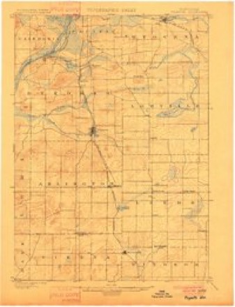
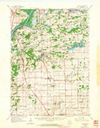
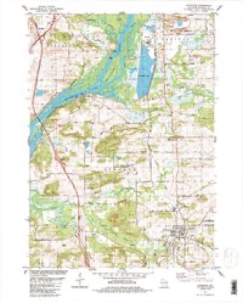
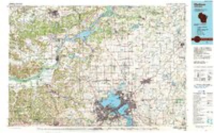
13 topographic sheets cover this place, the earliest surveyed in 1901 and the latest in 1991. It stands in Dekorra town. It lies in ZIP code area 53955. It stands on Rocky Run. The Survey maps it on the Poynette quadrangle. 255 people lived here at the 2020 count. It stands 807 feet above sea level.
Topographic sheets covering this place
6 surveys from 13 printed sheetsMatched by testing this settlement's coordinate against the published boundary of every sheet in the United States Geological Survey's historical collection. Each opens the scanned sheet at the Survey.
- 1901 USGS Poynette quadrangle1:62500, 3 printings
- 1957 USGS Madison quadrangle1:250000, 3 printings
- 1960 USGS Madison quadrangle1:250000, 2 printings
- 1962 USGS Poynette quadrangle1:62500, 2 printings
- 1984 USGS Poynette quadrangle1:24000, 2 printings
- 1991 USGS Madison quadrangle1:100000


In the county-history sources
4,472 words on this townshipThe History of Columbia County, Wisconsin, Containing an Account of Its Settlement .., published 1880 names this settlement in its chapter on Dekorra Town. These are the passages that mention it, exactly as the scans read.
McLartaD, who emigrated from Ireland to Canada about 1834, where he was enuaged in teaching ; he came to Columbia in 1846, and settled on a part of the farm which his son John now owns; he was accidentally killed in 1863. John was born on the farm where he now lives July 6, 1850. He was married to Harriet Hagan, daughter of John Hagan ; has one child - Daniel. Has taught eight winter terms of school in Columbia Co., five in the town of Dekorra ; his farm contains about 500 acres.
Passage source: The History of Columbia County, Wisconsin, Containing an Account of Its Settlement .., published 1880.
resident of Dekorra Township since 1838 ; he was born in Scotland, in June, 1803; he emigrated to Canada in 1832 ; went to New York City in 1836, to Detroit the following winter, and to Green Bay in 1837, where he remained till March, 1838, when ho came to Columbia Co., and located in the village of Uekorra, where he built a store, the first in the town ; he went to Madison in the fall of that year, where he worked at his trade, that of a carpenter ; he exchanged his store at Dekorra for 160 acres of land, ,1 part ot the farm of 400 acres which he now owns. He was married to Ann Patterson, born in Norway ; they have seven children - William, James, Elisabeth, Martha, Hector, John and Ronald.
Passage source: The History of Columbia County, Wisconsin, Containing an Account of Its Settlement .., published 1880.
Machine-read from a century-old scan, so expect the errors a machine makes: misspelled names, dropped words, stray characters.
Read the whole chapter on Dekorra Town - it names this place 7 more 7 times.
Fires near this place
188 since 1992Regional context, not property-specific evidence. The federal wildfire occurrence database lists 188 fires within 5 miles of Dekorra between 1992 and 2020, burning about 180 acres in total. 3 started naturally. 8 were recorded as arson. Distance is straight-line from the map coordinates, so a fire counted here may appear on a neighbouring settlement's page as well.
| Reported cause | Fires |
|---|---|
| Debris and open burning | 53 |
| Equipment and vehicle use | 44 |
| Missing data/not specified/undetermined | 34 |
| Other causes | 12 |
| Power generation/transmission/distribution | 9 |
| Arson/incendiarism | 8 |
| Smoking | 7 |
| Recreation and ceremony | 7 |
| Misuse of fire by a minor | 5 |
| Fireworks | 3 |
| Railroad operations and maintenance | 3 |
| Natural | 3 |
The most recent of them, most recent first, with the day each was reported and the service that recorded it.
| Date | Cause | Size | Reported by | Name on the report |
|---|---|---|---|---|
| 27 September 2004 | Equipment and vehicle use | under an acre | Wisconsin Department of Natural Resources | not named |
| 25 September 2004 | Missing data/not specified/undetermined | under an acre | Wisconsin Department of Natural Resources | not named |
| 15 September 1996 | Smoking | under an acre | Wisconsin Department of Natural Resources | not named |
| 30 August 2013 | Equipment and vehicle use | under an acre | Wisconsin Department of Natural Resources | not named |
| 30 August 2003 | Debris and open burning | under an acre | Wisconsin Department of Natural Resources | not named |
| 28 August 2005 | Missing data/not specified/undetermined | under an acre | Wisconsin Department of Natural Resources | not named |
| 2 August 2009 | Debris and open burning | under an acre | Wisconsin Department of Natural Resources | TROUT FARM |
| 19 August 2003 | Equipment and vehicle use | under an acre | Wisconsin Department of Natural Resources | not named |
Settlements close enough to share some of these fires:
Mines and quarries near this place
2 within 5 milesRegional context, not property-specific evidence. The federal mineral resources record lists 2 workings within 5 miles of Dekorra: 2 producers. All of them still produce. What was taken out: Sand and Gravel, Construction. Distance is straight-line from the map coordinates, so a quarry counted here may appear on a neighbouring settlement's page as well.
| Where | Site | Commodity | Status | Recorded |
|---|---|---|---|---|
| Blau Pit | Sand and Gravel, Construction | Producer | ||
| Brown Pit #2 | Sand and Gravel, Construction | Producer |
Storms near this place
22 since 2004Regional context, not property-specific evidence. The National Weather Service names Dekorra in 22 storm reports between 2004 and 2024: 7 thunderstorm wind, 7 hail, 5 flood, 2 tornado. No death or injury is recorded in these reports. Each account below is quoted exactly as the forecast office filed it, from the NOAA Storm Events Database, and each date opens the federal record of that event.
| When | Event | Place named | Harm | What the report says |
|---|---|---|---|---|
| June 2006 | Hail | Dekorra | $500,000,000 | A slow-moving thunderstorm moved from the Dekorra area southeast through the Poynette area to the North Leeds area, leaving in its wake a lot of crop damage due to hail. A roughly 40 to 45-minute hail shower (stones up to the size of quarters) fell in a band from about 3 miles south-southeast of Dekorra along Kent Rd. to the McKenzie Environmental Education Center just northeast of Poynette. Crop, vegetable, and fruit damage was noted, and in some cases, an entire year's crop was lost due to hail damage. Many residential homes and vehicles were damaged. Hail depth on some roads reached 8 inches and had to be plowed off the roads, especially along Kent Rd. and near the McKenzie Center. The crop damage estimate is based on a newspaper report which quoted a USDA report. The property damage is purely an estimate based on a variety of reports. |
| April 2008 | Tornado (EF1) | Dekorra | $600,000 | A long-tracked, partially rain-wrapped, tornado traveled through mostly rural areas of Columbia County and affected only a small portion of one village; otherwise property damage would have been more extensive. This tornado spun up about 2.75 miles east of Dekorra, just northwest of the intersection of STH 51 and CTH VJ, near Columbia Lake. It then tracked east-northeast through the far southeast reaches of the village of Wyocena, and crossed STH 22 just north of Patchin Road. It then moved through the intersection of CTH G and W. Hill Road, where the last structural damage to a couple barns and home occurred. Thereafter, this tornado tracked more northeast through rural areas (crossing STH 33 midway between Cunningham Road and Englehart Road), and eventually exited Columbia County just east of North County Line Road and Sterk Road. It continued for a few more miles through southeastern Green Lake County. Based on ground damage evidence, this tornado briefly lifted a couple times when it was north of STH 33. Most of the structural damage occurred south and southeast of Wyocena. Otherwise the rural damage consisted of uprooted trees or broken branches. At least two trained spotters video taped the tornado.||The Columbia County Emergency Management situation report indicated that 4 residential homes sustained minor damage, and 1 home suffered major damage. Additionally, 2 farm buildings had minor damage, 2 suffered major damage, and 3 were destroyed. The report estimated that private sector damage totaled about $550,000 (excluding electrical line damage). Public sector debris clearance totaled $3500, and protective measures totaled $1000. The Sheriff's Office had to close down 4 roads until power lines and trees could be cleared. Electrical line replacement is estimated at about $50,000. The lat-long pairs of numbers for this tornado segment in Columbia County include: N43.46179/W89.41637, N43.49223/W89.27809, N43.54813/W89.18491, and N43.63221/W89.06693. On the EF-scale, DI #1 (SBO) was used with a DOD of 6, for an EF-rating of EF1 and an wind estimate of about 100 mph (87 knots). |
| July 2021 | Tornado (EF1) | Dekorra | $500,000 | This was 1 of 17 tornadoes to occur in Wisconsin on the night of July 28th into the early morning hours of July 29th. This was the 5th overall tornado for the event.|A line of storms developed in northern Wisconsin and pushed south into southern Wisconsin in the overnight hours of the 28th into the 29th of July with mainly brief tornadoes and damaging winds occurring.||This tornado began in the Baraboo River Waterfowl Production Area just north of the I-94/I-39 split south of Portage. The tornado crossed the interstate and hit the I-39 Supply facility where 84 trailers were damaged or destroyed. The tornado continued to the southeast where it caused extensive tree damage through mainly rural areas. The last area of noted damage was to a large metal farming shed north of Thunderbird Drive. |
| June 2018 | Flash Flood | Dekorra | $51,260 | Approximately 9 roads in the Town of Caledonia were closed due to flooding and washouts. Road repairs were needed. |
| October 2018 | Flood | Dekorra | $30,000 | The Wisconsin River at Portage reached moderate flood stage, cresting at 18.02 ft. the early morning of October 15th. Water surrounds seasonal homes along Old River Road in Blackhawk Park. Old River Road, Blackhawk Road, and West Lake Road are flooded with several feet of water. West Lane Road in the Long Lake area has 4 feet of water over it in places. Water is over River Oaks Road and Oak Knoll Road at Hwy V in the Town of Dekorra. 12 homes are flooded on Hwy V. Floodwaters are at the base of Caledonia/Lewiston Levee on Old River Road. |
| June 2017 | Thunderstorm Wind | Dekorra | $15,000 | Numerous trees down from south to north through the county, including the Portage area. |
| May 2017 | Thunderstorm Wind | Dekorra | $12,000 | Numerous reports of trees and limbs down across the western portion of the county. |
| April 2014 | Flood | Dekorra | $5,000 | The Wisconsin river crested at 17.84 feet in Portage. Long Lake which is near the Wisconsin river also flooded. Several roads were closed in the Black Hawk Park area with up to 4 feet of water over the roads. Several homes and out buildings had water in the first floor in the town of Dekorra. Some people had to use boats for transportation to and from their home. |
| June 2018 | Thunderstorm Wind | Dekorra | $3,000 | Several trees and power lines down south of Portage. |
| June 2019 | Thunderstorm Wind | Dekorra | $2,000 | Numerous tree branches down near the intersection of highway 16 and 51. |
| October 2019 | Flood | Dekorra | $2,000 | The Baraboo River at Baraboo reached minor flood stage, cresting at 18.23 feet the morning of October 4th. Tritz Rd. was flooded and closed near the intersection with highway 33. Floodwaters affected a portion of the parking lot of a trailer rental business just east of the highway 33 bridge over the Baraboo River. A nearby wayside park was also partially flooded. |
| June 2024 | Flood | Dekorra | $1,000 | Floodwaters are over Tritz Rd. near Hwy 33 and I-90, as well as impacting parking lots to businesses in the same area. There is widespread flooding of agricultural land. |
| March 2019 | Flood | Dekorra | $1,000 | The Baraboo River at Baraboo reached minor flood stage, cresting at 20.68 feet the evening of March 17th. Floodwaters affect a trailer rental business and a road wayside park about 5 miles downstream from the gauge near the Highway 33 bridge. Floodwaters also affect an auto auction business near I90/94. |
| July 2015 | Thunderstorm Wind | Dekorra | $1,000 | Large tree down on Kent Road. |
| July 2015 | Thunderstorm Wind | Dekorra | $1,000 | A tree down on a road. |
| June 2018 | Hail | Dekorra | - | no account filed |
| June 2018 | Hail | Dekorra | - | no account filed |
| June 2018 | Hail | Dekorra | - | no account filed |
| June 2018 | Hail | Dekorra | - | no account filed |
| August 2014 | Hail | Dekorra | - | no account filed |
| June 2011 | Hail | Dekorra | - | no account filed |
| July 2004 | Thunderstorm Wind | Dekorra | - | no account filed |
Nearest settlements
The eight closest, with where each one stands in the county. Distances are straight-line, computed from the Geographic Names Information System coordinates.
| Map | Place | Distance | Sheets |
|---|---|---|---|
| Portage | 5.6 miles | 13 | |
| Poynette | 5.8 miles | 13 | |
| Durwards Glen | 6.7 miles | 22 | |
| Harmony Grove | 7.4 miles | 22 | |
| Lake Wisconsin | 8.1 miles | 22 | |
| Wyocena | 8.8 miles | 12 | |
| Lowville | 9.1 miles | 12 | |
| Okee | 9.1 miles | 22 |
Elsewhere
Matched on this settlement's Geographic Names Information System number rather than its name, so it cannot be a different place of the same name in another state.
| Wikipedia article on Dekorra | An encyclopaedic summary. Its text is share-alike, so it is linked here rather than copied. |
| Wikidata item Q5252834 | The structured record the population and elevation above come from. Public domain (CC0). |
Provenance
This settlement is recorded in the Geographic Names Information System as feature 1563868. The sheet list is computed by point-in-boundary test against the United States Geological Survey's historical topographic inventory. Both are works of the United States government and carry no copyright under 17 U.S.C. 105.
Wildfire. Short, Karen C. 2022. Spatial wildfire occurrence data for the United States, 1992-2020 [FPA_FOD_20221014]. 6th Edition. Fort Collins, CO: Forest Service Research Data Archive. https://doi.org/10.2737/RDS-2013-0009.6 Collected with United States Government funding and usable without additional permissions or fees.
Mines and quarries. USGS Mineral Resources Data System (MRDS) https://mrdata.usgs.gov/mrds/ A work of the United States government, no copyright under 17 U.S.C. 105.
Storms. NOAA National Centers for Environmental Information, Storm Events Database https://www.ncei.noaa.gov/stormevents/ A work of the United States government, no copyright under 17 U.S.C. 105. Narratives are quoted verbatim from the National Weather Service report and are not edited or summarised.