 Block
Okee, Wisconsin
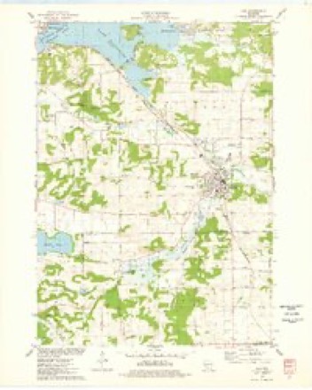
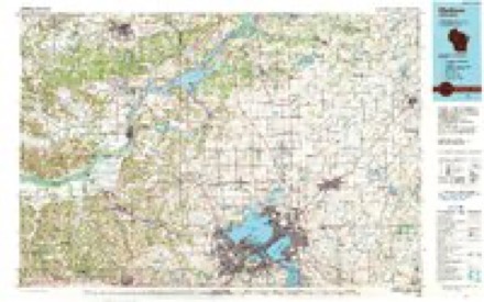
22 topographic sheets cover this place, the earliest surveyed in 1895 and the latest in 1991. It stands in Lodi town. It lies in ZIP code area 53555. It stands on Spring Creek. The Survey maps it on the Lodi quadrangle. It stands 801 feet above sea level.
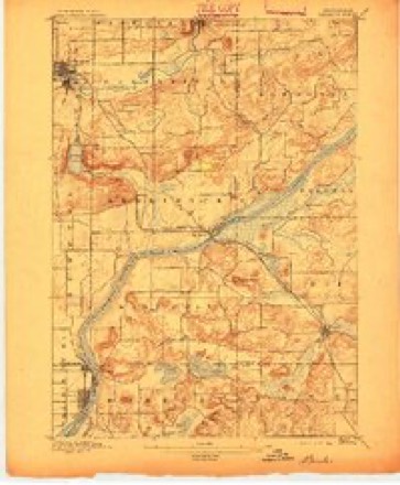
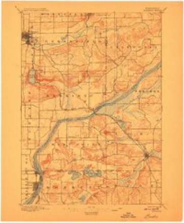
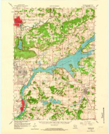
Topographic sheets covering this place
8 surveys from 22 printed sheetsMatched by testing this settlement's coordinate against the published boundary of every sheet in the United States Geological Survey's historical collection. Each opens the scanned sheet at the Survey.
- 1895 USGS Baraboo quadrangle1:62500, 9 printings
- 1908 USGS Baraboo quadrangle1:62500
- 1957 USGS Madison quadrangle1:250000, 3 printings
- 1959 USGS Baraboo quadrangle1:62500, 4 printings
- 1960 USGS Madison quadrangle1:250000, 2 printings
- 1974 USGS Baraboo SE quadrangle1:24000
- 1975 USGS Lodi quadrangle1:24000
- 1991 USGS Madison quadrangle1:100000


Fires near this place
157 since 1992Regional context, not property-specific evidence. The federal wildfire occurrence database lists 157 fires within 5 miles of Okee between 1992 and 2020, burning about 230 acres in total. 2 started naturally. 2 were recorded as arson. Distance is straight-line from the map coordinates, so a fire counted here may appear on a neighbouring settlement's page as well.
| Reported cause | Fires |
|---|---|
| Debris and open burning | 80 |
| Missing data/not specified/undetermined | 29 |
| Equipment and vehicle use | 23 |
| Recreation and ceremony | 5 |
| Smoking | 4 |
| Power generation/transmission/distribution | 4 |
| Misuse of fire by a minor | 4 |
| Other causes | 3 |
| Natural | 2 |
| Arson/incendiarism | 2 |
| Railroad operations and maintenance | 1 |
The most recent of them, most recent first, with the day each was reported and the service that recorded it.
| Date | Cause | Size | Reported by | Name on the report |
|---|---|---|---|---|
| 8 September 2003 | Debris and open burning | under an acre | Wisconsin Department of Natural Resources | not named |
| 5 September 2005 | Missing data/not specified/undetermined | under an acre | Wisconsin Department of Natural Resources | not named |
| 29 September 2010 | Equipment and vehicle use | under an acre | Wisconsin Department of Natural Resources | not named |
| 29 September 2010 | Equipment and vehicle use | under an acre | Wisconsin Department of Natural Resources | not named |
| 27 September 1997 | Missing data/not specified/undetermined | under an acre | Wisconsin Department of Natural Resources | not named |
| 17 September 1999 | Equipment and vehicle use | under an acre | Wisconsin Department of Natural Resources | not named |
| 9 August 1992 | Missing data/not specified/undetermined | under an acre | Wisconsin Department of Natural Resources | not named |
| 4 August 2015 | Equipment and vehicle use | under an acre | Wisconsin Department of Natural Resources | KOLTES PASTURE |
Settlements close enough to share some of these fires:
Mines and quarries near this place
3 within 5 milesRegional context, not property-specific evidence. The federal mineral resources record lists 3 workings within 5 miles of Okee: 2 past producers, 1 occurrence. None of them still produces. What was taken out: Stone, Crushed/Broken, Sand and Gravel, Construction. Distance is straight-line from the map coordinates, so a quarry counted here may appear on a neighbouring settlement's page as well.
| Where | Site | Commodity | Status | Recorded |
|---|---|---|---|---|
| Quam Pit | Sand and Gravel, Construction | Past Producer | ||
| John Smith Sandstone Quarry | Stone, Crushed/Broken | Occurrence | ||
| Thistle Sandstone Quarry | Stone, Crushed/Broken | Past Producer |
Storms near this place
25 since 1997Regional context, not property-specific evidence. The National Weather Service names Okee in 25 storm reports between 1997 and 2024: 9 thunderstorm wind, 7 hail, 4 flash flood, 4 flood. No death or injury is recorded in these reports. Each account below is quoted exactly as the forecast office filed it, from the NOAA Storm Events Database, and each date opens the federal record of that event.
| When | Event | Place named | Harm | What the report says |
|---|---|---|---|---|
| June 2008 | Flash Flood | Okee | $15,660,000 | Heavy rains resulted in a flash flood event that washed out some raods and gravel shoulders in the western part of the county. This event was one of 3 flash flood events over parts of Columbia County on 3 separate days. Two started on June 7th, and one on June 8th. In all 3 flash flood events, home and business damage was reported, and there was crop damage. Some farm fields remained flooded into early July. It was nearly impossible to break down the damages by flash flood. Therefore, the collective damage breakdown for these events is provided in this June 8th flash flood StormData entry for Columbia County.||The breakdown for residential home losses were: over 1500 minimally affected, 45 with minor damage, 26 with major damage, and 5 destroyed (total of $10 million for home losses). Total business losses were about $2 million. Crop losses were estimated at about $40 million. Public sector damage was about $3.66 million. There were several roads and bridges that sustained damage. |
| August 2007 | Flash Flood | Okee | $750,000 | Significant flash flooding affected the southwest half of Columbia County, especially from the Okee area near Lake Wisconsin/Wisconsin River over to the Lodi area. Several landslides were noted in the Civil Town of West Point area along the Wisconsin River. A pavement washout closed STH 188 in the Civil Town of West Point. Water depths on STH 188 reached 2 to 4 feet. A small pier on Lake Wisconsin was washed out by the fast flowing drainage water coming in fromt the countryside. A private road about 2.5 miles northeast of Harmony Grove had a washout. Gravel shoulder washouts occurred on several other roads ($50,000 damage) and crops across the southwest part of the county were damaged. Fifty-five residential homes sustained minor damage to basement contents, and 2 homes were destroyed by the flood waters. Three businesses sustained minor flood damage.||August, 2007, rainfall totals include: 11.33 at the Arlington Farm, 15.18 in Lodi, and 14.70 7WNW Poynette (near the Wisconsin River). |
| August 2010 | Flash Flood | Okee | $125,000 | Several rounds of thunderstorms produced heavy rain that closed numerous roads in Caledonia Township, west of the Wisconsin River and southwest of the city of Portage. The rushing water damaged roadways and washed out gravel shoulders, as well as causing damage to private driveways. |
| March 2019 | Flood | Okee | $50,000 | Ice jams on Spring Creek and the Crawfish River led to significant flooding in the Lodi and Columbus areas, respectively. Several businesses in the downtown area of Lodi were flooded, and roads were flooded and closed upstream and downstream of Spring Creek. An ice jam at the highway 16/60 bridge in Columbus caused significant flooding near the river. 40 residents were evacuated from apartments and homes. Highway 16/60 was closed from County Road TT in Dodge County to highway 73 in Columbus. Additional road closures occurred upstream on the branches of the Crawfish River near the Village of Fall River and Doylestown. Just southwest of Columbus, County Highway K was closed due to flooding from Robbins Creek. Farther north, the Fox River flooded, including Park Lake in Pardeeville, where severe erosion occurred to one property losing trees and soil along its shoreline. Highway 44 was closed in a couple sections northeast of Pardeeville due to the flooding of the Fox River. In the southwest portion of the county, the Crystal Lake Campground and RV Park was evacuated due to the high levels of Crystal Lake on March 15th, but conditions improved by the next day.|Flooding also occurred in low lying areas across the county which closed a few additional rural roads, including south of Arlington and a small section of highway 188 in the Town of West Point near Lake Wisconsin. |
| June 2024 | Flood | Okee | $20,000 | Following the flash flooding earlier in the evening, the flooding of Spring Creek in Lodi affected Goeres Park, including the pool and baseball diamond. A little farther downstream, floodwaters affected Habermann Park, and farther downstream yet the water approaches the Public Works garage. There was standing water in many low lying areas and streets in Lodi, but also throughout southwest and west central Columbia County. This included sections of Poynette and Arlington as well as portions of highway Q and CS. |
| July 2023 | Thunderstorm Wind | Okee | $20,000 | Several trees down in Okee and scattered trees and branches down on the east shore of Lake WI and just inland from the lake. |
| September 2012 | Thunderstorm Wind | Okee | $20,000 | Law enforcement officials reported trees and power lines were blown down by damaging thunderstorm wind gusts estimated at 56 knots (65 mph) in an 8-mile wide swath from Harmony Grove to 5 miles east-southeast of Arlington. |
| July 1997 | Thunderstorm Wind | Okee | $20,000 | no account filed |
| May 2024 | Thunderstorm Wind | Okee | $15,000 | A swath of significant tree damage from the golf course to a nearby subdivision. About a dozen large trees uprooted. Some trees snapped at various heights from the trunk. Many branches snapped off. |
| March 2022 | Flood | Okee | $10,000 | Heavy rainfall on a frozen ground lead to high runoff and some basement flooding. A basement wall of a home collapsed in Lodi. |
| June 2022 | Thunderstorm Wind | Okee | $10,000 | Multiple trees down. A branch down on a car. |
| April 2008 | Flash Flood | Okee | $10,000 | Flash flooding due to heavy rains resulted in washed-out gravel shoulders and driveways on Durwards Glen Road along a creek that eventually crosses STH 78. |
| August 2005 | Tornado (F2) | Okee | $10,000 | This tornado was a continuation of the "Leland" F2 Sauk County tornado that passed through the Badger Ammunition Plant grounds. It crossed into Columbia County from Sauk County at 1655CST about 5.4 miles west of Okee, or 1.2 miles northwest of the intersection of Gastrow Road and STH 188. This tornado headed east-southeast for 3.4 miles, while weakening, and ended at 1703CST about 3.2 miles southeast of Okee, or 0.2 mile southeast of the intersection of CTH J and Occonor Road. Some tree, power-line, and crop damage was noted, resulting in a F1 damage rating in Columbia County. Average path width was about 125 yards. |
| July 2023 | Thunderstorm Wind | Okee | $4,000 | Several large trees down along the northern portion of Lake Wisconsin. |
| April 2023 | Flood | Okee | $2,000 | Flooding across low lying areas over far southwest Columbia County. More specifically between Lodi and Prairie du Sac along highways 188 and 113. Water flowing over the roads in spots due to the culverts being plugged and ditches filled with water. |
| June 2019 | Thunderstorm Wind | Okee | $2,000 | Scattered trees down including a few large trees. |
| July 2023 | Thunderstorm Wind | Okee | $1,000 | A large tree down. |
| August 2021 | Thunderstorm Wind | Okee | - | Large tree limb down on power line off of County Highway V. |
| April 2023 | Hail | Okee | - | no account filed |
| July 2023 | Hail | Okee | - | no account filed |
| August 2018 | Hail | Okee | - | no account filed |
| April 2008 | Hail | Okee | - | no account filed |
| March 2007 | Hail | Okee | - | no account filed |
| August 2006 | Hail | Okee | - | no account filed |
| April 2002 | Hail | Okee | - | no account filed |
Nearest settlements
The eight closest, with where each one stands in the county. Distances are straight-line, computed from the Geographic Names Information System coordinates.
| Map | Place | Distance | Sheets |
|---|---|---|---|
| Lake Wisconsin | 1.1 miles | 22 | |
| Harmony Grove | 1.8 miles | 22 | |
| Lodi | 4.2 miles | 22 | |
| Durwards Glen | 5.6 miles | 22 | |
| Dekorra | 9.1 miles | 13 | |
| Poynette | 9.7 miles | 13 | |
| Arlington | 10.7 miles | 12 | |
| Lowville | 13.5 miles | 12 |
Elsewhere
Matched on this settlement's Geographic Names Information System number rather than its name, so it cannot be a different place of the same name in another state.
| Wikipedia article on Okee | An encyclopaedic summary. Its text is share-alike, so it is linked here rather than copied. |
| Wikidata item Q7081890 | The structured record the population and elevation above come from. Public domain (CC0). |
Provenance
This settlement is recorded in the Geographic Names Information System as feature 1570763. The sheet list is computed by point-in-boundary test against the United States Geological Survey's historical topographic inventory. Both are works of the United States government and carry no copyright under 17 U.S.C. 105.
Wildfire. Short, Karen C. 2022. Spatial wildfire occurrence data for the United States, 1992-2020 [FPA_FOD_20221014]. 6th Edition. Fort Collins, CO: Forest Service Research Data Archive. https://doi.org/10.2737/RDS-2013-0009.6 Collected with United States Government funding and usable without additional permissions or fees.
Mines and quarries. USGS Mineral Resources Data System (MRDS) https://mrdata.usgs.gov/mrds/ A work of the United States government, no copyright under 17 U.S.C. 105.
Storms. NOAA National Centers for Environmental Information, Storm Events Database https://www.ncei.noaa.gov/stormevents/ A work of the United States government, no copyright under 17 U.S.C. 105. Narratives are quoted verbatim from the National Weather Service report and are not edited or summarised.