 Block
Ironton, Wisconsin
11 topographic sheets cover this place, the earliest surveyed in 1956 and the latest in 1985. It stands in Ironton Village. It lies in ZIP code area 53941. It stands on Furnace Creek. The Survey maps it on the La Valle quadrangle. 662 people lived here at the 2020 count. It stands 1,079 feet above sea level.
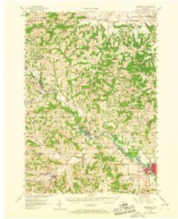
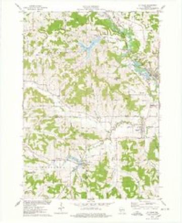
Topographic sheets covering this place
7 surveys from 11 printed sheetsMatched by testing this settlement's coordinate against the published boundary of every sheet in the United States Geological Survey's historical collection. Each opens the scanned sheet at the Survey.
- 1956 USGS Reedsburg quadrangle1:62500, 3 printings
- 1958 USGS La Crosse quadrangle1:250000, 2 printings
- 1961 USGS La Crosse quadrangle1:250000
- 1965 USGS La Crosse quadrangle1:250000
- 1975 USGS La Valle quadrangle1:24000
- 1976 USGS La Crosse quadrangle1:250000
- 1985 USGS Sparta quadrangle1:100000, 2 printings




In the county-history sources
37,495 words on this townshipThe History of Sauk County, Wisconsin, Containing an Account of Settlement, Growth, Development and Resources ... Biographical Sketches ... the Whole Preceded by a History of Wisconsin, published 1880 names this settlement in its chapter on Ironton Village. These are the passages that mention it, exactly as the scans read.
was born at Paris Hill, Oneida Co., N. Y., February 12, 1805, and died at Ironton December 26, 1878. His parents were pioneers in that part of New York, in which he found much more hard work than opportunities for education. In the absence of ca,nals and railroads, the usual routine of his rural youth was mostly varied by trips with sleigh to Albany, 140 miles, with farm produce and return with merchandise. The fashion and economy of those early days are illustrated by his taking from home enough cooked provisions for the round trip of ten days to two weeks, in order to clear anything by such hauling. Experiences in trading on such trips caused him, when of age, to engage in peddling through most of the New England States, in which he acquired more of experience than capital. During several years following, he alternately formed, ran a saw-mill and essayed a wagon and blacksmith shop, employing several hands. Soon after being married, January 1, 1835, to Ruby Bliss, who survives him, he had the misfortune to have his shop, tools and stock consumed, which led him to give up all his remaining property to his creditors. With several long-time acquaintances, he then determined to abandon New York, and make a new start in Wisconsin, in which Territory he settled, near Salem, Kenosha County, in 1844. One drawback after another, including sickness, induced him to desire a new location, and, hearing of the Baraboo country, he, with several friends, made no less than seven prospecting and hunting tours between 1848 and 1852, during which, by means of cash and warrants, he entered several hundred acres of excellent land lying about one or two miles northwest and west of Ironton Village. On this land he settled in the spring of 1852. Much of this land he soon disposed of, but retained enough for a good farm until about ten years ago. This farm being situated in Lavalle (then Marston, including what now is Woodland, Lavalle, Ironton and Washington), he was soon chosen Chairman of its Board of Supervisors, and many times represented it in the old county board. In these early days he was also a noted Justice of the Peace, and thereby acquired the title of " Squire," which clung to him through life. After the death of James Tower, founder of Ironton, who was one of the members of the County Board, he was appointed and then elected to the position, which he retained about four years, and gained the respect and good will of his colleagues. Having a good offer for his farm, he disposed of it in the spring of 1868, and purchased a comfortable home in the village of Ironton, where he resided until his death. Throughout his Sauk County career, he was one of the landmarks of Republicanism, never wavering in its support, and contributing freely of his money, time and labor for its success. He was specially noted for the persistence with which he insisted that his town should always be represented in county convention, whose every session he has attended for a generation. The massiveness and shape of his head betokened, what he really possessed, much more than average mental endowments, which, had they in youth been fairly cultivated, would have raised him to much more important stations in life than he occupied. " While observation and keen analysis, with sound reasoning and considerate judgment, guided by justice, insured him a f\iir measure of social, official and financial success without wronging another, and placed him on the right side of most public questions, and caused his opinion to be respected and frequently consulted ; wealth and station, however, were but secondary with him, for he distributed the one and waived the other more than is generally known. He was for many years an Odd Fellow, but gradually communed more and more with the Free Masons, with whom he remained in good standing to his death. He also worked with the Good Templars for a number of years. In all these organizations, he was an active and influential member, and frequently held important official positions in each. In the pioneer days of the Little Baraboo, many were those who Avere freely welcome to his bed and board, and a seat about the old-style fireplace ; and often did the capacious old log house contain a merry company whose down-right old-fashioned sport and ready wit caused the walls to fairly ring again ; and often do his children refer to the endearments of the old farm home.
Passage source: The History of Sauk County, Wisconsin, Containing an Account of Settlement, Growth, Development and Resources ... Biographical Sketches ... the Whole Preceded by a History of Wisconsin, published 1880.
Machine-read from a century-old scan, so expect the errors a machine makes: misspelled names, dropped words, stray characters.
Fires near this place
128 since 1992Regional context, not property-specific evidence. The federal wildfire occurrence database lists 128 fires within 5 miles of Ironton between 1992 and 2020, burning about 147 acres in total. 2 started naturally. 3 were recorded as arson. Distance is straight-line from the map coordinates, so a fire counted here may appear on a neighbouring settlement's page as well.
| Reported cause | Fires |
|---|---|
| Debris and open burning | 62 |
| Equipment and vehicle use | 29 |
| Missing data/not specified/undetermined | 19 |
| Recreation and ceremony | 5 |
| Arson/incendiarism | 3 |
| Fireworks | 2 |
| Smoking | 2 |
| Natural | 2 |
| Other causes | 2 |
| Power generation/transmission/distribution | 1 |
| Misuse of fire by a minor | 1 |
The most recent of them, most recent first, with the day each was reported and the service that recorded it.
| Date | Cause | Size | Reported by | Name on the report |
|---|---|---|---|---|
| 15 September 2020 | Equipment and vehicle use | under an acre | Wisconsin Department of Natural Resources | TWIN PINE |
| 11 September 1998 | Missing data/not specified/undetermined | under an acre | Wisconsin Department of Natural Resources | not named |
| 1 September 2009 | Equipment and vehicle use | under an acre | Wisconsin Department of Natural Resources | GREEN DITCH FIRE |
| 4 August 2000 | Debris and open burning | under an acre | Wisconsin Department of Natural Resources | not named |
| 11 August 1996 | Missing data/not specified/undetermined | under an acre | Wisconsin Department of Natural Resources | not named |
| 8 July 2012 | Smoking | under an acre | Wisconsin Department of Natural Resources | SMOKER |
| 3 July 2001 | Debris and open burning | under an acre | Wisconsin Department of Natural Resources | not named |
| 17 July 2002 | Power generation/transmission/distribution | under an acre | Wisconsin Department of Natural Resources | not named |
Settlements close enough to share some of these fires:
Mines and quarries near this place
2 within 5 milesRegional context, not property-specific evidence. The federal mineral resources record lists 2 workings within 5 miles of Ironton: 1 past producer, 1 producer. 1 still produces. What was taken out: Stone, Crushed/Broken. Distance is straight-line from the map coordinates, so a quarry counted here may appear on a neighbouring settlement's page as well.
| Where | Site | Commodity | Status | Recorded |
|---|---|---|---|---|
| Dooley Quarry | Stone, Crushed/Broken | Past Producer | ||
| Schultz Quarry | Stone, Crushed/Broken | Producer |
Storms near this place
8 since 1994Regional context, not property-specific evidence. The National Weather Service names Ironton in 8 storm reports between 1994 and 2020: 3 thunderstorm wind, 2 hail, 2 flash flood, 1 heavy rain. No death or injury is recorded in these reports. Each account below is quoted exactly as the forecast office filed it, from the NOAA Storm Events Database, and each date opens the federal record of that event.
| When | Event | Place named | Harm | What the report says |
|---|---|---|---|---|
| June 1996 | Flash Flood | Ironton | $170,000 | no account filed |
| August 2007 | Thunderstorm Wind | Ironton | $100,000 | Powerful thunderstorm wind gusts to 61 knots (70 mph) toppled many trees and damaged several power-lines. Some corn fields in the surrounding countryside were flattened by the winds. |
| September 1994 | Thunderstorm Wind | Ironton | $50,000 | no account filed |
| August 2010 | Flash Flood | Ironton | $10,000 | Several rounds of thunderstorms produced heavy rain that closed numerous roads, with 1 to 3 feet of water covering the roadways and washing out gravel shoulders. In addition, the thunderstorms knocked over a tree onto power lines that started a small fire along Highway 136 near North Freedom. |
| September 2007 | Thunderstorm Wind | Ironton | $5,000 | Powerful thunderstorm downburst winds gusting to an estimated 56 knots (65 mph) toppled several large trees. Tree branch debris knocked down some power lines. |
| October 2020 | Heavy Rain | Ironton | $1,000 | Four to six inches of rain led to some minor road flooding between La Valle and Reedsburg. A section of Birchwood Rd. was washed out and closed on the west side of Lake Delton. |
| August 2006 | Hail | Ironton | - | no account filed |
| September 1994 | Hail | Ironton | - | no account filed |
Nearest settlements
The eight closest, with where each one stands in the county. Distances are straight-line, computed from the Geographic Names Information System coordinates.
| Map | Place | Distance | Sheets |
|---|---|---|---|
| La Valle | 2.6 miles | 11 | |
| Lime Ridge | 5.5 miles | 11 | |
| Valton | 7.3 miles | 11 | |
| Reedsburg | 7.4 miles | 11 | |
| Baders Villa Estates | 7.8 miles | 16 | |
| Hill Point | 8.5 miles | 11 | |
| Loganville | 9.2 miles | 11 | |
| The Courtyards | 9.2 miles | 16 |
Elsewhere
Matched on this settlement's Geographic Names Information System number rather than its name, so it cannot be a different place of the same name in another state.
| Wikipedia article on Ironton | An encyclopaedic summary. Its text is share-alike, so it is linked here rather than copied. |
| Wikidata item Q926815 | The structured record the population and elevation above come from. Public domain (CC0). |
Provenance
This settlement is recorded in the Geographic Names Information System as feature 1566977. The sheet list is computed by point-in-boundary test against the United States Geological Survey's historical topographic inventory. Both are works of the United States government and carry no copyright under 17 U.S.C. 105.
Wildfire. Short, Karen C. 2022. Spatial wildfire occurrence data for the United States, 1992-2020 [FPA_FOD_20221014]. 6th Edition. Fort Collins, CO: Forest Service Research Data Archive. https://doi.org/10.2737/RDS-2013-0009.6 Collected with United States Government funding and usable without additional permissions or fees.
Mines and quarries. USGS Mineral Resources Data System (MRDS) https://mrdata.usgs.gov/mrds/ A work of the United States government, no copyright under 17 U.S.C. 105.
Storms. NOAA National Centers for Environmental Information, Storm Events Database https://www.ncei.noaa.gov/stormevents/ A work of the United States government, no copyright under 17 U.S.C. 105. Narratives are quoted verbatim from the National Weather Service report and are not edited or summarised.