 Block
La Valle, Wisconsin
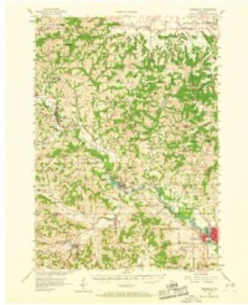
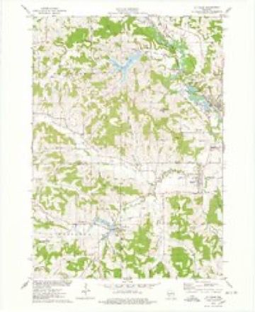
11 topographic sheets cover this place, the earliest surveyed in 1956 and the latest in 1985. It stands in La Valle Village. It lies in ZIP code area 53941. It stands on Little Baraboo River. The Survey maps it on the La Valle quadrangle. 1,420 people lived here at the 2020 count. It stands 1,024 feet above sea level.
Topographic sheets covering this place
7 surveys from 11 printed sheetsMatched by testing this settlement's coordinate against the published boundary of every sheet in the United States Geological Survey's historical collection. Each opens the scanned sheet at the Survey.
- 1956 USGS Reedsburg quadrangle1:62500, 3 printings
- 1958 USGS La Crosse quadrangle1:250000, 2 printings
- 1961 USGS La Crosse quadrangle1:250000
- 1965 USGS La Crosse quadrangle1:250000
- 1975 USGS La Valle quadrangle1:24000
- 1976 USGS La Crosse quadrangle1:250000
- 1985 USGS Sparta quadrangle1:100000, 2 printings




Fires near this place
144 since 1992Regional context, not property-specific evidence. The federal wildfire occurrence database lists 144 fires within 5 miles of La Valle between 1992 and 2020, burning about 150 acres in total. 4 started naturally. 3 were recorded as arson. Distance is straight-line from the map coordinates, so a fire counted here may appear on a neighbouring settlement's page as well.
| Reported cause | Fires |
|---|---|
| Debris and open burning | 76 |
| Equipment and vehicle use | 28 |
| Missing data/not specified/undetermined | 19 |
| Recreation and ceremony | 5 |
| Natural | 4 |
| Arson/incendiarism | 3 |
| Smoking | 2 |
| Power generation/transmission/distribution | 2 |
| Fireworks | 2 |
| Other causes | 2 |
| Misuse of fire by a minor | 1 |
The most recent of them, most recent first, with the day each was reported and the service that recorded it.
| Date | Cause | Size | Reported by | Name on the report |
|---|---|---|---|---|
| 11 September 1998 | Missing data/not specified/undetermined | under an acre | Wisconsin Department of Natural Resources | not named |
| 1 September 2009 | Equipment and vehicle use | under an acre | Wisconsin Department of Natural Resources | GREEN DITCH FIRE |
| 4 August 2000 | Debris and open burning | under an acre | Wisconsin Department of Natural Resources | not named |
| 11 August 1996 | Missing data/not specified/undetermined | under an acre | Wisconsin Department of Natural Resources | not named |
| 8 July 2012 | Smoking | under an acre | Wisconsin Department of Natural Resources | SMOKER |
| 7 July 2016 | Natural | under an acre | Wisconsin Department of Natural Resources | OLD TOWN HALL ROAD FIRE |
| 4 July 2012 | Fireworks | under an acre | Wisconsin Department of Natural Resources | FOUNTAIN FIRE |
| 3 July 2001 | Debris and open burning | under an acre | Wisconsin Department of Natural Resources | not named |
Settlements close enough to share some of these fires:
Mines and quarries near this place
1 within 5 milesRegional context, not property-specific evidence. The federal mineral resources record lists 1 working within 5 miles of La Valle: 1 producer. All of them still produce. What was taken out: Stone, Crushed/Broken. Distance is straight-line from the map coordinates, so a quarry counted here may appear on a neighbouring settlement's page as well.
| Where | Site | Commodity | Status | Recorded |
|---|---|---|---|---|
| Schultz Quarry | Stone, Crushed/Broken | Producer |
Storms near this place
53 since 1994Regional context, not property-specific evidence. The National Weather Service names La Valle in 53 storm reports between 1994 and 2025: 25 thunderstorm wind, 14 hail, 6 flash flood, 6 flood. No death or injury is recorded in these reports. Each account below is quoted exactly as the forecast office filed it, from the NOAA Storm Events Database, and each date opens the federal record of that event.
| When | Event | Place named | Harm | What the report says |
|---|---|---|---|---|
| August 2018 | Flood | La Valle | $4,900,000 | Flood levels continued to rapidly rise on the Baraboo River with near record crests reached in La Valle during the late morning hours on August 29th, and near record in Reedsburg late in the afternoon on August 29th. Evacuations continued in the early morning hours in La Valle on August 29th, while 10-15 persons were evacuated during the early morning hours on August 30th in Rock Springs and North Freedom. Many state and county highways, and bridges, were closed in the aforementioned communities near and along the Baraboo River. The Baraboo River also began to flood farther downstream in the Baraboo area. Other roads, bridges, and lowland areas across northern Sauk County remained flooded and closed from the heavy rains of the last several days. Overall, 116 homes sustained minor flood damage from late August into early September mainly in the communities of La Valle, Reedsburg, Rock Springs, and North Freedom. Many businesses also sustained minor flood damage in these communities. |
| August 2018 | Flood | La Valle | $1,000,000 | Flood levels were quickly rising on the lower Baraboo River basin and falling in the upper portions of the river basin. A near record crest of 27.6 feet occurred in Rock Springs during the late afternoon of August 31st, while a new record crest did occur in North Freedom at 25.3 feet. The river was approaching crest in West Baraboo late on August 31st. Many state and county highways, and bridges, were closed in the communities near and along the Baraboo River. Many homes and businesses sustained minor flood damage in these communities. |
| August 2018 | Flood | La Valle | $500,000 | Flooding of creeks and lowland continued north of La Valle. This included highway 33 which was washed out due to the flooding of Crossman Creek just south of Stout Rd. Highway F was closed due to bridge damage at an inlet to Lake Redstone. A portion of Highway H near highway 13 was closed due to a road and culvert wash out. |
| August 2018 | Flash Flood | La Valle | $500,000 | Portions of several roads north of La Valle are flooded and washed out after 3 to 6 inches of rain. This includes highway 33 which was washed out due to the flash flooding of Crossman Creek just south of Stout Rd. Highway F was closed due to bridge damage at an inlet to Lake Redstone. A portion of Highway H near highway 13 was closed due to a road and culvert wash out. |
| July 2006 | Thunderstorm Wind | La Valle | $50,000 | Trees and power lines reported down countywide. |
| July 1997 | Thunderstorm Wind | La Valle | $50,000 | no account filed |
| June 1998 | Thunderstorm Wind | La Valle | $40,000 | no account filed |
| June 2008 | Thunderstorm Wind | La Valle | $25,000 | Powerful thunderstorm winds knocked down large trees and power-lines. |
| July 2008 | Flash Flood | La Valle | $25,000 | A series of thunderstorms dumped 2 to 4 inches of rain in Sauk County that resulted in flash flooding. Several county roads were closed due to fast-flowing water depths of 1 to 2 feet. Basement flooding was noted, and there was some shoulder gravel washouts. A semi-tractor trailer stalled in deep water on a road near Loganville after the current pushed the truck off the road, and the driver had to be rescued. |
| June 2025 | Thunderstorm Wind | La Valle | $20,000 | Dispatch reports numerous trees down across the county. |
| July 2019 | Flash Flood | La Valle | $20,000 | Flash flooding of creeks and some roads from La Valle to Reedsburg after several inches of rain. A road washout occurred at the intersection of highway 33 and Twin Pine Rd. Babb Creek flooded the backyards of residential homes in Reedsburg. Some basement flooding occurred in Reedsburg. |
| July 2008 | Thunderstorm Wind | La Valle | $20,000 | Powerful thunderstorm wind gusts toppled large trees and broke branches that brought down some power-lines. |
| August 2007 | Thunderstorm Wind | La Valle | $20,000 | Powerful thunderstorm wind gusts to around 56 knots (65 mph) toppled many trees and power-poles/power-lines in and around La Valle. |
| June 2016 | Thunderstorm Wind | La Valle | $15,000 | Numerous trees and tree branches down from La Valle to Rock Springs to Baraboo. |
| July 2019 | Thunderstorm Wind | La Valle | $12,000 | Several branches and trees blown down from Reedsburg to La Valle. A large pine tree fell onto two vehicles in Reedsburg. |
| July 2016 | Thunderstorm Wind | La Valle | $10,000 | Fifteen to twenty trees or large branches down across the county. |
| July 2008 | Flash Flood | La Valle | $10,000 | Heavy rains of 1 to 2 inches in an hour resulted in flash flooding at generated fast-flowing water depths of 1 to 2 feet on several roads. Additonal sandbagging was noted in Reedsburg. Water was reported in some basements leading to damage of contents. Some roads were closed. |
| July 2008 | Thunderstorm Wind | La Valle | $10,000 | Powerful thunderstorm wind gusts toppled several large trees and broke branches that brought down some power-lines. |
| September 2007 | Thunderstorm Wind | La Valle | $5,000 | Powerful thunderstorm downburst winds gusting to an estimated 56 knots (65 mph) toppled several large trees. Tree branch debris knocked down some power lines. |
| July 2004 | Hail | La Valle | $5,000 | no account filed |
| September 2016 | Flood | La Valle | $3,000 | The Baraboo River peaked around 18.25 feet on September 23rd in La Valle. There was water is some basements in La Valle, especially on West Main Street. |
| June 1997 | Thunderstorm Wind | La Valle | $3,000 | no account filed |
| July 2024 | Thunderstorm Wind | La Valle | $1,000 | Downed trees near La Valle. |
| July 2019 | Thunderstorm Wind | La Valle | $1,000 | A few trees down in La Valle. |
| September 2018 | Flood | La Valle | $1,000 | Flood levels were quickly rising on the lower Baraboo River basin and falling in the upper portions of the river basin to begin September. The river crested at moderate flood stage in West Baraboo the morning of September 1st, while the river crested at major flood stage at Baraboo the morning of September 2nd. A new round of 5-9 inches of rain over the upper portion of the Baraboo River basin then resulted in another round of moderate to major flood stage on the river. La Valle crested at moderate flood stage the early morning of September 5th; Reedsburg crested at major flood stage the afternoon of September 5th; Rock Springs crested at major flood stage the morning of September 6th; North Freedom crested the afternoon of September 6th; West Baraboo crested at moderate flood stage the morning of September 7th; Baraboo crested at major flood stage the evening of September 7th. The Baraboo River gradually fell below minor flood stage during the 2nd week of September. Many state and county highways, and bridges, were closed in the communities near and along the Baraboo River. Many homes and businesses sustained minor flood damage in these communities. Thousands of acres of agricultural land were flooded. |
| March 2017 | Thunderstorm Wind | La Valle | $1,000 | Power lines down. |
| August 2004 | Lightning | La Valle | $1,000 | no account filed |
| June 1998 | Thunderstorm Wind | La Valle | $100 | no account filed |
| August 2018 | Flash Flood | La Valle | - | A quick 2.00-2.50 inches of rain during the onset of flooding on the Baraboo River from prior heavy rains, led to flash flooding in La Valle, Reedsburg, and locations in between along the Baraboo River. Evacuations occurred in a section of La Valle due to the flood waters. Other location across northern Sauk experienced street flooding in urban areas and lowland flooding in rural areas. Various roads and bridges remained closed from the prior heavy rains and flooding that had occurred. Additional roads and bridges were becoming inundated with high water from creeks and the Baraboo River in the far northwest portion of the county. |
| September 2016 | Heavy Rain | La Valle | - | Over 6 inches of rain fell in the area surrounding Lake Redstone. The lake rose about a foot causing piers to completely submerge and boats to float away. |
| September 2016 | Flood | La Valle | - | Floodwaters from the Little Baraboo River covered two bridges between La Valle and Ironton. The bridges were closed with one located on highway 58 about 1 mile south of La Valle, and the other on Branton Road about 2 miles south of La Valle. |
| July 2010 | Thunderstorm Wind | La Valle | - | The public reported trees blown down by thunderstorm wind gusts estimated up to 56 knots (70 mph). |
| August 2010 | Thunderstorm Wind | La Valle | - | County sheriff deputies reported trees were blown down by the strong thunderstorm gusts. |
| June 2008 | Flash Flood | La Valle | - | Sauk County experienced 4 flash flood events over a 3-day period. Two of the events started on June 7th, one on June 8th, and the last one on June 9th. In each case, flash flooding caused home and business damage as well as crop losses. Roads were blocked or washed out (STH 154 and CTH C), and bridges were damaged. Many vehicles stalled. Locations in the Baraboo River Valley sustained considerable damage as the river crested at all-time levels. Collectively, each of these 4 flash floods resulted in home and business damage along with some crop losses. It was nearly impossible to break down the damages by flash flood event. Therefore, the collective breakdown is provided in the June 9th StormData entry for Sauk County. |
| June 2008 | Hail | La Valle | - | Diameters of hail stones ranged from 0.88 to 1.00 inch. |
| July 2008 | Thunderstorm Wind | La Valle | - | Powerful thunderstorm winds toppled large trees. |
| June 2017 | Hail | La Valle | - | no account filed |
| May 2015 | Hail | La Valle | - | no account filed |
| August 2006 | Hail | La Valle | - | no account filed |
| August 2006 | Hail | La Valle | - | no account filed |
| August 2006 | Hail | La Valle | - | no account filed |
| August 2006 | Hail | La Valle | - | no account filed |
| August 2006 | Hail | La Valle | - | no account filed |
| June 2005 | Hail | La Valle | - | no account filed |
| August 2004 | Hail | La Valle | - | no account filed |
| June 2004 | Thunderstorm Wind | La Valle | - | no account filed |
| August 2002 | Thunderstorm Wind | La Valle | - | no account filed |
| September 2000 | Hail | La Valle | - | no account filed |
| May 1998 | Thunderstorm Wind | La Valle | - | no account filed |
| August 1997 | Hail | La Valle | - | no account filed |
| May 1996 | Hail | La Valle | - | no account filed |
| June 1995 | Thunderstorm Wind | La Valle | - | no account filed |
| September 1994 | Thunderstorm Wind | La Valle | - | no account filed |
Nearest settlements
The eight closest, with where each one stands in the county. Distances are straight-line, computed from the Geographic Names Information System coordinates.
| Map | Place | Distance | Sheets |
|---|---|---|---|
| Ironton | 2.6 miles | 11 | |
| Reedsburg | 7.5 miles | 11 | |
| Valton | 7.8 miles | 11 | |
| Baders Villa Estates | 7.9 miles | 16 | |
| Lime Ridge | 8.0 miles | 11 | |
| The Courtyards | 9.1 miles | 16 | |
| Hill Point | 10.9 miles | 11 | |
| Loganville | 10.9 miles | 11 |
Elsewhere
Matched on this settlement's Geographic Names Information System number rather than its name, so it cannot be a different place of the same name in another state.
| Wikipedia article on La Valle | An encyclopaedic summary. Its text is share-alike, so it is linked here rather than copied. |
| Wikidata item Q2671461 | The structured record the population and elevation above come from. Public domain (CC0). |
Provenance
This settlement is recorded in the Geographic Names Information System as feature 1567700. The sheet list is computed by point-in-boundary test against the United States Geological Survey's historical topographic inventory. Both are works of the United States government and carry no copyright under 17 U.S.C. 105.
Wildfire. Short, Karen C. 2022. Spatial wildfire occurrence data for the United States, 1992-2020 [FPA_FOD_20221014]. 6th Edition. Fort Collins, CO: Forest Service Research Data Archive. https://doi.org/10.2737/RDS-2013-0009.6 Collected with United States Government funding and usable without additional permissions or fees.
Mines and quarries. USGS Mineral Resources Data System (MRDS) https://mrdata.usgs.gov/mrds/ A work of the United States government, no copyright under 17 U.S.C. 105.
Storms. NOAA National Centers for Environmental Information, Storm Events Database https://www.ncei.noaa.gov/stormevents/ A work of the United States government, no copyright under 17 U.S.C. 105. Narratives are quoted verbatim from the National Weather Service report and are not edited or summarised.