 Block
Kansasville, Wisconsin
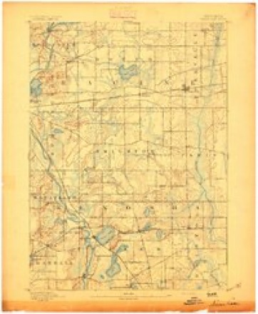
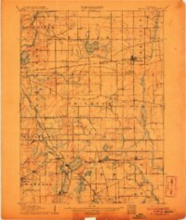
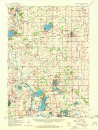
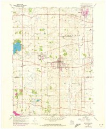
18 topographic sheets cover this place, the earliest surveyed in 1893 and the latest in 1980. It stands in Dover town. It lies in ZIP code area 53139. The Survey maps it on the Union Grove quadrangle.
Topographic sheets covering this place
9 surveys from 18 printed sheetsMatched by testing this settlement's coordinate against the published boundary of every sheet in the United States Geological Survey's historical collection. Each opens the scanned sheet at the Survey.
- 1893 USGS Silver Lake quadrangle1:62500, 2 printings
- 1906 USGS Silver Lake quadrangle1:62500, 3 printings
- 1954 USGS Rockford quadrangle1:250000
- 1955 USGS Rockford quadrangle1:250000
- 1958 USGS Rockford quadrangle1:250000, 4 printings
- 1960 USGS Silver Lake quadrangle1:62500, 3 printings
- 1960 USGS Union Grove quadrangle1:24000, 2 printings
- 1963 USGS Rockford quadrangle1:250000
- 1980 USGS Lake Geneva quadrangle1:100000





In the county-history sources
7,136 words on this townshipThe History of Racine and Kenosha Counties, Wisconsin .., published 1879 names this settlement in its chapter on Dover Town. These are the passages that mention it, exactly as the scans read.
J. C« BECHfiR, farmer; P. O. Dover; was born in the village of SchnickartshauMn, Grand Duchy of Hesse Darmstadt, Dec. 22, 1810, where his father was head forester; attended the village school from his 6th to 14th year; then a gymnasium until his 19th year, when he enlisted as a volunteer in the Hessian army. In 1832, at his father's request, was appointed his assistant. In 1833 his father was placed on a retiring pension, and he succeeded in the offict*, which he held until 1843. Then the present Czar, Alexander of Russia (then Crown Prince), married Princess Maria, of Hesse Darmstadt. The Crown Prince had in his suite several Russian princes, and others of noble extraction, one of whom, Baron Theodore Ungcrnstemberg, needing a skilled forester, made Mr. Becher a good offer of a position, which he accepted, after obtaining permission from the Hessian Goverpment. Remained in that position until the Baron was killed in a duel, and, being unmarried, his whole possessions on the Island of Dago, in the Baltic Sea, went to his mother and younger brothers, and Mr. Becher was thrown out of his office. He returned to Germany, with difficulty obtaining a passport, as he was suspected by the Government of having assisted the })er8on who had killed his employer to escape. On the contrary, Mr. B. had attempted, unsuccessfully, to secure his arrest. Finally De Caster de Tersac, a French professor in the University of Reval, secured for him a passport from the Governor of Riga. Reaching Germany, he could not obtain his former position, and had such indefinite promises of another, that he sold his property there and embarked for Russia, via River Rhine and Rotterdam, to London. There friends persuaded him to come to the United States instead, and after a voyage of twenty-eight days, landed in New York. Went thence to Milwaukee, where, through distrust of all who advised him, he lost opportunities of buying cheap property. Concluded to buy land in the town of Brighton, of Mr. John Ide. Six acres of it were broken, and on it was an old log cabin, in which he and his family lived through the severe winter of 1 848-49. Money gave out, and he sold mathematical instruments, six gold watches, and six guns, for half their value, to buy farming stock and implements. Remained there until 1855, then tried hotel-keeping in Racine, which was no business for him, and he returned the next year to the farm. In May, 1856, bought a house and lot in what is now Kansasville. Kept country store with Mr. John Walter, who h»d just arrived from Germany ; failed and lost everything. The same year was a pioneer of Dover ; bought land for SI, 400, but it had been mortgaged and he lost it all. Mr. B. has been fourteen years Postmaster, ten years express agent, and twenty years station agent, at Dover. He married, on Saturday, June 30, 1832, Rebecca Lenz, daughter of Adam Lenz, in the village Ekhardsborn, by Rev. Dr. Krom in the church at Schweskartshausen ; they had six children, two sons and four daughters - Philip, born March 3, 1833; Ottilie, Jan. 1, 1836; Lisette, Aug. 10, 1838 ; Amelia, Sept. 20, 1840; Mary, Sept. 30, 1842; Gustav, Nov. 15, 1845.
Passage source: The History of Racine and Kenosha Counties, Wisconsin .., published 1879.
RIEiVZIE J. HULCiT, merchant, Kansasville; born in Kenosha, Kenosha Co., June 18, 1850; hved in Paris and Brighton, and moved to Yorkville, in 1865, with his parents; his father, Gardner Hulet, owned 134 acres in Sec. 31, Yorkville, and was an auctioneer. He died very suddenly, Dec. 9, 1875, within one mile of Union Grove, while doing business. His mother is still living on the same farm. Rienzi Hulet owns 111 acres land in Sec. 36, Dover, but lives in the village of Kansasville, where he does a general mercantile business in farmers* supplies. He married, in Dover, Oct. 20, 1875, Jane Burns, of Dover, and has one son - Elmer G.
Passage source: The History of Racine and Kenosha Counties, Wisconsin .., published 1879.
JAnCiS ncOUIRCi, farmer, Sec. 9 ; P. O. Kansasville ; son of John McGuire, who was bom in Tipperary, Ireland, in 1802, and came to Boston, Mass., with his family, in 1849. He married, in Tipperary, Margaret McCormick, Feb. 8, 1836, and bad five children - Cornelius, John, Elizabeth, James, Mary. He came to Racine, with his family, in 1852 ; lived there five years ; came to Dover in 1857, where he died, Jan. 10, 1862. James owns 160 acres in Sec. 9, with residence and bam; his mother lives with him.
Passage source: The History of Racine and Kenosha Counties, Wisconsin .., published 1879.
Machine-read from a century-old scan, so expect the errors a machine makes: misspelled names, dropped words, stray characters.
Read the whole chapter on Dover Town - it names this place 11 more 11 times.
Fires near this place
12 since 2010Regional context, not property-specific evidence. The federal wildfire occurrence database lists 12 fires within 5 miles of Kansasville between 2010 and 2020, burning about 82 acres in total. None started naturally. None was recorded as arson. Distance is straight-line from the map coordinates, so a fire counted here may appear on a neighbouring settlement's page as well.
| Reported cause | Fires |
|---|---|
| Missing data/not specified/undetermined | 6 |
| Debris and open burning | 5 |
| Equipment and vehicle use | 1 |
The most recent of them, most recent first, with the day each was reported and the service that recorded it.
| Date | Cause | Size | Reported by | Name on the report |
|---|---|---|---|---|
| 14 June 2018 | Debris and open burning | under an acre | Wisconsin Department of Natural Resources | 393 |
| 10 June 2019 | Debris and open burning | under an acre | Wisconsin Department of Natural Resources | 293 |
| 5 April 2020 | Debris and open burning | under an acre | Wisconsin Department of Natural Resources | 27 |
| 2 April 2010 | Equipment and vehicle use | 80 acres | Wisconsin Department of Natural Resources | not named |
| 14 April 2018 | Missing data/not specified/undetermined | 1.0 acres | Wisconsin Department of Natural Resources | 28 |
| 11 April 2018 | Missing data/not specified/undetermined | under an acre | Wisconsin Department of Natural Resources | 25 |
| 9 March 2018 | Missing data/not specified/undetermined | under an acre | Wisconsin Department of Natural Resources | 111 |
| 30 March 2018 | Missing data/not specified/undetermined | under an acre | Wisconsin Department of Natural Resources | 153 |
Settlements close enough to share some of these fires:
Mines and quarries near this place
1 within 5 milesRegional context, not property-specific evidence. The federal mineral resources record lists 1 working within 5 miles of Kansasville: 1 past producer. None of them still produces. What was taken out: Sand and Gravel, Construction. Distance is straight-line from the map coordinates, so a quarry counted here may appear on a neighbouring settlement's page as well.
| Where | Site | Commodity | Status | Recorded |
|---|---|---|---|---|
| Kenosha County Hwy Dept Wilmot Pit | Sand and Gravel, Construction | Past Producer |
Storms near this place
8 since 1994Regional context, not property-specific evidence. The National Weather Service names Kansasville in 8 storm reports between 1994 and 2012: 3 thunderstorm wind, 3 hail, 1 flash flood, 1 tornado. No death or injury is recorded in these reports. Each account below is quoted exactly as the forecast office filed it, from the NOAA Storm Events Database, and each date opens the federal record of that event.
| When | Event | Place named | Harm | What the report says |
|---|---|---|---|---|
| July 1994 | Thunderstorm Wind | Kansasville | $500,000 | no account filed |
| September 2006 | Flash Flood | Kansasville | $100,000 | no account filed |
| June 2008 | Tornado (EF0) | Kansasville | $20,000 | This rural tornado damaged a few trees and some corn crop. It was seen by a storm chaser. Average path width was about 30 yards. It started just southeast of the intersection of CTH A and Cox Road and moved northeast across STH 75 about 1/2 mile east of N Beaumont Ave. and dissipated south of radio towers which are south of Bennet Rd. Wind speeds estimated at about 75 mph. DI#27 (TH), DOD2. |
| July 2006 | Thunderstorm Wind | Kansasville | $10,000 | Tree and power-line damage in the Eagle Lake area northwest of Kansasville. |
| June 2008 | Thunderstorm Wind | Kansasville | - | Powerful thunderstorm winds knocked down a few large trees. |
| March 2012 | Hail | Kansasville | - | no account filed |
| June 2008 | Hail | Kansasville | - | no account filed |
| August 2003 | Hail | Kansasville | - | no account filed |
Nearest settlements
The eight closest, with where each one stands in the county. Distances are straight-line, computed from the Geographic Names Information System coordinates.
| Map | Place | Distance | Sheets |
|---|---|---|---|
| Eagle Lake Manor | 1.7 miles | 19 | |
| Hickory Haven | 1.8 miles | 18 | |
| Eagle Lake | 1.9 miles | 19 | |
| Eagle Lake Terrace | 2.2 miles | 19 | |
| Lorimar Estates | 2.2 miles | 19 | |
| Rosewood | 3.1 miles | 19 | |
| Union Grove | 3.1 miles | 18 | |
| Beaumont | 4.1 miles | 18 |
Elsewhere
Matched on this settlement's Geographic Names Information System number rather than its name, so it cannot be a different place of the same name in another state.
| Wikipedia article on Kansasville | An encyclopaedic summary. Its text is share-alike, so it is linked here rather than copied. |
| Wikidata item Q6365196 | The structured record the population and elevation above come from. Public domain (CC0). |
Provenance
This settlement is recorded in the Geographic Names Information System as feature 1567343. The sheet list is computed by point-in-boundary test against the United States Geological Survey's historical topographic inventory. Both are works of the United States government and carry no copyright under 17 U.S.C. 105.
Wildfire. Short, Karen C. 2022. Spatial wildfire occurrence data for the United States, 1992-2020 [FPA_FOD_20221014]. 6th Edition. Fort Collins, CO: Forest Service Research Data Archive. https://doi.org/10.2737/RDS-2013-0009.6 Collected with United States Government funding and usable without additional permissions or fees.
Mines and quarries. USGS Mineral Resources Data System (MRDS) https://mrdata.usgs.gov/mrds/ A work of the United States government, no copyright under 17 U.S.C. 105.
Storms. NOAA National Centers for Environmental Information, Storm Events Database https://www.ncei.noaa.gov/stormevents/ A work of the United States government, no copyright under 17 U.S.C. 105. Narratives are quoted verbatim from the National Weather Service report and are not edited or summarised.