 Block
Union Grove, Wisconsin
18 topographic sheets cover this place, the earliest surveyed in 1893 and the latest in 1980. It stands in Union Grove Village. It lies in ZIP code area 53182. The Survey maps it on the Union Grove quadrangle. 4,806 people lived here at the 2020 count. It stands 774 feet above sea level.
Population over time
2 figuresUnion Grove fell from 4,915 to 4,806 between 2010 and 2020. These are the recorded population figures Wikidata holds for this place, reached through the Geographic Names Information System number this page is keyed on rather than by name, so they belong to this place and not to another of the same name. Most are census counts, but not all are: an early figure may be a founding or settlement estimate, and an estimate published within five years of a census is left out. The change column is computed, and is left blank where more than 20 years separate a figure from the one before it, because a gap that long is not a change between two counts.
| Year | People | Change |
|---|---|---|
| 2010 | 4,915 | |
| 2020 | 4,806 | -109 (-2%) |
Topographic sheets covering this place
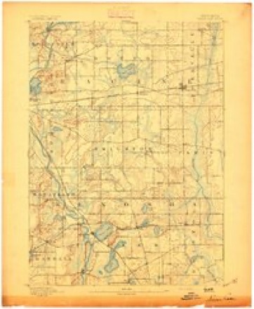
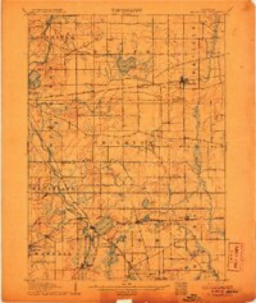
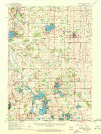
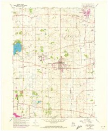
9 surveys from 18 printed sheetsMatched by testing this settlement's coordinate against the published boundary of every sheet in the United States Geological Survey's historical collection. Each opens the scanned sheet at the Survey.
- 1893 USGS Silver Lake quadrangle1:62500, 2 printings
- 1906 USGS Silver Lake quadrangle1:62500, 3 printings
- 1954 USGS Rockford quadrangle1:250000
- 1955 USGS Rockford quadrangle1:250000
- 1958 USGS Rockford quadrangle1:250000, 4 printings
- 1960 USGS Silver Lake quadrangle1:62500, 3 printings
- 1960 USGS Union Grove quadrangle1:24000, 2 printings
- 1963 USGS Rockford quadrangle1:250000
- 1980 USGS Lake Geneva quadrangle1:100000





In the county-history sources
993 words on this townshipThe History of Racine and Kenosha Counties, Wisconsin .., published 1879 names this settlement in its chapter on Union Grove Village. These are the passages that mention it, exactly as the scans read.
The Press, that Archimedean lever which moves the world, is well represented by the Union Grove JSnterprise, an independent paper which was established in September, 1877, by Mr. A. P. Colby, the present proprietor, who is also the editor. It is a weekly, and has a circulation of about 500. It is well gotten up and is well received.
Passage source: The History of Racine and Kenosha Counties, Wisconsin .., published 1879.
Machine-read from a century-old scan, so expect the errors a machine makes: misspelled names, dropped words, stray characters.
Fires near this place
11 since 2018Regional context, not property-specific evidence. The federal wildfire occurrence database lists 11 fires within 5 miles of Union Grove between 2018 and 2020, burning about 2 acres in total. None started naturally. None was recorded as arson. Distance is straight-line from the map coordinates, so a fire counted here may appear on a neighbouring settlement's page as well.
| Reported cause | Fires |
|---|---|
| Missing data/not specified/undetermined | 6 |
| Debris and open burning | 5 |
The most recent of them, most recent first, with the day each was reported and the service that recorded it.
| Date | Cause | Size | Reported by | Name on the report |
|---|---|---|---|---|
| 14 June 2018 | Debris and open burning | under an acre | Wisconsin Department of Natural Resources | 393 |
| 10 June 2019 | Debris and open burning | under an acre | Wisconsin Department of Natural Resources | 293 |
| 5 April 2020 | Debris and open burning | under an acre | Wisconsin Department of Natural Resources | 27 |
| 14 April 2018 | Missing data/not specified/undetermined | 1.0 acres | Wisconsin Department of Natural Resources | 28 |
| 11 April 2018 | Missing data/not specified/undetermined | under an acre | Wisconsin Department of Natural Resources | 25 |
| 9 March 2018 | Missing data/not specified/undetermined | under an acre | Wisconsin Department of Natural Resources | 111 |
| 30 March 2018 | Missing data/not specified/undetermined | under an acre | Wisconsin Department of Natural Resources | 153 |
| 26 March 2019 | Debris and open burning | under an acre | Wisconsin Department of Natural Resources | 162 |
Settlements close enough to share some of these fires:
Storms near this place
30 since 1995Regional context, not property-specific evidence. The National Weather Service names Union Grove in 30 storm reports between 1995 and 2020: 11 hail, 9 thunderstorm wind, 2 tornado, 2 heavy rain. No death or injury is recorded in these reports. Each account below is quoted exactly as the forecast office filed it, from the NOAA Storm Events Database, and each date opens the federal record of that event.
| When | Event | Place named | Harm | What the report says |
|---|---|---|---|---|
| November 2010 | Tornado (EF1) | Union Grove | $5,000,000 | This tornado is a continuation of a segment that started in Kenosha County. It quickly intensified to an EF-1 rating after moving into Racine County. It moved into southern Racine County about 2.3 miles southwest of Union Grove, around 1,700 feet to the east of the intersection of County Line Road and 224th Avenue. The tornado moved northeast before dissipating near the intersection of County Highway K and County Highway H, about 1/2 mile southeast of Franksville. There were no fatalities, but 2 people were injured in storm-related vehicle accidents. Newspaper articles indicated they were hospitalized. Union Grove bore the brunt of the damage. Eleven buildings, fencing, and trees were damaged on the Racine County Fairgrounds. Large oak trees in Old Settler's Park, which is the northwest corner of the Racine County Fairgrounds, were hit hard. Across the street (STH 11), two businesses had large pieces of roof covering peeled off. One of these, Grove Gear, had about 10,000 square feet of it's roof ripped off, which allowed rain to damage the inside offices and equipment. Newspaper articles indicated that damage to Grove Gear alone was about $1.4 Million. Two other businesses also had roof and siding damage. A residential-care facility had several of its buildings damaged. Around 100 homes in the Village of Union Grove sustained light to moderate damage to roofs, windows, and/or siding, and numerous trees were either uprooted or had large branches broken or snapped. Numerous gas leaks in and around Union Grove were reported. Only one home was extensively damaged and had to be demolished. A semi-trailer truck overturned on Interstate 94 near State Highway 20, blocking the northbound lanes, as the tornado crossed the interstate. Another semi-trailer was blown over on eastbound Highway 20 near the west frontage road next to the interstate. A number of campers were overturned and one was destroyed at the Burlington RV store at the intersection of STH 20 and Interstate-94. WeEnergy Utility estimated that 3200 customers lost electrical power in Racine County. The path of the tornado averaged 75 yards in width. A detailed examination of the tornado path suggests that this tornado consisted of three or four individual vortices, with one taking over as the previous one dissipated. Each vortex had it own path, which resulted in segmented-appearance of the tornado path as shown in the associated image attached to this severe weather episode. Although the header strip for this tornado event indicates a path length of 10.57 miles, a manual map measurement value of 10.67 miles was obtained. The total loss estimate of $5M was received from Racine County Emergency Management. The EF1 estimated wind speed of 105 mph was based on DI 21(MBS) DOD 3. The exact start location is Lat 42.66995 Lon -88.07447. The exact end location is Lat 42.75586 Lon -87.90231. |
| June 2009 | Flash Flood | Union Grove | $347,000 | Heavy rains resulted in flash flooding over the southeast part of Racine County. Damage was inflicted on a Union Grove retentiton basin in the Industrial Park Annex. There were some reports of gravel shoulder washouts. Many roads had 1 to 3 feet of water covering the low spots. At least 3 vehicles were submerged in water in the Township of Mount Pleasant. In the city of Racine, traffic had to be diverted due to flooded roads. In Downtown Racine, 6.93 inches of rain was measured in a 24-hour period ending at 2000 CST. ||The initial Uniform Disaster Situation Report generated by the Racine County Emergency Management Director indicated that 94 home were minimally affected by flood waters but the owners were unable to provide damage estimates. One home sustained minor flood damage. An estiamte of at least $347,000 was given in the report for private sector damage. Crop damage wazs noted in the report, but no monetary value was provided. Pulbic sector damage estimates were not available in the report. |
| May 2004 | Flash Flood | Union Grove | $100,000 | no account filed |
| March 2005 | Thunderstorm Wind | Union Grove | $50,000 | Portions of a roof were found on a road. Powerlines down. |
| August 2001 | Tornado (F1) | Union Grove | $25,000 | Thia weak tornado spun up in north-central Kenosha County, about 3.5 miles northeast of Paris. It exited Kenosha County about 3.7 miles northeast of Paris, or .8 miles east of the intersection of KR and D, and entered Racine County about 2.8 miles east-southeast of Union Grove. It proceeded northeast toward the intersection of Interstate 94 and Highway 11, and eventually dissipated 1.8 miles northwest of Sturtevant. Luckily, the tornado circulation wasn't at ground level the entire time, and traveled part of the time over some swamp land, otherwise there would have been more damage. In Racine County, the tornado intensified to the top of the F1 rating (winds about 87 to 96 knots, or 100 to 110 mph), and demolished a hay shed, damaged a pole barn (horse trailer inside was pushed through a closed door), flattened some fence, uprooted or snapped many trees, damaged a road sign, damaged a Sheriff Department speed trailer at the I-94/Hwy 11 intersection, and flattened some corn crop. A couple of power line poles were also damaged. Eyewitness reports indicated that the tornado briefly consisted of multiple vortices, and sounded like a jet engine. Average path length was about 25 yards. Synoptically, a 500 mb circulation center moved northeast through southeast Wisconsin at the time of the tornado. Scattered thunderstorms associated with the low moved northeast at about 30 mph. Maximum air temperatures during the afternoon were in the lower 80s with surface dewpoints in the mid to upper 60s. |
| May 2000 | Hail | Union Grove | $5,000 | no account filed |
| July 2017 | Thunderstorm Wind | Union Grove | $3,000 | Several branches down including one 15 inches in diameter. |
| August 2020 | Thunderstorm Wind | Union Grove | $2,000 | Scattered tree limbs or trees down in Union Grove. |
| July 1998 | Lightning | Union Grove | $2,000 | no account filed |
| April 2020 | Heavy Rain | Union Grove | $500 | Sixty-Seventh Dr. was closed between 58th Rd. and Mill Ave. due to high water on a portion of the road. |
| June 2009 | Thunderstorm Wind | Union Grove | - | Several large trees blown down by thunderstorm winds and tree debris was noted on several streets. |
| June 2008 | Thunderstorm Wind | Union Grove | - | Powerful thunderstorm winds knocked down a few large trees. |
| June 2008 | Thunderstorm Wind | Union Grove | - | Powerful thunderstorm winds knocked down a few large trees. |
| May 2014 | Hail | Union Grove | - | no account filed |
| March 2012 | Hail | Union Grove | - | no account filed |
| May 2011 | Thunderstorm Wind | Union Grove | - | no account filed |
| June 2009 | Funnel Cloud | Union Grove | - | no account filed |
| March 2007 | Hail | Union Grove | - | no account filed |
| March 2007 | Hail | Union Grove | - | no account filed |
| March 2007 | Hail | Union Grove | - | no account filed |
| October 2006 | Hail | Union Grove | - | no account filed |
| August 2005 | Funnel Cloud | Union Grove | - | no account filed |
| June 2004 | Hail | Union Grove | - | no account filed |
| May 2004 | Hail | Union Grove | - | no account filed |
| August 2003 | Hail | Union Grove | - | no account filed |
| August 2003 | Heavy Rain | Union Grove | - | no account filed |
| September 2000 | Flood | Union Grove | - | no account filed |
| July 1995 | Thunderstorm Wind | Union Grove | - | no account filed |
| August 1995 | Thunderstorm Wind | Union Grove | - | no account filed |
| April 1995 | Hail | Union Grove | - | no account filed |
Nearest settlements
The eight closest, with where each one stands in the county. Distances are straight-line, computed from the Geographic Names Information System coordinates.
| Map | Place | Distance | Sheets |
|---|---|---|---|
| Hickory Haven | 1.7 miles | 18 | |
| Harvest View Estates | 3.0 miles | 16 | |
| Kansasville | 3.1 miles | 18 | |
| Yorkville | 3.9 miles | 18 | |
| Eagle Lake | 4.3 miles | 19 | |
| Lorimar Estates | 4.3 miles | 19 | |
| Eagle Lake Manor | 4.5 miles | 19 | |
| Eagle Lake Terrace | 4.8 miles | 19 |
Elsewhere
Matched on this settlement's Geographic Names Information System number rather than its name, so it cannot be a different place of the same name in another state.
| Wikipedia article on Union Grove | An encyclopaedic summary. Its text is share-alike, so it is linked here rather than copied. |
| Wikidata item Q1322056 | The structured record the population and elevation above come from. Public domain (CC0). |
Provenance
This settlement is recorded in the Geographic Names Information System as feature 1575902. The sheet list is computed by point-in-boundary test against the United States Geological Survey's historical topographic inventory. Both are works of the United States government and carry no copyright under 17 U.S.C. 105.
Wildfire. Short, Karen C. 2022. Spatial wildfire occurrence data for the United States, 1992-2020 [FPA_FOD_20221014]. 6th Edition. Fort Collins, CO: Forest Service Research Data Archive. https://doi.org/10.2737/RDS-2013-0009.6 Collected with United States Government funding and usable without additional permissions or fees.
Storms. NOAA National Centers for Environmental Information, Storm Events Database https://www.ncei.noaa.gov/stormevents/ A work of the United States government, no copyright under 17 U.S.C. 105. Narratives are quoted verbatim from the National Weather Service report and are not edited or summarised.