 Block
La Crosse, Wisconsin
18 topographic sheets cover this place, the earliest surveyed in 1927 and the latest in 1998. It stands in La Crosse City. It lies in ZIP code area 54601. It sits by Grandson Bluff. The Survey maps it on the La Crosse quadrangle. 52,680 people lived here at the 2020 count. It stands 669 feet above sea level.
Research this city
On record in La Crosse
Buildings and businesses the archive holds for this place. Each opens its own page, with the source record it came from.
On the National Register 12 of 43 shown
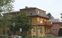 10th and Cass Streets Neighborhood Historic Districtlisted 2000
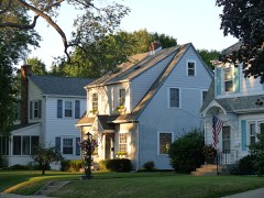 23rd and 24th Streets Historic Districtlisted 2010
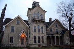 Mons Anderson Houselisted 1975
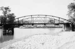 Bridge No. 4listed 1980
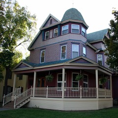 John L. Callahan Houselisted 1995
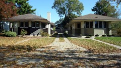 Chase, Dr. H. H., and Henry G. Wohlhuter Bungalowslisted 1983
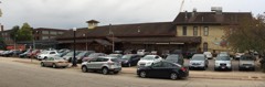 Freight Houselisted 1982
 Gund Brewing Company Bottling Workslisted 2008
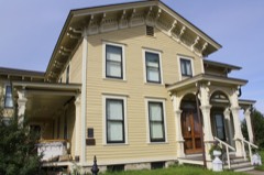 Gideon C. Hixon Houselisted 1974
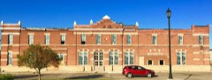 La Crosse Armorylisted 2016
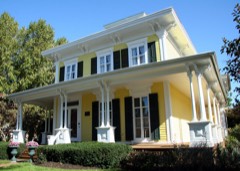 Laverty-Martindale Houselisted 1977
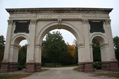 Losey Memorial Archlisted 2002
Population over time
3 figuresLa Crosse grew from 3,860 to 52,680 between 1860 and 2020. These are the recorded population figures Wikidata holds for this place, reached through the Geographic Names Information System number this page is keyed on rather than by name, so they belong to this place and not to another of the same name. Most are census counts, but not all are: an early figure may be a founding or settlement estimate, and an estimate published within five years of a census is left out. The change column is computed, and is left blank where more than 20 years separate a figure from the one before it, because a gap that long is not a change between two counts.
| Year | People | Change |
|---|---|---|
| 1860 | 3,860 | |
| 2010 | 51,320 | |
| 2020 | 52,680 | +1,360 (+3%) |
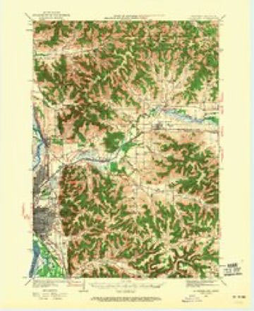
Topographic sheets covering this place
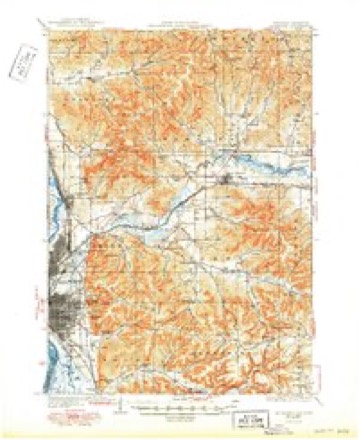
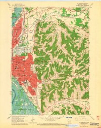
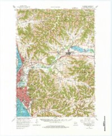
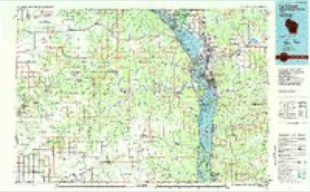
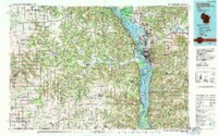
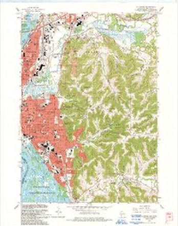
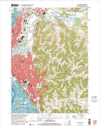
12 surveys from 18 printed sheetsMatched by testing this settlement's coordinate against the published boundary of every sheet in the United States Geological Survey's historical collection. Each opens the scanned sheet at the Survey.
- 1927 USGS La Crosse quadrangle1:62500
- 1930 USGS La Crosse quadrangle1:62500, 3 printings
- 1958 USGS La Crosse quadrangle1:250000, 2 printings
- 1961 USGS La Crosse quadrangle1:250000
- 1963 USGS La Crosse quadrangle1:24000, 2 printings
- 1963 USGS La Crosse quadrangle1:62500, 3 printings
- 1965 USGS La Crosse quadrangle1:250000
- 1976 USGS La Crosse quadrangle1:250000
- 1984 USGS La Crosse quadrangle1:100000
- 1990 USGS La Crosse quadrangle1:100000
- 1993 USGS La Crosse quadrangle1:24000
- 1998 USGS La Crosse quadrangle1:24000




What happened here
An account from the chapter on La Crosse city. The inset identifies its exact source book and publication year.
A Stikrixg Evknt
In the month of September of this year, 1847, a circumstance happened v.hich created immense excitement among the residents of La Crosse, involving the character and reputation of one citizen temporarily by the fear that he was guilty of the crime of murder, and had his suspected victim been found dead, as he was at one time likely to have been, the fate of a niui'derer would doulitless have been decreed him.
In the county-history sources
39,168 words on this townshipHistory of La Crosse County, Wisconsin : Containing an Account of Its Settlement, Growth, Development and Resources : an Extensive and Minute Sketch of Its Cities, Towns and Villages-their Improvements, Industries, Manufactories, Churches, Schools and Societies : Its War Record, Biographical Sketches, Portraits of Prominent Men and Early Settlers : the Whole Preceeded by a History of Wisconsin, Statistics of the State, and an Abstract of Its Laws and Constitution and the Constitution of the United States, published 1881 names this settlement in its chapter on La Crosse City. These are the passages that mention it, exactly as the scans read.
In the spring of 1S4G, the tide of emigration may be saiil to have turned in the direction of Noi'thcrn .Wisconsin, the chief point of attraeiion still being the lumber region of Black River, with La Crosse a desirable field for agricultural uses. JUit those who canie with a view to engage in the fornier as compared with the number who sought to engage in farming, was numerically greater. Large fortunes beckoned them to pursue the hazardous occupation of logging and lumbering in preference to the slow and laborious accumulation growin'^ out of a tilling of the soil. Cut while lumbering was remunerative, the labors to accomplish success were of the most arduous character, involving health and even life itself. Yet no one seemed disinclined to follow the devious and critical ways it led in search for -wealth, and the acquisition of means sufficient to render the toiler measurably independent was but a poor return for the dangers encountered.
The coming of those mentioned very naturally created some activity in trading and agricultural circles. The village grew in proportion, and boasted of five houses, Myiick's, Levy's, Cameron's, White's and Fetlieriein's. The farmers were James Connelly, Phillip Young, the Nagle Brothers anil a Frenchwoman who subsequently married Charles Nagle. Everything was new, of course, aiil with all it was a struggle for existence, but with each addition to the number of the inhabitants, the struggle ceased in a measure, and the charms of life appreciated - not such as are now deemed indispensable to existence, but that fraternity of feeling which makes the whole world kin, which smoothes over roagli places, which finds expansion in sympathies and rejoices at the success of a fellow-mau. Such were the charms that were experienced during the more youthful days of La Crosse, intensified by the trials each settler was obliged to encounter ami cementing a bond of brotherhood which the lapse of years has failed to dissipate.
Among those that were raisctl into prominence in ISlij, was the bowling alley erected by Myrick & Miller, near the corner of Vine and Front streets. Gambling, as a rule, was never to any extent cultivatoil in La Crosse, an'] this applies to its earlier as well as its later days. That indulged in was niostly among boatmen or Indians, both of the nomadic classes whose permanence of abode is never decided upon. The games of the former were those usual to the river and ten pins, of the latter La Crosse," or ball. and. when an opportunity was presented, those in which the pale-face excelled. The frequeut arrivals of flat-boats and rafts at La Crosse, where they stopped for supplies an^i other purposes, as also the serai-monthly arrivals of steamers, had made the village f[uite a landing-place, at which travelers, raftsmen, loggers, and the hoi polloi, were wont to resort for brief periods. This f;ict, and the further fact that there was no species of amusement to be ha<l, governed in procuring the building of the bowling alley during the summer. To supply this demand, then, it was put up and opened previous to cold weather. Some difficulty was experienced in procuring the tools " and equipments, which came from various points, and were bv no means of the mathematical e.xactness in dimensions or of as elegant finish as those which were substituted in their place years afterward. The pins were made of soft wood and architectui al extravagances, it is said, while the balls were constructed of almost any substance, the chief property of wliicli was solidity and capacity to resist damage, pine knots entering largelv into their composition. In thisold ball-alley, doubtless, many an e.xciting game was played, in which reputation for skill and large sums of money were the stakes. Whites and Indians, while the latter remained in the vicinity, were the patrons, the victors and the defeated. The old building has long since been torn away, but could its walls recount the scenes which have been witnessed within their embrace, how much could be related that would amuse and instruct.
Machine-read from a century-old scan, so expect the errors a machine makes: misspelled names, dropped words, stray characters.
Read the whole chapter on La Crosse City - it names this place 98 more 98 times.
Fires near this place
36 since 1992Regional context, not property-specific evidence. The federal wildfire occurrence database lists 36 fires within 5 miles of La Crosse between 1992 and 2020, burning about 63 acres in total. None started naturally. 4 were recorded as arson. Distance is straight-line from the map coordinates, so a fire counted here may appear on a neighbouring settlement's page as well.
| Reported cause | Fires |
|---|---|
| Missing data/not specified/undetermined | 12 |
| Debris and open burning | 8 |
| Recreation and ceremony | 6 |
| Equipment and vehicle use | 4 |
| Arson/incendiarism | 4 |
| Misuse of fire by a minor | 1 |
| Railroad operations and maintenance | 1 |
The most recent of them, most recent first, with the day each was reported and the service that recorded it.
| Date | Cause | Size | Reported by | Name on the report |
|---|---|---|---|---|
| 2 September 2019 | Debris and open burning | under an acre | Wisconsin Department of Natural Resources | 1900058 |
| 27 August 2020 | Missing data/not specified/undetermined | under an acre | Wisconsin Department of Natural Resources | 2004198 |
| 27 August 2020 | Missing data/not specified/undetermined | under an acre | Wisconsin Department of Natural Resources | 2004189 |
| 14 August 2020 | Missing data/not specified/undetermined | under an acre | Wisconsin Department of Natural Resources | 2003958 |
| 5 July 2020 | Arson/incendiarism | under an acre | Wisconsin Department of Natural Resources | 2003248 |
| 29 June 1997 | Arson/incendiarism | under an acre | Minnesota Department of Natural Resources | not named |
| 10 June 2005 | Recreation and ceremony | under an acre | Minnesota Department of Natural Resources | not named |
| 23 May 2006 | Arson/incendiarism | under an acre | Minnesota Department of Natural Resources | not named |
Settlements close enough to share some of these fires:
Mines and quarries near this place
4 within 5 milesRegional context, not property-specific evidence. The federal mineral resources record lists 4 workings within 5 miles of La Crosse: 3 past producers, 1 unknown. None of them still produces. What was taken out: Sand and Gravel, Construction, Stone, Stone, Crushed/Broken. Distance is straight-line from the map coordinates, so a quarry counted here may appear on a neighbouring settlement's page as well.
| Where | Site | Commodity | Status | Recorded |
|---|---|---|---|---|
| Kedhara Quarry | Stone, Crushed/Broken | Past Producer | ||
| La Crosse City Quarry | Stone | Unknown | ||
| La Crosse Sand Quarry | Sand and Gravel, Construction | Past Producer | ||
| Lacrosse Sand and Gravel Co. Mill | Sand and Gravel, Construction | Past Producer |
Storms near this place
60 of 171 shownRegional context, not property-specific evidence. The National Weather Service names La Crosse in 171 storm reports between 1993 and 2025: 77 thunderstorm wind, 38 flood, 33 hail, 7 flash flood. The reports record 1 injury. Each account below is quoted exactly as the forecast office filed it, from the NOAA Storm Events Database, and each date opens the federal record of that event.
| When | Event | Place named | Harm | What the report says |
|---|---|---|---|---|
| July 2003 | Thunderstorm Wind | La Crosse | 1 hurt, $2,750 | no account filed |
| May 2011 | Tornado (EF2) | La Crosse | $15,200,000 | This tornado originally began in Houston County Minnesota and crossed into La Crosse near Target Lake. The first damage occurred on Green Island where numerous mature trees were snapped off and substantial damage occurred to the Green Island ice arena. The tornado then moved into a residential area where buildings sustained partial roof removal and garages were heavily damaged. Buildings in a small industrial area near the intersection of Green Bay Street and West Ave had walls partially collapse causing the roofs to subsequently collapse and a small apartment complex had its roof cleanly removed. After this, the tornado tracked primarily through residential areas until it dissipated causing mainly tree damage and light structural damage to homes and garages. An estimated 200 homes and businesses were damaged, 9 homes were destroyed and another 6 buildings condemned and uninhabitable. An emergency shelter was set up where up to 40 people sought refuge at times with 14 spending the night. This tornado was the first to hit the city of La Crosse since 1966 when a tornado moved across the airport. Total damages were estimated to be just over $15 million. An estimated 6,300 customers lost power as a result of the tornado. There was not a single ambulance call right after the tornado, but some did occur during the following days during clean up. |
| August 2007 | Flash Flood | La Crosse | $11,900,000 | Heavy rain led to major flash flooding in the south end of the county, especially south of La Crosse. Mudslides were reported along Highways 35 and 33. There was also major street flooding and water in basements. Parts of a retaining wall washed away at the intersection of Highways 14, 61, and 35 and erosion washed away some smaller roads.||About 644 people applied for FEMA assistance. |
| August 2007 | Flash Flood | La Crosse | $1,300,000 | Up to 200 people were evacuated at Goose Island camp ground due to flash flooding and a nearby train derailment. The train derailment was due to mud and debris across the railroad tracks. |
| July 2024 | Flood | La Crosse | $540,000 | Significant rainfall throughout June pushed the Mississippi River at La Crosse into flood stage in June and continued into July. The river stage crested during the evening on July 2nd in moderate flood stage at 14.94 ft. |
| June 2008 | Flood | La Crosse | $400,000 | Heavy rains led to flooding over parts of the county, especially the southern tier where ponding of water flooded some basements and damaged secondary roads. About 60 residents applied for FEMA assistance. |
| August 2007 | Flood | La Crosse | $400,000 | Flooding continued along many creeks, streams and rivers. Law enforcement officials reported numerous roads and bridges were either washed out or still under water. All or portions of highways still closed included Highway 35 south of La Crosse and County Road GI to Goose Island Park. |
| August 2018 | Flash Flood | La Crosse | $375,000 | Runoff from heavy rains produced street flooding in various locations around the city of La Crosse. Travel in the city was severely impacted, water flowed into people's yards and lawns, and some cars became stranded in deeper intersections. |
| July 2004 | Hail | La Crosse | $350,000 | no account filed |
| July 2004 | Hail | La Crosse | $320,000 | no account filed |
| June 1998 | Thunderstorm Wind | La Crosse | $200,000 | no account filed |
| July 1995 | Thunderstorm Wind | La Crosse | $200,000 | no account filed |
| April 2013 | Hail | La Crosse | $170,000 | Quarter sized hail fell on the south side of the city of La Crosse. This hail created minor dings on almost 170 vehicles at a car dealership. |
| July 1999 | Thunderstorm Wind | La Crosse | $85,000 | no account filed |
| December 2021 | Thunderstorm Wind | La Crosse | $75,000 | Two temporary structures for the Rotary Lights display in La Crosse were destroyed. |
| June 2006 | Lightning | La Crosse | $75,000 | no account filed |
| July 2022 | Thunderstorm Wind | La Crosse | $50,000 | Several large trees were blown down across and near La Crosse. Some of the downed trees caused damage to homes and buildings. |
| August 1997 | Flash Flood | La Crosse | $50,000 | no account filed |
| August 2020 | Lightning | West La Crosse | $42,000 | A lightning strike started a fire at an apartment building in La Crosse. One unit sustained heavy fire and smoke damage as a result. |
| June 2014 | Flood | La Crosse | $40,000 | Runoff from heavy rain caused street flooding to occur in the city of La Crosse. The heavy rain also flooded the building of a local food pantry destroying some of the food that was stored in the building. |
| June 2006 | Heavy Rain | La Crosse | $40,000 | no account filed |
| June 1998 | Thunderstorm Wind | La Crosse | $40,000 | no account filed |
| August 2007 | Flash Flood | La Crosse | $30,000 | Streets flooded in the city of La Crosse and on the south side near Kwik Trip and Wal Mart. |
| August 1997 | Hail | La Crosse | $30,000 | no account filed |
| August 2021 | Flash Flood | La Crosse | $25,000 | Flash flooding occurred across the southern sections of La Crosse due to runoff from locally heavy rains. A portion of County Road NN was washed out south of Saint Joseph, a mudslide occurred along State Highway 33 in Shelby and boulders were washed into the U.S. Highway 14/61 and State Highway 35 split on the south side of La Crosse. |
| June 2014 | Thunderstorm Wind | West La Crosse | $25,000 | Several trees and power lines were blown down in the city of La Crosse causing the power to be lost for about 5,000 customers. |
| June 2014 | Thunderstorm Wind | West La Crosse | $25,000 | A large tree was blown over in the city of La Crosse, falling on top of a car and garage. |
| June 2014 | Thunderstorm Wind | West La Crosse | $25,000 | A city of La Crosse homeowner had several trees blown over. One of the larger trees fell on the house leaving several holes in the roof. |
| July 2004 | Hail | La Crosse | $25,000 | no account filed |
| June 1999 | Thunderstorm Wind | La Crosse | $25,000 | no account filed |
| March 2017 | Thunderstorm Wind | La Crosse | $23,000 | Around a dozen 1 to 2 foot diameter trees were blown down or uprooted in a cemetery and park in La Crosse. Another tree east of the cemetery went down and partially landed on a house. Trees were also blown down on the UW-La Crosse campus. |
| September 2011 | Thunderstorm Wind | La Crosse | $20,000 | Several trees and power lines were blown down in the city of La Crosse. One tree went down on an apartment building on South 33rd Street with several trees down in the vicinity of the Shelby ball fields. |
| June 1998 | Flash Flood | La Crosse | $20,000 | no account filed |
| May 2024 | Thunderstorm Wind | La Crosse | $15,000 | A National Weather Service employee reported several large tree branches down. Some fallen branches had damaged vehicles. |
| May 2019 | Flood | La Crosse | $15,000 | Flooding along the Mississippi River at La Crosse that began in March, temporarily ended in early May. |
| March 2017 | Thunderstorm Wind | La Crosse | $15,000 | A light post and business signs were blown down in downtown La Crosse. Three traffic lights with arms that stretch out over traffic were twisted and had to be repaired. Another traffic light and several street signs were blown down. |
| June 2014 | Thunderstorm Wind | La Crosse | $15,000 | A tree was blown over onto a car in the city of La Crosse. One person was inside the car at the time, but did not sustain any injuries. |
| September 2007 | Thunderstorm Wind | La Crosse | $15,000 | Power lines blown down in the city. |
| June 1998 | Thunderstorm Wind | La Crosse | $15,000 | no account filed |
| June 2014 | Thunderstorm Wind | La Crosse | $14,000 | Several trees were blown down near the University of Wisconsin - La Crosse campus and in downtown La Crosse. One of the trees landed on a car in a UW - La Crosse parking lot. |
| July 2004 | Thunderstorm Wind | La Crosse | $12,500 | no account filed |
| July 2022 | Thunderstorm Wind | West La Crosse | $10,000 | An estimated 60 mph wind gust occurred on French Island. Numerous trees were blown down on the north end of the island, prompting the Town of Campbell to close Nelson Park. |
| June 2019 | Thunderstorm Wind | West La Crosse | $10,000 | Trees and power lines were blown down in the city of La Crosse. A boat (of unknown size) was flipped over on French Island. |
| March 2017 | Thunderstorm Wind | La Crosse | $10,000 | In the city of La Crosse, a garage roof was blown off, which brought power lines down onto a house starting a fire in the house. |
| July 2017 | Thunderstorm Wind | La Crosse | $10,000 | An estimated 60 mph wind gust occurred on the east side of La Crosse that blew down some tree branches. One of the larger branches went through the roof of a house. |
| June 2014 | Lightning | West La Crosse | $10,000 | Lightning struck a power pole with the electrical surge going into a nearby house and starting a small fire in a La Crosse home. |
| September 2007 | Thunderstorm Wind | La Crosse | $10,000 | Several trees down on Eastood Drive. |
| June 1999 | Thunderstorm Wind | La Crosse | $10,000 | no account filed |
| July 2011 | Lightning | La Crosse | $8,000 | Lightning struck and caused a house to catch on fire in the city of La Crosse. The house sustained minor damage. |
| July 2004 | Hail | La Crosse | $8,000 | no account filed |
| June 2000 | Thunderstorm Wind | La Crosse | $8,000 | no account filed |
| June 1998 | Thunderstorm Wind | La Crosse | $6,000 | no account filed |
| May 2020 | Thunderstorm Wind | La Crosse | $5,000 | Trees were blown down in La Crosse. |
| June 2019 | Lightning | La Crosse | $5,000 | A lightning strike started a small house fire in La Crosse. The fire damage was limited to the basement. |
| June 2016 | Thunderstorm Wind | La Crosse | $5,000 | Several trees and branches, along with a light pole, were blown down in the city of La Crosse. The power was out in some parts of the city. |
| August 2011 | Lightning | La Crosse | $5,000 | A homeowner sustained minor injuries after lightning sparked a small garage fire. The nearby house only sustained minor smoke and water damage. |
| May 2007 | Thunderstorm Wind | West La Crosse | $5,000 | Large tree branches were blown down in addition to power lines. |
| June 2007 | Hail | West La Crosse | $5,000 | no account filed |
| June 1999 | Thunderstorm Wind | La Crosse | $5,000 | no account filed |
| June 1997 | Thunderstorm Wind | La Crosse | $5,000 | no account filed |
Nearest settlements
The eight closest, with where each one stands in the county. Distances are straight-line, computed from the Geographic Names Information System coordinates.
| Map | Place | Distance | Sheets |
|---|---|---|---|
| Herrington | 1.9 miles | 18 | |
| Grand Crossing | 3.1 miles | 18 | |
| North La Crosse | 3.1 miles | 18 | |
| West La Crosse | 3.3 miles | 14 | |
| Cold Springs | 3.5 miles | 18 | |
| Calvert | 3.7 miles | 18 | |
| Medary | 4.0 miles | 18 | |
| French Island | 4.1 miles | 14 |
Elsewhere
Matched on this settlement's Geographic Names Information System number rather than its name, so it cannot be a different place of the same name in another state.
| Wikipedia article on La Crosse | An encyclopaedic summary. Its text is share-alike, so it is linked here rather than copied. |
| Wikidata item Q936780 | The structured record the population and elevation above come from. Public domain (CC0). |
Provenance
This settlement is recorded in the Geographic Names Information System as feature 1567672. The sheet list is computed by point-in-boundary test against the United States Geological Survey's historical topographic inventory. Both are works of the United States government and carry no copyright under 17 U.S.C. 105.
Wildfire. Short, Karen C. 2022. Spatial wildfire occurrence data for the United States, 1992-2020 [FPA_FOD_20221014]. 6th Edition. Fort Collins, CO: Forest Service Research Data Archive. https://doi.org/10.2737/RDS-2013-0009.6 Collected with United States Government funding and usable without additional permissions or fees.
Mines and quarries. USGS Mineral Resources Data System (MRDS) https://mrdata.usgs.gov/mrds/ A work of the United States government, no copyright under 17 U.S.C. 105.
Storms. NOAA National Centers for Environmental Information, Storm Events Database https://www.ncei.noaa.gov/stormevents/ A work of the United States government, no copyright under 17 U.S.C. 105. Narratives are quoted verbatim from the National Weather Service report and are not edited or summarised.