 Block
Madison, Wisconsin
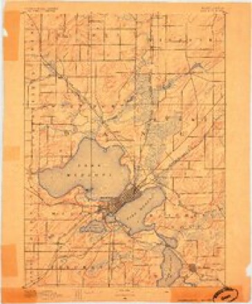
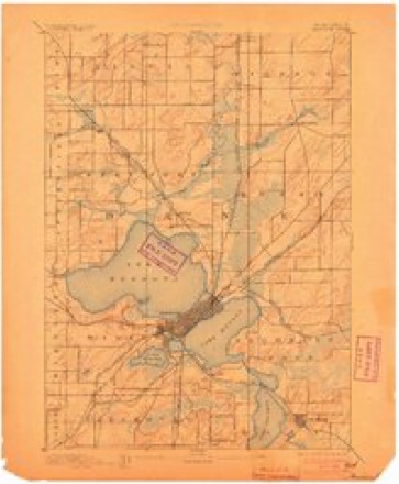
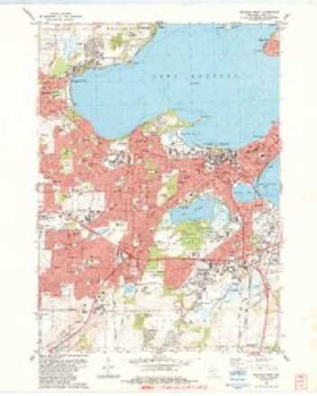
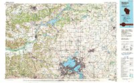
25 topographic sheets cover this place, the earliest surveyed in 1890 and the latest in 1991. It stands in Madison City. It lies in ZIP code area 53706. It lies near Bascom Hill. The Survey maps it on the Madison West quadrangle. 269,840 people lived here at the 2020 count.
Research this city
On record in Madison
Buildings and businesses the archive holds for this place. Each opens its own page, with the source record it came from.
On the National Register 12 of 141 shown
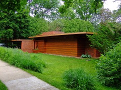 Herbert and Katherine Jacobs First HouseNational Historic Landmark · listed 2003
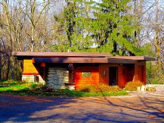 Herbert Jacobs Second HouseNational Historic Landmark · listed 1974
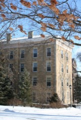 North Hall, University of WisconsinNational Historic Landmark · listed 1966
 University of Wisconsin Armory and GymnasiumNational Historic Landmark · listed 1993
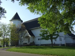 University of Wisconsin Dairy BarnNational Historic Landmark · listed 2002
 University of Wisconsin Science HallNational Historic Landmark · listed 1993
 Wisconsin State CapitolNational Historic Landmark · listed 1970
- Harold C. Bradley HouseNational Historic Landmark · listed 1972
 Agricultural Chemistry Buildinglisted 1985
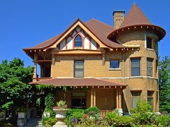 Agricultural Dean's Houselisted 1984
 Agricultural Engineering Buildinglisted 1985
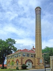 Agricultural Heating stationlisted 1985
Population over time
10 figuresMadison grew from 172 to 269,840 between 1840 and 2020. These are the recorded population figures Wikidata holds for this place, reached through the Geographic Names Information System number this page is keyed on rather than by name, so they belong to this place and not to another of the same name. Most are census counts, but not all are: an early figure may be a founding or settlement estimate, and an estimate published within five years of a census is left out. The change column is computed, and is left blank where more than 20 years separate a figure from the one before it, because a gap that long is not a change between two counts.
| Year | People | Change |
|---|---|---|
| 1840 | 172 | |
| 1850 | 1,525 | +1,353 (+787%) |
| 1860 | 6,611 | +5,086 (+334%) |
| 1870 | 9,176 | +2,565 (+39%) |
| 1880 | 10,324 | +1,148 (+13%) |
| 1890 | 13,426 | +3,102 (+30%) |
| 1900 | 19,164 | +5,738 (+43%) |
| 1910 | 25,531 | +6,367 (+33%) |
| 2010 | 233,209 | |
| 2020 | 269,840 | +36,631 (+16%) |
Topographic sheets covering this place
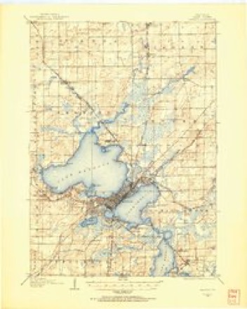
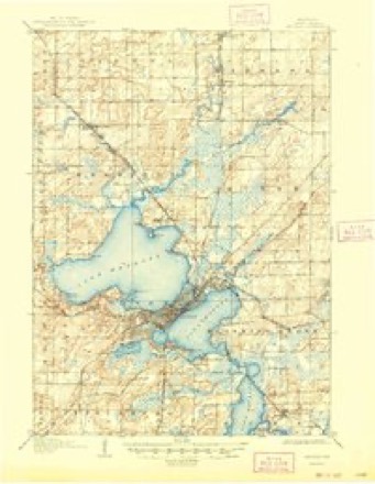
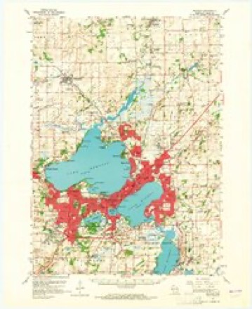
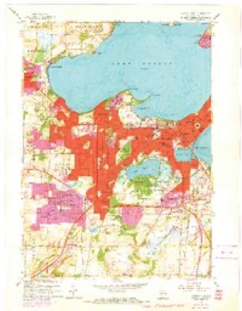
10 surveys from 25 printed sheetsMatched by testing this settlement's coordinate against the published boundary of every sheet in the United States Geological Survey's historical collection. Each opens the scanned sheet at the Survey.
- 1890 USGS Madison quadrangle1:62500
- 1892 USGS Madison quadrangle1:62500, 3 printings
- 1904 USGS Madison quadrangle1:62500
- 1906 USGS Madison quadrangle1:62500, 6 printings
- 1957 USGS Madison quadrangle1:250000, 3 printings
- 1959 USGS Madison quadrangle1:62500, 3 printings
- 1959 USGS Madison West quadrangle1:24000, 4 printings
- 1960 USGS Madison quadrangle1:250000, 2 printings
- 1983 USGS Madison West quadrangle1:24000
- 1991 USGS Madison quadrangle1:100000


What happened here
An account from the chapter on Madison city. The inset identifies its exact source book and publication year.
Chapter
Village and Town Elections 1846-49 - Water Power - Celebra¬ tion, July 4, 1846 - Public Cemetery - Dr. C. B. Chapman's and J. T. Clark's Reminiscences - Hope Lodge I. O. O. F. - Knapp's Account of Capitol Grounds - L. J. Farwell's Arrival - First Bell in Madison - Organization of Baptist Church 1847 - Trial of Gross for Murder - Growth of Village, 1848 - State Historical Society, 1849 - State University.
In the county-history sources
304,850 words on this townshipA History of Madison, the Capital of Wisconsin : Including the Four Lake Country : to July, 1874, with an Appendix of Notes on Dane County and Its Towns, published 1874 names this settlement in its chapter on Madison City. These are the passages that mention it, exactly as the scans read.
The writer is greatly indebted to many of the early settlers for the interest they have taken in the publication of this volume, and for their personal reminiscences of early times; among these may be named Mrs. Roseline Peck, of Baraboo, Wis., the first settler of that place as well as Madison; R. L. Ream, Esq., of Washingtonr D. C. ; Gen. S. Mills, of Madison; Hon. M. M. Strong, of Mineral Point, Wis. ; J. T. Clark, Esq., of Topeka, Kansas ; Dr. C. B. Chapman,. Maj. H. A. Tenney, and R. W. Lansing, Esq., of Madison. Thanks are also due to Lyman C. Draper, LL. D., Secretary of the State Historical Society, for valuable assistance. Among this number also, who took a deep interest in the enterprise, was the Hon. J ohn Catlin, one ot our most honored pioneers. This gentleman, while laboring under protracted illness, furnished much information of his early residence at Madison. While this work was passing through the press, and o*n the 4th of August, 1874, he departed this life at his residence at Elizabeth, N. J.y in the 71st year of his age, highly respected by every one.
Passage source: A History of Madison, the Capital of Wisconsin : Including the Four Lake Country : to July, 1874, with an Appendix of Notes on Dane County and Its Towns, published 1874.
Wisconsin, it is well known, was visited at an early date by the Jesuit Fathers, and a mission established at the Rapids de Pere, on the Fox river, near Green Bay, in 1669. In June, 1673, the Upper Mississippi river was discovered by Father Marquette and his companion Joliet, who passed up the Fox and down the Wisconsin rivers to the Mississippi. This was the great thoroughfare through Wisconsin for a long period but we do not find any record of explorations to the north or south of those streams, until Capt. Jona. Carver passed down the Wisconsin to the "Great Town of the Saukies, " Prairie du Sac, in October, 1766, and while at that place made an ex¬ cursion to what he calls "some mountains that lie about fifteen miles to the southward, and abound in lead ore." These moun¬ tains are now known as the " Blue Mounds."
Passage source: A History of Madison, the Capital of Wisconsin : Including the Four Lake Country : to July, 1874, with an Appendix of Notes on Dane County and Its Towns, published 1874.
The ground upon which Madison is built, was in common with most of the region included between the Mississippi and the Wisconsin and Rock rivers, purchased from the nations in 1825, at which time they relinquished all claim to lands east of the Mississippi. These Indians were reputed among the early settlers to be peculiarly faithless and savage. They seemed to have repented the surrender of their old hunting grounds, and in 1881 we find them again on the east side of the river, greatly annoying the settlers and destroying much property. They were speedily driven back, and entered into a new treaty with the United States, the terms of which were much the same as those of the treaty of 1825. The next year they again returned to the east side of the river, and shortly after took place what is usually known as the "Winnebago Outbreak," succeeded by the Black Hawk War ; after which the Indians were again and permanently removed to the west, and tranquility ensued.
Passage source: A History of Madison, the Capital of Wisconsin : Including the Four Lake Country : to July, 1874, with an Appendix of Notes on Dane County and Its Towns, published 1874.
Machine-read from a century-old scan, so expect the errors a machine makes: misspelled names, dropped words, stray characters.
Read the whole chapter on Madison City - it names this place 145 more 145 times.
Fires near this place
35 since 2007Regional context, not property-specific evidence. The federal wildfire occurrence database lists 35 fires within 5 miles of Madison between 2007 and 2020, burning about 45 acres in total. 2 started naturally. 2 were recorded as arson. Distance is straight-line from the map coordinates, so a fire counted here may appear on a neighbouring settlement's page as well.
| Reported cause | Fires |
|---|---|
| Missing data/not specified/undetermined | 24 |
| Debris and open burning | 4 |
| Arson/incendiarism | 2 |
| Natural | 2 |
| Smoking | 2 |
| Recreation and ceremony | 1 |
The most recent of them, most recent first, with the day each was reported and the service that recorded it.
| Date | Cause | Size | Reported by | Name on the report |
|---|---|---|---|---|
| 9 August 2019 | Debris and open burning | under an acre | Wisconsin Department of Natural Resources | 242 |
| 3 August 2018 | Missing data/not specified/undetermined | under an acre | Wisconsin Department of Natural Resources | 1818632 |
| 24 August 2020 | Missing data/not specified/undetermined | under an acre | Wisconsin Department of Natural Resources | 2019797 |
| 14 August 2020 | Smoking | under an acre | Wisconsin Department of Natural Resources | 2018928 |
| 26 July 2020 | Missing data/not specified/undetermined | 1.0 acres | Wisconsin Department of Natural Resources | 2017339 |
| 24 June 2018 | Missing data/not specified/undetermined | under an acre | Wisconsin Department of Natural Resources | 1815050 |
| 15 June 2020 | Smoking | 1.0 acres | Wisconsin Department of Natural Resources | 305 |
| 14 June 2020 | Missing data/not specified/undetermined | under an acre | Wisconsin Department of Natural Resources | 304 |
Settlements close enough to share some of these fires:
Mines and quarries near this place
7 within 5 milesRegional context, not property-specific evidence. The federal mineral resources record lists 7 workings within 5 miles of Madison: 3 unknowns, 3 producers, 1 past producer. 3 still produce. What was taken out: Sand and Gravel, Construction, Stone, Stone, Crushed/Broken. Distance is straight-line from the map coordinates, so a quarry counted here may appear on a neighbouring settlement's page as well.
| Where | Site | Commodity | Status | Recorded |
|---|---|---|---|---|
| Williams Quarry | Stone, Crushed/Broken | Past Producer | ||
| Fess Quarry | Stone | Unknown | ||
| John Hensen Quarry | Stone | Unknown | ||
| Blooming Grove Pit | Sand and Gravel, Construction | Producer | ||
| Engelhart Sand & Gravel Pit | Sand and Gravel, Construction | Unknown | ||
| Norway Grove Gravel Plant | Sand and Gravel, Construction | Producer | ||
| Yanggen Pit | Sand and Gravel, Construction | Producer |
Storms near this place
60 of 110 shownRegional context, not property-specific evidence. The National Weather Service names Madison in 110 storm reports between 1994 and 2026: 40 hail, 33 thunderstorm wind, 16 lightning, 8 flood. The reports record 7 injuries. Each account below is quoted exactly as the forecast office filed it, from the NOAA Storm Events Database, and each date opens the federal record of that event.
| When | Event | Place named | Harm | What the report says |
|---|---|---|---|---|
| July 1997 | Lightning | Madison | 6 hurt | An off-shoot branch of lightning struck 6 people, knocking them off their feet and causing headaches & numb fingers. |
| July 1999 | Lightning | Madison | 1 hurt | no account filed |
| July 2006 | Flash Flood | Madison | $10,000,000 | A 1-in-a-100-year flash flood occurred from the west side of Madison to around the Capitol Square after 3 to 5 inches of rain fell within a 90 minute timeframe. There were no reports of injuries or deaths. The heavy rain resulted from slow-moving and back-building thunderstorms that essentially remained nearly stationary over the city of Madison. The hilly terrain and a typical urban setting of a lot of concrete and asphalt enable the runoff water to quickly overwhelm the storm sewers and concentrate water in low-lying areas of the city. Water depths reach to the top of small vehicles - 4 to 5 feet deep in spots. Many roads became impassable due to the flood waters, and many residential homes and businesses on or near the UW-Madison campus had flooded basement and first-floor flooding. Some basement apartment units had water depths of 6 to 8 feet. Nearly all campus buildings had flooding of varying degrees of intensity, and the Camp Randall football field sustained damage. Some campus buildings had flat roofs that quickly flooded as storm drains became plugged - which allowed water to run thru the walls and ceilings of buildings. The buildings that sustained the most damage were the Memorial Union, Computer Sciences, and Veterinary Medicine. Numerous vehicles on or near the campus were damaged or totaled by the flood waters, and some were reported to be floating away. Unofficial rain gages measured 4.5 to 5 inches from just west of West High School up to the Capitol Square. WSR-88D Doppler rainfall estimates were in the 3 to 5 inch rain, therefore it appears the unofficial rain gages were very accurate. Rainfall amounts quickly fell off to 1 to 1.5 inches near the south Beltline (STH14/18/151). It is nearly impossible to assess the monetary value of the flash flood damage, therefore, the amount posted in the header strip of this event is only a ballpark estimate. |
| April 2006 | Hail | Madison | $5,550,000 | Hail size ranged from 1.25 to 3.00 inches in diameter. |
| April 2006 | Hail | Madison | $5,550,000 | Reported near the UW Campus. |
| April 2006 | Hail | Madison | $5,550,000 | no account filed |
| April 2006 | Hail | Madison | $5,550,000 | no account filed |
| April 2006 | Hail | Madison | $5,550,000 | no account filed |
| April 2006 | Hail | Madison | $5,550,000 | no account filed |
| June 1996 | Flash Flood | Madison | $4,000,000 | no account filed |
| June 2000 | Thunderstorm Wind | Madison | $200,000 | no account filed |
| May 2000 | Hail | Madison | $200,000 | no account filed |
| July 2006 | Thunderstorm Wind | Madison | $150,000 | Bricks were taken off a building in downtown Madison due to severe, hurricane-force wind gusts to an estimated 65 knots (75 mph). Dozens of power-lines were damaged. At least 3 vehicles were either damaged or destroyed by fallen trees. Many roads were blocked by the tree debris. A large tree was toppled onto a home on the near east side of Madison, resulting in minor roof damage. |
| May 2004 | Lightning | Madison | $150,000 | no account filed |
| May 1999 | Lightning | Madison | $150,000 | no account filed |
| May 1999 | Lightning | Madison | $110,000 | no account filed |
| June 2005 | Lightning | Madison | $60,000 | Lightning struck 3 condo units, causing 60,000 dollars in damage. |
| April 1994 | Thunderstorm Wind | Madison | $50,000 | no account filed |
| August 2004 | Thunderstorm Wind | Madison | $30,000 | no account filed |
| August 2002 | Thunderstorm Wind | Madison | $30,000 | no account filed |
| August 2001 | Lightning | Madison | $25,000 | Lightning struck the middle turret on the south side of the historic 1894 Red Gym on the UW-Madison campus (Dane Co). The outerbrick in a 4' by6' area was blown out, much of the inner brick crumbled, and a hole was knocked out in a ventilation duct, for a total of $25,000 in damage. |
| August 2001 | Lightning | Madison | $20,000 | The Trinity Church in Madison sustained damage when it's steeple collapsed due to a lightning fire. |
| June 1997 | Thunderstorm Wind | Madison | $20,000 | no account filed |
| July 1997 | Lightning | Madison | $15,000 | A lightning bolt struck a home and started an attic fire. |
| July 2004 | Hail | Madison | $15,000 | no account filed |
| July 1999 | Thunderstorm Wind | Madison | $15,000 | no account filed |
| July 1999 | Flash Flood | Madison | $15,000 | no account filed |
| June 2004 | Thunderstorm Wind | Madison | $10,000 | no account filed |
| July 2000 | Thunderstorm Wind | Madison | $10,000 | no account filed |
| July 1997 | Lightning | Madison | $6,000 | A Madison Gas & Electric substation sustained a direct lightning hit leaving 2800 patrons without power for 3 hours. |
| June 2022 | Thunderstorm Wind | North Madison | $5,000 | Roof damage to an apartment complex. |
| July 2006 | Thunderstorm Wind | Madison | $5,000 | Trees and power-lines down near the south Beltline. |
| April 2002 | Lightning | Madison | $5,000 | no account filed |
| April 2002 | Lightning | Madison | $5,000 | no account filed |
| June 2000 | Lightning | Madison | $5,000 | no account filed |
| July 2000 | Thunderstorm Wind | Madison | $3,000 | no account filed |
| June 1998 | Thunderstorm Wind | Madison | $3,000 | no account filed |
| May 2000 | Thunderstorm Wind | Madison | $2,000 | no account filed |
| May 1999 | Thunderstorm Wind | Madison | $2,000 | no account filed |
| June 1997 | Thunderstorm Wind | Madison | $2,000 | no account filed |
| May 1998 | Thunderstorm Wind | Madison | $1,500 | no account filed |
| June 1999 | Thunderstorm Wind | Madison | $1,000 | no account filed |
| February 1999 | Flood | Madison | $1,000 | no account filed |
| June 1998 | Lightning | Madison | $700 | no account filed |
| July 1997 | Thunderstorm Wind | Madison | $500 | no account filed |
| June 1997 | Thunderstorm Wind | Madison | $500 | no account filed |
| June 1997 | Thunderstorm Wind | Madison | $500 | no account filed |
| October 1996 | Lightning | Madison | $500 | no account filed |
| July 1997 | Lightning | Madison | $200 | Lightning struck and damaged a home 's chimney. |
| April 2026 | Funnel Cloud | North Madison | - | Trained spotter reports a funnel cloud to the south of their location in Maple Bluff. Time confirmed via radar data. |
| April 2026 | Hail | North Madison | - | Trained spotter reports 3.5 inch diameter hail east of Maple Bluff. |
| April 2026 | Hail | North Madison | - | Public report of 1 inch diameter hail east of Maple Bluff. |
| April 2026 | Hail | North Madison | - | Trained spotter reports 2.5 inch diameter hail east of Maple Bluff. |
| October 2023 | Hail | North Madison | - | Dented cars on east side of Madison. |
| July 2020 | Heavy Rain | North Madison | - | A flooded street from MATC to Covance after a quick couple inches of rain. Deeper water in low drainage areas adjacent to MATC parking lots. |
| July 2006 | Thunderstorm Wind | Madison | - | Several trees fell onto roads, blocking them. |
| July 2006 | Thunderstorm Wind | Madison | - | Trees were toppled. |
| August 2006 | Heavy Rain | Madison | - | More heavy rain of 1 to 2 inches on already saturated ground caused some minor urban flooding from around the Madison area to Cottage Grove. One car was stalled after trying to drive through flood waters. |
| July 1995 | Thunderstorm Wind | Madison | - | Scattered severe storms generated powerful winds which knocked down large trees in Cassville (Grant County), and significantly damaged a barn's roof west of Cuba City (Grant County). As another severe storm pushed through Madison (Dane County) it tore numerous large tree branches down throughout the city. Two homes sustained damage to their roofs due to fallen branches. A lightning strike started a fire which destroyed a farm shed, but no animals were hurt. Another lightning strike started a fire which partially destroyed an outbuilding north of Merton (Waukesha County). |
| November 2022 | Hail | North Madison | - | no account filed |
Nearest settlements
The eight closest, with where each one stands in the county. Distances are straight-line, computed from the Geographic Names Information System coordinates.
| Map | Place | Distance | Sheets |
|---|---|---|---|
| Preglers Addition | 0.5 miles | 25 | |
| Bowens Addition | 0.5 miles | 25 | |
| Warrens Addition | 0.7 miles | 25 | |
| Oakland Heights | 0.7 miles | 25 | |
| Greenbush Addition | 0.8 miles | 25 | |
| Wingra Park | 1.1 miles | 25 | |
| South Madison | 1.4 miles | 25 | |
| College Hills | 2.0 miles | 25 |
Elsewhere
Matched on this settlement's Geographic Names Information System number rather than its name, so it cannot be a different place of the same name in another state.
| Wikipedia article on Madison | An encyclopaedic summary. Its text is share-alike, so it is linked here rather than copied. |
| Wikidata item Q43788 | The structured record the population and elevation above come from. Public domain (CC0). |
Provenance
This settlement is recorded in the Geographic Names Information System as feature 1581834. The sheet list is computed by point-in-boundary test against the United States Geological Survey's historical topographic inventory. Both are works of the United States government and carry no copyright under 17 U.S.C. 105.
Wildfire. Short, Karen C. 2022. Spatial wildfire occurrence data for the United States, 1992-2020 [FPA_FOD_20221014]. 6th Edition. Fort Collins, CO: Forest Service Research Data Archive. https://doi.org/10.2737/RDS-2013-0009.6 Collected with United States Government funding and usable without additional permissions or fees.
Mines and quarries. USGS Mineral Resources Data System (MRDS) https://mrdata.usgs.gov/mrds/ A work of the United States government, no copyright under 17 U.S.C. 105.
Storms. NOAA National Centers for Environmental Information, Storm Events Database https://www.ncei.noaa.gov/stormevents/ A work of the United States government, no copyright under 17 U.S.C. 105. Narratives are quoted verbatim from the National Weather Service report and are not edited or summarised.