 Block
Manchester, Wisconsin
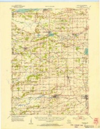
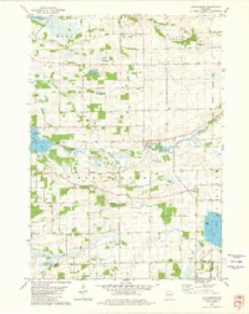
10 topographic sheets cover this place, the earliest surveyed in 1955 and the latest in 1990. It stands in Manchester town. It lies in ZIP code area 53946. The Survey maps it on the Manchester quadrangle. It stands 876 feet above sea level.
Topographic sheets covering this place
6 surveys from 10 printed sheetsMatched by testing this settlement's coordinate against the published boundary of every sheet in the United States Geological Survey's historical collection. Each opens the scanned sheet at the Survey.
- 1955 USGS Randolph quadrangle1:62500, 2 printings
- 1957 USGS Madison quadrangle1:250000, 3 printings
- 1960 USGS Madison quadrangle1:250000, 2 printings
- 1980 USGS Manchester quadrangle1:24000
- 1985 USGS Wisconsin Dells quadrangle1:100000
- 1990 USGS Wisconsin Dells quadrangle1:100000


Fires near this place
73 since 1992Regional context, not property-specific evidence. The federal wildfire occurrence database lists 73 fires within 5 miles of Manchester between 1992 and 2020, burning about 123 acres in total. 1 started naturally. 5 were recorded as arson. Distance is straight-line from the map coordinates, so a fire counted here may appear on a neighbouring settlement's page as well.
| Reported cause | Fires |
|---|---|
| Debris and open burning | 37 |
| Equipment and vehicle use | 13 |
| Missing data/not specified/undetermined | 6 |
| Arson/incendiarism | 5 |
| Power generation/transmission/distribution | 3 |
| Smoking | 3 |
| Other causes | 2 |
| Fireworks | 2 |
| Misuse of fire by a minor | 1 |
| Natural | 1 |
The most recent of them, most recent first, with the day each was reported and the service that recorded it.
| Date | Cause | Size | Reported by | Name on the report |
|---|---|---|---|---|
| 28 September 2013 | Power generation/transmission/distribution | under an acre | Wisconsin Department of Natural Resources | E433 FIRE |
| 26 September 2013 | Power generation/transmission/distribution | under an acre | Wisconsin Department of Natural Resources | CO M |
| 19 September 2004 | Equipment and vehicle use | 3.5 acres | Wisconsin Department of Natural Resources | not named |
| 17 September 1997 | Other causes | under an acre | Wisconsin Department of Natural Resources | not named |
| 13 September 1996 | Equipment and vehicle use | under an acre | Wisconsin Department of Natural Resources | not named |
| 20 August 1996 | Smoking | 4.2 acres | Wisconsin Department of Natural Resources | not named |
| 16 August 1992 | Missing data/not specified/undetermined | under an acre | Wisconsin Department of Natural Resources | not named |
| 31 July 2012 | Debris and open burning | under an acre | Wisconsin Department of Natural Resources | MELMAR DRIVE |
Settlements close enough to share some of these fires:
Mines and quarries near this place
7 within 5 milesRegional context, not property-specific evidence. The federal mineral resources record lists 7 workings within 5 miles of Manchester: 5 producers, 2 past producers. 5 still produce. What was taken out: Sand and Gravel, Construction, Stone, Crushed/Broken. Distance is straight-line from the map coordinates, so a quarry counted here may appear on a neighbouring settlement's page as well.
| Where | Site | Commodity | Status | Recorded |
|---|---|---|---|---|
| Broeder Quarry | Stone, Crushed/Broken | Producer | ||
| Gaastra Quarry | Stone, Crushed/Broken | Past Producer | ||
| Mackford Limestone Quarry | Stone, Crushed/Broken | Producer | ||
| Bernhagen Pit | Sand and Gravel, Construction | Past Producer | ||
| Broder Gettleman Nowatski Pit | Sand and Gravel, Construction | Producer | ||
| Manchester Pit | Sand and Gravel, Construction | Producer | ||
| Schulz Pit | Sand and Gravel, Construction | Producer |
Storms near this place
8 since 1996Regional context, not property-specific evidence. The National Weather Service names Manchester in 8 storm reports between 1996 and 2022: 4 tornado, 2 thunderstorm wind, 1 lightning, 1 hail. No death or injury is recorded in these reports. Each account below is quoted exactly as the forecast office filed it, from the NOAA Storm Events Database, and each date opens the federal record of that event.
| When | Event | Place named | Harm | What the report says |
|---|---|---|---|---|
| June 2004 | Tornado (F3) | Manchester | $1,410,000 | A strong tornado spun up near the intersection of STH 73 and CTH H, about 2 miles north of the village of Manchester. It increased its strength to F3 (estimated 175-200 mph) as it moved southeast across the southern part of the city of Markesan. Numerous trees were uprooted. At least 18 homes or ag-buildings had minor damage, at least 9 homes or ag-buildings had major damage, and at least 21 homes or ag-buildings were destroyed. This tornado exited Green Lake County at a point 6.4 miles southeast of Markesan, just south of Lake Maria Rd., and continued southeast through Fond du Lac County. The responsible supercell also spun up different tornadoes earlier in Adams and Marquette Counties. Newspaper headline: "A Day Like No Other." Average path width was about 350 yards. |
| July 2008 | Tornado (EF1) | Manchester | $30,000 | A brief, weak tornado spun up in a rural area southeast of Manchester, and uprooted or damage trees, pulled a roof off a pole shed, damaged the overhang and roofing of a residential home's garage, and damaged a part a small part of another home's roof. This tornado spun up just southeast of Lake Maria, and moved east-northeast across CTH O about 1/2 mile north of the county line, and then dissipated in open fields. Some corn crop was also damaged. The starting and ending lat/long pairs of numbers were: 43.63654/-88.98887 and 43.64454/-88.96897. DI#2 (FR12), DOD4. Winds were estimated at 97 mph, and the average path width was about 40 yards. |
| June 2022 | Thunderstorm Wind | Manchester | $5,000 | An area of trees and power lines down. |
| July 1996 | Lightning | Manchester | $1,000 | no account filed |
| July 2022 | Thunderstorm Wind | Manchester | - | Trained spotter estimates 60 mph winds and pea size hail. |
| April 2008 | Tornado (EF0) | Manchester | - | This tornado segment is a continuation of a long-tracked tornado that spun up east of Dekorra in Columbia County and affected the Wyocena area. It entered Green Lake County at the intersection of North County Line Road and Proscarian Road (3.78 miles south-southwest of Manchester) and tracked northeast to a point 1.85 miles southeast of Markesan on the Grand River near the southwestern intersection of CTH A and CTH S. In Green Lake County, this tornado affected only rural areas, and only intermitent tree branch damage was noted in a NWS storm survey. The beginning and ending lat-lon numbers for this tornado segment in Green Lake County were N43.63221/W89.06693 and N43.69813/W88.95858. This segment was rated EF0 on the EF-Scale, based on a DI #27, DOD2, with winds of 65 mph (58 knots). |
| June 2008 | Tornado (EF0) | Manchester | - | This weak, brief tornado lasted less than a minute and resulted in only minor tree damage. It spun up near a creek bounded by CTH S (Friesland Rd.), CTH X, and STH 73, or about 3/4 mile south of the village of Manchester. The starting and ending locations, with respect to lat/long pairs of numbers, were 43.67052/-89.03653 and 43.67038/-89.03166. Average path width was about 10 yards. DI#28 (TS), DOD2. Wind speeds estimated at about 65 knots (75 mph). |
| May 1998 | Hail | Manchester | - | no account filed |
Nearest settlements
The eight closest, with where each one stands in the county. Distances are straight-line, computed from the Geographic Names Information System coordinates.
| Map | Place | Distance | Sheets |
|---|---|---|---|
| Markesan | 3.3 miles | 8 | |
| Kingston | 4.2 miles | 10 | |
| Marquette | 6.2 miles | 10 | |
| Green Lake Terrace | 6.4 miles | 14 | |
| Greenwyck | 6.7 miles | 14 | |
| Lakewood Estates | 7.0 miles | 14 | |
| Utley | 8.0 miles | 8 | |
| Sylvan Shores | 8.0 miles | 14 |
Elsewhere
Matched on this settlement's Geographic Names Information System number rather than its name, so it cannot be a different place of the same name in another state.
| Wikipedia article on Manchester | An encyclopaedic summary. Its text is share-alike, so it is linked here rather than copied. |
| Wikidata item Q6747252 | The structured record the population and elevation above come from. Public domain (CC0). |
Provenance
This settlement is recorded in the Geographic Names Information System as feature 1568932. The sheet list is computed by point-in-boundary test against the United States Geological Survey's historical topographic inventory. Both are works of the United States government and carry no copyright under 17 U.S.C. 105.
Wildfire. Short, Karen C. 2022. Spatial wildfire occurrence data for the United States, 1992-2020 [FPA_FOD_20221014]. 6th Edition. Fort Collins, CO: Forest Service Research Data Archive. https://doi.org/10.2737/RDS-2013-0009.6 Collected with United States Government funding and usable without additional permissions or fees.
Mines and quarries. USGS Mineral Resources Data System (MRDS) https://mrdata.usgs.gov/mrds/ A work of the United States government, no copyright under 17 U.S.C. 105.
Storms. NOAA National Centers for Environmental Information, Storm Events Database https://www.ncei.noaa.gov/stormevents/ A work of the United States government, no copyright under 17 U.S.C. 105. Narratives are quoted verbatim from the National Weather Service report and are not edited or summarised.