 Block
Marshall, Wisconsin
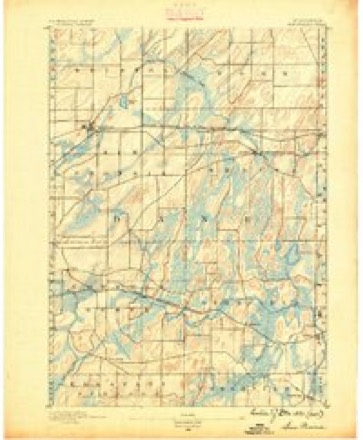
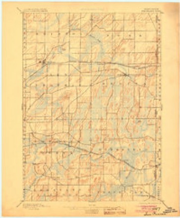
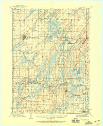
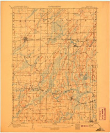
24 topographic sheets cover this place, the earliest surveyed in 1890 and the latest in 1991. It stands in Marshall Village. It lies in ZIP code area 53559. It stands on Spring Creek. The Survey maps it on the Marshall quadrangle. 3,787 people lived here at the 2020 count.
Population over time
2 figuresMarshall fell from 3,862 to 3,787 between 2010 and 2020. These are the recorded population figures Wikidata holds for this place, reached through the Geographic Names Information System number this page is keyed on rather than by name, so they belong to this place and not to another of the same name. Most are census counts, but not all are: an early figure may be a founding or settlement estimate, and an estimate published within five years of a census is left out. The change column is computed, and is left blank where more than 20 years separate a figure from the one before it, because a gap that long is not a change between two counts.
| Year | People | Change |
|---|---|---|
| 2010 | 3,862 | |
| 2020 | 3,787 | -75 (-2%) |
Topographic sheets covering this place
9 surveys from 24 printed sheetsMatched by testing this settlement's coordinate against the published boundary of every sheet in the United States Geological Survey's historical collection. Each opens the scanned sheet at the Survey.
- 1890 USGS Sun Prairie quadrangle1:62500, 2 printings
- 1896 USGS Sun Prairie quadrangle1:62500, 2 printings
- 1905 USGS Sun Prairie quadrangle1:62500
- 1907 USGS Sun Prairie quadrangle1:62500, 8 printings
- 1957 USGS Madison quadrangle1:250000, 3 printings
- 1960 USGS Madison quadrangle1:250000, 2 printings
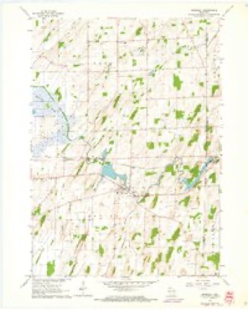
- 1962 USGS Marshall quadrangle1:24000, 3 printings
- 1962 USGS Sun Prairie quadrangle1:62500, 2 printings
- 1991 USGS Madison quadrangle1:100000


In the county-history sources
15,330 words on this townshipThe county-history sources names this settlement in its chapter on Marshall Village. These are the passages that mention it, exactly as the scans read.
Machine-read from a century-old scan, so expect the errors a machine makes: misspelled names, dropped words, stray characters.
Read the whole chapter on Marshall Village - it names this place 3 more 3 times.
Fires near this place
12 since 2018Regional context, not property-specific evidence. The federal wildfire occurrence database lists 12 fires within 5 miles of Marshall between 2018 and 2020, burning about 4 acres in total. None started naturally. 1 was recorded as arson. Distance is straight-line from the map coordinates, so a fire counted here may appear on a neighbouring settlement's page as well.
| Reported cause | Fires |
|---|---|
| Debris and open burning | 8 |
| Missing data/not specified/undetermined | 2 |
| Arson/incendiarism | 1 |
| Recreation and ceremony | 1 |
The most recent of them, most recent first, with the day each was reported and the service that recorded it.
| Date | Cause | Size | Reported by | Name on the report |
|---|---|---|---|---|
| 8 July 2019 | Debris and open burning | under an acre | Wisconsin Department of Natural Resources | 19092 |
| 13 July 2019 | Debris and open burning | under an acre | Wisconsin Department of Natural Resources | 19095 |
| 10 July 2019 | Debris and open burning | under an acre | Wisconsin Department of Natural Resources | 172 |
| 8 June 2019 | Debris and open burning | under an acre | Wisconsin Department of Natural Resources | 19079 |
| 19 May 2018 | Arson/incendiarism | 1.0 acres | Wisconsin Department of Natural Resources | 128 |
| 6 April 2020 | Recreation and ceremony | 1.0 acres | Wisconsin Department of Natural Resources | 20042 |
| 29 April 2019 | Debris and open burning | under an acre | Wisconsin Department of Natural Resources | 19063 |
| 15 April 2019 | Debris and open burning | 1.0 acres | Wisconsin Department of Natural Resources | 92 |
Settlements close enough to share some of these fires:
Mines and quarries near this place
2 within 5 milesRegional context, not property-specific evidence. The federal mineral resources record lists 2 workings within 5 miles of Marshall: 1 past producer, 1 unknown. None of them still produces. What was taken out: Stone, Crushed/Broken, Sand and Gravel, Construction. Distance is straight-line from the map coordinates, so a quarry counted here may appear on a neighbouring settlement's page as well.
| Where | Site | Commodity | Status | Recorded |
|---|---|---|---|---|
| John Hensen Quarry | Stone, Crushed/Broken | Past Producer | ||
| Marlin Shalitzly Pit | Sand and Gravel, Construction | Unknown |
Storms near this place
23 since 1995Regional context, not property-specific evidence. The National Weather Service names Marshall in 23 storm reports between 1995 and 2026: 11 hail, 8 thunderstorm wind, 1 flood, 1 lightning. No death or injury is recorded in these reports. Each account below is quoted exactly as the forecast office filed it, from the NOAA Storm Events Database, and each date opens the federal record of that event.
| When | Event | Place named | Harm | What the report says |
|---|---|---|---|---|
| June 2024 | Tornado (EF1) | Marshall | $3,000,000 | An EF-1 rated tornado developed south of Marshall near Highway 73, proceeding northwestward, damaging several farms and large areas of trees, before dissipating on the south side of Waterloo. |
| August 2006 | Lightning | Marshall | $60,000 | Twelve cows were killed by a lightning strike. |
| June 2014 | Thunderstorm Wind | Marshall | $15,000 | Some siding torn off homes and tree limbs down. |
| June 2013 | Thunderstorm Wind | Marshall | $10,000 | A trained spotter reported many large trees were blown down 7 miles north of Marshall from damaging thunderstorm wind gusts that were estimated up to 70 mph (61 knots). |
| August 2018 | Flash Flood | Marshall | $5,000 | Flash flooding of some streets in Marshall. Schlimgen Rd. near the Deansville State Wildlife Area was closed due to flooding. |
| April 2007 | Hail | Marshall | $5,000 | Hail shower lasted about 4 minutes, and resulted in slight damage (dents) to several vehicles. |
| May 2000 | Thunderstorm Wind | Marshall | $2,000 | no account filed |
| July 1997 | Thunderstorm Wind | Marshall | $1,100 | no account filed |
| July 1997 | Thunderstorm Wind | Marshall | $400 | no account filed |
| June 1997 | Thunderstorm Wind | Marshall | $300 | no account filed |
| April 2026 | Hail | Marshall | - | Trained spotter reports 2 inch diameter hail near Marshall. |
| July 2012 | Hail | Marshall | - | The public reported large hail, measured to be 1 inch in diameter, that fell 3 miles southeast of Marshall. |
| September 2011 | Thunderstorm Wind | Marshall | - | Law enforcement officers reported trees downed from severe thunderstorm wind gusts estimated at 56 knots (65 mph). |
| July 1995 | Hail | Marshall | - | Scattered severe thunderstorms developed in the morning hours on a westward moving lake breeze. Later in the day another family of severe storms moved out of Iowa into southern Wisconsin. Torrential rains, large hail, and powerful damaging winds were associated with the storms. Many large trees were toppled, some of which fell on homes and vehicles. Lightning strikes started a fire which did damage to a chimney of a historical building in Greenbush (Sheboygan County). Otherwise, powerful winds blew down large trees in both in Elkhart Lake and Plymouth (Sheboygan County). A lightning strike severely damaged a silo near the city of Darlington (Lafayette County). Hail up to three inches in diameter pounded the area around Rolling Prairie (Dodge County), which resulted in damage to area crops, cars, and the roofs/windows of several homes. A 13-year-old boy was killed by lightining in Brown Deer (Milwaukee County) while playing on a swing set. Considerable street flooding occurred in Wauwatosa (Milwaukee County) as over one inch of rain fell in 15 minutes. A gazebo was destroyed and large trees felled by powerful winds near a TV station in Brown Deer. High winds demolished and moved an eight car garage 55 feet in West Bend (Washington County). Roof shingles were torn from several homes in Waukesha (Waukesha County) as powerful winds blew down several large trees. A home in Wauwatosa (Milwaukee County) had its chimny blown knocked off by a lightning bolt. Another home in Wauwatosa sustained damage to a bathroom due to a lightning strike. Another severe storms winds brought down numerous large tree branches near Palmyra. Lightning damaged the Oak Creek (Milwaukee County) 911 computer system after hitting the police radio tower. Another lightning strike injured a 35-year-old female police officer in the village of Norway (Racine County). Powerful winds damaged a yacht club in Kenosha (Kenosha County) near the Coast Guard, and another severe storm spun a Beechcraft airplane 180 degrees as winds hit 75 mph at the Kenosha City Airport. Powerful winds pushed hay wagons onto a road east of Darlington (Lafayette County). A spotter estimated winds of 75 mph north of Elkhorn (Walworth County) as several large trees fell over. Severe storm winds blew down many large trees in the communities of Janesville, Union, Edgerton, and Lima Center, all in Rock County. Several large trees were toppled by powerful winds which hit Oregon (Dane County), while lightning struck a car in Cambridge (Dane County) and destroyed its electrical system. |
| May 2016 | Hail | Marshall | - | no account filed |
| October 2006 | Hail | Marshall | - | no account filed |
| October 2006 | Hail | Marshall | - | no account filed |
| March 2004 | Hail | Marshall | - | no account filed |
| August 2002 | Thunderstorm Wind | Marshall | - | no account filed |
| March 2000 | Hail | Marshall | - | no account filed |
| May 2000 | Hail | Marshall | - | no account filed |
| June 1999 | Flood | Marshall | - | no account filed |
| June 1995 | Hail | Marshall | - | no account filed |
Nearest settlements
The eight closest, with where each one stands in the county. Distances are straight-line, computed from the Geographic Names Information System coordinates.
| Map | Place | Distance | Sheets |
|---|---|---|---|
| Deansville | 2.1 miles | 24 | |
| Drovers Woods | 3.4 miles | 26 | |
| York Center | 4.9 miles | 24 | |
| Pierceville | 5.1 miles | 26 | |
| Old Deerfield | 5.9 miles | 23 | |
| City View Heights | 6.0 miles | 26 | |
| Burgess Corners | 6.4 miles | 26 | |
| Buss's Corners (historical) | 7.5 miles | 26 |
Elsewhere
Matched on this settlement's Geographic Names Information System number rather than its name, so it cannot be a different place of the same name in another state.
| Wikipedia article on Marshall | An encyclopaedic summary. Its text is share-alike, so it is linked here rather than copied. |
| Wikidata item Q2174753 | The structured record the population and elevation above come from. Public domain (CC0). |
Provenance
This settlement is recorded in the Geographic Names Information System as feature 1569082. The sheet list is computed by point-in-boundary test against the United States Geological Survey's historical topographic inventory. Both are works of the United States government and carry no copyright under 17 U.S.C. 105.
Wildfire. Short, Karen C. 2022. Spatial wildfire occurrence data for the United States, 1992-2020 [FPA_FOD_20221014]. 6th Edition. Fort Collins, CO: Forest Service Research Data Archive. https://doi.org/10.2737/RDS-2013-0009.6 Collected with United States Government funding and usable without additional permissions or fees.
Mines and quarries. USGS Mineral Resources Data System (MRDS) https://mrdata.usgs.gov/mrds/ A work of the United States government, no copyright under 17 U.S.C. 105.
Storms. NOAA National Centers for Environmental Information, Storm Events Database https://www.ncei.noaa.gov/stormevents/ A work of the United States government, no copyright under 17 U.S.C. 105. Narratives are quoted verbatim from the National Weather Service report and are not edited or summarised.