 Block
Menomonee Falls, Wisconsin
20 topographic sheets cover this place, the earliest surveyed in 1892 and the latest in 1991. It stands in Menomonee Falls Village. It lies in ZIP code area 53051. The Survey maps it on the Menomonee Falls quadrangle. 38,527 people lived here at the 2020 count. It stands 856 feet above sea level.
On record in Menomonee Falls
Buildings and businesses the archive holds for this place. Each opens its own page, with the source record it came from.
On the National Register 12 of 21 shown
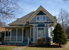 Albert R. Baer Houselisted 1988
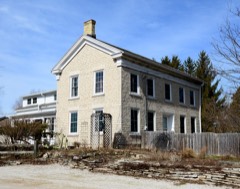 Thomas Camp Farmhouselisted 1988
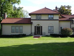 LeRoy A. Henze Houselisted 1988
 Herbert Hoeltz Houselisted 1988
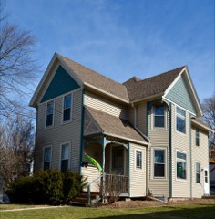 Elizabeth Hoos Houselisted 1988
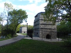 Garwin Mace Lime Kilnslisted 1982
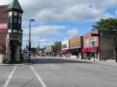 Main Street Historic Districtlisted 1988
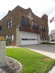 Menomonee Falls City Halllisted 1988
 Menomonee Golf Clublisted 1988
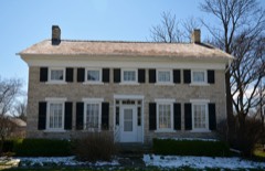 Miller-Davidson Houselisted 1973
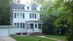 John A. Pratt Houselisted 1988
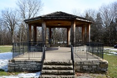 Village Park Bandstandlisted 1988
Population over time
2 figuresMenomonee Falls grew from 35,626 to 38,527 between 2010 and 2020. These are the recorded population figures Wikidata holds for this place, reached through the Geographic Names Information System number this page is keyed on rather than by name, so they belong to this place and not to another of the same name. Most are census counts, but not all are: an early figure may be a founding or settlement estimate, and an estimate published within five years of a census is left out. The change column is computed, and is left blank where more than 20 years separate a figure from the one before it, because a gap that long is not a change between two counts.
| Year | People | Change |
|---|---|---|
| 2010 | 35,626 | |
| 2020 | 38,527 | +2,901 (+8%) |
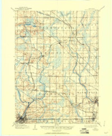
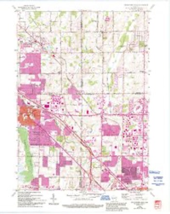
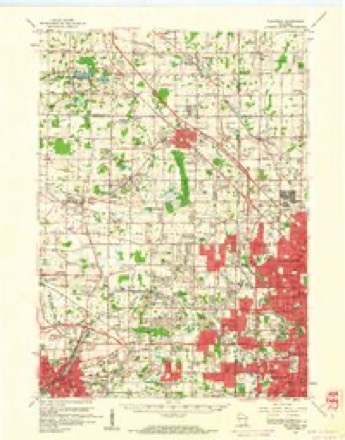
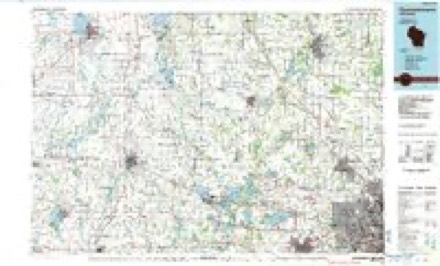
Topographic sheets covering this place
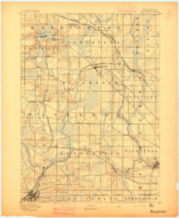
9 surveys from 20 printed sheetsMatched by testing this settlement's coordinate against the published boundary of every sheet in the United States Geological Survey's historical collection. Each opens the scanned sheet at the Survey.
- 1892 USGS Waukesha quadrangle1:62500
- 1901 USGS Waukesha quadrangle1:62500
- 1906 USGS Waukesha quadrangle1:62500, 4 printings
- 1957 USGS Madison quadrangle1:250000, 3 printings
- 1958 USGS Menomonee Falls quadrangle1:24000, 4 printings
- 1959 USGS Waukesha quadrangle1:62500, 3 printings
- 1960 USGS Madison quadrangle1:250000, 2 printings
- 1984 USGS Oconomowoc quadrangle1:100000
- 1991 USGS Oconomowoc quadrangle1:100000


Fires near this place
15 since 2012Regional context, not property-specific evidence. The federal wildfire occurrence database lists 15 fires within 5 miles of Menomonee Falls between 2012 and 2020, burning about 7 acres in total. 1 started naturally. 1 was recorded as arson. Distance is straight-line from the map coordinates, so a fire counted here may appear on a neighbouring settlement's page as well.
| Reported cause | Fires |
|---|---|
| Missing data/not specified/undetermined | 8 |
| Debris and open burning | 4 |
| Arson/incendiarism | 1 |
| Natural | 1 |
| Equipment and vehicle use | 1 |
The most recent of them, most recent first, with the day each was reported and the service that recorded it.
| Date | Cause | Size | Reported by | Name on the report |
|---|---|---|---|---|
| 9 August 2020 | Arson/incendiarism | 1.0 acres | Wisconsin Department of Natural Resources | 1768522 |
| 31 August 2012 | Natural | 1.0 acres | Wisconsin Department of Natural Resources | not named |
| 3 August 2018 | Debris and open burning | under an acre | Wisconsin Department of Natural Resources | 1801183 |
| 22 August 2020 | Missing data/not specified/undetermined | under an acre | Wisconsin Department of Natural Resources | 1772992 |
| 14 July 2020 | Missing data/not specified/undetermined | under an acre | Wisconsin Department of Natural Resources | 2002444 |
| 20 June 2020 | Debris and open burning | under an acre | Wisconsin Department of Natural Resources | 2002129 |
| 5 May 2020 | Missing data/not specified/undetermined | under an acre | Wisconsin Department of Natural Resources | 2000661 |
| 29 May 2018 | Missing data/not specified/undetermined | 1.0 acres | Wisconsin Department of Natural Resources | 1800799 |
Settlements close enough to share some of these fires:
Mines and quarries near this place
10 of 14 shownRegional context, not property-specific evidence. The federal mineral resources record lists 14 workings within 5 miles of Menomonee Falls: 7 producers, 6 past producers, 1 unknown. 7 still produce. What was taken out: Limestone, Dimension, Sand and Gravel, Construction, Stone, Crushed/Broken, Stone. Distance is straight-line from the map coordinates, so a quarry counted here may appear on a neighbouring settlement's page as well.
| Where | Site | Commodity | Status | Recorded |
|---|---|---|---|---|
| Genessee & Lannon Quarries | Stone | Unknown | ||
| Lannon Quarry | Stone, Crushed/Broken | Producer | ||
| Lannon Pit | Sand and Gravel, Construction | Past Producer | ||
| Merget Pit Number 2 | Sand and Gravel, Construction | Producer | ||
| Reimer and Sons Sand and Gravel Pit | Sand and Gravel, Construction | Past Producer | ||
| Taylor Pit | Sand and Gravel, Construction | Past Producer | ||
| Turner Sand and Gravel Taylor Pit | Sand and Gravel, Construction | Past Producer | ||
| Cawley Limestone Quarry | Limestone, Dimension | Past Producer | ||
| Halquist Stone Company Ideal Quarry | Limestone, Dimension | Producer | ||
| Lannon Quarry | Limestone, Dimension | Producer |
Storms near this place
24 since 1996Regional context, not property-specific evidence. The National Weather Service names Menomonee Falls in 24 storm reports between 1996 and 2026: 9 hail, 7 thunderstorm wind, 4 flash flood, 2 flood. The reports record 1 injury. Each account below is quoted exactly as the forecast office filed it, from the NOAA Storm Events Database, and each date opens the federal record of that event.
| When | Event | Place named | Harm | What the report says |
|---|---|---|---|---|
| August 2025 | Flash Flood | Menomonee Falls | 1 hurt, $89,000,000 | Widespread flash flooding of streets, creeks, rivers, and low lying neighborhoods and homes occurred especially in New Berlin, Brookfield, Butler, Menomonee Falls, Elm Grove, and Muskego. Some of the more notable creeks or rivers that flooded were the Fox and Menomonee Rivers and their tributaries. The Butler Ditch, Jewel Creek, Root River, and other unnamed creeks also flash flooded. For all of Waukesha County, 3 homes were classified as destroyed, 310 homes and businesses sustained major damage, 221 with minor damage and 119 with affected damage. These damages were from a variety of 1st floor flooding, basement flooding, and foundation collapse. Residential sewage backups, and raw sewage released into rivers by many municipalities were common. A small number of complete road washouts and swift water rescues occurred, in addition to dozens of people stranded in their vehicles in deep, still water in low lying areas. More specifically, a partial road washout occurred on Lily Road in Menomonee Falls due to the flash flooding of a tributary of the Menomonee River. The large collapse of a Y-shaped intersection at Campbell Dr. and Campbell Ct. in Menomonee Falls also occurred due to the flash flooding of Butler Ditch. A car was swept away at this intersection but the occupant escaped with minor injuries. 130 St. in New Berlin was partially washed out from the flash flooding of a tributary of the Root River. A swift water rescue occurred on Beres Rd. in New Berlin when a car was swept off the road by floodwaters. Dozens of people were evacuated or relocated from their flooded homes and neighborhoods. Very brief rise into moderate flood stage along the Menomonee River at Menomonee Falls between 1-1:15 AM local time August 10. |
| August 2025 | Flash Flood | Menomonee Falls | $9,000,000 | Widespread flash flooding of streets, creeks, rivers, and low lying neighborhoods and homes occurred especially in New Berlin, Brookfield, Menomonee Falls, Waukesha, Pewaukee, Merton, and Muskego. Some of the more notable creeks or rivers that flooded were the Fox River, Jewel Creek, and their tributaries, as well as some lake flooding. Some flood damage occurred to homes especially near Linnie Lac Lake toward Little Muskego Lake. These damages were from a variety of 1st floor flooding, basement flooding, and foundation collapse. Residential sewage backups, and raw sewage released into rivers by many municipalities were common. A small number of complete road washouts and swift water rescues occurred, in addition to dozens of people stranded in their vehicles in deep, still water in low lying areas. More specifically, one lane of Gold Dr. washed out due to the flash flooding of Jewel Creek in Muskego. Large sections of Barker Road in Brookfield and other nearby roads were closed due to the flash flooding of the Fox River, including the Fox River overtopping the Barker Rd. bridge. Dozens of people were evacuated or relocated from their flooded homes and neighborhoods, which included the Deer Path Subdivision near Minooka Park. A sidewall of the Merton Millpond Dam was damaged but quickly repaired. Many other dams in eastern Waukesha County were at or exceeding their maximum flow capacity, but no dam failures occurred. |
| June 1997 | Flash Flood | Menomonee Falls | $5,380,000 | no account filed |
| April 2006 | Hail | Menomonee Falls | $4,440,000 | Hail sized ranged from 1.00 to 2.75 inches in diameter. |
| July 2010 | Flash Flood | Menomonee Falls | $2,900,000 | Thunderstorms training over the region produced 4 to 7 inches of rain over Waukesha County. While many sections of the county experienced flash flooding, the north and northeast sections were hardest hit, with numerous roads flooded and basements flooded in Brookfield, Menomonee Falls and Sussex. A trained spotter reported 4 inches of rain in one hour in Menomonee Falls where the heavy rains caused a sink hole to form on Campbell Drive. Rushing water flooded roads in Delafield near U.S. Highway 18, closed STH 59 at STH 164 south of Waukesha, and covered sections of CTH Z, west of Eagle in western Waukesha County. Flooded roads were also reported in Muskego, New Berlin and Oconomowoc. |
| August 2025 | Flood | Menomonee Falls | $1,000,000 | Widespread flooding of streets, creeks, rivers, and low lying neighborhoods and homes continued over the eastern half of the county and was aggravated by additional showers and storms. The greatest concentration of flooding was in New Berlin, Brookfield, Butler, Menomonee Falls, Waukesha, Pewaukee, Merton, and Muskego. Some of the more notable creeks or rivers that flooded were the Fox River, Menomonee River, Jewel Creek, Butler Ditch, Root River, and their tributaries, as well as some lake flooding. Some flood damage occurred to homes especially near Linnie Lac toward Little Muskego Lake. These damages were from a variety of 1st floor flooding, basement flooding, and foundation collapse. Residential sewage backups, and raw sewage released into rivers by many municipalities were common. A small number of complete road washouts and swift water rescues occurred, in addition to dozens of people stranded in their vehicles in deep, still water in low lying areas. More specifically, one lane of Gold Dr. washed out due to the flash flooding of Jewel Creek in Muskego. Large sections of Barker Road in Brookfield and other nearby roads were closed due to the flash flooding of the Fox River, including the Fox River overtopping the Barker Rd. bridge. A partial road washout occurred on Lily Road in Menomonee Falls due to the flash flooding of a tributary of the Menomonee River. The large collapse of a Y-shaped intersection at Campbell Dr. and Campbell Ct. in Menomonee Falls also occurred due to the flash flooding of Butler Ditch. 130 St. in New Berlin was partially washed out from the flash flooding of a tributary of the Root River. Dozens of people were evacuated or relocated from their flooded homes and neighborhoods, which included the Deer Path Subdivision near Minooka Park and homes near Linnie Lac. A sidewall of the Merton Millpond Dam was damaged but quickly repaired. Many other dams in eastern Waukesha County were at or exceeding their maximum flow capacity, but no dam failures occurred. River flooding along the Lower Fox River in Waukesha peaks during the evening of August 11, with a 8.62 foot crest in moderate flood stage occurring at 5:15 PM local time. Moderate river flooding continues along Lower Fox River in Waukesha through the morning hours of August 13. In moderate flood stage, water from the Lower Fox River approaches the base of the Bastow St and Bank St Bridges in downtown Waukesha, in addition to some homes in the Bethesda Court area about one half mile south of downtown Waukesha. Water also inundates the Frame Park area, with waters at least 3 feet deep on land near the shoreline of the Lower Fox River. Water approaches Corrina Blvd and Union St to the south of downtown Waukesha. |
| May 2016 | Thunderstorm Wind | Menomonee Falls | $51,000 | Three apartment buildings suffered shingle and gutter damage. A tree was snapped. |
| August 1996 | Lightning | Menomonee Falls | $25,000 | no account filed |
| June 2019 | Thunderstorm Wind | Menomonee Falls | $7,000 | Scattered trees and power lines down across the area. |
| May 2024 | Thunderstorm Wind | Menomonee Falls | $6,000 | Several reports of trees, limbs and power lines down. |
| June 2007 | Thunderstorm Wind | Menomonee Falls | $2,000 | Powerful thunderstorm winds toppled large trees. Estimated wind gusts were on the order of 52 knots (60 mph). |
| July 2018 | Thunderstorm Wind | Menomonee Falls | $1,000 | Large tree down. |
| July 2018 | Thunderstorm Wind | Menomonee Falls | $1,000 | Branches onto power lines. |
| June 2014 | Thunderstorm Wind | Menomonee Falls | $1,000 | Sixteen inch diameter tree knocked down onto highway 145. |
| April 2026 | Hail | Menomonee Falls | - | Trained spotter reports 2 inch diameter hail northeast of Menomonee Falls. |
| April 2026 | Hail | Menomonee Falls | - | Public report of 1.25 inch diameter hail near Menomonee Falls. |
| April 2026 | Hail | Menomonee Falls | - | Public report of 1 inch diameter hail northeast of Menomonee Falls. |
| February 2024 | Hail | Menomonee Falls | - | no account filed |
| September 2021 | Hail | Menomonee Falls | - | no account filed |
| March 2007 | Hail | Menomonee Falls | - | no account filed |
| May 2004 | Funnel Cloud | Menomonee Falls | - | no account filed |
| May 2004 | Hail | Menomonee Falls | - | no account filed |
| June 2002 | Flood | Menomonee Falls | - | no account filed |
| May 2000 | Hail | Menomonee Falls | - | no account filed |
Nearest settlements
The eight closest, with where each one stands in the county. Distances are straight-line, computed from the Geographic Names Information System coordinates.
Elsewhere
Matched on this settlement's Geographic Names Information System number rather than its name, so it cannot be a different place of the same name in another state.
| Wikipedia article on Menomonee Falls | An encyclopaedic summary. Its text is share-alike, so it is linked here rather than copied. |
| Wikidata item Q1787576 | The structured record the population and elevation above come from. Public domain (CC0). |
Provenance
This settlement is recorded in the Geographic Names Information System as feature 1569346. The sheet list is computed by point-in-boundary test against the United States Geological Survey's historical topographic inventory. Both are works of the United States government and carry no copyright under 17 U.S.C. 105.
Wildfire. Short, Karen C. 2022. Spatial wildfire occurrence data for the United States, 1992-2020 [FPA_FOD_20221014]. 6th Edition. Fort Collins, CO: Forest Service Research Data Archive. https://doi.org/10.2737/RDS-2013-0009.6 Collected with United States Government funding and usable without additional permissions or fees.
Mines and quarries. USGS Mineral Resources Data System (MRDS) https://mrdata.usgs.gov/mrds/ A work of the United States government, no copyright under 17 U.S.C. 105.
Storms. NOAA National Centers for Environmental Information, Storm Events Database https://www.ncei.noaa.gov/stormevents/ A work of the United States government, no copyright under 17 U.S.C. 105. Narratives are quoted verbatim from the National Weather Service report and are not edited or summarised.