 Block
Plymouth, Wisconsin
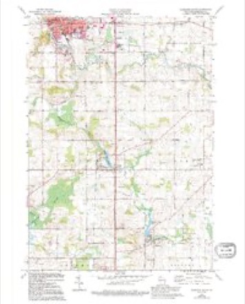
9 topographic sheets cover this place, the earliest surveyed in 1954 and the latest in 1989. It stands in Plymouth City. It lies in ZIP code area 53073. It stands on Jackson Creek. The Survey maps it on the Plymouth South quadrangle. 8,932 people lived here at the 2020 count. It stands 843 feet above sea level.
Research this city
On record in Plymouth
Buildings and businesses the archive holds for this place. Each opens its own page, with the source record it came from.
On the National Register 6 records
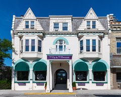 Hotel Laacklisted 1985
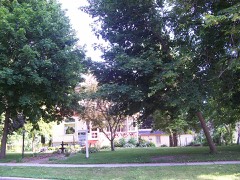 Henry H. Huson House and Water Towerlisted 1980
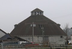 Lueder, Rudolph, 13 Sided Barnlisted 2016
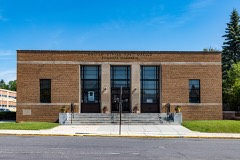 Plymouth Post Officelisted 2000
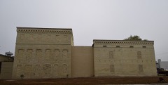 S and R Cheese Companylisted 2017
- Downtown Plymouth Historic Districtlisted 2016
Population over time
2 figuresPlymouth grew from 8,445 to 8,932 between 2010 and 2020. These are the recorded population figures Wikidata holds for this place, reached through the Geographic Names Information System number this page is keyed on rather than by name, so they belong to this place and not to another of the same name. Most are census counts, but not all are: an early figure may be a founding or settlement estimate, and an estimate published within five years of a census is left out. The change column is computed, and is left blank where more than 20 years separate a figure from the one before it, because a gap that long is not a change between two counts.
| Year | People | Change |
|---|---|---|
| 2010 | 8,445 | |
| 2020 | 8,932 | +487 (+6%) |
Topographic sheets covering this place
5 surveys from 9 printed sheetsMatched by testing this settlement's coordinate against the published boundary of every sheet in the United States Geological Survey's historical collection. Each opens the scanned sheet at the Survey.
- 1954 USGS Milwaukee quadrangle1:250000, 3 printings
- 1954 USGS Sheboygan Falls quadrangle1:62500, 2 printings
- 1958 USGS Milwaukee quadrangle1:250000
- 1974 USGS Plymouth South quadrangle1:24000, 2 printings
- 1989 USGS Sheboygan quadrangle1:100000
In the county-history sources
35,843 words on this townshipHistory of Sheboygan County, Wisconsin, Past and Present, published 1912 names this settlement in its chapter on Plymouth City. These are the passages that mention it, exactly as the scans read.
Plymouth town was surveyed in 1835 by United States Engineers Mullet, Brincke and King, and the river which flows through the town, the Mullet, a branch of the Sheboygan river, was named after the first named engineer. It was called by the Indians, Ta-quit-qui-oc (crooked river). The town is in the second tier from the north and is bounded on the north by Rhine, on the east by Sheboygan Falls, the south by Lyndon, and the west by Greenbush towns. It is well watered by the Mullet river and several smaller streams. The first land sold to private parties in the present town of Plymouth was a portion of section i, to John Law, of London, England, August 13, 1836. The next entry was on the 23d of August, 1836, by Thomas Margrave, of London, on section 5. Other aliens also held titles to land in the town about this time.
Passage source: History of Sheboygan County, Wisconsin, Past and Present, published 1912.
The town of Plymouth then comprising Rhine and Plymouth towns, was organized April 3, 1849. At the town meeting held on that date at the home of John W. Taylor, Daniel Hyatt was chosen temporary chairman, L. A. Babcock, clerk, and Albert Walton and Henry P. Davidson, trustees. There were then elected the following officers: Supervisors, Elon W. Baldwin, Daniel Hyatt and Francis Krackenberger ; clerk, James Cleveland; assessors, Adonijah Carter and Valentine Bub; superintendent of schools, Franklin Bond; treasurer, Hiram Bishop; justices of the peace, J. F. Moore, Erastus C. Sessions, Henry Giffin and Julius Wolff; constables, Samuel C. Jerome, S. D. Wilson and Augustus Bettlehauser ; sealer of weights and measures, Daniel Weary. The whole number of votes cast at the election was ninety.
Passage source: History of Sheboygan County, Wisconsin, Past and Present, published 1912.
The geographical center of the county is within this town in section 36. The eastern part of the town is gently undulating, is highly productive and the farms are among the finest in the county. The western part is more hilly, as here is located a range of the Potash Kettle hills. Notwithstanding this there are many good farms in this locality. The town of Plymouth is unsurpassed by any in the county for the variety and quality of rich productions. Its cheese factories have a world wide reputation.
Passage source: History of Sheboygan County, Wisconsin, Past and Present, published 1912.
Machine-read from a century-old scan, so expect the errors a machine makes: misspelled names, dropped words, stray characters.
Read the whole chapter on Plymouth City - it names this place 34 more 34 times.
Fires near this place
25 since 2012Regional context, not property-specific evidence. The federal wildfire occurrence database lists 25 fires within 5 miles of Plymouth between 2012 and 2020, burning about 12 acres in total. None started naturally. 3 were recorded as arson. Distance is straight-line from the map coordinates, so a fire counted here may appear on a neighbouring settlement's page as well.
| Reported cause | Fires |
|---|---|
| Debris and open burning | 12 |
| Missing data/not specified/undetermined | 5 |
| Smoking | 3 |
| Arson/incendiarism | 3 |
| Equipment and vehicle use | 1 |
| Recreation and ceremony | 1 |
The most recent of them, most recent first, with the day each was reported and the service that recorded it.
| Date | Cause | Size | Reported by | Name on the report |
|---|---|---|---|---|
| 15 September 2019 | Arson/incendiarism | under an acre | Wisconsin Department of Natural Resources | 352 |
| 4 August 2018 | Smoking | under an acre | Wisconsin Department of Natural Resources | 251 |
| 29 July 2018 | Debris and open burning | under an acre | Wisconsin Department of Natural Resources | 240 |
| 21 July 2012 | Debris and open burning | under an acre | Wisconsin Department of Natural Resources | GLENBEULAH |
| 10 July 2018 | Equipment and vehicle use | under an acre | Wisconsin Department of Natural Resources | 214 |
| 23 June 2018 | Arson/incendiarism | under an acre | Wisconsin Department of Natural Resources | 189 |
| 16 June 2020 | Missing data/not specified/undetermined | under an acre | Wisconsin Department of Natural Resources | 156 |
| 15 June 2019 | Arson/incendiarism | under an acre | Wisconsin Department of Natural Resources | 193 |
Settlements close enough to share some of these fires:
Mines and quarries near this place
6 within 5 milesRegional context, not property-specific evidence. The federal mineral resources record lists 6 workings within 5 miles of Plymouth: 4 producers, 2 past producers. 4 still produce. What was taken out: Sand and Gravel, Construction, Stone, Crushed/Broken. Distance is straight-line from the map coordinates, so a quarry counted here may appear on a neighbouring settlement's page as well.
| Where | Site | Commodity | Status | Recorded |
|---|---|---|---|---|
| Sheboygan County Agricultural Dept | Stone, Crushed/Broken | Producer | ||
| Bucholz Pit | Sand and Gravel, Construction | Past Producer | ||
| Crystal Lake Crushed Stone Quarry | Sand and Gravel, Construction | Producer | ||
| Jens Pit | Sand and Gravel, Construction | Producer | ||
| Jones Pit | Sand and Gravel, Construction | Past Producer | ||
| Northwest Area Operations | Sand and Gravel, Construction | Producer |
Storms near this place
32 since 1995Regional context, not property-specific evidence. The National Weather Service names Plymouth in 32 storm reports between 1995 and 2024: 13 thunderstorm wind, 8 hail, 7 lightning, 2 flash flood. The reports record 2 injuries. Each account below is quoted exactly as the forecast office filed it, from the NOAA Storm Events Database, and each date opens the federal record of that event.
| When | Event | Place named | Harm | What the report says |
|---|---|---|---|---|
| June 1999 | Lightning | Plymouth | 2 hurt | no account filed |
| June 2008 | Flash Flood | Plymouth | $150,000 | Heavy rains resulted in flash flooding around Plymouth and south to the county line. Water depths on road surfaces reached 3 feet or more and there were gravel washouts. Some farm fields remained flooded into early July. The breakdown for residential home losses were: 20 minimally affected, and 20 with minor damage (total of $50 thousand for home losses). There were no business losses. Crop losses were estimated at $200 thousand. Public sector damage was about $100 thousand. A couple roads and bridges sustained damage. |
| June 2020 | Thunderstorm Wind | Plymouth | $30,000 | A barn was toppled by strong winds. |
| August 2000 | Flash Flood | Plymouth | $30,000 | no account filed |
| September 1999 | Lightning | Plymouth | $25,000 | no account filed |
| July 1996 | Thunderstorm Wind | Plymouth | $20,000 | no account filed |
| July 2010 | Lightning | Plymouth | $10,000 | A lightning strike to a power pole near Plymouth destroyed insulators and damaged wire conductors, knocking out power to about 500 customers. Power was off to these customers for around 45 minutes. |
| June 2017 | Thunderstorm Wind | Plymouth | $5,000 | Several power poles knocked down. |
| June 2017 | Thunderstorm Wind | Plymouth | $5,000 | Tractor trailer overturned by straight-line winds. |
| May 2010 | Lightning | Plymouth | $5,000 | Lightning stuck an underground power cable in the 300 block of N. Highland Ave. in Plymouth. About 300 customers lost power for about 2.5 hours. |
| September 2004 | Thunderstorm Wind | Plymouth | $5,000 | no account filed |
| August 2002 | Lightning | Plymouth | $5,000 | no account filed |
| June 1997 | Thunderstorm Wind | Plymouth | $5,000 | no account filed |
| June 2017 | Thunderstorm Wind | Plymouth | $3,000 | Several trees down. |
| April 2011 | Lightning | Plymouth | $3,000 | Lightning struck a utility pole, destroying an insulator and caused an electrical wire to break and fall to the ground. 500 homes and businesses were left without power on the east side of Plymouth, until repairs were made and all power was restored around 915 pm CDT. |
| June 2024 | Thunderstorm Wind | Plymouth | $2,000 | Uprooted tree fell onto a fence. Photo provided. |
| August 2017 | Thunderstorm Wind | Plymouth | $2,000 | Several trees down. |
| September 1997 | Lightning | Plymouth | $2,000 | no account filed |
| August 2014 | Thunderstorm Wind | Plymouth | $1,000 | Several trees knocked down by straight line winds of a bow echo. Power was knocked out in some parts of Plymouth. |
| July 1997 | Flood | Plymouth | $700 | no account filed |
| August 2021 | Thunderstorm Wind | Plymouth | - | Wind gust of 63 mph measured at the Sheboygan County Memorial Airport ASOS. Reports of tree damage around Plymouth into Sheboygan as well. |
| April 2017 | Hail | Plymouth | - | A strong thunderstorm produced 1 inch hail. |
| March 2017 | Hail | Plymouth | - | no account filed |
| June 2017 | Hail | Plymouth | - | no account filed |
| July 2016 | Hail | Plymouth | - | no account filed |
| July 2014 | Hail | Plymouth | - | no account filed |
| May 2006 | Hail | Plymouth | - | no account filed |
| September 2005 | Thunderstorm Wind | Plymouth | - | no account filed |
| May 2004 | Hail | Plymouth | - | no account filed |
| August 2003 | Funnel Cloud | Plymouth | - | no account filed |
| April 2002 | Hail | Plymouth | - | no account filed |
| July 1995 | Thunderstorm Wind | Plymouth | - | no account filed |
Nearest settlements
The eight closest, with where each one stands in the county. Distances are straight-line, computed from the Geographic Names Information System coordinates.
| Map | Place | Distance | Sheets |
|---|---|---|---|
| New Paris | 1.1 miles | 9 | |
| Plymouth Country View Estates | 1.9 miles | 9 | |
| Johnsonville | 5.0 miles | 10 | |
| Glenbeulah | 5.0 miles | 10 | |
| Waldo | 5.3 miles | 9 | |
| Greenbush | 6.0 miles | 10 | |
| Elkhart Lake | 6.2 miles | 10 | |
| Cascade | 6.4 miles | 12 |
Elsewhere
Matched on this settlement's Geographic Names Information System number rather than its name, so it cannot be a different place of the same name in another state.
| Wikipedia article on Plymouth | An encyclopaedic summary. Its text is share-alike, so it is linked here rather than copied. |
| Wikidata item Q1570359 | The structured record the population and elevation above come from. Public domain (CC0). |
Provenance
This settlement is recorded in the Geographic Names Information System as feature 1571709. The sheet list is computed by point-in-boundary test against the United States Geological Survey's historical topographic inventory. Both are works of the United States government and carry no copyright under 17 U.S.C. 105.
Wildfire. Short, Karen C. 2022. Spatial wildfire occurrence data for the United States, 1992-2020 [FPA_FOD_20221014]. 6th Edition. Fort Collins, CO: Forest Service Research Data Archive. https://doi.org/10.2737/RDS-2013-0009.6 Collected with United States Government funding and usable without additional permissions or fees.
Mines and quarries. USGS Mineral Resources Data System (MRDS) https://mrdata.usgs.gov/mrds/ A work of the United States government, no copyright under 17 U.S.C. 105.
Storms. NOAA National Centers for Environmental Information, Storm Events Database https://www.ncei.noaa.gov/stormevents/ A work of the United States government, no copyright under 17 U.S.C. 105. Narratives are quoted verbatim from the National Weather Service report and are not edited or summarised.