 Block
Sauk City, Wisconsin
22 topographic sheets cover this place, the earliest surveyed in 1895 and the latest in 1991. It stands in Sauk City Village. It lies in ZIP code area 53583. The Survey maps it on the Sauk City quadrangle. 3,518 people lived here at the 2020 count. It stands 741 feet above sea level.
On record in Sauk City
Buildings and businesses the archive holds for this place. Each opens its own page, with the source record it came from.
On the National Register 6 records
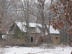 August W. Derleth Houselisted 1991
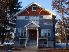 Freethinkers` Halllisted 1988
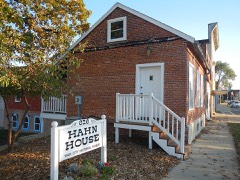 Otto Sr. and Lisette Hahn Houselisted 2012
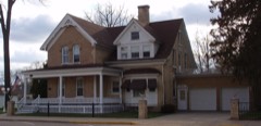 Lachmund Family Houselisted 2000
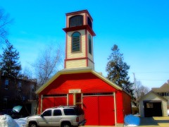 Sauk City Fire Stationlisted 1999
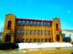 Sauk City High Schoollisted 1989
Population over time
2 figuresSauk City grew from 3,410 to 3,518 between 2010 and 2020. These are the recorded population figures Wikidata holds for this place, reached through the Geographic Names Information System number this page is keyed on rather than by name, so they belong to this place and not to another of the same name. Most are census counts, but not all are: an early figure may be a founding or settlement estimate, and an estimate published within five years of a census is left out. The change column is computed, and is left blank where more than 20 years separate a figure from the one before it, because a gap that long is not a change between two counts.
| Year | People | Change |
|---|---|---|
| 2010 | 3,410 | |
| 2020 | 3,518 | +108 (+3%) |
Topographic sheets covering this place
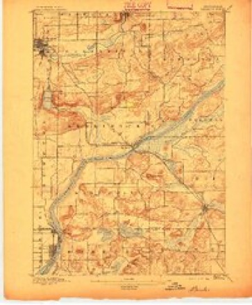
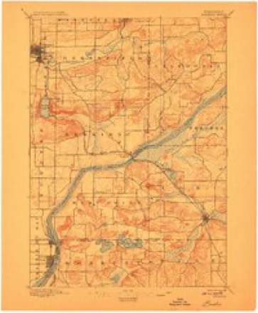
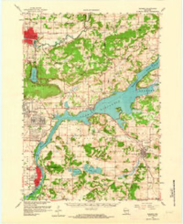
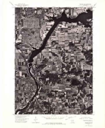
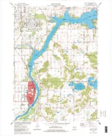
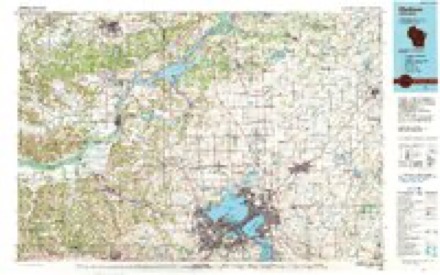
8 surveys from 22 printed sheetsMatched by testing this settlement's coordinate against the published boundary of every sheet in the United States Geological Survey's historical collection. Each opens the scanned sheet at the Survey.
- 1895 USGS Baraboo quadrangle1:62500, 9 printings
- 1908 USGS Baraboo quadrangle1:62500
- 1957 USGS Madison quadrangle1:250000, 3 printings
- 1959 USGS Baraboo quadrangle1:62500, 4 printings
- 1960 USGS Madison quadrangle1:250000, 2 printings
- 1974 USGS Baraboo SW quadrangle1:24000
- 1975 USGS Sauk City quadrangle1:24000
- 1991 USGS Madison quadrangle1:100000


In the county-history sources
28,526 words on this townshipA Standard History of Sauk County, Wisconsin, published 1918 names this settlement in its chapter on Sauk City Village. These are the passages that mention it, exactly as the scans read.
Black Hawk - Discontinued postoffice in the Town of Troy named for the Indian Chief, Black Hawk, leader of the Indians in the Black Hawk war. After the battle near Sauk City the Indians fled through the wilderness near where the hamlet is located.
Passage source: A Standard History of Sauk County, Wisconsin, published 1918.
Sauk City - Village first called Harszthy for Count Augustine Harszthy, one of the founders. The name was difficult to remember so it was changed to Westfield, but as the word city, when attached to names of places, was popular then,' it was later called Sauk City, after the name of the county.
Passage source: A Standard History of Sauk County, Wisconsin, published 1918.
The first meeting of the Old Settlers' Association of Sauk County was held June 20, 1872, in the grove near William Johnson's (Uncle Billy's) house, in the Town of Sumpter. In the following, its officers, well represented some of the best known pioneers then living: President, Charles Halasz, Sauk City; vice presidents, Cyrus Hill, Columbia County; William Johnson, Sumpter; J. Hatch, Baraboo; A. Hill, Prairie du Sac; Marvin Blake, Town of Baraboo ; J. Thilke, Town of Prairie du Sac; Enos Kimball, Freedom; secretary, William H. Canfield. Its members, who numbered more than 140, had settled in territorial times, previous to 1849. Archibald Barker, who came in June, 1837, the first of the living pioneers, gave place, in the estimation of some of the members, to Jonathan Hatch, the oldest actual settler then living in Sauk County. Uncle Billy Johnson came only a few months after Mr. Hatch.
Passage source: A Standard History of Sauk County, Wisconsin, published 1918.
Machine-read from a century-old scan, so expect the errors a machine makes: misspelled names, dropped words, stray characters.
Read the whole chapter on Sauk City Village - it names this place 10 more 10 times.
Fires near this place
127 since 1992Regional context, not property-specific evidence. The federal wildfire occurrence database lists 127 fires within 5 miles of Sauk City between 1992 and 2020, burning about 389 acres in total. None started naturally. 4 were recorded as arson. Distance is straight-line from the map coordinates, so a fire counted here may appear on a neighbouring settlement's page as well.
| Reported cause | Fires |
|---|---|
| Debris and open burning | 49 |
| Equipment and vehicle use | 35 |
| Missing data/not specified/undetermined | 15 |
| Recreation and ceremony | 8 |
| Power generation/transmission/distribution | 5 |
| Arson/incendiarism | 4 |
| Smoking | 4 |
| Misuse of fire by a minor | 4 |
| Other causes | 2 |
| Railroad operations and maintenance | 1 |
The most recent of them, most recent first, with the day each was reported and the service that recorded it.
| Date | Cause | Size | Reported by | Name on the report |
|---|---|---|---|---|
| 5 September 2005 | Missing data/not specified/undetermined | under an acre | Wisconsin Department of Natural Resources | not named |
| 29 September 2012 | Recreation and ceremony | under an acre | Wisconsin Department of Natural Resources | TRUSSEL SMOKE |
| 6 August 2012 | Debris and open burning | under an acre | Wisconsin Department of Natural Resources | FITZGERALD YARD |
| 5 August 2012 | Recreation and ceremony | under an acre | Wisconsin Department of Natural Resources | SNUFFYS |
| 27 August 2020 | Equipment and vehicle use | under an acre | Wisconsin Department of Natural Resources | BREUNIG RD |
| 26 August 2020 | Debris and open burning | 1.9 acres | Wisconsin Department of Natural Resources | MAGAZINE UNIT |
| 24 August 2010 | Debris and open burning | under an acre | Wisconsin Department of Natural Resources | MATCH BAG |
| 24 July 2008 | Recreation and ceremony | 4.8 acres | Wisconsin Department of Natural Resources | not named |
Settlements close enough to share some of these fires:
Mines and quarries near this place
2 within 5 milesRegional context, not property-specific evidence. The federal mineral resources record lists 2 workings within 5 miles of Sauk City: 2 producers. All of them still produce. What was taken out: Sand and Gravel, Construction, Stone, Crushed/Broken. Distance is straight-line from the map coordinates, so a quarry counted here may appear on a neighbouring settlement's page as well.
| Where | Site | Commodity | Status | Recorded |
|---|---|---|---|---|
| Matousek Quarry | Stone, Crushed/Broken | Producer | ||
| Pulvermacher Pit | Sand and Gravel, Construction | Producer |
Storms near this place
15 since 2006Regional context, not property-specific evidence. The National Weather Service names Sauk City in 15 storm reports between 2006 and 2024: 6 thunderstorm wind, 5 hail, 2 lightning, 2 flash flood. No death or injury is recorded in these reports. Each account below is quoted exactly as the forecast office filed it, from the NOAA Storm Events Database, and each date opens the federal record of that event.
| When | Event | Place named | Harm | What the report says |
|---|---|---|---|---|
| August 2007 | Lightning | Sauk City | $1,900,000 | Lightning struck a commerical peg farm near Sauk City, killing about 1900 pigs. The exact location of the farm isn't known. |
| August 2006 | Lightning | Sauk City | $25,000 | Lightning struck a home, resulting in a minor fire. |
| June 2014 | Thunderstorm Wind | Sauk City | $15,000 | Numerous trees down 18 to 24 inches in diameter. |
| July 2020 | Thunderstorm Wind | Sauk City | $5,000 | Some trees and power lines down in Sauk City. |
| July 2016 | Thunderstorm Wind | Sauk City | $5,000 | Trees and power lines down. |
| July 2023 | Thunderstorm Wind | Sauk City | $3,000 | A large branch around 8 inches in diameter down on a house. |
| June 2013 | Flash Flood | Sauk City | $3,000 | A road 3 miles north of Sauk City was reported to be covered by 1 to 3 feet of water due to heavy rain. |
| May 2024 | Thunderstorm Wind | Sauk City | $2,000 | Scattered tree limbs down in Sauk City and Prairie Du Sac. |
| July 2019 | Flash Flood | Sauk City | $500 | Highway 12 in Sauk City is closed due to heavy rainfall and flash flooding after a quick couple inches of rain. |
| July 2012 | Thunderstorm Wind | Sauk City | - | Law enforcement officials reported building damage in Sauk City caused by severe thunderstorm wind gusts estimated at 80 mph (70 knots). |
| April 2014 | Hail | Sauk City | - | no account filed |
| April 2013 | Hail | Sauk City | - | no account filed |
| June 2010 | Hail | Sauk City | - | no account filed |
| April 2008 | Hail | Sauk City | - | no account filed |
| March 2007 | Hail | Sauk City | - | no account filed |
Nearest settlements
The eight closest, with where each one stands in the county. Distances are straight-line, computed from the Geographic Names Information System coordinates.
| Map | Place | Distance | Sheets |
|---|---|---|---|
| Prairie du Sac | 1.1 miles | 22 | |
| Loddes Mill | 4.2 miles | 19 | |
| Moon Valley | 7.3 miles | 22 | |
| Bluffview | 7.4 miles | 19 | |
| Merrimac | 8.8 miles | 22 | |
| Witwen | 8.8 miles | 19 | |
| Maple Bluff Estates | 9.3 miles | 24 | |
| Denzer | 10.1 miles | 19 |
Elsewhere
Matched on this settlement's Geographic Names Information System number rather than its name, so it cannot be a different place of the same name in another state.
| Wikipedia article on Sauk City | An encyclopaedic summary. Its text is share-alike, so it is linked here rather than copied. |
| Wikidata item Q2166838 | The structured record the population and elevation above come from. Public domain (CC0). |
Provenance
This settlement is recorded in the Geographic Names Information System as feature 1573732. The sheet list is computed by point-in-boundary test against the United States Geological Survey's historical topographic inventory. Both are works of the United States government and carry no copyright under 17 U.S.C. 105.
Wildfire. Short, Karen C. 2022. Spatial wildfire occurrence data for the United States, 1992-2020 [FPA_FOD_20221014]. 6th Edition. Fort Collins, CO: Forest Service Research Data Archive. https://doi.org/10.2737/RDS-2013-0009.6 Collected with United States Government funding and usable without additional permissions or fees.
Mines and quarries. USGS Mineral Resources Data System (MRDS) https://mrdata.usgs.gov/mrds/ A work of the United States government, no copyright under 17 U.S.C. 105.
Storms. NOAA National Centers for Environmental Information, Storm Events Database https://www.ncei.noaa.gov/stormevents/ A work of the United States government, no copyright under 17 U.S.C. 105. Narratives are quoted verbatim from the National Weather Service report and are not edited or summarised.