 Block
Shullsburg, Wisconsin
13 topographic sheets cover this place, the earliest surveyed in 1902 and the latest in 1984. It stands in Shullsburg town. It lies in ZIP code area 53586. The Survey maps it on the Shullsburg quadrangle. 1,173 people lived here at the 2020 count. It stands 984 feet above sea level.
On record in Shullsburg
Buildings and businesses the archive holds for this place. Each opens its own page, with the source record it came from.
On the National Register 2 records
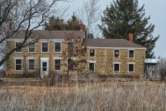 Gratiot Houselisted 1980
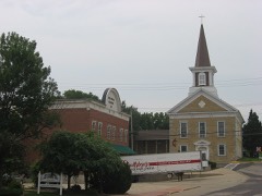 Water Street Commercial Historic Districtlisted 1990
Population over time
2 figuresShullsburg fell from 1,226 to 1,173 between 2010 and 2020. These are the recorded population figures Wikidata holds for this place, reached through the Geographic Names Information System number this page is keyed on rather than by name, so they belong to this place and not to another of the same name. Most are census counts, but not all are: an early figure may be a founding or settlement estimate, and an estimate published within five years of a census is left out. The change column is computed, and is left blank where more than 20 years separate a figure from the one before it, because a gap that long is not a change between two counts.
| Year | People | Change |
|---|---|---|
| 2010 | 1,226 | |
| 2020 | 1,173 | -53 (-4%) |
Topographic sheets covering this place
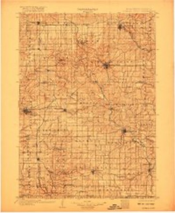
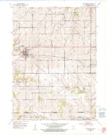
7 surveys from 13 printed sheetsMatched by testing this settlement's coordinate against the published boundary of every sheet in the United States Geological Survey's historical collection. Each opens the scanned sheet at the Survey.
- 1902 USGS Mineral Point quadrangle1:125000, 4 printings
- 1952 USGS Shullsburg quadrangle1:24000, 2 printings
- 1959 USGS Dubuque quadrangle1:250000
- 1961 USGS Dubuque quadrangle1:250000
- 1962 USGS Dubuque quadrangle1:250000, 2 printings
- 1976 USGS Dubuque quadrangle1:250000
- 1984 USGS Dubuque North quadrangle1:100000, 2 printings
In the county-history sources
23,048 words on this townshipHistory of Lafayette County, Wisconsin, Containing an Account of Its Settlement, Growth, Development and Resources; an Extensive and Minute Sketch of Its Cities, Towns and Villages ... Its War Record, Biographical Sketches ... the Whole Preceded by a History of Wisconsin, Statistics of the State, and an Abstract of Its Laws and Constitution, and of the Constitution of the United States, published 1881 names this settlement in its chapter on Shullsburg Town. These are the passages that mention it, exactly as the scans read.
" Drainage. - The most marked and persistent feature of the lead region is the long dividing ridge, or water-shed, which, commencing near Madison, continues almost directly west to the Blue Mounds, a distance of about twenty miles. Here it takes a slight bend to the southwest for fifteen miles until it reaches Dodgeville, where it resumes its westerly course until it terminates in the bluffs at the confluence of the Wisconsin and Mississippi Rivers. Its total length is about eighty-five miles. Two points are noticeable - one is its general uniform directness of outline (it being subject to but few and unimportant flexures), and the other is its parallelism with Wisconsin River so long as the latter holds an approximately westerly course, tl\e summit of the ridge being always about fifteen miles from the river. The divide maintains an average elevation of about six hundred feet above Lake Michigan, and is seldom less than five hundred or more than seven hundred, except at the Blue Mounds, where it gradually rises east and west for several miles until it attains an elevation at the west mound of one thousand one hundred and fifty-one feet. This, however, is an extreme case, and, in fact, the only marked exception to the general level. In the town of Mount Hope, a slight decrease of elevation is about four hundred and thirty feet at a point within a mile of both the Mississippi and Wisconsin Rivers. There are also two main branches or subdivisions of the water-shed. Of these, the western is the ridge which separates the waters that flow into the Platte and Fever Rivers from those which flow into the Pecatonica. It leaves the main divide in the town of Wingville, and, passing through the townships of Bellmont and Shullsburg in a southeasterly direction, passes out of the State in the town of Monticello. The ridge is not so conspicuous as the main watershed, either for the directness of its course or the uniformity of its elevation. The most conspicuous points on it are the Platte Mounds, which appear from a distance to be very high, but their height is only relative, their actual elevation being about seven hundred feet above Lake Michigan. The ridge appears to slope somewhat in its approach to Illinois, its average elevation there being about five hundred feet.
" Prairie and Forest. - The prairie area of the lead region is comparatively small, and seems to be chiefly a continuation of the great prairies of Illinois. The most extensive prairie is that found in the southern part of Grant and La Fayette Counties, comprising the townships of Jamestown, Hazel Green, Benton, Xew Diggings, Shullsburg, Seymour. Monticello and Gratiot. From this there is a branch extending in a northwestern direction (corresponding to the eastern subdivision of the water-shed previously alluded to), until it unites with the main water-shed ; here .it branches to the east and west. The western extension forms a prairie in the towns of Glen Haven, Patch Grove, Little Grant, and some parts of Fennimore and Wingville. The eastern prairie follows the main divide already described, the prairie being from six to ten miles in width. Between the east and west branches of the Pecatonica there is a prairie, including most of the towns of Fayette, Waldwick and Wiota. Small patches of prairie are to be found in other localities. The original timber of the woodland has been mostly cut off, and is replaced by second-growth black, white and burr oak, maple, hickory, poplar and elm, the trees being generally of small size, not exceeding one foot in diameter.
Machine-read from a century-old scan, so expect the errors a machine makes: misspelled names, dropped words, stray characters.
Read the whole chapter on Shullsburg Town - it names this place 1 more 1 time.
Fires near this place
2 since 2018Regional context, not property-specific evidence. The federal wildfire occurrence database lists 2 fires within 5 miles of Shullsburg in 2018, burning under an acre in total. None started naturally. None was recorded as arson. Distance is straight-line from the map coordinates, so a fire counted here may appear on a neighbouring settlement's page as well.
| Reported cause | Fires |
|---|---|
| Missing data/not specified/undetermined | 2 |
The most recent of them, most recent first, with the day each was reported and the service that recorded it.
| Date | Cause | Size | Reported by | Name on the report |
|---|---|---|---|---|
| 30 April 2018 | Missing data/not specified/undetermined | under an acre | Wisconsin Department of Natural Resources | 6 |
| 11 April 2018 | Missing data/not specified/undetermined | under an acre | Wisconsin Department of Natural Resources | 4 |
Settlements close enough to share some of these fires:
Mines and quarries near this place
10 of 110 shownRegional context, not property-specific evidence. The federal mineral resources record lists 110 workings within 5 miles of Shullsburg: 58 past producers, 47 unknowns, 4 producers, 1 occurrence. 4 still produce. What was taken out: Zinc, Lead, Lead, Zinc, Zinc, Lead. Distance is straight-line from the map coordinates, so a quarry counted here may appear on a neighbouring settlement's page as well.
| Where | Site | Commodity | Status | Recorded |
|---|---|---|---|---|
| Galena Level | Lead, Zinc, Iron | Past Producer | ||
| Schullsburg Mine | Zinc, Lead, Barium-Barite, Iron | Producer | Barite, Galena, Marcasite, Pyrite, Sphalerite | |
| Doc Schampers Quarry | Stone, Crushed/Broken | Producer | ||
| Eagle-Picher Ind Shullsburg Tailing | Stone, Crushed/Broken | Past Producer | ||
| Eagle-Pitcher Ind. Shullsburg Mill | Stone, Crushed/Broken | Past Producer | ||
| Glendenning Limestone Quarry | Stone, Crushed/Broken | Past Producer | ||
| Wiegel Quarry | Stone, Crushed/Broken | Producer | ||
| Andrews Mine | Zinc, Lead | Past Producer | 1942, 1944 | |
| Bear Hole Mill | Zinc, Lead | Past Producer | ||
| Ernest and Meyers Level | Zinc, Lead | Past Producer | 1850 |
Storms near this place
26 since 1994Regional context, not property-specific evidence. The National Weather Service names Shullsburg in 26 storm reports between 1994 and 2025: 18 thunderstorm wind, 5 hail, 1 lightning, 1 tornado. No death or injury is recorded in these reports. Each account below is quoted exactly as the forecast office filed it, from the NOAA Storm Events Database, and each date opens the federal record of that event.
| When | Event | Place named | Harm | What the report says |
|---|---|---|---|---|
| August 2005 | Thunderstorm Wind | Shullsburg | $500,000 | Widespread tree damage, trees on homes, and barns damaged, were reported within a 5 mile corridor along Highway 11. |
| August 2021 | Thunderstorm Wind | Shullsburg | $50,000 | Many trees, grain bins, and power lines down in the southern part of Lafayette County, especially near Martin Rd, County Highway P, and County Highway W. |
| August 2007 | Flash Flood | Shullsburg | $50,000 | Flash flooding occurred south of the Village of Shullsburg due to repeated thunderstorms with heavy rains on top of a saturated ground. CTH O south of Shullsburg was coverd with fast-flowing water depths of 6 inches to 1 foot. One mile south of the village a mudslide occurred onto CTH O. Hourly rainfall rates were 1.5 to 2 inches based on WSR-88D Doppler radar estimates. Soil erosion and crop damage also occurred on several other farms in that area. Additionally, a few basements had water damage to contents. Most creeks and streams in the area exceeded flood stage by one to two feet.||August, 2007, rainfall totals include: 16.98 at Arygle, and 17.22 at Blanchardville. |
| September 1997 | Thunderstorm Wind | Shullsburg | $13,000 | no account filed |
| September 2019 | Thunderstorm Wind | Shullsburg | $10,000 | Several power poles snapped. |
| July 2006 | Thunderstorm Wind | Shullsburg | $5,000 | Trees and power lines down. |
| July 1994 | Thunderstorm Wind | Shullsburg | $5,000 | no account filed |
| June 1998 | Lightning | Shullsburg | $4,000 | no account filed |
| June 2017 | Thunderstorm Wind | Shullsburg | $3,000 | Trees and power lines down. |
| February 1999 | Thunderstorm Wind | Shullsburg | $3,000 | no account filed |
| June 1996 | Thunderstorm Wind | Shullsburg | $3,000 | no account filed |
| July 2025 | Thunderstorm Wind | Shullsburg | $2,000 | Wind gust was reported from a home weather station. Trees reported down. |
| July 2020 | Thunderstorm Wind | Shullsburg | $2,000 | A tree down and some branches down on power lines. |
| August 2000 | Thunderstorm Wind | Shullsburg | $2,000 | no account filed |
| September 2019 | Thunderstorm Wind | Shullsburg | $500 | A tree blown down. |
| July 2012 | Thunderstorm Wind | Shullsburg | - | Law enforcement officials reported trees and power lines blown down in Shullsburg by damaging thunderstorm wind gusts estimated up to 56 knots (65 mph). |
| April 2010 | Hail | Shullsburg | - | Shullsburg Fire Dept. reported 7/8 hail. |
| June 2009 | Thunderstorm Wind | Shullsburg | - | Several large trees were blown down by thunderstorm winds. |
| June 2007 | Tornado (EF0) | Shullsburg | - | A brief, weak tornado spun up about 3.8 miles south (168 degrees) of Shullsburg. Only some minor tree damage was noted. Specifically, it occurred about 0.7 miles southwest/225 degrees of the intersection of Blackhawk Rd. and Monticello Rd. The lat/lon data is: N42.51590 W90.21600 for the start point and N42.51696 W90.21577 for the end point. The average path width was about 10 yards. DI#27 (TH), DOD2. Estimated winds 65-70 knots (75-80 mph). |
| August 2006 | Thunderstorm Wind | Shullsburg | - | Trees down. |
| April 2023 | Hail | Shullsburg | - | no account filed |
| July 2001 | Hail | Shullsburg | - | no account filed |
| June 2001 | Thunderstorm Wind | Shullsburg | - | no account filed |
| May 2000 | Hail | Shullsburg | - | no account filed |
| July 1995 | Thunderstorm Wind | Shullsburg | - | no account filed |
| July 1995 | Hail | Shullsburg | - | no account filed |
Nearest settlements
The eight closest, with where each one stands in the county. Distances are straight-line, computed from the Geographic Names Information System coordinates.
| Map | Place | Distance | Sheets |
|---|---|---|---|
| White Oak | 4.5 miles | 12 | |
| Etna | 5.1 miles | 12 | |
| Dunbarton | 5.2 miles | 13 | |
| Lead Mine | 6.1 miles | 12 | |
| New Diggings | 6.1 miles | 12 | |
| Benton | 7.9 miles | 14 | |
| Strawbridge | 8.3 miles | 14 | |
| Jenkinsville | 8.5 miles | 13 |
Elsewhere
Matched on this settlement's Geographic Names Information System number rather than its name, so it cannot be a different place of the same name in another state.
| Wikipedia article on Shullsburg | An encyclopaedic summary. Its text is share-alike, so it is linked here rather than copied. |
| Wikidata item Q1569636 | The structured record the population and elevation above come from. Public domain (CC0). |
Provenance
This settlement is recorded in the Geographic Names Information System as feature 1574081. The sheet list is computed by point-in-boundary test against the United States Geological Survey's historical topographic inventory. Both are works of the United States government and carry no copyright under 17 U.S.C. 105.
Wildfire. Short, Karen C. 2022. Spatial wildfire occurrence data for the United States, 1992-2020 [FPA_FOD_20221014]. 6th Edition. Fort Collins, CO: Forest Service Research Data Archive. https://doi.org/10.2737/RDS-2013-0009.6 Collected with United States Government funding and usable without additional permissions or fees.
Mines and quarries. USGS Mineral Resources Data System (MRDS) https://mrdata.usgs.gov/mrds/ A work of the United States government, no copyright under 17 U.S.C. 105.
Storms. NOAA National Centers for Environmental Information, Storm Events Database https://www.ncei.noaa.gov/stormevents/ A work of the United States government, no copyright under 17 U.S.C. 105. Narratives are quoted verbatim from the National Weather Service report and are not edited or summarised.