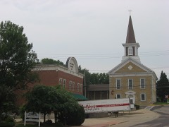
BlockBefore

Lafayette County, Wisconsin

53 topographic sheets cover 30 settlements here, and 13 properties are on the National Register of Historic Places.

Research this county

From the record

13 National Register listings published here · the county-history sources tell 2 stories and name 6 people · people the book names include Early Settlement And General History (Darlington City, 1881) · Hon, Peter Parkinson, Jr (Belmont Village, 1881) (machine-read).

Sources: the county history on the Internet Archive · the National Register database, National Park Service

Wisconsin within the United States
Lafayette County within Wisconsin

What the record shows

  • 383 topographic sheet readings cover the county's settlements.
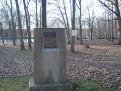
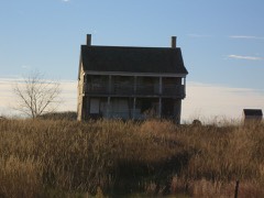
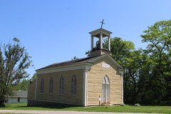
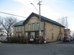
  • 13 properties here are on the National Register of Historic Places: 9 buildings, 2 districts, 1 structure and 1 site.
  • 3 of the 13 listings were added during the 1970s.
  • The Geographic Names Information System records 30 populated places in this county; 30 are covered by at least one topographic sheet.
  • 1 public-domain county history, 1881, supplies 235,368 words of narrative reproduced here.

What happened here

2 accounts

Among them: Col. John Moore; Village Of Riverside. These passages come from the identified county-history source books. Each inset names its own source and opens the exact section it comes from.

From History of Lafayette County, Wisconsin, Containing an Account of Its Settlement, Growth, Development and Resources; an Extensive and Minute Sketch of Its Cities, Towns and Villages ... Its War Record, Biographical Sketches ... the Whole Preceded by a History of Wisconsin, Statistics of the State, and an Abstract of Its Laws and Constitution, and of the Constitution of the United States, published 1881 - Belmont Village

Col. John Moore

Col. Moore was born in the year 1784 (January 28), in the State of North Carolina, and emigrated to West Tennessee in the year 1802. While living in that State, he setved in the war of 1812, under Gen. Jackson, and commanded a company as Captain, and participated in the memorable battle of New Orleans, having a brother and brother-in-law killed in that engatrement.

Read the rest of this passage

From History of Lafayette County, Wisconsin, Containing an Account of Its Settlement, Growth, Development and Resources; an Extensive and Minute Sketch of Its Cities, Towns and Villages ... Its War Record, Biographical Sketches ... the Whole Preceded by a History of Wisconsin, Statistics of the State, and an Abstract of Its Laws and Constitution, and of the Constitution of the United States, published 1881 - White Oak Springs Town

Village Of Riverside

This village, located at Shultz Ford, on Section 4, was surveyed in 1856, by Charles Temple, for J. J. Ross, and here the first depot, already mentioned, was built, in 1857. It now stands disused. The first business done here was the selling of whisky by N. Barrington, in 1857. He was drowned soon after beginning his traffic, and his place was then taken by A.

Read the rest of this passage

Places on the National Register

13

Every property in this county listed on the National Register of Historic Places, with the year it was listed and the federal nomination document.

Photograph PropertyType ListedReference
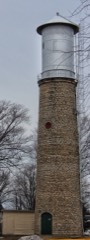
Benton Stone Water Towerstructure199998001598
Darlington Carnegie Free Librarybuilding2022100007661
First Capitolbuilding197070000036
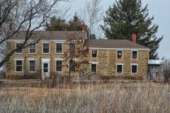
Gratiot Housebuilding198080000153
Lafayette County Courthousebuilding197878000114
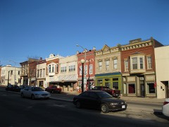
Main Street Historic Districtdistrict199494001210
Mottley Family Farmsteadbuilding200101000564
Pecatonica Battlefieldsite201111000488
Prairie Spring Hotelbuilding199999001273
St. Augustine Churchbuilding197272000057
Star Theatrebuilding198080000154
Water Street Commercial Historic Districtdistrict199090000998
Welty, Daniel and Catherine Barnbuilding2024100010205

Wildfire, 1999 to 2020

44 fires

Every wildfire the federal occurrence database records inside this county: 44 of them, burning about 160 acres. 1 started naturally and 1 was recorded as arson. Each settlement page carries the fires within five miles of it.

Reported cause Fires
Debris and open burning20
Missing data/not specified/undetermined17
Equipment and vehicle use3
Smoking1
Natural1
Recreation and ceremony1
Arson/incendiarism1

The five largest, by the area the report gives. One of them was set deliberately.

DateCause SizeReported by Name on the report
30 March 1999Debris and open burning60 acresWisconsin Department of Natural Resourcesnot named
21 March 2018Debris and open burning23 acresWisconsin Department of Natural Resources2018012
24 April 2018Debris and open burning15 acresWisconsin Department of Natural Resources18026
21 April 2019Arson/incendiarism14 acresWisconsin Department of Natural Resources19031
7 November 2020Debris and open burning6.0 acresWisconsin Department of Natural Resources20064
24 April 2018Missing data/not specified/undetermined5.0 acresWisconsin Department of Natural Resources2018006
3 November 2020Missing data/not specified/undetermined5.0 acresWisconsin Department of Natural Resources20062
24 April 2020Debris and open burning5.0 acresWisconsin Department of Natural Resources2020002

Every settlement page carries the fires within five miles of it - see the settlement index below.

Storms, 1955 to 2026

60 of 349 shown

The NOAA Storm Events Database holds 349 reports for this county, causing no deaths, 13 injuries and about $23,719,860 in recorded property damage. Each settlement page carries the reports that name it.

Kind of event Reports
Thunderstorm Wind177
Hail80
Tornado34
Flood24
Flash Flood20
Lightning7
Funnel Cloud4
Heavy Rain3

The most serious of them, by death, then injury, then recorded damage. The accounts are quoted exactly as the forecast office filed them.

WhenEvent Place namedHarm What the report says
May 1998Tornado (F2)Benton11 hurt, $1,700,000A supercell thunderstorm, after dropping a couple tornadoes in northeast Iowa, eventually moved northeast into Lafayette county, creating another tornado. This tornado touched down just southwest of Benton and hopped/skipped northeast for 20 miles. It caused moderate to severe damage to 40 different farms and their outbuildings, and homes. Numerous power lines were downed. Eleven people were injured: 2 children near Cuba city, 3 children southwest of Truman, and 6 adults in a vehicle on Highway 81 south of Benton. Several farm fields sustained damage.
July 2018Thunderstorm WindGratiot1 hurt, $200,000Downburst winds of 80 mph rolled and damaged 10 large campers. Nearby corn was flattened.
May 2003Tornado (F1)Belmont1 hurt, $200,000A tornado spun up 5.0 miles southwest of the village Belmont (Lafayette Co.), near the intersection of Pine Tree and Field Drive, and proceeded to track northeast to near Belmont before dissipating 2.7 miles northeast of Belmont (just southeast of the intersection of Cottage Inn Road and Bethel Grove Rd). Just east of Belmont, the tornado destroyed a farm's mobile home, injuring one of five people inside. In addition, a pole shed on this farm was damaged. On two other farms, this tornado inflicted minor to extensive damage on homes, barns, wind mills, and decks. Law enforcement officials video taped this tornado; estimated at the top end of F1 (about 110 mph).
April 1967Tornado (F3)not stated$2,500,000no account filed
April 2006HailDarlington$2,380,000no account filed
April 2006HailBelmont$2,380,000no account filed
June 2014Tornado (EF1)Leslie$1,500,000A narrow path of EF1 tornado damage. Numerous trees and power poles down. A large calf barn was nearly completely destroyed, killing two calves. Several pole barns were completely destroyed. Minor roof damage to a couple homes. A garage blown off the foundation.
June 2024Tornado (EF2)Lamont$1,000,000Strong tornado developed west of Argyle and tracked to the north of it, hitting multiple barns and a church along it's path.
March 2023Tornado (EF1)Ipswich$1,000,000A number of farm buildings had substantial damage to them, particularly a large farm operation along County Road G where an empty grain bin was destroyed and a large shed lost it's I beam and the roof collapsed inward. A row of 13 power poles were snapped due to the wind.
May 1998Thunderstorm WindCountywide$875,000no account filed
July 2009HailBenton$500,000A 5-mile wide hail swath damaged crops (corn, soy beans, wheat, and alflafa), vehicles (dents and broken windows), and at least 25 homes (roofs, windows, and siding). This swath merged with another hail swath from an ealier storm that traveled from Northwest Lafayette County to southeast of Shullsburg. Some farm fiels were stripped to nothing by the hail stones.||Newspaper accounts indicated that the two hail swaths resulted in damage to 20,000 acres of corn and 10,000 acres of soybeans in Lafayette County. Using an avarge of 135 bushes of corn per acre with a price of $3.45 per bushels yields a corn loss of $9.315 M. Using an average of 38 bushels of soybeans per acre, and a price of $9.25 per bushel yields a soybean loss of $3.515 M. These loss estimates were divided by two and assigned to the two hail swaths equally.
July 2009HailBelmont$500,000A 5-mile wide hail swath damaged crops (corn, soy beans, wheat, and alfalfa), vehicles (windows and dents), and at least 25 homes (windows, siding, and roofs). This hail swath merged with a another, later, hail swath, with the merger southeast of Shullsburg. Some fields southeast of Shullsburg were totally stripped by the hail stones.||Newspaper accounts indicated that the two hail swaths resulted in damage to 20,000 acres of corn and 10,000 acres of soybeans in Lafayette County. Using an avarge of 135 bushes of corn per acre with a price of $3.45 per bushels yields a corn loss of $9.315 M. Using an average of 38 bushels of soybeans per acre, and a price of $9.25 per bushel yields a soybean loss of $3.515 M. These loss estimates were divided by two and assigned to the two hail swaths equally.
August 2005Thunderstorm WindShullsburg$500,000Widespread tree damage, trees on homes, and barns damaged, were reported within a 5 mile corridor along Highway 11.
July 1994Tornado (F1)Dickeyville$500,000no account filed
July 1994Thunderstorm WindSouth Wayne$500,000no account filed
July 1994Tornado (F1)Woodford$500,000no account filed
July 2017Flash FloodMeekers Grove$491,500Flash flooding of creeks and the Galena River in the far southwest portion of the county due to approximately 5 inches of rain. Roads, bridges, and culverts washed-out. Approximately 13 homes experienced very minor flooding with 2 homes with more substantial basement flooding.
July 1996Flash FloodBlanchardville$480,000no account filed
June 2008Flash FloodDarlington$462,160Heavy rains resulted in flash flooding from the Darlington area to Yellowstone Lake State Park. Water depths on road surfaces reached 3 feet or more and there were gravel washouts. Home damage totaled about $200 thousand. Business damage totaled about $100 thousand. Crop losses totaled about $300 thousand. Public sector damage totaled about $162,160. There were several roads and bridges that sustained damage.
April 1997Thunderstorm WindDarlington$400,000no account filed
March 2023Tornado (EF1)Leslie$300,000Damage was mainly to a barn lean-to which was distributed through a field behind the facility. Another barn had roofing damage going in the opposite direction on the same grounds.
May 1999Flash FloodSouth Portion$250,000no account filed
May 1988Tornado (F3)not stated$250,000no account filed
May 1988Tornado (F1)not stated$250,000no account filed
August 1987Tornado (F1)not stated$250,000no account filed
June 1984Tornado (F2)not stated$250,000no account filed
June 1969Tornado (F2)not stated$250,000no account filed
September 1963Tornado (F1)not stated$250,000no account filed
May 1958Tornado (F2)not stated$250,000no account filed
July 2011Thunderstorm WindBelmont$200,000Law enforcement reported damage in a 15-mile wide swath from southwest of Belmont to Woodford from thunderstorm wind gusts estimated at 75 mph (65 knots). Downed trees blocked roads and fallen power lines caused power outages in the towns of Belmont, Argyle and Darlington. Six homes were damaged, and a 100-year-old 38 foot by 100 foot barn was flattened on a farm near Argyle, damaging a tractor inside.
August 2002Thunderstorm WindLamont$110,000no account filed
October 2019Thunderstorm WindCalamine$100,000A swath of snapped and uprooted trees and flattened corn. Some structural damage to homes and farm buildings. A large tree limb fell on a truck.
June 2015Thunderstorm WindIpswich$100,000Three pole barns and one small barn all located southwest of Belmont suffered severe damage with the lost of the roofs and some walls collapsed. Large trees uprooted and snapped in Belmont. Trees down on one house causing severe roof damage and a couple mobile homes suffering minor damage from fallen trees or the high winds. Scattered trees and power lines were reported down throughout the remainder of the county.
July 2009Tornado (EF0)Seymour Corners$100,000A weak tornado spun up a little north of the intersection of CTH Q and Prairie Rd. (about 4 miles northwest of Shullsburg). It proceded to move on a 145 degreee bearing southeast to just southeast of the intersecton of CTH U and Jackson Rd. a couple miles north-northeast of Shullsburg. Major damage was inflicted on a barn and storage pole shed, several trees were uprooted or snapped, and some minor damage was inflicted on a corn field. The specific starting and ending GPS coordinates were 42.63011/-90.26829 and 42.59963/-90.21671, and the damage intensity was based on DI 1 (SBO), DOD 8. The average width was about 30 yards. The wind was estimated to be about 105 mph.
August 2007Flash FloodDarlington$100,000Flash flooding occurred in scattered locations between the northwest side of Darlington to the extreme northeast corner of Lafayette County. Just northwest of Darlington, a road was closed due to fast flowing water covering the road to a depth of 1 to 2 feet. Just east of Blanchardville, CTH H was closed due to fast-flowing water covering that road to a depth of 1 to 2 feet. Some mudslides, soil erosion, and crop losses were also noted. At least 20 homes had some water damage to basement contents. WSR-88D Doppler overnight rainfall estimates ranged from around 2 inches over the southern part of the county to 5 to 6 inches over the northern half.
August 2005Thunderstorm WindSouth Wayne$100,000Barns, trees, and sheds damaged.
August 2005Thunderstorm WindArgyle$100,000A building was destroyed and numerous trees were damaged.
May 2004Flash FloodBenton$100,000Several reports of houses flooded, people evacuated, mudslides destroyed freshly planted crops.
June 2000Tornado (F1)Calamine$100,000no account filed
April 1997Thunderstorm WindGratiot$100,000no account filed
May 2024Thunderstorm WindDunbarton$50,000Straight-line winds of approximately 90 mph snapped numerous trees greater than half way up the trees. Also multiple farm outbuildings and sheds were damaged including one calf barn that was completely destroyed. Debris was lying from southwest to northeast.
August 2021Thunderstorm WindShullsburg$50,000Many trees, grain bins, and power lines down in the southern part of Lafayette County, especially near Martin Rd, County Highway P, and County Highway W.
July 2019Thunderstorm WindFayette$50,000Multiple grain and fertilizer bins blown over or collapsed. The roof and wall on one end of a pole barn severely damaged with the debris damaging a home and cattle building. Minor damage to a home when a swing set was blown into it. A portion of the roof to a small and old shed pealed off. Another small shed blown over. An uprooted tree.
August 2009Thunderstorm WindYellowstone Lake State Park$50,000Law enforcement reported numerous trees and power lines down in a 3-mile wide swath over northeastern Lafayette County. The damage swath extended north into Iowa County and east-northeast into the counties of Green and Dane. Roof damage was also reported on several homes. Outside of the city of Blancardville, a barn was blown down.
July 2009Tornado (EF0)New Digging$50,000A weak tornado spun up about 1/3 mile south-southwest of the intsection of STH 11 and CTH I, or roughly a couple northeast of New Diggings. It proceded to move on a 122 degreee bearing southeast to about 1/3 mile east of the intersecton of CTH O and Blackhawk Rd., about 3.5 miles southeast of Shullsburg. A small pole shed was destroyed and small portions of a side-wall and roof of a home were peeled off. Otherwise several trees were uprooted or snapped. The specific starting and ending GPS coordinates were 42.55270/-90.31193 and 42.52115/-90.24236, and the damage intensity was based on DI 1 (SBO), DOD 6. The average width was about 25 yards. The wind was estimated to be about 90 mph.
August 2007Flash FloodShullsburg$50,000Flash flooding occurred south of the Village of Shullsburg due to repeated thunderstorms with heavy rains on top of a saturated ground. CTH O south of Shullsburg was coverd with fast-flowing water depths of 6 inches to 1 foot. One mile south of the village a mudslide occurred onto CTH O. Hourly rainfall rates were 1.5 to 2 inches based on WSR-88D Doppler radar estimates. Soil erosion and crop damage also occurred on several other farms in that area. Additionally, a few basements had water damage to contents. Most creeks and streams in the area exceeded flood stage by one to two feet.||August, 2007, rainfall totals include: 16.98 at Arygle, and 17.22 at Blanchardville.
May 2000Flash FloodSouth Portion$50,000no account filed
June 2014Thunderstorm WindWoodford$45,000A 60 foot by 120 foot pole barn was mostly leveled. The steel sheeting from the barn was blown about 1/4 mile to the northeast. The collapse of the pole barn damaged tractors, a combine, and other farm equipment. Another farm lost roofs from two sheds and several large trees were downed with a fallen tree totaling a car. At yet another residence, fallen trees damaged two buildings. Finally another residence had a 16 inch spruce tree snapped off at the base and it partially landed on the home damaging the sofitts and gutters.
August 2021Thunderstorm WindBelmont$40,000Dispatch reported damage to home caused by a falling tree and a downed tree on Olson Lane, SSE of Mineral Point.
September 2013Thunderstorm WindBenton$40,000Numerous trees and power lines down.
July 2018Thunderstorm WindGratiot$30,000Much of the roof of a large barn collapsed.
June 2014Thunderstorm WindLeslie$30,000The roof of a poll shed was removed. A couple campers were rolled by the wind onto the median of highway 151.
June 2014Thunderstorm WindDarlington Arpt$30,000Minor damage to several outbuildings. A guard rail fence was leveled by straight line winds. The wooden posts of the fence were snapped at the base.
June 2014Tornado (EF1)Leslie$30,000Numerous downed trees and snapped trees through the woods.
June 2014Thunderstorm WindFayette$30,000A large poll shed was mostly destroyed by straight line winds.
July 2009Flash FloodBelmont$30,000Heavy rains from severe thunderstorms produced flash flooding that washed out the gravel shoulders of roads in and near Belmont in Lafayette County. Damage due to the flash flooding totaled $30,000. Rainfall estimates from National Weather Service radar totaled 2 to 3 inches during this time.
July 2009Flash FloodNew Digging$30,000Repeated heavy rains from a couple thunderstorms resulted in flash flooding in the area from New Diggings to southeast of Shullsburg. All rivers and streams in this area rose above flood stage, and many roads had water over them. Some roads had depths of 2 to 3 feet of fast-flowing water. Several of the gravel shoulders were washed out, and lots of vegetative debris was left on some roads.
September 2000LightningSouth Wayne$30,000no account filed
June 2014Thunderstorm WindWiota$25,000A barn was destroyed.
August 2007Thunderstorm WindBelmont$25,000Powerful thunderstorm wind gusts to 52 knots (60 mph) toppled several large trees and damaged several power-lines.

Mines and quarries

377 recorded

The Survey's mineral resources record lists 377 workings inside this county. 9 still produce and 368 are closed or unrecorded. Each settlement page carries the workings within five miles of it.

Commodity Workings
Zinc250
Lead189
Lead, Zinc44
Stone, Crushed/Broken34
Zinc, Lead16
Copper8
Stone6
Barium-Barite, Iron1
Lead, Barium-Barite1
Barium-Barite, Lead1
Lead, Zinc, Iron1
Iron, Zinc1
Iron1

The least common of them first, because a county's hundredth gravel pit says nothing its first ten did not.

Where SiteCommodity StatusRecorded
Etna MineLead, IronPast Producer
Farrey MineIron, ZincPast Producer1940
Galena LevelLead, Zinc, IronPast Producer
Negro Jim MineLead, Barium-Barite, ZincPast ProducerGalena
Raisbeck MineZinc, Barium-Barite, LeadUnknownBarite
Schullsburg MineZinc, Lead, Barium-Barite, IronProducerBarite, Galena, Marcasite, Pyrite, Sphalerite
Argyle QuarryStoneUnknown
Larson QuarryStoneUnknown
Olson QuarryStoneUnknown
Opie QuarryStoneUnknown
Reddy Seiling QuarryStoneUnknown
Scott QuarryStoneUnknown
Unnamed Copper Prospect Along AmeCopperOccurrence
Unnamed Prospect Along Apple BranCopperOccurrence
Unnamed Prospect Along Copper CreCopperOccurrence
Unnamed Prospect Along PecatonicaCopperOccurrence
Andrews MineZinc, LeadPast Producer1942, 1944
Bear Hole MillZinc, LeadPast Producer
Byrnes MineZinc, LeadPast Producer1927, 1928
Ernest and Meyers LevelZinc, LeadPast Producer1850
Ewing and Cook MineZinc, LeadPast Producer1941, 1942
Fields Upper Run MineZinc, LeadPast Producer
Helena-Roachdale MineZinc, LeadPast Producer1890
Hird No.1 MineZinc, LeadPast Producer1913, 1915
Iowa MineZinc, LeadPast Producer1919
Little Joe MineZinc, LeadPast Producer
Lucky Hit MineZinc, LeadPast Producer1904
Moore LevelZinc, LeadPast Producer1941
Mulcahy MineZinc, LeadPast Producer1950, 1952
New Calvert MineZinc, LeadProspect1917
Old Cottingham MineZinc, LeadPast Producer1944, 1945
Vinegar Hill Blackstone MineZinc, LeadPast Producer1950
Als Trucking Co. QuarryStone, Crushed/BrokenPast Producer
Anderson QuarryStone, Crushed/BrokenPast Producer
Appell QuarryStone, Crushed/BrokenPast Producer
Argyle QuarryStone, Crushed/BrokenProducer
Belmont QuarryStone, Crushed/BrokenProducer
Calvert QuarryStone, Crushed/BrokenPast ProducerUnderground
Calvert QuarryStone, Crushed/BrokenPast Producer
Carey QuarryStone, Crushed/BrokenPast Producer
Eagle-Picher Ind Shullsburg TailingStone, Crushed/BrokenPast Producer
Eagle-Pitcher Ind. Shullsburg MillStone, Crushed/BrokenPast Producer
Emil Maurer QuarryStone, Crushed/BrokenPast Producer
G.A. WatsonStone, Crushed/BrokenPast Producer
George Wendtlandt, Inc.Stone, Crushed/BrokenPast Producer
Glendenning Limestone QuarryStone, Crushed/BrokenPast Producer
Hardy QuarryStone, Crushed/BrokenPast Producer
Hoeper QuarryStone, Crushed/BrokenPast Producer
Huggins QuarryStone, Crushed/BrokenProducer
Judkins QuarryStone, Crushed/BrokenPast Producer
King QuarryStone, Crushed/BrokenPast Producer
Lancaster QuarryStone, Crushed/BrokenPast Producer
Lange QuarryStone, Crushed/BrokenProducer
Mauthe QuarryStone, Crushed/BrokenPast Producer
Munson QuarryStone, Crushed/BrokenProducer
Niffenegger QuarryStone, Crushed/BrokenPast Producer
Oppie QuarryStone, Crushed/BrokenPast Producer
Otto Jean Kelly QuarryStone, Crushed/BrokenPast Producer
Palzkil QuarryStone, Crushed/BrokenPast Producer
Presbroten QuarryStone, Crushed/BrokenPast Producer
Reddy QuarryStone, Crushed/BrokenPast Producer
Reichers QuarryStone, Crushed/BrokenPast Producer
Ruff QuarryStone, Crushed/BrokenPast Producer
Shager QuarryStone, Crushed/BrokenProducer
Whalen QuarryStone, Crushed/BrokenPast Producer
Wiegel QuarryStone, Crushed/BrokenProducer
Annie Walton MineLead, ZincPast Producer1947
Badger MineLead, ZincPast Producer1900
Birkett MineLead, ZincPast Producer1925, 1926
Blain and Logan MineLead, ZincPast Producer1895
Century MineLead, ZincPast Producer1900
Champion and Eureka MinesLead, ZincPast Producer1895
Cleveland MineLead, ZincPast Producer1909, 1910
Coltman MineLead, ZincPast Producer1879
Coor MineLead, ZincPast Producer1908
De Rocher MineLead, ZincPast Producer1935
Empress MineLead, ZincPast Producer1891
Etna MineLead, ZincPast Producer1850
Fox MineLead, ZincPast Producer1906
Hird No.2 MineLead, ZincPast Producer1917
Hoskins-Fields MineLead, ZincPast Producer1916, 1917
Indian Mound MineLead, ZincPast Producer1917, 1919
Jack of ClubsLead, ZincPast Producer1903
James Ore BodyLead, ZincPast Producer1920, 1925
Kennedy MineLead, ZincPast Producer1851
KingeterLead, ZincProspect1906
Kittoe MineLead, ZincPast Producer1914, 1915
Martin MineLead, ZincPast Producer1912, 1913
Mermaid MineLead, ZincPast Producer
Milwaukee-Shullsburg MineLead, ZincPast Producer1917
Monmouth & North Monmouth MinesLead, ZincPast Producer1924
Murphy MineLead, ZincPast Producer1903
New Cottingham MineLead, ZincPast Producer1946
New Hoskins MineLead, ZincPast Producer1944
New Longhorn MineLead, ZincPast Producer1917, 1926
New Mullen MineLead, ZincPast Producer1935, 1937
Old Ida-Blende MineLead, ZincPast Producer1880
Old Occidental MineLead, ZincPast Producer1873
Old Winskell MineLead, ZincPast Producer1908, 1909
Paul Graber MineLead, ZincPast Producer1942
Penna-Benton, ExpansionLead, ZincPast Producer1837
Pittsburg-Benton MineLead, ZincPast Producer1944
Richards MineLead, ZincPast Producer
Rodham MineLead, ZincPast Producer1909
Rowley MineLead, ZincPast Producer
Shullsburg MillLead, ZincPast Producer
Swift and Rooney MineLead, ZincPast Producer1861
Trewartha MineLead, ZincPast Producer1931, 1932
Wilkinson MineLead, ZincPast Producer1908, 1909
Wipet MineLead, ZincPast Producer1917, 1938
Andrews MineZinc, LeadUnknownSphalerite
Annie Walton MineLeadPast Producer
Appleby LevelZinc, LeadUnknownSphalerite
B and C MineZinc, LeadUnknownSphalerite
B.A.T. MineZinc, LeadUnknownSphalerite
Badger MineZinc, LeadUnknownSphalerite
Baxter MineZinc, LeadUnknownSphalerite
Beacon Light MineZinc, LeadUnknownSphalerite
Bear Hole MineZinc, LeadProducerGalena, Sphalerite
Bearcat Or Hird No. 3 MineZinc, LeadUnknownSphalerite
Bearhole MineZinc, LeadPast Producer1895, 1900
Benton Star MineZinc, LeadUnknownSphalerite
Best MineZinc, LeadUnknownSphalerite
Best MineLead, ZincPast Producer
Big Dad MineZinc, LeadUnknownSphalerite
Big Dick MineZinc, LeadUnknownSphalerite
Big Dick MineLead, ZincPast Producer
Big Ten MineZinc, LeadUnknownSphalerite
Big Ten MineLead, ZincPast Producer
Birkett MineZinc, LeadUnknownSphalerite
Blackstone MineZinc, LeadUnknownSphalerite
Booty MineZinc, LeadUnknownSphalerite
Boyle MineZinc, LeadUnknownSphalerite
Bull Moose MineZinc, LeadUnknownSphalerite
Byrnes MineZinc, LeadUnknownSphalerite
C.A.T. MineZinc, LeadUnknownSphalerite
Calumet MineZinc, LeadUnknownSphalerite
Calvert MineZinc, LeadUnknownSphalerite
Century MineZinc, LeadUnknownSphalerite
Champion and Eureka MineZinc, LeadUnknownSphalerite
Chesterfield DiggingsLead, ZincPast Producer
Cleveland MineZinc, LeadUnknownSphalerite
Coltman MineZinc, LeadUnknownSphalerite
Connecting Link No. 1 MineZinc, LeadUnknownSphalerite
Connecting Link No. 2 MineZinc, LeadUnknownSphalerite
Copeland MineZinc, LeadUnknownSphalerite
Corr MineZinc, LeadUnknownSphalerite
Coughlin MineZinc, LeadUnknownSphalerite
CrawhallZinc, LeadPast Producer1970
Crawhall MineZinc, LeadUnknownSphalerite
Cuba City MineZinc, LeadUnknownSphalerite
Cuba City MineLead, ZincPast Producer
Curwen MineZinc, LeadUnknownSphalerite
Dall and Cook MineZinc, LeadUnknownSphalerite
Depp MineZinc, LeadUnknownSphalerite
Depp MineZinc, LeadPast Producer
Derocher MineZinc, LeadUnknownSphalerite
Doll MineZinc, LeadPast Producer
Drum MineZinc, LeadUnknownSphalerite
Empress MineZinc, LeadUnknownSphalerite
Ernest and Myers LevelLead, ZincUnknownGalena
Etna MineZinc, LeadUnknownSphalerite
Ewing and Cook MineZinc, LeadUnknownSphalerite
Expansion MineZinc, LeadUnknownSphalerite
Farrey MineZinc, LeadUnknownSphalerite
Federal MineZinc, LeadUnknownSphalerite
Fields Upper Run MineZinc, LeadUnknownSphalerite
Fox MineZinc, LeadUnknownSphalerite
Frontier MineZinc, LeadUnknownSphalerite
Galena Level MineZinc, LeadUnknownSphalerite
Gritty Six MineZinc, LeadUnknownSphalerite
Gundry DiggingsLead, ZincPast Producer
Hames Rowe Lead MineLead, ZincUnknownGalena
Harney Range MineLeadPast Producer
Helena-Roachdale MineZinc, LeadUnknownSphalerite
Henrietta MineZinc, LeadUnknownSphalerite
Henrietta MineZinc, LeadPast Producer
Hird No. 1 MineZinc, LeadUnknownSphalerite
Hird No. 2 MineZinc, LeadUnknownSphalerite
Ida-Blende MineZinc, LeadPast Producer
Imperial MineZinc, LeadUnknownSphalerite
Indian Mound MineZinc, LeadUnknownSphalerite
Jack of Clubs MineZinc, LeadUnknownSphalerite
Jack of Diamonds MineZinc, LeadUnknownSphalerite
James MineZinc, LeadUnknownSphalerite
Jug Handle MineZinc, LeadUnknownSphalerite
Kearns MineZinc, LeadUnknownSphalerite
Kennedy MineZinc, LeadUnknownSphalerite
Kingeter MineZinc, LeadUnknownSphalerite
Kittoe MineZinc, LeadUnknownSphalerite
Kivlahan MineZinc, LeadUnknownSphalerite
Koll MineZinc, LeadUnknownSphalerite
L.V. and M. MinesLeadPast Producer
Lafayette MineZinc, LeadUnknownSphalerite
Lawrence MineZinc, LeadUnknownSphalerite
Leadmine MineZinc, LeadUnknownSphalerite
Liberty MineZinc, LeadUnknownSphalerite
Liberty MineLead, ZincPast Producer
Little Bennie MineZinc, LeadUnknownSphalerite
Little Dad MineZinc, LeadUnknownSphalerite
Little Giant MineZinc, LeadUnknownSphalerite
Little Minnie MineZinc, LeadUnknownSphalerite
Longhenry MineZinc, LeadUnknownSphalerite
Luck Hit MineZinc, LeadUnknownSphalerite
Lucky Twelve MineZinc, LeadUnknownSphalerite
Lyne MineZinc, LeadUnknownSphalerite
M.C. MineZinc, LeadUnknownSphalerite
Maloney Range MineLeadPast Producer
Martin MineZinc, LeadUnknownSphalerite
Masbruch MineZinc, LeadUnknownSphalerite
Masbruch MineZinc, LeadPast Producer
Mayer&Thiede MineLeadPast Producer
Mccabe MineZinc, LeadUnknownSphalerite
Mccann MineZinc, LeadUnknownSphalerite
Mcmillan MineZinc, LeadUnknownSphalerite
Meekers Grove MineZinc, LeadUnknownSphalerite
Meloy MineZinc, LeadUnknownSphalerite
Mermaid MineZinc, LeadUnknownSphalerite
Middie MineZinc, LeadUnknownSphalerite
Midway MineZinc, LeadUnknownSphalerite
Mills DiggingsLeadPast Producer
Milwaukee-Shullsburg MineZinc, LeadUnknownSphalerite
Monmouth MineZinc, LeadUnknownSphalerite
Monroe MineZinc, LeadUnknownSphalerite
Mulcahy MineZinc, LeadUnknownSphalerite
Mullen MineZinc, LeadUnknownSphalerite
Murphy MineZinc, LeadUnknownSphalerite
New Birkett MineZinc, LeadUnknownSphalerite
New Calvert MineZinc, LeadUnknownSphalerite
New Cottingham MineZinc, LeadUnknownSphalerite
New Harty MineZinc, LeadUnknownSphalerite
New Hoskins MineZinc, LeadUnknownSphalerite
New Ida Blende MineZinc, LeadUnknownSphalerite
New Longhorn MineZinc, LeadUnknownSphalerite
New Mulcahy MineZinc, LeadUnknownSphalerite
New Mullen MineZinc, LeadUnknownSphalerite
New Occidental MineZinc, LeadUnknownSphalerite
Nightingale MineZinc, LeadUnknownSphalerite
Nip and Tuck MineZinc, LeadUnknownSphalerite
North Star MneZinc, LeadUnknownSphalerite
O'Brien MineZinc, LeadUnknownSphalerite
Oakland Level MineZinc, LeadUnknownSphalerite
Old Cottingham MineZinc, LeadUnknownSphalerite
Old Dutch DiggingsLeadPast Producer
Old Ida Blende MineZinc, LeadUnknownSphalerite
Old Occidental MineZinc, LeadUnknownSphalerite
Old Windkell MineZinc, LeadUnknownSphalerite
Ollie Belle MineZinc, LeadUnknownSphalerite
Oregon MineZinc, LeadUnknownSphalerite
Paquette MineZinc, LeadUnknownSphalerite
Paul Graber MineZinc, LeadUnknownSphalerite
Peaceful Valley MineZinc, LeadUnknownSphalerite
Penna-Benton MineZinc, LeadUnknownSphalerite
Pine Tree MineZinc, LeadUnknownSphalerite
Pittsburg MineZinc, LeadUnknownSphalerite
Pittsburg-Benton MineZinc, LeadUnknownSphalerite
Quinlan DiggingsZinc, LeadUnknownSphalerite
Richards MineZinc, LeadUnknownSphalerite
Rico MineZinc, LeadUnknownSphalerite
Rodham MineZinc, LeadUnknownSphalerite
Roosevelt MineZinc, LeadUnknownSphalerite
Rowley MineZinc, LeadUnknownSphalerite
Sally Waters MineZinc, LeadUnknownSphalerite
Seven Oaks Lead MineLeadPast Producer
ShullsburgZinc, LeadPast Producer1940, 1955
Slateford MineLead, ZincPast Producer
Southwestern Wisconsin MineZinc, LeadUnknownSphalerite
Strawberry Blonde MineZinc, LeadUnknownSphalerite
Swift and Rooney MineZinc, LeadUnknownSphalerite
The Hoskins-Field MineZinc, LeadUnknownSphalerite
Thompson MineZinc, LeadUnknownSphalerite
Treganza MineZinc, LeadUnknownSphalerite
Trego-Anthony MineZinc, LeadUnknownSphalerite
Trewartha MineZinc, LeadUnknownSphalerite
Tunnel Hill MineZinc, LeadUnknownSphalerite
Uniset MineZinc, LeadUnknownSphalerite
Unnamed Lead MineLeadPast Producer
Unnamed Lead MineLead, ZincPast Producer
Unnamed Lead MineLeadPast Producer
Unnamed Lead MineLead, ZincPast Producer
Unnamed Lead MineLeadPast Producer
Unnamed Lead PitsLeadPast Producer
Vandeventer MineZinc, LeadUnknownSphalerite
Victory MineZinc, LeadUnknownSphalerite
Weiskircher MineZinc, LeadUnknownSphalerite
Whaley MineZinc, LeadUnknownSphalerite
White Property ProspectLead, ZincProspect
Wilkinson MineZinc, LeadUnknownSphalerite
Winrock MineZinc, LeadUnknownSphalerite
Winskell MineLead, ZincPast Producer
Wipet MineZinc, LeadUnknownSphalerite
American Zinc Thompson MineZincPast Producer1953, 1956
B and C MineZincPast Producer1904
B.A.T.MineZincPast Producer1928, 1941
Beacon LightZincProspect1908
Benton Star MineZincPast Producer1903
Big Dad MineZincPast Producer1903
Big Tom MineZincPast Producer
Blackstone MineZincPast Producer1915, 1916
Booty MineZincPast Producer1923, 1924
Bull Moose MineZincPast Producer1912, 1913
C.A.T.MineZincPast Producer1914, 1916
Calumet and Hecla MineZincPast Producer1947, 1949
Calvert,Frontier,And TreganzaZincPast Producer1905, 1909
Consolidated MineZincPast Producer1907, 1946
Copeland MineZincPast Producer1917, 1918
Coughlin MineZincPast Producer1904
Crawhall MineZincPast Producer1912, 1913
Crooked Six MineZincPast Producer
Curwen MineZincPast Producer1924
Drum MineZincPast Producer1909
Drybone Opencut MineZincPast Producer
Expansion MineZincPast Producer
Federal MineZincPast Producer
Giles MineZincPast Producer1938
Gritty Six MineZincPast Producer
Hird No. 1 MineZincUnknownSphalerite
Hird No.3 MineZincPast Producer1918, 1919
Hofer MineZincPast Producer
Jack of Diamonds MineZincPast Producer1902
Jug Handle MineZincPast Producer1901
Kearns MineZincPast Producer1910
Kivlahan MineZincPast Producer
Koll MineZincPast Producer
Lafayette Lake Superior MineZincPast Producer1906
Lawrence MineZincPast Producer1912, 1913
LeadmineZincPast Producer1847
Leadmine MineZincUnknownSphalerite
Little Dad MineZincPast Producer
Little Elm MineZincPast Producer
Little Giant MineZincPast Producer1839
Little Minnie MineZincPast Producer1907, 1909
Logan MineZincOccurrence
Longhenry MineZincPast Producer
Lucky Twelve MineZincPast Producer1910, 1911
Lyne MineZincPast Producer1918, 1941
Maid of Erin MineZincPast Producer
Mccabe MineZincPast Producer
Mccann MineZincPast Producer
Mcmillan MineZincProspect1914
Meloy Fields-Meloy, RobsonZincPast Producer1906
Middle MineZincPast Producer1926, 1927
Midway MineZincPast Producer
Milner MineZincPast Producer1901
New Birkett MineZincPast Producer1920, 1942
New Ida Blende MineZincPast Producer1930
New Mulcahy MineZincPast Producer1943
New Occidental MineZincPast Producer1900
Nightingale MineZincPast Producer1920, 1921
North Star MineZincPast Producer1943, 1944
Oakland Level, Brady Mine, and McZincPast Producer
Obrien MineZincPast Producer1941
Old Mulcahy MineZincPast Producer1917
Ollie Bell MineZincPast Producer
Paquette MineZincPast Producer1917, 1920
Peaceful ValleyZincPast Producer1912
Peaceful Valley MineZincPast Producer
Quinlan DiggingsZincPast Producer
Raisbeck-Craig MineZincPast Producer
Rico MineZincUnknownSphalerite
Sally Waters MineZincPast Producer1902
Silver Plume MineZincUnknown
Strawberry Blonde MineZincPast Producer1900
Tunnel Hill MineZincPast Producer
Uniset Opencut MineZincPast Producer
Weiskircher MineZincPast Producer1900
Winrock MineZincPast Producer1923

The townships, in 1881

235,368 words

History of Lafayette County, Wisconsin, Containing an Account of Its Settlement, Growth, Development and Resources; an Extensive and Minute Sketch of Its Cities, Towns and Villages ... Its War Record, Biographical Sketches ... the Whole Preceded by a History of Wisconsin, Statistics of the State, and an Abstract of Its Laws and Constitution, and of the Constitution of the United States devotes a chapter to each township: its boundaries and streams, who settled it and when, the mills, the schools and the churches. All 8 are reproduced here in full. Each row shows the township's own shape and where it lies in the county, drawn from the Census Bureau's boundary. Which settlements belong to which township is computed from that same boundary, not taken from the book.

Shape and position in the county TownshipSettlements in it LengthSections
Belmont VillageBelmont16,814 words12
Darlington CityAvon, Darlington105,727 words57
Gratiot TownGratiot, Riverside28,387 words8
Kendall TownSlateford, Truman904 words2
New Diggings TownEtna, Lead Mine, New Diggings12,581 words3
Shullsburg TownDunbarton, Shullsburg23,048 words15
White Oak Springs TownWhite Oak46,254 words51
Wiota TownWiota, Woodford1,653 words1

The people it describes

6 named

Everyone History of Lafayette County, Wisconsin, Containing an Account of Its Settlement, Growth, Development and Resources; an Extensive and Minute Sketch of Its Cities, Towns and Villages ... Its War Record, Biographical Sketches ... the Whole Preceded by a History of Wisconsin, Statistics of the State, and an Abstract of Its Laws and Constitution, and of the Constitution of the United States stops to write about, with the section that describes them. Among them are the men who founded the place and governed the Territory. Each name opens the passage itself, in the words of 1881.

Every populated place in the county

30

Named settlements recorded in the Geographic Names Information System, each with the topographic sheets covering it. Villages, hamlets and abandoned places alike. Each is shown with the nearest named watercourse or landform and the survey quadrangle it falls on.

The vanished settlements of Lafayette County: the places named above that are no longer on the map.

Provenance

  • Topographic sheets. USGS Historical Topographic Map Collection, county index, measured from the bulk metadata.
  • Fire insurance maps. Library of Congress Sanborn collection, faceted to this county.
  • Photographs. Each place queried individually against the Library of Congress Prints and Photographs search.
  • Wildfire. Short, Karen C. 2022. Spatial wildfire occurrence data for the United States, 1992-2020 [FPA_FOD_20221014]. 6th Edition. Fort Collins, CO: Forest Service Research Data Archive. https://doi.org/10.2737/RDS-2013-0009.6 Collected with United States Government funding and usable without additional permissions or fees.
  • Mines and quarries. USGS Mineral Resources Data System (MRDS) https://mrdata.usgs.gov/mrds/ A work of the United States government, no copyright under 17 U.S.C. 105.
  • Storms. NOAA National Centers for Environmental Information, Storm Events Database https://www.ncei.noaa.gov/stormevents/ A work of the United States government, no copyright under 17 U.S.C. 105. Narratives are quoted verbatim from the National Weather Service report and are not edited or summarised.