 Block
Sturgeon Bay, Wisconsin
7 topographic sheets cover this place, the earliest surveyed in 1954 and the latest in 1984. It stands in Sturgeon Bay City. It lies in ZIP code area 54235. The Survey maps it on the Sturgeon Bay West quadrangle. 9,646 people lived here at the 2020 count. It stands 600 feet above sea level.
Research this city
On record in Sturgeon Bay
Buildings and businesses the archive holds for this place. Each opens its own page, with the source record it came from.
On the National Register 12 of 14 shown
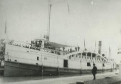 Bullhead Point Historical and Archeological Districtlisted 2003
 Carnegie Free Librarylisted 1988
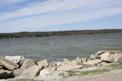 JOYS (Shipwreck)listed 2007
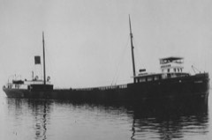 LAKELAND (steam screw) Shipwrecklisted 2015
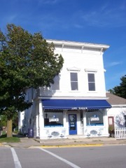 Larson, L. A., & Co. Storelisted 1985
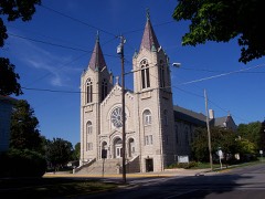 Louisiana Street/Seventh Avenue Historic Districtlisted 1983
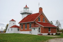 Sherwood Point Light Stationlisted 1984
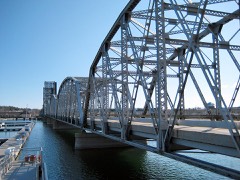 Sturgeon Bay Bridgelisted 2008
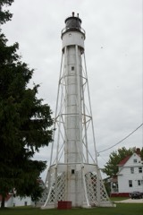 Sturgeon Bay Canal Lighthouselisted 1984
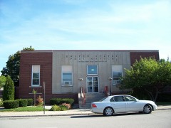 Sturgeon Bay Post Officelisted 2000
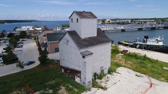 Teweles and Brandeis Grain Elevatorlisted 2018
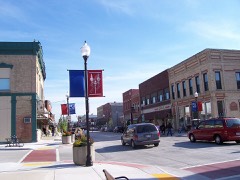 Third Avenue Historic Districtlisted 1983
Population over time
2 figuresSturgeon Bay grew from 9,144 to 9,646 between 2010 and 2020. These are the recorded population figures Wikidata holds for this place, reached through the Geographic Names Information System number this page is keyed on rather than by name, so they belong to this place and not to another of the same name. Most are census counts, but not all are: an early figure may be a founding or settlement estimate, and an estimate published within five years of a census is left out. The change column is computed, and is left blank where more than 20 years separate a figure from the one before it, because a gap that long is not a change between two counts.
| Year | People | Change |
|---|---|---|
| 2010 | 9,144 | |
| 2020 | 9,646 | +502 (+5%) |
Topographic sheets covering this place
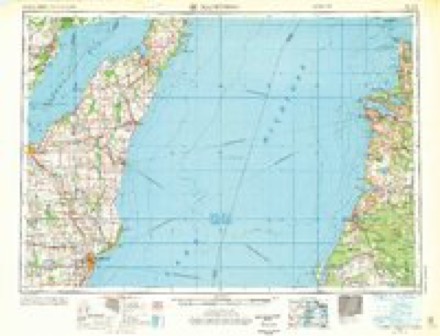
5 surveys from 7 printed sheetsMatched by testing this settlement's coordinate against the published boundary of every sheet in the United States Geological Survey's historical collection. Each opens the scanned sheet at the Survey.
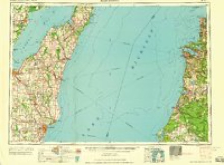
- 1954 USGS Manitowoc quadrangle1:250000, 2 printings
- 1958 USGS Manitowoc quadrangle1:250000
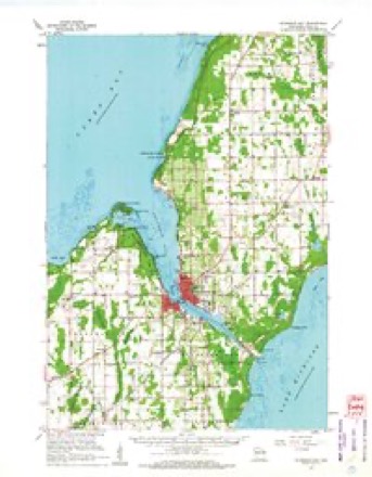
- 1960 USGS Sturgeon Bay quadrangle1:62500
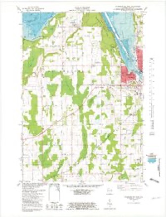
- 1981 USGS Sturgeon Bay West quadrangle1:24000
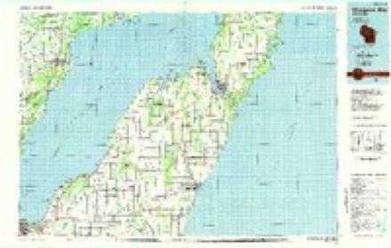
- 1984 USGS Sturgeon Bay quadrangle1:100000, 2 printings
In the county-history sources
8,908 words on this townshipHistory Of Door County Wisconsin The County Beautiful, published 1917 names this settlement in its chapter on Sturgeon Bay City. These are the passages that mention it, exactly as the scans read.
Sturgeon Bay seems to have been a center for human intercourse long before white men came here and began to do business. The remains of several Indian villages have been discovered in or near Sturgeon Bay which show that it had a large population hundreds of years ago. One of these villages was located on the property of the "Cove" summer resort about three hundred feet south of the boat landing. Another was across the bay at Circle Ridge on block 5. A great many fine relics have been unearthed here. Another village site has been found on block 8 of Wagener's second addition to Sturgeon Bay, just north of the city. Two large village sites are also found at Little Harbor.
Passage source: History Of Door County Wisconsin The County Beautiful, published 1917.
The Indians presumably found this a convenient place of habitation because of its proximity to the waters of both Lake Michigan and Green Bay. When the first settlers came they found a well trodden path leading from the head of Sturgeon Bay to Lake Michigan, just north of the present canal, over which the Indians had portaged their canoes for centuries.
Passage source: History Of Door County Wisconsin The County Beautiful, published 1917.
One of the first white men known to have visited Sturgeon Bay was the great missionary and explorer, Father Sines Marquette. On the 25th of October, 1674, a solitary canoe left the majestic waters of the Fox River at a point then known as St. Francis Xavier Mission, at the head of Green Bay. A black-gown with two companions manned the canoe. This priest was Father Marquette, on his last visit to the Illinois Indians, a visit from which he never returned. On the 27th of October he landed at a point where there was an Indian village (probably Cirele Ridge) and remained there three days instructing and ministering to the Indians. Proceeding on their journey they carried their canoes across the portage to Lake Michigan, surveying, as it were, the ship canal of two centuries later.
Passage source: History Of Door County Wisconsin The County Beautiful, published 1917.
Machine-read from a century-old scan, so expect the errors a machine makes: misspelled names, dropped words, stray characters.
Read the whole chapter on Sturgeon Bay City - it names this place 40 more 40 times.
Fires near this place
14 since 2018Regional context, not property-specific evidence. The federal wildfire occurrence database lists 14 fires within 5 miles of Sturgeon Bay between 2018 and 2020, burning about 7 acres in total. None started naturally. None was recorded as arson. Distance is straight-line from the map coordinates, so a fire counted here may appear on a neighbouring settlement's page as well.
| Reported cause | Fires |
|---|---|
| Missing data/not specified/undetermined | 7 |
| Debris and open burning | 4 |
| Smoking | 3 |
The most recent of them, most recent first, with the day each was reported and the service that recorded it.
| Date | Cause | Size | Reported by | Name on the report |
|---|---|---|---|---|
| 5 September 2020 | Missing data/not specified/undetermined | 1.0 acres | Wisconsin Department of Natural Resources | 134 |
| 8 June 2020 | Missing data/not specified/undetermined | 1.0 acres | Wisconsin Department of Natural Resources | 580 |
| 18 June 2020 | Smoking | under an acre | Wisconsin Department of Natural Resources | 623 |
| 16 June 2020 | Missing data/not specified/undetermined | under an acre | Wisconsin Department of Natural Resources | 610 |
| 17 May 2018 | Debris and open burning | 1.0 acres | Wisconsin Department of Natural Resources | 497 |
| 30 April 2018 | Debris and open burning | under an acre | Wisconsin Department of Natural Resources | 440 |
| 30 April 2018 | Debris and open burning | under an acre | Wisconsin Department of Natural Resources | 439 |
| 29 April 2018 | Smoking | 1.0 acres | Wisconsin Department of Natural Resources | 71 |
Settlements close enough to share some of these fires:
Mines and quarries near this place
10 of 15 shownRegional context, not property-specific evidence. The federal mineral resources record lists 15 workings within 5 miles of Sturgeon Bay: 6 producers, 5 past producers, 3 unknowns, 1 plant. 7 still produce. What was taken out: Sand and Gravel, Construction, Stone, Crushed/Broken, Limestone, Dimension, Stone. Distance is straight-line from the map coordinates, so a quarry counted here may appear on a neighbouring settlement's page as well.
| Where | Site | Commodity | Status | Recorded |
|---|---|---|---|---|
| Adamski Fisher Limestone Quarry | Limestone, Dimension | Past Producer | ||
| Eliason Quarry | Stone | Unknown | ||
| Elliason Quarry | Stone, Crushed/Broken | Past Producer | ||
| Jutting Point Limestone Quarry | Stone, Crushed/Broken | Past Producer | ||
| Kiehnau Quarry | Stone, Crushed/Broken | Past Producer | ||
| The Reef Limestone Quarry | Stone, Crushed/Broken | Past Producer | ||
| Walker Road Quarry | Stone, Crushed/Broken | Producer | ||
| Bissen Quarry | Sand and Gravel, Construction | Producer | ||
| County Pit | Sand and Gravel, Construction | Unknown | ||
| Door Pit South | Sand and Gravel, Construction | Producer |
Storms near this place
54 since 1994Regional context, not property-specific evidence. The National Weather Service names Sturgeon Bay in 54 storm reports between 1994 and 2023: 32 thunderstorm wind, 14 hail, 3 lightning, 3 funnel cloud. The reports record 5 injuries. Each account below is quoted exactly as the forecast office filed it, from the NOAA Storm Events Database, and each date opens the federal record of that event.
| When | Event | Place named | Harm | What the report says |
|---|---|---|---|---|
| June 1998 | Thunderstorm Wind | Sturgeon Bay | 3 hurt, $150,000 | no account filed |
| August 2003 | Lightning | Sturgeon Bay | 1 hurt | no account filed |
| June 1998 | Thunderstorm Wind | Sturgeon Bay | 1 hurt | no account filed |
| June 1998 | Thunderstorm Wind | Sturgeon Bay | $150,000 | no account filed |
| September 1994 | Thunderstorm Wind | Sturgeon Bay | $25,000 | no account filed |
| July 2011 | Lightning | Sturgeon Bay | $10,000 | Lightning struck a tree, followed the copper in the underground gas propane line to a house, and ignited the wooden support holding up a pipe in the basement. |
| August 1996 | Thunderstorm Wind | Sturgeon Bay | $5,000 | no account filed |
| June 1998 | Thunderstorm Wind | Sturgeon Bay | $2,000 | no account filed |
| May 1996 | Thunderstorm Wind | Sturgeon Bay | $2,000 | no account filed |
| July 2023 | Hail | Sturgeon Bay | - | Penny size hail fell in Sturgeon Bay. |
| July 2023 | Hail | Sturgeon Bay | - | Half dollar size hail fell near Sturgeon Bay. The time of this report is an estimate based on radar data. |
| August 2023 | Hail | Sturgeon Bay | - | Penny size hail fell near Sturgeon Bay. |
| August 2023 | Thunderstorm Wind | Sturgeon Bay | - | Thunderstorm winds downed trees just north of Sturgeon Bay. |
| June 2022 | Thunderstorm Wind | Sturgeon Bay | - | Thunderstorm winds downed trees and power lines near Sturgeon Bay. The time of this report is an estimate based on radar data. |
| July 2021 | Thunderstorm Wind | Sturgeon Bay | - | Thunderstorm winds downed trees and power lines in Sturgeon Bay, and across Door County. The time of this event is an estimate based on radar data. |
| April 2020 | Hail | Sturgeon Bay | - | Golf ball size hail fell in Sturgeon Bay. |
| July 2020 | Thunderstorm Wind | Sturgeon Bay | - | Thunderstorm winds downed trees in Sturgeon Bay. The time of this report is an estimate based on radar data. |
| August 2018 | Thunderstorm Wind | Sturgeon Bay | - | Thunderstorm winds downed trees and power lines in Sturgeon Bay. The time of this report was estimated based on radar data. |
| June 2017 | Thunderstorm Wind | Sturgeon Bay | - | Thunderstorm winds caused widespread tree damage across Door County. |
| June 2017 | Thunderstorm Wind | Sturgeon Bay | - | Thunderstorm winds downed trees and power lines in Sturgeon Bay, Baileys Harbor, Fish Creek and Sister Bay. The time of this report was estimated for Sturgeon Bay based on radar data. |
| July 2016 | Thunderstorm Wind | Sturgeon Bay | - | Thunderstorm winds downed trees just north of Sturgeon Bay, on Reynolds Road, and just south of Sturgeon Bay, near Clay Banks. |
| July 2011 | Thunderstorm Wind | Sturgeon Bay | - | Law enforcement reported trees and power lines were blown down in the city of Sturgeon Bay and across much of southern Door County. |
| June 2007 | Thunderstorm Wind | Sturgeon Bay | - | Tree uprooted and landed on wires. |
| June 2007 | Hail | Sturgeon Bay | - | Golf ball size hail. |
| June 2007 | Hail | Sturgeon Bay | - | Ping pong ball size hail covered the ground. |
| July 2007 | Thunderstorm Wind | Sturgeon Bay | - | Straight-line winds from thunderstorms knocked down several trees in central Door County. |
| June 2007 | Thunderstorm Wind | Sturgeon Bay | - | Trees and branches down. |
| June 2007 | Hail | Sturgeon Bay | - | no account filed |
| June 2007 | Hail | Sturgeon Bay | - | no account filed |
| October 2006 | Hail | Sturgeon Bay | - | no account filed |
| September 2005 | Thunderstorm Wind | Sturgeon Bay | - | no account filed |
| August 2004 | Thunderstorm Wind | Sturgeon Bay | - | no account filed |
| July 2003 | Thunderstorm Wind | Sturgeon Bay | - | no account filed |
| May 2002 | Hail | Sturgeon Bay | - | no account filed |
| July 2002 | Hail | Sturgeon Bay | - | no account filed |
| September 2001 | Funnel Cloud | Sturgeon Bay | - | no account filed |
| August 2001 | Thunderstorm Wind | Sturgeon Bay | - | no account filed |
| August 2001 | Hail | Sturgeon Bay | - | no account filed |
| August 2001 | Thunderstorm Wind | Sturgeon Bay | - | no account filed |
| July 2000 | Hail | Sturgeon Bay | - | no account filed |
| June 2000 | Thunderstorm Wind | Sturgeon Bay | - | no account filed |
| September 2000 | Thunderstorm Wind | Sturgeon Bay | - | no account filed |
| September 1999 | Funnel Cloud | Sturgeon Bay | - | no account filed |
| September 1999 | Funnel Cloud | Sturgeon Bay | - | no account filed |
| August 1999 | Waterspout | Sturgeon Bay | - | no account filed |
| September 1999 | Waterspout | Sturgeon Bay | - | no account filed |
| June 1999 | Thunderstorm Wind | Sturgeon Bay | - | no account filed |
| July 1999 | Thunderstorm Wind | Sturgeon Bay | - | no account filed |
| July 1999 | Thunderstorm Wind | Sturgeon Bay | - | no account filed |
| July 1999 | Thunderstorm Wind | Sturgeon Bay | - | no account filed |
| June 1999 | Thunderstorm Wind | Sturgeon Bay | - | no account filed |
| June 1998 | Hail | Sturgeon Bay | - | no account filed |
| June 1998 | Lightning | Sturgeon Bay | - | no account filed |
| August 1995 | Thunderstorm Wind | Sturgeon Bay | - | no account filed |
Nearest settlements
The eight closest, with where each one stands in the county. Distances are straight-line, computed from the Geographic Names Information System coordinates.
| Map | Place | Distance | Sheets |
|---|---|---|---|
| Stevens Hill | 0.6 miles | 8 | |
| Idlewild | 4.6 miles | 7 | |
| Salona | 6.2 miles | 8 | |
| Institute | 6.3 miles | 7 | |
| Vignes | 7.5 miles | 8 | |
| Valmy | 7.9 miles | 7 | |
| Maplewood | 8.1 miles | 8 | |
| Carlsville | 8.4 miles | 7 |
Elsewhere
Matched on this settlement's Geographic Names Information System number rather than its name, so it cannot be a different place of the same name in another state.
| Wikipedia article on Sturgeon Bay | An encyclopaedic summary. Its text is share-alike, so it is linked here rather than copied. |
| Wikidata item Q1023559 | The structured record the population and elevation above come from. Public domain (CC0). |
Provenance
This settlement is recorded in the Geographic Names Information System as feature 1575000. The sheet list is computed by point-in-boundary test against the United States Geological Survey's historical topographic inventory. Both are works of the United States government and carry no copyright under 17 U.S.C. 105.
Wildfire. Short, Karen C. 2022. Spatial wildfire occurrence data for the United States, 1992-2020 [FPA_FOD_20221014]. 6th Edition. Fort Collins, CO: Forest Service Research Data Archive. https://doi.org/10.2737/RDS-2013-0009.6 Collected with United States Government funding and usable without additional permissions or fees.
Mines and quarries. USGS Mineral Resources Data System (MRDS) https://mrdata.usgs.gov/mrds/ A work of the United States government, no copyright under 17 U.S.C. 105.
Storms. NOAA National Centers for Environmental Information, Storm Events Database https://www.ncei.noaa.gov/stormevents/ A work of the United States government, no copyright under 17 U.S.C. 105. Narratives are quoted verbatim from the National Weather Service report and are not edited or summarised.