BlockBefore

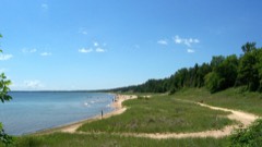
Door County, Wisconsin

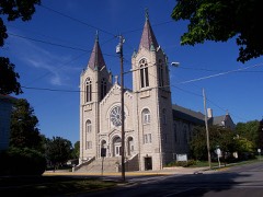
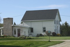
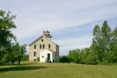
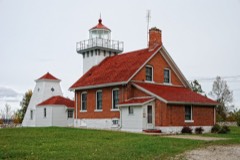
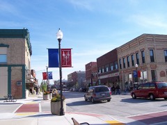
48 topographic sheets cover 32 settlements here, and 68 properties are on the National Register of Historic Places.

Research this county

From the record

68 National Register listings published here, 2 of them National Historic Landmarks · the county-history sources name 1 person · people the book names include Charles Scofield (Sturgeon Bay City, 1917) (machine-read).

Sources: the county history on the Internet Archive · the National Register database, National Park Service

Wisconsin within the United States
Door County within Wisconsin

What the record shows

  • 256 topographic sheet readings cover the county's settlements.
  • 68 properties here are on the National Register of Historic Places: 36 buildings, 17 sites, 11 districts and 4 structures.
  • 7 of the 68 listings were added during the 1970s.
  • The Geographic Names Information System records 32 populated places in this county; 32 are covered by at least one topographic sheet.
  • 3 public-domain county histories, 1881 and 1917, supply 43,882 words of narrative reproduced here.

Places on the National Register

68

Every property in this county listed on the National Register of Historic Places, with the year it was listed and the federal nomination document.

Photograph PropertyType ListedReference
ADVANCE shipwreck (Barge)site2019100004024
AUSTRALASIA (wooden bulk carrier) Shipwrecksite201313000466
Anderson Dock Historic Districtdistrict198585001249
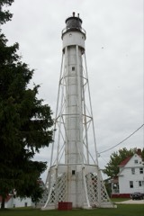
BOAZ (schooner) Shipwrecksite2023100009414
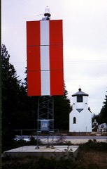
Baileys Harbor Range Lightdistrict198989001466
Baileys Harbor Town Hall-McArdle Librarybuilding200000000408
J.B. Bouche Housebuilding200404000411
Bullhead Point Historical and Archeological Districtdistrict200303000167
CHRISTINA NILSSON (shipwreck)site200303000668
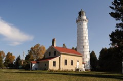
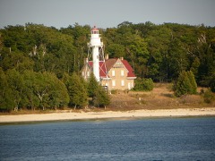
Cana Island Lighthousebuilding197676000201
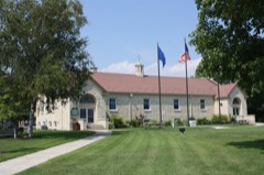
Carnegie Free Librarybuilding198888003069
Chambers Island Lighthousebuilding197575000063
Church of the Atonementbuilding198585000487
Clearing, Thesite197474000080
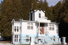
Cupola Housebuilding197979000073
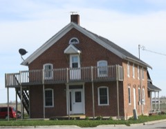
August Draize Farmsteadbuilding200404000398
EMILIN (schooner) Shipwrecksite2023100009197
Eagle Bluff Lighthousebuilding197070000032
Ephraim Moravian Churchbuilding198585000662
Ephraim Village Hallbuilding198585000663
Joachine J. Falque Housebuilding200404000407
Free Evangelical Lutheran Church-Bethania Scandinavian Evangelical Lutheran Congregationbuilding198585000664
GRAPE SHOT (schooner) Shipwrecksite201616000564
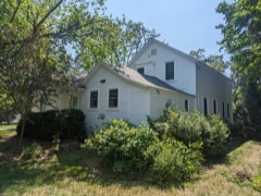
Gibraltar District School No. 2building198585001250
Globe Hotelbuilding198282000663
HANOVER (schooner) Shipwrecksite201515000710
Hillside Hotelbuilding198585000665
IRIS (Shipwreck)site200606000638
JOYS (Shipwreck)site200707001218
Jacksonport Wharf Archaeological District (Boundary Increase and Additional Documentation)district201515000478
Jacksonport Wharf Archeological Districtdistrict201212000053
Jischke's Meat Marketbuilding198686002306
Joint Brussels and Garner Dristrict School Number Onebuilding200404000408
LAKELAND (steam screw) Shipwrecksite201515000403
Larson, L. A., & Co. Storebuilding198585001357
Louisiana Street/Seventh Avenue Historic Districtdistrict198383003372
Joseph Monfils Farmsteadbuilding200404000409
Murphy Farms Number 1building201212000314
Namur Belgian-American Districtdistrict198987002553
Alexander Noble Housebuilding199696000159
OCEAN WAVE (Shipwreck)site200606000639
PEORIA Shipwreck (Schooner)site2024100010152
PRIDE Shipwreck (Schooner)site2024100010860
Peter Peterson Housebuilding198585000666
Pilot Island Lightbuilding198383004279
Plum Island Range Rear Lightstructure198484003659
Plum island Life-Saving and Light Stationdistrict201010000385
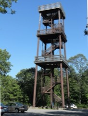
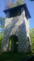
Potawatomi State Park Observation Towerstructure2021100006108
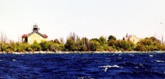
Pottawatomie Lighthousebuilding197979000074
Rock Island Historic Districtsite197272000050
SUCCESS (scow schooner) Shipwrecksite201515000711
Sherwood Point Light Stationbuilding198484003663
Dr. Joseph and Olivia Soper Housebuilding2024100010301
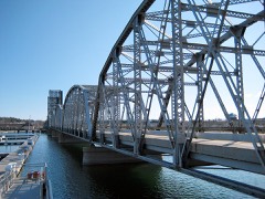
Sturgeon Bay Bridgestructure200807001420
Sturgeon Bay Canal Lighthousestructure198484003666
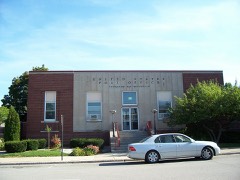
Sturgeon Bay Post Officebuilding200000001237
Sunshine Shipwreck (Scow Schooner)site2023100009481
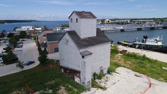
Teweles and Brandeis Grain Elevatorbuilding2018100002091
Third Avenue Historic Districtdistrict198383004282
Thordarson Estate Historic Districtdistrict198585000641
Freeman and Jesse Thorp House and Cottagesbuilding199797000887
Louis Vangindertahlen Housebuilding200404000410
Vorous General Storebuilding199797000429
Water Towerbuilding198585000640
Welcker's Resort Historic Districtdistrict199797000328
William Zachow Farmsteadbuilding199796001578
Albert Zahn Housebuilding200000000492
August Zahn Balcksmith Shop and Housebuilding200000000455

Wildfire, 1993 to 2020

75 fires

Every wildfire the federal occurrence database records inside this county: 75 of them, burning about 146 acres. None started naturally and 4 were recorded as arson. Each settlement page carries the fires within five miles of it.

Reported cause Fires
Debris and open burning32
Missing data/not specified/undetermined31
Arson/incendiarism4
Smoking3
Power generation/transmission/distribution1
Equipment and vehicle use1
Fireworks1
Recreation and ceremony1
Misuse of fire by a minor1

The five largest, by the area the report gives. One of them was set deliberately.

DateCause SizeReported by Name on the report
23 June 1998Debris and open burning88 acresWisconsin Department of Natural Resourcesnot named
2 April 2020Misuse of fire by a minor18 acresWisconsin Department of Natural Resources20684
15 April 2020Debris and open burning4.0 acresWisconsin Department of Natural Resources20762
30 May 2019Arson/incendiarism3.0 acresWisconsin Department of Natural Resources85
30 April 2018Debris and open burning2.0 acresWisconsin Department of Natural Resources19
15 April 2019Debris and open burning2.0 acresWisconsin Department of Natural Resources132
6 July 2020Missing data/not specified/undetermined1.0 acresWisconsin Department of Natural Resources87
18 October 2018Debris and open burning1.0 acresWisconsin Department of Natural Resources57

Every settlement page carries the fires within five miles of it - see the settlement index below.

Storms, 1956 to 2025

60 of 252 shown

The NOAA Storm Events Database holds 252 reports for this county, causing no deaths, 11 injuries and about $9,664,200 in recorded property damage. Each settlement page carries the reports that name it.

Kind of event Reports
Thunderstorm Wind138
Hail82
Tornado10
Lightning7
Waterspout6
Funnel Cloud4
Heavy Rain3
Flash Flood2

The most serious of them, by death, then injury, then recorded damage. The accounts are quoted exactly as the forecast office filed them.

WhenEvent Place namedHarm What the report says
June 1998Thunderstorm WindSturgeon Bay3 hurt, $150,000no account filed
August 1998Tornado (F3)Egg Harbor2 hurt, $4,740,000no account filed
April 1970Tornado (F2)not stated2 hurt, $250,000no account filed
August 2003LightningSturgeon Bay1 hurtno account filed
September 2001Thunderstorm WindFish Creek1 hurtno account filed
June 1998Thunderstorm WindSturgeon Bay1 hurtno account filed
July 1992Thunderstorm Windnot stated1 hurtno account filed
June 1985Tornado (F2)not stated$2,500,000no account filed
July 2010LightningFish Creek$433,700Lightning struck a home in Fish Creek around 2:30 pm CST. Every fire department in Door County, except Washington Island, helped fight the fire but the house and attached three-stall garage were a total loss. Three vintage automobiles were also destroyed by the fire.
August 2025Thunderstorm WindEphraim$431,000Thunderstorm winds downed and uprooted multiple trees in Ephraim. The time of this report is an estimate based on radar data. The thunderstorms produced $431,938 worth of damage and debris clean up across central and northern parts of Door County.
April 1970Tornado (F2)not stated$250,000no account filed
July 1956Tornado (F2)not stated$250,000no account filed
March 2016LightningStrgn Bay Door Co Ar$150,000Lightning is believed to be the cause of a fire that caused substantial damage to a home near Sturgeon Bay. The damage total is an estimate.
August 2015Thunderstorm WindEgg Harbor$150,000Thunderstorm winds uprooted and snapped an area of trees a couple of miles either side of a west-east line from Frank E. Murphy Park to Jacksonport.
June 1998Thunderstorm WindSturgeon Bay$150,000no account filed
September 2014Flash FloodEphraim$75,000Heavy rainfall flooded basements, resorts, and campgrounds, and damaged roads in the Sister Bay, Fish Creek, and Baileys Harbor areas. In excess of 6 inches of rain in Baileys Harbor caused nearly every home there to sustain a backup from the sewage disposal plant. Flood waters damaged documents at the Ephraim Historical Society. The flooding also washed out shoulders of several roads in the area.
September 1994Thunderstorm WindSturgeon Bay$25,000no account filed
July 1973Tornado (F1)not stated$25,000no account filed
June 2024Flash FloodCarnot$20,000County U and Shiloh Road washed out and closed due to flash flooding with 3 to 4 inches of rain falling between 2 AM and 5:15 AM CDT.
August 2015Thunderstorm WindEgg Harbor$15,000Thunderstorm winds to 70 mph downed trees and knocked out power in the Egg Harbor area. The time of this event is an estimate based on radar data.
July 2011LightningSturgeon Bay$10,000Lightning struck a tree, followed the copper in the underground gas propane line to a house, and ignited the wooden support holding up a pipe in the basement.
September 1996Thunderstorm WindValmy$10,000no account filed
August 2015Thunderstorm WindEllison Bay$6,000Thunderstorm winds downed a few trees and power lines near Ellison Bay.
August 1996Thunderstorm WindEgg Harbor$5,000no account filed
August 1996Thunderstorm WindSturgeon Bay$5,000no account filed
July 1996Thunderstorm WindBrussels$3,000no account filed
July 1966Tornado (F0)not stated$2,500no account filed
June 1998Thunderstorm WindGills Rock$2,000no account filed
June 1998Thunderstorm WindSturgeon Bay$2,000no account filed
May 1996Thunderstorm WindSturgeon Bay$2,000no account filed
October 1997LightningSister Bay$1,000Lightning struck a business in Sister Bay, igniting a small fire. The strike also broke a water line, which may have put the fire out.
July 1995Thunderstorm WindSister Bay$1,000no account filed
July 2025Thunderstorm WindMaplewood-Thunderstorm winds downed trees in Maplewood. The time of this report is an estimate based on radar data.
July 2025Thunderstorm WindEgg Harbor-Thunderstorm winds downed trees in Egg Harbor. The time of this report is an estimate based on radar data.
August 2025Thunderstorm WindBaileys Harbor-Thunderstorm winds produced widespread tree damage across Cana Island. This tree damage temporarily stranded campers on the island as the roads were inaccessible due to trees blocking the roads. The time of this report is an estimate based on radar data.
August 2025Thunderstorm WindRowleys Bay-Thunderstorm winds produced widespread tree damage in Newport State Park. The time of this report is an estimate based on radar data.
August 2025Thunderstorm WindEgg Harbor-Thunderstorms produced a wind gust to 82 mph.
August 2025Tornado (EF0)Ephraim-A tornado briefly touched down near Ephraim in Peninsula State Park at 3:54 PM CDT. The most significant damage was an uprooted tree with the NWS on the low end of the damage scale due to saturated ground. The tornado crossed into Eagle Harbor as a waterspout at 3:55 pm CDT. Total path length is estimated to be 0.25 miles long, with a width of 32 yards. Peak wind estimated to be around 73 mph.
August 2025Thunderstorm WindEgg Harbor-Thunderstorm winds downed trees and power lines on highway 42 from Egg Harbor to Fish Creek, making the road impassable. The time of this report is an estimate based on radar data.
August 2025Thunderstorm WindEphraim-Thunderstorm winds downed trees and power lines on highway 42 from Fish Creek to Ephraim, making the road impassable. The time of this report is an estimate based on radar.
August 2025Thunderstorm WindJacksonport-Thunderstorm winds downed trees in Jacksonport. The time of this report is an estimate based on radar data.
May 2024Thunderstorm WindFish Creek-Thunderstorm winds downed trees in Fish Creek. The time of this report is an estimate based on radar data.
May 2024Thunderstorm WindEgg Harbor-Thunderstorm winds downed trees and power lines in Egg Harbor. The time of this report is an estimate based on radar data.
May 2024Thunderstorm WindDetroit Harbor-Thunderstorm winds downed trees and power lines on Washington Island.
May 2024Tornado (EF1)Detroit Harbor-A tornado formed at 10:32 pm CDT on the southern part of Washington Island in northern Door County and continued northeast before dissipating at 10:34 pm CDT in the central part of Washington Island. Total path length is estimated to be 2.28 miles long, with a width of 50 yards. Peak wind estimated to be around 90 mph.
July 2023HailSturgeon Bay-Penny size hail fell in Sturgeon Bay.
August 2023HailCarlsville-Nickel size hail fell in Carlsville.
July 2023HailSturgeon Bay-Half dollar size hail fell near Sturgeon Bay. The time of this report is an estimate based on radar data.
August 2023HailSturgeon Bay-Penny size hail fell near Sturgeon Bay.
August 2023Thunderstorm WindDoor Co Arpt-Thunderstorm winds downed trees and power lines near Little Sturgeon. The time of this report is an estimate based on radar data.
August 2023Thunderstorm WindDoor Co Arpt-Thunderstorm winds downed trees and power lines near Sturgeon Bay. The time of this report is an estimate based on radar data.
July 2023Thunderstorm WindSister Bay-Thunderstorm winds downed trees in Sister Bay. The time of this report is an estimate based on radar data.
July 2023HailSister Bay-Penny size hail fell in Sister Bay.
August 2023Thunderstorm WindSturgeon Bay-Thunderstorm winds downed trees just north of Sturgeon Bay.
May 2022HailBaileys Harbor-Nickel size hail fell in Baileys Harbor.
May 2022HailBaileys Harbor-Penny size hail fell northeast of Baileys Harbor.
June 2022Thunderstorm WindSturgeon Bay-Thunderstorm winds downed trees and power lines near Sturgeon Bay. The time of this report is an estimate based on radar data.
June 2021Thunderstorm WindInstitute-Thunderstorm winds downed trees and power lines near Sturgeon Bay. The time of this report is an estimate based on radar data.
September 2021Thunderstorm WindJacksonport-Thunderstorm winds downed trees and power lines around and north of Jacksonport. The time of this event is an estimate based on radar data.
September 2021Thunderstorm WindFish Creek-Thunderstorm winds downed trees in Peninsula State Park. The time of this event is an estimate based on radar data.

Mines and quarries

37 recorded

The Survey's mineral resources record lists 37 workings inside this county. 17 still produce and 20 are closed or unrecorded. Each settlement page carries the workings within five miles of it.

Commodity Workings
Sand and Gravel, Construction20
Stone, Crushed/Broken14
Limestone, Dimension2
Stone1
Manganese, Ferromanganese1

The least common of them first, because a county's hundredth gravel pit says nothing its first ten did not.

Where SiteCommodity StatusRecorded
Eliason QuarryStoneUnknown
Green Bay Manganese NodulesManganese, FerromanganeseUnknown
Adamski Fisher Limestone QuarryLimestone, DimensionPast Producer
Macco Creek Dolomite QuarryLimestone, DimensionPast Producer
Crossroads Limestone QuarryStone, Crushed/BrokenPast Producer
Door County QuarriesStone, Crushed/BrokenProducer
Door Quarry SouthStone, Crushed/BrokenProducer
Elliason QuarryStone, Crushed/BrokenPast Producer
Jarman QuarryStone, Crushed/Broken, Sand and Gravel, ConstructionProducer
Jutting Point Limestone QuarryStone, Crushed/BrokenPast Producer
Kiehnau QuarryStone, Crushed/BrokenPast Producer
Lautenbach QuarryStone, Crushed/BrokenPast Producer
Little Hill Limestone QuarryStone, Crushed/BrokenPast Producer
Njord Heim QuarryStone, Crushed/BrokenPast Producer
Old Limestone QuarryStone, Crushed/BrokenPast Producer
Reiner QuarryStone, Crushed/BrokenPast Producer
The Reef Limestone QuarryStone, Crushed/BrokenPast Producer
Walker Road QuarryStone, Crushed/BrokenProducer
Becker PitSand and Gravel, ConstructionPast Producer
Bissen QuarrySand and Gravel, ConstructionProducer
Charles Sand and Gravel PitSand and Gravel, ConstructionProducer
County PitSand and Gravel, ConstructionUnknown
Door County Highway Dept. PitSand and Gravel, ConstructionPast Producer
Door Pit NorthSand and Gravel, ConstructionProducer
Door Pit SouthSand and Gravel, ConstructionProducer
Hagen PitSand and Gravel, ConstructionProducer
Josephs PitSand and Gravel, ConstructionProducer
Mohr PitSand and Gravel, ConstructionProducer
Parent PitSand and Gravel, ConstructionPast Producer
Peterson PitSand and Gravel, ConstructionProducer
Pit No 7 - BrusselsSand and Gravel, ConstructionProducer
Serrahn PitSand and Gravel, ConstructionProducer
Simons PitSand and Gravel, ConstructionPast Producer
Trodahl Pit & MillSand and Gravel, ConstructionPlant
Walter Fischer Sand and Gravel PitSand and Gravel, ConstructionProducer
Washington Island PitsSand and Gravel, ConstructionProducer
Worefl PitSand and Gravel, ConstructionUnknown

The townships, in 1881

43,882 words

History of Door County, Wisconsin, Together with Biographies of Nearly Seven Hundred Families, and Mention of 4,000 Persons .. devotes a chapter to each township: its boundaries and streams, who settled it and when, the mills, the schools and the churches. All 9 are reproduced here in full. Each row shows the township's own shape and where it lies in the county, drawn from the Census Bureau's boundary. Which settlements belong to which township is computed from that same boundary, not taken from the book.

The county's history books

385,532 words

2 books written about this county, cut here where the book itself is cut, at its printed chapters: 42 chapters in all. Every chapter is public domain, machine-read from the scan and reproduced complete. A chapter already given under one of the county's towns is not repeated in this list.

History Of Door County (1881)

ChapterLength
The whole text45,684 words in 3 parts

History Of Door County Wisconsin The County Beautiful (1917)

ChapterLength
Chapter 1: General View of Door County1,688 words
Chapter 2: Discovery of Door County and the West1,530 words
Chapter 3: Indian Remains in Door County8,425 words
Chapter 4: Historical Traditions of the Indian Tribes of the Door County Peninsula6,597 words
Chapter 5: Early French Explorers in Door County1,704 words
Chapter 6: The Great Explorers1,397 words
Chapter 7: Jesuit Missionaries in Door County2,074 words
Chapter 8: Indian Outbreaks1,132 words
Chapter 9: Early Visitors to Door County4,410 words
Chapter 10: Door County's First Settler2,055 words
Chapter 11: An Outline of Door County's History2,418 words
Chapter 13: Political Organization of Door County with Lists of County Officers and Members of the Legislature4,979 words
Chapter 14: Assessments and Taxes2,539 words
Chapter 16: Door County Schools2,773 words
Chapter 17: The Sturgeon Bay Canal3,005 words
Chapter 18: Door County Industries7,510 words
Chapter 19: Banking993 words
Chapter 20: Door County Highways1,274 words
Chapter 21: The Railroad and Telegraph2,447 words
Chapter 22: History of Door County Churches8,369 words
Chapter 23: Newspapers and Literary Productions10,966 words
Chapter 24: Peninsula State Park2,723 words
Chapter 25: Door County Lighthouses3,517 words
Chapter 26: A Forgotten Community: a Record of Rock Island, the Threshold of Wisconsin4,303 words
Chapter 27: David Kennison1,058 words
Chapter 28: Washington Island10,516 words
Chapter 29: A Man of Iron: a Tale of Death's Door1,945 words
Chapter 32: The Sage of Shivering Sands742 words
Chapter 33: Chambers Island2,771 words
Chapter 35: The Birth of Fish Creek1,776 words
Chapter 37: A Terrible Experience2,465 words
Chapter 39: The Giant of Gills Rock1,606 words
Chapter 40: The.rise and Fall of Rowleys Bay3,083 words
Chapter 44: Southern Door County1,207 words
Chapter 45: The Belgian Settlement in Gardner, Union and Brussels5,552 words
Chapter 46: The Great Fire of 18712,502 words
Chapter 47: The Golden Age of Little Sturgeon2,622 words
Chapter 48: The German Settlement in Forestville and Nasewaupee4,075 words
Chapter 49: Clay Banks and the Norwegian Settlement2,878 words
Chapter 50: Door County's Contribution to the European War3,350 words
Biographical sketches202,872 words in 13 parts

The people it describes

1 named

Everyone History of Door County, Wisconsin, Together with Biographies of Nearly Seven Hundred Families, and Mention of 4,000 Persons .. stops to write about, with the section that describes them. Among them are the men who founded the place and governed the Territory. Each name opens the passage itself, in the words of 1881.

Every populated place in the county

32

Named settlements recorded in the Geographic Names Information System, each with the topographic sheets covering it. Villages, hamlets and abandoned places alike. Each is shown with the nearest named watercourse or landform and the survey quadrangle it falls on.

The vanished settlements of Door County: the places named above that are no longer on the map.

Provenance

  • Topographic sheets. USGS Historical Topographic Map Collection, county index, measured from the bulk metadata.
  • Fire insurance maps. Library of Congress Sanborn collection, faceted to this county.
  • Photographs. Each place queried individually against the Library of Congress Prints and Photographs search.
  • Wildfire. Short, Karen C. 2022. Spatial wildfire occurrence data for the United States, 1992-2020 [FPA_FOD_20221014]. 6th Edition. Fort Collins, CO: Forest Service Research Data Archive. https://doi.org/10.2737/RDS-2013-0009.6 Collected with United States Government funding and usable without additional permissions or fees.
  • Mines and quarries. USGS Mineral Resources Data System (MRDS) https://mrdata.usgs.gov/mrds/ A work of the United States government, no copyright under 17 U.S.C. 105.
  • Storms. NOAA National Centers for Environmental Information, Storm Events Database https://www.ncei.noaa.gov/stormevents/ A work of the United States government, no copyright under 17 U.S.C. 105. Narratives are quoted verbatim from the National Weather Service report and are not edited or summarised.