 Block
Twin Lakes, Wisconsin
19 topographic sheets cover this place, the earliest surveyed in 1893 and the latest in 1980. It stands in Twin Lakes Village. It lies in ZIP code area 53181. It lies near Mount Moriah. The Survey maps it on the Silver Lake quadrangle. 6,309 people lived here at the 2020 count. It stands 801 feet above sea level.
Population over time
2 figuresTwin Lakes grew from 5,989 to 6,309 between 2010 and 2020. These are the recorded population figures Wikidata holds for this place, reached through the Geographic Names Information System number this page is keyed on rather than by name, so they belong to this place and not to another of the same name. Most are census counts, but not all are: an early figure may be a founding or settlement estimate, and an estimate published within five years of a census is left out. The change column is computed, and is left blank where more than 20 years separate a figure from the one before it, because a gap that long is not a change between two counts.
| Year | People | Change |
|---|---|---|
| 2010 | 5,989 | |
| 2020 | 6,309 | +320 (+5%) |
Topographic sheets covering this place
9 surveys from 19 printed sheetsMatched by testing this settlement's coordinate against the published boundary of every sheet in the United States Geological Survey's historical collection. Each opens the scanned sheet at the Survey.
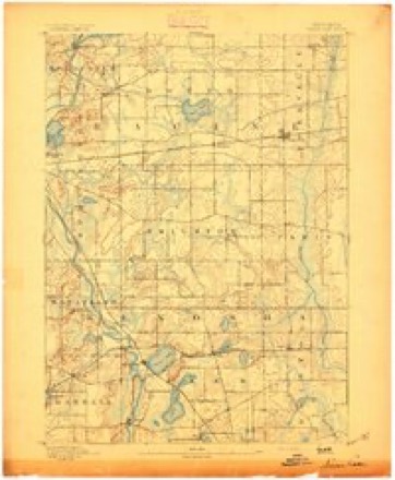
- 1893 USGS Silver Lake quadrangle1:62500, 2 printings
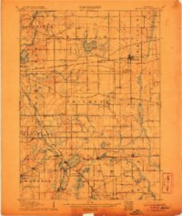
- 1906 USGS Silver Lake quadrangle1:62500, 3 printings
- 1954 USGS Rockford quadrangle1:250000
- 1955 USGS Rockford quadrangle1:250000
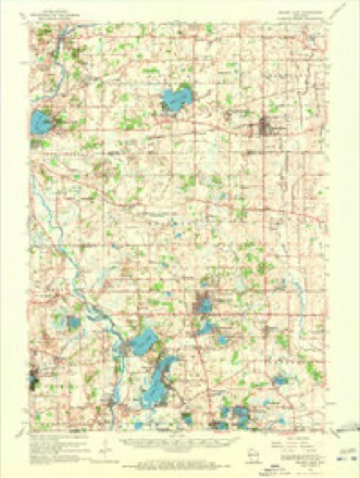
- 1958 USGS Rockford quadrangle1:250000, 4 printings
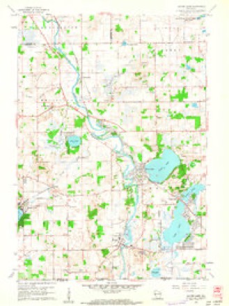
- 1960 USGS Silver Lake quadrangle1:24000, 3 printings
- 1960 USGS Silver Lake quadrangle1:62500, 3 printings
- 1963 USGS Rockford quadrangle1:250000
- 1980 USGS Lake Geneva quadrangle1:100000





Fires near this place
9 since 2013Regional context, not property-specific evidence. The federal wildfire occurrence database lists 9 fires within 5 miles of Twin Lakes between 2013 and 2020, burning about 34 acres in total. 1 started naturally. 1 was recorded as arson. Distance is straight-line from the map coordinates, so a fire counted here may appear on a neighbouring settlement's page as well.
| Reported cause | Fires |
|---|---|
| Missing data/not specified/undetermined | 5 |
| Debris and open burning | 2 |
| Natural | 1 |
| Arson/incendiarism | 1 |
The most recent of them, most recent first, with the day each was reported and the service that recorded it.
| Date | Cause | Size | Reported by | Name on the report |
|---|---|---|---|---|
| 15 July 2013 | Missing data/not specified/undetermined | 1.0 acres | Illinois Division of Forestry Resources | 13-294 |
| 1 June 2018 | Missing data/not specified/undetermined | 1.0 acres | Wisconsin Department of Natural Resources | 62 |
| 19 May 2018 | Arson/incendiarism | 1.0 acres | Wisconsin Department of Natural Resources | 44 |
| 30 April 2018 | Missing data/not specified/undetermined | under an acre | Wisconsin Department of Natural Resources | 857 |
| 16 April 2013 | Natural | 6.0 acres | Illinois Division of Forestry Resources | 13-150 |
| 31 March 2014 | Missing data/not specified/undetermined | 12 acres | Illinois Division of Forestry Resources | 14-166 |
| 17 March 2020 | Debris and open burning | under an acre | Wisconsin Department of Natural Resources | 80 |
| 5 November 2020 | Debris and open burning | 13 acres | Wisconsin Department of Natural Resources | NEW MUNSTER |
Settlements close enough to share some of these fires:
Mines and quarries near this place
6 within 5 milesRegional context, not property-specific evidence. The federal mineral resources record lists 6 workings within 5 miles of Twin Lakes: 5 past producers, 1 occurrence. None of them still produces. What was taken out: Sand and Gravel, Construction. Distance is straight-line from the map coordinates, so a quarry counted here may appear on a neighbouring settlement's page as well.
| Where | Site | Commodity | Status | Recorded |
|---|---|---|---|---|
| Barthel Pit | Sand and Gravel, Construction | Past Producer | ||
| Bassett Sand Deposit | Sand and Gravel, Construction | Occurrence | ||
| Fox Pit | Sand and Gravel, Construction | Past Producer | ||
| Powers Lake Sand and Gravel Pit | Sand and Gravel, Construction | Past Producer | ||
| S and W Dairy Pit | Sand and Gravel, Construction | Past Producer | ||
| Techert Pit | Sand and Gravel, Construction | Past Producer |
Storms near this place
41 since 1995Regional context, not property-specific evidence. The National Weather Service names Twin Lakes in 41 storm reports between 1995 and 2024: 22 thunderstorm wind, 8 hail, 3 lightning, 3 flood. The reports record 15 injuries. Each account below is quoted exactly as the forecast office filed it, from the NOAA Storm Events Database, and each date opens the federal record of that event.
| When | Event | Place named | Harm | What the report says |
|---|---|---|---|---|
| July 1997 | Thunderstorm Wind | Twin Lakes | 9 hurt, $1,000,000 | Nine thousand people were evacuated moments before wet-micorburst winds estimated to 80 mph blew down a stage at the Country Thunder Music Festival. The stage was lifted up and twisted by the winds. Fying debis damaged parked vehicles, and many chairs were scrambled. Interestingly, the stage was anchored with steel cable. However, the local terrain aided in funneling the powerful winds toward the stage. A boat in a nearby yard was lifted up by the same winds and the cover torn off. 9 people were injured, 3 needed to go to the hospital. |
| July 2001 | Lightning | Twin Lakes | 4 hurt | no account filed |
| July 2018 | Lightning | Twin Lakes | 1 hurt | A woman suffered a direct hit from a lightning strike at the Country Thunder Music Festival. She was seriously injured but did recover. |
| April 1996 | Lightning | Twin Lakes | 1 hurt | no account filed |
| July 2017 | Flood | Twin Lakes | $4,000,000 | Three to eight inches of rain fell over Kenosha County from late evening on July 11th through much of the morning of July 12th causing days of areal flooding over portions of the county, including near the Fox River. The Fox River near New Munster had a record crest of 17.47 feet on July 13th. There was widespread flooding adjacent to the river in the Town of Wheatland, the Town of Salem, and the Village of Salem Lakes. Floodwaters are into the lower levels of some homes in those areas...including Shorewood Drive and Riverside Drive in the Village of Salem Lakes. Highway 50 is closed at the Fox River. Many roads were closed or washed-out in and near the Village of Paddock Lake, the Village of Salem Lakes, and in the Town of Somers. The Des Plaines River flooded a residence near the river and highway 50. Three buildings and three vehicles were flooded in 2-3 feet of water. |
| June 2008 | Flash Flood | Twin Lakes | $1,970,000 | Heavy rains resulted in flash flooding across much of Kenosha County. Water depths on road surfaces reached 3 feet or more and there were gravel washouts. Some farm fields remained flooded into early July. The breakdown for residential home losses were: 37 minimally affected, 47 with minor damage, 33 with major damage, and 3 destroyed (total of $300 thousand for home losses). There were no business losses. Crop losses were estimated at 2 million. Public sector damage was about $673 thousand. There were several roads and bridges that sustained damage. |
| April 1996 | Thunderstorm Wind | Twin Lakes | $700,000 | no account filed |
| May 2004 | Flash Flood | Twin Lakes | $200,000 | no account filed |
| July 2017 | Flash Flood | Twin Lakes | $100,000 | Three to eight inches of rain fell over Kenosha County over several hours causing urban and rural flash flooding. The highest amounts occurred west of I-94. Kenosha County declared an emergency. Sheriff deputies assisted with the evacuations of campers at Sunrise and Sunset Campgrounds at the Richard Bong State Recreation Area. Eight people were evacuated from the Pleasant Prairie Mobile Home Park in the Town of Somers due to flooding from the Kilbourn Road Ditch. Some water rescues occurred due to vehicles driving into deep water. The Chicago-Milwaukee Amtrak Hiawatha Service and the Metra Train Service in the Milwaukee district was temporary closed due to flooding. The right lane of I-94 southbound was closed at County Highway A. Many roads were closed or washed-out in and near the Village of Paddock Lake, the Village of Salem Lakes, and in the Town of Somers. Flooding began on the Fox River in the western portion of the county. |
| June 2002 | Thunderstorm Wind | Twin Lakes | $75,000 | no account filed |
| June 2024 | Thunderstorm Wind | Twin Lakes | $30,000 | Random pockets of tree damage blown down in a divergent pattern on the west side of Lake Mary and Elizabeth Lake . Powerlines down as well. |
| July 2007 | Thunderstorm Wind | Twin Lakes | $30,000 | Powerful thunderstorm gusts to around 52 knots (60 mph) toppled large trees and tree branches. The tree debris damage a home's porch and garage, and a car and boat. |
| June 2017 | Thunderstorm Wind | Twin Lakes | $25,000 | There were branches broken off of several large trees as a squall line moved through southeastern Wisconsin. |
| June 2001 | Thunderstorm Wind | Twin Lakes | $15,000 | no account filed |
| August 2004 | Thunderstorm Wind | Twin Lakes | $10,000 | no account filed |
| May 1998 | Thunderstorm Wind | Twin Lakes | $10,000 | no account filed |
| February 2018 | Flood | Twin Lakes | $5,000 | Widespread flooding of lowland and agricultural land including some roads. |
| July 2015 | Thunderstorm Wind | Twin Lakes | $5,000 | A few branches and trees down including a few power lines. |
| July 2006 | Thunderstorm Wind | Twin Lakes | $5,000 | Trees and power lines down. |
| July 2006 | Thunderstorm Wind | Twin Lakes | $5,000 | Trees down. |
| July 2016 | Thunderstorm Wind | Twin Lakes | $4,000 | Many large tree branches down and damage to a tent gazebo. |
| August 2013 | Thunderstorm Wind | Twin Lakes | $3,000 | Damage to Randall school roof allowed water to leak into the building. |
| July 1999 | Thunderstorm Wind | Twin Lakes | $3,000 | no account filed |
| August 2000 | Thunderstorm Wind | Twin Lakes | $1,000 | no account filed |
| June 1999 | Thunderstorm Wind | Twin Lakes | $1,000 | no account filed |
| August 2019 | Thunderstorm Wind | Twin Lakes | $500 | An uprooted tree. |
| September 1997 | Flood | Twin Lakes | $500 | no account filed |
| September 1997 | Strong Wind | Twin Lakes | $500 | no account filed |
| May 2018 | Hail | Twin Lakes | - | Pictures of hail provided between 2 and 2.9 inches in diameter. |
| August 2011 | Thunderstorm Wind | Twin Lakes | - | Police officers reported trees, tree limbs and power lines blown down in Twin Lakes in southwest Kenosha County by thunderstorm wind gusts estimated at 58 mph (50 knots). |
| May 2018 | Hail | Twin Lakes | - | no account filed |
| April 2016 | Hail | Twin Lakes | - | no account filed |
| May 2006 | Hail | Twin Lakes | - | no account filed |
| September 2005 | Hail | Twin Lakes | - | no account filed |
| September 2005 | Hail | Twin Lakes | - | no account filed |
| May 2004 | Thunderstorm Wind | Twin Lakes | - | no account filed |
| August 2002 | Thunderstorm Wind | Twin Lakes | - | no account filed |
| May 2001 | Hail | Twin Lakes | - | no account filed |
| July 2001 | Thunderstorm Wind | Twin Lakes | - | no account filed |
| July 1997 | Funnel Cloud | Twin Lakes | - | no account filed |
| April 1995 | Hail | Twin Lakes | - | no account filed |
Nearest settlements
The eight closest, with where each one stands in the county. Distances are straight-line, computed from the Geographic Names Information System coordinates.
| Map | Place | Distance | Sheets |
|---|---|---|---|
| Bassett | 1.3 miles | 19 | |
| Powers Lake | 2.9 miles | 18 | |
| New Munster | 3.5 miles | 19 | |
| Fox River | 3.8 miles | 19 | |
| Slades Corners | 4.3 miles | 18 | |
| Silver Lake | 4.5 miles | 19 | |
| Wheatland | 4.8 miles | 19 | |
| Camp Lake | 5.5 miles | 19 |
Elsewhere
Matched on this settlement's Geographic Names Information System number rather than its name, so it cannot be a different place of the same name in another state.
| Wikipedia article on Twin Lakes | An encyclopaedic summary. Its text is share-alike, so it is linked here rather than copied. |
| Wikidata item Q2097652 | The structured record the population and elevation above come from. Public domain (CC0). |
Provenance
This settlement is recorded in the Geographic Names Information System as feature 1575813. The sheet list is computed by point-in-boundary test against the United States Geological Survey's historical topographic inventory. Both are works of the United States government and carry no copyright under 17 U.S.C. 105.
Wildfire. Short, Karen C. 2022. Spatial wildfire occurrence data for the United States, 1992-2020 [FPA_FOD_20221014]. 6th Edition. Fort Collins, CO: Forest Service Research Data Archive. https://doi.org/10.2737/RDS-2013-0009.6 Collected with United States Government funding and usable without additional permissions or fees.
Mines and quarries. USGS Mineral Resources Data System (MRDS) https://mrdata.usgs.gov/mrds/ A work of the United States government, no copyright under 17 U.S.C. 105.
Storms. NOAA National Centers for Environmental Information, Storm Events Database https://www.ncei.noaa.gov/stormevents/ A work of the United States government, no copyright under 17 U.S.C. 105. Narratives are quoted verbatim from the National Weather Service report and are not edited or summarised.