Block
From the record
25 National Register listings published here · the county-history sources tell 1 story.
Sources: the county history on the Internet Archive · the National Register database, National Park Service
81 topographic sheets cover 37 settlements here, and 25 properties are on the National Register of Historic Places.
25 National Register listings published here · the county-history sources tell 1 story.
Sources: the county history on the Internet Archive · the National Register database, National Park Service
Among them: Miscellaneous. These passages come from the identified county-history source books. Each inset names its own source and opens the exact section it comes from.
The Hanging of John McCaffrey. - Capital punishment, as is known, is prohibited by statute in Wisconsin. In two cases only, has it been enforced, and one of these occurred in Kenosha County, when John McCaffrey suffered the extreme penalty of the law, for the murder of his wife. The crime was committed on the night of Monday, July 22, 1850.
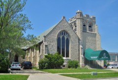
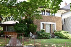
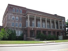
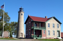
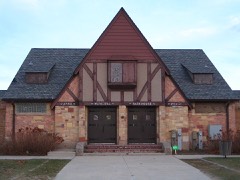
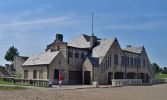
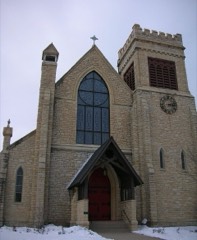
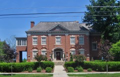
Every property in this county listed on the National Register of Historic Places, with the year it was listed and the federal nomination document.
Every wildfire the federal occurrence database records inside this county: 57 of them, burning about 144 acres. None started naturally and 2 were recorded as arson. Each settlement page carries the fires within five miles of it.
| Reported cause | Fires |
|---|---|
| Missing data/not specified/undetermined | 32 |
| Debris and open burning | 12 |
| Smoking | 8 |
| Arson/incendiarism | 2 |
| Equipment and vehicle use | 2 |
| Railroad operations and maintenance | 1 |
The five largest, by the area the report gives. One of them was set deliberately.
| Date | Cause | Size | Reported by | Name on the report |
|---|---|---|---|---|
| 2 April 2010 | Equipment and vehicle use | 80 acres | Wisconsin Department of Natural Resources | not named |
| 30 April 2018 | Missing data/not specified/undetermined | 20 acres | Wisconsin Department of Natural Resources | 1800402 |
| 5 November 2020 | Debris and open burning | 13 acres | Wisconsin Department of Natural Resources | NEW MUNSTER |
| 18 March 2018 | Missing data/not specified/undetermined | 3.0 acres | Wisconsin Department of Natural Resources | 218145 |
| 8 April 2018 | Debris and open burning | 2.0 acres | Wisconsin Department of Natural Resources | 218175 |
| 2 May 2018 | Missing data/not specified/undetermined | 1.0 acres | Wisconsin Department of Natural Resources | 218249 |
| 19 May 2018 | Arson/incendiarism | 1.0 acres | Wisconsin Department of Natural Resources | 44 |
| 10 July 2018 | Missing data/not specified/undetermined | 1.0 acres | Wisconsin Department of Natural Resources | 1383 |
Every settlement page carries the fires within five miles of it - see the settlement index below.
The NOAA Storm Events Database holds 340 reports for this county, causing 2 deaths, 31 injuries and about $68,609,500 in recorded property damage. Each settlement page carries the reports that name it.
| Kind of event | Reports |
|---|---|
| Thunderstorm Wind | 168 |
| Hail | 74 |
| Flood | 33 |
| Flash Flood | 22 |
| Lightning | 17 |
| Tornado | 12 |
| Heavy Rain | 9 |
| Funnel Cloud | 4 |
| Strong Wind | 1 |
The most serious of them, by death, then injury, then recorded damage. The accounts are quoted exactly as the forecast office filed them.
| When | Event | Place named | Harm | What the report says |
|---|---|---|---|---|
| June 2011 | Thunderstorm Wind | Somers | 1 killed, 1 hurt, $100,000 | Law enforcement officials reported numerous trees and power lines down across far eastern Kenosha County from severe thunderstorm winds that gusted up to 75 mph (65 knots) as estimated by a trained spotter. A 31-year-old man riding a motorcycle was killed when a tree blew over on him in the 7600 block of 25th Avenue. A Pleasant Prairie woman injured her hip when she was struck by debris form a shed. Two other residents of the City of Kenosha were injured when they touched live wires brought down by the strong winds. Many large branches were also broken off by the powerful winds, which also damaged several homes. Officials estimate 500 to 800 trees were destroyed or badly damaged by the winds. |
| June 1997 | Lightning | Kenosha | 1 killed | Victim was riding a bike in heavy rainfall when struck by lightning. |
| January 2008 | Tornado (EF3) | Powers Lake | 15 hurt, $13,710,000 | This tornado in western Kenosha County was a continuation of the tornado that spun up 2.27 mils NE of Pell Lake in southeastern Walworth County. It crossed into Kenosha County about 0.4 mile north of where CTH U in Walworth County crosses the county line and becomes CTH F in Walworth County. The tornado continued northeast to just east of the intersection of STH 50 and CTH O, crossed STH 83 just north of 51st Street just north of New Munster Creek, passed through the Village of Wheatland, turned more east and crossed 308th Ave. just north of Peterson Creek, and then dissipated near a pond between CTH PH and 41st Street (Town Rd). Fifteen people in the Civil Town of Wheatland sustained minor injuries. Also in the Civil Town of Wheatland, 7 homes were affected, 25 sustained minor damage, 27 had major damage, and 25 were destroyed. In the Civil Town of Brighton, 10 homes were affected, 3 had minor damage, 3 had major damage, and 4 were destroyed. About 160 people were homeless due to residential damage. This tornado traveled over frozen ponds and creeks, as well as snow piles leftover from recent snowmelt. Average path width was about 100 yards. The wind speed was estimated at 150 to 160 mph (DI 2 - FR12, DOD 8). For a couple homes, the visual damage suggested an EF4 rating, however insufficient anchoring allowed these structures to fail at a lower wind speed. Additionally, other nearby damage indicators didn't support an EF4 rating. The specific starting location in Kenosha County was 42.556342,-88.30533, and the ending location was 42.60061,-88.13524. For plotting purposes, here are a couple mid-point locations of this tornadoe's path: crossing of STH 83 - 42.59297, -88.22230, and the crossing of CTH B - 42.59756, -88.15928. |
| July 1997 | Thunderstorm Wind | Twin Lakes | 9 hurt, $1,000,000 | Nine thousand people were evacuated moments before wet-micorburst winds estimated to 80 mph blew down a stage at the Country Thunder Music Festival. The stage was lifted up and twisted by the winds. Fying debis damaged parked vehicles, and many chairs were scrambled. Interestingly, the stage was anchored with steel cable. However, the local terrain aided in funneling the powerful winds toward the stage. A boat in a nearby yard was lifted up by the same winds and the cover torn off. 9 people were injured, 3 needed to go to the hospital. |
| July 2001 | Lightning | Twin Lakes | 4 hurt | no account filed |
| July 2018 | Lightning | Twin Lakes | 1 hurt | A woman suffered a direct hit from a lightning strike at the Country Thunder Music Festival. She was seriously injured but did recover. |
| April 1996 | Lightning | Twin Lakes | 1 hurt | no account filed |
| August 2006 | Lightning | Kenosha | $14,000,000 | Several lightning strikes to several buildings caused structural fires and power outages. A large apartment building, known as St. Catherine Commons, was struck by lightning. The resultant fire severely damaged the building, displacing about 125 residents. |
| June 2009 | Flash Flood | Downtown Kenosha | $12,290,000 | Heavy rains resluted in flash flooding in the southeast part of Kenosha County. Numerous streets were flooded with water depths of 2 to 4 feet , and several were impassable. Several vehicles were stranded in the flood waters and rescues were performed. Water depths were up to the windows of cars in the city of Kenosha. Interstate 94 at STH 165 was covered by water and southbound lanes were closed. STH 50 was closed from Intestate 94 east to CTH H. CTH C was closed going west from Interstate 94 due to high water levels. Several other roads were closed. Damage was noted to several culverts and road shoulders, and water lift stations/pumps were damaged in some facilities. Compounding the flooding problem was the loss of electrical service which meant sump pumps in homes didn't operate. Basement flooding was a major issue. WSR-88D Doppler radar rainfall estimates on top of a wet ground were on the order of 3 to 6 inches for a 24-hour period ending 2000 CST. Some farm fields were probably flooded, per newspaper articles, but no direct loss estimates were available. Therefore, a nominal $200K was estimated for the purpose of this documentation.||The initial Uniform Disaster Situation Report compiled by the Kenosha County Emergency Management indicated at at least 600 homes were affected by flood waters, but had no damage, at least 590 homes had minor flood damage, at least 11 homes had major damage, and at least 1 home was destroyed, for a monetary loss of at least $11,975,000. At least one business had major flood damage for a monetary loss of at least $310,000. Total estimated private sector damage was at least $12,285,000. Public sector damage inlcuded about $265,000 to road systems, $110,000 damage to water control facilities, $18,000 damage to public buildings & related equipment, and about $295,000 to public utility systems, for a total public sector damage estimate of about $683,000. Additionally, debris clearance cost about $22,000, protective measures cost about $57,000, and there was other $91,000 in miscellaneous costs. These last three values are not considered direct property damage. |
| January 2008 | Tornado (EF1) | Somers | $7,930,000 | This tornado was the 2nd of two tornadoes to affect southeastern Wisconsin on January 7th. It spun up near the intersection of CTH L (18th St.) and 47th Ave. and moved east/northeast through the northern reaches of the city of Kenosha, and dissipated just north of Carthage College and just short of Lake Michigan. In the Civil Town of Somers it resulted in minor damage to 2 homes, and major damage to one home. In the City of Kenosha, it affected one home, inflicted minor damage to 21 homes, inflicted major damage to 6 homes, and destroyed 5 homes. Additionally, it destroyed one church in the City of Kenosha. Several power-lines were toppled and there were transformer explosions. Dozens of trees were damaged or uprooted. Average path width was about 50 yards. The maximum winds were estimated at around 95 mph (DI 27 - TH, DOD 3). This tornado was photographed and video taped. The specific starting location was 42.62399,-87.86591, and the ending location was 42.63127,-87.81820. |
| June 2000 | Flash Flood | Countywide | $4,100,000 | no account filed |
| July 2017 | Flood | Twin Lakes | $4,000,000 | Three to eight inches of rain fell over Kenosha County from late evening on July 11th through much of the morning of July 12th causing days of areal flooding over portions of the county, including near the Fox River. The Fox River near New Munster had a record crest of 17.47 feet on July 13th. There was widespread flooding adjacent to the river in the Town of Wheatland, the Town of Salem, and the Village of Salem Lakes. Floodwaters are into the lower levels of some homes in those areas...including Shorewood Drive and Riverside Drive in the Village of Salem Lakes. Highway 50 is closed at the Fox River. Many roads were closed or washed-out in and near the Village of Paddock Lake, the Village of Salem Lakes, and in the Town of Somers. The Des Plaines River flooded a residence near the river and highway 50. Three buildings and three vehicles were flooded in 2-3 feet of water. |
| June 2008 | Flash Flood | Twin Lakes | $1,970,000 | Heavy rains resulted in flash flooding across much of Kenosha County. Water depths on road surfaces reached 3 feet or more and there were gravel washouts. Some farm fields remained flooded into early July. The breakdown for residential home losses were: 37 minimally affected, 47 with minor damage, 33 with major damage, and 3 destroyed (total of $300 thousand for home losses). There were no business losses. Crop losses were estimated at 2 million. Public sector damage was about $673 thousand. There were several roads and bridges that sustained damage. |
| June 2000 | Flash Flood | Countywide | $1,500,000 | no account filed |
| April 1996 | Thunderstorm Wind | Pleasant Prairie | $1,100,000 | no account filed |
| September 2002 | Lightning | Trevor | $1,000,000 | no account filed |
| April 1996 | Thunderstorm Wind | Twin Lakes | $700,000 | no account filed |
| May 2004 | Flash Flood | Salem | $300,000 | no account filed |
| August 2020 | Tornado (EF1) | Wilmot | $250,000 | Tornado started in NW Lake County Illinois where some house and structural damage occurred just south of the WI/IL border. The tornado then crossed into Wisconsin and knocked hundreds of trees down (trunks snapped and uprooted) at Promised Land camp. Tornado continued northeast toward the southwest side of Camp Lake where shingle damage was noted on a few houses. Tornado then crossed Camp Lake and exited it on the northeast side where more tree damage was noted. Some pontoon boats and docks were toppled on Camp Lake. Tornado was embedded within a line of storms that also had winds of 50-60 mph. |
| July 2017 | Flash Flood | Somers | $250,000 | Severe street flooding east of I-94 including the city of Kenosha after 3.0-5.50 of rain fell over a few hours. The most severe flash flooding occurred in a 10 block area around 40th Ave. and 75th St. in Kenosha. Stranded vehicles with water up to the windows were reported along with several buildings and homes flooded. |
| June 1974 | Tornado (F1) | not stated | $250,000 | no account filed |
| April 2026 | Tornado (EF1) | Somers | $209,000 | The tornado began northwest of Somers, east of Interstate 94. It went through the north and east side of the city, through the fire department and near Somers Elementary School. Numerous trees were uprooted along the path, some falling into houses. |
| June 2007 | Hail | Wheatland | $200,000 | Large hail up to 1 inch in diameter coated the ground white from Wheatland to Paddock Lake. In this swath, at least 600 acres of corn, soybean, and hay were severely damaged. |
| August 2007 | Flash Flood | Brighton | $200,000 | Flash flooding affected a broad swath of Kenosha County from the northwest corner to the city of Kenosha after heavy rains fell overnight on top of a nearly saturated ground. Fast-flowing water depths on some roads in low spots reached 2 to 3 feet, and significant soil erosion was noted in the surrounding countryside, as well as some crop damage. At least 25 homes sustained minor flood damage to basement contents, and at least 5 businesses had major damage. Gravel shoulder washouts occurred and some crops in the area were damaged. Significant street flooding was reported in the city of Paddock Lake, in the Village of Salem, in the Village of Somer, as well as on CTH KR and CTH H. At least 100 homes had flood damage to basement contents. Overnight rainfall amounts, based on WSR-88D Doppler radar estimates, ranged from around 2 inches over the southern part of the county to around 4 inches across the northern parts. |
| May 2004 | Flash Flood | Twin Lakes | $200,000 | no account filed |
| May 2000 | Flash Flood | Somers | $200,000 | no account filed |
| June 1998 | Thunderstorm Wind | Bristol | $200,000 | no account filed |
| July 1998 | Thunderstorm Wind | Countywide | $200,000 | no account filed |
| June 2007 | Thunderstorm Wind | Benet Lake | $150,000 | A powerful macroburst moved northeast through central Kenosha County and tore up dozens of trees, and damaged a number of powerlines. The width of the damage path was on the order of 5 to 6 miles. Estimated peak wind gusts were probably on the order of 74 knots (85 mph). A large tree in Bristol fell on a church, resulting in appreciable damage. In the civil town of Paris, on CTH D, a 10' by 50' part of a home's roof was ripped off. |
| August 2006 | Lightning | Pleasant Prairie | $150,000 | Several lightning strikes to several buildings caused structural fires and power outages. |
| July 2017 | Flash Flood | Twin Lakes | $100,000 | Three to eight inches of rain fell over Kenosha County over several hours causing urban and rural flash flooding. The highest amounts occurred west of I-94. Kenosha County declared an emergency. Sheriff deputies assisted with the evacuations of campers at Sunrise and Sunset Campgrounds at the Richard Bong State Recreation Area. Eight people were evacuated from the Pleasant Prairie Mobile Home Park in the Town of Somers due to flooding from the Kilbourn Road Ditch. Some water rescues occurred due to vehicles driving into deep water. The Chicago-Milwaukee Amtrak Hiawatha Service and the Metra Train Service in the Milwaukee district was temporary closed due to flooding. The right lane of I-94 southbound was closed at County Highway A. Many roads were closed or washed-out in and near the Village of Paddock Lake, the Village of Salem Lakes, and in the Town of Somers. Flooding began on the Fox River in the western portion of the county. |
| May 2011 | Thunderstorm Wind | Silver Lake | $100,000 | Severe thunderstorms produced damaging wind gusts estimated at 80 mph (70 knots). Many power lines and trees were taken down by the strong winds, and several homes and cars were damaged, including a home that had the roof taken off by the severe wind gusts. |
| October 2010 | Tornado (EF1) | Somers | $100,000 | An EF1 tornado developed about 0.95 mile north of Somers, about 2300 feet southwest of the intersection of County Highway KR (County Line Road) and County Highway EA (72nd Avenue). The tornado moved northeast just under one-half mile in Kenosha County before crossing into southern Racine County about 1.34 miles northeast of Somers at the intersection of CTH EA and County Line Rd. While in Kenosha County it destroyed a 6-vehicle garage and damaged a nearby home, trees, and power lines. The tornado path averaged 50 yards in width, with a maximum width of 100 yards. The EF-rating was based on DI 27(TH) DOD 4 with estimated wind speeds up to 100 mph. The exact start location is Lat 42.66377 Lon -87.89961. The exact end location on the Kenosha-Racine County line is Lat 42.66901 Lon -87.89515. Property damage values were estimated. |
| June 2010 | Thunderstorm Wind | Downtown Kenosha | $100,000 | HAM radio operator reported trees and power lines down. Law enforcement reported a section of roof measuring 20 feet by 20 feet was blown off a building. A tree fell onto a vehicle and damaged it. Elsewhere a tree damaged an awning. At least 50 calls were made to the city 911 dispatchers about downed wires. |
| June 2007 | Flash Flood | Silver Lake | $100,000 | Repeated rounds of thunderstorms resulted in a brief flash flood that left water depths on some roads to 2 to 3 feet. CTH B, south of STH 50, was washed out by fast-flowing water, and water depths in that area reached 3 feet. Some gravel shoulder washouts were also noted around Silver Lake. WSR-88D Doppler radar rainfall estimates were in the 2 to 3 inch range. Private citizes measured 2.6 inches in Bristol and Paris. |
| August 2007 | Flash Flood | Wheatland | $100,000 | Several rounds of thunderstorms with heavy rains on top of a saturated ground resulted in flash flooding from the Sturtevant area into the city of Racine. STH 50 between STH 75 and STH 83 was closed in several spots due to water depths of 3 to 5 feet. Some local residents indicated that this was the highest water levels they've ever seen. The Fox River and Des Plains river exceeded flood stage. Sandbagging occurred and a berm was built in Wheatland. At least a couple dozen homes had water damage to basement contents, or sewage backups. Some soil erosion and crop damage were noted in the area.||August, 2007, rainfall totals include: 11.50 in Kenosha, 10.78 at the Kenosha Airport, 9.96 in Paddock Lake, and 12.18 in Twin Lakes. |
| September 2006 | Flash Flood | Kenosha | $100,000 | no account filed |
| May 2004 | Flash Flood | Kenosha | $100,000 | no account filed |
| May 2000 | Lightning | Kenosha | $80,000 | no account filed |
| July 2007 | Thunderstorm Wind | Kenosha Airport | $75,000 | Powerful thunderstorm winds toppled many trees. The hardest-hit area in the city of Kenosha was centered around 30th Ave. and 75th St. where a church steeple was knocked over by the winds. At least 4 vehicles were damaged by tree debris. Additionally, minor urban-type flooding (water up to the curb) occurred for about 30 minutes on some roads in the city of Kenosha. The gust was measured at the Kenosha Airport ASOS site, although a higher gust was possible where the church steeple was toppled. About a dozen power-lines came down on the south side of the city of Kenosha due to tree debris, leaving about 3600 customers without power. |
| June 2002 | Thunderstorm Wind | Twin Lakes | $75,000 | no account filed |
| April 2026 | Thunderstorm Wind | Downtown Kenosha | $70,000 | A swath of straight-line wind damage was observed. Dozens of trees were uprooted and widespread large limb damage occurred. A partial loss of roof shingles and fascia on several homes, and a partial loss of siding on some homes. A few small sheds were destroyed and several power lines were downed. 2200 We Energies customers were without power. The greatest concentration of damage was near the intersection of 45th Street and 38th Avenue. |
| July 2014 | Thunderstorm Wind | Truesdell | $70,000 | A 3.6 mile west to east path of significant straight line wind damage. The most concentrated damage was just south of highway 50 and east of Green Bay Road. Numerous large trees snapped and uprooted. Shingle damage to approximately 8 homes with two roofs likely requiring replacement. Many privacy fences destroyed. A large tree fell on a home. The Burger King sign was destroyed. A camper was overturned. |
| July 2010 | Thunderstorm Wind | Kenosha Airport | $50,000 | A severe thunderstorm moved east from near Kenosha Airport, where a small plane was damaged, across western and southern portions of the city of Kenosha. Sporadic damage was reported as the damaging thunderstorm wind gusts fanned out along and either side of a line from the airport to near the intersection of 56th Avenue and 42nd Street. Power poles were snapped and a transformer exploded knocking out power to about 5000 customers. Ten to twelve-inch tree limbs were broken and trees were felled by the powerful winds. A portion of the roof of the Oemmcco building was blown off. |
| June 2008 | Thunderstorm Wind | Downtown Kenosha | $50,000 | Powerful thunderstorms winds knocked down large trees and power-lines throughout the city of Kenosha. |
| July 2006 | Thunderstorm Wind | Kenosha | $50,000 | Trees and power lines toppled. |
| April 1994 | Thunderstorm Wind | Kenosha | $50,000 | A line of severe thunderstorms raced across southern Wisconsin producing winds up to 80 mph and hail up to the size of golf balls. A barn was downed by intense winds near Mt. Sterling, Crawford County. Otherwise minor property damage along with downed trees and power lines took place. |
| June 1998 | Thunderstorm Wind | Silver Lake | $50,000 | no account filed |
| July 1995 | Thunderstorm Wind | Kenosha AP | $50,000 | no account filed |
| August 2007 | Lightning | Brighton | $40,000 | Lightning struck a gas-line meter on the side of a residential home. The resultant fire damaged the living room and attic. |
| May 1999 | Thunderstorm Wind | Wheatland | $38,000 | no account filed |
| July 2003 | Lightning | Kenosha | $35,000 | no account filed |
| June 2024 | Thunderstorm Wind | Twin Lakes | $30,000 | Random pockets of tree damage blown down in a divergent pattern on the west side of Lake Mary and Elizabeth Lake . Powerlines down as well. |
| August 2009 | Thunderstorm Wind | Downtown Kenosha | $30,000 | Thunderstorm winds left a 3-mile wide swath of damage through the City of Kenosha. Numerous trees were uprooted and tree debris knocked down several power-lines. Construction arricades and signs were blown around, and one stop sign was pushed over. |
| July 2007 | Thunderstorm Wind | Twin Lakes | $30,000 | Powerful thunderstorm gusts to around 52 knots (60 mph) toppled large trees and tree branches. The tree debris damage a home's porch and garage, and a car and boat. |
| November 2013 | Thunderstorm Wind | Bristol | $28,000 | A path of trees, branches and wires down. A partial roof removed from a residential home. The west to east corridor of damage was bounded on the north near highway S and in the south by highway 50. |
| June 2017 | Thunderstorm Wind | Twin Lakes | $25,000 | There were branches broken off of several large trees as a squall line moved through southeastern Wisconsin. |
| June 2008 | Thunderstorm Wind | Silver Lake | $25,000 | Powerful thunderstorms winds knocked down large trees and power-lines. |
| March 2007 | Flood | Wheatland | $25,000 | The Fox River at New Munster (Kenosha Co.) went more than 2 feet above flood stage, and remained above flood stage for the longest period of time (compared to other rivers in south-central and southeast Wisconsin) - from March 12th through March 29th. Low-land river flooding along the Fox River in western Kensoha County resulted in some minor damage to contents in basements of homes and some soil erosion. At the New Munster gage site, the river crested at 12.34 feet at 0245CST on March 15th, 2.34 inches over flood stage. |
| May 2004 | Thunderstorm Wind | Paddock Lake | $25,000 | no account filed |
The Survey's mineral resources record lists 11 workings inside this county. 5 still produce and 6 are closed or unrecorded. Each settlement page carries the workings within five miles of it.
| Commodity | Workings |
|---|---|
| Sand and Gravel, Construction | 10 |
| Vermiculite | 1 |
The least common of them first, because a county's hundredth gravel pit says nothing its first ten did not.
| Where | Site | Commodity | Status | Recorded |
|---|---|---|---|---|
| Koos Inc. Plant | Vermiculite | Plant | ||
| Bassett Sand Deposit | Sand and Gravel, Construction | Occurrence | ||
| Bristol Sand and Gravel Pit | Sand and Gravel, Construction | Producer | ||
| Fischer Pit | Sand and Gravel, Construction | Producer | ||
| Hillard Pit | Sand and Gravel, Construction | Past Producer | ||
| Kd Pit Yard 28 | Sand and Gravel, Construction | Producer | ||
| Kenosha County Hwy Dept Wilmot Pit | Sand and Gravel, Construction | Past Producer | ||
| Pit No. 1 | Sand and Gravel, Construction | Past Producer | ||
| Ponderosa Pit | Sand and Gravel, Construction | Producer | ||
| Powers Lake Sand and Gravel Pit | Sand and Gravel, Construction | Past Producer | ||
| Techert Pit | Sand and Gravel, Construction | Past Producer |
The History of Racine and Kenosha Counties, Wisconsin .. devotes a chapter to each township: its boundaries and streams, who settled it and when, the mills, the schools and the churches. All 7 are reproduced here in full. Each row shows the township's own shape and where it lies in the county, drawn from the Census Bureau's boundary. Which settlements belong to which township is computed from that same boundary, not taken from the book.
| Shape and position in the county | Township | Settlements in it | Length | Sections |
|---|---|---|---|---|
| Brighton Town | Brighton, Klondike | 4,238 words | 0 | |
| Bristol Village | Bristol, Pikeville, Woodworth | 5,017 words | 1 | |
| Kenosha City | Kenosha, Prairie Lake Estates, Shorecrest Pointe, South Kenosha | 31,974 words | 20 | |
| Pleasant Prairie Village | Pleasant Prairie, State Line, Timber Ridge, Tobin, Truesdell, Westwood Estates | 7,887 words | 1 | |
| Randall Town | Bassett | 1,165 words | 3 | |
| Somers Village | Somers | 4,615 words | 1 | |
| Wheatland Town | New Munster, Powers Lake, Slades Corners, Wheatland | 7,323 words | 1 |
Named settlements recorded in the Geographic Names Information System, each with the topographic sheets covering it. Villages, hamlets and abandoned places alike. Each is shown with the nearest named watercourse or landform and the survey quadrangle it falls on.
Salem Lakes village · 53105 · On Bassett Creek · Silver Lake quadrangle
19 sheets, 1893 to 1980
Wheatland town · 53105 · On New Munster Creek · Silver Lake quadrangle
19 sheets, 1893 to 1980
Pleasant Prairie village · 53158 · On Center Creek · Pleasant Prairie quadrangle
14 sheets, 1892 to 1980
Pleasant Prairie village · 53158 · On Barnes Creek · Kenosha quadrangle
16 sheets, 1892 to 1980
Twin Lakes village · 53181 · Near Mount Moriah · Silver Lake quadrangle
19 sheets, 1893 to 1980
Pleasant Prairie village · 53158 · Pleasant Prairie quadrangle
14 sheets, 1892 to 1980
Wheatland town · 53105 · On New Munster Creek · Silver Lake quadrangle
19 sheets, 1893 to 1980