 Block
Walworth, Wisconsin
19 topographic sheets cover this place, the earliest surveyed in 1893 and the latest in 1980. It stands in Walworth Village. It lies in ZIP code area 53184. It stands on Van Slyke Creek. The Survey maps it on the Walworth quadrangle. 2,759 people lived here at the 2020 count. It stands 1,004 feet above sea level.
Population over time
2 figuresWalworth fell from 2,816 to 2,759 between 2010 and 2020. These are the recorded population figures Wikidata holds for this place, reached through the Geographic Names Information System number this page is keyed on rather than by name, so they belong to this place and not to another of the same name. Most are census counts, but not all are: an early figure may be a founding or settlement estimate, and an estimate published within five years of a census is left out. The change column is computed, and is left blank where more than 20 years separate a figure from the one before it, because a gap that long is not a change between two counts.
| Year | People | Change |
|---|---|---|
| 2010 | 2,816 | |
| 2020 | 2,759 | -57 (-2%) |
Topographic sheets covering this place
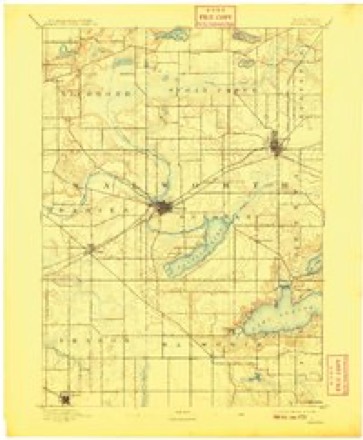
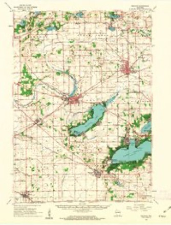
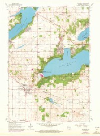
8 surveys from 19 printed sheetsMatched by testing this settlement's coordinate against the published boundary of every sheet in the United States Geological Survey's historical collection. Each opens the scanned sheet at the Survey.
- 1893 USGS Delavan quadrangle1:62500, 6 printings
- 1954 USGS Rockford quadrangle1:250000
- 1955 USGS Rockford quadrangle1:250000
- 1958 USGS Rockford quadrangle1:250000, 4 printings
- 1960 USGS Delavan quadrangle1:62500, 2 printings
- 1960 USGS Walworth quadrangle1:24000, 3 printings
- 1963 USGS Rockford quadrangle1:250000
- 1980 USGS Lake Geneva quadrangle1:100000





In the county-history sources
17,862 words on this townshipHistory of Walworth County, Wisconsin, Containing an Account of Its Settlement, Growth, Development and Resources...its War Record, Biographical Sketches, Portraits of Prominent Men and Early Settlers; the Whole Preceded by a History of Wisconsin...and an Abstract of Its Laws and Constitution.., published 1882 names this settlement in its chapter on Walworth Village. These are the passages that mention it, exactly as the scans read.
Walworth is known in the Government survey as Town 1, Range Ifi east. It was fonnerly, under the act of 1838, a part of the town of Delavan. In ISSV), it was set off, with what is now Sharon, into a separate town and named Walworth. Subsequently, by act of the Legislature, March 21, 1843. Sharon was erected into a separate town, leaving its geographical limits as they now are.
Passage source: History of Walworth County, Wisconsin, Containing an Account of Its Settlement, Growth, Development and Resources...its War Record, Biographical Sketches, Portraits of Prominent Men and Early Settlers; the Whole Preceded by a History of Wisconsin...and an Abstract of Its Laws and Constitution.., published 1882.
The town, in some regaixls, is more historic, or pre-historic. than any other part of the county. It had located near the head of Geneva Lake, which nearly covers Section 12 and a part of Section 11. the only considerable Indian village at the tinie the white settlers began to come in in 1836. Big Foot, a chief of the Pottawatomies, had his residence and council house there, and from there he took his final leave of the Walworth County hunting-grounds, in the latter part of that year, when the terms of the treaty whereby his lands were ceded demanded his evacuation. There, it is told, that the body of his son. a youth of some fifteen years, was left, inclosed in a rude log casket, in a tree overhanging the lake. There has been some dispute as to whether the remains were those of ii lad or of an adult person. Some old settlers over that it was the body of an old man, and was that of Big Foot's father, instead of his son. There seems little doubt that the casket hung in the tree when the first white man came, but what became of it - whether desecrated or given more Christian sepulture - is not known.
Passage source: History of Walworth County, Wisconsin, Containing an Account of Its Settlement, Growth, Development and Resources...its War Record, Biographical Sketches, Portraits of Prominent Men and Early Settlers; the Whole Preceded by a History of Wisconsin...and an Abstract of Its Laws and Constitution.., published 1882.
Among those who came in prior to 1840, the following are remembered, and their first location given, fi-om the memory of those still living: Cyrus Church, oldest living settler, Febmary, 1837, on Section 21: Jake G. Saunders, on Section 22. in 1837, removed to Illinois many years ago; P. Van Slyke, on Section 14. made the first claim made in town in fall of 1836; moved away many years ago; present whereabouts, if living, not known; Marcus Russell, in 1837, on Section r5,'died in 1875; Robert Russell, in 1837, on Section 15, now Hving in Iowa; J. C. Chm-ch, in 1837, on Section 10, died in Delavan; Thomas Godfrey, in 183/, on Section 20, died in 1877 or 1S7S: John Reader, in 1837, on Section 18. died in 1879; James A. Maxwell, in 1837, on Section 27. moved to Nevada; Israel W. Starr, in 1837, on Section 13: Amos Bailey, in 1837, on Section 11; Jonathan Wai-d, in 1837, on Section 13; William Bell, in 1837, on Section 16; moved to Elkhorn, then to Kansas, where he died some yeai-s ago; D. C. Porter, fall of 1837, on Section 24, still living; C. L. Douglass, in 1837. tii-sib on Section 26. now living on Section 15; Drs. H. Clark and L. N. Wood, in 1837-38, both settled on Section 23, first physicians in the town, and among the earliest in the county; both deceased; their widows living; Matthias Molu-, in 1837, bought a part of Van Slyke's claim on Section 14: still living in the town; John Cummings and John Cummings, Sr.. in as eai-ly as 1838; Joseph Bailey, in 1838, moved to Iowa, where he died; Jonathan Fish, in 1838. on Section 33, died in Walworth in 1881; Jesse Bowman, in 1838 or 1839, on Section 18, deceased; place now owned by G. W. Webber; Thomas Waddle, in 1838, section not certain - probably 18; moved to Illinois early; David Davids, in 1839, Section 27, now living in Baraboo. Wis. ; William Reed, in 1838, on Section 14, deceased; son still lives on the old place; Elder P. W. Lake, in 1838 or 1839, on Section 34, died some years since; Mrs. Lake still lives on the place, at the advanced age of ninety years; Beardsley Lake, their son. lives in Harvard. 111. : Lucius Smith, in 1840. on Section 28, now lives in Sharon; Newell Crooks came in with the Douglass family in 1838; married (me of the daughters; settled on Section 15; now living in California: Sylvester Hawvei-, now in California, came in 1838 or 1839; Thadeus Smith, an unmarried man, came in 1838; Henry W^ Stevens, in 1839 or 1840, on Section 28, now in Colorado: William Rumsey, in 1837, on Section 30, now in Iowa: Mills Chm-ch, in 1838, on Section 28, now in Missouri.
Passage source: History of Walworth County, Wisconsin, Containing an Account of Its Settlement, Growth, Development and Resources...its War Record, Biographical Sketches, Portraits of Prominent Men and Early Settlers; the Whole Preceded by a History of Wisconsin...and an Abstract of Its Laws and Constitution.., published 1882.
Machine-read from a century-old scan, so expect the errors a machine makes: misspelled names, dropped words, stray characters.
Read the whole chapter on Walworth Village - it names this place 72 more 72 times.
Fires near this place
16 since 2015Regional context, not property-specific evidence. The federal wildfire occurrence database lists 16 fires within 5 miles of Walworth between 2015 and 2020, burning about 19 acres in total. None started naturally. 1 was recorded as arson. Distance is straight-line from the map coordinates, so a fire counted here may appear on a neighbouring settlement's page as well.
| Reported cause | Fires |
|---|---|
| Debris and open burning | 6 |
| Missing data/not specified/undetermined | 6 |
| Equipment and vehicle use | 2 |
| Arson/incendiarism | 1 |
| Smoking | 1 |
The most recent of them, most recent first, with the day each was reported and the service that recorded it.
| Date | Cause | Size | Reported by | Name on the report |
|---|---|---|---|---|
| 5 September 2020 | Missing data/not specified/undetermined | 1.0 acres | Wisconsin Department of Natural Resources | 20340 |
| 8 May 2019 | Arson/incendiarism | under an acre | Wisconsin Department of Natural Resources | 174 |
| 26 May 2018 | Smoking | 1.0 acres | Wisconsin Department of Natural Resources | 18-084 |
| 7 April 2018 | Missing data/not specified/undetermined | under an acre | Wisconsin Department of Natural Resources | 1804008 |
| 4 April 2015 | Debris and open burning | 4.0 acres | Illinois Division of Forestry Resources | 15-282 |
| 26 April 2018 | Missing data/not specified/undetermined | under an acre | Wisconsin Department of Natural Resources | 109 |
| 23 April 2018 | Missing data/not specified/undetermined | under an acre | Wisconsin Department of Natural Resources | 108 |
| 14 April 2015 | Debris and open burning | 1.0 acres | Illinois Division of Forestry Resources | 15-334 |
Settlements close enough to share some of these fires:
Mines and quarries near this place
1 within 5 milesRegional context, not property-specific evidence. The federal mineral resources record lists 1 working within 5 miles of Walworth: 1 past producer. None of them still produces. What was taken out: Sand and Gravel, Construction. Distance is straight-line from the map coordinates, so a quarry counted here may appear on a neighbouring settlement's page as well.
| Where | Site | Commodity | Status | Recorded |
|---|---|---|---|---|
| Stewart Pit | Sand and Gravel, Construction | Past Producer |
Storms near this place
27 since 1995Regional context, not property-specific evidence. The National Weather Service names Walworth in 27 storm reports between 1995 and 2024: 18 thunderstorm wind, 3 lightning, 2 hail, 2 tornado. No death or injury is recorded in these reports. Each account below is quoted exactly as the forecast office filed it, from the NOAA Storm Events Database, and each date opens the federal record of that event.
| When | Event | Place named | Harm | What the report says |
|---|---|---|---|---|
| November 2010 | Tornado (EF1) | Walworth | $1,000,000 | A tornado moved into extreme south-central Walworth County from Illinois about 5,100 feet west of the intersection of Alden Road and State Line Road, and quickly intensified to EF-1 rating. It moved northeast for over 5 miles before dissipating about 1,700 feet southeast of the intersection of County Road BB and Zenda Road. Five homes sustained damage, with two homes severely damaged. The tornado crossed CTH B where it dog-legs east of Swamp Angel Rd. Collectively, three sheds and two barns were damaged, with one of the barns flattened. Eight wooden power poles were also snapped, along with numerous trees and fences. On one farm, 4 cows, and several chickens and turkeys were killed by tornado debris. WeEnergy Utility reported about 4000 homes without electrical power in the county due to downed power-lines. The average path length was 60 yards in width. The EF1 estimated wind speed of 105 mph was based on DI 2(FR12) DOD 4. The loss estimate was produced by Walworth County Emergency Management. The exact start location is Lat 42.49507 Lon -88.56948. The exact end location is Lat 42.53464 Lon -88.47970. |
| June 2000 | Flash Flood | Walworth | $850,000 | no account filed |
| March 2023 | Tornado (EF0) | Walworth | $100,000 | Tornado damage path which damaged a barn and shed and also caused 16 power lines to be snapped. |
| September 1997 | Lightning | Walworth | $100,000 | no account filed |
| September 1997 | Lightning | Walworth | $40,000 | no account filed |
| June 1995 | Thunderstorm Wind | Walworth | $40,000 | no account filed |
| August 2010 | Thunderstorm Wind | Walworth | $25,000 | The Walworth County Emergency Manager reported a pole barn was partially damaged by thunderstorm winds estimated at 50 knots (58 mph). |
| May 2017 | Thunderstorm Wind | Walworth | $15,000 | Numerous large branches down and a few rotten trees snapped. Over 100 square feet of siding removed from a home. A power pole was leaning from the strong winds. Some power lines down. |
| May 1998 | Thunderstorm Wind | Walworth | $12,000 | no account filed |
| June 2017 | Thunderstorm Wind | Walworth | $10,000 | Multiple trees were downed across the town of Walworth as a thunderstorm pushed through the area. |
| September 2000 | Lightning | Walworth | $10,000 | no account filed |
| April 1997 | Thunderstorm Wind | Walworth | $10,000 | no account filed |
| May 2024 | Thunderstorm Wind | Walworth | $7,000 | A large tree branch down and a leaning power pole near the intersection of Highway 67 and County Road B. Power lines down in the Walworth and Fontana areas. |
| May 2024 | Thunderstorm Wind | Walworth | $5,000 | Tractor trailer rolled over at intersection of Highway 67 and US 14. Power lines down in the area. |
| June 2001 | Thunderstorm Wind | Walworth | $5,000 | no account filed |
| February 1999 | Thunderstorm Wind | Walworth | $5,000 | no account filed |
| May 1998 | Thunderstorm Wind | Walworth | $5,000 | no account filed |
| June 1997 | Thunderstorm Wind | Walworth | $5,000 | no account filed |
| May 1999 | Thunderstorm Wind | Walworth | $3,000 | no account filed |
| July 1999 | Thunderstorm Wind | Walworth | $2,000 | no account filed |
| November 2020 | Thunderstorm Wind | Walworth | $1,000 | A small shed destroyed by straight line winds. |
| June 1996 | Thunderstorm Wind | Walworth | $300 | no account filed |
| September 2021 | Hail | Walworth | - | no account filed |
| June 2008 | Hail | Walworth | - | no account filed |
| September 2002 | Flood | Walworth | - | no account filed |
| September 2001 | Thunderstorm Wind | Walworth | - | no account filed |
| April 1995 | Thunderstorm Wind | Walworth | - | no account filed |
Nearest settlements
The eight closest, with where each one stands in the county. Distances are straight-line, computed from the Geographic Names Information System coordinates.
| Map | Place | Distance | Sheets |
|---|---|---|---|
| Fontana | 1.9 miles | 19 | |
| Delavan Lake | 4.1 miles | 19 | |
| Williams Bay | 4.5 miles | 19 | |
| Linton | 5.2 miles | 19 | |
| East Delavan | 5.7 miles | 19 | |
| Zenda | 6.4 miles | 19 | |
| Lake Lawn | 6.5 miles | 19 | |
| Lake Como | 6.6 miles | 19 |
Elsewhere
Matched on this settlement's Geographic Names Information System number rather than its name, so it cannot be a different place of the same name in another state.
| Wikipedia article on Walworth | An encyclopaedic summary. Its text is share-alike, so it is linked here rather than copied. |
| Wikidata item Q2609667 | The structured record the population and elevation above come from. Public domain (CC0). |
Provenance
This settlement is recorded in the Geographic Names Information System as feature 1576186. The sheet list is computed by point-in-boundary test against the United States Geological Survey's historical topographic inventory. Both are works of the United States government and carry no copyright under 17 U.S.C. 105.
Wildfire. Short, Karen C. 2022. Spatial wildfire occurrence data for the United States, 1992-2020 [FPA_FOD_20221014]. 6th Edition. Fort Collins, CO: Forest Service Research Data Archive. https://doi.org/10.2737/RDS-2013-0009.6 Collected with United States Government funding and usable without additional permissions or fees.
Mines and quarries. USGS Mineral Resources Data System (MRDS) https://mrdata.usgs.gov/mrds/ A work of the United States government, no copyright under 17 U.S.C. 105.
Storms. NOAA National Centers for Environmental Information, Storm Events Database https://www.ncei.noaa.gov/stormevents/ A work of the United States government, no copyright under 17 U.S.C. 105. Narratives are quoted verbatim from the National Weather Service report and are not edited or summarised.