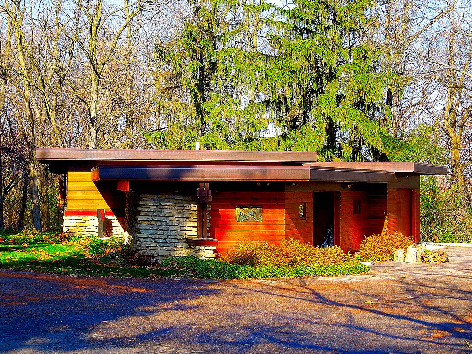
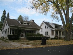
A National Historic Landmark. Built in 1948 (modern architecture). Listed on the National Register of Historic Places in 2003.
From the record
“The Herbert and Katherine Jacobs Second House is a house in Madison, Wisconsin, United States. Designed by Frank Lloyd Wright and built in 1946-1948, the house was designed for the journalist Herbert Jacobs and his wife Katherine, whose first house he had designed a decade earlier.”
Wikipedia article Herbert and Katherine Jacobs Second House, CC BY-SA 4.0.
One of 238 National Register listings published here for Dane County · listed in 2003 · category: Building · built in 1948, modern architecture, by Frank Lloyd Wright · a National Historic Landmark.
National Register reference number.03001038- the number the National Park Service assigned this property when it was listed, and the key its nomination file is catalogued under at the National Archives.
What happened here
An account from the chapter on Madison city. The inset identifies its exact
source book and publication year.
Village and Town Elections 1846-49 - Water Power - Celebra¬ tion, July 4, 1846 - Public Cemetery - Dr. C. B. Chapman's and J. T. Clark's Reminiscences - Hope Lodge I. O. O. F. - Knapp's Account of Capitol Grounds - L. J. Farwell's Arrival - First Bell in Madison - Organization of Baptist Church 1847 - Trial of Gross for Murder - Growth of Village, 1848 - State Historical Society, 1849 - State University.
The anniversary of National Independence was not formally observed by the citizens or authorities. Celebrations were held at Mazomaine and Middleton station in this county. The an¬ niversary this year came on Sunday, and as a consequence Satturday, Sunday and Monday were more or less observed by the different nationalities as a holiday on Saturday, the Dane County Stock Association had a fair, which, with races adver¬ tized in connection with it, drew a large crowd. The sermons by the city clergymen on the 4th, were of a highly patriotic character.
The Township of Middleton lies near the central part of the county, adjoining Madison on the west, and known as township 7 north, of range 8 east. This is one of the early settled towns in Dane county. It is watered on the northeast by Pheasant Branch, and on section 1 is the small village of that name. On section 9 is a large expansion of water known as Mud lake, from which a small stream runs westward into Black Earth creek.
Regional context, not property-specific
evidence. The
federal wildfire occurrence database
lists 27 fires within 5 miles of Herbert and Katherine Jacobs Second House
between 2008 and 2020, burning about 23 acres in total. 1 started naturally. 1 was recorded as arson.
Distance is straight-line from the map coordinates, so a fire counted
here may appear on a neighbouring settlement's page as well.
Reported cause
Fires
Missing data/not specified/undetermined
15
Debris and open burning
6
Smoking
3
Natural
1
Arson/incendiarism
1
Equipment and vehicle use
1
The most recent of
them, most recent first, with the day each was reported and the service
that recorded it.
Regional context, not property-specific
evidence. The federal mineral resources record lists
8 workings within 5 miles of Herbert and Katherine Jacobs Second House: 5 producers, 3 past producers.
5 still produce. What was taken out: Sand and Gravel, Construction, Stone, Crushed/Broken. Distance is straight-line from the
map coordinates, so a quarry counted here may appear on a neighbouring
settlement's page as well.
Regional context, not property-specific
evidence. The National Weather Service names
Middleton, the town this property stands in, in 57 storm reports between 1996 and 2026: 31 hail, 13 thunderstorm wind, 4 heavy rain, 3 funnel cloud.
No death or injury is recorded in these reports. Each account below is quoted exactly as the forecast office
filed it, from the NOAA Storm Events Database, and each date
opens the federal record of that event.
A weak F1 tornado (100-110 mph) spun up just west of the southwest Beltline at a point 2.5 miles SW of Middleton (half-mile north of intersection of CTH S and Pleasant View Rd.). It moved east-southeast across the West Town Mall, through the UW-Madison Research Park, ultimately ending about 1/3 mile east of STH 151/Park St (2.3 miles south of Capitol Square). In the Research Park many windows were blown out of business offices, and damage was inflicted to UW-MSN agricultural buildings. At least 194 residential homes had minor damage (roof/siding), and 11 had major damage (windows/roofs - total of $410K). At least 8 businesses had minor damage, and 1 had major damage (roof partially torn off and 1 wall damaged). Total business damage was about $246K. The UW-Madison Research Park had about $729K in damage. Many vehicles sustained some degree of damage ($100K), and one semi was blown over. At least 1000 large trees were damaged. Estimated total tornado damage is $1.485M. An additional cleanup cost of about $347K was reported. At least 2000 customers lost their electrical power. Average path width was about 150 yards.
Madison TV 27 reported numerous trees and power lines blown down by thunderstorm wind gusts estimated at 65 mph (56 knots) in Middleton. Some cars were damaged by the downed trees, as well as a tree piercing the roof of a condominium. A shed was also destroyed by the damaging thunderstorm wind gusts.
A swath of straight line wind damage occurred. Exterior walls of several floors of the WI Trade Center sustained damage. Trees down in the surrounding area. A 3 to 4 block area between Sawmill Road and Tramore Trail suffered numerous uprooted or snapped trees. The upper portion of the side of a home was torn off, along with some shingles removed from homes. A large tree landed on and crushed a mini-van.
Heavy rains of 3 to 5 inches (radar estimated) from thunderstorms caused water to flood over many roads just north of Middleton. Some gravel shoulder washouts were noted, as well as some basement flooding.
Sheriff deputies reported large trees blown down from damaging thunderstorm wind gusts estimated at 65 knots (75 mph). A large tree fell on a house in the 7000 block of Sagebrush Trail, resulting in minor damage.
Hail ranged from 1.5 to 2 inches in diameter. Hail damage to car, roof of home, siding, and window screens. Hail damage to trees and plants. Power outage around 1 hour.
Heavy rains resulted in flash flooding as water reached depths of 3 feet or more and several cars stalled. This was the 3rd of 6 flash floods in Dane County on 3 different days. The first one occurred on June 7th, the next two on June 8th, and the last three on June 12th. In all six cases, damage to homes, businesses, and crops was noted. It was nearly impossible to break down the damages by flash flood event. Therefore, the collective breakdown is provided in the last June 12th flash flood StormData entry for Dane County. On June 7th, 2.23 inches of rain broke the old record rainfall for the date which was 2.01 inches (June 7, 1993). On June 8th, 4.11 inches of rain broke the old record rainfall for the date which was 1.40 inches (June 8, 1874).
No historic map-sheet match is published
for this property yet. That does not mean no map exists. This record needs
a coordinate-quality review before it can be joined to a sheet boundary.
Browse the county's mapped places while that work is
pending.
Listed places nearby
6 within 8 miles
Other National Register properties close
enough to walk or drive between, ordered by distance from this one. Both
positions come from the same geocoding pass that matched these properties
to their map sheets.
Listing record. National Park Service National Register of Historic Places, listed-properties dataset, current to 2026-05-22.
Map join. Address geocoded through the United States Census geocoder, then tested against the published boundary of every sheet in the USGS Historical Topographic Map Collection.
How this page is made. Listing fields come from federal records; map-sheet coverage is a labelled coordinate-to-boundary calculation, not a source-field claim.
Wildfire. Short, Karen C. 2022. Spatial wildfire occurrence data for the United States, 1992-2020 [FPA_FOD_20221014]. 6th Edition. Fort Collins, CO: Forest Service Research Data Archive. https://doi.org/10.2737/RDS-2013-0009.6 Collected with United States Government funding and usable without additional permissions or fees.
Mines and quarries. USGS Mineral Resources Data System (MRDS) https://mrdata.usgs.gov/mrds/ A work of the United States government, no copyright under 17 U.S.C. 105.
Storms. NOAA National Centers for Environmental Information, Storm Events Database https://www.ncei.noaa.gov/stormevents/ A work of the United States government, no copyright under 17 U.S.C. 105. Narratives are quoted verbatim from the National Weather Service report and are not edited or summarised.
 Block