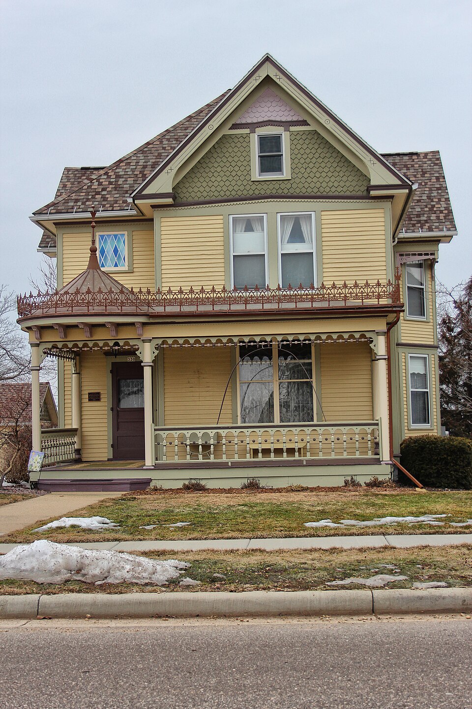
National Register reference number.03001215- the number the National Park Service assigned this property when it was listed, and the key its nomination file is catalogued under at the National Archives.
The ground it stands on
15,892 words
The chapter on Monticello Village in History of Green County, Wisconsin, published 1884 names Monticello. This is what it says, exactly as the scans read.
The Marty Bros., wlio were prominent among the pioneers of Monticello, were natives of Switzerland. They were well educated and good business men. Mathias was married to a daughter of Josiah Pierce, and is now a resi- dent of California, whither he went on account of his health. He is also a large property holder in Kansas City, Mo. Jacob Marty married a daughter of Sylvester Hills, and is now a resident of Paola, Kansas.
Thomas Mitchell, blacksmith and wagon maker, began business in Monticello in 1877. In 1878, he erected the shop which he now occupies, a commodious building, 26x32 feet. He is engaged in the manufacture of wagons and carriages, and does shoeing and general blacksmith work. He is a first-class workman, and is liberally patronized. He is a native of Bohemia, born Dec. 9, 1838. At the age of eleven he was apprenticed to a blacksmith to learn the trade. He served three and a half years. When he was sixteen years old, he left his native land and came to America. He first located at Rock River, Dodge county, where he worked at his trade until 1856, then went to Bad Axe, now Vernon county, and oj)ened a shop at Liberty Pole. He remained there one and a half years, then went to Madison, where he worked as journeyman one year, then to Minnesota, where he stopped a short time in Nininger City. In 1858, he located in New Glarus, Green county, and in the fall of that years, was married to Catharine Schindier, a native of canton Glarus, Switzerland. In 1861, he enlisted in the service as blacksmith, and served six months. He then established himself in business at Rockport, Atchison Co., Mo., continuing there until 1873, when he sold out and returned to Wisconsin. He opened a shop at Junction House, three miles west of Monroe. Six months later he went to Adauisville, Iowa county, and remained until 1^75, then went to Dane county and remained two years, and, as before stated, came to Monticello in 1877. He owns a residence here, besides two store buildings, one of which he rents, and in the other has a stock of groceries. Mr. and Mrs. Mitchell are the parents of seven children - Elizabeth, May, Agnes, Clara, Katie, Edith and Thomas.
Regional context, not property-specific
evidence. The
federal wildfire occurrence database
lists 13 fires within 5 miles of John C. and Barbara Steinman House
between 2018 and 2020, burning about 20 acres in total. None started naturally. None was recorded as arson.
Distance is straight-line from the map coordinates, so a fire counted
here may appear on a neighbouring settlement's page as well.
Reported cause
Fires
Debris and open burning
10
Missing data/not specified/undetermined
2
Smoking
1
The most recent of
them, most recent first, with the day each was reported and the service
that recorded it.
Regional context, not property-specific
evidence. The federal mineral resources record lists
7 workings within 5 miles of John C. and Barbara Steinman House: 5 past producers, 1 producer, 1 unknown.
1 still produces. What was taken out: Stone, Crushed/Broken, Stone. Distance is straight-line from the
map coordinates, so a quarry counted here may appear on a neighbouring
settlement's page as well.
Regional context, not property-specific
evidence. The National Weather Service names
Monticello, the town this property stands in, in 21 storm reports between 1995 and 2025: 7 hail, 6 thunderstorm wind, 4 funnel cloud, 2 flood.
No death or injury is recorded in these reports. Each account below is quoted exactly as the forecast office
filed it, from the NOAA Storm Events Database, and each date
opens the federal record of that event.
The west branch of the Little Sugar River and the Little Sugar River flooded during the afternoon of July 20th after several inches of overnight rain. A small number of roads near the river were closed and the parking lot for the Badger and Sugar River Bike Trails was flooded. In downtown Monticello, basement flooding occurred at a cafe, the village hall, and a chemical LLC. A portion of Fahey Road, south of Belleville, was washed out during the morning hours.
No historic map-sheet match is published
for this property yet. That does not mean no map exists. This record needs
a coordinate-quality review before it can be joined to a sheet boundary.
Browse the county's mapped places while that work is
pending.
Listed places nearby
6 within 8 miles
Other National Register properties close
enough to walk or drive between, ordered by distance from this one. Both
positions come from the same geocoding pass that matched these properties
to their map sheets.
Listing record. National Park Service National Register of Historic Places, listed-properties dataset, current to 2026-05-22.
Map join. Address geocoded through the United States Census geocoder, then tested against the published boundary of every sheet in the USGS Historical Topographic Map Collection.
How this page is made. Listing fields come from federal records; map-sheet coverage is a labelled coordinate-to-boundary calculation, not a source-field claim.
Wildfire. Short, Karen C. 2022. Spatial wildfire occurrence data for the United States, 1992-2020 [FPA_FOD_20221014]. 6th Edition. Fort Collins, CO: Forest Service Research Data Archive. https://doi.org/10.2737/RDS-2013-0009.6 Collected with United States Government funding and usable without additional permissions or fees.
Mines and quarries. USGS Mineral Resources Data System (MRDS) https://mrdata.usgs.gov/mrds/ A work of the United States government, no copyright under 17 U.S.C. 105.
Storms. NOAA National Centers for Environmental Information, Storm Events Database https://www.ncei.noaa.gov/stormevents/ A work of the United States government, no copyright under 17 U.S.C. 105. Narratives are quoted verbatim from the National Weather Service report and are not edited or summarised.
 Block