 Block
From the record
One of 36 National Register listings published here for Grant County · listed in 2006 · category: District.
Sources: the case file at the National Archives · the National Register database, National Park Service
Listed on the National Register of Historic Places in 2006.
One of 36 National Register listings published here for Grant County · listed in 2006 · category: District.
Sources: the case file at the National Archives · the National Register database, National Park Service
The chapter on Lancaster City in History of Grant County, Wisconsin, published 1881 names Lancaster. This is what it says, exactly as the scans read.
Within the confines of Lancaster are embraced Townships 4 and 5 north, of Range 3 west of the Fourth Principal Meridian. It is bounded on the north by the west half of Fennimore town, which, with Lancaster, forms the only double town in the county; on the east by Liberty and Ellenboro; on the south by Potosi, and on the west by Beetown and Little Grant. It includes within its borders some of the best farming land in the county, the wealth of the town being rather on the surface than beneath, as has been the case in many other towns.
Passage source: History of Grant County, Wisconsin, published 1881.
The site of the present city of Lancaster was originally, before the advent of the white man, a beautifully-rounded knoll, covered with low brush at intervals, through which forest trees, singly or in groves, spread their sheltering branches. At the foot of this knoll bubbled forth a limpid spring, clear as tlie purest crystal, into whose sandy depths, in all probability, many a dusky face had looked, and upon its glittering surface had reflected back the swarthy countenance, hideous with war paint, or stained with the dust and heat of the chase. Past this spring poured a brawling brook, fed by this and lesser neighboring fountains.
Passage source: History of Grant County, Wisconsin, published 1881.
Machine-read from a century-old scan, so expect the errors a machine makes: misspelled names, dropped words, stray characters.
Read the whole chapter on Lancaster City - 34,102 words on its settlement, mills, schools and churches.
Regional context, not property-specific evidence. The federal wildfire occurrence database lists 2 fires within 5 miles of Courthouse Square Historic District in 2018, burning about 5 acres in total. None started naturally. None was recorded as arson. Distance is straight-line from the map coordinates, so a fire counted here may appear on a neighbouring settlement's page as well.
| Reported cause | Fires |
|---|---|
| Missing data/not specified/undetermined | 1 |
| Equipment and vehicle use | 1 |
The most recent of them, most recent first, with the day each was reported and the service that recorded it.
| Date | Cause | Size | Reported by | Name on the report |
|---|---|---|---|---|
| 27 April 2018 | Equipment and vehicle use | under an acre | Wisconsin Department of Natural Resources | 16A2018 |
| 26 April 2018 | Missing data/not specified/undetermined | 5.0 acres | Wisconsin Department of Natural Resources | 100050 |
Regional context, not property-specific evidence. The federal mineral resources record lists 3 workings within 5 miles of Courthouse Square Historic District: 2 past producers, 1 producer. 1 still produces. What was taken out: Stone, Crushed/Broken. Distance is straight-line from the map coordinates, so a quarry counted here may appear on a neighbouring settlement's page as well.
| Where | Site | Commodity | Status | Recorded |
|---|---|---|---|---|
| Becker and Tuckwood Griswold Quarry | Stone, Crushed/Broken | Producer | ||
| Mcman Quarry | Stone, Crushed/Broken | Past Producer | ||
| Stanton Quarry | Stone, Crushed/Broken | Past Producer |
Regional context, not property-specific evidence. The National Weather Service names Lancaster, the town this property stands in, in 51 storm reports between 1995 and 2026: 27 thunderstorm wind, 16 hail, 3 flash flood, 2 flood. The reports record 1 injury. Each account below is quoted exactly as the forecast office filed it, from the NOAA Storm Events Database, and each date opens the federal record of that event.
| When | Event | Place named | Harm | What the report says |
|---|---|---|---|---|
| June 1998 | Tornado (F0) | Lancaster | 1 hurt, $200,000 | no account filed |
| July 2009 | Hail | Lancaster | $1,100,000 | Large hail was reported on Borah Ridge Road. |
| June 2015 | Thunderstorm Wind | Lancaster | $400,000 | Numerous trees and power lines were blown down from Lancaster to Platteville along State Highway 133. Farm buildings were also severely damaged and homes sustained roof damage from the strong winds. |
| June 1998 | Thunderstorm Wind | Lancaster | $200,000 | no account filed |
| May 2017 | Thunderstorm Wind | Lancaster | $175,000 | An estimated 70 mph wind gust occurred in Lancaster. Several barns and outbuildings were blown down and destroyed across the southwest half of Grant County as the line storms moved across. Lots of power lines were also down. |
| June 1998 | Thunderstorm Wind | Lancaster | $150,000 | no account filed |
| August 2025 | Flash Flood | Lancaster | $75,000 | Emergency management reported street flooding in addition to flooding in basements of some residences in Lancaster. |
| May 2000 | Hail | Lancaster | $75,000 | no account filed |
| June 2024 | Thunderstorm Wind | Lancaster | $60,000 | Trees were reported down on power lines in Lancaster and Boscobel. |
| June 2002 | Thunderstorm Wind | Lancaster | $45,000 | no account filed |
| May 2000 | Hail | Lancaster | $30,000 | no account filed |
| July 2025 | Flash Flood | Lancaster | $25,000 | Emergency management reported Morningview Road underwater in Lancaster as well as some water flowing into homes. |
| May 2000 | Hail | Lancaster | $25,000 | no account filed |
| August 2010 | Thunderstorm Wind | Lancaster | $20,000 | A large tree was uprooted by strong thunderstorm winds. The tree fell on and damaged an outbuilding, while also causing damage to utility lines that were pulled from the ground. |
| June 1997 | Thunderstorm Wind | Lancaster | $18,000 | no account filed |
| July 2009 | Hail | Lancaster | $15,000 | no account filed |
| May 2000 | Hail | Lancaster | $10,000 | no account filed |
| July 2017 | Thunderstorm Wind | Lancaster | $6,000 | Significant tree and power line damage occurred in Lancaster from an estimated 70 mph wind gust. |
| July 2025 | Thunderstorm Wind | Lancaster | $5,000 | Emergency management reported a tree branch down on a garage in Lancaster. |
| August 2025 | Flash Flood | Lancaster | $5,000 | Emergency management reported numerous streets and intersections were closed due to flash flooding in Lancaster. |
| September 2018 | Thunderstorm Wind | Lancaster | $5,000 | Several trees and some power lines were blown down near and just west of Lancaster. |
| July 2017 | Lightning | Lancaster | $5,000 | A house was struck by lightning in Lancaster. |
| August 2020 | Thunderstorm Wind | Lancaster | $4,000 | An estimated 60 mph wind gust occurred in Lancaster causing power outages. |
| September 2010 | Thunderstorm Wind | Lancaster | $4,000 | Numerous trees were blown down around the city of Lancaster and one of the trees fell onto a house. |
| August 1996 | Thunderstorm Wind | Lancaster | $4,000 | no account filed |
| June 2017 | Thunderstorm Wind | Lancaster | $3,000 | A 64 mph wind gust occurred northeast of Lancaster. |
| July 2012 | Thunderstorm Wind | Lancaster | $3,000 | Several trees were blown down across Lancaster. |
| July 2020 | Thunderstorm Wind | Lancaster | $2,000 | Power lines were blown down northwest of Lancaster. |
| May 2013 | Thunderstorm Wind | Lancaster | $2,000 | Trees were blown down in Lancaster. |
| July 2008 | Thunderstorm Wind | Lancaster | $2,000 | Amateur radio reported power lines down in the town of Lancaster. |
| June 2008 | Hail | Lancaster | $1,500 | no account filed |
| June 2008 | Hail | Lancaster | $1,500 | no account filed |
| September 2001 | Thunderstorm Wind | Lancaster | $1,250 | no account filed |
| July 2018 | Thunderstorm Wind | Lancaster | $1,000 | Tree limbs were blown down in Lancaster. |
| June 2001 | Hail | Lancaster | $1,000 | no account filed |
| July 2008 | Thunderstorm Wind | Lancaster | $500 | Large trees were knocked down. |
| June 1998 | Thunderstorm Wind | Lancaster | $200 | The county Emergency Manager reported large trees down. |
| April 2026 | Hail | Lancaster | - | Emergency management reported nickel sized hail at the Sheriff's office southeast of Lancaster. |
| June 2017 | Thunderstorm Wind | Lancaster | - | A 58 mph wind gust was measured just north of Lancaster. |
| June 2014 | Thunderstorm Wind | Lancaster | - | A wind gust of 78 mph was measured north of Lancaster. |
| June 2014 | Flood | Lancaster | - | Heavy rain caused street flooding to occur in Lancaster. |
| May 2013 | Thunderstorm Wind | Lancaster | - | A wind gust of 70 mph occurred just south of Lancaster. |
| September 2012 | Heavy Rain | Lancaster | - | Just over 3 inches of rain fell in Lancaster during the evening of the 4th into the early morning of the 5th. |
| April 2008 | Flood | Lancaster | - | An embankment failure occurred on Highway 35, just west of Highway 81. A substancial amount of debris was reported on the road, with several vehicles stuck in the debris. |
| June 2008 | Hail | Lancaster | - | no account filed |
| April 2006 | Hail | Lancaster | - | no account filed |
| May 2000 | Hail | Lancaster | - | no account filed |
| May 2000 | Hail | Lancaster | - | no account filed |
| March 1998 | Hail | Lancaster | - | no account filed |
| February 1996 | Hail | Lancaster | - | no account filed |
| July 1995 | Thunderstorm Wind | Lancaster | - | no account filed |
No historic map-sheet match is published for this property yet. That does not mean no map exists. This record needs a coordinate-quality review before it can be joined to a sheet boundary. Browse the county's mapped places while that work is pending.
Other National Register properties close enough to walk or drive between, ordered by distance from this one. Both positions come from the same geocoding pass that matched these properties to their map sheets.
| Photograph | Property | Distance | Listed |
|---|---|---|---|
 | Grant County Courthouse | under 500 feet | 1978 |
 | Lancaster Municipal Building | under 500 feet | 1983 |
 | Lancaster Post Office | 0.1 miles | 2000 |
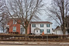 | L. J. Arthur House | 0.1 miles | 1985 |
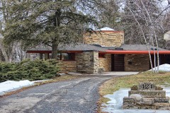 | Patrick and Margaret Kinney House | 0.6 miles | 2008 |
| National Archives record | The nomination case file for reference 06000233 in Record Group 79. |
| Grant County | All 36 listed properties in this county. |