BlockBefore

Grant County, Wisconsin

91 topographic sheets cover 63 settlements here, and 36 properties are on the National Register of Historic Places.

Research this county

From the record

“Chaney followed the occupation of mining for many years. I. ; was severely wounded at the siege of Vicksburg, and died at Memphis, Tenn., in the fall of 186.3. Chaney has three children by her first husband; she had five by second marriage, four of whom are living - William H., Lewis, Isabelle and Clara; all born in Iowa Co.; William H.”

Town Of Wingville - History of Grant County, Wisconsin (1881). Machine-read text.

36 National Register listings published here · the county-history sources tell 12 stories and name 3 people · people the book names include Hon. Jambs W. Seaton (Potosi Town, 1900) · Dk. James G. Percival (Hazel Green Village, 1881) (machine-read).

Sources: the county history on the Internet Archive · the National Register database, National Park Service

Wisconsin within the United States
Grant County within Wisconsin

What the record shows

  • 907 topographic sheet readings cover the county's settlements.
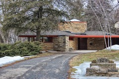
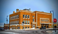
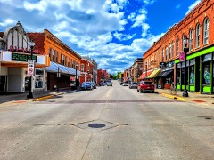
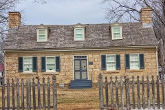
  • 36 properties here are on the National Register of Historic Places: 27 buildings, 6 districts and 3 sites.
  • 8 of the 36 listings were added during the 1970s.
  • The Geographic Names Information System records 63 populated places in this county; 63 are covered by at least one topographic sheet.
  • 3 public-domain county histories, 1881 and 1900, supply 315,312 words of narrative reproduced here.

What happened here

12 accounts

Among them: Thb Db La8Sbaux Mus'D Hr; The Great Fire; Thu Jim Crow Murder. These passages come from the identified county-history source books. Each inset names its own source and opens the exact section it comes from.

From History of Grant County Wisconsin, published 1900 - Beetown Town

Thb Db La8Sbaux Mus'D Hr

The principal crime which has been committed in Beetown was the murder of De Lasseaux (or De Lassaulx) by a miner named Robert B. Brewer, in April, 1846. The murdered man was a smelter, a man of considerable means and good education, and Alsatian by birth, and a civil engineer by profession. He was very popular on account of his liberality, and respected on account of his ability and education.

Read the rest of this passage

From History of Grant County Wisconsin, published 1900 - Bloomington Village

The Great Fire

For nearly forty-five years Blooeqiugton existed as a village with¬ out a house being burned - a remarkable record. The Finn building caught fire three times, but each tune the .fire was discovered in time to he extinguished without serious damage. But at last, on the night of March 22, 1897, what everybody had been expecting for thirty years happened, and two-thirds of the business part of the vil¬ lage was swept away in .a night.

Read the rest of this passage

From History of Grant County Wisconsin, published 1900 - Potosi Town

Thu Jim Crow Murder

In 1838 occurred the "Jim Crow " murder, which created great excitement, not only in Potosi but throughout the county. The Long Range, referred to on page 517, was discovered by one Phipps, who failed to find the main body of mineral and sold to Moore & Watson. The wealth soon developed in the lode tempted some persons to try to obtain forcible possession of it, and to accomplish this they enlisted two or three of a gang of ruffians who then infested the settlement, ready for any evil deed that promised plunder.

Read the rest of this passage

From History of Grant County Wisconsin, published 1900 - Potosi Town

Murders, Suicides, And Accidents

Homicides have not been numerous in Potosi. Besides the two kill¬ ings already described, the most noted one was the murder of James Short in 1837 by a man named Gardner. The body was not discovered for a longtime. The murderer was hanged at Jacksonville, Illinois, three years afterward for another crime and confessed to this one.

Read the rest of this passage

From History of Grant County, Wisconsin, published 1881 - Muscoda Village

Early History And Growth

There is a tradition that some English immigrants settled on the site of this village at a very early day and were massacred by the In¬ dians. Nothing definite is known about it, but on the strength of the tradition the place was called English Prairie until about 1840. The present name was evidently taken from Longfellow's Hiawatha in which is mentioned 44 the muscoda, the meadow." The place was also called Savannah.

Read the rest of this passage

From History of Grant County Wisconsin, published 1900 - Jamestown Town

The Harney Murder

One of the most terrible crimes in the annals of the county was committed at Fairplay September 25,1865. Dr. Harney, an old resi¬ dent of the place, and a man of good character (except that he was subject to fits of almost insane anger), killed his step-daughter and seriously injured his wife. The daughter of Mrs.

Read the rest of this passage

From History of Grant County Wisconsin, published 1900 - Jamestown Town

Murder Of Christian Kelly

Christian Kelly, living nearly two miles east of Fairplay, was murdered on the night of November 15, 1869. On Tuesday morning, the 16th, his wife got up and went out and found the body of the murdered man lying near the house covered with the snow which had skull was crushed in. He was seen by a neighbor doing the chores that night, and was also seen in bed between nine and ten o'clock.

Read the rest of this passage

From History of Grant County, Wisconsin, published 1881 - Platteville City

Small-Pox Epidemic

In December following, the small-pox broke out in the village, and, before the physicians were able to agree as to the exact nature of the malady, an epidemic succeeded. It was believed to have been imported hither from Milwaukee by a merchant of Platteville, whose clothing had become impregnated with the seeds of disease while in the former city.

Read the rest of this passage

From History of Grant County, Wisconsin, published 1881 - Platteville City

Town Of Bloomington

April in Co. C, 2d W. V. I. ; discharjred in the spring of 1863 ; wounded at the battle of Grainesville, Va., the 28th of August, 1862 ; was with the regiment all through, up to the time of being wounded ; appointed Postmaster in 1870, which office he has held creditably ever since. He was married, in Bloomington, in 1863, to Miss Rachael J.

Read the rest of this passage

From History of Grant County, Wisconsin, published 1881 - Platteville City

Town Of Mount Hope

J. W. BRUJirSON, farmer, Sec. 30 ; P. 0. Mt. Hope ; was born in 1805, in Sing Sing, N. Y.; son of Ira Brunson. His father was a stone-cutter by trade, and was drowned one year after the birth of this SOD, while he was keeping the ferry across the Hudson Biver, at that time. His mother moved to Danbury, Conn. At the age of 15 years, he became an apprentice to the hatter's trade, under Capt.

Read the rest of this passage

From History of Grant County, Wisconsin, published 1881 - Platteville City

Small-Pox Epidemic

In December following, the small-pox broke out in the village, and, before the physicians were able to agree as to the exact nature of the malady, an epidemic succeeded. It was believed to have been imported hither from Milwaukee by a merchant of Platteville, whose clothing had become impregnated with the seeds of disease while in the former city.

Read the rest of this passage

From History of Grant County, Wisconsin, published 1881 - Platteville City

Town Of Wingville

Mrs. John Russell, formerly Miss Hughes. Mr. Chaney followed the occupation of mining for many years. He enlisted in 1861 in the 11th W. V. I. ; was severely wounded at the siege of Vicksburg, and died at Memphis, Tenn., in the fall of 186.3. Mrs. Chaney has three children by her first husband; she had five by second marriage, four of whom are living - William H., Lewis, Isabelle and Clara; all born in Iowa Co.; William H.

Read the rest of this passage

Places on the National Register

36

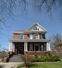
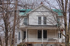
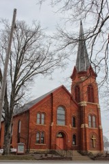
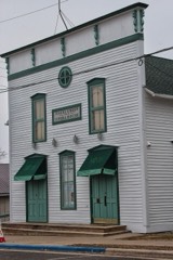
Every property in this county listed on the National Register of Historic Places, with the year it was listed and the federal nomination document.

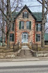
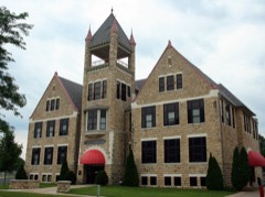
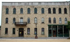
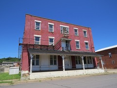
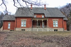
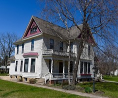
Photograph PropertyType ListedReference
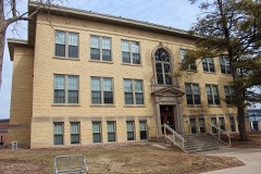
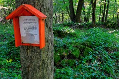
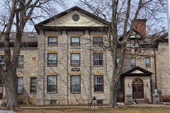
Agriculture and Manual Arts Building/Platteville State Normal Schoolbuilding198585000578
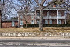
L. J. Arthur Housebuilding198585001951
James Ballantine Housebuilding197676000062
Bayley Avenue Historic Districtdistrict200707000708
Beebe Housebuilding197979000078
Boscobel Grand Army of the Republic Hallbuilding200707001329
Boscobel High Schoolbuilding198686003518
Central House Hotelbuilding199696001361
Leonard and Caroline Coates Housebuilding2021100007031
Courthouse Square Historic Districtdistrict200606000233
Edward and Mary Davies Housebuilding2023100009038
Denniston Housebuilding197575000213
Division Street Historic Districtdistrict200707000709
Jonathan H. Evans Housebuilding198282000670
First Congregational Churchbuilding198585001359
German Evangelical Lutheran Church of Peacebuilding2022100007631
Grant County Courthousebuilding197878000096
Hazel Green Town Hallbuilding198988003231
Patrick and Margaret Kinney Housebuilding200808000160
Lancaster Municipal Buildingbuilding198383003397
Lancaster Post Officebuilding200000001245
Main Street Commercial Historic Districtdistrict199090000377
Mitchell-Rountree Housebuilding197272000052
Dwight T. Parker Public Librarybuilding198383003398
Potosi Badger Huts Sitesite199696001532
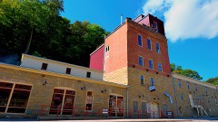
Potosi Brewerybuilding198080000138
Rock School and Hanmer Robbins School Complexbuilding2023100009102
Rountree Hallbuilding197474000091
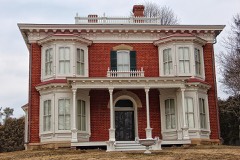
J. H. Rountree Mansionbuilding198686001307
St. John Minesite197979000079
Stonefieldsite197070000034
Trinity Episcopal Churchbuilding2023100009063
West Main Street Historic Districtdistrict200707000710
Wyalusing State Park Mounds Archeological Districtdistrict199999001175
John Young Housebuilding199494001157

Wildfire, 1992 to 2020

302 fires

Every wildfire the federal occurrence database records inside this county: 302 of them, burning about 701 acres. 3 started naturally and 28 were recorded as arson. Each settlement page carries the fires within five miles of it.

Reported cause Fires
Debris and open burning126
Missing data/not specified/undetermined62
Equipment and vehicle use45
Arson/incendiarism28
Recreation and ceremony15
Smoking11
Railroad operations and maintenance4
Natural3
Power generation/transmission/distribution3
Fireworks2
Misuse of fire by a minor2
Other causes1

The five largest, by the area the report gives. None of them was recorded as arson.

DateCause SizeReported by Name on the report
12 April 1996Missing data/not specified/undetermined62 acresWisconsin Department of Natural Resourcesnot named
18 March 2009Debris and open burning43 acresWisconsin Department of Natural Resourcesnot named
18 April 2001Smoking42 acresWisconsin Department of Natural Resourcesnot named
14 April 2004Equipment and vehicle use29 acresWisconsin Department of Natural Resourcesnot named
11 April 2014Debris and open burning28 acresWisconsin Department of Natural ResourcesDODGEVILLE CO-OP 6
2 April 1997Equipment and vehicle use27 acresWisconsin Department of Natural Resourcesnot named
19 November 2020Missing data/not specified/undetermined21 acresWisconsin Department of Natural Resources20217
23 March 2000Recreation and ceremony20 acresWisconsin Department of Natural Resourcesnot named

Every settlement page carries the fires within five miles of it - see the settlement index below.

Storms, 1954 to 2026

60 of 825 shown

The NOAA Storm Events Database holds 825 reports for this county, causing 2 deaths, 13 injuries and about $65,559,950 in recorded property damage. Each settlement page carries the reports that name it.

Kind of event Reports
Thunderstorm Wind331
Hail252
Flash Flood69
Flood65
Tornado55
Heavy Rain29
Funnel Cloud16
Lightning8

The most serious of them, by death, then injury, then recorded damage. The accounts are quoted exactly as the forecast office filed them.

WhenEvent Place namedHarm What the report says
July 2006Thunderstorm WindCassville1 killed, $1,000no account filed
August 2001LightningBloomington1 killedno account filed
June 2014Tornado (EF2)Platteville5 hurt, $20,500,000A tornado formed along a squall line west of Platteville, just south of County Road B, and traveled through Memorial Park on to the Univ. of Wisconsin - Platteville campus. Five people were injured, one of them seriously. There was extensive damage done to five buildings and the stadium on campus. Roofs of two new residential halls were partially destroyed and a third residential hall was also damaged along with one academic building. Two large lighting structures at the football stadium were knocked over, with one crashing across the bleachers causing the concrete foundation underneath the bleachers to be substantially moved. Damage continued into nearby homes and businesses as the tornado tracked across Business Highway 151. The top level of a split level home was ripped off one house, another house lost part of a roof and a porch while several other homes had windows blown out and trees knocked down. A gas station/convenience store was leveled by the tornado where it also ripped a pump out of the ground and blew over a semi. Numerous other business and vehicles suffered blown out windows. After hitting a cemetery on the south side of town, the tornado dissipated just before reaching U.S. Highway 151 southeast of town. A total of 12 homes were destroyed with another 20 damaged.||At UW-Platteville, the tornado caused $7.3 million in damage to Bridgeway Commons, $4.8 million in damage to Rountree Commons and $1.8 million to Southwest Hall. All three buildings are dorms.||The tornado caused $1.8 million in damage to Engineering Hall, a classroom building, and $1.7 million in damage to the stadium.
May 1985Tornado (F3)not stated2 hurt, $2,500,000no account filed
June 1973Tornado (F1)not stated2 hurt, $250,000no account filed
June 1969Tornado (F2)not stated2 hurt, $25,000no account filed
June 1998Tornado (F0)Lancaster1 hurt, $200,000no account filed
April 2005LightningMontfort1 hurtno account filed
June 2013Flash FloodBoscobel$7,100,000Very heavy rain produced flash flooding across the northeast part of Grant County. |In Boscobel, numerous houses became surrounded by water with evacuations needed, most streets were flooded and cars were under water. 650 homes were impacted by the flood waters with two dozen families displaced. County Roads M and S near Boscobel were impassable due to high water and several other county roads between Blue River and Fennimore were covered with water and impassable. Portions of County Road C southwest of Woodman were under water. The flooding washed out sections of State Highway 133 outside of Woodman and Blue River. Debris was washed down Glass Hollow and Dry Hollow Creeks where it became lodged across railroad bridges in Bagley producing flooding in the town. The railroad tracks through Woodman were washed out. Flooding debris blocked some roads around Patch Grove. 54 canoeists had to be rescued from the Wisconsin River because of rising water.
June 2008Flash FloodCassville$6,500,000A major flash flood hit Grant County during the afternoon of June 12th impacting the communities of Lancaster, Potosi, Tennyson, Ellenboro, and other rural areas. Numerous rescues were performed from people trapped in cars, especially in the Potosi area where terrain enhanced the runoff from repeat thunderstorms. Several homes on Hippie Hollow Road in Potosi Township were destroyed along with damage to as many as 600 homes elsewhere in the region. Many highways and county roads suffered flood damage including major bridge and road infrastructure.
July 2007Flash FloodBagley$2,200,000Flash flood waters backed up in town as debris blocked area bridges. The water was three to four feet deep in places and propane gas containers began floating on the Mississippi River. Property damage in town was extensive.
July 2009HailPotosi$1,800,000no account filed
July 2009Thunderstorm WindLouisburg$1,500,000no account filed
July 2010FloodPlatteville$1,250,000The Grant County Emergency Manager reported that U.S. Highway 151 was closed at the SW Road interchange. County Road B was also closed for a while. County Road O sustained substantial damage and was likely closed for around a week. County Road U sustained shoulder damage. Water was also over SW Road near the intersection with Pioneer Road in the southwest part of the city of Platteville. Newspaper articles indicate at least 90 homes throughout the county were damaged by the flooding. Some of the homes had water at least 5 feet above ground level. A two day rainfall total of 9.25 inches was measured at 6 a.m. CST on July 24th in Dickeyville. A three day rainfall total of 8.96 inches in Rockville was measured at 6 a.m. CST July 24th.
June 2008Flash FloodPatch Grove$1,200,000Highways 35 and 18 were closed due to mudslides and debris. Trees were even being knocked down by the slides.
June 2000Flash FloodCountywide$1,200,000no account filed
July 2009HailLancaster$1,100,000Large hail was reported on Borah Ridge Road.
July 2017Flash FloodGlenhaven$942,000Locally heavy rains of 4 to 8 inches, produced flash flooding across the southern half of Grant County. Parts of State Highway 81 north of Cassville were washed out where a sinkhole formed. The flood waters around Cassville caused five people to be trapped in their residences and swept away three cars. About a dozen homes had water over the first floor and one home was a complete loss as the flood waters shifted it off the foundation. A person had to be rescued from a floating camper at a campground southeast of Cassville. Around 20 roads were closed or significantly damaged throughout the county because of the flooding. Across the county, a total of 5 homes were destroyed, 12 sustained major damage and 20 had minor damage. In Platteville, numerous streets were flooded with lots of houses surrounded by water and some basements were flooded.
September 2019Flash FloodBloomington$900,000Runoff from heavy rains caused flash flooding to occur across the northwest portion of Grant County. Nearly every township road was closed because of flood damage across Wyalusing, Millville and Woodman townships. Roads were also closed in and near Fennimore. Water over the road, debris on the road and mudslides affected U.S. Highway 61 for about 5 miles south of Boscobel.
April 2008Flash FloodBagley$800,000More than 20 roads were reported closed due to flash flooding. In fact, several roads remained closed, even one week after the heavy rains. There was also damage to bridges and culverts. For example, Ellenboro Road Bridge was closed for nearly a week after the heavy rains due to damage from a large amount of debris hitting the bridge. In addition, numerous farm fields were either water logged or had significant soil erosion, which could delay spring planting significantly.
June 2008FloodMuscoda$750,000Water was reported over numerous roads across the county.
June 2008Flash FloodMuscoda$750,000Numerous mudslides were reported, along with high water in valleys.
April 2008FloodGlenhaven$700,000Runoff from excessive rainfall caused significant flooding of several homes and businesses. In fact, there were approximately 70 homes which suffered damage to flood waters. Some of the locations which were hardest hit included Lancaster, Platteville, Ellenboro, Glenn Haven, Cassville and Potosi. Even a week after the heavy rains, some roads and bridges remained closed due to washouts and effects of debris hitting these structures. In addition, some farm fields remained unusable due to erosion or standing water. Grant County has been hit by major flooding in 2002, 2004, 2007 and 2008.
June 2014Tornado (EF1)Platteville$540,000A second tornado (EF1) hit the northeast corner of Platteville, near the Golf and Country Club. The track was about 1/2 mile long with a 50 yard width. Damage included some trees knocked down and a roof off an apartment building.
June 2002Flash FloodSouth Portion$500,000no account filed
July 2011Thunderstorm WindKieler$460,000High winds from severe thunderstorms created considerable damage from Keiler and Dickeyville east to Cuba City and Hazel Green. Farm buildings were damaged and corn was flattened along County Roads H and Z. Between Keiler and Cuba City, numerous homes had siding and shingles blown off or were damaged by falling trees. More than three dozen trees were blown down, a barn was destroyed and several buildings received minor damage along Banfield and Indian Creek Roads. In Dickeyville, a roof was torn off, a side wall of a building knocked down and trees were uprooted or snapped off. North of Hazel Green, a machine shed was destroyed. Numerous power lines were blown down causing power outages over a large portion of southern Grant County.
August 2021Tornado (EF3)Boscobel$430,000A NWS storm survey confirmed that an EF3 tornado occurred across northern Grant County. The tornado started in Boscobel where damage to trees, power poles and power lines occurred. The tornado then moved east/southeast before dissipating south of Blue River. Along the path, six homes sustained enough damage to be considered total losses while numerous other had minor to moderate damage. No injuries were reported.
September 2012Tornado (EF2)Patch Grove$420,000A slow moving tornado formed on the edge of a passing severe thunderstorm between Patch Grove and Bloomington. The tornado was mainly confined to one landowner near Hickory and Maine Roads in rural Grant County. Several outbuildings, a barn, and the home were demolished or heavily damaged. Trees on the property were also sheared off or blown over. Considering the roof was torn off and several walls were down or damaged, the tornado was rated an EF2 but it's possible the slow movement allowed the tornado to remain nearly stationary long enough to cause worse damage. Interviews by local residents and video evidence suggests the tornado may have moved to the northwest at times as well.
July 2019Flash FloodBoscobel$410,000Slow moving thunderstorms dropped between 3 and 5 inches of rain across the northeast portion of Grant County. Runoff from the rain caused a mudslide to occur along County Highway M south of Blue River and water covered County Highway B southeast of Ellenboro. A mudslide near Glen Haven covered some railroad tracks resulting in a train derailment. Nine cars derailed with one partially going into the Mississippi River.
June 2014Tornado (EF1)Fennimore$410,000A tornado touched down 2 miles northeast of Fennimore and skipped along an east path to 3 miles northwest of Montfort. The tornado damaged several mature hardwood trees, several outbuildings and three homes. On one farm alone, eight buildings were destroyed. The homes sustained minor damage compared to the hardwood trees and outbuildings. The tornado was rated an EF1 with maximum estimated winds of 110 mph. Total path length was 8.2 miles and the maximum width of the tornado was 600 yards.
June 2015Thunderstorm WindLancaster$400,000Numerous trees and power lines were blown down from Lancaster to Platteville along State Highway 133. Farm buildings were also severely damaged and homes sustained roof damage from the strong winds.
May 2024Thunderstorm WindHurricane$350,000Emergency management reported numerous trees and power lines down in central Grant County.
August 2025Flash FloodBagley$300,000Emergency management reported debris blocking a railroad bridge resulting in storm water to overflow into portions of Bagley. This resulted in the inundation of several residences and prompted evacuations in the town.
August 2010FloodBoscobel$300,000Widespread rainfall amounts of 2 to 3 inches fell in two hours across much of the eastern half of Grant County. Many roads throughout the county were underwater and closed temporarily, including U.S. Highway 151 near Platteville. Damage did occur to some roads as well as to homes and businesses. The cities that had the worst impacts included Boscobel, Fennimore, Livingston, Cuba City, Kieler, and Hazel Green.
August 2007Flash FloodMillville$265,000Flash flooding affected about 40 homes across parts of mainly northern Grant County. One home was destroyed. Several bridges and roads were also damaged.
May 1988Tornado (F2)not stated$250,000no account filed
May 1985Tornado (F2)not stated$250,000no account filed
August 1980Tornado (F1)not stated$250,000no account filed
September 1970Tornado (F2)not stated$250,000no account filed
June 1969Tornado (F2)not stated$250,000no account filed
July 1966Tornado (F2)not stated$250,000no account filed
June 2015Thunderstorm WindCassville$200,000Trees, power lines and a barn were blown down in Cassville. A hangar at the municipal airport was damaged and a fabric covered plane that was inside the hangar was damaged extensively. Downed trees briefly blocked the Burlington Northern Santa Fe railroad tracks. Hundreds of trees were reported to have been blown down across town and several homes near the airport were damaged by the fallen trees.
May 1999Flash FloodSouth Portion$200,000no account filed
June 1998Thunderstorm WindLancaster$200,000no account filed
March 2020Tornado (EF1)Rockville$180,000An EF1 tornado touched down north of Potosi and move northeast for 6 miles before dissipating west of Ellenboro. One house, numerous farm buildings, trees and power lines were damaged along the path of the tornado.
April 2026HailMt Hope$175,000The public reported 2 inch diameter hail near Mount Hope. The report was relayed via social media.
May 2017Thunderstorm WindLancaster$175,000An estimated 70 mph wind gust occurred in Lancaster. Several barns and outbuildings were blown down and destroyed across the southwest half of Grant County as the line storms moved across. Lots of power lines were also down.
May 2014Thunderstorm WindHurricane$175,000Strong thunderstorms winds destroyed a 9,000 square foot metal shed dumping about 20,000 bushels of corn on the ground. The shed was destroyed but the corn was able to be salvaged.
June 2008FloodCassville$175,000Flooding continued in many areas of southwest Wisconsin during the evening of June 12th, especially on the Platte and Grant Rivers where rises of 4 feet an hour were reported. About 50 locations on Grant County roads were closed at one point due to flood waters and damage to infrastructure. Emergency Operation Centers and shelters were opened. A state of emergency was declared for the county.
June 2017Thunderstorm WindLivingston$170,000More than 20 power poles were snapped causing power lines to go down along State Highway 80 between Livingston and Montfort. Farm buildings were damaged north of Livingston.
May 2004Flash FloodCountywide$150,000no account filed
June 2004Flash FloodSouthwest Portion$150,000no account filed
June 1998Thunderstorm WindLancaster$150,000no account filed
June 2015Thunderstorm WindHazel Green$110,000An estimated wind gust of 65 mph blew down trees and powerlines in and around Hazel Green. The winds also damaged farm buildings and homes.
May 2024HailDickeyville$100,000Golf ball sized hail was reported near Dickeyville by local law enforcement.
August 2005Tornado (F1)Muscoda$100,000no account filed
May 2004Flash FloodNorth Portion$100,000no account filed
June 1998Thunderstorm WindBagley$95,000Jellystone Campground was hit with many campers damaged.

Mines and quarries

212 recorded

The Survey's mineral resources record lists 212 workings inside this county. 16 still produce and 196 are closed or unrecorded. Each settlement page carries the workings within five miles of it.

Commodity Workings
Zinc128
Lead102
Stone, Crushed/Broken44
Stone9
Lead, Zinc6
Zinc, Lead5
Iron, Manganese1
Iron1
Sand and Gravel, Construction1
Copper, Lead1
Iron, Lead1
Calcium1

The least common of them first, because a county's hundredth gravel pit says nothing its first ten did not.

Where SiteCommodity StatusRecorded
Cassville PitSand and Gravel, ConstructionPast Producer
Hodgson QuarryCalciumProducer
Jones and Snow MineIron, ManganesePast Producer
Jones and Snow MineIron, ZincPast Producer
Red Dog MineZinc, Iron, LeadPast Producer
Upper Mississippi Valley ProspectZinc, Copper, LeadProspect
Big JackZinc, LeadPast Producer1926, 1941
BlockhouseZinc, LeadPast Producer1914, 1916
Crawford MineZinc, LeadPast Producer1931, 1932
CrusonZinc, LeadPast Producer1908, 1909
RoseleipZinc, LeadPast Producer1925
Beloit-ElmoLead, ZincPast Producer1908, 1909
Goke-BlockhouseLead, ZincPast Producer1920, 1921
Honest Bob MineLead, ZincPast Producer
Jefferson MineLead, ZincPast Producer1903
Kistler and StephensLead, ZincPast Producer1917
Madison MineLead, ZincPast Producer
A Dickes QuarryStoneUnknown
Bell QuarryStoneUnknown
Deitzman QuarryStoneUnknown
Finn QuarryStoneUnknown
Fortney QuarryStoneUnknown
Hodgson QuarryStoneUnknown
Kirschbaum QuarryStoneUnknown
Morsehead QuarryStoneUnknown
Zuegel Bell QuarryStoneUnknown
Becker and Tuckwood Griswold QuarryStone, Crushed/BrokenProducer
Bell QuarryStone, Crushed/BrokenProducer
Big Patch QuarryStone, Crushed/BrokenPast Producer
Blue River QuarryStone, Crushed/BrokenPast Producer
Blum QuarryStone, Crushed/BrokenPast Producer
Bob Richards QuarryStone, Crushed/BrokenPast Producer
Brogley QuarryStone, Crushed/BrokenPast Producer
Charlie White QuarryStone, Crushed/BrokenProducer
Clark QuarryStone, Crushed/BrokenPast Producer
Croft QuarryStone, Crushed/BrokenProducer
Dallas Cohen QuarryStone, Crushed/BrokenPast Producer
Dell Needham Various QuarriesStone, Crushed/BrokenProducer
Ellenboro QuarryStone, Crushed/BrokenPast Producer
Ellenboro Township QuarryStone, Crushed/BrokenPast Producer
Finn QuarryStone, Crushed/BrokenProducer
George Wendtlandt Inc Deiter QuarryStone, Crushed/BrokenProducer
Grant County QuarriesStone, Crushed/BrokenPast Producer
Hodgeson QuarryStone, Crushed/BrokenPast Producer
Johns QuarryStone, Crushed/BrokenPast Producer
Julius Wiest QuarryStone, Crushed/BrokenProducer
Klaas QuarryStone, Crushed/BrokenPast Producer
Klar QuarryStone, Crushed/BrokenPast Producer
Klar QuarryStone, Crushed/BrokenProducer
Kowalski-Kieler Inc Kieler QuarryStone, Crushed/BrokenProducer
Kruel QuarryStone, Crushed/BrokenPast Producer
Martin QuarryStone, Crushed/BrokenPast Producer
Mcman QuarryStone, Crushed/BrokenPast Producer
Merkus QuarryStone, Crushed/BrokenPast Producer
Millville QuarryStone, Crushed/BrokenProducer
Pautsman QuarryStone, Crushed/BrokenPast Producer
Pennecamp QuarryStone, Crushed/BrokenPast Producer
Peter Kershbaum QuarryStone, Crushed/BrokenPast Producer
Platteville QuarryStone, Crushed/BrokenProducer
Rosemeyer QuarryStone, Crushed/BrokenProducer
Salzgeber QuarryStone, Crushed/BrokenProducer
Stanton QuarryStone, Crushed/BrokenPast Producer
Staskal and Son-Sand and GravelStone, Crushed/BrokenPast Producer
Ulbircht-Schaefer QuarryStone, Crushed/BrokenPast Producer
Ulbrick QuarryStone, Crushed/BrokenProducer
Ulehoven QuarryStone, Crushed/BrokenPast Producer
Updike QuarryStone, Crushed/BrokenPast Producer
Vorwald QuarryStone, Crushed/BrokenPast Producer
Werley QuarryStone, Crushed/BrokenPast Producer
Zenz QuarryStone, Crushed/BrokenPast Producer
Acme MineZinc, LeadUnknownSphalerite
Atkinson MineLeadUnknownGalena
Beloit-Elmo MineZinc, LeadUnknownSphalerite
Big Jack MineZinc, LeadUnknownSphalerite
Black Hawk MineZinc, LeadUnknownSphalerite
Black JackZinc, LeadUnknownSphalerite
Blockhouse MineZinc, LeadUnknownSphalerite
Board of Trade MineZinc, LeadUnknownSphalerite
Calvert MineLeadPast Producer
Capitola MneZinc, LeadUnknownSphalerite
Cardiff Mine No. 2Zinc, LeadPast Producer
Cardiff No. 1 MineZinc, LeadUnknownSphalerite
Cardiff No. 2 MineZinc, LeadUnknownSphalerite
Columbia MineZinc, LeadUnknownSphalerite
Crawford MineZinc, LeadUnknownSphalerite
Crow Branch MineZinc, LeadUnknownSphalerite
Crow Branch MineZinc, LeadPast Producer
Cruson MineZinc, LeadUnknownSphalerite
Durley Lead PitsLeadPast Producer
East End MineZinc, LeadUnknownSphalerite
Eberle MineZinc, LeadUnknownSphalerite
Eberle MineZinc, LeadPast Producer
Eclipse MineZinc, LeadPast Producer
Elmo No. 3Zinc, LeadPast Producer1969
Empire MineZinc, LeadUnknownSphalerite
Enterprise MineZinc, LeadUnknownSphalerite
Evans MineZinc, LeadPast Producer
Fairplay LevelLead, ZincUnknownGalena
Fairplay Level MineZinc, LeadPast Producer
Goke-Blockhouse MineZinc, LeadUnknownSphalerite
Graham and Stephens MineZinc, LeadUnknownSphalerite
Grant County MineZinc, LeadUnknownSphalerite
Great Northern MineZinc, LeadPast Producer
Green and Gibson MineLeadPast Producer
Hazel Green MineZinc, LeadUnknownSphalerite
Hibernia MineZinc, LeadUnknownSphalerite
Highland Park MineZinc, LeadPast Producer
Hodge MineZinc, LeadUnknownSphalerite
Holman MineLeadPast Producer
Homestead MineZinc, LeadUnknownSphalerite
Honest Bob MineZinc, LeadUnknownSphalerite
Honest Bob MineZinc, LeadPast Producer
Horseshoe MineZinc, LeadUnknown
Horseshoe MineZinc, LeadPast Producer
Jarrett MineZinc, LeadUnknownSphalerite
Jefferson MineZinc, LeadUnknownGalena, Sphalerite
Johns MineZinc, LeadUnknownSphalerite
Kistler and Stephens MineZinc, LeadUnknownSphalerite
Klar-Piquette MineZinc, LeadUnknownSphalerite
Kroag and Webster MineLeadPast Producer
Krog and Webster MineZinc, LeadUnknownSphalerite
Kuster and Ray MineLead, ZincPast Producer
L.B.Brogley ProspectLeadProspect
Last Chance MineZinc, LeadUnknownSphalerite
Last Chance and La Follette MinesLead, ZincPast Producer
Little Dick MineZinc, LeadUnknownSphalerite
Little Grant MineZinc, LeadUnknownSphalerite
Long Range Lead DiggingsLead, ZincPast Producer
Lucky Four MineZinc, LeadPast Producer
Lyght MineZinc, LeadUnknownSphalerite
Madison MineZinc, LeadUnknownSphalerite
Mann Brothers MineLeadPast Producer
Mc Govern MineLeadPast Producer
Mithcell Hollow MineZinc, LeadUnknownSphalerite
Montfort MineZinc, LeadPast Producer
New Blockhouse MineZinc, LeadUnknownSphalerite
New Rose MineZinc, LeadUnknownSphalerite
Preston Point Level MineZinc, LeadUnknownSphalerite
Red Dog MineZinc, LeadUnknownSphalerite
Roseleip MineZinc, LeadUnknownSphalerite
Royal MineZinc, LeadUnknownSphalerite
Scrabble Creek MineZinc, LeadUnknownSphalerite
Seitz MineZinc, LeadUnknownSphalerite
St. Rose MineZinc, LeadUnknownSphalerite
Tennyson Area ProspectsLead, ZincPast Producer
Tiffany MineZinc, LeadUnknownSphalerite
Tiffany MineLead, ZincPast Producer
Tippecanoe MineZinc, LeadUnknownSphalerite
Tommy Dodd MineZinc, LeadUnknownSphalerite
Travis Farm ProspectsLead, ZincPast Producer
Trego MineZinc, LeadUnknownSphalerite
Trego No. 2 MineZinc, LeadUnknownSphalerite
United MineZinc, LeadUnknownSphalerite
Unnamed Lead MineLeadPast Producer
Unnamed Lead PitsLeadPast Producer
W. Vinyard MineLeadPast Producer
Washburn MineZinc, LeadUnknownSphalerite
Washburn MineLead, ZincPast Producer
Waters MineLeadPast Producer
Weigle MineZinc, LeadUnknownSphalerite
West Empire MineZinc, LeadUnknownSphalerite
West Hill MineZinc, LeadUnknownSphalerite
Western Star MineZinc, LeadUnknownSphalerite
Whig and Edgerton MinesZinc, LeadUnknownSphalerite
Wicklow MineZinc, LeadUnknownSphalerite
Wilson MineZinc, LeadUnknownSphalerite
Wilson MineLeadPast Producer
Yellow Jacket MineZinc, LeadUnknownSphalerite
AcmeZincPast Producer1906, 1907
Black HawkZincPast Producer1904
Board of Trade MineZincPast Producer
CapitolaZincPast Producer1900, 1902
ColumbiaZincPast Producer1908
Coon Hollow MineZincPast Producer
Dugdale MineZincPast Producer
East EndZincPast Producer1911
Edgerton MineZincPast Producer
EmpireZincPast Producer1902
EnterpriseZincPast Producer1899
Graham and StephensZincPast Producer1897
Grant CountyZincPast Producer1903
Hazel Green MineZincPast Producer1902
HiberniaZincPast Producer1903
HodgeZincPast Producer1910
HomesteadZincPast Producer1907, 1908
Johns MineZincUnknownSphalerite
Klar-PiquetteZincPast Producer1907, 1908
Little Dick MineZincPast Producer
Little GrantZincPast Producer1900
LyghtZincPast Producer1908, 1909
M and HZincPast Producer1913
Mitchell HollowZincPast Producer1908, 1909
North Wicklow MineZincPast Producer
Rasque MineZincPast Producer
RoyalZincPast Producer1906, 1907
SeitzZincPast Producer1913, 1914
Seng Farm ProspectZincOccurrence
St. RoseZincPast Producer1902
TippecanoeZincProspect1899
Tommy Dodd MineZincPast Producer
TregoZincPast Producer1905
United MineZincPast Producer
Vinegar Hill BlockhouseZincPast Producer1923, 1933
WeigleZincPast Producer1907, 1908
West EmpireZincPast Producer1906
West HillZincPast Producer
Western StarZincProspect1904
WhigZincPast Producer1904

The townships, in 1900

315,312 words

History of Grant County Wisconsin devotes a chapter to each township: its boundaries and streams, who settled it and when, the mills, the schools and the churches. All 18 are reproduced here in full. Each row shows the township's own shape and where it lies in the county, drawn from the Census Bureau's boundary. Which settlements belong to which township is computed from that same boundary, not taken from the book.

The county's history books

500,961 words

2 books written about this county, cut here where the book itself is cut, at its printed chapters: 44 chapters in all. Every chapter is public domain, machine-read from the scan and reproduced complete. A chapter already given under one of the county's towns is not repeated in this list.

History of Grant County, Wisconsin (1881)

ChapterLength
Chapter with an unread heading (no. 1 of those read)255,882 words in 17 parts
Chapter 110,008 words
Chapter 314,607 words
Chapter 430,696 words in 2 parts
Chapter with an unread heading (no. 7 of those read)14,801 words

History of Grant County Wisconsin (1900)

ChapterLength
Chapter 1: Early History4,414 words
Chapter 2: The Lead Mining Era in Grant County7,033 words
Chapter 3: Grant County Described2,078 words
Chapter 4: Grant County During the Thirties2,983 words
Chapter 5: Grant County in the Forties3,250 words
Chapter 6: Grant County in the Fifties and Later2,964 words
Chapter 7: Transportation and Communication5,224 words
Chapter 8: County Buildings and Institutions4,917 words
Chapter 9: Grant County's Distinguished Dead11,800 words
Chapter 10: Some Notorious Criminal Trials1,667 words
Chapter 1: Civil History3,579 words
Chapter 2: Judicial History4,780 words
Chapter 3: Political History2,121 words
Chapter 1: Geological History of Wisconsin8,109 words
Chapter 3: Mines of Grant County in 18708,159 words
Chapter 4: Present Condition of Grant County Mines1,964 words
Chapter 5: Prehistoric Mounds in Grant County4,220 words
Chapter 1: Old Wars3,400 words
Chapter 2: The Civil War, Grant County's Advance Guard2,449 words
Chapter 3: The Iron Brigade8,646 words
Chapter 4: Third and Fifth Infantry4,441 words
Chapter 5: Eighth, Ninth, and Tenth Infantry1,936 words
Chapter 6: Eleventh, Twelfth, Sixteenth, and Nineteenth3,838 words
Chapter 7: Twentieth and Twenty-Fifth Infantry3,522 words
Chapter 8: Thirty-First, Thirty-Third, and Thirty-Fifth In¬ Fantry6,867 words
Chapter 10: Second, Third, and Milwaukee Cavalry and Miscel¬ Laneous Organizations2,292 words
Lancaster) General History9,025 words
Chapter 2: Lancaster, Special History9,981 words
Chapter 3: Platteville, General History6,992 words
Chapter 4: Platteville, Special History13,819 words
Chapter 10: Patch Grove and Wyalusing3,668 words
Chapter 12: Millville Amd Mount Hope2,055 words
Chapter 15: Fennimore and Mt. Ida2,391 words
Chapter 16: Glen Haven and Waterloo2,610 words
Chapter 17: Wingv1lle3,909 words
Chapter 19: Liberty and Ellenboro804 words
Chapter 20: Clifton and Lima972 words
Chapter 22: Woodman, Marion, and Little Grant1,019 words
Chapter 23: Watterstown, Hickory Grove, and Castle Rock1,069 words

The people it describes

3 named

Everyone History of Grant County Wisconsin stops to write about, with the section that describes them. Among them are the men who founded the place and governed the Territory. Each name opens the passage itself, in the words of 1900.

Every populated place in the county

63

Named settlements recorded in the Geographic Names Information System, each with the topographic sheets covering it. Villages, hamlets and abandoned places alike. Each is shown with the nearest named watercourse or landform and the survey quadrangle it falls on.

Provenance

  • Topographic sheets. USGS Historical Topographic Map Collection, county index, measured from the bulk metadata.
  • Fire insurance maps. Library of Congress Sanborn collection, faceted to this county.
  • Photographs. Each place queried individually against the Library of Congress Prints and Photographs search.
  • Wildfire. Short, Karen C. 2022. Spatial wildfire occurrence data for the United States, 1992-2020 [FPA_FOD_20221014]. 6th Edition. Fort Collins, CO: Forest Service Research Data Archive. https://doi.org/10.2737/RDS-2013-0009.6 Collected with United States Government funding and usable without additional permissions or fees.
  • Mines and quarries. USGS Mineral Resources Data System (MRDS) https://mrdata.usgs.gov/mrds/ A work of the United States government, no copyright under 17 U.S.C. 105.
  • Storms. NOAA National Centers for Environmental Information, Storm Events Database https://www.ncei.noaa.gov/stormevents/ A work of the United States government, no copyright under 17 U.S.C. 105. Narratives are quoted verbatim from the National Weather Service report and are not edited or summarised.