 Block
From the record
One of 36 National Register listings published here for Dodge County · listed in 2009 · category: Building.
Sources: the case file at the National Archives · the National Register database, National Park Service
Listed on the National Register of Historic Places in 2009.
One of 36 National Register listings published here for Dodge County · listed in 2009 · category: Building.
Sources: the case file at the National Archives · the National Register database, National Park Service
The chapter on Beaver Dam City in The History of Dodge County, Wisconsin, Containing ... Its Early Settlement, Growth ... an Extensive and Minute Sketch of Its Cities ... War Record, Biographical Sketches, published 1880 names Beaver Dam. This is what it says, exactly as the scans read.
Upon the eastern shore of a placid lake, nestling beneath the brow and along the crest of a semicircular hill of such gradual elevation and gentle slope that the housetops in the dimpled valleys on either side are scarcely hidden one from the other ; shaded by the branches of lovely m;iples, elms and oaks, clustered here and there together in veritable Eden bowers; wrapped in an atmosphere whose balmy, life-prolonging breath fans you in the face at every step and meets you round the corner like a perfumed zephyr escaped from Paradise, lies the city of Beaver Dam - the Garden City of Dodge County - noted for its palatial residences, and enterprising citizens, and famed for its beautiful women and chivalric men.
Passage source: The History of Dodge County, Wisconsin, Containing ... Its Early Settlement, Growth ... an Extensive and Minute Sketch of Its Cities ... War Record, Biographical Sketches, published 1880.
Such is the picture. What the place has been, who the individuals that built it, what their privations and tribulations, we leave to abler pens, to whiter heads, to those who bore a part in the grand undertakings and achievements that have resulted in the phenomenal growth of Beaver Dam, and made its founders illustrious.
Passage source: The History of Dodge County, Wisconsin, Containing ... Its Early Settlement, Growth ... an Extensive and Minute Sketch of Its Cities ... War Record, Biographical Sketches, published 1880.
Machine-read from a century-old scan, so expect the errors a machine makes: misspelled names, dropped words, stray characters.
Read the whole chapter on Beaver Dam City - 36,217 words on its settlement, mills, schools and churches.
Regional context, not property-specific evidence. The federal wildfire occurrence database lists 15 fires within 5 miles of Fountain Inn between 1992 and 2020, burning about 160 acres in total. 1 started naturally. 4 were recorded as arson. Distance is straight-line from the map coordinates, so a fire counted here may appear on a neighbouring settlement's page as well.
| Reported cause | Fires |
|---|---|
| Missing data/not specified/undetermined | 6 |
| Arson/incendiarism | 4 |
| Debris and open burning | 3 |
| Natural | 1 |
| Equipment and vehicle use | 1 |
The most recent of them, most recent first, with the day each was reported and the service that recorded it.
| Date | Cause | Size | Reported by | Name on the report |
|---|---|---|---|---|
| 3 September 2003 | Equipment and vehicle use | 138 acres | Wisconsin Department of Natural Resources | not named |
| 3 August 2019 | Debris and open burning | under an acre | Wisconsin Department of Natural Resources | 1908195 |
| 29 July 2018 | Missing data/not specified/undetermined | under an acre | Wisconsin Department of Natural Resources | 220 |
| 29 June 2020 | Natural | under an acre | Wisconsin Department of Natural Resources | 2006173 |
| 10 June 2019 | Arson/incendiarism | under an acre | Wisconsin Department of Natural Resources | 1906143 |
| 30 May 2020 | Missing data/not specified/undetermined | under an acre | Wisconsin Department of Natural Resources | 2005142 |
| 9 April 2018 | Missing data/not specified/undetermined | 1.0 acres | Wisconsin Department of Natural Resources | 114 |
| 25 April 2018 | Missing data/not specified/undetermined | under an acre | Wisconsin Department of Natural Resources | 127 |
Regional context, not property-specific evidence. The federal mineral resources record lists 4 workings within 5 miles of Fountain Inn: 3 past producers, 1 producer. 1 still produces. What was taken out: Stone, Crushed/Broken. Distance is straight-line from the map coordinates, so a quarry counted here may appear on a neighbouring settlement's page as well.
| Where | Site | Commodity | Status | Recorded |
|---|---|---|---|---|
| Budde-Miller Quarries | Stone, Crushed/Broken | Producer | ||
| C C Linck Garage Quarry | Stone, Crushed/Broken | Past Producer | ||
| Kohloff Quarry | Stone, Crushed/Broken | Past Producer | ||
| Miller Quarry | Stone, Crushed/Broken | Past Producer |
Regional context, not property-specific evidence. The National Weather Service names Beaver Dam, the town this property stands in, in 77 storm reports between 1994 and 2026: 38 thunderstorm wind, 26 hail, 4 funnel cloud, 2 flood. The reports record 5 injuries. Each account below is quoted exactly as the forecast office filed it, from the NOAA Storm Events Database, and each date opens the federal record of that event.
| When | Event | Place named | Harm | What the report says |
|---|---|---|---|---|
| July 2011 | Thunderstorm Wind | Beaver Dam | 5 hurt | Wind gusts up to 40 mph (35 knots) accompanied a gust front through Southeast Wisconsin. The gusty winds snapped the tether holding a hot-air balloon causing it to roll along the ground. A passenger on the balloon suffered minor injuries, while 4 spectators on the ground were also injured. |
| September 1994 | Hail | Beaver Dam | $200,000 | Severe thunderstorms deposited hail up to the size of golf balls over parts of Dodge County. About 100 vehicles received hail damage in Beaver Dam, nearly 50 of them on one auto dealer's lot. |
| June 2001 | Thunderstorm Wind | Beaver Dam | $200,000 | no account filed |
| August 2007 | Flash Flood | Beaver Dam | $100,000 | Heavy rain from thunderstorms resulted in scattered flash flood conditions in the Beaver Dam to Horicon area. Fast-flowing water depths of 1 to 2 feet were reported, as well as basement flood damage in about 20 homes. Sandbagging occurred in Beaver Dam. There were reports of soil erosion and some crop damage. |
| May 2011 | Lightning | Beaver Dam | $50,000 | A house was damaged in the 500 block of west Burnett Street in Beaver Dam by lightning that struck a nearby tree and traveled through the ground into the house. The resulting fire caused $50,000 in damage to the structure. Two firefighters were injured (indirectly-related) when a portion of the ceiling collapsed in the home. |
| April 1997 | Thunderstorm Wind | Beaver Dam | $35,000 | no account filed |
| July 2007 | Flash Flood | Beaver Dam | $25,000 | Heavy rains measured at 3.80 inches within 1 hour and 50 minutes resulted in flash flooding in and near the city of Beaver Dam. Several cars stalled in water over roads, and one driver had to be rescued by first reponders. Some of the vechiles sustained water damage. Water depths on some streets reached 2 to 4 feet. |
| July 2008 | Thunderstorm Wind | Beaver Dam | $20,000 | Powerful thunderstorm winds toppled many large trees in a wide path of about 10 miles, and broken tree branches brought down some power-lines. One vehicle in Beaver Dam was damaged by tree debris. |
| July 1999 | Thunderstorm Wind | Beaver Dam | $20,000 | no account filed |
| June 1995 | Thunderstorm Wind | Beaver Dam | $20,000 | no account filed |
| April 2026 | Tornado (EF0) | South Beaver Dam | $15,000 | Brief tornado started south of Beaver Dam and went through a garage near Shaw Hill Rd, west of the Shaw Marsh Wildlife Area. Other wind damage was noted on the southern side of the tornado path, attributed to downburst winds. |
| June 2020 | Thunderstorm Wind | Beaver Dam | $15,000 | Numerous trees and power lines down in Beaver Dam. |
| July 2016 | Thunderstorm Wind | South Beaver Dam | $15,000 | Numerous trees and branches down in the Beaver Dam area, including a 36 inch diameter tree that was uprooted. |
| June 1996 | Thunderstorm Wind | Beaver Dam | $15,000 | no account filed |
| April 2011 | Hail | Beaver Dam | $12,000 | A shower of 3/4 inch hail produced icy roads that caused a two-vehicle accident on State Highway 151 north of State Highway 33, north of Beaver Dam. A 26-year-old Green Bay woman was killed, and the male drivers of the two vehicles were injured. |
| July 2008 | Thunderstorm Wind | Beaver Dam | $10,000 | Powerful thunderstorm wind gusts toppled several large trees and broke branches that brought down some power-lines. |
| July 2000 | Thunderstorm Wind | Beaver Dam | $10,000 | no account filed |
| February 1999 | Thunderstorm Wind | Beaver Dam | $10,000 | no account filed |
| May 2024 | Thunderstorm Wind | Beaver Dam | $7,000 | Multiple trees and limbs down in Beaver Dam. |
| July 2006 | Thunderstorm Wind | Beaver Dam | $5,000 | Trees and power-lines down. |
| August 2025 | Thunderstorm Wind | Beaver Dam | $3,000 | Trees and power lines down in Beaver Dam. |
| July 2022 | Thunderstorm Wind | Beaver Dam | $3,000 | Several large tree limbs down. |
| June 2019 | Thunderstorm Wind | Beaver Dam | $3,000 | Several trees and power lines down in the Beaver Dam area. |
| July 2022 | Thunderstorm Wind | Beaver Dam | $2,000 | Several branches and a street light down. |
| September 2022 | Thunderstorm Wind | Beaver Dam | $2,000 | Several 3 inch diameter branches down. |
| July 2017 | Thunderstorm Wind | Beaver Dam | $2,000 | Several trees down. |
| July 2005 | Thunderstorm Wind | Beaver Dam | $2,000 | no account filed |
| July 1999 | Thunderstorm Wind | Beaver Dam | $2,000 | no account filed |
| June 2017 | Thunderstorm Wind | Beaver Dam | $1,000 | A tree down on a power line. |
| June 1999 | Thunderstorm Wind | Beaver Dam | $1,000 | no account filed |
| July 2025 | Tornado (EF0) | Beaver Dam | - | Brief tornado that occurred in a corn field north of Beaver Dam west of Buckhorn Road. Reports from emergency management and storm chasers in the area was that the tornado lasted about 20 seconds. Satellite imagery confirmed the tornado path cutting across two corn fields while hitting one tree. |
| June 2022 | Flood | Beaver Dam | - | Portions of Grove and Center St. under water. |
| July 2015 | Thunderstorm Wind | South Beaver Dam | - | Measured with a home weather station. |
| July 2015 | Thunderstorm Wind | Beaver Dam | - | Straight line winds with line of thunderstorms. |
| June 2014 | Heavy Rain | Beaver Dam | - | An estimated one inch of rain in 20 minutes resulted in urban street flooding with some street closures. |
| October 2013 | Thunderstorm Wind | Beaver Dam | - | Strong downburst winds from a supercell thunderstorm. Torrential rainfall reported at the time. |
| July 2011 | Thunderstorm Wind | Beaver Dam | - | Large tree branches were reported blown down from thunderstorm wind gusts estimated at 61 mph (52 knots) that blocked a road and also blew down other large branches across Beaver Dam. |
| July 2010 | Thunderstorm Wind | Beaver Dam | - | A trained spotter estimated thunderstorm wind gusts up to 52 knots (60 mph). |
| September 2010 | Hail | Beaver Dam | - | Sheriff deputies reported half dollar-sized hail northeast of Beaver Dam. |
| June 2009 | Thunderstorm Wind | Beaver Dam | - | Seveal large trees were blown down by thunderstorm winds. |
| June 2008 | Hail | Beaver Dam | - | Hail ranging from 0.75 to 1.75 inches in diameter was reported just north of Beaver Dam. There were no damage reports, although there could have been, considering the size of the hail stones. |
| June 2006 | Thunderstorm Wind | Beaver Dam | - | Three trees, 1 powerline, and 1 cable line were reported down due to powerful thunderstorm winds. |
| August 2006 | Thunderstorm Wind | Beaver Dam | - | Trees down. |
| May 2025 | Hail | South Beaver Dam | - | no account filed |
| May 2025 | Hail | Beaver Dam | - | no account filed |
| April 2024 | Hail | Beaver Dam | - | no account filed |
| April 2023 | Hail | South Beaver Dam | - | no account filed |
| April 2023 | Hail | Beaver Dam | - | no account filed |
| September 2022 | Hail | Beaver Dam | - | no account filed |
| September 2022 | Hail | Beaver Dam | - | no account filed |
| April 2014 | Hail | Beaver Dam | - | no account filed |
| April 2014 | Hail | South Beaver Dam | - | no account filed |
| April 2014 | Hail | Beaver Dam | - | no account filed |
| April 2014 | Hail | Beaver Dam | - | no account filed |
| July 2011 | Hail | Beaver Dam | - | no account filed |
| November 2010 | Hail | Beaver Dam | - | no account filed |
| April 2007 | Hail | Beaver Dam | - | no account filed |
| October 2006 | Hail | Beaver Dam | - | no account filed |
| March 2005 | Funnel Cloud | Beaver Dam | - | no account filed |
| May 2005 | Hail | Beaver Dam | - | no account filed |
No historic map-sheet match is published for this property yet. That does not mean no map exists. This record needs a coordinate-quality review before it can be joined to a sheet boundary. Browse the county's mapped places while that work is pending.
Other National Register properties close enough to walk or drive between, ordered by distance from this one. Both positions come from the same geocoding pass that matched these properties to their map sheets.
| Photograph | Property | Distance | Listed |
|---|---|---|---|
 | Hotel Rogers | 0.2 miles | 1989 |
 | Williams Free Library | 0.2 miles | 1974 |
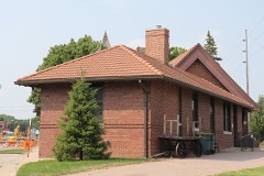 | Dodge County Historical Museum | 0.2 miles | 1981 |
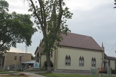 | St. Mark's Episcopal Church | 0.3 miles | 1980 |
 | Paramount Knitting Company Mill | 0.3 miles | 2011 |
 | Swan House and Vita Spring Pavilion | 0.4 miles | 1980 |
| National Archives record | The nomination case file for reference 09000797 in Record Group 79. |
| Dodge County | All 36 listed properties in this county. |