 Block
From the record
One of 141 National Register listings published here for Rock County · listed in 2010 · category: Building.
Sources: the case file at the National Archives · the National Register database, National Park Service
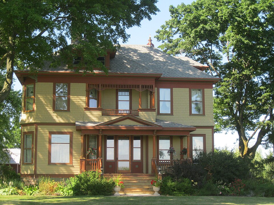
Listed on the National Register of Historic Places in 2010.
One of 141 National Register listings published here for Rock County · listed in 2010 · category: Building.
Sources: the case file at the National Archives · the National Register database, National Park Service
The chapter on Union Town in History of Rock County, and Transactions of the Rock County Agricultural Society and Mechanics' Institute, published 1856; The History of Rock County, Wisconsin; Its Early Settlement, Growth, Development, Resources, Etc., published 1879 names Union. This is what it says, exactly as the scans read.
Is the most North-western town in the County, and 16 miles North- w«st from Janesville. ' The face of country is similar to that of Magnolia, except that it has less prairio; and the land generally iiot so rolling. ' The earliest settlers were Ira Jones, Stephen Jones, Boyd Phelps, Charles McMilleB, Hi- i-am Griffith, John Sayles, Erastus Quivoy, "Washington Higday, Samuel Lenis, Jacob West, John T. Baker, Levi Leonard, Willis T. Bunton. This town was organized in 1842, and at that time included what is now Union, Porter, and north half each of Center and Magnolia.
Passage source: History of Rock County, and Transactions of the Rock County Agricultural Society and Mechanics' Institute, published 1856.
This is the most northwestern town in Rock County, and sixteen miles northwest of Janesville. It was incorporated by act of the Legislature, approved February 17, 1842, and at that time included what is now Union, Porter, and the north half each of Center and Magnolia. Its present limits are included in what is known as Township 4, north of Range 10 east.
Passage source: The History of Rock County, Wisconsin; Its Early Settlement, Growth, Development, Resources, Etc., published 1879.
Machine-read from a century-old scan, so expect the errors a machine makes: misspelled names, dropped words, stray characters.
Read the whole chapter on Union Town - 8,068 words on its settlement, mills, schools and churches.
Regional context, not property-specific evidence. The federal wildfire occurrence database lists 13 fires within 5 miles of John C. and Mary Robinson Farmstead between 1999 and 2020, burning about 1,932 acres in total. None started naturally. 1 was recorded as arson. Distance is straight-line from the map coordinates, so a fire counted here may appear on a neighbouring settlement's page as well.
| Reported cause | Fires |
|---|---|
| Debris and open burning | 5 |
| Missing data/not specified/undetermined | 3 |
| Equipment and vehicle use | 2 |
| Smoking | 1 |
| Recreation and ceremony | 1 |
| Arson/incendiarism | 1 |
The most recent of them, most recent first, with the day each was reported and the service that recorded it.
| Date | Cause | Size | Reported by | Name on the report |
|---|---|---|---|---|
| 4 July 2020 | Missing data/not specified/undetermined | 1.0 acres | Wisconsin Department of Natural Resources | 83 |
| 14 July 2012 | Arson/incendiarism | 26 acres | Leopold Wetland Management District | BIGLOW RD |
| 11 July 2019 | Debris and open burning | under an acre | Wisconsin Department of Natural Resources | 2019135 |
| 5 May 2013 | Equipment and vehicle use | under an acre | Wisconsin Department of Natural Resources | TRAILER DRAGGING |
| 5 April 2006 | Debris and open burning | 41 acres | Leopold Wetland Management District | LUND CONVERSION |
| 28 April 2018 | Debris and open burning | 2.0 acres | Wisconsin Department of Natural Resources | 201823 |
| 21 April 2019 | Debris and open burning | under an acre | Wisconsin Department of Natural Resources | 55 |
| 18 April 2004 | Smoking | 169 acres | Wisconsin Department of Natural Resources | not named |
Regional context, not property-specific evidence. The federal mineral resources record lists 8 workings within 5 miles of John C. and Mary Robinson Farmstead: 7 past producers, 1 producer. 1 still produces. What was taken out: Stone, Crushed/Broken, Sand and Gravel, Construction. Distance is straight-line from the map coordinates, so a quarry counted here may appear on a neighbouring settlement's page as well.
| Where | Site | Commodity | Status | Recorded |
|---|---|---|---|---|
| Brunsell Pit | Sand and Gravel, Construction | Past Producer | ||
| Brunsell Pit | Sand and Gravel, Construction | Past Producer | ||
| Kauk Quarry | Stone, Crushed/Broken | Past Producer | ||
| Knutson Pit | Sand and Gravel, Construction | Past Producer | ||
| Liberty Pole Quarry | Stone, Crushed/Broken | Past Producer | ||
| Thickpenny Quarry | Stone, Crushed/Broken | Past Producer | ||
| Union Pit | Sand and Gravel, Construction | Producer | ||
| Wealti Limestone Quarry | Stone, Crushed/Broken | Past Producer |
Regional context, not property-specific evidence. The National Weather Service names Union, the town this property stands in, in 8 storm reports between 1995 and 2025: 6 thunderstorm wind, 2 hail. No death or injury is recorded in these reports. Each account below is quoted exactly as the forecast office filed it, from the NOAA Storm Events Database, and each date opens the federal record of that event.
| When | Event | Place named | Harm | What the report says |
|---|---|---|---|---|
| April 2006 | Hail | Union | $4,360,000 | no account filed |
| July 2006 | Thunderstorm Wind | Union | $75,000 | Trees and power lines down in a large swath from northwestern to southeastern Rock County. In the city of Janesville, at least 3 cars were damaged by felled trees or tree branch debris. Several roads were temporarily blocked by tree debris. |
| October 1996 | Thunderstorm Wind | Union | $20,000 | no account filed |
| July 1999 | Thunderstorm Wind | Union | $1,000 | no account filed |
| March 2025 | Thunderstorm Wind | Union | - | Trees down in the Town of Union. |
| March 2007 | Hail | Union | - | no account filed |
| June 1995 | Thunderstorm Wind | Union | - | no account filed |
| July 1995 | Thunderstorm Wind | Union | - | no account filed |
No historic map-sheet match is published for this property yet. That does not mean no map exists. This record needs a coordinate-quality review before it can be joined to a sheet boundary. Browse the county's mapped places while that work is pending.
Other National Register properties close enough to walk or drive between, ordered by distance from this one. Both positions come from the same geocoding pass that matched these properties to their map sheets.
| Photograph | Property | Distance | Listed |
|---|---|---|---|
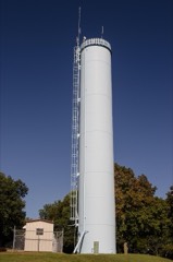 | Evansville Standpipe | 2.2 miles | 2008 |
 | St. John's Lutheran Church | 2.7 miles | 2012 |
| Leonard-Leota Park | 2.7 miles | 2012 | |
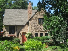 | Grove Street Historic District | 2.8 miles | 2011 |
| Evansville Historic District | 2.8 miles | 1978 | |
| South First Street Residential Historic District | 3.0 miles | 2011 |
| National Archives record | The nomination case file for reference 09001221 in Record Group 79. |
| Rock County | All 141 listed properties in this county. |