BlockBefore

Rock County, Wisconsin

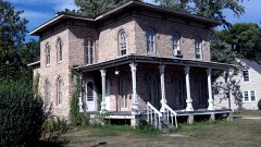
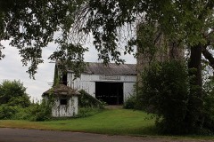
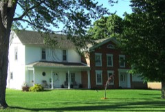
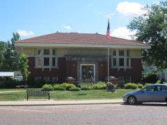
95 topographic sheets cover 47 settlements here, and 141 properties are on the National Register of Historic Places.

Research this county

From the record

141 National Register listings published here, 1 of them a National Historic Landmark · the county-history sources name 3 people · people the book names include D. R. Spooner (Johnstown Town, 1856) · Henry F. Janes (Janesville City, 1879) (machine-read).

Sources: the county history on the Internet Archive · the National Register database, National Park Service

Wisconsin within the United States
Rock County within Wisconsin

What the record shows

  • 812 topographic sheet readings cover the county's settlements.
  • 141 properties here are on the National Register of Historic Places: 107 buildings, 28 districts, 3 structures, 2 sites and 1 object.
  • 36 of the 141 listings were added during the 1970s.
  • The Geographic Names Information System records 47 populated places in this county; 47 are covered by at least one topographic sheet.
  • 4 public-domain county histories, 1856 to 1908, supply 265,775 words of narrative reproduced here.

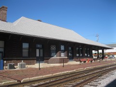
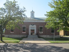
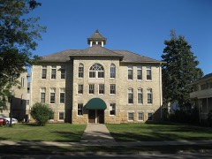
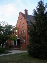
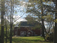
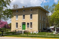
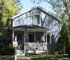
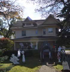
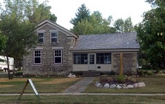
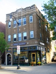
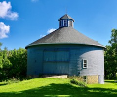
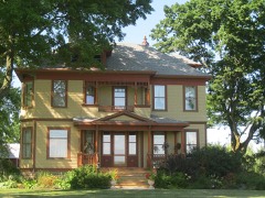
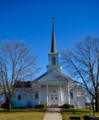
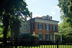
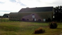
Places on the National Register

141

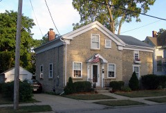
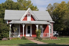
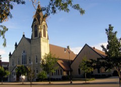
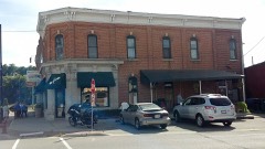
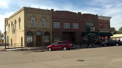
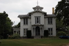
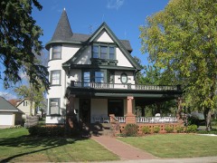
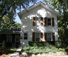
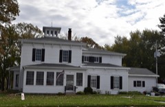
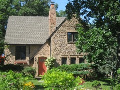
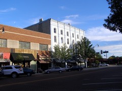
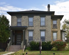
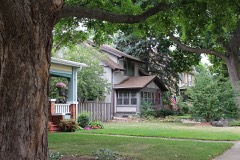
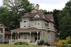
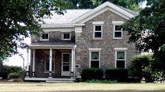
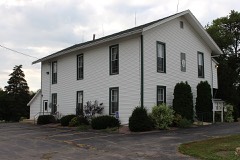
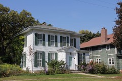
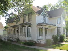
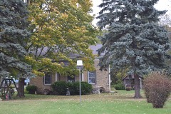
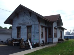
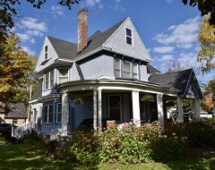
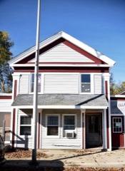
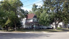
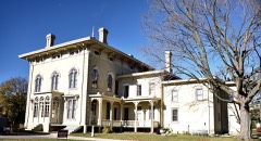
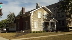
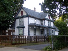
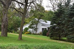
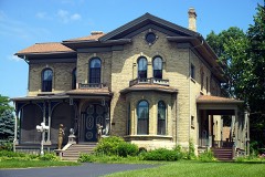
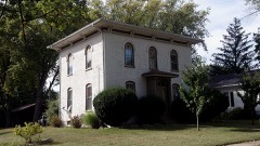
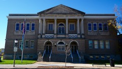
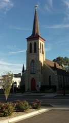
Every property in this county listed on the National Register of Historic Places, with the year it was listed and the federal nomination document.

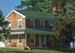
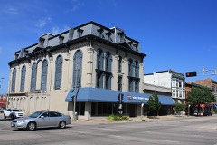
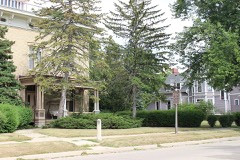
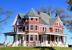
Photograph PropertyType ListedReference
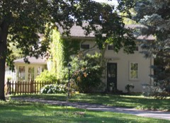
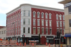
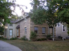
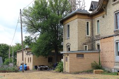
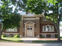
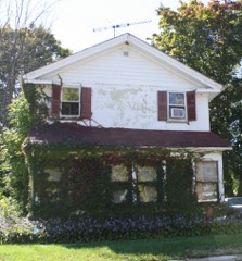
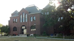
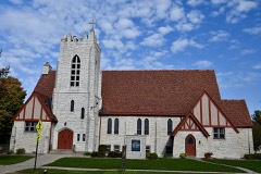
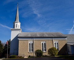
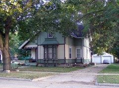
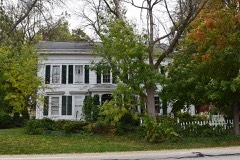
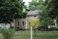
Adams Elementary Schoolbuilding2025100011592
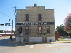
John Alexander Wheat Warehousebuilding197878003383
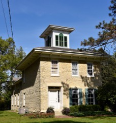
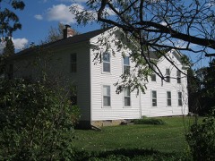
Abram Allen Housebuilding197878003386
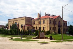
Armory, Thebuilding197878000130
Bartlett Memorial Historical Museumbuilding197777000048
Beloit Power Plantbuilding2017100001404
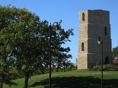
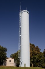
Beloit Water Towerbuilding198383003410
Benton Avenue Historic Districtdistrict199696000251
Selvy Blodgett Housebuilding198080000183
Bluff Street Historic Districtdistrict198383003411
Bostwick Avenue Historic Districtdistrict200606000321
Brasstown Cottagebuilding198383003412
Church of St. Thomas the Apostlebuilding198383003413
Citizens Bankbuilding198585001661
City of Beloit Waterworks and Pump Stationdistrict199090001460
Clark-Brown Housebuilding198585002126
Clinton Village Hallbuilding198585001660
Clinton Water Towerstructure198585000493
Columbus Circle Historic Districtdistrict200505000453
Conrad Cottages Historic Districtdistrict199393000157
Cooksville Cheese Factorybuilding198080000395
Cooksville Historic Districtdistrict197373000254
Cooksville Historic District (Boundary Increase)district198002000090
Cooksville Mill and Mill Pond Sitesite198080000394
Cooper-Gillies Housebuilding198080000397
Courier Buildingbuilding201515000552
Court Street Methodist Churchbuilding197777000045
Courthouse Hill Historic Districtdistrict198686000205
J. W. Crist Housebuilding198383003414
Crosby Blockbuilding198585001658
James B. Crosby Housebuilding199595001454
Charles L. Culton Housebuilding197777000046
De Jean Housebuilding197878003388
Homer B. DeLong Housebuilding198585001659
Erastus Dean Farmsteadbuilding197878000131
John T. Dow Housebuilding198080000396
Eager Free Public Librarybuilding197777000047
Almeron Eager Funerary Monument and Plotobject201111000477
East Milwaukee Street Historic Districtdistrict198080000184
Edgerton Depotbuilding199898000283
Edgerton Post Officebuilding200000001239
Edgerton Public Grade Schoolsbuilding198786003568
Emerson Hallbuilding197979000109
Evansville Historic Districtdistrict197878000132
Evansville Standpipestructure200808000120
Fairbanks Flatsbuilding198383003416
First Congregational Churchbuilding197575000078
Footville Condenserybuilding198282000704
Footville State Bankbuilding198282000705
Fredendall Blockbuilding198282000706
Fulton Congregational Churchbuilding197676000077
Fulton Street Historic Districtdistrict199999000788
Gempeler Round Barnbuilding197979000110
Gifford Housebuilding197878003387
Gilley-tofsland Octagonal Barnbuilding197979000111
Goodrich Blacksmith Shopbuilding197878003382
Ezra and Elizabeth Goodrich Housebuilding201515000425
Goodrich-Buten Housebuilding197878003385
William H. and Edith Gray Farmsteadbuilding201515000377
Reynolds and Lois Greenman Housebuilding201616000567
Grove Street Historic Districtdistrict201111000531
Hanchett Blockbuilding198080000185
Haven-Crandall Housebuilding201616000575
Hilton House Hotelbuilding200303001128
John and Martha Hugunin Housebuilding200505000534
Janesville Cotton Millbuilding198080000186
Janesville High Schoolbuilding199999000760
Janesville Public Librarybuilding198181000057
Janesville Pumping Stationbuilding198585000494
Jefferson Avenue Historic Districtdistrict200606000300
John H. Jones Housebuilding200808000186
Samuel S. Jones Cobblestone Housebuilding197878000133
LaPrairie Grange Hall No. 79building197777000050
Lappin-Hayes Blockbuilding197676000224
Lathrop-Munn Cobblestone Housebuilding197777000051
Leonard-Leota Parkdistrict201212000610
Look West Historic Districtdistrict198787000506
Look West Historic District (Boundary Increase)district199393001429
Lovejoy and Merrill-Nowlan Housesbuilding198080000187
Masonic Templebuilding201515000458
Peter McEwan Warehousebuilding197878003384
Merchant Row Historic Districtdistrict201515000504
Merrill Avenue Historic Districtdistrict199393000028
Miller Housebuilding198080000399
Milton College Historic Districtdistrict198080000188
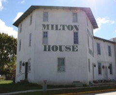
Milton Housebuilding197272000065
Moran's Saloonbuilding198383003417
Murray-George Housebuilding198585002125
Peter Myers Pork Packing Plant and Willard Coleman Buildingbuilding198383003418
Myers-Newhoff Housebuilding197979000277
Near East Side Historic Districtdistrict198383003419
Elbert Neese Housebuilding198383003420
North Main Street Historic Districtdistrict198080000189
Sterling North Housebuilding199796001579
Clark Nye Housebuilding198383003422
Old Fourth Ward Historic Districtdistrict199090000789
Orfordville Depotbuilding198888002004
John and Margaret Owen Housebuilding201616000568
William J. Owen Storebuilding198282000707
J. L. Pangborn Housebuilding198585001664
Parkview Historic Districtdistrict201515000505
Payne-Craig Housebuilding198787000990
Pearsons Hall of Sciencebuilding198080000190
Pomeroy and Pelton Tobacco Warehousebuilding199898000848
J. K. Porter Farmsteadbuilding198080000400
Prospect Hill Historic Districtdistrict199292001558
Brewster Randall Housebuilding198484003782
Rasey Housebuilding197474000123
Charles Rau Housebuilding198383003423
Richardson Grout Housebuilding198080000402
Hamilton Richardson Housebuilding197878000135
Richardson-Brinkman Cobblestone Housebuilding197777000052
Rindfleisch Buildingbuilding198383003424
Risum Round Barnbuilding197979000112
John C. and Mary Robinson Farmsteadbuilding201009001221
Roosevelt Elementary Schoolbuilding2025100011593
Seventh Day Baptist Churchbuilding201616000569
Shopiere Congregational Churchbuilding197676000078
Stephen Slaymaker Housebuilding198383003425
Samuel Smiley Housebuilding198282001849
John Smith Housebuilding198585001663
South First Street Residential Historic Districtdistrict201111000532
South Main Street Historic Districtdistrict199090000820
St. John's Lutheran Churchbuilding201212000521
St. Paul's Episcopal Churchbuilding197878000136
Stark-Clint Housebuilding198585002124
Harrison Stebbins Housebuilding198080000401
Soloman J. Strang Housebuilding198282000708
Strong Buildingbuilding198383003426
Strong Partridge Mound Groupsite199494000057
John and Eleanor Strunk Housebuilding200808000184
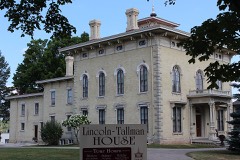
Tallman Housebuilding197070000085
A. E. Taylor Housebuilding198585001662
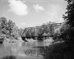
Turtleville Iron Bridgestructure197777000053
Washington Elementary Schoolbuilding2025100011594
West Luther Valley Lutheran Churchbuilding198080000191
West Milwaukee Street Historic Districtdistrict199090000790
Whiton-Parker Housebuilding201615001056
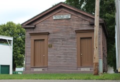
Frances Willard Schoolhousebuilding197777000054
Wyman-Rye Farmsteadbuilding197777000055
Florence Yates Housebuilding198383003427

Wildfire, 1993 to 2020

117 fires

Every wildfire the federal occurrence database records inside this county: 117 of them, burning about 2,642 acres. 1 started naturally and 7 were recorded as arson. Each settlement page carries the fires within five miles of it.

Reported cause Fires
Missing data/not specified/undetermined53
Debris and open burning32
Smoking13
Arson/incendiarism7
Equipment and vehicle use5
Recreation and ceremony5
Natural1
Power generation/transmission/distribution1

The five largest, by the area the report gives. None of them was recorded as arson.

DateCause SizeReported by Name on the report
31 March 2000Equipment and vehicle use1,100 acresWisconsin Department of Natural Resourcesnot named
30 March 1999Missing data/not specified/undetermined580 acresWisconsin Department of Natural Resourcesnot named
30 March 2016Missing data/not specified/undetermined500 acresWisconsin Department of Natural ResourcesROCK CO. FIRE
18 April 2004Smoking169 acresWisconsin Department of Natural Resourcesnot named
11 April 2020Equipment and vehicle use50 acresWisconsin Department of Natural Resources330
6 April 2000Smoking44 acresWisconsin Department of Natural Resourcesnot named
5 April 2006Debris and open burning41 acresLeopold Wetland Management DistrictLUND CONVERSION
9 March 2018Missing data/not specified/undetermined25 acresWisconsin Department of Natural Resources2018048

Every settlement page carries the fires within five miles of it - see the settlement index below.

Storms, 1955 to 2026

60 of 735 shown

The NOAA Storm Events Database holds 735 reports for this county, causing 1 death, 21 injuries and about $95,134,590 in recorded property damage. Each settlement page carries the reports that name it.

Kind of event Reports
Thunderstorm Wind375
Hail173
Flood58
Tornado38
Lightning38
Flash Flood25
Funnel Cloud13
Heavy Rain13
Strong Wind2

The most serious of them, by death, then injury, then recorded damage. The accounts are quoted exactly as the forecast office filed them.

WhenEvent Place namedHarm What the report says
June 2014LightningDowntown Janesville1 killedA man was struck by lightning and killed when he got out of his vehicle on highway 14 to correct the windshield wiper. A line of severe thunderstorms was moving through the area at the time.
June 1998LightningJanesville5 hurtno account filed
August 2000Thunderstorm WindEvansville2 hurt, $5,000,000no account filed
August 1998Flash FloodClinton2 hurt, $250,000no account filed
June 1999Thunderstorm WindEvansville2 hurt, $3,000no account filed
July 1991Thunderstorm Windnot stated2 hurtno account filed
February 2024Tornado (EF2)Magnolia1 hurt, $6,800,000Beginning section of the second tornado to ever occur in February in Wisconsin. Storm chaser/spotter/public videos show the tornado beginning around 5:39pm south of Evansville. The tornado intensified as it tracked to the east of Evansville where it impacted 30 primary residences (2 destroyed, 10 major impacts, 13 minor impacts, 5 affected). Numerous barns and outbuildings were destroyed along the path as it tracked to the northwest of Edgerton. The main EF-2 damage was confined to a stretch from east of Evansville to just southwest of the Yahara River. There was one person in a car that was hit by the tornado that had injuries serious enough to warrant transportation to the hospital, but they were deemed minor and released. Almost every person that was impacted by the tornado that the damage surveyors talked to said that they received the warning via Wireless Emergency Alert on their cell phone and then went to their shelter to gather more information via TV, radio, social media. County wide estimates of damage was at about $2.5 million.
August 1998Flash FloodJanesville1 hurt, $1,500,000no account filed
November 1971Tornado (F2)not stated1 hurt, $250,000no account filed
October 1970Tornado (F2)not stated1 hurt, $250,000no account filed
September 1997Strong WindJanesville1 hurt, $1,000no account filed
July 2009LightningClinton1 hurtA 44-year-old woman was struck by lightning while standing in the doorway of a barn holding the reins of a horse. She was taken to Beloit Memorial Hospital and treated in the emergency department.
August 1989Thunderstorm Windnot stated1 hurtno account filed
May 1988Thunderstorm Windnot stated1 hurtno account filed
April 2026Flash FloodDowntown Janesville$30,000,000Around 700 911 calls mainly attributed to flash flooding. Flash flooding of streets and yards in Janesville with basement flooding in many homes. Many vehicles stranded in deep water. A bridge was washed out due to the flooding of Fisher Creek over Rockport Rd. Severe flooding of a church, and the basement of an elementary school. The school's mechanical systems and main power panel were destroyed. The school has been closed. RAJ stadium flooded. A train derailment in downtown Janesville with 3 locomotives off the tracks, due to a sinkhole. 1st responders conducted a water rescue of the engineer using a rope.
June 2024Tornado (EF2)Afton$24,800,000The tornado began just west of Murray Rd, north of Bass Creek where portions of several trees were snapped. The tornado quickly grew, moved to the east-northeast and produced damage rated EF-1 neighborhoods near Loch Lomond park. EF-2 damage was noted at a residence on the east side of county highway D where well over one hundred trees were snapped or uprooted. The tornado continued to the northeast, crossing the Rock River, Highway 11 and Highway 51 producing damage rated EF-1. The second area of EF-2 damage was noted a neighborhood just northwest of Burbank Park, where a house lost its roof and a portion of its second story. The roof was found to the north-northwest over a block away. The tornado continued northeast crossing Beloit Ave. and ending in the fields to the west of South Read Rd. Damage along the majority of the path was rated EF-1. Tree damage was substantial with well over 1000 trees that were snapped, uprooted or had large sections damaged. Roof damage on several structures included shingle loss, occasional loss of roof decking material, peeled or dislodged siding and other facia and soffit peeling and removal. A few structure sustained damage to walls when their garage doors were breached. Numerous power poles were leaning, with several snapped.
April 2006HailUnion$4,360,000no account filed
August 1998LightningBeloit$3,500,000no account filed
March 1991Tornado (F2)not stated$2,500,000no account filed
April 1965Tornado (F1)not stated$2,500,000no account filed
June 1998Tornado (F2)Leyden$845,000no account filed
April 1996Thunderstorm WindBeloit$800,000no account filed
March 2023Tornado (EF0)Beloit$600,000Tornado started in the center of Beloit in the Merrill Park area. The tornado uprooted numerous trees along its path through the eastern side of the city toward the Turtle area. The path then went east and appears to have crossed I-39 before ending in a field.
August 1998Flash FloodJanesville$550,000no account filed
August 2007Flash FloodEvansville$500,000Several rounds of thunderstorms with heavy rains on top of a saturated ground resulted in scattered flash flooding from the Evansville area to the Janesville vicinity. Water damage to basement contents and/or basement walls, as well as fast-flowing water depths of 6 inches to 1 foot on roads, were reported in the Civil Towns of Avon, Fulton, Magnolia, Union, and Plymouth. Some soil erosion, gravel washouts, and crop damage were noted. Badfish Crreek and Allen Creek just east and northeast of Evansville exceeded flood stages by 3 to 5 feet and overflowed adjacent roads.||August, 2007, rainfall totals include: 17.39 at Afton, 13.15 in Beloit, 16.24 in Clinton, 15.22 in Milton, and over 17 in Janesville.
August 1993Thunderstorm WindEvansville$500,000no account filed
June 2008Flash FloodOrfordville$462,160Heavy rains resulted in flash flooding across much of the northwest half of the county. Water depths on road surfaces reached 3 feet or more and there were gravel washouts. Two hundred thirty-nine homes had minor damage, 9 homes had major damage, and 26 were destroyed (total of $7.46 million for all home property losses). Fifty-four businesses had minor damage, and 24 had major damage (total business losses were about $810 thousand. Crops losses were estimated at $15 million). Public sector damage was about $10.3 million. There were several roads and bridges that sustained damage.
April 2026Tornado (EF1)Tiffany$408,000Brief tornado that caused damage near Maple Lane southeast of Janesville. Storm chaser video confirmed a brief tornado in this area. More widespread damage occurred west and east of this track due to downburst winds.
April 1995Thunderstorm WindBeloit$350,000no account filed
July 2005Tornado (F1)Milton$300,000A tornado spun up at 1507CST about 4 miles north-northeast of Milton (Rock Co.). about 1/4 mile north of the intersection of Vickerman Rd. and Godfrey Rd. It traveled east-southeast for 2 miles and dissipated just northwest of the intersection of McCord Rd. and Salisbury Drive. On Godfrey Rd it destroyed one large barn, severely damaged another barn, destroyed a shed, and inflicted minor damage to a home. Otherwise many large trees were uprooted or shredded, and a couple power lines were ripped.
April 2001Thunderstorm WindEvansville$300,000no account filed
June 2000Flash FloodCountywide$300,000no account filed
July 1999Thunderstorm WindOrfordville$300,000no account filed
July 2007LightningDowntown Janesville$275,000A 2-story Janesville home was destroyed by a fire after ligntning struck it.
May 1991Tornado (F1)not stated$250,000no account filed
May 1988Tornado (F2)not stated$250,000no account filed
April 1978Tornadonot stated$250,000no account filed
June 1969Tornado (F1)not stated$250,000no account filed
April 2026Tornado (EF1)Emerald Grove$215,000Brief tornado went through Emerald Grove, destroying a barn and causing damage to an antique store. Significant tree damage along the path as well with debris lofted well to the ENE from the structures.
March 2023Tornado (EF0)Magnolia$200,000Tornado started just south of Decatur Lake and tracked to the north through Decatur Lake Golf Course, causing some minor tree damage. Further to the north, a barn had roof damage with a number of sheets of metal lofted off of the building. Tornado tracked into a small portion of Rock County before dissapating.
July 2005Thunderstorm WindMilton$200,000no account filed
May 1999Thunderstorm WindJanesville$175,000no account filed
August 2009Thunderstorm WindMilton$150,000Police reported numerous trees and power lines down between Milton and Janesville. Roof damage was reported in Janesville from the thunderstorm wind gusts, and several homes were damaged by tree debris. One home had some windows blown out. Barn damage was noted in the countryside around Janesville. A 68 knot (78 mph) wind gust was recorded at the Janesville Airport (KJVL).
August 2007Heavy RainEvansville$150,000Urban and small stream flooding occurred across the northern third of Rock County after 3 to 4 inches of rain fell overnight. Water depths on roads reached a foot, especially in the Evansville and Edgerton areas, however no roads were closed. Reports indicated that the flood waters were not fast flowing, nor did they pose a danger to the public. Some crop damage was noted. Overnight rainfall of 6.4 inches were measured by a spotter in Edgerton. Local residents near Badfish Creek, west of Cooksville, noted that this creek flooded and merged with Frog Pond Creek and the water was 3.5 feet deep between the creeks.
June 1996Flash FloodCooksville$150,000no account filed
July 2011Thunderstorm WindOrfordville$125,000Law enforcement officials in Rock County reported trees and power lines down in a 23-mile wide swath from west northwest of Orfordville to northeast of Clinton due to damaging thunderstorm wind gusts estimated at 65 knots (75 mph). Corn crops, valued at $700,000, were also flattened. A home in downtown Janesville had a bedroom addition crushed when a tree fell on it. The winds also blew down a barn on Creek Road where it crosses Turtle Creek, as well as a giant 22-foot, 2,000 pound fiberglass pumpkin off of a 65-foot tall silo at Meyer's Farm Market north of Janesville.
April 2026Tornado (EF1)Johnstown Center$124,000Multivortex tornado documented southwest of Richmond. Multiple sheds with sheet metal damage along County Highway M before entering Walworth County.
May 2024Tornado (EF0)Leyden$112,000Tornado mainly caused tree damage as it tracked from west of Janesville and ended northeast of Milton after going through the northern side of the city. Some areas west of Janesville had extensive, yet narrow tree damage. In Milton, it was mainly large trees that were knocked over though the DPW garage had two doors blown in. Storm chasers and spotters documented this tornado and shared their videos and pictures with NWS.
July 2022LightningBeloit$100,000A lightning strike and subsequent fire to a residential home resulted in significant damage.
July 2015Tornado (EF1)Johnstown$100,000Three old barns were mostly destroyed. Fields of corn partially blown over. Large trees snapped.
June 2010Thunderstorm WindDowntown Janesville$100,000Powerful thunderstorm winds raked the city of Janesville. At least 50 large trees were uprooted, and numerous power-lines were down. A metal roof of a business was ripped off by the winds. Elsewhere, a tree fell on a flatbed truck (minor damage), and a carriage house roof was blown off. Heavy rains resulted in minor urban flooding and a couple stalled vehicles.
July 2005Thunderstorm WindMilton$100,000no account filed
August 2004Thunderstorm WindAfton$100,000no account filed
July 1998Thunderstorm WindJanesville$100,000no account filed
May 2012LightningEdgerton$75,000Fire officials say lightning ignited a fire that damaged a 21-unit senior living facility in Edgerton, displacing 30 residents.
June 2008Thunderstorm WindEvansville$75,000Powerful thunderstorm winds knocked down large trees and power-lines.
July 2006Thunderstorm WindUnion$75,000Trees and power lines down in a large swath from northwestern to southeastern Rock County. In the city of Janesville, at least 3 cars were damaged by felled trees or tree branch debris. Several roads were temporarily blocked by tree debris.
May 1999Thunderstorm WindEmerald Grove$75,000no account filed
October 1996LightningJohnstown$75,000no account filed
April 1997Thunderstorm WindBeloit$65,000no account filed

Mines and quarries

54 recorded

The Survey's mineral resources record lists 54 workings inside this county. 22 still produce and 32 are closed or unrecorded. Each settlement page carries the workings within five miles of it.

Commodity Workings
Sand and Gravel, Construction26
Stone, Crushed/Broken25
Stone3

The least common of them first, because a county's hundredth gravel pit says nothing its first ten did not.

Where SiteCommodity StatusRecorded
Bass QuarryStoneUnknown
Coles QuarryStoneUnknown
Little QuarryStoneProducer
Alseths QuarryStone, Crushed/BrokenProducer
Austin QuarryStone, Crushed/BrokenPast Producer
Beaudin QuarryStone, Crushed/BrokenProducer
Bjoin QuarryStone, Crushed/BrokenProducer
Boutelle QuarryStone, Crushed/BrokenProducer
Braukoff QuarryStone, Crushed/BrokenPast Producer
C. Johnson QuarryStone, Crushed/BrokenPast Producer
Cole QuarryStone, Crushed/BrokenPast Producer
County Shop QuarryStone, Crushed/BrokenPast Producer
Dunn QuarryStone, Crushed/BrokenProducer
Dunn Trucking & Limestone QuarryStone, Crushed/BrokenPast Producer
Escher QuarryStone, Crushed/BrokenPast Producer
Footville QuarryStone, Crushed/BrokenProducer
Frank Brothers QuarryStone, Crushed/BrokenProducer
Gunn PitStone, Crushed/BrokenProducer
Hanke QuarryStone, Crushed/BrokenPast Producer
Haugen QuarryStone, Crushed/BrokenPast Producer
Hunt QuarryStone, Crushed/BrokenPast Producer
Larson QuarryStone, Crushed/BrokenProducer
Little QuarryStone, Crushed/BrokenProducer
Miller QuarryStone, Crushed/BrokenPast Producer
O'Leary QuarryStone, Crushed/BrokenPast Producer
Rock County Highway DepartmentStone, Crushed/BrokenPast Producer
Wealti Limestone QuarryStone, Crushed/BrokenPast Producer
Beggs PitSand and Gravel, ConstructionPast Producer
Bradford Township PitSand and Gravel, ConstructionPast Producer
Brunsell PitSand and Gravel, ConstructionPast Producer
EdgertonSand and Gravel, ConstructionPast Producer
Egan PitSand and Gravel, ConstructionProducer
Frank BrothersSand and Gravel, ConstructionPast Producer
Hanover PitSand and Gravel, ConstructionPast Producer
Janesville Pit & MillSand and Gravel, ConstructionProducer
Kidder PitSand and Gravel, ConstructionProducer
Knudsen PitSand and Gravel, ConstructionPast Producer
Knutson PitSand and Gravel, ConstructionPast Producer
Lathers PitSand and Gravel, ConstructionProducer
Poff PitSand and Gravel, ConstructionPast Producer
Rock County Pioneer Crusher 493Sand and Gravel, ConstructionProducer
Rye PitSand and Gravel, ConstructionPast Producer
Rye PitSand and Gravel, ConstructionProducer
Skunk Hollow Pit Number 2Sand and Gravel, ConstructionPast Producer
Stearns PitSand and Gravel, ConstructionPast Producer
Stores Lake PitSand and Gravel, ConstructionProducer
Tiffany PitSand and Gravel, ConstructionProducer
Townline PitSand and Gravel, ConstructionProducer
Turtle Township PitSand and Gravel, ConstructionProducer
Union PitSand and Gravel, ConstructionProducer
Wenham PitSand and Gravel, ConstructionPast Producer
Wheeler PitSand and Gravel, ConstructionPast Producer

The townships, in 1908

265,775 words

Rock County, Wisconsin; a New History of Its Cities, Villages, Towns, Citizens and Varied Interests, from the Earliest Times, Up to Date devotes a chapter to each township: its boundaries and streams, who settled it and when, the mills, the schools and the churches. All 21 are reproduced here in full. Each row shows the township's own shape and where it lies in the county, drawn from the Census Bureau's boundary. Which settlements belong to which township is computed from that same boundary, not taken from the book.

The county's history books

575,801 words

3 books written about this county, cut here where the book itself is cut, at its printed chapters: 12 chapters in all. Every chapter is public domain, machine-read from the scan and reproduced complete. A chapter already given under one of the county's towns is not repeated in this list.

History of Rock County, and Transactions of the Rock County Agricultural Society and Mechanics' Institute (1856)

ChapterLength
The whole text106,887 words in 7 parts

The History of Rock County, Wisconsin; Its Early Settlement, Growth, Development, Resources, Etc. (1879)

ChapterLength
Chapter 10172,295 words in 11 parts
Chapter 16,884 words
Chapter 29,671 words
Chapter 316,105 words in 2 parts
Chapter 415,628 words
Chapter 534,042 words in 3 parts
Chapter 7: Towns of Rock County15,963 words
Chapter 10: Rock County Villages24,906 words in 2 parts

Rock County, Wisconsin; a New History of Its Cities, Villages, Towns, Citizens and Varied Interests, from the Earliest Times, Up to Date (1908)

ChapterLength
Chapter 5631 words
Chapter 26964 words
Chapter with an unread heading (no. 3 of those read)171,825 words in 11 parts

The people it describes

3 named

Everyone Rock County, Wisconsin; a New History of Its Cities, Villages, Towns, Citizens and Varied Interests, from the Earliest Times, Up to Date stops to write about, with the section that describes them. Among them are the men who founded the place and governed the Territory. Each name opens the passage itself, in the words of 1908.

Every populated place in the county

47

Named settlements recorded in the Geographic Names Information System, each with the topographic sheets covering it. Villages, hamlets and abandoned places alike. Each is shown with the nearest named watercourse or landform and the survey quadrangle it falls on.

The vanished settlements of Rock County: the places named above that are no longer on the map.

Provenance

  • Topographic sheets. USGS Historical Topographic Map Collection, county index, measured from the bulk metadata.
  • Fire insurance maps. Library of Congress Sanborn collection, faceted to this county.
  • Photographs. Each place queried individually against the Library of Congress Prints and Photographs search.
  • Wildfire. Short, Karen C. 2022. Spatial wildfire occurrence data for the United States, 1992-2020 [FPA_FOD_20221014]. 6th Edition. Fort Collins, CO: Forest Service Research Data Archive. https://doi.org/10.2737/RDS-2013-0009.6 Collected with United States Government funding and usable without additional permissions or fees.
  • Mines and quarries. USGS Mineral Resources Data System (MRDS) https://mrdata.usgs.gov/mrds/ A work of the United States government, no copyright under 17 U.S.C. 105.
  • Storms. NOAA National Centers for Environmental Information, Storm Events Database https://www.ncei.noaa.gov/stormevents/ A work of the United States government, no copyright under 17 U.S.C. 105. Narratives are quoted verbatim from the National Weather Service report and are not edited or summarised.