 Block
From the record
One of 52 National Register listings published here for Jefferson County · listed in 2018 · category: Building.
Sources: the National Register database, National Park Service · the Wikipedia article
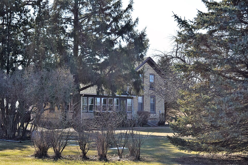
Listed on the National Register of Historic Places in 2018.
One of 52 National Register listings published here for Jefferson County · listed in 2018 · category: Building.
Sources: the National Register database, National Park Service · the Wikipedia article
The chapter on Jefferson Town in The History of Jefferson County, Wisconsin, Containing ... Biographical Sketches .., published 1879 names Jefferson. This is what it says, exactly as the scans read.
Jefferson, the county seat of .Jefferson County, is a pleasant city of about three tliousand inhabitants, delightfully located at the junction of Crawfish and Rock Rivers, in the central part of the county, surrounded by a rich firming country, thickly settled and contributing vast resources to swell the general prosperity of the county seat.
Passage source: The History of Jefferson County, Wisconsin, Containing ... Biographical Sketches .., published 1879.
On June 13, 1837, Silas R. Stevens, following in the wake of these pioneers, landed at the residence of Robert Masters, located on Rock River, about (me mile below the present city. In 1887, E. G. Darling piloted a scow from Hebron on Bark River to Rock River, thence to Jefferson, where he took up his permanent abode. He was accompanied by Melissa and Marion Brown, half sisters, Alonzo Brown, half brother. Lavina Carpenter, Edward Sawyer and David Bartlett. The scow was also laden with their household goods and the frame of a house, which was fashioned at Bark Mills and brought to Jefferson ready to be completed and occupied. The emigrants took possession of a log shanty said to have been "put up " by James and Peter Rogan a year previous (which, if true, makes this unpretentious protection of logs rolled up together the first habitation constructed in this section of the county), and prepared to locate and finish a house, framed at Bark Mills. In October of the same year, arrangements were completed in that behalf, and the "frame " elevated on a piece of ground, the present site of the Jefferson House. The building was completed during the fall and used as a tavern, court house and salesroom for dry goods and groceries, the first goods ever sold in the town of Jefferson. A man named Buck officiated as salesman and no doubt realized a fair profit on his venture. In this month, also, came Hiram Z. Brittan, his wife, daughter (Jane), and one son. It should also be observed that the first session of the Circuit Court was held in the bar-room of this hostelry, Judge Irwin presiding. His Honor was a bachelor and a queer compound of ability and eccentricity. He occasionally adjourned court to go fishing, and was in the habit of improvising rules for the government of his subordinates, which, in those days, while not attracting particular attention, were regarded as arbitrary ; to-day, they would be considered as e.\tra-judicial. During tliis year, occurred the first death in the vicinity. It was that of E. Foster, Sr., which took place October 10, at the residence of his son in the south part of tlie town ; he was buried at Big Bend, four miles down the river. It is also said that Robert Kennedy and wife came to Jefferson from Janesville during that year and kept house for Rodney J. Currier and Andrew Lansing.
Passage source: The History of Jefferson County, Wisconsin, Containing ... Biographical Sketches .., published 1879.
Machine-read from a century-old scan, so expect the errors a machine makes: misspelled names, dropped words, stray characters.
Read the whole chapter on Jefferson Town - 18,033 words on its settlement, mills, schools and churches.
Regional context, not property-specific evidence. The federal wildfire occurrence database lists 11 fires within 5 miles of Michael and Margaritha Beck Farmstead between 2014 and 2020, burning about 298 acres in total. None started naturally. 1 was recorded as arson. Distance is straight-line from the map coordinates, so a fire counted here may appear on a neighbouring settlement's page as well.
| Reported cause | Fires |
|---|---|
| Debris and open burning | 6 |
| Missing data/not specified/undetermined | 2 |
| Equipment and vehicle use | 2 |
| Arson/incendiarism | 1 |
The most recent of them, most recent first, with the day each was reported and the service that recorded it.
| Date | Cause | Size | Reported by | Name on the report |
|---|---|---|---|---|
| 24 June 2019 | Debris and open burning | under an acre | Wisconsin Department of Natural Resources | 1923 |
| 31 May 2019 | Debris and open burning | under an acre | Wisconsin Department of Natural Resources | 87 |
| 7 April 2018 | Debris and open burning | 253 acres | Wisconsin Department of Natural Resources | JEFFERSON MARSH 1 |
| 18 April 2020 | Missing data/not specified/undetermined | 5.0 acres | Wisconsin Department of Natural Resources | 2017 |
| 13 April 2019 | Debris and open burning | under an acre | Wisconsin Department of Natural Resources | 1916 |
| 26 March 2018 | Missing data/not specified/undetermined | 2.0 acres | Wisconsin Department of Natural Resources | 2018015 |
| 22 March 2016 | Arson/incendiarism | 2.1 acres | Wisconsin Department of Natural Resources | JEFFERSON MARSH FIRE |
| 18 March 2018 | Debris and open burning | 35 acres | Wisconsin Department of Natural Resources | 104 |
Regional context, not property-specific evidence. The federal mineral resources record lists 1 working within 5 miles of Michael and Margaritha Beck Farmstead: 1 past producer. None of them still produces. What was taken out: Sand and Gravel, Construction. Distance is straight-line from the map coordinates, so a quarry counted here may appear on a neighbouring settlement's page as well.
| Where | Site | Commodity | Status | Recorded |
|---|---|---|---|---|
| Janke Pit | Sand and Gravel, Construction | Past Producer |
Regional context, not property-specific evidence. The National Weather Service names Jefferson, the town this property stands in, in 32 storm reports between 1994 and 2023: 14 thunderstorm wind, 11 hail, 4 flood, 2 flash flood. No death or injury is recorded in these reports. Each account below is quoted exactly as the forecast office filed it, from the NOAA Storm Events Database, and each date opens the federal record of that event.
| When | Event | Place named | Harm | What the report says |
|---|---|---|---|---|
| July 1997 | Thunderstorm Wind | Jefferson | $159,000 | no account filed |
| June 2005 | Thunderstorm Wind | Jefferson | $75,000 | A twenty by twenty foot section of Jefferson High School's roof was torn off. In addition, many large trees and power lines were knocked down in and around the city of Jefferson. |
| May 1998 | Thunderstorm Wind | Jefferson | $70,000 | no account filed |
| August 2004 | Flash Flood | Jefferson | $30,000 | no account filed |
| May 1999 | Flash Flood | Jefferson | $30,000 | no account filed |
| June 2007 | Thunderstorm Wind | Jefferson | $25,000 | Powerful thunderstorm winds toppled trees and resulted in damage to power-lines and cable-TV lines. Electrical customers were without power for several hours. Associated rain was described as going sideways in white sheets. Between Jeffeson and Helenville a couple roads were blocked with tree debris. About 2 inches of rain accompanied the storms. |
| April 2013 | Flood | Jefferson | $10,000 | The Rock River near Jefferson experienced moderate flooding, cresting at 12.31 feet, or 2.31 feet over the flood stage of 10 feet, at 658 AM CDT on April 20th. The river remained above flood stage into May. |
| August 2018 | Thunderstorm Wind | Jefferson | $6,000 | Numerous trees and branches down in Jefferson. |
| June 1998 | Thunderstorm Wind | Jefferson | $6,000 | no account filed |
| August 2023 | Thunderstorm Wind | Jefferson | $5,000 | Multiple trees down across Jefferson. |
| October 2019 | Flood | Jefferson | $5,000 | The Rock River at Jefferson reached moderate flood stage, cresting at 11 feet the morning of October 12th. Floodwaters affect low lying areas of residential and business property in Jefferson. Water approaches the intersection of Main St. and E. Dane St. The retention pond at this intersection is full. South Center Ave. near the river is flooded and Riverview Drive near the wastewater plant is flooded. Riverfront Park is flooded. |
| March 2019 | Flood | Jefferson | $5,000 | The Rock River at Jefferson reached moderate flood stage, cresting at 11.5 feet the late morning of March 16th. Floodwaters affect low lying areas of residential and business property in Jefferson. Water approaches the intersection of Main St. and E. Dane St. South Center Ave. near the river is flooded and E. Riverview Drive near the wastewater plant is flooded and closed. Flooding in Riverfront Park. |
| September 2018 | Flood | Jefferson | $5,000 | The Rock River at Jefferson reached moderate flood stage, cresting at 11.72 feet the afternoon of September 8th. Floodwaters affect some low lying residences and businesses in Jefferson. Shallow floodwaters at the intersection of Main St. and E. Dane St., and nearby S. Center Ave. Riverview Drive near the wastewater plant is flooded and closed. Floodwaters affect portions of Highway K between Jefferson and Fort Atkinson. |
| August 2013 | Thunderstorm Wind | Jefferson | $5,000 | Trees down in Jefferson and east of Jefferson. |
| October 1996 | Thunderstorm Wind | Jefferson | $5,000 | no account filed |
| July 2017 | Thunderstorm Wind | Jefferson | $4,000 | Sporadic tree damage including power lines down from Jefferson to Fort Atkinson. |
| July 2016 | Thunderstorm Wind | Jefferson | $2,000 | Twelve inch diamter tree down. Other branches down in the area. |
| September 2010 | Thunderstorm Wind | Jefferson | - | A National Weather Service employee reported a thunderstorm wind gust estimated at 56 knots (65 mph). |
| June 2022 | Hail | Jefferson | - | no account filed |
| April 2017 | Hail | Jefferson | - | no account filed |
| May 2011 | Hail | Jefferson | - | no account filed |
| May 2011 | Hail | Jefferson | - | no account filed |
| March 2007 | Hail | Jefferson | - | no account filed |
| March 2007 | Hail | Jefferson | - | no account filed |
| April 2006 | Hail | Jefferson | - | no account filed |
| May 2004 | Heavy Rain | Jefferson | - | no account filed |
| May 2004 | Hail | Jefferson | - | no account filed |
| June 2003 | Thunderstorm Wind | Jefferson | - | no account filed |
| September 2000 | Hail | Jefferson | - | no account filed |
| August 1998 | Hail | Jefferson | - | no account filed |
| July 1994 | Thunderstorm Wind | Jefferson | - | no account filed |
| September 1994 | Hail | Jefferson | - | no account filed |
No historic map-sheet match is published for this property yet. That does not mean no map exists. This record needs a coordinate-quality review before it can be joined to a sheet boundary. Browse the county's mapped places while that work is pending.
Other National Register properties close enough to walk or drive between, ordered by distance from this one. Both positions come from the same geocoding pass that matched these properties to their map sheets.
| Photograph | Property | Distance | Listed |
|---|---|---|---|
 | Hebron Town Hall | 6.1 miles | 2002 |
 | Richard C. Smith House | 6.5 miles | 1979 |
| Emil and Flora Stoppenbach House | 6.6 miles | 2019 | |
 | Jefferson Fire Station | 6.7 miles | 1984 |
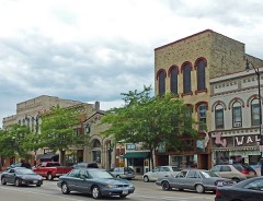 | Main Street Commercial Historic District | 6.7 miles | 1998 |
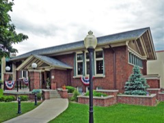 | Jefferson Public Library | 6.7 miles | 1980 |
| National Archives record | The nomination case file for reference 100002092 in Record Group 79. |
| Wikipedia article | Community-written account of this property, licensed CC BY-SA. |
| Jefferson County | All 52 listed properties in this county. |