Block
From the record
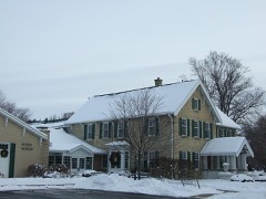
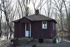
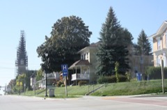
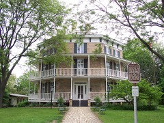
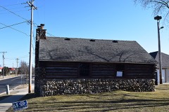
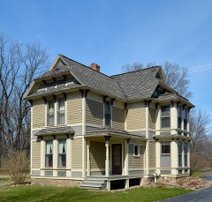
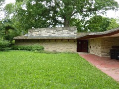
52 National Register listings published here, 1 of them a National Historic Landmark.
Sources: the county history on the Internet Archive · the National Register database, National Park Service
108 topographic sheets cover 45 settlements here, and 52 properties are on the National Register of Historic Places.
52 National Register listings published here, 1 of them a National Historic Landmark.
Sources: the county history on the Internet Archive · the National Register database, National Park Service
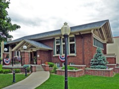
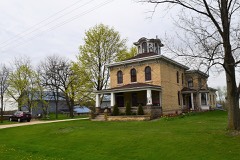
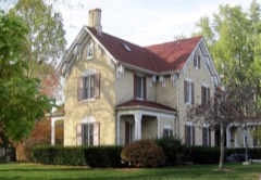
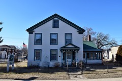
Every property in this county listed on the National Register of Historic Places, with the year it was listed and the federal nomination document.
Every wildfire the federal occurrence database records inside this county: 86 of them, burning about 1,135 acres. 2 started naturally and 11 were recorded as arson. Each settlement page carries the fires within five miles of it.
| Reported cause | Fires |
|---|---|
| Missing data/not specified/undetermined | 32 |
| Debris and open burning | 30 |
| Arson/incendiarism | 11 |
| Equipment and vehicle use | 7 |
| Recreation and ceremony | 2 |
| Natural | 2 |
| Misuse of fire by a minor | 1 |
| Smoking | 1 |
The five largest, by the area the report gives. Two of them were set deliberately.
| Date | Cause | Size | Reported by | Name on the report |
|---|---|---|---|---|
| 14 April 2003 | Arson/incendiarism | 290 acres | Wisconsin Department of Natural Resources | not named |
| 10 November 2012 | Arson/incendiarism | 255 acres | Wisconsin Department of Natural Resources | HOPE LAKE FIRE |
| 7 April 2018 | Debris and open burning | 253 acres | Wisconsin Department of Natural Resources | JEFFERSON MARSH 1 |
| 29 October 2012 | Missing data/not specified/undetermined | 139 acres | Wisconsin Department of Natural Resources | not named |
| 18 March 2018 | Debris and open burning | 35 acres | Wisconsin Department of Natural Resources | 104 |
| 19 September 2012 | Debris and open burning | 20 acres | Wisconsin Department of Natural Resources | not named |
| 22 April 2019 | Equipment and vehicle use | 15 acres | Wisconsin Department of Natural Resources | 107 |
| 4 April 2015 | Missing data/not specified/undetermined | 13 acres | Wisconsin Department of Natural Resources | CARLIN TRAIL |
Every settlement page carries the fires within five miles of it - see the settlement index below.
The NOAA Storm Events Database holds 629 reports for this county, causing 4 deaths, 53 injuries and about $134,950,500 in recorded property damage. Each settlement page carries the reports that name it.
| Kind of event | Reports |
|---|---|
| Thunderstorm Wind | 302 |
| Hail | 176 |
| Tornado | 51 |
| Flood | 34 |
| Lightning | 24 |
| Flash Flood | 17 |
| Funnel Cloud | 12 |
| Heavy Rain | 11 |
| Strong Wind | 1 |
| Dust Devil | 1 |
The most serious of them, by death, then injury, then recorded damage. The accounts are quoted exactly as the forecast office filed them.
| When | Event | Place named | Harm | What the report says |
|---|---|---|---|---|
| April 1965 | Tornado (F2) | not stated | 3 killed, 28 hurt, $2,500,000 | no account filed |
| July 2008 | Lightning | Grellton | 1 killed | Lightning struck and killed a boy watching the storms outside. He lived on Ebenezer Road in the Civil Town of Watertown. |
| May 1998 | Thunderstorm Wind | Countywide | 8 hurt, $2,700,000 | no account filed |
| June 2005 | Lightning | Ft Atkinson | 5 hurt | Five people in a tent were indirectly injured at Jelleystone Campground when a lightning bolt struck nearby, and the current traveled to the tent. They were treated in area hospitals. |
| June 1981 | Tornado (F2) | not stated | 3 hurt, $250,000 | no account filed |
| July 1972 | Tornado (F1) | not stated | 3 hurt, $250,000 | no account filed |
| September 1986 | Tornado (F2) | not stated | 1 hurt, $2,500,000 | no account filed |
| June 1996 | Flash Flood | Watertown | 1 hurt, $400,000 | no account filed |
| July 2008 | Lightning | Watertown Airport | 1 hurt, $30,000 | LIghting struck and injured a 16-year boy. He was transfered to a hospital for medical treatment. |
| June 1971 | Tornado (F1) | not stated | 1 hurt, $25,000 | no account filed |
| July 2003 | Lightning | Watertown | 1 hurt | no account filed |
| September 1986 | Thunderstorm Wind | not stated | 1 hurt | no account filed |
| June 2008 | Flash Flood | Lake Mills | $102,220,000 | Heavy rains resulted in flash flooding across much of Jefferson County. Water depths on road surfaces reached 3 feet or more and there were gravel washouts. The rain on June 12th ultimately lead to record-setting crests on the Rock and Crawfish Rivers, and many farm fields remained flooded into early July. The cities of Watertown, Jefferson, and Ft. Atkinson were hard hit by high river levels. The breakdown on residential home damage losses were: 100 with minor damage, 400 with major damage, and 10 destroyed (total of about $36 million). Business losses totaled abouit $21.4 million. Crops losses were estimated at $35 million. Public sector damage was about $44.811 million. There were several roads and bridges that sustained damage. |
| April 2006 | Hail | Johnson Creek | $4,360,000 | Hail sizes ranged from 1.00 to 2.50 inches in diameter. |
| April 2006 | Hail | Lake Mills | $4,360,000 | no account filed |
| April 2006 | Hail | Concord | $4,360,000 | no account filed |
| March 1991 | Tornado (F2) | not stated | $2,500,000 | no account filed |
| August 2018 | Flash Flood | Waterloo | $943,000 | Approximately 100 911 calls related to flash flooding in Watertown. Numerous streets in Watertown flooded and closed. Some neighborhoods completely flooded with streets, yards, and driveways filled with water. Basement flooding common. A portion of Jefferson Rd. washed out at the bridge where a creek flows into the nearby Rock River. Other road damage or washouts as well. Three vehicle water rescues involving 4 citizens performed by the fire department. A section of track ballast was washed away compromising the railroad ties and tracks. The flooding caused a sanitary sewer overflow/bypass around 10 AM. Additional street flooding and basement flooding in Waterloo, Ixonia, and northern Jefferson County with some city streets and county roads closed and damaged. Overall, 93 homes sustained affected damage and 66 homes with minor damage. 5 businesses also sustained minor damage. |
| September 1997 | Tornado (F0) | Lake Mills | $650,000 | no account filed |
| June 2010 | Tornado (EF1) | Busseyville | $620,000 | An EF1 tornado developed in Busseyville just south of the intersection of Draves Road and Loga Road, and moved northeast about 1.3 miles and dissipated at the intersection of STH 106 and Carcajou Rd. Thirty residential structures were minimally affected, 1 had minor damage , and 2 sustained major damage (one of which had a large tree collapse part of the structure). A vehicle was damaged when a large tree branch fell on it. Total private sector damage was estimated at $620,000, which included $590,000 for residential structures, $25,000 for farm buildings, and $5,000 for the damaged vehicle. Uprooted trees and snapped tree limbs were noted along the path of the tornado. Some crop damage was noted with a loss estimate of about $10,000. Public sector service (non-damage) costs were limited to just debris clearance which totaled $8,000. The exact start location was Lat.42.89798 Lon. -88.98371. The exact end location was Lat 42.91102 Lon. -88.96454. The EF-rating was based on DI 27 (TH) DOD3 which suggests wind speeds between 90 and 100 mph. The average path width was 50 yards. |
| August 2005 | Tornado (F1) | Ft Atkinson | $355,000 | The fourth of five tornadoes in or near Fort Atkinson developed at 1837CST about 1.1 mile southwest of Fort Atkinson in a grassy area west of The Fireside Dinner Theater which is on STH 26 Business. This tornado moved due east through the southern part of the city of Fort Atkinson, just missing The Fireside which had some 500 guests inside, and dissipated 1.3 southeast of the city center on STH 12/89 about 0.2 mile south of Fox Hill Rd. Twenty residential homes and 5 businesses sustained minor damage, one business was destroyed, numerous many large trees were uprooted or twisted, some power-lines were damaged, and minor crop damage was noted. As for business losses, a portion of the roof of the Rock River Lanes was peeled back, the Best Western Motel had minor sign and roofing damage, and the Fort Plaza Mini Warehouse was destroyed. This tornado was rated as F1 with estimated wind speeds of 64-97 knots (74-112 mph). The average path width was about 30 yards. |
| March 2023 | Tornado (EF1) | Palmyra | $300,000 | Very short lived tornado with substantial damage to under-construction property and many healthy trees snapped. Heavy debris lofted several hundred yards. Path continued northward and hit a house and bent over a stop sign. |
| May 2001 | Hail | Watertown | $300,000 | no account filed |
| July 1997 | Lightning | Ixonia | $250,000 | Lightning struck a machine shed. The ensuing fire destroyed the half-dozen pieces of farm equipment inside. |
| May 1988 | Tornado (F2) | not stated | $250,000 | no account filed |
| June 1980 | Tornado (F3) | not stated | $250,000 | no account filed |
| July 1972 | Tornado (F1) | not stated | $250,000 | no account filed |
| July 2003 | Thunderstorm Wind | Waterloo | $175,000 | no account filed |
| July 1997 | Thunderstorm Wind | Jefferson | $159,000 | no account filed |
| March 2016 | Lightning | Helenville | $150,000 | Lightning struck a home causing a significant fire. The fire department reported the home as a total loss. Two people escaped the fire unharmed. |
| July 2010 | Flash Flood | Watertown | $150,000 | Training thunderstorms produced 3 to 5 inches of rain in two hours or less across mainly the northern two-thirds of the county. Many roads were rendered impassable for a time due to the heavy downpours. Localized flooding of roads and some basements, with damage to contents, were reported by the county emergency manager in Waterloo, Watertown, Lake Mills, Jefferson, Ixonia and Johnson Creek. STH 19 was closed east of Watertown due to high water over the road. Some storm total rainfall reports include 5.45 inches at Palmyra; 4.97 inches in Milford; 4.70 inches at the National Weather Service office in Sullivan; and 4.59 inches in Waterloo. |
| June 2004 | Tornado (F1) | Cold Spg | $150,000 | A weak F1 tornado (90-100 mph) spun up 1.8 miles east-southeast of Cold Springs and traveled east-southeast to the Jefferson/Walworth County line about 3.2 miles southwest of Palmyra. Shortly after it spun up this tornado destroyed a garage, one vehicle, a wind mill, and hay wagon. Later on, severely damaged a pole shed, damaged a couple vehicles, and suck a fair amount of insulation into a relatively new home that had closed windows and doors. Otherwise, many trees were uprooted or twisted. Average path width was about 125 yards. |
| June 2000 | Flash Flood | Countywide | $150,000 | no account filed |
| June 1996 | Flash Flood | Johnson Creek | $150,000 | no account filed |
| March 2023 | Tornado (EF0) | Cambridge | $100,000 | Several trees either uprooted or damaged. Some fascia, shingles removed from a roof. Shed and fencing damaged. |
| May 2013 | Thunderstorm Wind | Waterloo | $100,000 | The public reported numerous trees and power lines downed by thunderstorm wind gusts estimated at 75 mph (65 knots). The damage, in a 6-mile wide swath from 2 miles south of Waterloo to 2.5 miles east of Ixonia, included the destruction of a large pole barn, which had 4-inch by 4-inch support posts ripped out of the ground by the winds. Other homes, barns and sheds were reported to be damaged by the severe thunderstorm wind gusts. |
| August 2007 | Flash Flood | Lake Mills | $100,000 | Flash flooding affected a swath of Jefferson County from the Lake Mills area to the city of Jefferson after 3 to 6 inches of rain fell overnight. Shorewood Road near Lake Mills was closed where a retention pond overflowed and flooded the road with water 2 to 3 feet deep. Most low roads in county had water over them. Bark River Road in Fort Atkinson was closed. Some soil erosion and crop damage was noted in the surrounding countryside. At least 10 homes sustained minor flood damage to basement contents, and at least 3 businesses had minor damage. Some gravel shoulder washouts were also noted. At a location 3.6WNW Lake Mills, 5.23 of rain was measured overnight through 0145CST on August 19th. It was noted that peak rainfall rates at this location reached 2.98 in 2.3 hours. Ultimately , the CoCORaHS observer at this location measured 6.04 by 1000CST on August 19th. A City of Jefferson spotter measured 5.50 overnight. In the extreme southeast corner of the county, a NWS employee measured 3.81. |
| September 2006 | Flash Flood | Milford | $100,000 | no account filed |
| July 2005 | Lightning | Watertown | $100,000 | no account filed |
| November 2005 | Lightning | Cold Spg | $100,000 | no account filed |
| April 1998 | Lightning | Cambridge | $100,000 | no account filed |
| April 1997 | Thunderstorm Wind | Hebron | $100,000 | no account filed |
| April 2026 | Thunderstorm Wind | Waterloo | $80,000 | A swath of scattered tree, power line, and structural damage across northern Jefferson County. This included many uprooted and snapped trees, power lines down, and fallen trees on vehicles especially in Waterloo and Watertown. Eight power poles were snapped on East Clarkson Rd. in Waterloo. A farm on highway B east of Johnson Creek suffered severe silo damage, and a grove of trees were knocked down nearby. |
| April 2026 | Thunderstorm Wind | Cambridge | $80,000 | A swath of scattered tree, power line, and structural damage across central and southern Jefferson County. This included many uprooted and snapped trees, power lines down, and fallen trees on homes and vehicles especially in Fort Atkinson and Jefferson. The entire roof of a home was removed by the strong winds in Jefferson near the high school. Lakeview Cemetery in Fort Atkinson suffered significant tree damage with trees down on grave sites. An agricultural business near Hellenville sustained damage to fences and shelters built for animals. A 60 mph wind was estimated at the National Weather Service office several miles southeast of Sullivan. |
| August 1995 | Thunderstorm Wind | Milford | $80,000 | no account filed |
| June 2005 | Thunderstorm Wind | Jefferson | $75,000 | A twenty by twenty foot section of Jefferson High School's roof was torn off. In addition, many large trees and power lines were knocked down in and around the city of Jefferson. |
| July 2000 | Hail | Rome | $75,000 | no account filed |
| May 1998 | Thunderstorm Wind | Jefferson | $70,000 | no account filed |
| July 2023 | Thunderstorm Wind | Ft Atkinson | $60,000 | A swath of tree damage in Fort Atkinson. This includes 60-70 trees and branches down in Evergreen Cemetery. Other scattered trees and branches down in the city and just northwest of the city. Trees down on a car. 6000-7000 households and businesses without power. |
| April 2026 | Lightning | Ft Atkinson | $50,000 | Home struck by lightning and followed by a fire. The Fort Atkinson Fire Department reported it took 45 minutes to get the fire under control. No injuries, but structural and smoke and water damage displaced the 4 residents from the home. |
| May 2011 | Thunderstorm Wind | Watertown | $50,000 | Numerous trees and power lines were reported blown down by damaging thunderstorm wind gusts estimated at 56 knots in a swath from 2 miles south of Watertown to Watertown. A tree fell on a home, with minimal damage reported by firefighters responding to the scene. The winds blew over a shed that damaged fencing, a viewing platform and a horse trailer at the Avalon Therapeutic Equestrian Center. Damage in the area totaled $50,000 dollars. |
| August 2007 | Flash Flood | Lake Mills | $50,000 | Flash flooding occurred in the Lake Mills to Watertown area due to repeated thunderstorms with heavy rains on top of a saturated ground. Numerous roads were covered with fast-flowing water depths of 6 inches to 1 foot. Hourly rainfall rates were 1.5 to 2 inches based on WSR-88D Doppler radar estimates. Soil erosion and crop damage also occurred on several other farms in that area. Additionally, a few basements had water damage to contents. Most creeks and streams in the area exceeded flood stage by one to 2 feet.||August, 2007, rainfall totals include: 10.64 in Ft. Atkinson, 12.68 in Jefferson, 17.75 in Lake Mills, 14.39 in Watertown, 12.54 in Waterloo, and 12.78 at the NWS office 3.8SE of Sullivan. |
| August 2005 | Tornado (F0) | Ft Atkinson | $50,000 | The first of five tornadoes in or around Fort Atkinson developed at 1815CST, 5.5 miles west of Fort Atkinson, or near the end of West Grove Rd. It headed southeast and dissipated 5.2 miles west of Fort Atkinson at 1817CST, or about 0.2 mile north-northeast of the intersection of STH 106 and Kreutz Rd. Two mobile homes minor damage, one residential home was damaged and its 3-car garage was destroyed, one farm shed was destroyed, many large trees were uprooted, and minor crop damage was noted. This tornado was rated F0 with estimated wind speeds of 35-63 knots (40-72 mph). Average path width was 20 yards. |
| July 1997 | Lightning | Waterloo | $50,000 | Lightning struck a home causing significant damage to the second story. |
| July 1997 | Lightning | Waterloo | $50,000 | A bolt of lightning struck a home, starting a fire that made the upper story unlivable until repair. |
| July 2000 | Hail | Johnson Creek | $50,000 | no account filed |
| June 1997 | Flood | Watertown | $50,000 | no account filed |
| October 1996 | Lightning | Ixonia | $50,000 | no account filed |
| April 2026 | Flash Flood | Watertown | $40,000 | Flash flooding of streets in Watertown. A few stranded vehicles across the city. A 3 to 4 foot sinkhole occurred due to the floodwaters. |
| June 2008 | Thunderstorm Wind | Hubbleton | $40,000 | Powerful thunderstorms winds rolled through the Ixonia area. Damage consited of shingles ripped off of roofs, 6 imploded windows in a home, a gas tank blown over, numerous uprooted or snapped large trees, and downed power-lines. Based on measured wind gusts with similar storms that affected the Juneau area in Dodge County, the Ixonia winds were estimated at about 74 knots (85 mph). |
The Survey's mineral resources record lists 17 workings inside this county. 6 still produce and 11 are closed or unrecorded. Each settlement page carries the workings within five miles of it.
| Commodity | Workings |
|---|---|
| Sand and Gravel, Construction | 11 |
| Stone, Crushed/Broken | 4 |
| Stone | 2 |
The least common of them first, because a county's hundredth gravel pit says nothing its first ten did not.
| Where | Site | Commodity | Status | Recorded |
|---|---|---|---|---|
| Own Crews | Stone | Unknown | ||
| Poyers Quarry | Stone | Unknown | ||
| Aztalan Township Quarry | Stone, Crushed/Broken | Past Producer | ||
| Fort Quarry | Stone, Crushed/Broken | Producer | ||
| Poyers Pit | Stone, Crushed/Broken | Producer | ||
| Strasburg Quarry | Stone, Crushed/Broken | Past Producer | ||
| Burlington Pit | Sand and Gravel, Construction | Past Producer | ||
| Cambridge Pit | Sand and Gravel, Construction | Past Producer | ||
| Duwe Pit | Sand and Gravel, Construction | Past Producer | ||
| Janke Pit | Sand and Gravel, Construction | Past Producer | ||
| Mankowski Quarry | Sand and Gravel, Construction | Producer | ||
| Mud Lake Pit | Sand and Gravel, Construction | Producer | ||
| Nelson Pit | Sand and Gravel, Construction | Producer | ||
| Schuth Pit | Sand and Gravel, Construction | Past Producer | ||
| Scollard Pit | Sand and Gravel, Construction | Past Producer | ||
| Strasburg Pit | Sand and Gravel, Construction | Producer | ||
| Wolf Construction Co. Pit | Sand and Gravel, Construction | Past Producer |
The History of Jefferson County, Wisconsin, Containing ... Biographical Sketches .. devotes a chapter to each township: its boundaries and streams, who settled it and when, the mills, the schools and the churches. All 10 are reproduced here in full. Each row shows the township's own shape and where it lies in the county, drawn from the Census Bureau's boundary. Which settlements belong to which township is computed from that same boundary, not taken from the book.
| Shape and position in the county | Township | Settlements in it | Length | Sections |
|---|---|---|---|---|
| Aztalan Town | Aztalan, Jefferson Junction | 137 words | 0 | |
| Farmington Town | Farmington | 1,350 words | 0 | |
| Hebron Town | Hebron | 4,609 words | 3 | |
| Ixonia Town | Ixonia, Lake Lac La Belle, Pipersville | 206 words | 0 | |
| Jefferson Town | Helenville | 18,033 words | 12 | |
| Milford Town | Grellton, Hoopers Mill, Hubbleton, Milford | 276 words | 1 | |
| Oakland Town | Breezy Knoll, Lake Ripley, Oakland, Sylvan Mounds | 51 words | 0 | |
| Sullivan Town | Heath Mills, Oak Hill, Rome, Slabtown | 5,004 words | 2 | |
| Sumner Town | Busseyville, Carcajou, Glenn Oaks Beach, Koshkonong Manor, Lake Koshkonong, North Shore | 1,406 words | 1 | |
| Watertown Town | Ebenezer | 35,675 words | 11 |
One book written about this county, cut here where the book itself is cut, at its printed chapters: 1 chapter in all. Every chapter is public domain, machine-read from the scan and reproduced complete. A chapter already given under one of the county's towns is not repeated in this list.
| Chapter | Length |
|---|---|
| The whole text | 444,653 words in 28 parts |
Named settlements recorded in the Geographic Names Information System, each with the topographic sheets covering it. Villages, hamlets and abandoned places alike. Each is shown with the nearest named watercourse or landform and the survey quadrangle it falls on.
Koshkonong town · 53538 · On Allen Creek · Busseyville quadrangle
18 sheets, 1891 to 1980
Sumner town · 53534 · On Koshkonong Creek · Busseyville quadrangle
18 sheets, 1891 to 1980
Cold Spring town · 53190 · On Galloway Creek · Fort Atkinson quadrangle
18 sheets, 1891 to 1980
Fort Atkinson city · 53538 · On Bark River · Fort Atkinson quadrangle
18 sheets, 1891 to 1980
Sumner town · 53534 · On Koshkonong Creek · Busseyville quadrangle
18 sheets, 1891 to 1980
Johnson Creek village · 53038 · On Johnson Creek · Jefferson quadrangle
15 sheets, 1891 to 1991
Watertown city · 53094 · Near Tivoli Island · Watertown quadrangle
19 sheets, 1892 to 1991