 Block
From the record
One of 51 National Register listings published here for Outagamie County · listed in 2018 · category: Building · built in 1928.
Sources: the National Register database, National Park Service
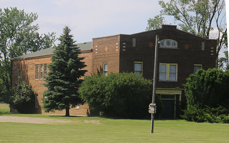
Built in 1928. Listed on the National Register of Historic Places in 2018.
One of 51 National Register listings published here for Outagamie County · listed in 2018 · category: Building · built in 1928.
Sources: the National Register database, National Park Service
Regional context, not property-specific evidence. The federal wildfire occurrence database lists 28 fires within 5 miles of South Greenville Grange No. 225 between 2007 and 2020, burning about 426 acres in total. None started naturally. 1 was recorded as arson. Distance is straight-line from the map coordinates, so a fire counted here may appear on a neighbouring settlement's page as well.
| Reported cause | Fires |
|---|---|
| Missing data/not specified/undetermined | 8 |
| Debris and open burning | 6 |
| Equipment and vehicle use | 4 |
| Smoking | 3 |
| Fireworks | 2 |
| Misuse of fire by a minor | 2 |
| Railroad operations and maintenance | 2 |
| Arson/incendiarism | 1 |
The most recent of them, most recent first, with the day each was reported and the service that recorded it.
| Date | Cause | Size | Reported by | Name on the report |
|---|---|---|---|---|
| 6 September 2019 | Debris and open burning | under an acre | Wisconsin Department of Natural Resources | 106 |
| 15 September 2019 | Debris and open burning | under an acre | Wisconsin Department of Natural Resources | 112 |
| 11 August 2020 | Missing data/not specified/undetermined | 1.0 acres | Wisconsin Department of Natural Resources | 1711 |
| 6 July 2018 | Fireworks | under an acre | Wisconsin Department of Natural Resources | 9000084 |
| 4 July 2020 | Missing data/not specified/undetermined | under an acre | Wisconsin Department of Natural Resources | 20GV003 |
| 23 June 2018 | Fireworks | under an acre | Wisconsin Department of Natural Resources | 88 |
| 13 June 2018 | Equipment and vehicle use | under an acre | Wisconsin Department of Natural Resources | 980 |
| 9 May 2018 | Equipment and vehicle use | 3.0 acres | Wisconsin Department of Natural Resources | 63 |
Regional context, not property-specific evidence. The federal mineral resources record lists 14 workings within 5 miles of South Greenville Grange No. 225: 11 past producers, 2 producers, 1 occurrence. 2 still produce. What was taken out: Sand and Gravel, Construction, Stone, Crushed/Broken. Distance is straight-line from the map coordinates, so a quarry counted here may appear on a neighbouring settlement's page as well.
| Where | Site | Commodity | Status | Recorded |
|---|---|---|---|---|
| Curtiss Quarry | Stone, Crushed/Broken | Past Producer | ||
| Jorgenson Quarry | Stone, Crushed/Broken | Past Producer | ||
| F Acheson Gravel Pit | Sand and Gravel, Construction | Past Producer | ||
| Greenville Pit | Sand and Gravel, Construction | Producer | ||
| Island Road Gravel Pit | Sand and Gravel, Construction | Past Producer | ||
| J Jentz Gravel Pit | Sand and Gravel, Construction | Past Producer | ||
| J R Lathrop Gravel Pit | Sand and Gravel, Construction | Past Producer | ||
| Jentz Pit | Sand and Gravel, Construction | Past Producer | ||
| Julius Road Gravel Pit | Sand and Gravel, Construction | Past Producer | ||
| Mccarthy Road Gravel Pit | Sand and Gravel, Construction | Past Producer |
Regional context, not property-specific evidence. The National Weather Service names Greenville, the town this property stands in, in 40 storm reports between 1996 and 2024: 19 hail, 17 thunderstorm wind, 2 tornado, 1 heavy rain. No death or injury is recorded in these reports. Each account below is quoted exactly as the forecast office filed it, from the NOAA Storm Events Database, and each date opens the federal record of that event.
| When | Event | Place named | Harm | What the report says |
|---|---|---|---|---|
| August 2013 | Tornado (EF1) | Greenville | $10,000,000 | A tornado formed near Highway 41 northwest of Appleton and moved east across northern portions of Appleton, Kimberly and Kaukauna. The tornado caused some roof damage to the Northland Mall (DI 11, DOD 2) and caused roof and window damage to two small retail buildings (DI 8, DOD 3 and 4). The storm then knocked over four wood electrical poles (DI 24, DOD 2 and 3) and uprooted or heavily damaged hundreds of trees in a nearby neighborhood (DI 27, DOD 2 and 3; DI 28, DOD 2 and 3). Although the houses in the area sustained relatively minor wind damage directly, fallen trees caused considerable collateral damage to roofs, siding and vehicles. The tornado exited Outagamie County about four miles east-southeast of Kaukauna at 12:49 am CDT and continued east into far southwest Brown County, then into northern Calumet County. The average path width in Outagamie County was 125 yards. |
| September 2011 | Thunderstorm Wind | Greenville | $5,300,000 | Thunderstorm winds, with gusts estimated to 80 mph, downed thousands of trees and knocked out power to 20,000 customers in Appleton alone. Around 200 homes sustained at least minor damage, including one that was destroyed. More than 60 businesses also sustained damage. A semi-trailer was blown over near US-41 and US-10. |
| July 2024 | Flash Flood | Greenville | $290,000 | Rainfall of 2.5 to 3.5 inches of rain in a short time caused flash flooding in Appleton, Combined Locks, Kimberly and Kaukauna during the evening. Multiple roads were under water and closed with stalled vehicles in the deeper water. |
| July 2019 | Tornado (EF0) | Greenville | $10,000 | A brief tornado damaged a few tree limbs (DI 27,28, DOD 2) and took some shingles and siding off a house (DI 2, DOD 2) northeast of Greenville. A power pole was also damaged. Peak winds were estimated near 85 mph. |
| September 2018 | Thunderstorm Wind | Greenville | $3,000 | Thunderstorm winds downed signs and damaged lightweight buildings in Greenville. |
| April 2022 | Hail | Greenville | - | Ping pong size hail fell near Stephensville. |
| April 2022 | Hail | Greenville | - | Quarter size hail fell near Greenville. |
| April 2022 | Hail | Greenville | - | Quarter size hail fell near Greenville. |
| April 2022 | Hail | Greenville | - | Half dollar size hail fell in Greenville. |
| April 2022 | Hail | Greenville | - | Golf ball size hail fell in Greenville. |
| June 2022 | Thunderstorm Wind | Greenville | - | Thunderstorm winds downed numerous trees near Greenville. The time of this report is an estimate based on radar data. |
| September 2021 | Hail | Greenville | - | Softball size hail fell west of Mackville. The time of this event is an estimate based on radar data. |
| June 2019 | Hail | Greenville | - | Tennis ball size hail fell three miles southeast of Stephensville. |
| July 2019 | Thunderstorm Wind | Greenville | - | A thunderstorm wind gust of 60 mph was measured at Appleton International Airport. |
| September 2018 | Thunderstorm Wind | Greenville | - | Thunderstorm winds downed numerous trees in Grand Chute, Appleton, Little Chute and Kimberly. The time of this report is an estimate based on radar data. |
| May 2017 | Thunderstorm Wind | Greenville | - | Thunderstorms produced a wind gust to 61 mph at Appleton International Airport. |
| June 2016 | Thunderstorm Wind | Greenville | - | Thunderstorm winds gusted to 62 mph as the storms moved across Appleton International Airport. |
| August 2015 | Hail | Greenville | - | Quarter size hail fell at the intersection of Highway 76 and Highway 96 in Greenville. |
| August 2014 | Hail | Greenville | - | Nickel size hail fell at the intersection of State Highways 76 and 96, near Appleton. |
| September 2014 | Hail | Greenville | - | Penny size hail fell in Greenville. |
| June 2013 | Hail | Greenville | - | Thunderstorms produced quarter size hail around the Town of Grand Chute. |
| August 2013 | Thunderstorm Wind | Greenville | - | A wind gust of 59 mph was recorded by the automated weather observing system at the Outagamie County Airport. |
| May 2012 | Heavy Rain | Greenville | - | Heavy rainfall from thunderstorms that moved through southern Outagamie County produced urban flooding in the Appleton and Grand Chute areas. |
| April 2011 | Hail | Greenville | - | Thunderstorms produced penny size hail that fell near the intersection of State Highways 15 and 76. |
| May 2011 | Hail | Greenville | - | Thunderstorms dropped golf ball size hail in Greenville. |
| May 2011 | Thunderstorm Wind | Greenville | - | Thunderstorm winds downed large tree limbs in Greenville. The storm also produced pea size hail. |
| May 2011 | Hail | Greenville | - | Ping pong ball size hail fell near Greenville. |
| May 2011 | Hail | Greenville | - | Quarter size hail fell in Grand Chute. |
| August 2010 | Thunderstorm Wind | Greenville | - | Thunderstorm winds to 60 mph downed a few trees and tree limbs in Greenville. |
| July 2010 | Hail | Greenville | - | Golf ball size hail fell near Greenville. |
| July 2010 | Hail | Greenville | - | Golf ball size hail fell near Greenville. |
| July 2010 | Hail | Greenville | - | Quarter size hail fell and thunderstorm wind gusts tore small branches from the trees around Greenville. |
| July 2010 | Thunderstorm Wind | Greenville | - | A thunderstorm wind gust of 60 mph was measured at Greenville. |
| July 2008 | Thunderstorm Wind | Greenville | - | Thunderstorms winds downed trees in the Greenville area. |
| April 2008 | Thunderstorm Wind | Greenville | - | Thunderstorm winds downed trees at the intersection of Highway 15 and Highway 41. |
| July 2008 | Hail | Greenville | - | no account filed |
| August 1999 | Thunderstorm Wind | Greenville | - | no account filed |
| August 1999 | Thunderstorm Wind | Greenville | - | no account filed |
| July 1997 | Thunderstorm Wind | Greenville | - | no account filed |
| August 1996 | Thunderstorm Wind | Greenville | - | no account filed |
No historic map-sheet match is published for this property yet. That does not mean no map exists. This record needs a coordinate-quality review before it can be joined to a sheet boundary. Browse the county's mapped places while that work is pending.
Other National Register properties close enough to walk or drive between, ordered by distance from this one. Both positions come from the same geocoding pass that matched these properties to their map sheets.
| Photograph | Property | Distance | Listed |
|---|---|---|---|
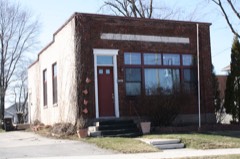 | Greenville State Bank | 4.3 miles | 1982 |
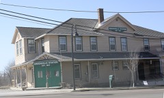 | Joseph Kronser Hotel and Saloon | 4.6 miles | 1988 |
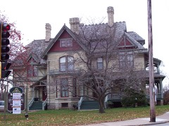 | Hearthstone | 5.8 miles | 1974 |
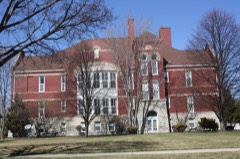 | Washington School | 5.8 miles | 1984 |
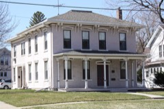 | James Tompkins House | 5.9 miles | 1986 |
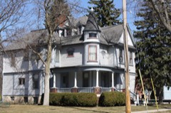 | Schuetter, Henry House | 6.1 miles | 1996 |
| National Archives record | The nomination case file for reference 100002443 in Record Group 79. |
| Outagamie County | All 51 listed properties in this county. |