Block
From the record
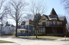
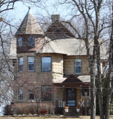
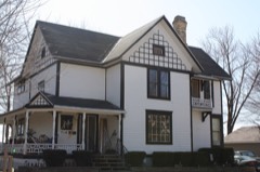
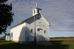
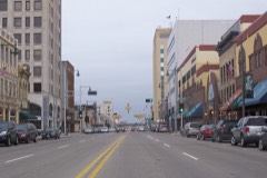
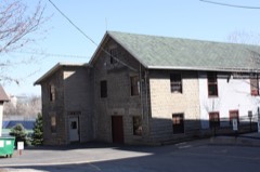
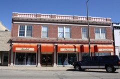
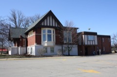
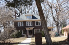
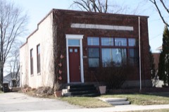
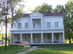
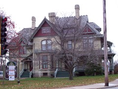
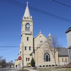
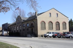
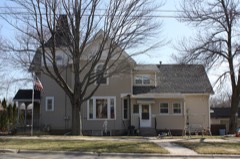
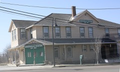
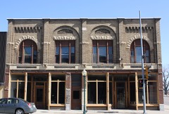
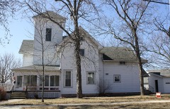
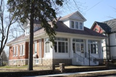
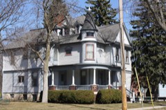
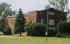
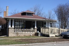
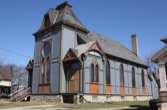
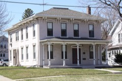
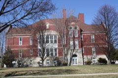
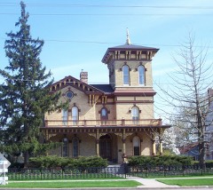
51 National Register listings published here.
Sources: the county history on the Internet Archive · the National Register database, National Park Service
42 topographic sheets cover 31 settlements here, and 51 properties are on the National Register of Historic Places.
51 National Register listings published here.
Sources: the county history on the Internet Archive · the National Register database, National Park Service
Every property in this county listed on the National Register of Historic Places, with the year it was listed and the federal nomination document.
Every wildfire the federal occurrence database records inside this county: 100 of them, burning about 176 acres. 2 started naturally and 17 were recorded as arson. Each settlement page carries the fires within five miles of it.
| Reported cause | Fires |
|---|---|
| Missing data/not specified/undetermined | 41 |
| Debris and open burning | 23 |
| Arson/incendiarism | 17 |
| Equipment and vehicle use | 6 |
| Smoking | 6 |
| Misuse of fire by a minor | 2 |
| Natural | 2 |
| Recreation and ceremony | 2 |
| Fireworks | 1 |
The five largest, by the area the report gives. One of them was set deliberately.
| Date | Cause | Size | Reported by | Name on the report |
|---|---|---|---|---|
| 26 October 1999 | Smoking | 100 acres | Wisconsin Department of Natural Resources | not named |
| 5 April 2020 | Misuse of fire by a minor | 5.0 acres | Wisconsin Department of Natural Resources | 05 |
| 7 November 2020 | Equipment and vehicle use | 5.0 acres | Wisconsin Department of Natural Resources | 1107401 |
| 29 April 2018 | Debris and open burning | 4.0 acres | Wisconsin Department of Natural Resources | 9000106 |
| 15 April 2019 | Arson/incendiarism | 4.0 acres | Wisconsin Department of Natural Resources | 11 |
| 8 November 2009 | Debris and open burning | 3.9 acres | Wisconsin Department of Natural Resources | not named |
| 30 April 2020 | Equipment and vehicle use | 3.0 acres | Wisconsin Department of Natural Resources | 2007 |
| 29 April 2018 | Debris and open burning | 3.0 acres | Wisconsin Department of Natural Resources | 9000107 |
Every settlement page carries the fires within five miles of it - see the settlement index below.
The NOAA Storm Events Database holds 475 reports for this county, causing 1 death, 18 injuries and about $59,736,250 in recorded property damage. Each settlement page carries the reports that name it.
| Kind of event | Reports |
|---|---|
| Thunderstorm Wind | 218 |
| Hail | 181 |
| Tornado | 34 |
| Flash Flood | 10 |
| Funnel Cloud | 9 |
| Heavy Rain | 9 |
| Lightning | 8 |
| Flood | 6 |
The most serious of them, by death, then injury, then recorded damage. The accounts are quoted exactly as the forecast office filed them.
| When | Event | Place named | Harm | What the report says |
|---|---|---|---|---|
| May 1989 | Thunderstorm Wind | not stated | 1 killed, 5 hurt | no account filed |
| April 1984 | Tornado (F4) | not stated | 9 hurt, $2,500,000 | no account filed |
| June 1969 | Tornado (F3) | not stated | 1 hurt, $2,500,000 | no account filed |
| April 1999 | Lightning | Kimberly | 1 hurt, $750 | no account filed |
| July 1996 | Lightning | New London | 1 hurt | no account filed |
| August 1984 | Thunderstorm Wind | not stated | 1 hurt | no account filed |
| August 2013 | Tornado (EF1) | Greenville | $10,000,000 | A tornado formed near Highway 41 northwest of Appleton and moved east across northern portions of Appleton, Kimberly and Kaukauna. The tornado caused some roof damage to the Northland Mall (DI 11, DOD 2) and caused roof and window damage to two small retail buildings (DI 8, DOD 3 and 4). The storm then knocked over four wood electrical poles (DI 24, DOD 2 and 3) and uprooted or heavily damaged hundreds of trees in a nearby neighborhood (DI 27, DOD 2 and 3; DI 28, DOD 2 and 3). Although the houses in the area sustained relatively minor wind damage directly, fallen trees caused considerable collateral damage to roofs, siding and vehicles. The tornado exited Outagamie County about four miles east-southeast of Kaukauna at 12:49 am CDT and continued east into far southwest Brown County, then into northern Calumet County. The average path width in Outagamie County was 125 yards. |
| June 2004 | Tornado (F1) | Little Chute | $6,800,000 | no account filed |
| April 2011 | Tornado (EF2) | Kaukauna | $6,700,000 | A fast moving tornado touched down in the southwest side of Kaukauna near County Road CE at 8:43 pm CDT (1743 CST). The tornado cut through the center of a subdivision as it moved north-northeast to near the Fox River before lifting off the ground. Seven homes were destroyed, 24 homes and four businesses sustained major damage, and 160 other homes sustained minor damage. Several houses lost large sections of their roofs (DI 2, DOD 6) in the hardest hit area of the city. The average path width was 125 yards. |
| July 2010 | Hail | Appleton | $6,200,000 | Golf ball size hail near Appleton damaged nearly 1,000 vehicles and at least 200 homes. Many of the homes sustained significant damage as the hail damaged roofs and siding. |
| September 2011 | Thunderstorm Wind | Greenville | $5,300,000 | Thunderstorm winds, with gusts estimated to 80 mph, downed thousands of trees and knocked out power to 20,000 customers in Appleton alone. Around 200 homes sustained at least minor damage, including one that was destroyed. More than 60 businesses also sustained damage. A semi-trailer was blown over near US-41 and US-10. |
| April 2026 | Flood | New London | $4,600,000 | Widespread low-land flooding occurred in Outagamie County, resulting in considerable flood damage along the Wolf River and Embarrass River to 52 homes and $4.6 million of damage. Evacuations occurred in the towns of Shiocton and New London for multiple days. Power and gas in these areas were shutoff as flood waters impacted many homes and businesses. |
| June 2001 | Thunderstorm Wind | Appleton | $3,500,000 | no account filed |
| August 2013 | Tornado (EF1) | New London | $2,500,000 | The tornado that struck Waupaca County at 12:24 am CDT entered Outagamie County about a mile south of New London at 12:25 am CDT. The tornado damaged or uprooted several hundred trees (DI 27, DOD 3 and 4; DI 28, DOD 3 and 4) along the path, many falling on houses in a two block area of Hortonville, causing considerable roof and siding damage. The average path width in Outagamie County was approximately 100 yards. |
| December 1970 | Tornado (F3) | not stated | $2,500,000 | no account filed |
| August 2013 | Tornado (EF1) | Mackville | $1,500,000 | Another fast-moving tornado developed within a line of severe thunderstorms and moved east-southeast across the Fox Valley. The tornado caused significant damage to several outbuildings and barns (DI 1, DOD 6 and 7) and flattened sections of mature corn fields. The roof of a power substation was damaged (similar to DI 9, DOD 5) southwest of Freedom. The average path width of the tornado in Outagamie County was 150 yards. The tornado moved into Brown County near Highway 41, 1.8 miles northwest of Wrightstown, at 12:48 am CDT. |
| August 2013 | Tornado (EF1) | Mackville | $1,500,000 | A tornado developed near Mackville and moved rapidly to the east-southeast. The tornado caused a barn to collapse (DI 1, DOD 6) and heavily damaged a boat showroom (DI 21, DOD 3) just north of Little Chute. Another barn lost part of its roof (DI 1, DOD 4) northwest of Kaukauna. Damage to trees was sporadic as the tornado moved out of Outagamie County into Brown County, about two miles southwest of Wrightstown, at 12:48 am CDT. The average path width in Outagamie County was 100 yards. |
| September 2005 | Thunderstorm Wind | Appleton | $1,100,000 | no account filed |
| July 2024 | Flash Flood | Greenville | $290,000 | Rainfall of 2.5 to 3.5 inches of rain in a short time caused flash flooding in Appleton, Combined Locks, Kimberly and Kaukauna during the evening. Multiple roads were under water and closed with stalled vehicles in the deeper water. |
| July 2024 | Flash Flood | Mackville | $289,000 | Rainfall amounts of 2 to 3 inches in the Appleton area during the early afternoon caused 1 to 2 feet of flowing water in some locations. |
| June 2017 | Tornado (EF1) | Darboy | $250,000 | This tornado moved out of far northeast Winnebago County (1.8 miles south of Appleton) and entered Outagamie County at 3:29 PM CDT. The tornado uprooted or snapped several dozen trees (DI 27 and 28, DOD 1-3), some of which fell on houses along its path across the southeast side of the city of Appleton. Two large industrial buildings suffered damage on Appleton's east side. One building's large HVAC system was blown off its roof and another large building had several overhead doors blown in and lost portions of its roof and a wall (DI 23, DOD 3 and 4). A self-service car wash lost its roof in Kimberly. An industrial park in Little Chute was also affected. A building had an HVAC unit damaged and a couple trees were knocked down. The tornado dissipated after crossing I-41 north of Kaukauna. |
| May 1992 | Tornado (F1) | not stated | $250,000 | no account filed |
| May 1982 | Tornado (F2) | not stated | $250,000 | no account filed |
| August 1968 | Tornado (F1) | not stated | $250,000 | no account filed |
| July 2010 | Flash Flood | Black Creek | $150,000 | Two inches of rain fell in an hour flooding 4 blocks of downtown Black Creek and 30 basements. State Highway 54 had to be closed due to 4 feet of standing water on the road. |
| April 2017 | Lightning | Stephensville | $100,000 | Lightning stuck a gas meter outside a home, causing it to ignite. The fire caused considerable heat and smoke damage to the home and displaced its two residents. |
| July 1997 | Thunderstorm Wind | Appleton | $100,000 | no account filed |
| July 2013 | Heavy Rain | Appleton | $98,500 | Heavy rain fell in Appleton during the early morning of June 8th, mainly between 0315CST and 0700CST. The 24-hour rainfall total ending at 0600CST was 2.35 inches. The weight of the rainwater caused the roof of a building to collapse around 0900CST. The collapse caused a gas leak, and the Appleton building inspector declared 3 buildings uninhabitable while contractors examined the damage. |
| July 2019 | Tornado (EF1) | Hortonville | $75,000 | A tornado damaged three power poles (DI 24, DOD 3,4), destroyed a car port of an outbuilding (DI 1, DOD 5), partially damaged two outbuildings (DI 1, DOD 3), removed siding off a couple houses (DI 2, DOD 2), and damaged trees along its path. Estimated peak winds around 90 mph. |
| June 2016 | Thunderstorm Wind | Drephal | $50,000 | North of Black Creek, near the intersection of Highway 47 and County Road G, thunderstorm winds snapped or damaged dozens of trees, tore the roof from a silo, and caused shingle and siding damage to a house and garage. |
| July 2019 | Thunderstorm Wind | Appleton | $40,000 | Thunderstorm winds uprooted 2 trees and damaged a house in Appleton. |
| July 2019 | Tornado (EF1) | New London | $25,000 | The tornado that formed at 11:09 AM CDT in eastern Waupaca County crossed the county line 1.4 miles south of New London at 11:10 AM CDT. The tornado continued northeast and destroyed a storage shed (DI 1, DOD 4,5), heavily damaged trees (DI 28, DOD 3,4), ripped shingles and siding off a house (DI 2, DOD 2), and destroyed part of a wooden deck. A power pole also fell onto a car. Peak wind speeds were estimated around 90 mph. |
| August 2010 | Flash Flood | Kaukauna | $25,000 | Heavy rain fell across the Fox Valley, causing flash flooding near Kaukauna. Nearby Darboy measured 3.50 inches of rain during the morning storms. Kankapot Creek in Kaukauna flooded Highway KK, which was closed for some time. Wisconsin International Raceway, which was hosting a Pyrotechnics Guild International event, had to be evacuated due to the flood. |
| May 1980 | Tornado (F1) | not stated | $25,000 | no account filed |
| June 1976 | Tornado (F1) | not stated | $25,000 | no account filed |
| July 1973 | Tornado (F1) | not stated | $25,000 | no account filed |
| August 1968 | Tornado (F2) | not stated | $25,000 | no account filed |
| May 1959 | Tornado (F2) | not stated | $25,000 | no account filed |
| June 2016 | Thunderstorm Wind | Isaar | $15,000 | North of Seymour, at the intersection of Highway 55 and County Road VV, thunderstorm winds downed trees and power lines. One of the trees fell on a car and another landed on a house. |
| August 2015 | Thunderstorm Wind | Kaukauna | $15,000 | Thunderstorm winds downed trees in Kaukauna. |
| June 1999 | Thunderstorm Wind | Appleton | $14,000 | no account filed |
| July 2019 | Tornado (EF0) | Greenville | $10,000 | A brief tornado damaged a few tree limbs (DI 27,28, DOD 2) and took some shingles and siding off a house (DI 2, DOD 2) northeast of Greenville. A power pole was also damaged. Peak winds were estimated near 85 mph. |
| August 2018 | Flash Flood | Darboy | $10,000 | Torrential rainfall caused roads in Appleton to become impassible as water levels rose as high as the hoods of cars. |
| June 2016 | Thunderstorm Wind | Little Chute | $10,000 | Thunderstorm winds downed trees in Kaukauna and damaged the roof of a house. |
| September 2016 | Thunderstorm Wind | Stephensville | $10,000 | Thunderstorm winds pushed a 28 foot by 40 foot shed off its foundation and damaged several apple trees north of Hortonville. |
| September 2016 | Thunderstorm Wind | Applecreek | $10,000 | Thunderstorm winds downed an old barn and a 12-inch diameter tree just north of Kaukauna. Vehicles being stored inside the barn were damaged when it fell. |
| July 2008 | Lightning | Combined Locks | $10,000 | Lightning struck the roof of a home causing a fire that spread to the attic. Firefighters were able to extinguish the blaze in about 15 minutes. |
| July 2008 | Thunderstorm Wind | Appleton | $10,000 | High winds from thunderstorms knocked a large tree onto a garage, blew lawn furniture from a yard and damaged a storefront. |
| October 2020 | Lightning | Applecreek | $5,000 | A lightning strike caused a power pole to become engulfed in flames on Appleview and Fuji Drive in Appleton. The power pole and attached light were damaged due to the fire and had to be replaced. |
| June 2019 | Thunderstorm Wind | Combined Locks | $5,000 | Thunderstorm winds knocked a tree onto a house near the intersection of County Highway N and Kennedy Avenue. The time of this report is an estimate based on radar data. |
| July 2015 | Thunderstorm Wind | Hortonville | $5,000 | Thunderstorm winds tore part of the roof from a barn in Hortonville. |
| August 2015 | Thunderstorm Wind | Kaukauna | $4,000 | Thunderstorm winds snapped large trees about five feet above the ground in Kaukauna. |
| May 1998 | Thunderstorm Wind | Appleton | $4,000 | no account filed |
| September 2018 | Thunderstorm Wind | Greenville | $3,000 | Thunderstorm winds downed signs and damaged lightweight buildings in Greenville. |
| August 2015 | Thunderstorm Wind | Freedom | $3,000 | Thunderstorm winds downed trees in Freedom. |
| August 2015 | Thunderstorm Wind | Black Creek | $3,000 | Thunderstorm winds downed trees in Black Creek. |
| August 2015 | Thunderstorm Wind | Kimberly | $3,000 | Thunderstorm winds downed trees in Kimberly, blocking a road. |
| May 1998 | Thunderstorm Wind | Appleton | $3,000 | no account filed |
| July 1996 | Thunderstorm Wind | Appleton | $3,000 | no account filed |
| August 2019 | Flash Flood | Kimberly | $2,500 | Heavy rainfall led to flash flooding that caused the closure of part of southbound Interstate Highway 441 near the Appleton-Little Chute border. |
The Survey's mineral resources record lists 86 workings inside this county. 12 still produce and 74 are closed or unrecorded. Each settlement page carries the workings within five miles of it.
| Commodity | Workings |
|---|---|
| Sand and Gravel, Construction | 59 |
| Stone, Crushed/Broken | 25 |
| Stone | 1 |
| Perlite | 1 |
The least common of them first, because a county's hundredth gravel pit says nothing its first ten did not.
| Where | Site | Commodity | Status | Recorded |
|---|---|---|---|---|
| Midwest Perlite Co. | Perlite | Plant | ||
| Own Crews | Stone | Unknown | ||
| Black Creek Limestone Quarry | Stone, Crushed/Broken | Producer | ||
| Black Creek Quarry | Stone, Crushed/Broken | Past Producer | ||
| Brun-Van Hoof Quarry | Stone, Crushed/Broken | Past Producer | ||
| Cizmon Quarry | Stone, Crushed/Broken | Past Producer | ||
| Dan Mueller Dolomite Quarry | Stone, Crushed/Broken | Past Producer | ||
| Freedom Quarry | Stone, Crushed/Broken | Producer | ||
| G Bruhn Dolomite Quarry | Stone, Crushed/Broken | Past Producer | ||
| Hortonville Limestone Quarry | Stone, Crushed/Broken | Past Producer | ||
| J Marcks Dolomite Deposit | Stone, Crushed/Broken | Occurrence | ||
| Jenkins Quarry | Stone, Crushed/Broken | Past Producer | ||
| John Wolf Dolomite Quarry | Stone, Crushed/Broken | Past Producer | ||
| Jurack Quarry | Stone, Crushed/Broken | Past Producer | ||
| Kaukauna Limestone Quarry | Stone, Crushed/Broken | Past Producer | ||
| Mackville Quarry | Stone, Crushed/Broken | Producer | ||
| Monnot Quarry | Stone, Crushed/Broken | Producer | ||
| Mrk & Murphy Quarry | Stone, Crushed/Broken | Past Producer | ||
| Murphy Construction Company | Stone, Crushed/Broken | Past Producer | ||
| Nelson Quarry | Stone, Crushed/Broken | Producer | ||
| Nichols Quarry | Stone, Crushed/Broken | Past Producer | ||
| Pit H | Stone, Crushed/Broken | Producer | ||
| Rock Road Blue Bell Quarry | Stone, Crushed/Broken | Producer | ||
| Rocky Road Quarry | Stone, Crushed/Broken | Producer | ||
| Shuh Quarry | Stone, Crushed/Broken | Producer | ||
| Tesch Dolomite Quarry | Stone, Crushed/Broken | Past Producer | ||
| Turney Hill Sandstone Quarry | Stone, Crushed/Broken | Past Producer | ||
| A Matz Gravel Pit | Sand and Gravel, Construction | Past Producer | ||
| B Duch Gravel Pit | Sand and Gravel, Construction | Past Producer | ||
| Bodde Road Gravel Deposit | Sand and Gravel, Construction | Occurrence | ||
| Breiting Road Gravel Pit | Sand and Gravel, Construction | Past Producer | ||
| C Flanagan Gravel Pit | Sand and Gravel, Construction | Past Producer | ||
| Clyde Main Gravel Pit #1 | Sand and Gravel, Construction | Past Producer | ||
| Clyde Main Gravel Pit #2 | Sand and Gravel, Construction | Past Producer | ||
| Cummings Road Gravel Pit | Sand and Gravel, Construction | Past Producer | ||
| Dobrinska Gravel Pit | Sand and Gravel, Construction | Past Producer | ||
| Duck Creek Gravel Pit | Sand and Gravel, Construction | Past Producer | ||
| F Acheson Gravel Pit | Sand and Gravel, Construction | Past Producer | ||
| Finger Gravel Pit | Sand and Gravel, Construction | Past Producer | ||
| Givens Road Sand Deposit | Sand and Gravel, Construction | Occurrence | ||
| Gonnering Pit | Sand and Gravel, Construction | Past Producer | ||
| Grand View Road Sand Deposit | Sand and Gravel, Construction | Occurrence | ||
| Greenville Pit | Sand and Gravel, Construction | Producer | ||
| Hortonville Sand Deposit | Sand and Gravel, Construction | Occurrence | ||
| Hortonville Sand Deposit #1 | Sand and Gravel, Construction | Occurrence | ||
| Hortonville Sand Deposit #2 | Sand and Gravel, Construction | Occurrence | ||
| Hortonville Sand Deposit #3 | Sand and Gravel, Construction | Occurrence | ||
| Hortonville Sand Deposit #4 | Sand and Gravel, Construction | Occurrence | ||
| Hortonville Sand Pit | Sand and Gravel, Construction | Past Producer | ||
| Island Road Gravel Pit | Sand and Gravel, Construction | Past Producer | ||
| J Jentz Gravel Pit | Sand and Gravel, Construction | Past Producer | ||
| J Klement Sand Deposit | Sand and Gravel, Construction | Occurrence | ||
| J R Lathrop Gravel Pit | Sand and Gravel, Construction | Past Producer | ||
| J Samson Gravel Pit | Sand and Gravel, Construction | Past Producer | ||
| Jentz Pit | Sand and Gravel, Construction | Past Producer | ||
| John Kelly Gravel Pit | Sand and Gravel, Construction | Past Producer | ||
| Julius Road Gravel Pit | Sand and Gravel, Construction | Past Producer | ||
| Kirschner Road Gravel Pit #1 | Sand and Gravel, Construction | Past Producer | ||
| Kirschner Road Gravel Pit #2 | Sand and Gravel, Construction | Past Producer | ||
| Kurey Gravel Pit | Sand and Gravel, Construction | Past Producer | ||
| Laird Road Gravel Pit | Sand and Gravel, Construction | Past Producer | ||
| Laird Road Gravel Pit #1 | Sand and Gravel, Construction | Past Producer | ||
| Mary Lemke Gravel Pit | Sand and Gravel, Construction | Past Producer | ||
| Mccarthy Road Gravel Pit | Sand and Gravel, Construction | Past Producer | ||
| Medina Gravel Pit #1 | Sand and Gravel, Construction | Past Producer | ||
| Medina Gravel Pit #2 | Sand and Gravel, Construction | Past Producer | ||
| Medina Gravel Pit #3 | Sand and Gravel, Construction | Past Producer | ||
| Medina Pit | Sand and Gravel, Construction | Producer | ||
| Murphy Const. Co. Gravel Pit | Sand and Gravel, Construction | Past Producer | ||
| Nussbaum Gravel Pit | Sand and Gravel, Construction | Past Producer | ||
| R Evers Gravel Pit | Sand and Gravel, Construction | Past Producer | ||
| R Lathrop Sand Deposit | Sand and Gravel, Construction | Occurrence | ||
| R Lathrop Sand Pit | Sand and Gravel, Construction | Past Producer | ||
| Rabbit Road Sand Pit | Sand and Gravel, Construction | Past Producer | ||
| S Schuster Gravel Pit | Sand and Gravel, Construction | Past Producer | ||
| Sasse Road Gravel Pit | Sand and Gravel, Construction | Past Producer | ||
| Schoettler Gravel Deposit | Sand and Gravel, Construction | Occurrence | ||
| School Road Gravel Pit | Sand and Gravel, Construction | Past Producer | ||
| Shay Lake Road Gravel Pit | Sand and Gravel, Construction | Past Producer | ||
| Small Hill Gravel Deposit | Sand and Gravel, Construction | Occurrence | ||
| Sugar Bush Gravel Pit | Sand and Gravel, Construction | Past Producer | ||
| Thompson Road Sand Pit | Sand and Gravel, Construction | Past Producer | ||
| Turney Hill Sand Deposit | Sand and Gravel, Construction | Occurrence | ||
| Van Handel Gravel Pit | Sand and Gravel, Construction | Past Producer | ||
| Van Handel Pit | Sand and Gravel, Construction | Unknown | ||
| W Pingel Gravel Pit | Sand and Gravel, Construction | Past Producer |
One book written about this county, cut here where the book itself is cut, at its printed chapters: 1 chapter in all. Every chapter is public domain, machine-read from the scan and reproduced complete. A chapter already given under one of the county's towns is not repeated in this list.
| Chapter | Length |
|---|---|
| The whole text | 87,410 words in 6 parts |
Named settlements recorded in the Geographic Names Information System, each with the topographic sheets covering it. Villages, hamlets and abandoned places alike. Each is shown with the nearest named watercourse or landform and the survey quadrangle it falls on.
Combined Locks village · 54113 · On Garners Creek · Kaukauna quadrangle
9 sheets, 1955 to 1992
Little Chute village · 54140 · On Little Chute Islands · Kaukauna quadrangle
9 sheets, 1955 to 1992