 Block
From the record
One of 51 National Register listings published here for Fond du Lac County · listed in 2019 · category: District.
Sources: the National Register database, National Park Service
Listed on the National Register of Historic Places in 2019.
One of 51 National Register listings published here for Fond du Lac County · listed in 2019 · category: District.
Sources: the National Register database, National Park Service
Regional context, not property-specific evidence. The federal wildfire occurrence database lists 35 fires within 5 miles of Waupun Commercial Historic District between 1994 and 2018, burning about 2,025 acres in total. None started naturally. 7 were recorded as arson. Distance is straight-line from the map coordinates, so a fire counted here may appear on a neighbouring settlement's page as well.
| Reported cause | Fires |
|---|---|
| Missing data/not specified/undetermined | 15 |
| Debris and open burning | 8 |
| Arson/incendiarism | 7 |
| Equipment and vehicle use | 3 |
| Recreation and ceremony | 2 |
The most recent of them, most recent first, with the day each was reported and the service that recorded it.
| Date | Cause | Size | Reported by | Name on the report |
|---|---|---|---|---|
| 18 August 2012 | Missing data/not specified/undetermined | 2.0 acres | Horicon National Wildlife Refuge | PEACHY NORTH WF |
| 23 July 2012 | Equipment and vehicle use | 7.0 acres | Horicon National Wildlife Refuge | NEITZEL WF |
| 22 July 2007 | Arson/incendiarism | 1.4 acres | Horicon National Wildlife Refuge | PEACHY RD. WF |
| 14 July 2018 | Missing data/not specified/undetermined | under an acre | Wisconsin Department of Natural Resources | 1807037 |
| 28 June 2017 | Arson/incendiarism | under an acre | Horicon National Wildlife Refuge | MOWER WF |
| 8 May 2011 | Debris and open burning | 12 acres | Horicon National Wildlife Refuge | ZELLMER WF |
| 19 May 2010 | Missing data/not specified/undetermined | 100 acres | Horicon National Wildlife Refuge | TENPASS WF |
| 18 May 2018 | Missing data/not specified/undetermined | under an acre | Wisconsin Department of Natural Resources | F180545 |
Regional context, not property-specific evidence. The federal mineral resources record lists 5 workings within 5 miles of Waupun Commercial Historic District: 3 past producers, 2 producers. 2 still produce. What was taken out: Stone, Crushed/Broken. Distance is straight-line from the map coordinates, so a quarry counted here may appear on a neighbouring settlement's page as well.
| Where | Site | Commodity | Status | Recorded |
|---|---|---|---|---|
| Howard Quarry | Stone, Crushed/Broken | Past Producer | ||
| Larson Quarry | Stone, Crushed/Broken | Past Producer | ||
| Linck Waupun Quarries | Stone, Crushed/Broken | Producer | ||
| Waupun Ready Mix Quarry | Stone, Crushed/Broken | Producer | ||
| Wegenke Quarry | Stone, Crushed/Broken | Past Producer |
Regional context, not property-specific evidence. The National Weather Service names Waupun, the town this property stands in, in 18 storm reports between 1997 and 2019: 7 thunderstorm wind, 5 flood, 3 lightning, 2 hail. No death or injury is recorded in these reports. Each account below is quoted exactly as the forecast office filed it, from the NOAA Storm Events Database, and each date opens the federal record of that event.
| When | Event | Place named | Harm | What the report says |
|---|---|---|---|---|
| August 2001 | Lightning | Waupun | $20,000 | no account filed |
| May 2011 | Lightning | Waupun | $15,000 | Lightning struck a building in the township of Chester, setting the 100-foot by 60-foot structure on fire. Damage was moderate, totaling $15,000, and contained to one bay in the shop area at the rear of the building. |
| June 2017 | Thunderstorm Wind | Waupun | $10,000 | Straight-line wind damage on the north side of Waupun. Half the shingles blown off the roof of a home and branches and trees down. |
| May 2018 | Heavy Rain | Waupun | $5,000 | A few roads closed throughout the county due to flooding, and several homes had sewer backups. The Fond du Lac River in the city of Fond du Lac was running high and approached the bottom of the bridge on Western Ave. Partially-treated wastewater was released into Lake Winnebago due to the treatment plant reaching over-capacity. |
| October 2019 | Flood | Waupun | $3,000 | The south branch of the Rock River at Waupun reached minor flood stage, cresting at 7.83 feet by late morning on October 2nd. Water reaches the support beams underneath the Fond du Lac St. bridge and it is closed. Gateway Dr. is flooded and closed. Water starts to over top the dam at Shaler Park. County Park Rd. is closed at the bridge as the river flows around the north end of bridge. Various parks and associated roads are closed along the river. |
| March 2019 | Flood | Waupun | $3,000 | The South Branch of the Rock River reached moderate flood stage, cresting at 8.66 feet during the early morning of March 15th in Waupun. Water reached the support beam underneath the Fond du Lac St. bridge and it was closed. County Park Rd. was closed at the bridge as the Rock River flowed around the north end of the bridge, reconnecting with the river. Water was flowing around the north end of the city of Waupun Dam, reconnecting with the river. Gateway Dr. near the river was flooded and closed. Various parks along the river were flooded. |
| July 1997 | Thunderstorm Wind | Waupun | $2,000 | no account filed |
| May 2018 | Flood | Waupun | $1,000 | The South Branch of the Rock River reached minor flood stage, cresting at 7.23 feet in Waupun. County Park Rd. was closed at the bridge as the Rock River flowed around the north end of the bridge, reconnecting with the river. Water was flowing around the north end of the city of Waupun Dam, reconnecting with the river. Gateway Dr. near the river was flooded and closed. Various parks along the river were flooded. |
| August 2018 | Flood | Waupun | $1,000 | The South Branch of the Rock River reached minor flood stage, cresting at 7.43 feet during the early afternoon on August 29th in Waupun. Water reached the support beam underneath the Fond du Lac St. bridge and it was closed. County Park Rd. was closed at the bridge as the Rock River flowed around the north end of the bridge, reconnecting with the river. Water was flowing around the north end of the city of Waupun Dam, reconnecting with the river. Gateway Dr. near the river was flooded and closed. Various parks along the river were flooded. |
| July 2011 | Thunderstorm Wind | Waupun | - | Large tree branches were reported blown down from thunderstorm wind gusts estimated at 61 mph (52 knots) at the intersection of County A and County AW just west of Waupun. |
| July 2008 | Thunderstorm Wind | Waupun | - | Powerful thunderstorm wind gusts toppled large trees. |
| May 2006 | Hail | Waupun | - | no account filed |
| September 2005 | Thunderstorm Wind | Waupun | - | no account filed |
| April 2002 | Thunderstorm Wind | Waupun | - | no account filed |
| April 2002 | Lightning | Waupun | - | no account filed |
| August 2001 | Thunderstorm Wind | Waupun | - | no account filed |
| March 2000 | Hail | Waupun | - | no account filed |
| June 2000 | Flood | Waupun | - | no account filed |
No historic map-sheet match is published for this property yet. That does not mean no map exists. This record needs a coordinate-quality review before it can be joined to a sheet boundary. Browse the county's mapped places while that work is pending.
Other National Register properties close enough to walk or drive between, ordered by distance from this one. Both positions come from the same geocoding pass that matched these properties to their map sheets.
| Photograph | Property | Distance | Listed |
|---|---|---|---|
 | Waupun Post Office | under 500 feet | 2000 |
 | End of the Trail | 0.3 miles | 1980 |
 | Recording Angel, The | 0.4 miles | 1974 |
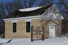 | Zion Congregational Church | 5.2 miles | 2006 |
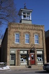 | Brandon Village Hall and Library | 7.5 miles | 2008 |
| National Archives record | The nomination case file for reference 100004468 in Record Group 79. |
| Fond du Lac County | All 51 listed properties in this county. |