 Block
From the record
One of 21 National Register listings published here for Bayfield County · listed in 2020 · category: District.
Sources: the National Register database, National Park Service
Listed on the National Register of Historic Places in 2020.
One of 21 National Register listings published here for Bayfield County · listed in 2020 · category: District.
Sources: the National Register database, National Park Service
Regional context, not property-specific evidence. The federal wildfire occurrence database lists 11 fires within 5 miles of Shaw Point Historic District between 1995 and 2020, burning about 25 acres in total. 2 started naturally. None was recorded as arson. Distance is straight-line from the map coordinates, so a fire counted here may appear on a neighbouring settlement's page as well.
| Reported cause | Fires |
|---|---|
| Debris and open burning | 4 |
| Missing data/not specified/undetermined | 2 |
| Natural | 2 |
| Other causes | 1 |
| Firearms and explosives use | 1 |
| Fireworks | 1 |
The most recent of them, most recent first, with the day each was reported and the service that recorded it.
| Date | Cause | Size | Reported by | Name on the report |
|---|---|---|---|---|
| 6 July 2007 | Natural | under an acre | Apostle Islands National Lakeshore | PLOT FIRE |
| 5 July 2006 | Fireworks | under an acre | Great Lakes Agency | EAGLE BAY RD |
| 28 July 2001 | Natural | under an acre | Apostle Islands National Lakeshore | FIR FIRE |
| 1 July 2004 | Missing data/not specified/undetermined | 23 acres | Great Lakes Agency | WDNR_BILL |
| 9 June 2010 | Firearms and explosives use | under an acre | Apostle Islands National Lakeshore | LITTLE SAND BAY |
| 23 May 2020 | Debris and open burning | 1.5 acres | Wisconsin Department of Natural Resources | VALLEY |
| 23 May 1995 | Missing data/not specified/undetermined | under an acre | Wisconsin Department of Natural Resources | not named |
| 30 April 2015 | Other causes | under an acre | Wisconsin Department of Natural Resources | RIDGE ROAD FIRE |
Regional context, not property-specific evidence. The federal mineral resources record lists 4 workings within 5 miles of Shaw Point Historic District: 2 past producers, 2 occurrences. None of them still produces. What was taken out: Sand and Gravel, Construction. Distance is straight-line from the map coordinates, so a quarry counted here may appear on a neighbouring settlement's page as well.
| Where | Site | Commodity | Status | Recorded |
|---|---|---|---|---|
| Gilbert A. Larson Gravel Pit | Sand and Gravel, Construction | Occurrence | ||
| J. M. Black Gravel Pit | Sand and Gravel, Construction | Past Producer | ||
| Sand River Gravel Pit #1 | Sand and Gravel, Construction | Occurrence | ||
| Sand River Gravel Pit #2 | Sand and Gravel, Construction | Past Producer |
Regional context, not property-specific evidence. The National Weather Service names Bayfield, the town this property stands in, in 16 storm reports between 1995 and 2026: 12 thunderstorm wind, 2 hail, 2 flash flood. The reports record 2 injuries. Each account below is quoted exactly as the forecast office filed it, from the NOAA Storm Events Database, and each date opens the federal record of that event.
| When | Event | Place named | Harm | What the report says |
|---|---|---|---|---|
| July 2006 | Thunderstorm Wind | Bayfield | 2 hurt, $1,500,000 | Downburst winds hit the Bayfield waterfront where an art fair was in progress at Memorial Park. Most of the ninety fair tents were demolished and art pieces were tossed into Lake Superior. A woman broke her hand while a man received a large gash on his hand. Numerous large trees were blown down in Bayfield. The local Catholic church lost a portion of its roof, resulting in damage estimated at $300,000. There was an unverified report of a private weather system clocking the wind at 99 mph before it became inoperable. At the Apostle Island Marina numerous boats lost their canvas coverings. Many boats lost their stanchions after being tipped under the docks by the strong winds. Damage estimates at the marina ranged from $25,000 to $30,000. Trees were reported down all across northern Douglas County. |
| June 2006 | Thunderstorm Wind | Bayfield | $400,000 | Major wind damage to docks and a few boats occurred at two marinas. Many docks were destroyed. One 40 foot boat was destroyed. There was also three-quarter inch hail and some downed trees. |
| October 2005 | Flash Flood | Bayfield | $345,000 | no account filed |
| June 2024 | Flash Flood | Bayfield | $100,000 | Areas of flooding and washed out roads were reported in the City of Bayfield. |
| April 2026 | Thunderstorm Wind | Bayfield | - | Numerous reports were received of several tall pine trees uprooted in Washburn including several that blocked Highway 13. |
| July 2023 | Thunderstorm Wind | Bayfield | - | A power pole was knocked down and on fire. |
| June 2007 | Thunderstorm Wind | Bayfield | - | The severe thunderstorm winds blew down trees and power lines. |
| June 2006 | Thunderstorm Wind | Bayfield | - | The concession tent at the Big Top Chautauqua outdoor performance area was blown down. The main tent received hail and water damage. Shows at the tent were cancelled for three days. Hail size is unknown. |
| July 2003 | Hail | Bayfield | - | The hail fell for two minutes. |
| August 2001 | Thunderstorm Wind | Bayfield | - | Numerous trees were blown down on County Highway J. |
| August 2001 | Thunderstorm Wind | Bayfield | - | Numerous trees were blown down at Little Sand Bay. |
| July 1995 | Thunderstorm Wind | Bayfield | - | Several trees were blown down on highway 13 between Bayfield and Cornucopia. |
| July 2000 | Hail | Bayfield | - | no account filed |
| July 1999 | Thunderstorm Wind | Bayfield | - | no account filed |
| June 1999 | Thunderstorm Wind | Bayfield | - | no account filed |
| May 1998 | Thunderstorm Wind | Bayfield | - | no account filed |
No historic map-sheet match is published for this property yet. That does not mean no map exists. This record needs a coordinate-quality review before it can be joined to a sheet boundary. Browse the county's mapped places while that work is pending.
Other National Register properties close enough to walk or drive between, ordered by distance from this one. Both positions come from the same geocoding pass that matched these properties to their map sheets.
| Photograph | Property | Distance | Listed |
|---|---|---|---|
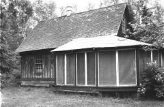 | Sevona Cabin | under 500 feet | 1976 |
| Shaw Farm | 0.1 miles | 1976 | |
| West Bay Club | 2.0 miles | 2014 | |
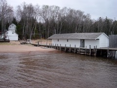 | Hokenson Fishing Dock | 2.4 miles | 1976 |
| National Archives record | The nomination case file for reference 100005371 in Record Group 79. |
| Bayfield County | All 21 listed properties in this county. |