 Block
From the record
21 National Register listings published here.
Sources: the National Register database, National Park Service
96 topographic sheets cover 33 settlements here, and 21 properties are on the National Register of Historic Places.
21 National Register listings published here.
Sources: the National Register database, National Park Service
Every property in this county listed on the National Register of Historic Places, with the year it was listed and the federal nomination document.
| Photograph | Property | Type | Listed | Reference |
|---|---|---|---|---|
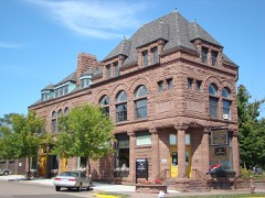 | Bank of Washburn | building | 1980 | 80000105 |
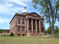 | Bayfield County Courthouse | building | 1975 | 75000060 |
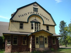 | Bayfield Fish Hatchery | building | 1981 | 81000033 |
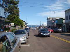 | Bayfield Historic District | district | 1980 | 80000106 |
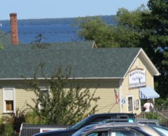 | Booth Cooperage | building | 1976 | 76000049 |
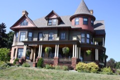 | Frank Boutin Jr. House | building | 1974 | 74000056 |
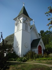 | Christ Episcopal Church | building | 1974 | 74000057 |
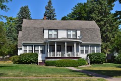 | East Third Street Residential Historic District | district | 2014 | 14000430 |
| Forest Lodge | building | 2002 | 02000031 | |
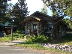 | Forest Lodge Library | building | 2001 | 01000735 |
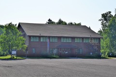 | Herbster Community Center | building | 1997 | 97000888 |
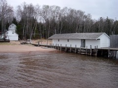 | Hokenson Fishing Dock | building | 1976 | 76000050 |
| Island Lake Camp | building | 1982 | 82000629 | |
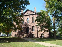 | Old Bayfield County Courthouse | building | 1974 | 74000058 |
| John and Justina Palo Homestead | building | 2002 | 02001007 | |
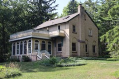 | Pureair Sanatorium | building | 1981 | 81000034 |
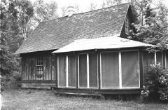 | Sevona Cabin | building | 1976 | 76000051 |
| Shaw Farm | building | 1976 | 76000052 | |
| Shaw Point Historic District | district | 2020 | 100005371 | |
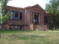 | Washburn Public Library | building | 1984 | 84003621 |
| West Bay Club | building | 2014 | 14000385 |
Every wildfire the federal occurrence database records inside this county: 787 of them, burning about 2,866 acres. 30 started naturally and 42 were recorded as arson. Each settlement page carries the fires within five miles of it.
| Reported cause | Fires |
|---|---|
| Debris and open burning | 275 |
| Missing data/not specified/undetermined | 149 |
| Equipment and vehicle use | 94 |
| Power generation/transmission/distribution | 84 |
| Recreation and ceremony | 53 |
| Arson/incendiarism | 42 |
| Natural | 30 |
| Smoking | 26 |
| Other causes | 19 |
| Misuse of fire by a minor | 10 |
| Fireworks | 3 |
| Railroad operations and maintenance | 1 |
| Firearms and explosives use | 1 |
The five largest, by the area the report gives. One of them was set deliberately.
| Date | Cause | Size | Reported by | Name on the report |
|---|---|---|---|---|
| 29 April 2007 | Power generation/transmission/distribution | 1,167 acres | Chequamegon-Nicolet National Forest | PIONEER |
| 3 May 1999 | Power generation/transmission/distribution | 258 acres | Chequamegon-Nicolet National Forest | SAWDUST LAKE |
| 15 March 2017 | Arson/incendiarism | 80 acres | Wisconsin Department of Natural Resources | SUSIENKA ROAD FIRE |
| 30 July 1992 | Smoking | 70 acres | Chequamegon-Nicolet National Forest | not named |
| 12 April 1998 | Recreation and ceremony | 63 acres | Chequamegon-Nicolet National Forest | MCGINNIS LAKE |
| 20 May 2009 | Power generation/transmission/distribution | 50 acres | Chequamegon-Nicolet National Forest | BIRCHWOOD |
| 12 April 2015 | Power generation/transmission/distribution | 47 acres | Wisconsin Department of Natural Resources | PORT WING FIRE |
| 24 April 2003 | Debris and open burning | 46 acres | Wisconsin Department of Natural Resources | not named |
Every settlement page carries the fires within five miles of it - see the settlement index below.
The NOAA Storm Events Database holds 322 reports for this county, causing 2 deaths, 10 injuries and about $6,474,250 in recorded property damage. Each settlement page carries the reports that name it.
| Kind of event | Reports |
|---|---|
| Thunderstorm Wind | 172 |
| Hail | 108 |
| Flash Flood | 32 |
| Tornado | 5 |
| Flood | 4 |
| Funnel Cloud | 1 |
The most serious of them, by death, then injury, then recorded damage. The accounts are quoted exactly as the forecast office filed them.
| When | Event | Place named | Harm | What the report says |
|---|---|---|---|---|
| July 2016 | Flood | Cable Union Arpt | 1 killed, 1 hurt | An 84-year-old Illinois man died when his car became partially submerged into floodwaters along a ditch along County Highway M, about 3 miles east of Cable. The man and his 84-year-old wife were attempting to turn around after encountering a washed out section of the Highway near the Namekagon River, but accidentally backed up into the flooded ditch. The man drowned, but a firefighter saved the wife. |
| July 1999 | Thunderstorm Wind | Drummond | 1 killed | no account filed |
| July 2006 | Thunderstorm Wind | Bayfield | 2 hurt, $1,500,000 | Downburst winds hit the Bayfield waterfront where an art fair was in progress at Memorial Park. Most of the ninety fair tents were demolished and art pieces were tossed into Lake Superior. A woman broke her hand while a man received a large gash on his hand. Numerous large trees were blown down in Bayfield. The local Catholic church lost a portion of its roof, resulting in damage estimated at $300,000. There was an unverified report of a private weather system clocking the wind at 99 mph before it became inoperable. At the Apostle Island Marina numerous boats lost their canvas coverings. Many boats lost their stanchions after being tipped under the docks by the strong winds. Damage estimates at the marina ranged from $25,000 to $30,000. Trees were reported down all across northern Douglas County. |
| July 1983 | Tornado (F1) | not stated | 2 hurt, $250,000 | no account filed |
| June 1968 | Tornado (F2) | not stated | 2 hurt, $250,000 | no account filed |
| June 2024 | Flash Flood | Herbster | 1 hurt, $50,000 | A 5 foot wide section of State Highway 13 just east of Herbster washed out when the culvert underneath failed. A car drove into the washout and the driver was trapped but only had minor injuries. |
| July 1995 | Thunderstorm Wind | Red Cliff | 1 hurt, $8,000 | A large tree was blown down on to a camper trailer, sending one person to the hospital with serious head injuries. |
| July 2016 | Flash Flood | Grandview | 1 hurt | A sheriff deputy was rescued from Twentymile Creek near Mason, WI after he mistakenly drove his vehicle into a washed-out section of road caused by heavy rainfall across the region. The deputy clung to a tree using an emergency tourniquet to keep from being swept away. It took emergency personnel close to 4 hours to rescue the deputy. The deputy was rushed to the hospital where he was hospitalized for kidney failure and other life-threatening problems associated with clinging to the tree in the flood waters. The deputy has since made a full recovery and returned to duty later that month. |
| June 2018 | Flash Flood | Ino | $2,200,000 | US Highway 2 was washed out at North Fish Creek west of Tomich Road east of Ino. The culvert failed and eroded the road on both sides. |
| July 1999 | Flash Flood | Central Portion | $500,000 | no account filed |
| July 1999 | Flash Flood | North Portion | $500,000 | no account filed |
| June 2006 | Thunderstorm Wind | Bayfield | $400,000 | Major wind damage to docks and a few boats occurred at two marinas. Many docks were destroyed. One 40 foot boat was destroyed. There was also three-quarter inch hail and some downed trees. |
| October 2005 | Flash Flood | Bayfield | $345,000 | no account filed |
| August 1988 | Tornado (F1) | not stated | $250,000 | no account filed |
| June 2024 | Flash Flood | Bayfield | $100,000 | Areas of flooding and washed out roads were reported in the City of Bayfield. |
| April 1984 | Tornado (F0) | not stated | $25,000 | no account filed |
| April 2023 | Flood | Port Wing | $16,000 | Warm temperatures early in April led to rapid snowmelt of a well above normal snowpack across the region. Additionally, heavy rainfall on top of the snowpack led to additional high runoff across the county as well. Roads began to be impacted on the 11th with water overtopping low spots leading to washouts and failed culverts. Temperatures cooled during the middle of the month along with a heavy snow event the 16th into the 17th. This allowed the runoff to slow and water levels to drop. However, water levels rose again later in the month as this new snow melted as well. Numerous road closures were reported across the entire county due to failed culverts, washouts and gravel roads being washed away. Multiple communities in addition to the county issued disaster declarations due to the extent of washed out roads. Damage estimates were not readily available from the county for the most part. High water continued to impact homes, driveways and farm fields into the latter portion of the month. |
| June 2025 | Thunderstorm Wind | Cornucopia Fld Arpt | $10,000 | Hundreds of big oak and maple trees were uprooted and snapped. Observer reports nearly all trees in about a five acre area around their house were destroyed with car and house damage. |
| June 2024 | Flash Flood | Red Cliff | $10,000 | Flooding was reported at the intersection of State Highway 13 and Blueberry Road in Red Cliff. |
| May 2022 | Thunderstorm Wind | Barksdale | $10,000 | A very large spruce tree was split near the base with part landing on a home causing roof damage. |
| June 2014 | Hail | Red Cliff | $10,000 | There was major damage to a camper trailer. |
| July 2010 | Thunderstorm Wind | Iron River | $10,000 | Trees were blown down on a recreational vehicle, trapping a camper at Twin Bear Campground. |
| July 2010 | Hail | Ino | $8,000 | Three vehicles were dented by the hail, and a police car windshield was smashed. High winds accompanied the hail. |
| July 2010 | Thunderstorm Wind | Benoit | $5,000 | A roof was blown off of a barn. |
| July 2010 | Thunderstorm Wind | Ino | $5,000 | Shingles were blown from a roof and siding was damaged on a house. A barn was severely damaged. |
| July 2010 | Thunderstorm Wind | Barnes | $2,500 | Trees were blown down. |
| July 2010 | Hail | Iron River | $2,000 | The hail fell at Scenic Drive Resort. In addition to the hail, strong winds blew down trees along County Highway H. |
| July 2010 | Hail | Mason | $2,000 | A few trees were blown down, in addition to the hail. |
| June 2010 | Thunderstorm Wind | Drummond | $1,500 | Trees were blown down across Tri Lakes Road. |
| July 2016 | Flash Flood | Washburn | $1,000 | There was flash flooding in Washburn with backups from storm drains in town. There were several inches of water on roadways. |
| July 2016 | Flash Flood | Grandview | $1,000 | Highway 61 was washed out due to flash flooding along Twentymile Creek. |
| July 2016 | Flash Flood | Grandview | $1,000 | Highway 61 was washed out due to flash flooding along Eighteenmile Creek. |
| July 2016 | Flash Flood | Ashland Jct | $1,000 | Flash flooding along South Fish Creek flooded the nearby stretch of Highway 137. |
| July 1983 | Tornado (F0) | not stated | $250 | no account filed |
| April 2026 | Thunderstorm Wind | Moquah | - | Numerous trees were down in the vicinity of Fish Creek Hill on Old US 2. Some of the trees were tall pine trees. |
| April 2026 | Thunderstorm Wind | Ashland Jct | - | Many dead branches were down that were approximately 2 inches in diameter. |
| April 2026 | Thunderstorm Wind | Washburn | - | Nevers Road reported impassable with photos of trees completely blocking the road. Several trees were also damaged at corner of Nevers Road and Highway 13. |
| April 2026 | Thunderstorm Wind | Bayfield | - | Numerous reports were received of several tall pine trees uprooted in Washburn including several that blocked Highway 13. |
| March 2025 | Hail | Washburn | - | Hail accumulated to a depth of 1 inch. |
| May 2025 | Thunderstorm Wind | Namekagon | - | Two balsam trees were downed by the storm. |
| May 2025 | Thunderstorm Wind | Namekagon | - | Measured by an anemometer located 90 feet above the ground and above the tree tops. |
| May 2025 | Thunderstorm Wind | Namekagon | - | Measured by an anemometer located 90 feet above the ground and above the tree tops. |
| June 2025 | Thunderstorm Wind | Cornucopia | - | Three large poplar and one partially dead pine tree were snapped part way up the trunk. |
| June 2025 | Thunderstorm Wind | Red Cliff | - | Five to ten medium to large poplar trees were snapped approximately four to eight feet up and were across the road. |
| June 2025 | Thunderstorm Wind | Cornucopia Fld Arpt | - | Wisconsin Mesonet site BYFD Bayfield recorded a 78 mph wind gust. |
| June 2025 | Thunderstorm Wind | Port Wing | - | Port Wing station PNGW3 recorded a gust of 61 mph. |
| June 2025 | Thunderstorm Wind | Washburn | - | A tree fell on a powerline bringing the powerline down and across a road. |
| June 2025 | Thunderstorm Wind | Cornucopia Fld Arpt | - | Several hundreds trees down in the woods and across Echo Valley Road. |
| June 2025 | Thunderstorm Wind | Red Cliff | - | Several hundred trees down with approximately 70 percent uprooted and the rest snapped four to eight feet up, some higher. All were down in approximately the same direction. There was also some damage to trail infrastructure at Beaver Hollow. |
| June 2025 | Thunderstorm Wind | Red Cliff | - | Approximately 20 to 30 trees were snapped near the base and partially across the road. |
| June 2025 | Thunderstorm Wind | Leonards | - | A 12-inch diameter live and healthy oak tree was snapped. |
| June 2025 | Thunderstorm Wind | Port Wing | - | One large birch tree was down partially across Highway 13. |
| June 2025 | Thunderstorm Wind | Port Wing | - | Two medium spruce trees were snapped near their bases. |
| June 2025 | Thunderstorm Wind | Herbster | - | A tree was down at the spotter's location. |
| July 2025 | Thunderstorm Wind | Drummond | - | Multiple trees were down across a roadway. |
| July 2025 | Thunderstorm Wind | Delta | - | Three large trees were down along Scenic Drive. |
| June 2024 | Thunderstorm Wind | Delta | - | Photos were received showing many trees down throughout a campground. The trees all appeared to be large and healthy and were uprooted by the thunderstorm winds. |
| June 2024 | Thunderstorm Wind | Delta | - | Multiple reports were received of downed trees on roadways including County Highway H, Scenic Drive and Yderstad Road along with adjacent driveways between the Village of Delta and the Town of Drummond. |
| June 2024 | Thunderstorm Wind | Iron River | - | A partially dead or sick tree was snapped at the trunk about 10 feet from the base in the town of Iron River. |
| July 2023 | Thunderstorm Wind | Benoit | - | Multiple trees were down, uprooted or snapped at the base. |
The Survey's mineral resources record lists 142 workings inside this county. 9 still produce and 133 are closed or unrecorded. Each settlement page carries the workings within five miles of it.
| Commodity | Workings |
|---|---|
| Sand and Gravel, Construction | 117 |
| Copper | 22 |
| Copper, Nickel | 1 |
| Copper, Silver | 1 |
| Flagstone | 1 |
The least common of them first, because a county's hundredth gravel pit says nothing its first ten did not.
| Where | Site | Commodity | Status | Recorded |
|---|---|---|---|---|
| Bayview Sandstone Quarry | Flagstone | Past Producer | ||
| Unnamed Prosect Near Long Mil | Copper, Nickel | Occurrence | ||
| Unnamed Prospect Near Lake Owen | Copper, Silver | Occurrence | ||
| Bender Prospect | Copper | Occurrence | ||
| Bender Prospect | Copper | Occurrence | ||
| Nd Unnamed Prospect Near Long Mi | Copper | Occurrence | ||
| Nd Unnamed Prospect Near Marengo | Copper | Occurrence | ||
| Rd Unnamed Prosect Near Long Mil | Copper | Occurrence | ||
| Rd Unnamed Prospect Near Marengo | Copper | Occurrence | ||
| Unnamed Prospect Near Lake Osborn | Copper | Occurrence | ||
| Unnamed Prospect Near Lake Osborn | Copper | Occurrence | ||
| Unnamed Prospect Near Lake Owen | Copper | Occurrence | ||
| Unnamed Prospect Near Long Mi | Copper | Occurrence | ||
| Unnamed Prospect Near Long Mile F | Copper | Occurrence | ||
| Unnamed Prospect Near Long Mile F | Copper | Occurrence | ||
| Unnamed Prospect Near Marengo | Copper | Occurrence | ||
| Unnamed Prospect Near Marengo | Copper | Occurrence | ||
| Unnamed Prospect Near Marengo Riv | Copper | Occurrence | ||
| Unnamed Prospect Near Marengo Riv | Copper | Occurrence | ||
| Unnamed Prospect Near Ounce River | Copper | Occurrence | ||
| Unnamed Prospect Near Ounce River | Copper | Occurrence | ||
| Unnamed Prospect Near Totagatic R | Copper | Occurrence | ||
| Unnamed Prospect Near Totagatic R | Copper | Occurrence | ||
| Unnamed Prospect Near Upper Eau C | Copper | Occurrence | ||
| Unnamed Prospect Near Upper Eau C | Copper | Occurrence | ||
| A. T. Guyer Sand and Gravel Pit | Sand and Gravel, Construction | Past Producer | ||
| Alfred J. Schneider Gravel Pit | Sand and Gravel, Construction | Past Producer | ||
| August Voigt Gravel Pit | Sand and Gravel, Construction | Past Producer | ||
| Barbara and Simon Susienka Pit | Sand and Gravel, Construction | Past Producer | ||
| Bayfield County Gravel Deposit #1 | Sand and Gravel, Construction | Occurrence | ||
| Bayfield County Gravel Deposit #2 | Sand and Gravel, Construction | Occurrence | ||
| Bayfield County Gravel Pit #1 | Sand and Gravel, Construction | Past Producer | ||
| Bayfield County Gravel Pit #2 | Sand and Gravel, Construction | Past Producer | ||
| Bayfield County Gravel Pit #3 | Sand and Gravel, Construction | Past Producer | ||
| Bayfield County Sand Deposit #1 | Sand and Gravel, Construction | Occurrence | ||
| Bayfield County Sand Deposit #2 | Sand and Gravel, Construction | Occurrence | ||
| Bayfield County Sand Deposit #3 | Sand and Gravel, Construction | Occurrence | ||
| Bayfield County Sand Deposit #4 | Sand and Gravel, Construction | Occurrence | ||
| Cable Gravel Pit #1 | Sand and Gravel, Construction | Past Producer | ||
| Cable Gravel Pit #2 | Sand and Gravel, Construction | Past Producer | ||
| Charlotte G. Perry Gravel Deposit | Sand and Gravel, Construction | Occurrence | ||
| Chequamegon Bay Sand Deposit | Sand and Gravel, Construction | Occurrence | ||
| Crescent Springs Gravel Pit | Sand and Gravel, Construction | Past Producer | ||
| Crest View Gravel Pit | Sand and Gravel, Construction | Past Producer | ||
| Crooked Lake Pit | Sand and Gravel, Construction | Unknown | ||
| Dan Maxcy Gravel Deposit | Sand and Gravel, Construction | Past Producer | ||
| Darrell Krouse Gravel Deposit | Sand and Gravel, Construction | Occurrence | ||
| Deep Lake Gravel Pit | Sand and Gravel, Construction | Past Producer | ||
| Drummond Gravel Deposit #1 | Sand and Gravel, Construction | Occurrence | ||
| Drummond Gravel Pit #2 | Sand and Gravel, Construction | Past Producer | ||
| Dudley Wallin Gravel Deposit | Sand and Gravel, Construction | Occurrence | ||
| Ellen W. Miller Gravel Deposit | Sand and Gravel, Construction | Occurrence | ||
| Elmer E. Gruel Gravel Pit | Sand and Gravel, Construction | Past Producer | ||
| F. L. Wolfe Gravel Pit | Sand and Gravel, Construction | Past Producer | ||
| Florence Dempsey Gravel Pit | Sand and Gravel, Construction | Past Producer | ||
| Fourmile Creek Gravel Pit | Sand and Gravel, Construction | Past Producer | ||
| Frank Yachinich Gravel Pit | Sand and Gravel, Construction | Past Producer | ||
| Fred Peterson Gravel Pit | Sand and Gravel, Construction | Past Producer | ||
| Gilbert A. Larson Gravel Pit | Sand and Gravel, Construction | Occurrence | ||
| Gilbert F. Rasmussen Gravel Pit #1 | Sand and Gravel, Construction | Occurrence | ||
| Gilbert F. Rasmussen Gravel Pit #2 | Sand and Gravel, Construction | Occurrence | ||
| Grandview Gravel Deposit | Sand and Gravel, Construction | Occurrence | ||
| Grandview Gravel Deposit | Sand and Gravel, Construction | Occurrence | ||
| Grandview Sand Deposit #1 | Sand and Gravel, Construction | Occurrence | ||
| Grandview Sand Deposit #2 | Sand and Gravel, Construction | Occurrence | ||
| Grandview Township Gravel Pit | Sand and Gravel, Construction | Past Producer | ||
| H. J. Ehlers Gravel Deposit | Sand and Gravel, Construction | Occurrence | ||
| Hammil Lake Gravel Pit | Sand and Gravel, Construction | Past Producer | ||
| Harlor M. Smith Sand Pit | Sand and Gravel, Construction | Past Producer | ||
| Harlow Detle Gravel Pit | Sand and Gravel, Construction | Past Producer | ||
| Hazel Hills Pit No. 1 | Sand and Gravel, Construction | Producer | ||
| Henry Maschivitz Gravel Deposit | Sand and Gravel, Construction | Occurrence | ||
| Hitesman Pit | Sand and Gravel, Construction | Past Producer | ||
| Holly Lake Gravel Pit | Sand and Gravel, Construction | Past Producer | ||
| Iron River Gravel | Sand and Gravel, Construction | Producer | ||
| Iron River Pit | Sand and Gravel, Construction | Producer | ||
| Irving Svendson Gravel Deposit | Sand and Gravel, Construction | Occurrence | ||
| Island Lake Gravel Deposit | Sand and Gravel, Construction | Occurrence | ||
| J. M. Black Gravel Pit | Sand and Gravel, Construction | Past Producer | ||
| John A Anderson Gravel Deposit | Sand and Gravel, Construction | Occurrence | ||
| John D. Hare Gravel Pit | Sand and Gravel, Construction | Past Producer | ||
| John D. Miskulin Jr. Gravel Pit | Sand and Gravel, Construction | Past Producer | ||
| John L. Hegstrom Gravel Pit | Sand and Gravel, Construction | Past Producer | ||
| John Lunda Gravel Pit | Sand and Gravel, Construction | Past Producer | ||
| Joseph Galik Sand Deposit | Sand and Gravel, Construction | Occurrence | ||
| Joseph J. Mihalk Gravel Deposit | Sand and Gravel, Construction | Occurrence | ||
| K. D. Bark Gravel Deposit | Sand and Gravel, Construction | Occurrence | ||
| L. Olson Pit | Sand and Gravel, Construction | Producer | ||
| Lake Horseshoe Gravel Deposit | Sand and Gravel, Construction | Occurrence | ||
| Lake Owen Gravel Pit #1 | Sand and Gravel, Construction | Past Producer | ||
| Lake Owen Gravel Pit #2 | Sand and Gravel, Construction | Past Producer | ||
| Leo Spanjer's Pit | Sand and Gravel, Construction | Producer | ||
| Lillian Ottman Sand Pit | Sand and Gravel, Construction | Past Producer | ||
| Lind Pit | Sand and Gravel, Construction | Producer | ||
| M. Reed and E. Case Gravel Pit | Sand and Gravel, Construction | Past Producer | ||
| Mason Township Gravel Pit | Sand and Gravel, Construction | Past Producer | ||
| Mildred Westbeg Gravel Deposit | Sand and Gravel, Construction | Occurrence | ||
| Mill Pond Lake Sand Pit #1 | Sand and Gravel, Construction | Past Producer | ||
| Mill Pond Lake Sand Pit #2 | Sand and Gravel, Construction | Past Producer | ||
| Moquah Grael Pit #2 | Sand and Gravel, Construction | Past Producer | ||
| Moquah Gravel Pit #1 | Sand and Gravel, Construction | Past Producer | ||
| Motyka Lake Gravel Pit | Sand and Gravel, Construction | Past Producer | ||
| Nekoosa Edwards Sand Deposit | Sand and Gravel, Construction | Occurrence | ||
| Nekoosa Edwards Sand Pit | Sand and Gravel, Construction | Past Producer | ||
| Nels Olson Sand Pit | Sand and Gravel, Construction | Past Producer | ||
| P. Radloff Gravel Deposit | Sand and Gravel, Construction | Occurrence | ||
| Pat E. Mason Gravel Pit | Sand and Gravel, Construction | Past Producer | ||
| Paul Schnabel Sand Deposit | Sand and Gravel, Construction | Occurrence | ||
| Peter Heclmovich Gravel Pit | Sand and Gravel, Construction | Past Producer | ||
| Peterson Lake Gravel Pit | Sand and Gravel, Construction | Past Producer | ||
| Pot Lake Gravel Deposit | Sand and Gravel, Construction | Occurrence | ||
| Price Lake Gravel Deposit | Sand and Gravel, Construction | Occurrence | ||
| Red Cliff Gravel Deposit | Sand and Gravel, Construction | Occurrence | ||
| Richard E. Smith Sand Pit | Sand and Gravel, Construction | Past Producer | ||
| Roberta Anderson Gravel Deposit | Sand and Gravel, Construction | Occurrence | ||
| Roy S. Smith Gravel Pit | Sand and Gravel, Construction | Occurrence | ||
| Russell Madson Gravel Pit | Sand and Gravel, Construction | Past Producer | ||
| Sam Johnson Gravel Pit | Sand and Gravel, Construction | Past Producer | ||
| Sand River Gravel Pit #1 | Sand and Gravel, Construction | Occurrence | ||
| Sand River Gravel Pit #2 | Sand and Gravel, Construction | Past Producer | ||
| Spider Lake Gravel Deposit | Sand and Gravel, Construction | Occurrence | ||
| Svend Rasmussen Gravel Pit | Sand and Gravel, Construction | Past Producer | ||
| Thomas Fischer Sand Deposit | Sand and Gravel, Construction | Occurrence | ||
| Thomas G. Kliszcz Gravel Pit | Sand and Gravel, Construction | Past Producer | ||
| Thomas J. Swenson Gravel Deposit | Sand and Gravel, Construction | Occurrence | ||
| Town of Bayview Gravel Pit | Sand and Gravel, Construction | Past Producer | ||
| U.S. Forest Service Gravel Pit #1 | Sand and Gravel, Construction | Occurrence | ||
| U.S. Forest Service Gravel Pit #2 | Sand and Gravel, Construction | Occurrence | ||
| U.S. Forest Service Gravel Pit #3 | Sand and Gravel, Construction | Occurrence | ||
| U.S. Forest Service Gravel Pit #4 | Sand and Gravel, Construction | Past Producer | ||
| U.S. Forest Service Gravel Pit #5 | Sand and Gravel, Construction | Past Producer | ||
| U.S. Forest Service Gravel Pit #6 | Sand and Gravel, Construction | Occurrence | ||
| U.S. Forest Service Gravel Pit #7 | Sand and Gravel, Construction | Occurrence | ||
| U.S. Forest Service Gravel Pit #8 | Sand and Gravel, Construction | Occurrence | ||
| W. F. Defoe Gravel Pit | Sand and Gravel, Construction | Past Producer | ||
| W. and K. H. Sponsel Gravel Pit | Sand and Gravel, Construction | Occurrence | ||
| Wald Pit | Sand and Gravel, Construction | Producer | ||
| Walter Wald Gravel Deposit #1 | Sand and Gravel, Construction | Occurrence | ||
| Walter Wald Gravel Pit #2 | Sand and Gravel, Construction | Past Producer | ||
| Walter Wald Pit | Sand and Gravel, Construction | Producer | ||
| Wayne Vernon Gravel Pit | Sand and Gravel, Construction | Past Producer | ||
| Wissota Sand & Gravel Co. Pit | Sand and Gravel, Construction | Producer |
Named settlements recorded in the Geographic Names Information System, each with the topographic sheets covering it. Villages, hamlets and abandoned places alike. Each is shown with the nearest named watercourse or landform and the survey quadrangle it falls on.
Eileen town · 54806 · On North Fish Creek · Ashland West quadrangle
13 sheets, 1942 to 1989
Drummond town · 54832 · Drummond quadrangle
13 sheets, 1944 to 2005
No longer a settlement
Namakagon town · 54821 · On Castle Creek · Namekagon Lake quadrangle
12 sheets, 1943 to 2005
The vanished settlements of Bayfield County: the places named above that are no longer on the map.