 Block
From the record
One of 300 National Register listings published here for Milwaukee County · listed in 2021 · category: Building.
Sources: the National Register database, National Park Service
Listed on the National Register of Historic Places in 2021.
One of 300 National Register listings published here for Milwaukee County · listed in 2021 · category: Building.
Sources: the National Register database, National Park Service
Regional context, not property-specific evidence. The federal wildfire occurrence database lists 26 fires within 5 miles of Milwaukee Journal Complex between 2018 and 2020, burning about 14 acres in total. None started naturally. None was recorded as arson. Distance is straight-line from the map coordinates, so a fire counted here may appear on a neighbouring settlement's page as well.
| Reported cause | Fires |
|---|---|
| Missing data/not specified/undetermined | 19 |
| Debris and open burning | 3 |
| Smoking | 1 |
| Equipment and vehicle use | 1 |
| Recreation and ceremony | 1 |
| Misuse of fire by a minor | 1 |
The most recent of them, most recent first, with the day each was reported and the service that recorded it.
| Date | Cause | Size | Reported by | Name on the report |
|---|---|---|---|---|
| 6 September 2020 | Missing data/not specified/undetermined | under an acre | Wisconsin Department of Natural Resources | 1778249 |
| 7 August 2020 | Missing data/not specified/undetermined | under an acre | Wisconsin Department of Natural Resources | 1767699 |
| 12 August 2018 | Missing data/not specified/undetermined | 1.0 acres | Wisconsin Department of Natural Resources | 1806123 |
| 11 August 2018 | Debris and open burning | 1.0 acres | Wisconsin Department of Natural Resources | 1806070 |
| 1 August 2018 | Debris and open burning | 1.0 acres | Wisconsin Department of Natural Resources | 1803975 |
| 30 July 2020 | Missing data/not specified/undetermined | 1.0 acres | Wisconsin Department of Natural Resources | 2005439 |
| 24 July 2020 | Missing data/not specified/undetermined | 1.0 acres | Wisconsin Department of Natural Resources | 1762641 |
| 19 July 2018 | Missing data/not specified/undetermined | under an acre | Wisconsin Department of Natural Resources | 1805394 |
Regional context, not property-specific evidence. The federal mineral resources record lists 3 workings within 5 miles of Milwaukee Journal Complex: 1 unknown, 1 plant, 1 past producer. 1 still produces. What was taken out: Stone, Iron, REE, Thorium. Distance is straight-line from the map coordinates, so a quarry counted here may appear on a neighbouring settlement's page as well.
| Where | Site | Commodity | Status | Recorded |
|---|---|---|---|---|
| Cerac Inc. | REE, Thorium | Past Producer | ||
| Dcs Mill | Iron | Plant | ||
| Own Crews | Stone | Unknown |
Regional context, not property-specific evidence. The National Weather Service names Milwaukee, the town this property stands in, in 77 storm reports between 1993 and 2026: 33 thunderstorm wind, 20 hail, 9 flood, 8 lightning. The reports record 6 injuries. Each account below is quoted exactly as the forecast office filed it, from the NOAA Storm Events Database, and each date opens the federal record of that event.
| When | Event | Place named | Harm | What the report says |
|---|---|---|---|---|
| February 1999 | Thunderstorm Wind | Milwaukee | 3 hurt, $25,000 | no account filed |
| July 2010 | Lightning | West Milwaukee | 2 hurt | Two sisters, 25 years old and 30 years old, attempting to run home from a nearby sandwich shop, were injured when struck by lightning. They were taken to a nearby hospital and admitted for treatment of their injuries. |
| July 1998 | Thunderstorm Wind | Milwaukee | 1 hurt, $1,000 | no account filed |
| July 1997 | Lightning | Milwaukee | $1,000,000 | Lightning caused a massive fire at a towing business on the south side of Milwaukee. The building and its contents were a total loss. |
| June 1999 | Thunderstorm Wind | Milwaukee | $200,000 | no account filed |
| June 1999 | Flash Flood | Milwaukee | $75,000 | no account filed |
| August 2016 | Flash Flood | West Milwaukee | $50,000 | Two to three inches or rain in approximately 1 hour resulted in the flooding of creeks and streets. Several cars were stalled or stranded, especially on Layton Avenue just west of Howell Avenue. A car drove into a drainage ditch when the driver could not tell where the parking lot ended and a drainage ditch began. Knee deep water was reported on the streets. Some basements flooded, and manhole covers were reported blown off by the overflowing storm sewers. |
| July 2006 | Thunderstorm Wind | Milwaukee | $50,000 | Powerful wind gusts to an estimated 61 knots (70 mph) took the roof of a lumberyard off, which took down nearby power-lines. Around 45 customers were without power for a time as a result. Large trees and powerlines were toppled. |
| July 2006 | Flash Flood | Milwaukee | $50,000 | Two lanes on westbound and eastbound I-94 were closed due to flash flooding near the Marquette Interchange. Some water damaged occurred to construction equipment, and there was some soil erosion. |
| September 2005 | Flash Flood | Milwaukee | $50,000 | Widespread flooding across most of Milwaukee County. Several feet of water was reported on Interstate 43 at North Avenue, causing it to close for several hours. Three cars were stranded as water rose very rapidly. One to three feet of water was also reported on roadways at the UW-Milwaukee campus. On the UW-Milwaukee campus, over 4 inches of rain fell during the evening. Some basements were flooded in low lying areas, resulting in damage to contents. |
| August 1993 | Thunderstorm Wind | Milwaukee | $50,000 | Over extreme southeast Wisconsin isolated severe thunderstorms knocked down trees and power lines and produced a funnel cloud and three waterspouts. |
| May 2000 | Thunderstorm Wind | Milwaukee | $50,000 | no account filed |
| April 2026 | Thunderstorm Wind | West Milwaukee | $30,000 | A large tree down on cars at the intersection of 20th St. and West Greenfield Ave. |
| September 2000 | Lightning | Milwaukee | $30,000 | no account filed |
| July 1999 | Thunderstorm Wind | Milwaukee | $30,000 | no account filed |
| May 1999 | Flash Flood | Milwaukee | $25,000 | no account filed |
| June 1997 | Lightning | South Milwaukee | $20,400 | Lightning struck an antenna and traveled into garage, setting fire to two cars, a truck camper, motorcycle and other things in the garage. |
| June 2006 | Thunderstorm Wind | Milwaukee | $20,000 | Trees and power lines down on West Tower Rd. |
| June 2006 | Thunderstorm Wind | Milwaukee | $20,000 | Trees and power lines down on 25th and Wells. |
| June 2006 | Thunderstorm Wind | Milwaukee | $20,000 | Trees and power lines down on Wright and Holton. |
| June 2006 | Thunderstorm Wind | Milwaukee | $20,000 | Trees and power lines down on 76th street. |
| June 2005 | Hail | South Milwaukee | $20,000 | Hail dented cars and siding, and broke a patio glass table top along with a window. |
| August 2005 | Thunderstorm Wind | Milwaukee | $20,000 | no account filed |
| August 1998 | Flood | Milwaukee | $20,000 | no account filed |
| July 2006 | Lightning | Milwaukee | $15,000 | Lightning struck a home in the 1800 block of W. Greenfield Ave., resulting in a roof fire. |
| June 2022 | Thunderstorm Wind | South Milwaukee | $12,000 | Numerous trees and tree limbs down at Grant Park. |
| August 1996 | Thunderstorm Wind | North Milwaukee | $11,000 | no account filed |
| June 2022 | Thunderstorm Wind | South Milwaukee | $10,000 | Numerous trees and branches down. |
| June 2006 | Thunderstorm Wind | Milwaukee | $10,000 | Trees and power lines down on N. 13th St. |
| September 2022 | Thunderstorm Wind | West Milwaukee | $7,000 | Downed tree on top of a car. |
| May 2000 | Lightning | Milwaukee | $5,000 | no account filed |
| May 1999 | Lightning | Milwaukee | $4,000 | no account filed |
| May 1999 | Lightning | Milwaukee | $4,000 | no account filed |
| May 2024 | Flood | West Milwaukee | $3,000 | A car lost control and hit the median wall after driving through deep, ponded water during heavy rain in the left lane of southbound Interstate 94/43 on the high rise bridge. The lane was briefly closed while Milwaukee Public Works addressed the high water issue. |
| September 2000 | Thunderstorm Wind | Milwaukee | $2,000 | no account filed |
| June 2016 | Thunderstorm Wind | South Milwaukee | $1,000 | A rotted 2-3 foot diameter tree snapped at its base. |
| May 2000 | Thunderstorm Wind | Milwaukee | $1,000 | no account filed |
| February 1999 | Flood | Milwaukee | $1,000 | no account filed |
| July 1997 | Thunderstorm Wind | Milwaukee | $1,000 | no account filed |
| July 1997 | Thunderstorm Wind | Milwaukee | $800 | no account filed |
| June 2015 | Thunderstorm Wind | North Milwaukee | $500 | Two large tree branches down. |
| May 2024 | Hail | South Milwaukee | - | Photo provided on Facebook. |
| May 2024 | Hail | South Milwaukee | - | Photo provided on Facebook. |
| April 2006 | Hail | Milwaukee | - | Reported at 27th and Oklahoma. |
| April 2006 | Funnel Cloud | South Milwaukee | - | A trained spotter reported a cold air funnel cloud at the intersection of Highway 32 and Drexel. |
| April 2006 | Hail | Milwaukee | - | Report provided by WISN TV 12 studios. |
| June 2006 | Thunderstorm Wind | Milwaukee | - | Trees down. |
| July 2006 | Hail | Milwaukee | - | Some small tree branches down due to hail. |
| March 2005 | Hail | Milwaukee | - | Located on the UW-Milwaukee campus. |
| September 2005 | Thunderstorm Wind | Milwaukee | - | Measured by the Fox TV-6 school network site at UW-Milwaukee. Large tree branches down. |
| July 1994 | Thunderstorm Wind | Milwaukee | - | A line of severe thunderstorms accompanied by hail up to one inch in diameter and winds to 60 mph knocked down many trees and power lines and caused minor property damage across southern Wisconsin. Several funnel clouds were also observed. |
| May 2024 | Hail | South Milwaukee | - | no account filed |
| May 2024 | Hail | South Milwaukee | - | no account filed |
| April 2016 | Hail | West Milwaukee | - | no account filed |
| August 2015 | Hail | South Milwaukee | - | no account filed |
| November 2013 | Hail | South Milwaukee | - | no account filed |
| July 2006 | Hail | Milwaukee | - | no account filed |
| August 2006 | Hail | Milwaukee | - | no account filed |
| June 2005 | Thunderstorm Wind | Milwaukee | - | no account filed |
| June 2005 | Thunderstorm Wind | Milwaukee | - | no account filed |
No historic map-sheet match is published for this property yet. That does not mean no map exists. This record needs a coordinate-quality review before it can be joined to a sheet boundary. Browse the county's mapped places while that work is pending.
Other National Register properties close enough to walk or drive between, ordered by distance from this one. Both positions come from the same geocoding pass that matched these properties to their map sheets.
| Photograph | Property | Distance | Listed |
|---|---|---|---|
 | Milwaukee County Historical Center | under 500 feet | 1973 |
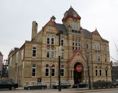 | Turner Hall | under 500 feet | 1977 |
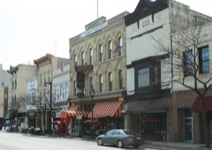 | Old World Third Street Historic District | under 500 feet | 1987 |
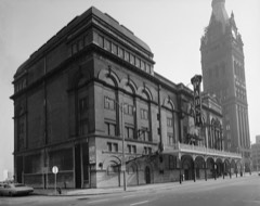 | Pabst Theater | 0.1 miles | 1972 |
 | Century Building | 0.2 miles | 2017 |
 | Plankinton-Wells-Water Street Historic District | 0.2 miles | 1986 |
| National Archives record | The nomination case file for reference 100006270 in Record Group 79. |
| Milwaukee County | All 300 listed properties in this county. |