Block
From the record
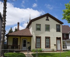
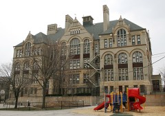
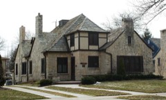
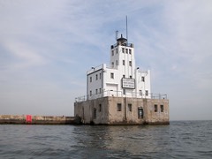
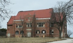
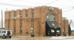
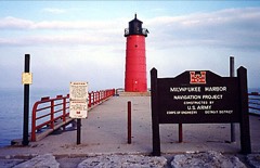
300 National Register listings published here, 11 of them National Historic Landmarks.
Sources: the county history on the Internet Archive · the National Register database, National Park Service
88 topographic sheets cover 24 settlements here, and 300 properties are on the National Register of Historic Places.
300 National Register listings published here, 11 of them National Historic Landmarks.
Sources: the county history on the Internet Archive · the National Register database, National Park Service
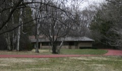
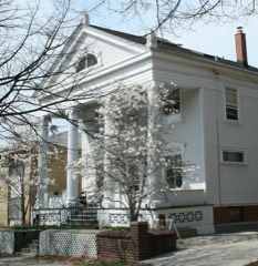
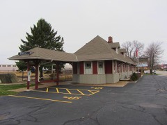
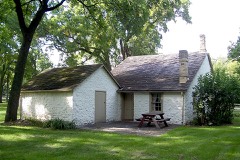
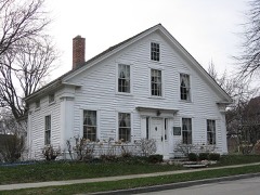
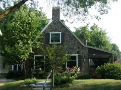
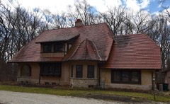
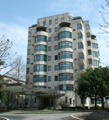
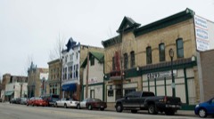
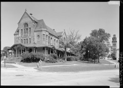
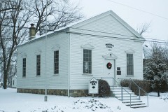
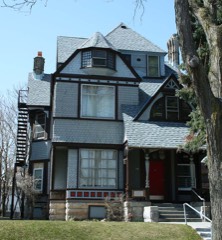
Every property in this county listed on the National Register of Historic Places, with the year it was listed and the federal nomination document.
Every wildfire the federal occurrence database records inside this county: 94 of them, burning about 60 acres. 2 started naturally and 6 were recorded as arson. Each settlement page carries the fires within five miles of it.
| Reported cause | Fires |
|---|---|
| Missing data/not specified/undetermined | 57 |
| Debris and open burning | 12 |
| Arson/incendiarism | 6 |
| Smoking | 5 |
| Misuse of fire by a minor | 5 |
| Equipment and vehicle use | 3 |
| Power generation/transmission/distribution | 2 |
| Natural | 2 |
| Recreation and ceremony | 2 |
The five largest, by the area the report gives. Two of them were set deliberately.
| Date | Cause | Size | Reported by | Name on the report |
|---|---|---|---|---|
| 25 March 2019 | Arson/incendiarism | 11 acres | Wisconsin Department of Natural Resources | HAVENWOODS |
| 24 April 2014 | Missing data/not specified/undetermined | 3.5 acres | Wisconsin Department of Natural Resources | HAVENWOODS |
| 9 July 2018 | Missing data/not specified/undetermined | 1.0 acres | Wisconsin Department of Natural Resources | 2317 |
| 11 January 2020 | Power generation/transmission/distribution | 1.0 acres | Wisconsin Department of Natural Resources | 130 |
| 16 November 2018 | Debris and open burning | 1.0 acres | Wisconsin Department of Natural Resources | 3549 |
| 27 May 2018 | Debris and open burning | 1.0 acres | Wisconsin Department of Natural Resources | 1391 |
| 27 April 2018 | Missing data/not specified/undetermined | 1.0 acres | Wisconsin Department of Natural Resources | 1127 |
| 5 November 2018 | Arson/incendiarism | 1.0 acres | Wisconsin Department of Natural Resources | 3802 |
Every settlement page carries the fires within five miles of it - see the settlement index below.
The NOAA Storm Events Database holds 599 reports for this county, causing 5 deaths, 187 injuries and about $334,160,600 in recorded property damage. Each settlement page carries the reports that name it.
| Kind of event | Reports |
|---|---|
| Thunderstorm Wind | 250 |
| Hail | 212 |
| Flash Flood | 39 |
| Flood | 31 |
| Lightning | 29 |
| Tornado | 19 |
| Heavy Rain | 16 |
| Funnel Cloud | 2 |
| Strong Wind | 1 |
The most serious of them, by death, then injury, then recorded damage. The accounts are quoted exactly as the forecast office filed them.
| When | Event | Place named | Harm | What the report says |
|---|---|---|---|---|
| June 2022 | Flood | West Allis | 3 killed | A 10 year old boy fell into rapidly rising waters of a concrete drainage ditch after a thunderstorm with heavy rainfall. His father and neighbor jumped in to help, but all three were swept away and drowned. The boy was found downstream the next day in the Kinnickinnic River. The other two men were found June 16th in the same river. |
| August 2025 | Flash Flood | Carrollville | 1 killed, $60,000,000 | Widespread and numerous reports of flash flooding in streets, in addition to rivers, creeks, and streams across the southern two thirds of Milwaukee County. 1800 homes were classified as major damage or destroyed due to flash flooding of the Lincoln and Honey Creeks. Many instances of flooded basements across the impacted area. Six foundations collapsed into basements of homes in the 60th street neighborhood near Lincoln Creek, with two homes being condemned. Additional basement collapse reported in West Allis near Honey Creek. Many vehicles stranded in flood waters, with multiple water rescues conducted by the Milwaukee Fire Department. Water reached the bottom of car doors at Wisconsin State Fair Park. Reports of water inside vehicles along Delaware Avenue in Bay View. Multiple runway and taxiway closures reported at Mitchell International Airport and Timmerman Field from flooding. Impacts contribute to an estimated $65,813,855 in public and individual infrastructure damages countywide. Brief (30-45 minute total duration) rises into moderate flood stage along the Kinnickinnic River at Milwaukee and Oak Creek in South Milwaukee between 12:30 & 2:30 AM local time on August 10. At 10 feet, water impacts the yards of homes along Oak Creek in South Milwaukee. At 16 feet, flood water is approximately 1 foot over the top of the concrete-lined channel of the Kinnickinnic River at Milwaukee, affecting homes in the residential neighborhood next to the river. Homeless camp swept away as a result of rapid rises along the Kinnickinnic River, leaving some dead and missing. |
| July 2010 | Flash Flood | Granville | 1 killed, $24,100,000 | Thunderstorms training over the region produced flooding rains over all of Milwaukee County...causing massive flooding, shutting down streets and the freeway system at rush hour with up to 4 feet of rushing water.||There was one fatality - the body of a 19-year-old male was found in Lincoln Creek near N. 32nd St. and W. Hampton Ave. in Milwaukee. He was swept from his vehicle when Lincoln Creek flooded. ||County Executive Scott Walker issued a Declaration of a Major Disaster for Milwaukee County since more than 7 inches of rain fell around the county, and an estimated $24.1 million in damage in the private sector, and nearly $11.6 million in public sector costs, which includes protective measures and clean-up costs. ||The private sector damage costs include: $22,396,790 dollars to residential buildings and $1,686,752 dollars to businesses. The public sector costs include: $2,003,010 dollars of damage to public buildings and equipment; $2,385,760 dollars of damage to public utility systems; $2,774,400 dollars or damage to road systems; $310,000 dollars of damage to water control facilities and another $1,326,100 dollars in damage to other public property for a total of $8,799,270. In addition, another $1,946,100 dollars were spent in debris clearance and $894,988 dollars were spent for overtime. These costs are not directly related to the flood damage.||The Milwaukee Fire Department logged 50 rescues from homes and streets. ||The Milwaukee Metropolitan Sewerage District (MMSD) reported that the storm resulted in a combined sewer overflow of around 2 billion gallons. All Lake Michigan beaches in Milwaukee were closed through the following weekend of July 24th and 25th due to sewer contamination. The City of Milwaukee received at least 2000 calls for sewer backups into basements of homes. It appeared that the northern half of the city of Milwaukee was hardest hit. ||The flooding rains created a massive sink hole 20 feet deep and some 20 to 40 feet wide at the intersection of Oakland and North in the city of Milwaukee around 830 pm. It swallowed a Sport Utility Vehicle and a street light. The driver of the SUV was injured and treated at a hospital. Electrical power cables and other cable lines were damaged by the sink hole. ||Milwaukee Mitchell International Airport was closed late Thursday night (July 22nd) through 2 pm Friday (July 23rd) due to flooded runways. One runway was opened at 2 pm Friday, however there were additional delays. ||In Milwaukee County, over 4,400 homes reported water-filled basements in the city of Milwaukee alone.||11,764 homes received some sort of impact from the flooding, with 6 homes destroyed; 57 homes receiving major damage; 1,859 home receiving minor damage; and an additional 9,842 homes minimally affected by the flood waters. Sixty-eight businesses were affected, with 9 having major damage and 59 having minor damage.||The north side of the city received the heaviest downpours with 7 to 8 inches of rain falling in 2 to 3 hours. WTMJ-TV4 on Milwaukee's northeast side measured 6.73 inches of rain in 1 hour, between 5:15 pm and 6:15 pm. The twenty-four hour rainfall (midnight to midnight July 22nd) was 8.31 inches. They also received another inch of rain after midnight on July 23rd, so the two-day total was 9.31 inches. ||The Milwaukee Fire Department logged 50 rescues from homes and streets.||Nicolet High School in the north suburban community of Glendale had a completely flooded basement and 16 of water on the main floor.||Hourly rainfall amounts of 2 to 4 inches were reported, and WTMJ TV-4 on Milwaukee's northeast side measured 7 inches of rain in about 2.5 hours ending at 745 pm Thursday evening. The one-hour rainfall was 6.73 inches between 5:15 PM and 6:15 PM CDT in the late afternoon/evening. The twenty-four hour rainfall (midnight to midnight July 22nd) was 8.31 inches, with another inch after midnight on July 23rd, so the two day total was 9.31 inches. ||Mitchell Field recorded 5.61 inches for the day, breaking a record for the date. The previous record was 1.26 set in 1948. This also is the second highest daily rainfall total on record for Milwaukee. The greatest one-day precipitation record was the 6.81 inches which fell on August 6, 1986. |
| August 1969 | Tornado (F1) | not stated | 153 hurt, $250,000 | no account filed |
| March 2000 | Tornado (F1) | Milwaukee Mtchell Ar | 16 hurt, $4,570,000 | Narrative can be found below in summary of March 8, 2000. |
| August 1958 | Tornado (F2) | not stated | 4 hurt, $25,000 | no account filed |
| September 1959 | Tornado (F2) | not stated | 3 hurt, $250,000 | no account filed |
| February 1999 | Thunderstorm Wind | Milwaukee | 3 hurt, $25,000 | no account filed |
| June 1997 | Thunderstorm Wind | West Allis | 2 hurt, $5,000 | no account filed |
| July 2010 | Lightning | West Milwaukee | 2 hurt | Two sisters, 25 years old and 30 years old, attempting to run home from a nearby sandwich shop, were injured when struck by lightning. They were taken to a nearby hospital and admitted for treatment of their injuries. |
| August 1998 | Flash Flood | Wauwatosa | 1 hurt, $22,140,000 | no account filed |
| August 2001 | Thunderstorm Wind | West Allis | 1 hurt, $75,000 | no account filed |
| July 1998 | Thunderstorm Wind | Milwaukee | 1 hurt, $1,000 | no account filed |
| August 2009 | Thunderstorm Wind | State Fair Park | 1 hurt | Wind gusts to around an estimated 39 knots (45 mph) affected the Wisconsin State Fair Park grounds in West Allis. One gust blew over scaffolding that holds up a banner over a ticket booth welcoming people to the fair. The toppled scaffolding injured a women who was treated at a hospital. Milwaukee Mitchell Field had a measured wind gust of 38 knots (43 mph). |
| June 1997 | Flash Flood | Fox Pt | $78,700,000 | no account filed |
| June 2008 | Flash Flood | Brown Deer | $77,970,000 | Heavy rains resulted in flash flooding across much of Milwaukee County. Water depths on some roads reached 3 to 4 feet and many cars stalled. Water entered many homes and businesses. Two other flash flood event occurred in Milwaukee County on June 7th. Collectively, these 3 flash floods resulted in home and business damage along with some crop losses. It was nearly impossible to break down the damages by flash flood event. Therefore, the collective breakdown for the 3 flash flood events is provided in the June 8th StormData entry for Milwaukee County.||The collective breakdown for residential home losses were: 3957 minimally affected, 2583 with minor damage, and 1135 with major damage (total of $32/301 million for home losses). The total business losses were $5.855 million. Crop losses were $15.5 thousand. Public sector damage was about $40.814 million. Several roads and bridges that sustained damage. On June 7th, 4.93 inches of rain fell at Milwaukee Mitchell Field, breaking the old record rainfall for the date which was 2.44 inches (June 7, 1916). On June 8th, 2.25 inches of rain broke the old record rainfall for the date which was 1.24 inches (June 8, 1974). Combined, these two days of rainfall broke the 48-hour all-time rainfall record at Milwaukee. The previous record was 6.84 inches, which was recorded on August 5-6, 1986. On June 7-8, 2008, Milwaukee observed 7.18 inches of rain. |
| May 1998 | Thunderstorm Wind | Countywide | $19,200,000 | no account filed |
| June 2009 | Flash Flood | West Allis | $13,130,000 | Heavy rains resulted in flash flooding ini parts of Milwaukee County, especially in the West Allis to Wauwatosa area east to the Downtown Milwaukee area. Many roads were covered with water to a depth of 1 to 3 feet. Basement flooding was reported. Milwaukee Mitchell Field measured 3.65 inches of rain in the 24-hour period ending 2000 CST. WSR-88D Doppler radar rainfall estimates were in the 3 to 5 inch range over parts of Milwaukee County. The City of Milwaukee sewer system was overwhelmed. High water levels on the Menomonee River jsut east of Miller Park resulted in part of an earthen berm being washed away. The subsequent flood water moved west to Miller Park and extensively flooded the lower service area, clubhouses, and part of the dugouts and warehouse. The playing field wasn't affected. Milwaukee Brewer executives said damage was in the millions, but they would not specify an amount. Therfore, for the purpose of this StormData documentation, a value of $5 Million was assiged.||A Uniform Disaster Situation Report generated by the Milwaukee County Emergency Management indicated that at least 1227 homes sustained minor flood damage, and at least 2 homes had major damage, for a monetary loss of about $7,079,000. Also, at least 12 businesses sustained minor flood damage and 1 had major damage for a business loss estimate of $215,000. The total estimated private sector damage in this report was $7,294,000. Additionally, damage in the public sector amounted to about $40,000 to road systems, about $25,000 to water control facilities, about $269,000 to public buildings & related equipment, and about $5,000 to public utility systems. The total public sector damage estimate is about $339,000. Other costs in the report included about $24,000 in debris clearance, about $21,385 for protective measures, and about $107,718 in miscellaneous expenses. However, the last three values are not considered direct property damage. Flood damage to Miller Park is not included in the Uniform report. |
| July 2000 | Flash Flood | South Portion | $6,820,000 | no account filed |
| August 2025 | Flash Flood | West Granville | $5,800,000 | Continuation of widespread flash flooding impacts occurring countywide. Delayed flash flooding onset across far northern portions of Milwaukee County, where heavy rain arrived later in the overnight hours of August 9-10, 2025. Additional numerous reports of flash flooding near rivers, creeks, and streams. Numerous reports of water in basements across the impacted area. Portion of 47th street between Churchill Ln & Willow Rd completely washed away from flooding of an unnamed creek in Brown Deer. Flooding impacts contribute to an estimated $65,813,855 in public and individual infrastructure damage across Milwaukee County. |
| August 2002 | Thunderstorm Wind | Timmerman Arpt | $5,100,000 | no account filed |
| April 2006 | Hail | Brown Deer | $1,990,000 | no account filed |
| April 2006 | Hail | Glendale | $1,990,000 | no account filed |
| April 2006 | Hail | West Allis | $1,990,000 | no account filed |
| April 2006 | Hail | Brown Deer | $1,990,000 | no account filed |
| July 2000 | Tornado (F1) | Milwaukee Mtchell Ar | $1,530,000 | no account filed |
| July 1997 | Lightning | Milwaukee | $1,000,000 | Lightning caused a massive fire at a towing business on the south side of Milwaukee. The building and its contents were a total loss. |
| August 2002 | Lightning | Fox Pt | $500,000 | no account filed |
| September 2018 | Lightning | Shorewood | $405,000 | A home fire caused by a lightning strike resulted in the total loss of the home. |
| May 1989 | Tornado (F0) | not stated | $250,000 | no account filed |
| August 1980 | Tornado (F2) | not stated | $250,000 | no account filed |
| August 1964 | Tornado (F1) | not stated | $250,000 | no account filed |
| September 1964 | Tornado (F2) | not stated | $250,000 | no account filed |
| April 2008 | Lightning | (Mke)Mitchell Apt Mi | $200,000 | Lightning struck the steeple of St. Stephen Catholic Church in Milwaukee, just south-southwest of Milwaukee Mitchell Field. The fire was contained to just the steeple and belfry area. |
| May 2000 | Flash Flood | North Portion | $200,000 | no account filed |
| June 1999 | Thunderstorm Wind | Milwaukee | $200,000 | no account filed |
| April 2026 | Tornado (EF1) | Franklin Arpt | $105,000 | Tornado started near 6 Mile Rd west of Raynor Ave and tracked to the northeast, ending in southern Milwaukee county. Possible that this tornado merged with the other one directly to the south. |
| September 2006 | Flash Flood | Wauwatosa | $100,000 | no account filed |
| August 2002 | Thunderstorm Wind | Cudahy | $100,000 | no account filed |
| September 2000 | Flash Flood | Wauwatosa | $100,000 | no account filed |
| November 2020 | Thunderstorm Wind | St Martins | $75,000 | A swath of snapped and uprooted trees and downed power lines from southwest Milwaukee County to Mitchell Field and nearby St. Francis. The ASOS at Mitchell Field measured a wind gust of 79 mph. A power pole was snapped near the airport. Some roofing material of a hangar was removed. Sliding doors to the main entrance of an airport building were blown in. Several cars in an employee parking lot at the airport had windows blown in. |
| June 1999 | Flash Flood | Milwaukee | $75,000 | no account filed |
| July 1999 | Lightning | West Allis | $75,000 | no account filed |
| August 2018 | Heavy Rain | Glendale | $60,000 | Heavy rainfall in a construction zone resulted in a flooded I-43 at Green Tree Rd. on two separate occasions during the morning hours. Both lanes of I-43 were closed in both instances. Before the first closing, 6 vehicles were stranded in deep water and four occupants of the vehicles had to be rescued by the fire department. |
| August 2020 | Flash Flood | Hales Corners | $50,000 | Three to seven inches of rain from persistent thunderstorms resulted in the flash flooding of creeks, streets, parks, and residential yards in southern Milwaukee County. This included the communities of West Allis, Greenfield, Oak Creek, Franklin, and others in southern Milwaukee County. Many streets were impassable and closed. Many vehicles were stranded in 2 to 4 feet of floodwaters. Portions of I-43 were closed due to flooding. Many yards and basements were flooded especially when the floodwaters rose from the streets into the yards. Oak Creek at South Milwaukee rapidly rose and nearly reached moderate flood stage. |
| August 2016 | Flash Flood | West Milwaukee | $50,000 | Two to three inches or rain in approximately 1 hour resulted in the flooding of creeks and streets. Several cars were stalled or stranded, especially on Layton Avenue just west of Howell Avenue. A car drove into a drainage ditch when the driver could not tell where the parking lot ended and a drainage ditch began. Knee deep water was reported on the streets. Some basements flooded, and manhole covers were reported blown off by the overflowing storm sewers. |
| May 2013 | Thunderstorm Wind | Wauwatosa | $50,000 | A trained spotter reported numerous trees and power lines downed by thunderstorm wind gusts estimated up to 70 mph (61 knots) along a path from 2 miles west of Wauwatosa to just east of Cudahy. A downed power line sparked a house fire 3 miles southwest of downtown Milwaukee. |
| July 2006 | Thunderstorm Wind | Milwaukee | $50,000 | Powerful wind gusts to an estimated 61 knots (70 mph) took the roof of a lumberyard off, which took down nearby power-lines. Around 45 customers were without power for a time as a result. Large trees and powerlines were toppled. |
| July 2006 | Flash Flood | Milwaukee | $50,000 | Two lanes on westbound and eastbound I-94 were closed due to flash flooding near the Marquette Interchange. Some water damaged occurred to construction equipment, and there was some soil erosion. |
| September 2005 | Flash Flood | Milwaukee | $50,000 | Widespread flooding across most of Milwaukee County. Several feet of water was reported on Interstate 43 at North Avenue, causing it to close for several hours. Three cars were stranded as water rose very rapidly. One to three feet of water was also reported on roadways at the UW-Milwaukee campus. On the UW-Milwaukee campus, over 4 inches of rain fell during the evening. Some basements were flooded in low lying areas, resulting in damage to contents. |
| August 1993 | Thunderstorm Wind | Milwaukee | $50,000 | Over extreme southeast Wisconsin isolated severe thunderstorms knocked down trees and power lines and produced a funnel cloud and three waterspouts. |
| August 2002 | Thunderstorm Wind | West Allis | $50,000 | no account filed |
| June 2001 | Thunderstorm Wind | Countywide | $50,000 | no account filed |
| June 2000 | Flash Flood | Fox Pt | $50,000 | no account filed |
| May 2000 | Thunderstorm Wind | Milwaukee | $50,000 | no account filed |
| August 2000 | Lightning | Countywide | $50,000 | no account filed |
| May 1999 | Lightning | Greenfield | $50,000 | no account filed |
| April 2026 | Flash Flood | White Fish Bay | $40,000 | Flash flooding of streets and sidewalks mainly in northwest Milwaukee County, including stranded vehicles in floodwaters. Some reports of basement flooding in northern Milwaukee County. Pictures and videos provided. |
| June 2011 | Thunderstorm Wind | Cudahy | $40,000 | The City of Cudahy Emergency Manager reported numerous trees down in the city. One tree severely damaged a mobile home-trailer. |
| July 1999 | Flash Flood | Countywide | $40,000 | no account filed |
The Survey's mineral resources record lists 11 workings inside this county. 3 still produce and 8 are closed or unrecorded. Each settlement page carries the workings within five miles of it.
| Commodity | Workings |
|---|---|
| Stone | 6 |
| Stone, Crushed/Broken | 2 |
| Iron | 1 |
| Sand and Gravel, Construction | 1 |
| REE | 1 |
| Thorium | 1 |
The least common of them first, because a county's hundredth gravel pit says nothing its first ten did not.
| Where | Site | Commodity | Status | Recorded |
|---|---|---|---|---|
| Cerac Inc. | REE, Thorium | Past Producer | ||
| Dcs Mill | Iron | Plant | ||
| Lake Michigan Sand Pit | Sand and Gravel, Construction | Past Producer | ||
| Franklin Quarry | Stone, Crushed/Broken | Producer | ||
| Lippman Plant # 2 | Stone, Crushed/Broken | Producer | ||
| Own Crews | Stone | Unknown | ||
| Own Crews | Stone | Unknown | ||
| Own Crews | Stone | Unknown | ||
| Own Crews | Stone | Unknown | ||
| Own Crews | Stone | Unknown | ||
| Own Crews | Stone | Unknown |
One book written about this county, cut here where the book itself is cut, at its printed chapters: 1 chapter in all. Every chapter is public domain, machine-read from the scan and reproduced complete. A chapter already given under one of the county's towns is not repeated in this list.
| Chapter | Length |
|---|---|
| The whole text | 549,016 words in 35 parts |
Named settlements recorded in the Geographic Names Information System, each with the topographic sheets covering it. Villages, hamlets and abandoned places alike. Each is shown with the nearest named watercourse or landform and the survey quadrangle it falls on.
Milwaukee city · 53202 · On Menomonee River · Milwaukee quadrangle
18 sheets, 1892 to 1980
River Hills village · 53217 · On Indian Creek · Thiensville quadrangle
19 sheets, 1892 to 1980
South Milwaukee city · 53172 · On Oak Creek · South Milwaukee quadrangle
17 sheets, 1891 to 1980
Whitefish Bay village · 53217 · On Lincoln Creek · Milwaukee quadrangle
18 sheets, 1892 to 1980