 Block
From the record
One of 60 National Register listings published here for La Crosse County · listed in 2021 · category: Building.
Sources: the National Register database, National Park Service
Listed on the National Register of Historic Places in 2021.
One of 60 National Register listings published here for La Crosse County · listed in 2021 · category: Building.
Sources: the National Register database, National Park Service
Regional context, not property-specific evidence. The federal wildfire occurrence database lists 22 fires within 5 miles of Razy and John Wright House between 2004 and 2020, burning about 33 acres in total. None started naturally. 2 were recorded as arson. Distance is straight-line from the map coordinates, so a fire counted here may appear on a neighbouring settlement's page as well.
| Reported cause | Fires |
|---|---|
| Missing data/not specified/undetermined | 11 |
| Recreation and ceremony | 4 |
| Debris and open burning | 4 |
| Arson/incendiarism | 2 |
| Equipment and vehicle use | 1 |
The most recent of them, most recent first, with the day each was reported and the service that recorded it.
| Date | Cause | Size | Reported by | Name on the report |
|---|---|---|---|---|
| 2 September 2019 | Debris and open burning | under an acre | Wisconsin Department of Natural Resources | 1900058 |
| 27 August 2020 | Missing data/not specified/undetermined | under an acre | Wisconsin Department of Natural Resources | 2004198 |
| 27 August 2020 | Missing data/not specified/undetermined | under an acre | Wisconsin Department of Natural Resources | 2004189 |
| 14 August 2020 | Missing data/not specified/undetermined | under an acre | Wisconsin Department of Natural Resources | 2003958 |
| 5 July 2020 | Arson/incendiarism | under an acre | Wisconsin Department of Natural Resources | 2003248 |
| 14 June 2020 | Equipment and vehicle use | under an acre | Wisconsin Department of Natural Resources | 2002887 |
| 15 May 2020 | Arson/incendiarism | under an acre | Wisconsin Department of Natural Resources | 2002320 |
| 9 April 2018 | Missing data/not specified/undetermined | under an acre | Wisconsin Department of Natural Resources | 1801712 |
Regional context, not property-specific evidence. The federal mineral resources record lists 5 workings within 5 miles of Razy and John Wright House: 4 past producers, 1 unknown. None of them still produces. What was taken out: Sand and Gravel, Construction, Stone, Crushed/Broken, Stone. Distance is straight-line from the map coordinates, so a quarry counted here may appear on a neighbouring settlement's page as well.
| Where | Site | Commodity | Status | Recorded |
|---|---|---|---|---|
| La Crosse City Quarry | Stone | Unknown | ||
| Bahr Quarry | Stone, Crushed/Broken | Past Producer | ||
| Kedhara Quarry | Stone, Crushed/Broken | Past Producer | ||
| La Crosse Sand Quarry | Sand and Gravel, Construction | Past Producer | ||
| Lacrosse Sand and Gravel Co. Mill | Sand and Gravel, Construction | Past Producer |
Regional context, not property-specific evidence. The National Weather Service names Medary, the town this property stands in, in 17 storm reports between 2013 and 2025: 9 flood, 3 hail, 3 thunderstorm wind, 1 lightning. No death or injury is recorded in these reports. Each account below is quoted exactly as the forecast office filed it, from the NOAA Storm Events Database, and each date opens the federal record of that event.
| When | Event | Place named | Harm | What the report says |
|---|---|---|---|---|
| July 2013 | Hail | Medary | $150,000 | Large spiky hail, estimated to be in excess of 2.5 inches in diameter, fell along Interstate 90 in Onalaska. Vehicles at two car dealerships were damaged by the hail. |
| July 2013 | Hail | Medary | $44,000 | Hail that ranged in diameter from 1.5 to 2 inches fell at Valley View Mall. |
| June 2014 | Thunderstorm Wind | Medary | $25,000 | Numerous trees were uprooted along Country Road B in the northeast part of the city of La Crosse. The downed trees blocked roads and landed on homes and garages. |
| July 2022 | Tornado (EF0) | Medary | $10,000 | An EF0 tornado developed in the La Crosse River valley east of the city of La Crosse and moved southeast through marshlands before dissipating northwest of Barre Mills. Damage from this tornado was limited to some trees. |
| April 2014 | Lightning | Medary | $10,000 | Lightning struck a large retail store in Onalaska. The damage was limited to a portion of the roof. The store had to be evacuated until the fire was extinguished and it was determined that it was safe to be occupied. |
| July 2016 | Thunderstorm Wind | Medary | $5,000 | One person was trapped and had to be rescued when a fireworks tent was blown down in Onalaska. The person was not injured. |
| June 2021 | Thunderstorm Wind | Medary | $1,000 | Shingles were blown off a building east of Onalaska. |
| June 2025 | Flood | Medary | - | Repeated rounds of heavy rain during the month of June contributed to the La Crosse River at La Crosse to rise into flood stage during the evening hours on June 25th, cresting in minor flood stage at a height of 8.65 ft in the morning on June 27th. The river then fell below flood stage on June 30th during the morning hours. |
| July 2024 | Flood | Medary | - | Significant rainfall during the middle of July pushed the La Crosse River at La Crosse into flood stage on July 14th. The river stage crested during the early morning on July 17th in minor flood stage at 10.99 ft. |
| June 2022 | Flood | Medary | - | Runoff from heavy rain pushed the La Crosse River out of its banks near La Crosse twice between June 13th and the 16th. The highest crest occurred on June 14th and was around a quarter of a foot above the flood stage at 7.83 feet. |
| March 2019 | Flood | Medary | - | Runoff from rain and melting snow pushed the La Crosse River out of its banks near La Crosse. The river crested almost four feet over the flood stage at 11.13 feet on March March 15th. |
| January 2018 | Flood | Medary | - | Ice jams and runoff from heavy rain caused flooding along the La Crosse River in La Crosse. The river crested less than a quarter of a foot above the flood stage at 7.53 feet. |
| January 2018 | Flood | Medary | - | Ice jams and runoff from heavy rain caused flooding along the La Crosse River in La Crosse. The river crested almost five feet above the flood stage at 12.19 feet. |
| September 2018 | Flood | Medary | - | Runoff from heavy rains pushed the La Crosse River out of its banks in La Crosse. The river crested almost two feet above the flood stage at 9.23 feet on September 6th. |
| August 2018 | Flood | Medary | - | Runoff from heavy rain caused flooding to occur along the La Crosse River near La Crosse. The river crested just over four feet above the flood stage at 11.8 feet. |
| July 2017 | Hail | Medary | - | Quarter sized hail was reported by a NWS employee in Onalaska. |
| July 2017 | Flood | Medary | - | Runoff from heavy rains pushed the La Crosse River out of its banks near La Crosse. The river crested almost four and a half feet above the flood stage at 11.94 feet. This was a crest of record for this site. |
No historic map-sheet match is published for this property yet. That does not mean no map exists. This record needs a coordinate-quality review before it can be joined to a sheet boundary. Browse the county's mapped places while that work is pending.
Other National Register properties close enough to walk or drive between, ordered by distance from this one. Both positions come from the same geocoding pass that matched these properties to their map sheets.
| Photograph | Property | Distance | Listed |
|---|---|---|---|
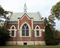 | Our Lady of Sorrows Chapel | 1.6 miles | 1986 |
| Edgewood Place Historic District | 1.7 miles | 2010 | |
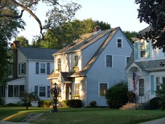 | 23rd and 24th Streets Historic District | 1.7 miles | 2010 |
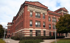 | Main Hall/La Crosse State Normal School | 2.1 miles | 1985 |
 | Physical Education Building/La Crosse State Normal School | 2.1 miles | 1985 |
 | LaCrosse State Teachers College Training School Building | 2.2 miles | 1999 |
| National Archives record | The nomination case file for reference 100007152 in Record Group 79. |
| La Crosse County | All 60 listed properties in this county. |