 Block
From the record
One of 238 National Register listings published here for Dane County · listed in 2022 · category: Building.
Sources: the National Register database, National Park Service
Listed on the National Register of Historic Places in 2022.
One of 238 National Register listings published here for Dane County · listed in 2022 · category: Building.
Sources: the National Register database, National Park Service
Regional context, not property-specific evidence. The federal wildfire occurrence database lists 39 fires within 5 miles of Ray S. and Theo P. Owen House between 2007 and 2020, burning about 48 acres in total. 1 started naturally. 4 were recorded as arson. Distance is straight-line from the map coordinates, so a fire counted here may appear on a neighbouring settlement's page as well.
| Reported cause | Fires |
|---|---|
| Missing data/not specified/undetermined | 23 |
| Debris and open burning | 5 |
| Recreation and ceremony | 4 |
| Arson/incendiarism | 4 |
| Natural | 1 |
| Misuse of fire by a minor | 1 |
| Smoking | 1 |
The most recent of them, most recent first, with the day each was reported and the service that recorded it.
| Date | Cause | Size | Reported by | Name on the report |
|---|---|---|---|---|
| 6 September 2018 | Missing data/not specified/undetermined | under an acre | Wisconsin Department of Natural Resources | 256 |
| 28 September 2018 | Missing data/not specified/undetermined | under an acre | Wisconsin Department of Natural Resources | 1824118 |
| 17 September 2020 | Missing data/not specified/undetermined | 1.0 acres | Wisconsin Department of Natural Resources | 2021851 |
| 9 August 2019 | Debris and open burning | under an acre | Wisconsin Department of Natural Resources | 242 |
| 3 August 2019 | Arson/incendiarism | 1.0 acres | Wisconsin Department of Natural Resources | 1919678 |
| 3 August 2018 | Missing data/not specified/undetermined | under an acre | Wisconsin Department of Natural Resources | 1818632 |
| 29 August 2020 | Arson/incendiarism | under an acre | Wisconsin Department of Natural Resources | 2020209 |
| 24 August 2020 | Missing data/not specified/undetermined | under an acre | Wisconsin Department of Natural Resources | 2019797 |
Regional context, not property-specific evidence. The federal mineral resources record lists 9 workings within 5 miles of Ray S. and Theo P. Owen House: 5 producers, 3 unknowns, 1 past producer. 5 still produce. What was taken out: Sand and Gravel, Construction, Stone, Crushed/Broken, Stone. Distance is straight-line from the map coordinates, so a quarry counted here may appear on a neighbouring settlement's page as well.
| Where | Site | Commodity | Status | Recorded |
|---|---|---|---|---|
| Fess Quarry | Stone | Unknown | ||
| John Hensen Quarry | Stone | Unknown | ||
| Kampmeier Quarry | Stone, Crushed/Broken | Producer | ||
| Milwaukee Street Quarry | Stone, Crushed/Broken | Producer | ||
| Williams Quarry | Stone, Crushed/Broken | Past Producer | ||
| Blooming Grove Pit | Sand and Gravel, Construction | Producer | ||
| Engelhart Sand & Gravel Pit | Sand and Gravel, Construction | Unknown | ||
| Norway Grove Gravel Plant | Sand and Gravel, Construction | Producer | ||
| Yanggen Pit | Sand and Gravel, Construction | Producer |
Regional context, not property-specific evidence. The National Weather Service names Monona, the town this property stands in, in 28 storm reports between 1996 and 2026: 16 hail, 8 thunderstorm wind, 2 flash flood, 2 dust devil. No death or injury is recorded in these reports. Each account below is quoted exactly as the forecast office filed it, from the NOAA Storm Events Database, and each date opens the federal record of that event.
| When | Event | Place named | Harm | What the report says |
|---|---|---|---|---|
| April 2006 | Hail | Monona | $5,550,000 | Hail size ranged from 1.50 to 3.00 inches in diameter. |
| April 2006 | Hail | Monona | $5,550,000 | no account filed |
| June 1996 | Flash Flood | Monona | $1,600,000 | no account filed |
| July 2008 | Thunderstorm Wind | Monona | $40,000 | Powerful thunderstorm wind gusts toppled several large trees and broke branches that brought down some power-lines. One home had its living room and bedroom windows and wall damaged by a toppled large tree. |
| June 2000 | Thunderstorm Wind | Monona | $20,000 | no account filed |
| June 2022 | Thunderstorm Wind | Monona | $15,000 | Numerous trees and power poles down. |
| July 2006 | Thunderstorm Wind | Monona | $15,000 | Hurricane force wind gusts to 71 knots (82 mph) produced tree and power line damage 4.0 miles northeast of Monona. |
| July 2017 | Thunderstorm Wind | Monona | $7,000 | Several trees down including one tree on a house. |
| July 2024 | Flash Flood | Monona | $2,000 | Localized flash flooding of streets on the east side of Madison and north to Warner Park. |
| March 2011 | Dust Devil | Monona | $500 | no account filed |
| April 2026 | Hail | Monona | - | Public report of 1.5 inch diameter hail east of Maple Bluff. |
| April 2026 | Hail | Monona | - | Trained spotter reports 2 inch diameter hail northeast of Monona. |
| April 2026 | Hail | Monona | - | Trained spotter reports 2 inch diameter hail north of Monona. |
| April 2026 | Hail | Monona | - | Trained spotter reports 2.75 inch diameter hail northeast of Monona. |
| August 2013 | Dust Devil | Monona | - | A dust devil moved from land to the Lake Monona shoreline and tipped over a Pontoon boat and the hoist that it was sitting on. Pier damage also occurred. |
| May 2006 | Thunderstorm Wind | Monona | - | Trees down. |
| July 2006 | Thunderstorm Wind | Monona | - | Multiple trees down. |
| May 2025 | Hail | Monona | - | no account filed |
| November 2022 | Hail | Monona | - | no account filed |
| July 2022 | Hail | Monona | - | no account filed |
| September 2022 | Hail | Monona | - | no account filed |
| April 2011 | Hail | Monona | - | no account filed |
| May 2011 | Hail | Monona | - | no account filed |
| June 2011 | Hail | Monona | - | no account filed |
| March 2007 | Hail | Monona | - | no account filed |
| May 2006 | Thunderstorm Wind | Monona | - | no account filed |
| April 2002 | Hail | Monona | - | no account filed |
| October 1996 | Hail | Monona | - | no account filed |
No historic map-sheet match is published for this property yet. That does not mean no map exists. This record needs a coordinate-quality review before it can be joined to a sheet boundary. Browse the county's mapped places while that work is pending.
Other National Register properties close enough to walk or drive between, ordered by distance from this one. Both positions come from the same geocoding pass that matched these properties to their map sheets.
| Photograph | Property | Distance | Listed |
|---|---|---|---|
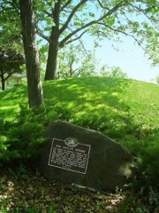 | Outlet Mound | 0.2 miles | 2003 |
| Willard and Fern Tompkins House | 0.3 miles | 2023 | |
| Tompkins-Brindler Mound Group | 0.7 miles | 2003 | |
| Schroeder-Bohrod House | 0.9 miles | 2023 | |
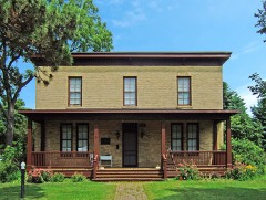 | Nathaniel W. Dean House | 1.1 miles | 1980 |
| Kohl's Food Store | 1.5 miles | 2022 |
| National Archives record | The nomination case file for reference 100008108 in Record Group 79. |
| Dane County | All 238 listed properties in this county. |